A Daily History of Holes, Dots, Lines, Science, History, Math, Physics, Art, the Unintentional Absurd, Architecture, Maps, Data Visualization, Blank and Missing Things, and so on. |1.6 million words, 7500 images, 4.9 million hits| Press & appearances in The Times, Le Figaro, Mensa, The Economist, The Guardian, Discovery News, Slate, Le Monde, Sci American Blogs, Le Pont, and many other places… 5000+ total posts since 2008.

  • How Much White House Manure Cost in 1849

    JF Ptak Science Books   Post 2683      [Images are expandable]
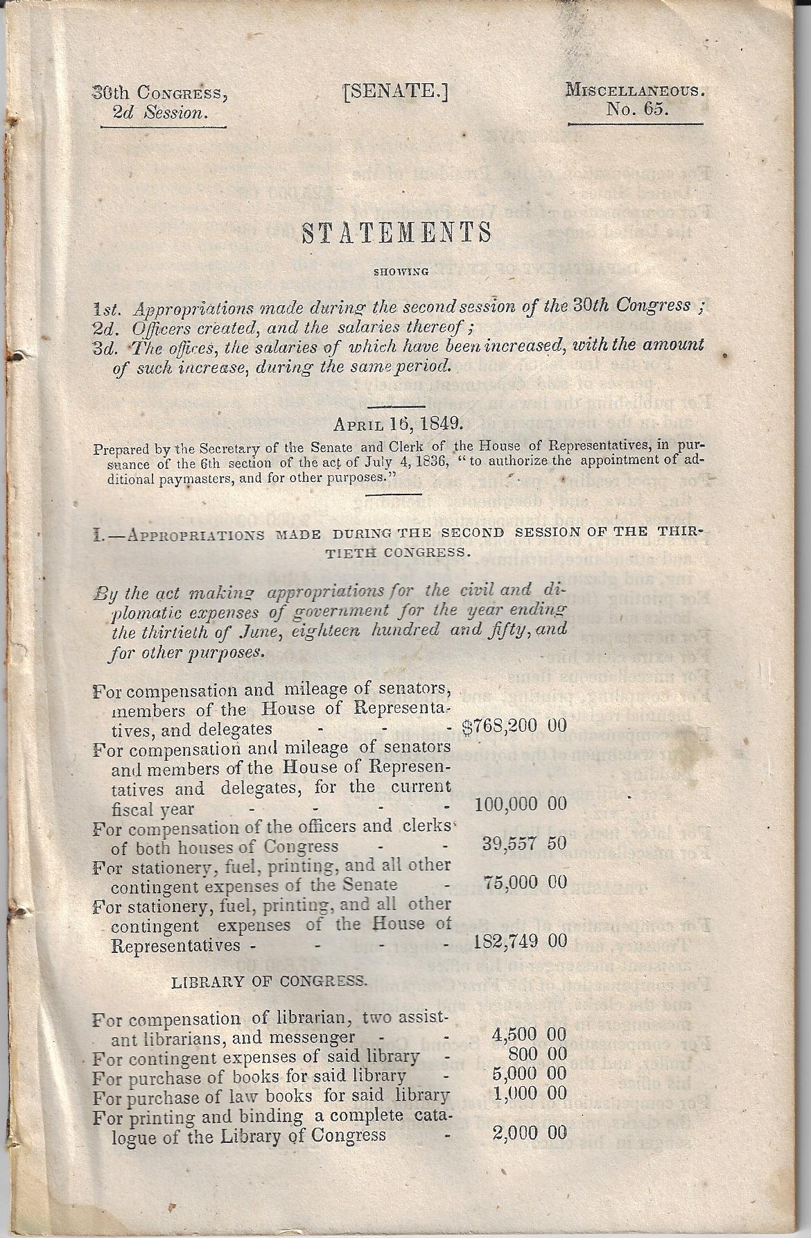
    Wages and payouts US Govt  _1849 1_There are many points of interest in this little pamphlet that I uncovered on the trail of money, seeing a simple 63-page document covering the endgame of Congressional appropriations back in 1849. Aside from its immediately absorbable and relative simplicity as a general consumable, there are of course the details in the paper trail. The first to register is the cost for running the staff of the Library of Congress, which included a librarian, two assistant librarians, and a messenger for $4,500 a year, which is a bit of a far cry from the LC’s 5,000 current employees.  The next big bit was the salary of the U.S. president, which in 1849 stood at $25,000 a year.

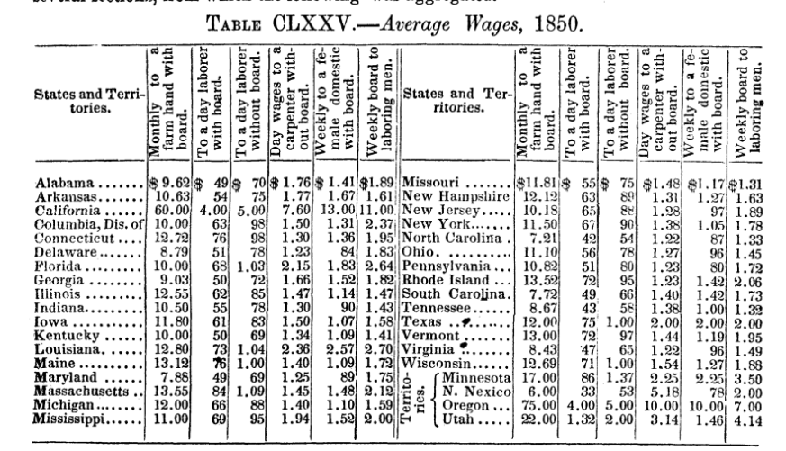
    $25,000 1849 dollars in 2017 dollars explodes quite a bit in reference to its purchasing power, though I can’t really find a good indicator of just how much that might be. For later figures closer to the 20th century I enjoy using the Bureau of Labor Statistics’ (U.S. Department of Labor) Consumer Price Index and Inflation Calculator (or the USDL’ BLS CPI calculator) which I think gives a better taste of the value of money over different periods. Looking at that $25k in another way, for most states in the U.S. a day wage for a carpenter (without board) was about 2 bucks, or $40-50 a month, or about .02% of the president’s salary. In those terms a craftsman making the same cut of the POTUS salary in 2017 would be making about $8,000/yr. There are many different ways of looking at this but in general I’d say that the president making that money was doing nicely in comparison to the rest of the country. The salary was doubled to $50k in 1873, and then again by 50% in 1909 to $75,000. This is the first level at which the BLS calculator comes into play, equating that salary with about $1.8 million in 2017 dollars. The president’s salary (alone) wouldn’t reach Babe Ruth’s high dollar until 1949, when there was an increase to $100,000 ($1.02 million in 2017 dollars) and then again doubling to $200k in 1969. But according to the BLS tool the presidential salary has been going down since then, even when the president began to make $400k in 2001 (still about $550 in 2017 dollars). The job has a ton of perks, of course, but the dollar end of it (salary alone) has been on the general downside for about the entire history of the payment schedule (in constant dollars) 

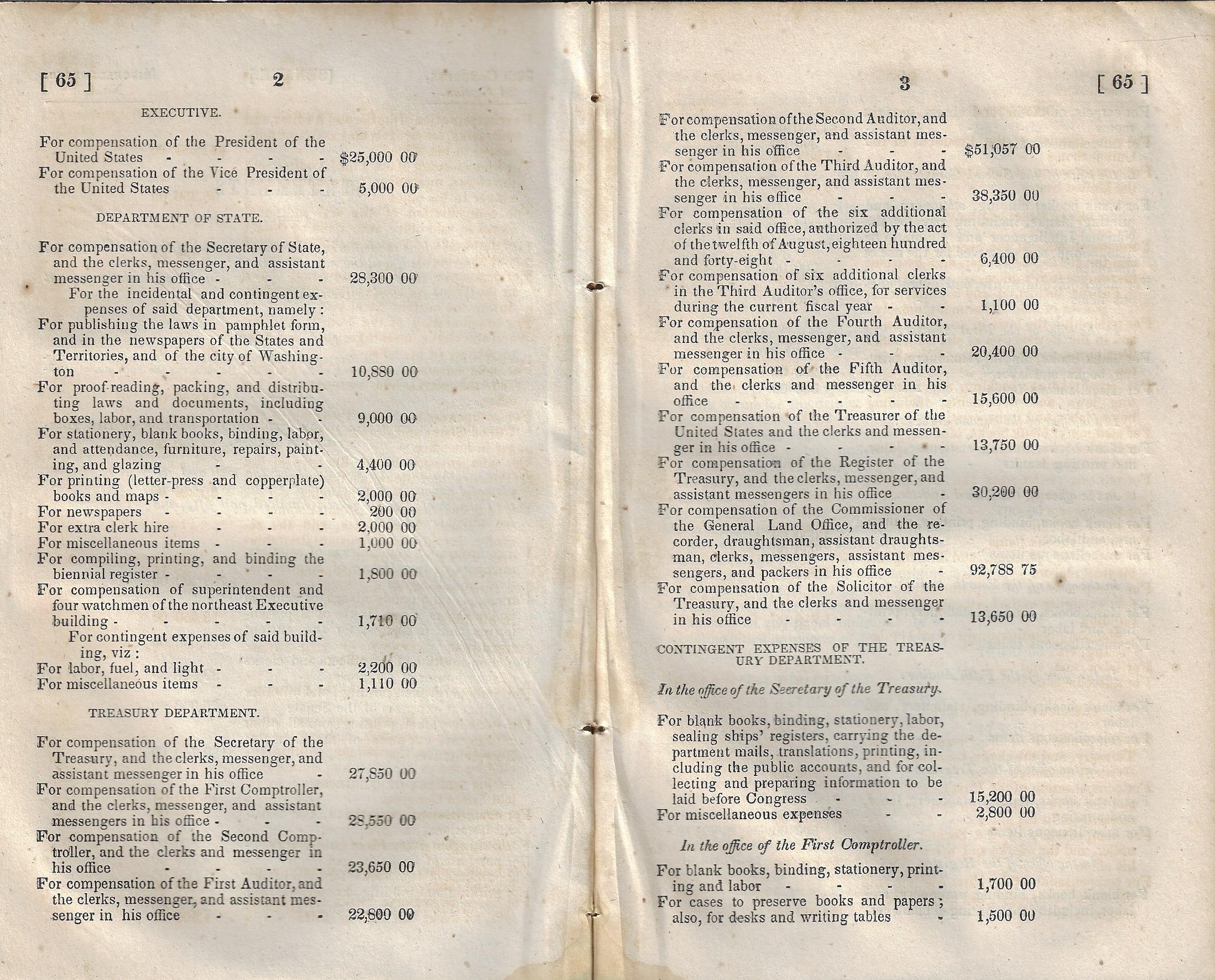
     So getting back to 1849, here’s a scan of the next two pages in the report. where we see that the vice president made a small fraction of his boss ($5000 a year versus $25). There was more allocated ($6,000) for a section of “lighting Pennsylvania Avenue” , as well as the White House (then the “President’s House”) and the U.S. Capitol and grounds…and for compensation for one lamplighter for the same”. There was also an allocation of $3,500 for annual repairs and upkeep at the White House and for running the physical aspect of the place (but not staff) for $3500, which included paying for cartage, “manure, leather, nails, tools &c.”.
    Wages and payouts US Govt  _1849 2_

    And so on and on it goes, but on for those 60-odd pages, which today wouldn’t hold very much info at all unless it was all microdot.In this instance, in 1849, 63 pages would do the trick, outlining the expenditure of $35 million or so. Mostly though I found this interesting for the staffing of the Library of Congress, because at this point, that is all it was–a library for Congressmen. It was still a decade or two away from expansive collecting, and more than 40 years off from having its own building. 
     

    Wages in the U.S. 1850

    The long-titled source for this boxed data:  Statistical view of the United States, embracing its territory, population–white, free colored, and slave–moral and social condition, industry, property, and revenue : the detailed statistics of cities, towns and counties; being a compendium of the seventh census, to which are added the results of every previous census, beginning with 1790, in comparative tables, with explanatory and illustrative notes, based upon the schedules and other official sources of information, by J. D. B. De Bow, superintendent of the United States census. Lots of cool data in there…
     

    ·Posted by :

    ·in:

  • Moving Stationary People on a Moving Sidewalk and Not Moving People on a Stationary Sidewalk (1903)

    JF Ptak Science Books   Post 2684

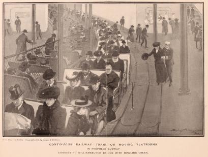
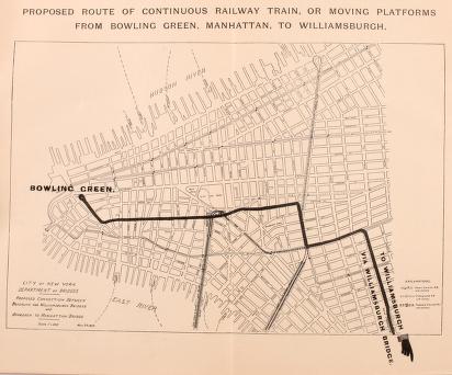
    I came upon this interesting pamphlet and thought to share it: Transportation of Passengers in Greater New York by Continuous Railway Train, or Moving Platforms.  Argument in favor of equipping the East River Bridges, and connecting subway to Bowling Green, Manhattan, with a continuous railway train or Moving Platforms. It was prepared by Schmidt & Gallatin, of New York, and printed in 1903. (Oddly it is the pamphlet that I started working on directly after working through a 1903 double-brick volume of the Journal of the American Chemical Society.) It is only 20 pages long, but decorated with four folding plates, including two maps, and two drawings of the envisioned walkways. 

    Sidewalks 3

    This seems a wonderful example of future thinking and city planning–but just not a very good idea.  It is hard to imagine a continuously moving sidewalk functioning in lower Manhattan. 

    From the pamphlet: 

    “Moving Platforms for the conveyance of passengers were recommended by Mr. Horace Greeley thirty years ago. They were successfully operated, first, at the World’s Columbian Exposition of 1893, where 2,700,000 people were transported. In 1896 they were installed at the Berlin Exposition, and again at the Paris Exposition of 1900, where they carried over eight million passengers. Few persons know what Moving Platforms are. From the face that sometimes they are called ” Moving Side- walks,” it is believed that they must be some sort of a pavement on rollers, on which it is difficult to step with safety and maintain equilibrium. The Moving Platforms are to all intents a railway, operated like other railways, propelled by electricity, with cars, seats, motors, passenger stations, ticket booths, guards, electric lights — in fact, everything belonging to a first-class railway.” 

    Sidewalks map

    “Where it differs from the ordinary railway is that the cars, or trains, are not running at intervals, but are coupled up continuously, so that there is no interruption of traffic at any time, but a large seating capacity at all times. It differs also in the construction of the cars, which are mere flat cars, provided with seats placed crosswise, and so arranged that all passengers face in the direction of motion. Each of these seats may be made wide enough to accommodate one, two or more persons. The most approved plan is to provide seats on one side of the cars only and leave the other for passengers to walk, thus giving them an opportunity to further accelerate their speed if they so desire…”

  • A Technical Report on the V-1, January 1945

    JF Ptak Science Books    Quick Post

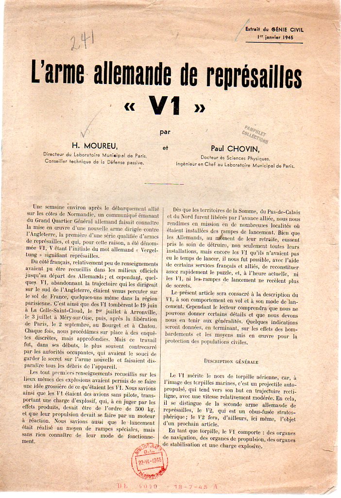
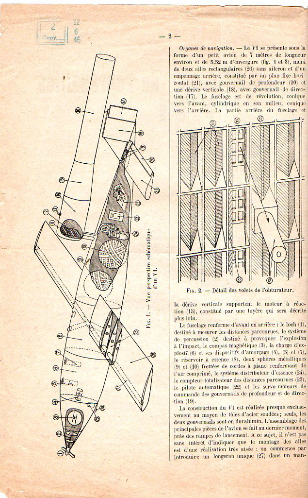
    I was  surprised to find this fairly-well documented piece on the V-1 published during the war, so I decided to reprint the report in its entirety. Some of the text runs off the side of the scanner, but that is the best I can do in scanning the pamphlet without taking it completely apart. 

    The document: Moreau, Henri (1893-1978) and Paul Chovin.  “L’arme allemande de represailles V1”, offprint from Genie Civil, 1 January 1945.  9×6 inches, 8pp, printed in Paris (newly liberated from the German army 25 August 1944) in early 1945. Very good condition, printed on a decent paper stock. It is rare as an offprint, at least, with no copies located in the WorldCat/OCLC. 


    V1519
    V1521

    ·Posted by :

    ·in:

    —
  • Dumping Garbage in the Sky and Other Visions of the Future, (1906)

    JF Ptak Science Books  Post 2685

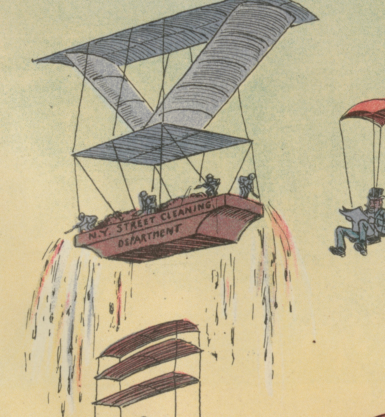
    Airship LC PuckGov. Jerry Brown (D, CA) once had a vision of getting rid of nuclear waste–load it into rockets and shoot it into space. Dumping radioactive materials in the sky was at least a novel idea though not a very good one, what with the possibility of imperfection built into sending the highly dangerous material from the ground and out of orbit. He was not the first to suggest getting rid of unwantables (excluding burning things) in the sky.

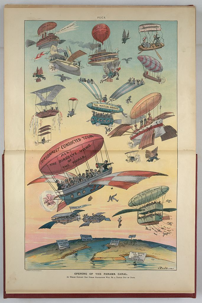
    An earlier and perhaps weirder (though I doubt it) idea came in a section of this image of the future, found in the pages of Puck magazine in 1910.  The illustrator, J.S. Pughe1, had a pretty high time picturing the future, and was probably half-right, in a way. The cartoon came out at the time that the Panama Canal was under constructed (it was completed in 1914), and Pughe thought that–given the new advances in flight in the few years following the Wright’s first heavier than air flight–the canal would be made obsolete in short order. To that end he depicted what might be a common use of the airship, the most prominent being the touring vessel, offering its passengers a true “bird’s-eye” view of whatever there was to see.  There’s also the Cong Air Line just below it, dinghy in tow, and an conventioneer airship for “Hughie Ginty” whatever that might be.  There’s also a floating battleship, and up in the left-top corner there is a way off course Staten Island Ferry, thousands of miles from home, having missed its visual clues in navigating the Narrows. Oddly there are no depictions of freight aircraft, which is probably themost essential aspect of the canal (after military purposes). 

    Airships future panama canal water wagon

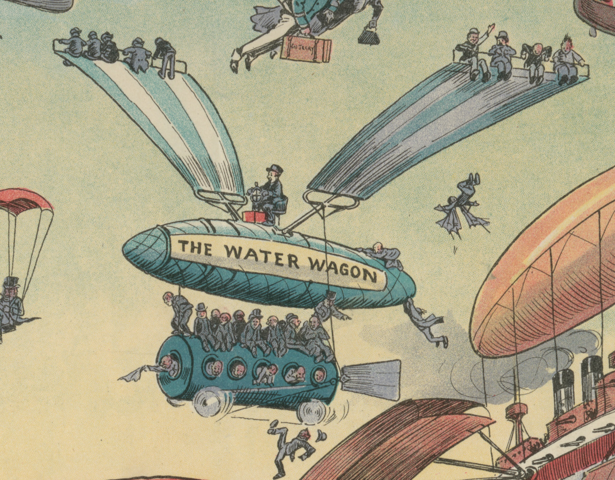
    Overall, it is a pretty light-hearted view of the future. we even seen a “water-wagon” floating on by, filled to capacity with people with generally non-committal expressions. I do believe that this is the famous “wagon” onto which people with a drinking problem would ride on the road to sobriety.  One version of the “on the wagon” expression dates back to the late 19th c and the Salvation Army, the members of which would drive a wagon looking for folks in need of cleaner leaving and a perhaps-salvation, offering them a ride back to headquarter/church/whatever and the promise of drinking water and not booze.  It is I think that this interpretation of this particular water wagon being a sobriety ride is hammered down when you look closely at the face of the guy falling off the wagon, because he looks to be happy and a little on the drunky side of things.

    Airships future panama canal water wagon detail smile

     There’s some dark bits to this haphazard scene as well. There seem to be a lot of falling people. At least six people are headed down, including a couple at top-right in a rowboat under a failed balloon (with a sky-cop in pursuit), and another person falling with his failed bird wings. For a whimsical peep into a contentious future, the artist may have decided to add an aerial version of the commonplace tragedy of being run over by a streetcar. 

    The oddest thing, though (and this gets us back to Jerry Brown) is the much-magnified “N.Y. Street Cleaning Department” dumping refuse over the side of an airship (of unknown propulsion and engineering). Perhaps the artist decided that In The Future the use of the sky will be so commonplace that people will use it as they had streams and harbors and other bodies of water–as a dumping ground. On the other hand maybe it is just showing that this is exactly what is happening, again, only from a height, and into the Panama Canal.  

    Airships future panama canal waste

    [Image source: Library of Congress, https://www.loc.gov/resource/ppmsca.26030/   My details are taken from the 132 meg download available on their site.]

    Notes:

    1. John Samuel Pughe, Welsh-born U.S. artist, 1870-1909.  He joined Puck in 1894 and worked there until his early death in 1909. Puck, v. 59, no. 1509 (1906 January 31), centerfold.

    Before writing this post script this blog entry ended at 713 words–that’s the final tally of Babe Ruth’s home runs, which is a good place to end. 

  • A Map with a Point (1943)

    JF Ptak Science Books  Quick Post 

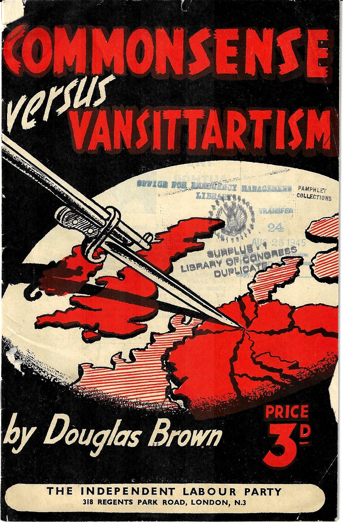
    I admit that did not look at this pamphlet (printed in 1943) to determine the conflict between “commonsense” [sic] and “Vansittartism” (which I had to look up1). Mr. Brown, the author, was a prominent Socialist, who advocated–in my peep at the last page of the pamphlet–reallocation of land/industry/transport/”banking” to the community and the abolition of private profit-making, and thus to the shout-whisper political argument becomes just a wisp of smoke in a shallow hole. The only reason I stopped here was the cover design, showing a strike to the northern part of Germany.  

      Book cover bayonette in Germany map

    Notes:

    1. From Merriam-Webster: “Vansittartism, doctrine holding that the conduct of German war leaders from the Franco-Prussian war on has had the wholehearted support of the majority of Germans and that Germany must be demilitarized during a protracted period of occupation and reeducation to insure against her undertaking further wars of conquest.”

  • Rare and Unusual Work on RAF Paratroopers, 1943/4

    JF Ptak Science Books   Quick Post

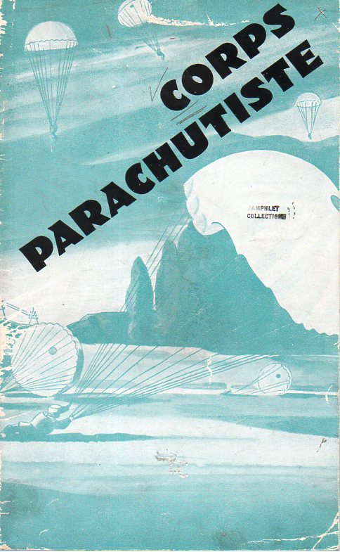
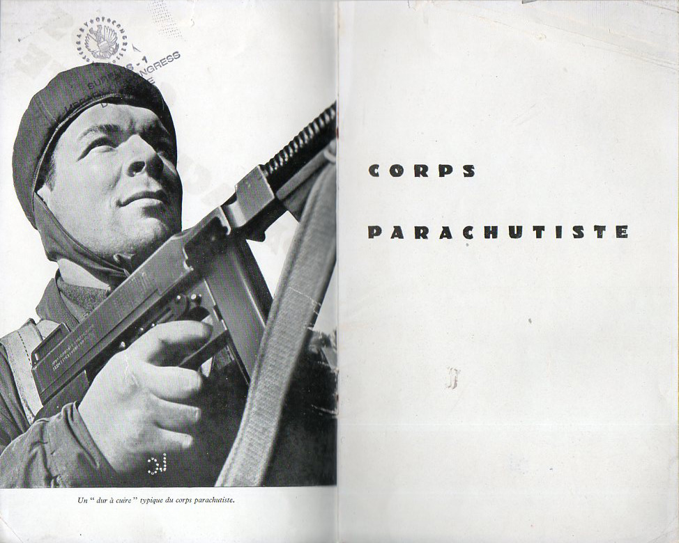
    This pamphlet turned up in my Library of Congress “Pamphlets Collection” collection-it had the feel of something that was widely distributed as a home front piece of positive news, but it turns out that it does not show up cataloged in the usual places (like WorldCat/OCLC).  There is no printed date and no place of publication other than “Imprime en Angleterre” (stamped on the back cover). There is a LC cataloging stamp of 17 April 1944, which means it may have been first issued in late 1943.

    There are no copies whatsoever located in WorldCat/OCLC. 

    I’ve reprinted the full work (below) for those with an interest in Airborne:

    Corps parachutiste265


    Corps parachutiste b266

    ·Posted by :

    ·in:

  • It Will Always Be the RCA Building (1941)

    JF Ptak Science Books  Quick Post

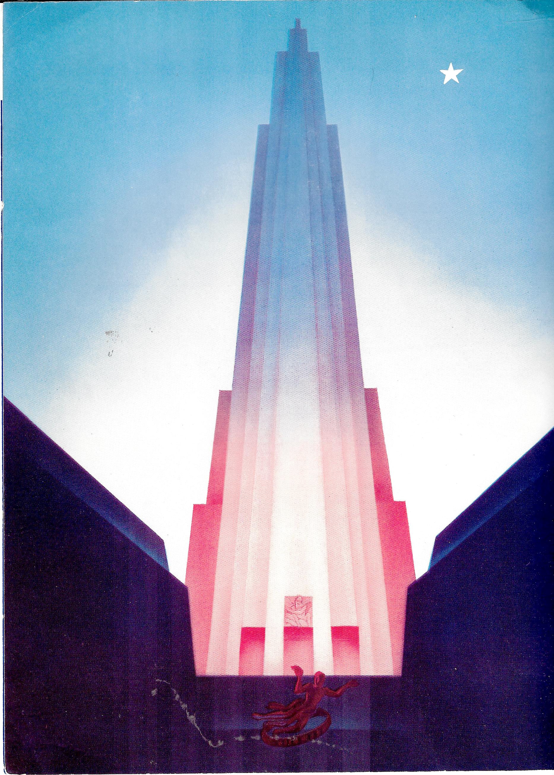
    RCA published the oversized (13″ tall) pamphlet, Radio Answers the Call, in the pre-U.S. declaration of war year 1941, outlining what it was doing in their supportive role to the U.S. policy of aid to the Allies at war against the Axis powers and for national defense in general. There’s a cover letter by David Sarnoff introducing it, and then a couple of pages of large type with a few of the particulars. Mostly I was interested in this showstopping image of the RCA building in Manhattan.

    Yes, the RCA building. Not the GE building, and definitely not the Comcast building. It is the RCA Building, period. It may be one of the finest skyscrapers ever built, a beautiful Art Deco masterpiece designed by Raymond Hood, 70 stories of superb, and the centerpiece of the complex of buildings at Rockefeller Center. And whoever the artist was who made this image got the spirit of the space right…except for that star, of course, which must have been punched in there by, well, somebody.

    Anyway I wanted to share this image because it doesn’t seem to be around.  My copy is from the Library of Congress, and it was in FDR’s (or at least the White House’s) library before that.  


    RCA Answers the Call


    RCA answers the Call _2_

    ·Posted by :

    ·in:

  • High Above Brooklyn, Looking at Manhattan (1938)

    JF Ptak Science Books   Quick Post

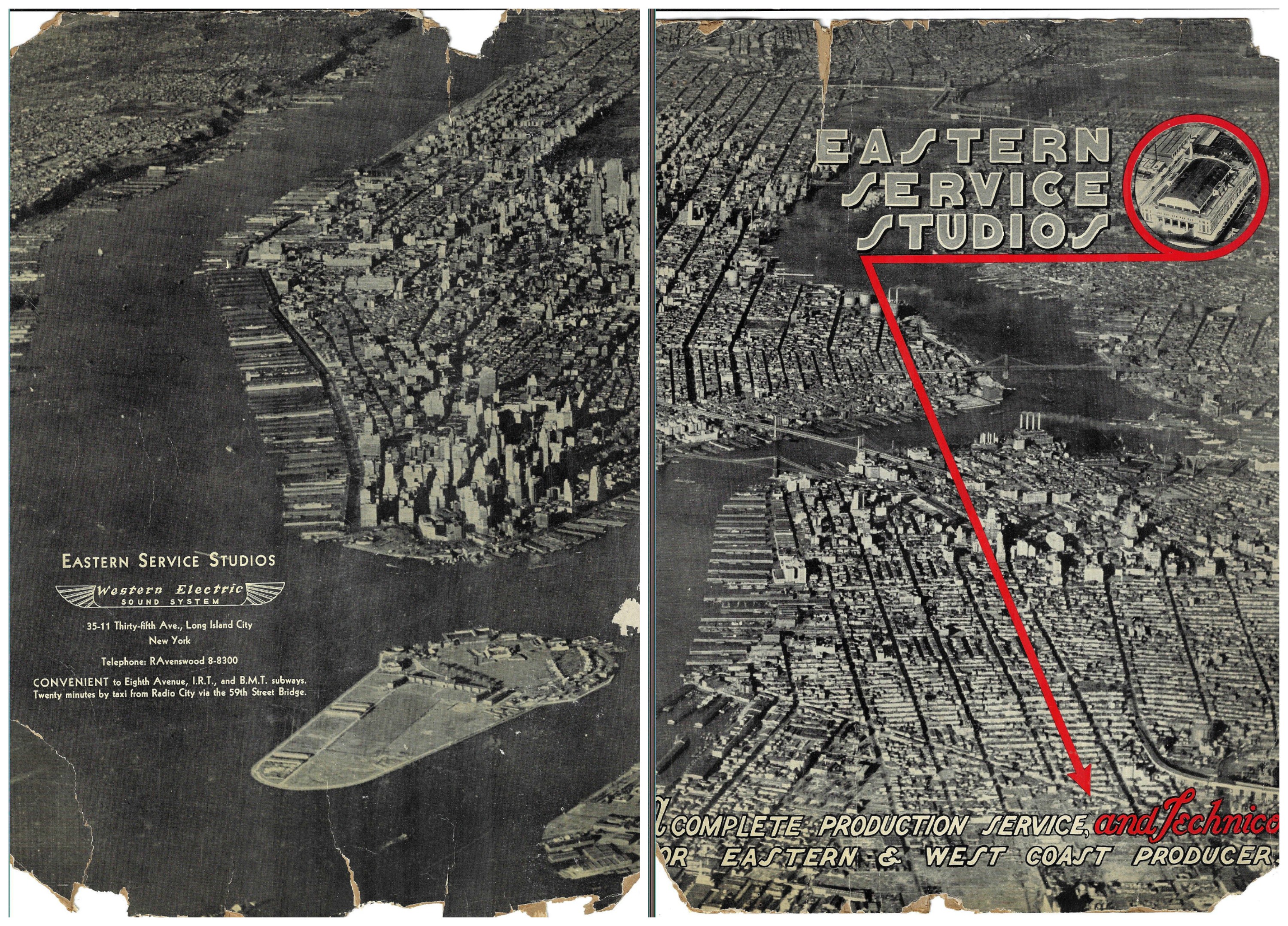
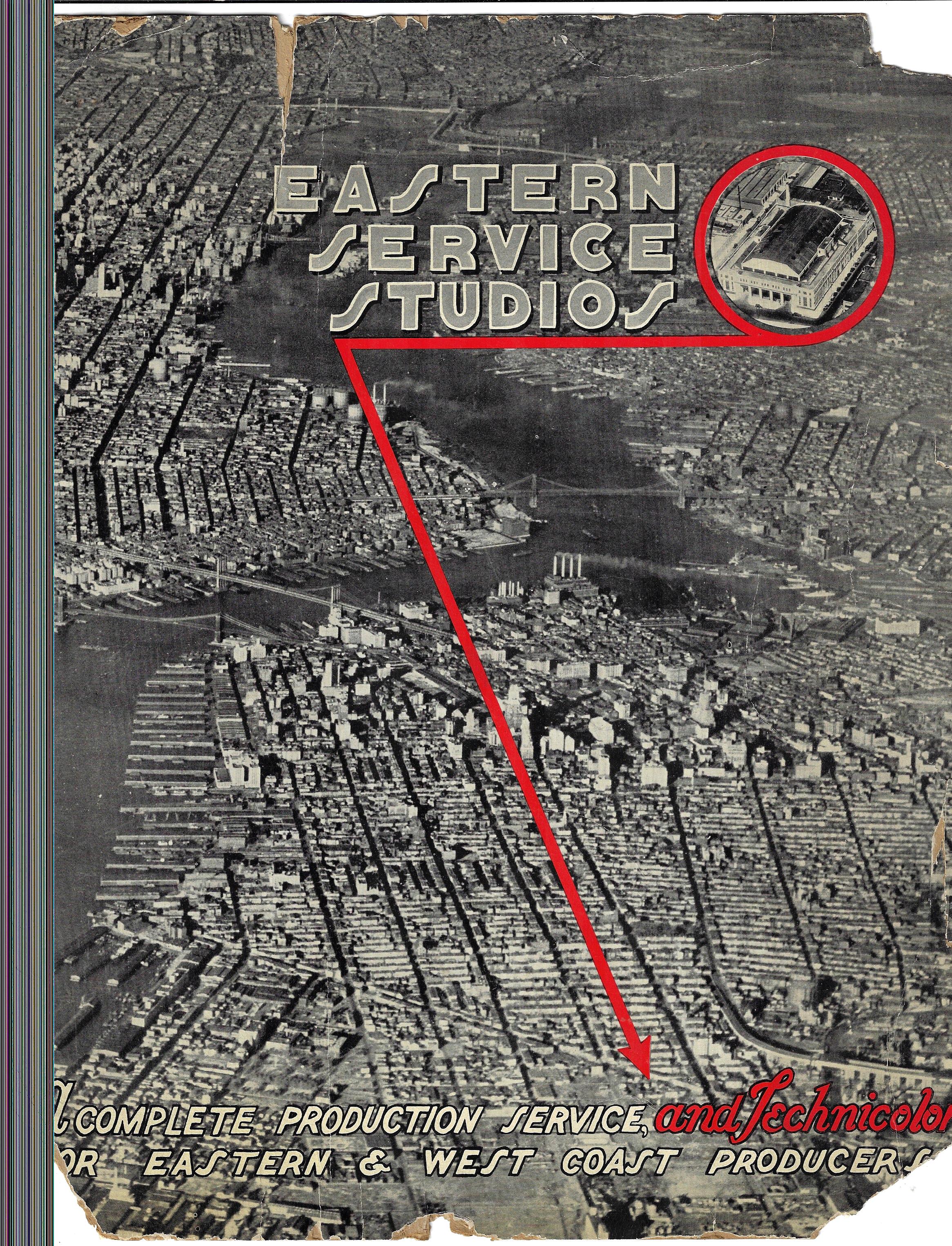
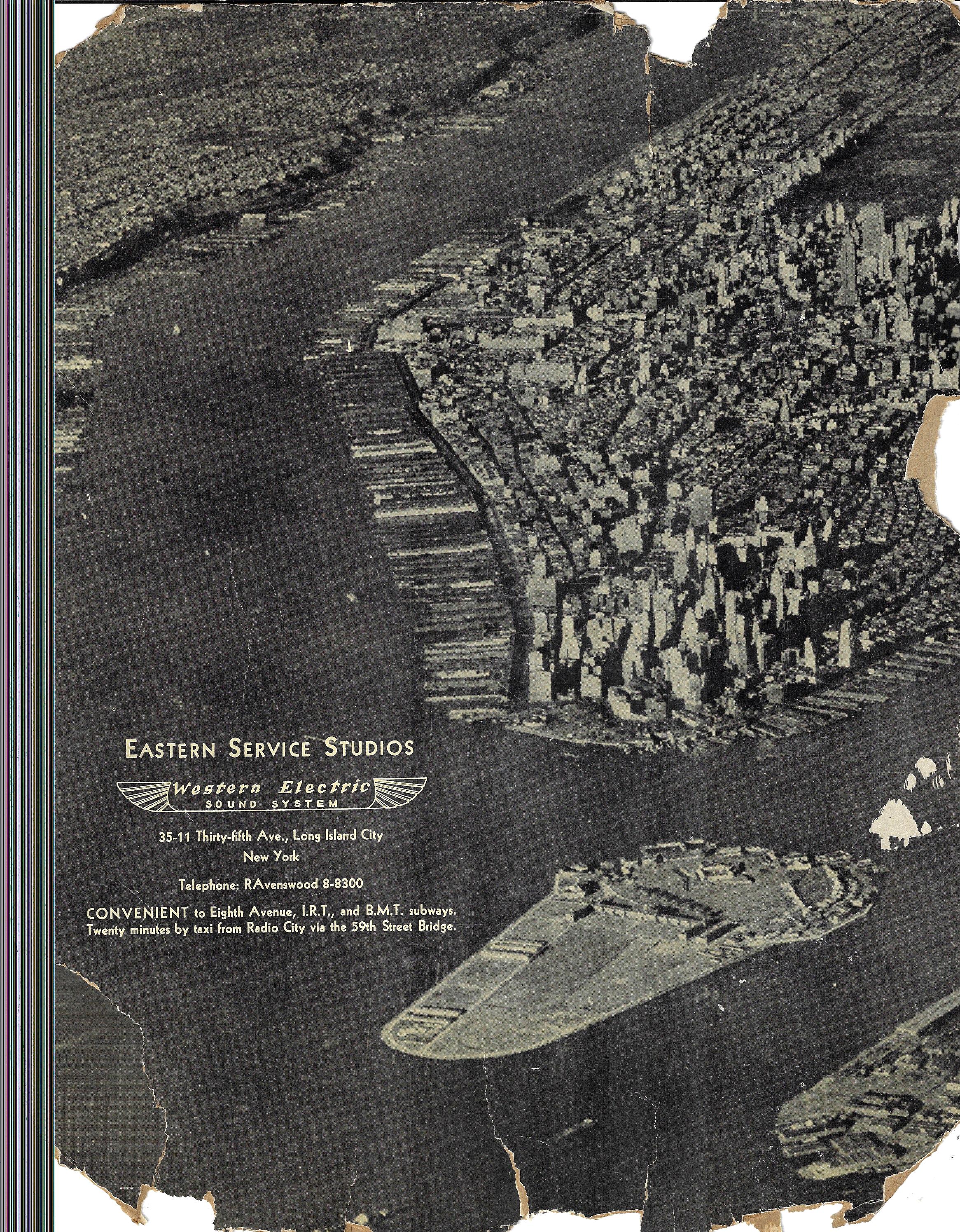
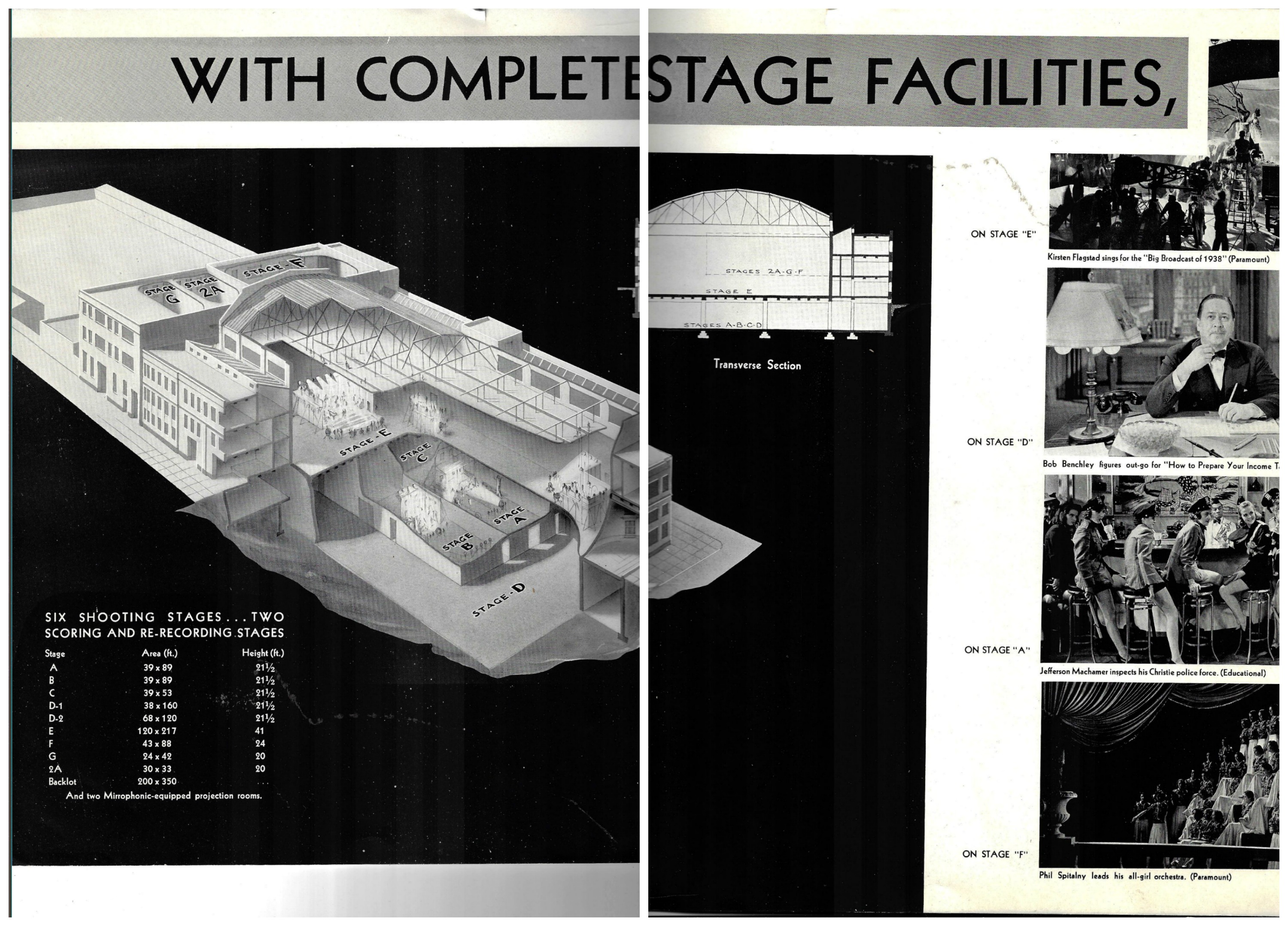
    As much as I like the history of the film industry in NYC in the early days (and then of television in the 1940s and 1950s) this post will not address that–I’m simply interested here in the cover art of NYC on this 1938 pamphlet about Eastern Service Studios. The place has a long and fine history–built by Paramount in 1920, it is still in service today as Kaufman Studios, in Long Island City…there’s plenty on the place online, detailing the history of production there from the first two Marx Brothers  movies through Law & Order.  But as I said, it is the cover that really interest me, as they’re almost an artwork on their own. The pamphlet is huge, 15×10″, making the photograph of the city front and back about 20″ long–it is a large piece.

    What we see is a view of New York City from about the Brooklyn Navy Yard and Brooklyn Heights,  at bottom and just north of Green-Wood and west of Prospect Park/Grand Army Plaza; in the East River we see the Brooklyn, Manhattan, and Williamsburg Bridges, and as we move a little to the west, we see all of Manhattan, all the way up to east Harlem and Randall’s Island, and then some. It is a marvelous photo. Unfortunately, the covers of the pamphlet are big/thick cardboard, making them very crumbly, and so the chips and missing pieces. Still, it is an aggressively interesting work.  

    Eastern Service montage


    The images in detail:

    Eastern Service Stuido _1_

    Eastern Service Studio _2_

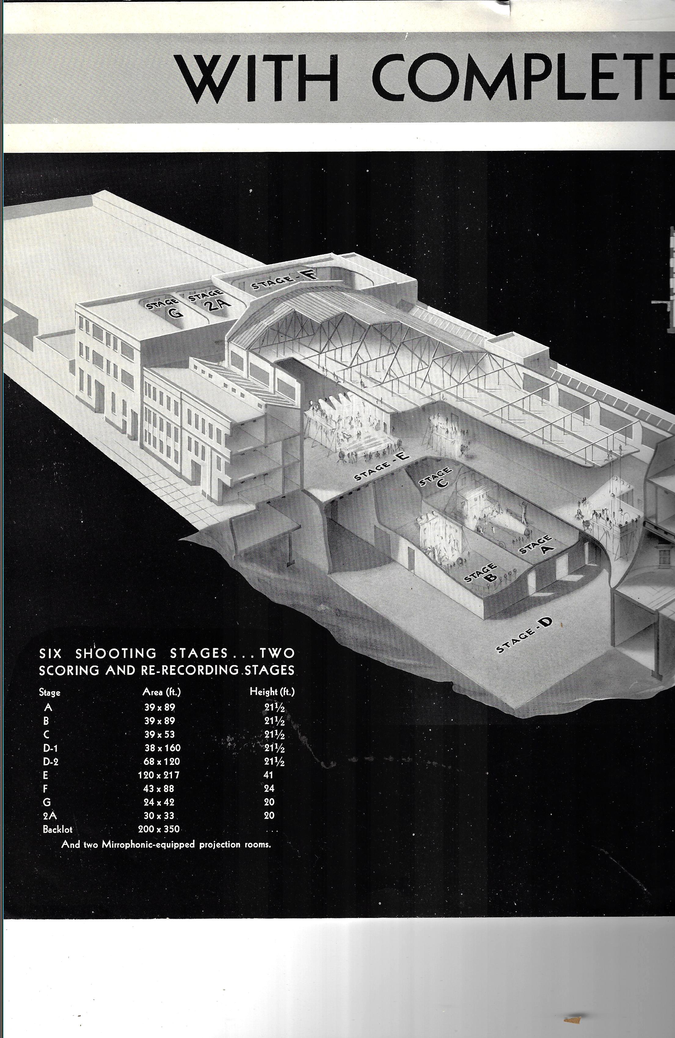
    And the stages at the studio:

    Eastern service studio stage montage

    Eastern service studios _3_


  • A Rare Set of Specs for the RCA Photophone (Full Text Posted)

    JF Ptak Science Books

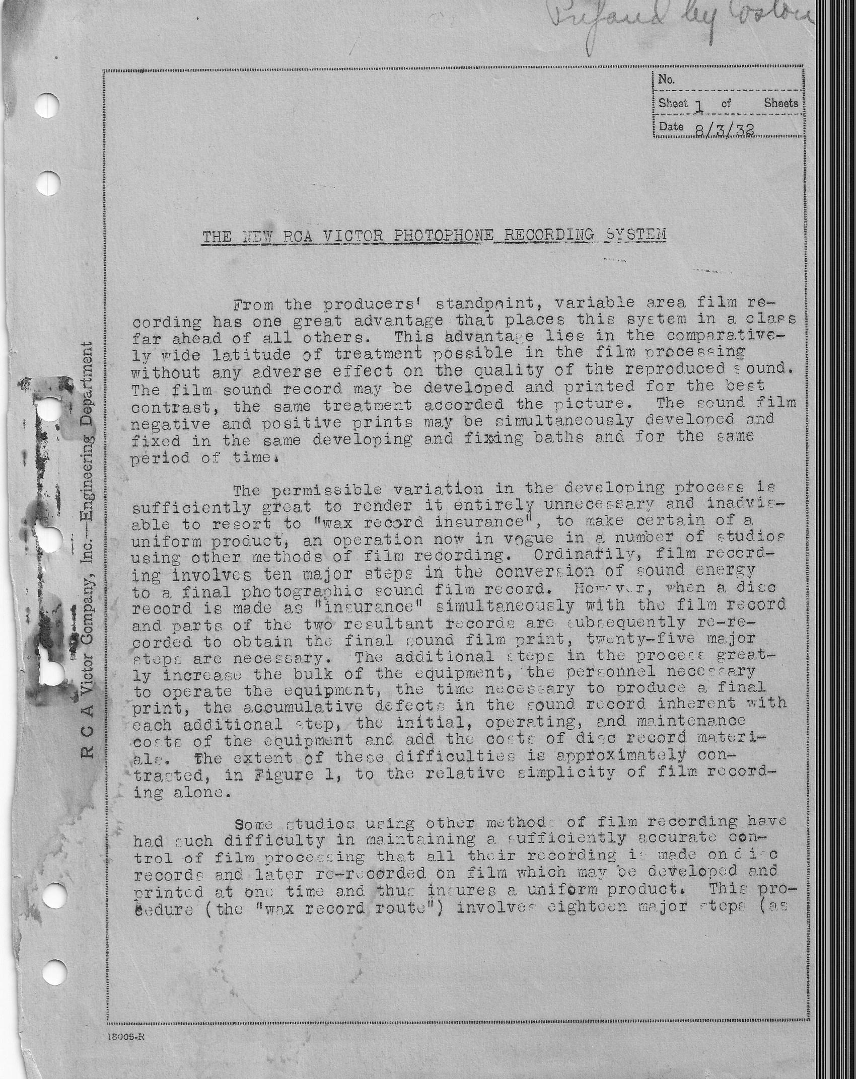
    The New RCA Victor Photophone Recording System.  11×8.5″, 44 typed mimeo leaves, with 24 leaves of blue-line photographs and schematics of the  equipment.  Punch-bound at one time, though metallic binding element is not present. Printed on the stationery of  “R.C.A. Victor Company, Inc.,  Engineering Department”.  Very good condition. Document pp 1-44, lacking 26 and 27 (which seems to be a two-page section); images/blueprints 1-28, lacks 17,18, and 22.

    The text includes: General introduction (1-7, 4 illustrations), the Ribbon Microphone (8-12, 3 illustrations); Microphone Distribution Panel, (13-14pp, 2 illustrations); Microphone Mixing Panel (15-17, 2 illustrations); Compensator Panel (18-21, 2 illustrations); Recording Amplifier (22-25pp, 2 illustrations); Ground Noise reduction Amplifier (28-30, 2 illustrations); 35mm Film Recorder (31-34, 2 illustrations); 16mm Film recorder (page 35, 2 illustrations); Film Phonograph Reproducing Equipment (36-39 pages, 2 illustrations); Phototube Amplifier (40-41pp, 1 illustration); 35mm to 16mm Film Re-recorder, 42-44pp, 2 illustrations). 

    This a sound-on-film incunable. This means the pamphlet was printed within the first few years of the first “talking”  (synchronized sound, or sound technologically coupled to image) motion picture. The first feature length film using sound throughout1 the length of the movie was The Jazz Singer, which was released in 1927 and used a sound-on-disc2system of recording. That means that the audio portion of the film was recorded onto records, and then synchronized in playback with the film to match up the audio and video–this technology was obviously not the future.

    The technology of sound-on-film would take the day, and in very short order, leading to four different systems, of which the Photophone was one.  Photophone’s share of the prospective studio users was pretty good: the earliest major producers/licensees included Walt Disney Productions (after 1932), RKO Radio Pictures, republic Pictures, Warner Borthers, and Pathe.

    And on the Film Phonograph Reproducing Equipment:  “the need for combining two or more sound tracks, the adding of sound effects to an original recording, or matching around levels of scenes in the final editing of a picture has brought re-recording into an increasingly important position in sound picture production”.

    The work is in general a technical report and sales pitch for the new system.  It includes the following sections:

    Notes:

    1.  Earlier on in the mid-1920’s there were efforts of using sound in film but limited to music or very specific areas of the film, most of which in the end was silent. 

    2. The  movie was made with the Vitaphone system, which was not long for this world, soon to be replaced by the more sophisticated sound-on-film systems.

    “In 1925 GE started a program to develop commercial sound-on-film equipment based on Hoxie’s work. Unlike the Phonofilm and Movietone systems in which the audio modulated the intensity of a recording lamp which exposed the soundtrack, thus creating a variable-density track, the GE system employed a fast-acting mirror galvanoemter to create a variable-area soundtrack. A number of demonstrations of this system, now known as Photophone, were given in 1926 and 1927. The first public screenings with this system were of a sound version (music plus sound effects only) of the silent film Wings which was exhibited as a road-show in around a dozen specially equipped theatres during 1927.”–Wiki

     First page of the document, followed by the remained (44pp+26pp):


    RCA Photophone Recording Sysytem 1932 _1__0001


    ·Posted by :

    ·in:

  • TV and the Nazis, Redux (1944)

    JF Ptak Science Books  (Expanding an earlier Quick Post)

    Television 1939

    Nazi tv770

    In all my exposure to the history of WWII  I am pretty sure that the only reference to Nazi television has been along the lines of the Berlin Olympics or Carl Sagan’s Contact–that and some dim memory about Hermann Goering somehow in the great bowels of the labyrinthine Nazi bureaucracy being in control of the fledgling German television broadcasting. The International Future of Television, an address by Paul Railbourn before the American Television Society in NY in January 1944, discusses the possibility of television in the Post WWII era–and in that, stresses in no uncertain terms that the to-be-defeated Nazis should not have access to the new medium. Railbourne (who would later become a VP at Paramount Pictures) talks about how Hitler utilized and dominated the radio, and how after the war re-education of Germany was necessary along with free enterprise undertaking of newspapers, radio, television, and motion pictures. (He does make a good point, especially with the Nazi domination of radio–not only did they control development, sale, and distribution of radios but also the overwhelming majority of the content of broadcasts. The Nazi control of popular broadcast and live performance culture was virtually complete. 

    He notes that “The Nazis are well aware of the importance of television…destroy the Luftwaffe and the Krupps Armament works, but leave television in their hands, and we shall be leaving them with the most powerful weapon of all…”

    To that end the author discusses post-war control of radio and television in German. He also talks about establishing television networks throughout the U,.S. as quickly as possibly to “capture world leadership in television programming” and “carry the gosphel of the Four Freedoms to all mankind”.  “…Television will play a vital role, for good or ill as it is intelligently or evilly directed, in the establishment and maintenance of an enduring peace, once the present war comes to an end.”

    Railbourne made good sense, and had I think a pretty good idea of the coming possible influence of the new medium.

    A recent book does a fantastic job in investigating and telling the history of the Nazis and sound: Carolyn Birdsall’s Nazi Soundscapes: Sound, Technology and Urban Space in Germany, 1933‑…(published in 2012)

    (“In Nazi Soundscapes, Carolyn Birdsall offers an in-depth analysis of the cultural significance of sound and new technologies like radio and loudspeaker systems during the rise of the National Socialist party in the 1920s to the end of World War II. Focusing specifically on the urban soundscape of Düsseldorf, this study examines both the production and reception of sound-based propaganda in the public and private spheres. Birdsall provides a vivid account of sound as a key instrument of social control, exclusion, and violence during Nazi Germany, and she makes a persuasive case for the power of sound within modern urban history.”–Goodreads. I highly recommend this book. )

     
  • A True “Severance of the Sea”–the “Perpendicular Barrier of Ice”

    JF Ptak Science Books  Post 2689

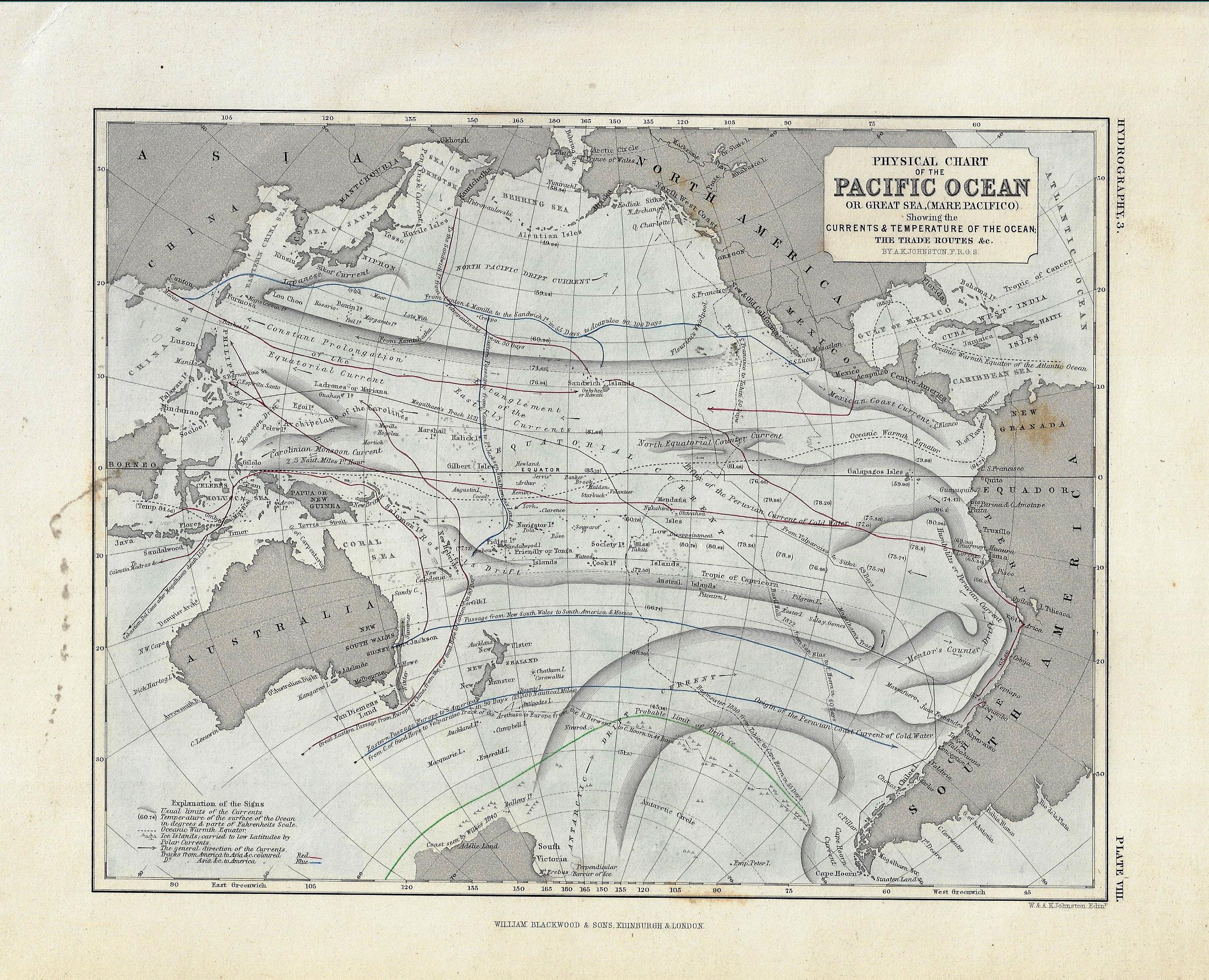
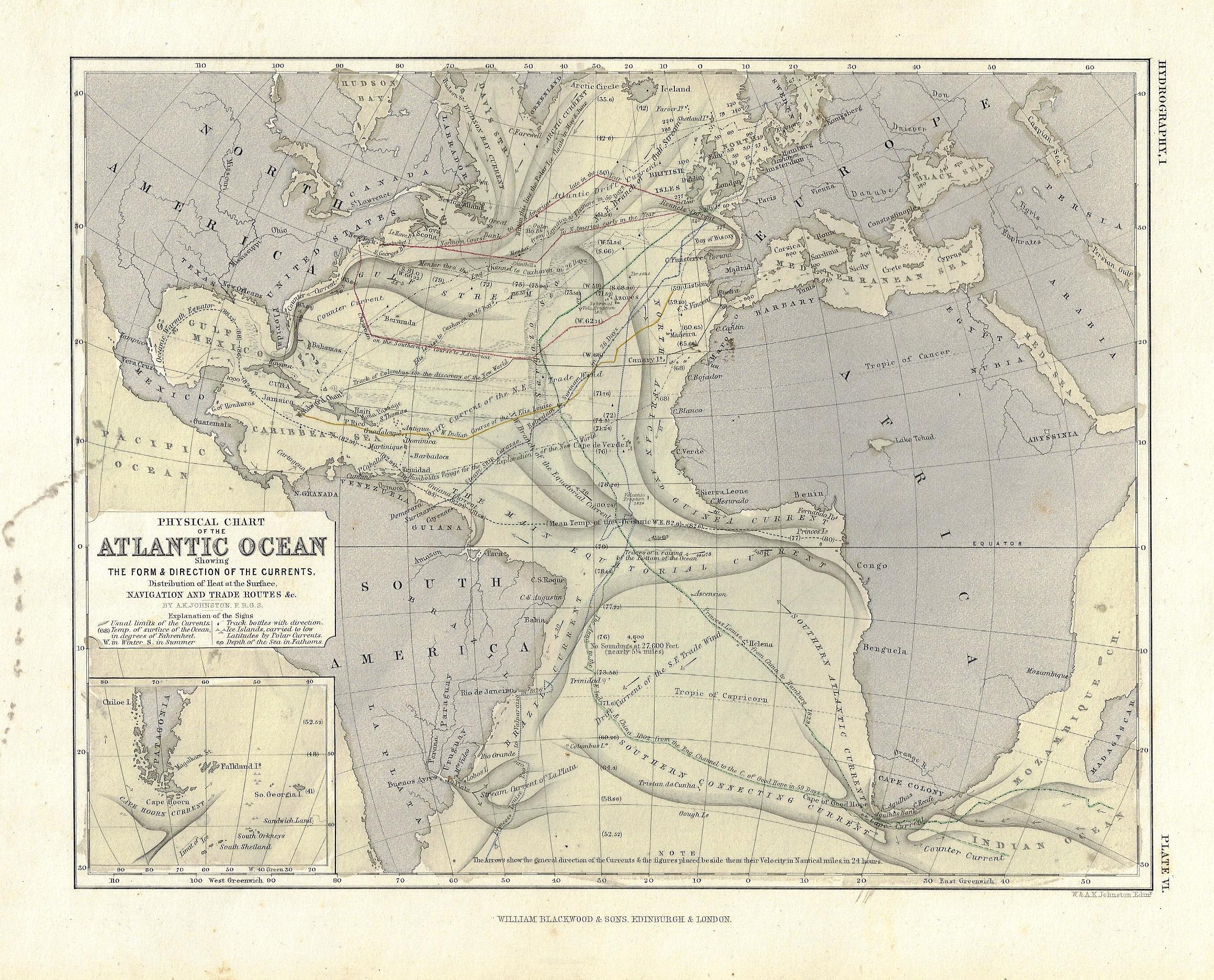
    These maps seems both simple and complex, orderly and chaotic. The truth of the matter is that there’s very little black ink on these sheets for as much information as they are sharing, and yet still look to be pretty deep in the data department.  They are maps1 of ocean currents of the Atlantic and Pacific Oceans, and show water temperatures, charts of historic voyages, lines of transportation along with how long the voyage would last, and other pieces of information. 

    Maps ocean currents pacific detail

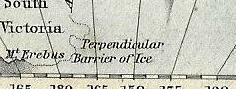
    I’ve scanned these in some detail so that they can be enlarged so that the tiny text can be read. While I was looking over these beautiful lines, I found the following lines at the extreme south edge of the Pacific Ocean map, in Antarctica, under the wide “Antarctic Drift Currents”, just barely on the map next to South Victoria: “perpendicular barrier of ice”.  ANd no doubt they meant it. The phrase is cold and barren striking, so I went looking for it online, to see how often it may have been used–and according to google, it hasn’t been used very much at all. One result from the Geographical Journal, which reads:

    “The result of these two seasons exploration was the discovery of a pool of more or less open water some 600 miles in diameter between latitudes 68 and 78 bounded on the west by a stupendous range of ice clad mountains on the south by a perpendicular barrier of ice and on the east and north east and for the most part on the north by the main pack.”2

    This was in response to the approach of reaching the magnetic South Pole, but in addition to everything else, there was this perpendicular wall of ice that stretched for miles and miles, an unapproachable mass hundreds of feet high, after which stood mountain, which were much higher. 

    There are many pieces of data like this on these maps–take your time and enjoy them

    Notes:

    1. The maps are from Johnston’s Physical Atlas, printed by William Blackwood & SOns in London, ca. 1860-1870. (There were earlier editions of this map, beginning in 1852 it looks like, that were considerably larger. The present maps are 20x26cm.)

    2. “Renewal of Antarctic Discovery”, by John Murray, in The Geographical Journal, 1904, volume 3, page 28.

      Maps ocean currents pacific


    Maps ocena currents atlantic

Recent Posts

Archives

Categories