A Daily History of Holes, Dots, Lines, Science, History, Math, Physics, Art, the Unintentional Absurd, Architecture, Maps, Data Visualization, Blank and Missing Things, and so on. |1.6 million words, 7500 images, 4.9 million hits| Press & appearances in The Times, Le Figaro, Mensa, The Economist, The Guardian, Discovery News, Slate, Le Monde, Sci American Blogs, Le Pont, and many other places… 5000+ total posts since 2008.

Category: American History: Western Exploration & Native Americans

  • A Suggestion for Another Genre of Boundary: the Nothing Frontier, 1900.

    JF Ptak Science Books   Post 2792  Part of the History of Nothing series

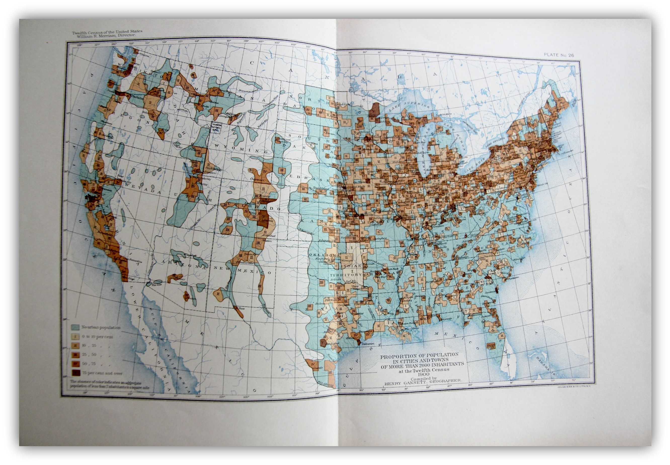
    The “frontier” in the history of the U.S. West is a pretty big deal, and old, the academic concept of  the frontier pressing its way back 13 decades, when for the most part once it was introduced it was pronounced to be “closed” by the man who reinterpreted it, Frederick Jackson Turner1.   On my shelves alone there are books on the mining frontier, the mineral frontier, the transportation frontier, the Indian frontier, the military frontier,the farming frontier, and so on, divisions allotted by wealth, nationality, numerous geographical attributes, and the like. One thing I think that I have not seen was the Nothing Frontier, where there are divisions divided by, well, sort of “nothing”. This is mostly a prosaic statement, slightly poetical, dependent on visual clues. And of course there isn’t “nothing” there because there is always “something”–there just isn’t very much of it.  And when things get colored-coded on map depending upon percentage distributions, and that object of measurement is left to a null color or no color at all, then it appears that the divisions one left to nothing.
    Maps--Census 1900 Urban

    [The image above is very expandable.]

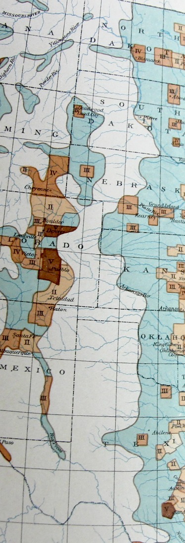
    This can be seen if you squint somewhat you can see an example of it in plate 26, “Proportion of Population in Cities and Towns of More than 2000 Inhabitants…” Statistical Atlas, prepared under the Supervision of Henry Gannett (Geographer of the the Twelfth Census), printed in Washington by the U.S. Census Bureau, 1903. This map–which is part of an historic series of atlases published with U.S. census data–shows the distribution of urban population in five shades of brown (as seen in the legend) plus a blueish color for “no urban population” as well as no color (“The allowance of color indicates an aggregate population of less than 2 inhabitants to a square mile”).
    Maps Census 1900 Urban detail

    It is that absence of color that makes it a frontier-ish sort of frontier, a part of the Made Up Frontier, this one being very straightforward north/south, Big Bend to Montana, pretty much the Lonesome Dove trail from the rough Big Bend Texas to nearly Canada.  

    I know it is just a thing I made up just now looking at the map, but given some effort, maybe the idea actually has some legs.  

    Notes

    1. Turner, Frederick Jackson. The Frontier in American History, Harvard University, 1920, full text via Project Gutenberg,  http://www.gutenberg.org/files/22994/22994-h/22994-h.htm
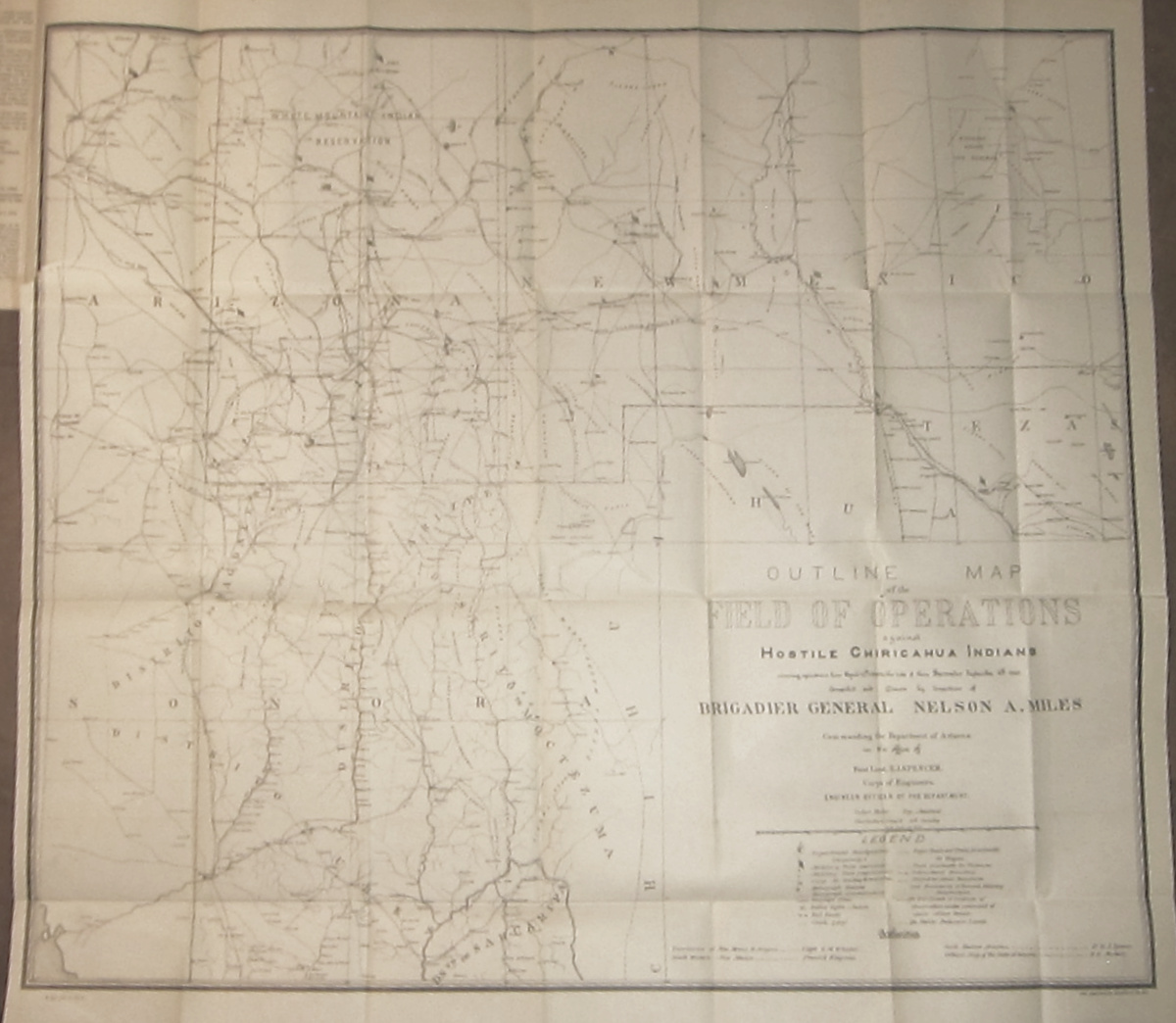

  • Geronimo Finally Defeated: of Miles, miles, and the Sun (1886)

    JF Ptak Science Books  (Expanding on an earlier post from 2011.)

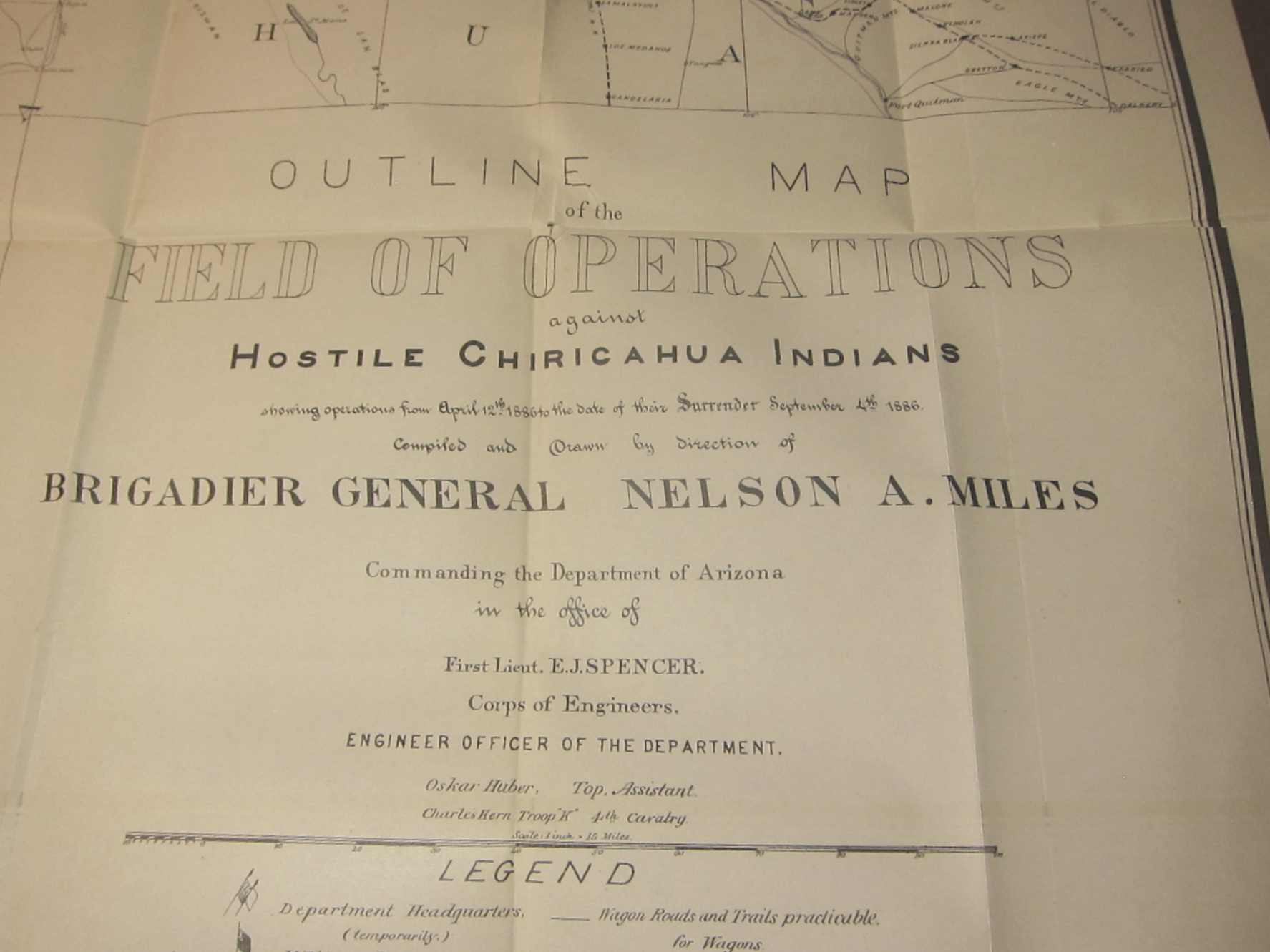
    The Chiricahuan Apache leader and chief, Geronimo (1829-1909), famously led a progressively diminishing band  through the  Apache Wars of the 1850’s-1880’s.  For thirty  years of so he quirted the U.S. Cavalry, darting here and there in great exploits and famous escapes, evading the armies of the United States and Mexico.  In the end, by 1886, there were just dozens who were following him, including women and children, and the elderly, ragged, tired, hungry, and pretty much, finally, beaten. A graphic display of this end is found in this terrific map:

    Geronimo _1_ full
    Outline Map of the Field of Operations against Hostile Chiricahuan Indians showing operations from April 12th, 1886 to the date of their Surrender 4th, 1886, which is a large, 29×25-inch folding black and white map lithographed by the American Graphic Company.1  [It covers all of Arizona and New Mexico south of 34 degrees N, from Phoenix on the west to not quite Roswell on the east, northern Sonora to well below Hermosillo, and extreme west Texas, and locates at least 40 army forts, camps and posts, as well as innumerable railroad whistle stops, ranches, and water holes…and of course locations of heliographic stations.]

    .

    Geronimo _2_

    I think what finally did Geronimo in were the miles of pursuit and the sun. 

    The sun got to him via the heliographic communication network established by Major W.J, Volkman under the direction of General Nelson Miles (the other “miles” of this equation of defeat), which allowed the pursuing American army to communicate instantaneously over great distances, over hundreds of miles, without the need for runners or men or horseback or cutable telegraph wires or time  The heliograph is an ancient instrument, used for more than two thousand years–in this case, they were very highly polished mirrors that reflected brilliant signals between stations, getting their light source from the sun. It allowed the army an enormous advantage, and one that finally caught up to Geronimo.

    The “miles” were just those, the thousands of miles Geronimo was tracked and retracked over that very difficult terrain in the southeastern part of Arizona and into northern Mexico, sharp mountains, endless badlands, caves, heat, height, cold….very difficult. (I’ve been there on treks.. .its tough land.)

    The capitalized “Miles” was the surname of General Nelson A. Miles who sent out  with Lt. Col. George F. Crook to track down and capture Geronimo–and they almost did, again, in late March, 1886, when Geronimo presumably surrendered, but then fled to Mexico. After another five months and 1,600 miles, Miles came upon Geronimo om in Sonoran mountain camp, and induced him for the final time in September, 1886, at Skeleton Canyon, Arizona.

    The details of the capture and surrender are told in many places by many others–I just wanted to surface the role of the sun in the capture of Geronimo.

    The old man was shipped east,  never to see Arizona again. He died after being thrown from his horse and contracting pneumonia as a result of being unable to help himself to safety through a long cold night, died in a bed as a prisoner in Ft. Sill, Oklahoma.


  • Teepees and Petroleum Companies, 1885

    JF Ptak Science Books  Quick Post

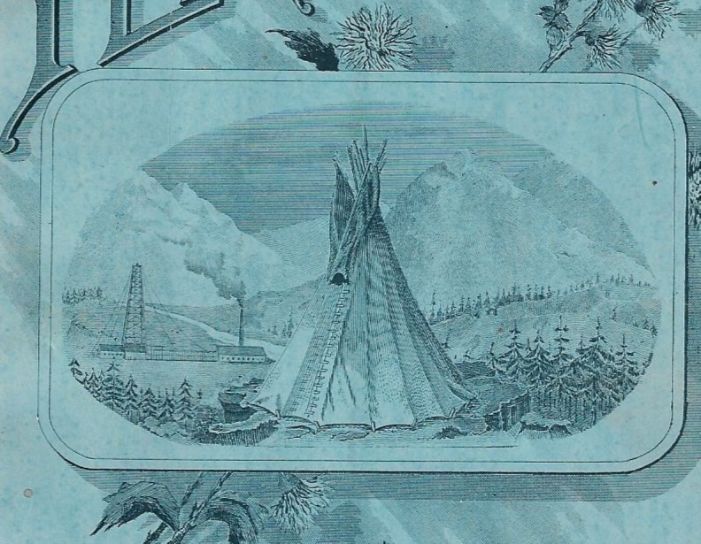
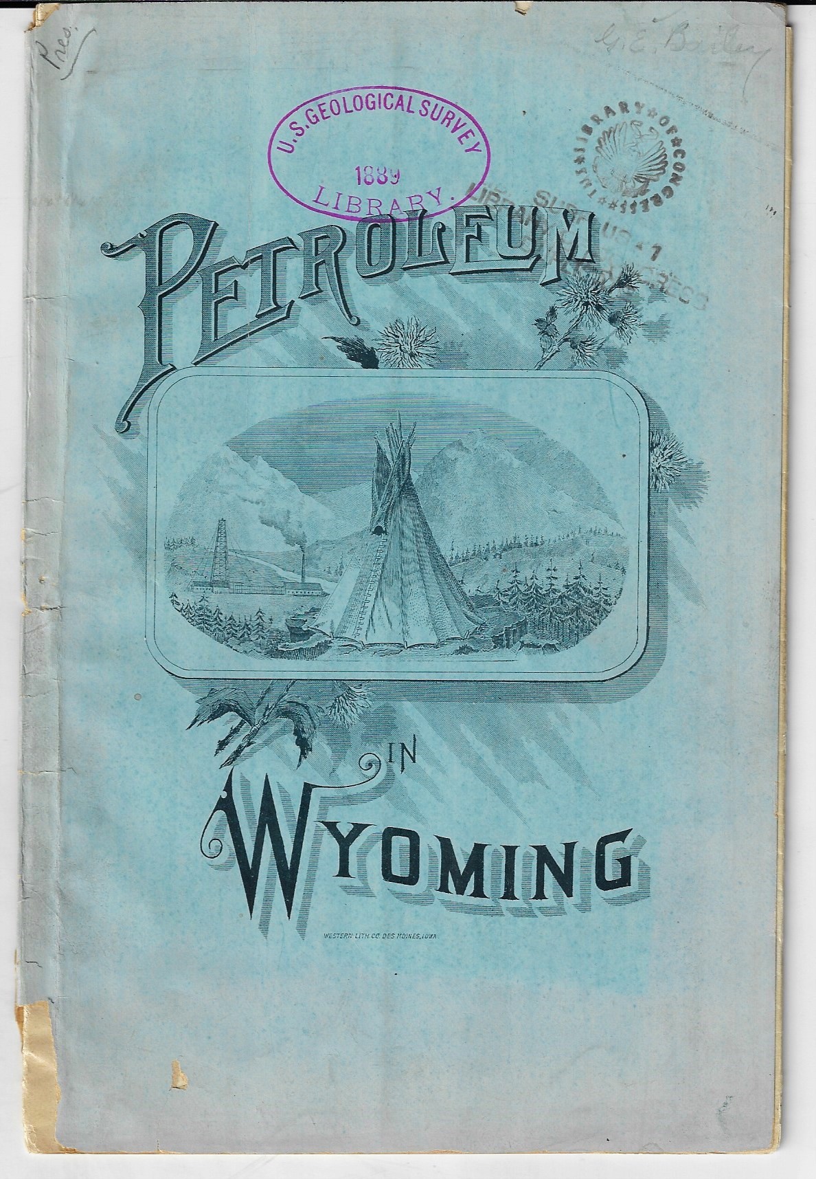
    Wyoming _2_I was working on this 1885 pamphlet1 on petroleum in Wyoming territory, and was stopped by the cover illustration. As you can see, the cover shows a teepee (which would be about right seeing that most of the numerous Indian tribes there in the territory before White incursion were nomadic)—behind it though we see oil derricks, which I am sure was not the case, unless the derricks were on Indian land. In 1880 the (non-Indian) population of Crook County was 239, which “jumped” to 2,300 in 1890, (then to 6k in 1910 where it has stayed about constant since). In 1890 the Indian population in all of Wyoming was 2,063 (or thereabouts, according to the U.S.1890 census special volume Indians Taxed and Indians Not Taxed), and of that figure nearly the entirety of the population–1,861–were on reservations. And according to the census report of the 189,000 reported Indian population in the country 133,000 were on reservations, while another 50,000 were living in Indian Territory which did not in the government’s mind count for being on a reservation, making for something like 5,000 Indians not on reservations or I.T. territory in the entire U.S. and territories. So, picturing the teepee set before a petroleum industry scene was exceedingly and vapidly prosaic.

    WyomingNotes:

    1. Gilbert Ellis Bailey (former State Geologist of Wyoming). Petroleum in Wyoming Territory and special report on the Stockade oil district and the property of the Lakota oil and coal mining company in Crook County, Wyoming. No publisher or place of printing is noted. No date (though it is certainly before statehood in 1890); Stanford guesses 1885.  8.25”x5.75”, 19pp, with a small folding map of the county.  Printed wrappers. Provenance: U.S. Geological Survey Library, gifted to the Library of Congress in 1921. One copy only (Stanford) located by WorldCat.  


  • North American Native American Populations from a 1790-ish Source

    JF Ptak Science Books   Quick Post

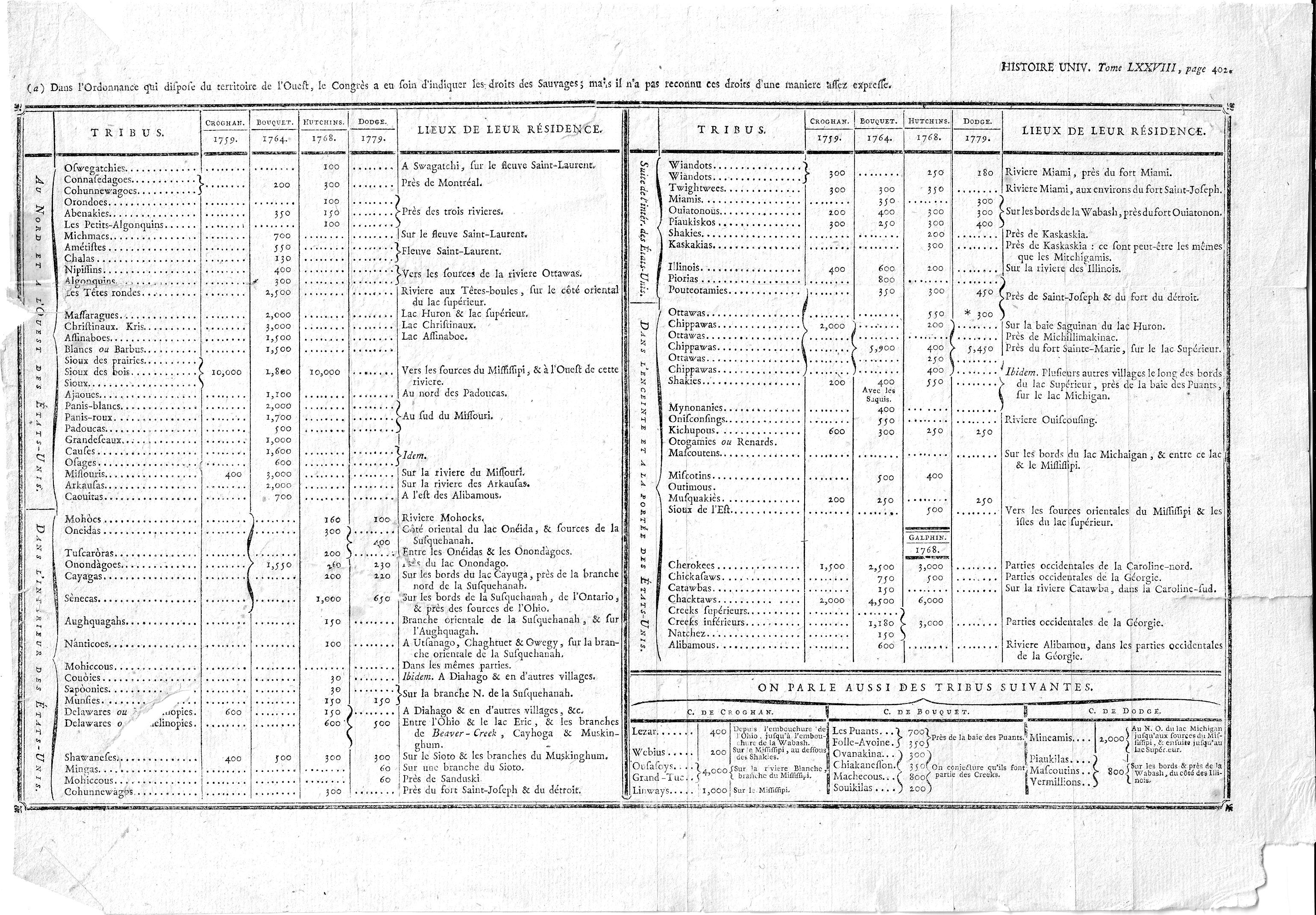
    I’ve decided to simply post this interesting chart without comment–it seems that in my experience I haven’t often seen such a long list of tribes with populations at such an early date. Here’s the thing, though–I’m not exactly sure of it origin. It is a folding plate from Histoire Universelle, though with this generic title I don’t know the author or year, though I guess it to be 1790’s (judging by the paper and other clues). As a matter of fact the only hit I get from the interweb on the title of the graphic is for a reproduction of the data over four pages in Jean Nicolas Démeunier’s L’Amérique indépendante, ou Les différentes constitutions des treize provinces…though he gives no attribution for his heavily-borrowed stats. The author of this set of stats though, did, with estimates of population numbers from four sources for 1759-1779. So:

    Indian tribe populations

    And some detail images:


  • A Fine Moment in the History of Mistakes: Attacking California, 1842

    JF Ptak Science Books  Quick Post     Part of the series on the History of Anticipation

    Catesby ap JonesOops!

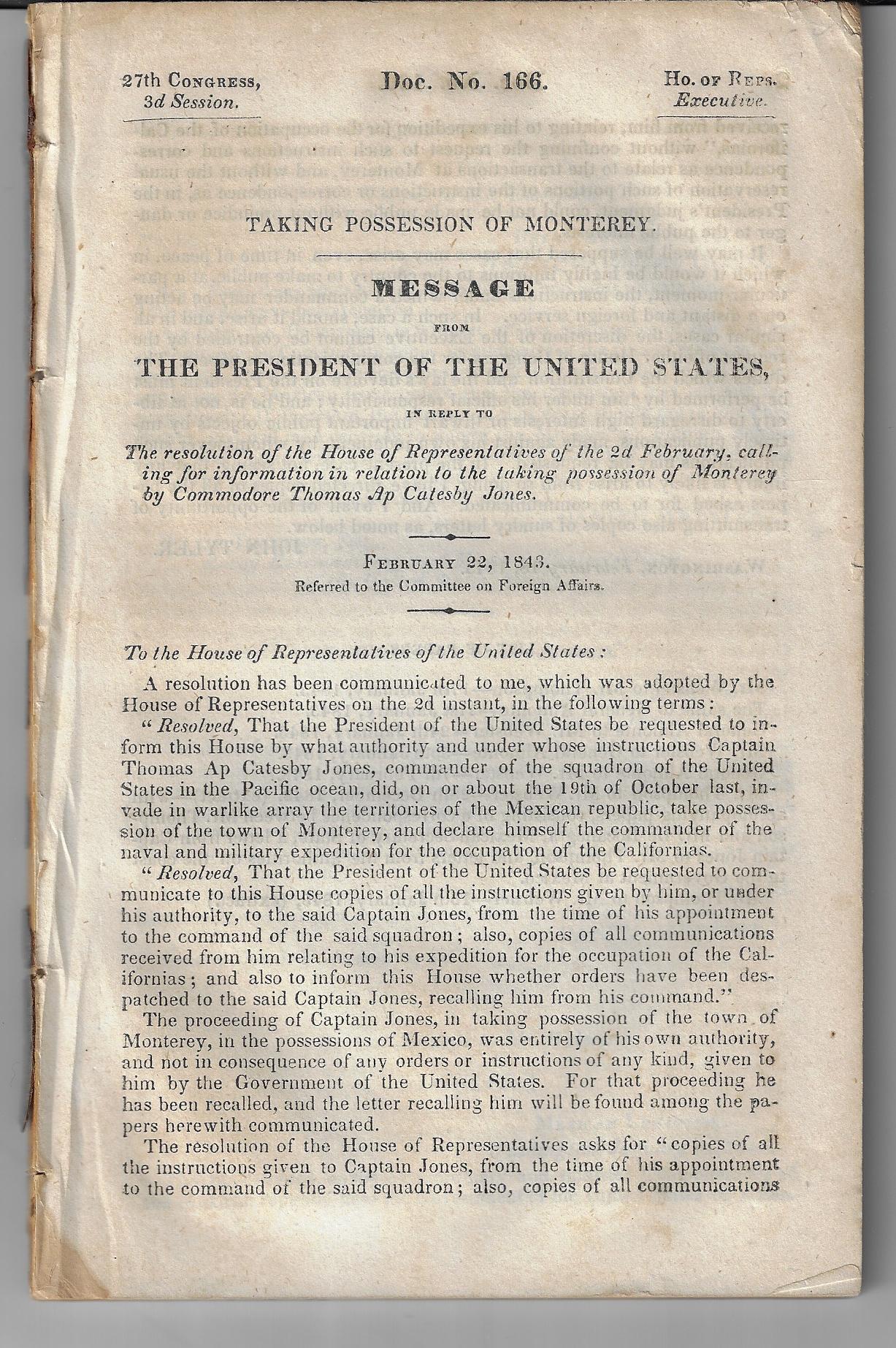
    The wonderfully-named Thomas ap Catesby Jones (the “ap” evidently a Welsh patronymic indicating “Thomas, son of Catesby”) was a Commodore in the U.S. Navy in 1842 when a Short Series of Unfortunate Events occurred. Jones (1790-1858), a War of 1812 veteran, commanded a group of three naval vessels (including his frigate the USS United States and two sloops of war) from Lima Peru to upper California after understanding that the U.S. Was at war with Mexico and that there was a fear that the Brits were on their way to take over the middle-western coastline. So off he went, arriving at Monterey1 in October 1842, about four years ahead of the war. He settled off the cost and demanded the surrender of the Mexican gallery there, which consisted of about 60 soldiers in an old fort. The Mexicans, outnumbered and no doubt confused, surrendered the port the next day. The day after that, Jones received word that he had jumped the gun, somewhat, and withdrew from Monterey, with his apologies. From there, he went off to chase the British away from Hawaii, and somewhere in this course of events transports the deserter Herman Melville back to the U.S.

    I cannot leave this without mentioning that Jones’ nephew was named Catesby ap Roger Jones (1821-1877).

    Notes:

    1.  A good source of information on this action: Taking Possession of Monterey. Message from the President of the United States in rely to the resolution of the House of representatives…calling for information in relation to the taking possession of Monterey by Commodore Thomas Ap Catesby Jones. February 22, 1843. House of representatives Executive Document Number 166, 27thCongress, 3rd session. 9X6”, 117pp. Howes M 740aa. Cowan 317


  • “Indian Title Extinguished”

    JF Ptak Science Books  Quick Post

    Indian title has been extinguished711

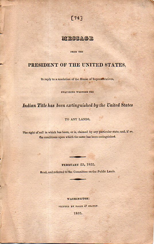
    That’s part of a short (12pp) and stiff little report from President James Monroe asking if Indians of all sorts did indeed have title to their lands within the United States, which means, I guess, that this was really a question in 1822.  Given the number of treaties and the number of treaties with the Indian Nations abrogated and annulled, it still didn’t set me up for this basic question, which really surprised me.  The publication comes a few years after the end of the first Seminole War (1816 or so to 1819), the aim of which was to move the Seminoles from north Florida (Florida having just been ceded to the U.S. a few years earlier) to, well, somewhere else–this occurred in 1819, when the Indians succumbed and were forced to live in central-ish Florida. This didn’t last for long, though, as the Second Seminole War (a much more expanded conflict fought 1835-1842) decimated the Seminole population, the remaining people subsequently were removed from central Florida completely away to Indian Territory.  This was all before the official “removal policies” begun under Monroe and John C. Calhoun (and many others), something that people like Ben Franklin and George Washington were against back in their late days.  

    Indian title has been extinguished712

    The answer seems to be that the question was too big for an answer. and that each treaty had to be treated individually–in short to me it reads like a null response.  


  • A Great National Moment Hidden in a Single-Sentence Description (1814)

    JF Ptak Science Books    Post 2624

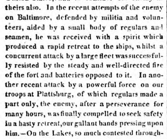
    I was working my way through a stack of volumes of  William Cobbett’s Political Register containing reporting for the war years for the War of 1812–this magazine/newspaper was  a weekly journal of news and interpretation by an American-sympathizing radical journalist reformer Brit.  Looking for one event in particular, I came across it in an official report of September 19, 1814, dated from Washington City, in the November 14, 1814 issue of the  Register, Nestled in the “official reports” section is this summation of the action of September 13, 1814, in the city of Baltimore, which was under siege by a large British fleet, which was “successfully resisted by the steady and well-directed fire of the fort and batteries opposed to it”.

    Here’s the snippet:

    Cobbett Ft McHenry

    • Source: William Cobbett, Cobbett’s Political Register, London, printed for the author and sold by Richard Bagshaw in Covent Garden, volume 26, November 5, 1814.  

    Much of the critical bombardment of the fort occurred at night, and for one observer–an official U.S. representative then being held in custody by the British on board a ship in the harbor–the outcome of the battle would not be known until the first light of day.  What he saw that morning by dawn’s early light was what he had seen in the evening, hailed at the twilight’s last gleaming,–a U.S. flag (a “star-spangled banner”) flown above the fort, meaning that the fort had survived, the defense maintained, with a victory in hand. 

    The fort was Fort McHenry, and the U.S. representative here of course was Francis Scott Key, who turned his experience into a national witnessing, presenting it in a poem later to to music that would become the national anthem.  

    There was no mistaking the victory described here at Baltimore (and also the mention of the major victory at Plattsburg), though there was not much flavor to the reporting. But here it is, a great national moment, appearing as a single sentence with four commas. Given the scanty capabilities of overseas reporting perhaps these were the scant public facts that were presented to the British people buying Cobbett’s two-penny weekly (much scorned by the wealthy/well-do-do and much read by the actual working class), so the emotive significance of the event was lost to detail and translation. The impact of the victory was certainly felt very quickly in the U.S. 

    This is one reason why it is so interesting to read the original reports and publications of historical social and scientific events.


  • When U.S. Forces Occupied Los Angeles (1848)

    JF Ptak Science Books    Quick Post

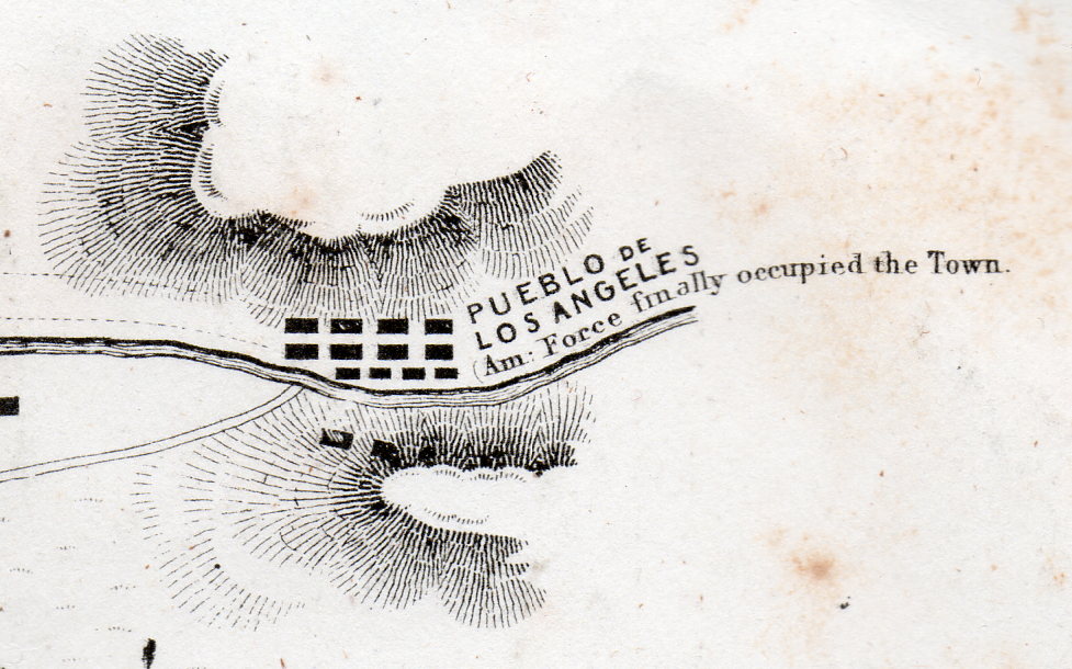
    Battle Los Angeles 1848926[Detail of a one square inch area in the original.]

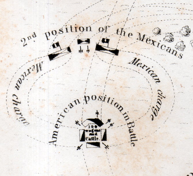
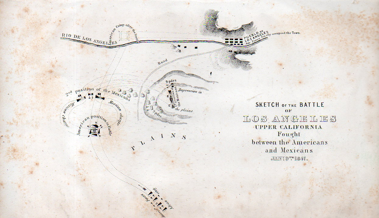
    This lovely map has a few tiny bits of unexpectedly weird details–I mean they’re historically accurate and all, it is just that removed and presented apart from the context of the rest of the map the details take on a peculiar–and attractive–surreal quality.

    Battle Los Angeles 1848927[Detail of a one square inch area in the original.]

    The map is a Sketch of the Battle of Los Angeles Upper California fought between the Americans and Mexicans, Jan 9, 1847, and published in 1848. The map depicts the grounds of the Battle of the San Gabriel River, a victory for the United States, which resulted in the retaking of Los Angeles from the Californos a couple of days later, on January 10.  

    Full explanations of the battle can be found in a number of places, but this one is pretty concise and clear. 

    ,Battle Los Angeles 1848925

    Origin:  EMORY, W[illiam] H[emsley] (1811-1887). Notes of a Military Reconnaissance, from Fort Leavenworth, in Missouri, to San Diego, in California, Including Parts of the Arkansas, Del Norte, and Gila Rivers…Made in 1846-7, with the Advanced Guard of the “Army of the West.” Washington: Senate Executive Document No. 7 [30th Congress, 1st Session] Wendell and Van Benthuysen, Printers, 1848.  (13 x 22.2 cm; 5-1/8 x 8-3/4 inches). A bit of foxing, otherwise a good copy of this map.  

    This map is available from our blog bookstore, here.


  • A Peep at Some Texas Poker Players, 1930

    JF Ptak Science Books    Post 2462

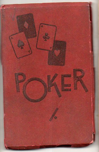
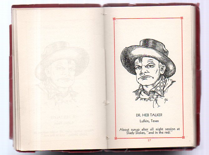
    Here’s an interesting (literally) little book1 on Western poker players and poker in general published in the Great State in 1930.  What makes it very appealing to me is that it has colorful and rusty minute biographies (with drawings) of some of the noteworthy Western players, though it is particularly Texas-centric.(15 of 21 of the players are from that state). 

    Poker584(The Library of Congress Copyright entries for 1930 lists “J.F. Dresing, Jr.” 2 in what may be the author’s chair.)  

    Poker582

    Contents of the pamphlet:

    Introductory:

    • “Rules for Winners (How to win more)” with advice such as “…Get in first blow on arriving home by advising wife of the pre-carious condition of the SICK FRIEND…”
    • The pamphlet also offers “Rules for Losers (How to lose more)” such as “…attempt to “bluff” the winners frequently, and note result….” And “…draw for middle straights whenever the opportunity offers…” and “…never despair…”
    • General Rules, such as “… when the cards are passed around, and the ‘pot not opened,’ do not neglect to mention, ‘honest dealer’”
    • Rules for On-Lookers or Sweaters, such as “…request the cinch players to loosen up…” and “…talk all the time, criticize every man’s play…”

    Wild Cards section:

    • “Addresses to Make Up a Game table”
    • “Experience log to track who owes what”

    And then comes the 21 images of the great Texas poker players and their one-line identifications, which are entertaining and probably not very helpful:

    Damon G. Gaiter, Dallas, Texas, “Who plays them wide open and makes the ‘going’ rough for the Leathered Vested FRATERNITY.”

    B.A. Parrett, Owl-Den, Texas, “Who talks loose, but plays tight.”


  • What They Knew in 8th Grade in 1895 (And What You Probably Don’t Know Now)

    JF Ptak Science Books   Post 2457

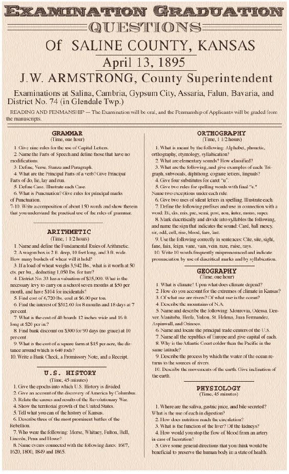
    I’ve bumped into this exam a number of times around the web–it is for an eight grade final exam for Salina, Kansas, in 1895. (That’s the year that physics changed nearly completely with the discovery of the x-ray by W. Roentgen.)  Perhaps it is an “average” test of competency for kids of this rank and year–that would be sort of appropriate, in a way, since the geography of Salina puts it almost at the middle of the state and almost at the center of the country.  Salina wasn’t organized as a town until nearly the Civil War; it grew from 900 people in 1870 to 3,000 in 1880 to 6,000 in 1890, mostly because of the cattle trade and then farming.  So when this test was made, the kids taking it were probably the children of farmers or millers, working class families.  

    Salina[Source:  http://fanaticcook.blogspot.com/2011/11/1895-eighth-grade-final-exam-from.html]

    It reminds me a lot of the general physics and natural philosophy and mechanics textbooks for kids that I’ve seen from the 1850-1900 period–lots of very practical stuff that went into running a life, plus the theoretical bits, and applied inferential parts.  I know that I can go to Ganot’s Physics for 1885 and see how I can pull the stuff together that I can make an explosive with to remove a stump.  Also there’s the mechanics of rolling a wagon sideways along a steep embankment and what makes it possibe/dangerous to do so.  And much more.  A lot of that would fly out of you head in short order, but a lot wouldn’t; and at least you’d have the cerebral muscle memory to know how to try to figure a problem out even if you didn’t have all of the parts to do so.  


    And so, with the Salina test, there’s a lot of material that an 8th grader (or adult) would just not know because there was no need to teach it. On the other hand, sitting down to “explain” arithmetic is a good question, and probably a necessary one, but still looks foreign to the reader in 2015.  Also the question “what is punctuation?”–that’s a good one.  

    So here’s the questions. I think that they reveal more of what you’d like to know rather than what you do know..

    Also I note that they used the term “U.S.” history rather than “American” history, since the questions are more about the United States of America and not about the continent/s, which includes a lot more than just the U.S.  

    Eighth Grade Final Examination, Salina, Kansas 1895