A Daily History of Holes, Dots, Lines, Science, History, Math, Physics, Art, the Unintentional Absurd, Architecture, Maps, Data Visualization, Blank and Missing Things, and so on. |1.6 million words, 7500 images, 4.9 million hits| Press & appearances in The Times, Le Figaro, Mensa, The Economist, The Guardian, Discovery News, Slate, Le Monde, Sci American Blogs, Le Pont, and many other places… 5000+ total posts since 2008.

Category: American History: Western Exploration & Native Americans

  • Among the Earliest Published Images of Chaco Culture, 1851

    JF Ptak Science Books   Post 2467

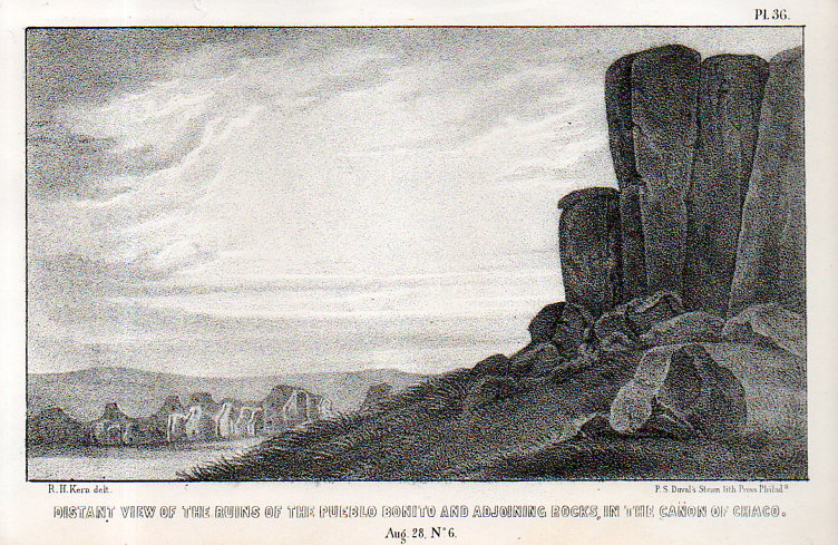
     Pueblo Bonito–built between 840-1100 SCE– is a ruin of the ancestral Puebloan peoples and is located in northern New Mexico. It is situated on a small rise in the long Chaco Canyon, and I’d say that viewing the ruins from photos or maps doesn’t convey the grandeur as you approach it walking up the slight rise–it really does sit prettily in its environment, and is very impressive. (The ruins are about 50 miles east of Canyon de Chelly and about the same distance from the Four Corners.)Kern bonito002

    This image–the first ever published of the structure?–appeared via the military and government exploring expedition and published in the report Journal of a military reconnaissance, from Santa Fé, New Mexico, to the Navajo country, by J.H. Simpson. Simpson was in charge of the exploring party, assisted by the guides Sandoval (Navajo), Hosta (Jemez Pueblo), and Carravahal (Mexico)1.

    The artwork is by Richard Kern (d. 1853) who along with his brother Edward (1822/3-1863) led extraordinary and near Zelig-like lives of exploration, and were among the first to provide accurate, scientific visual reports of the environment, architecture, and people in the Arizona, New Mexico, and southern Colorado areas (and especially in the Four Corners region). 

    • Full text of the report can be found here:  https://archive.org/details/journalamilitar00simpgoog

    This is one of the many images made for the work, undertaken under great duress at times, and under severe hardships, by Richard and Edward Kern during this reconnaissance of the Navajo lands of the Southwest. The remarkable thing is not only how they survived, but also how truthful the published images are to the original drawings.  

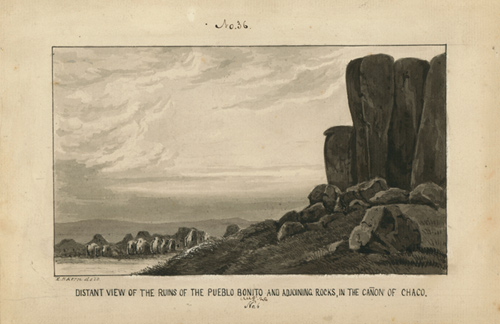
    And the original black+white wash, found int eh collections of the Academy of Natural Science of Philadelphia:

    Kern pueblo bonito

    [Source: Academy of Natural Sciences, Philadelphia, Everett Sale Library  http://www.ansp.org/research/library/archives/0100-0199/kern146/]

    And the text associated with the drawing, pp 40-42: 


  • Two Very Early Los Angeles Maps, 1850-1855

     JF Ptak Science Books   Post 2443

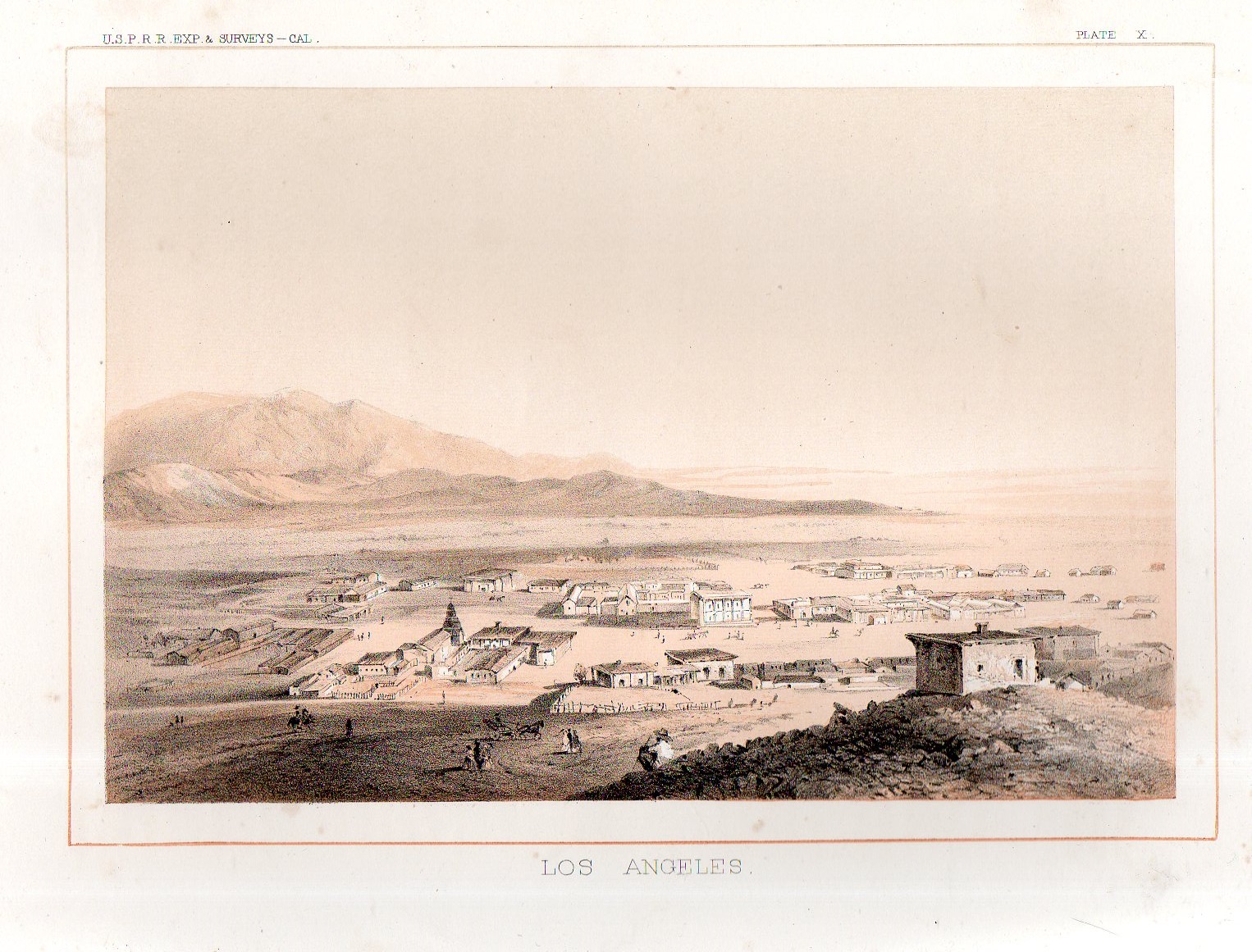
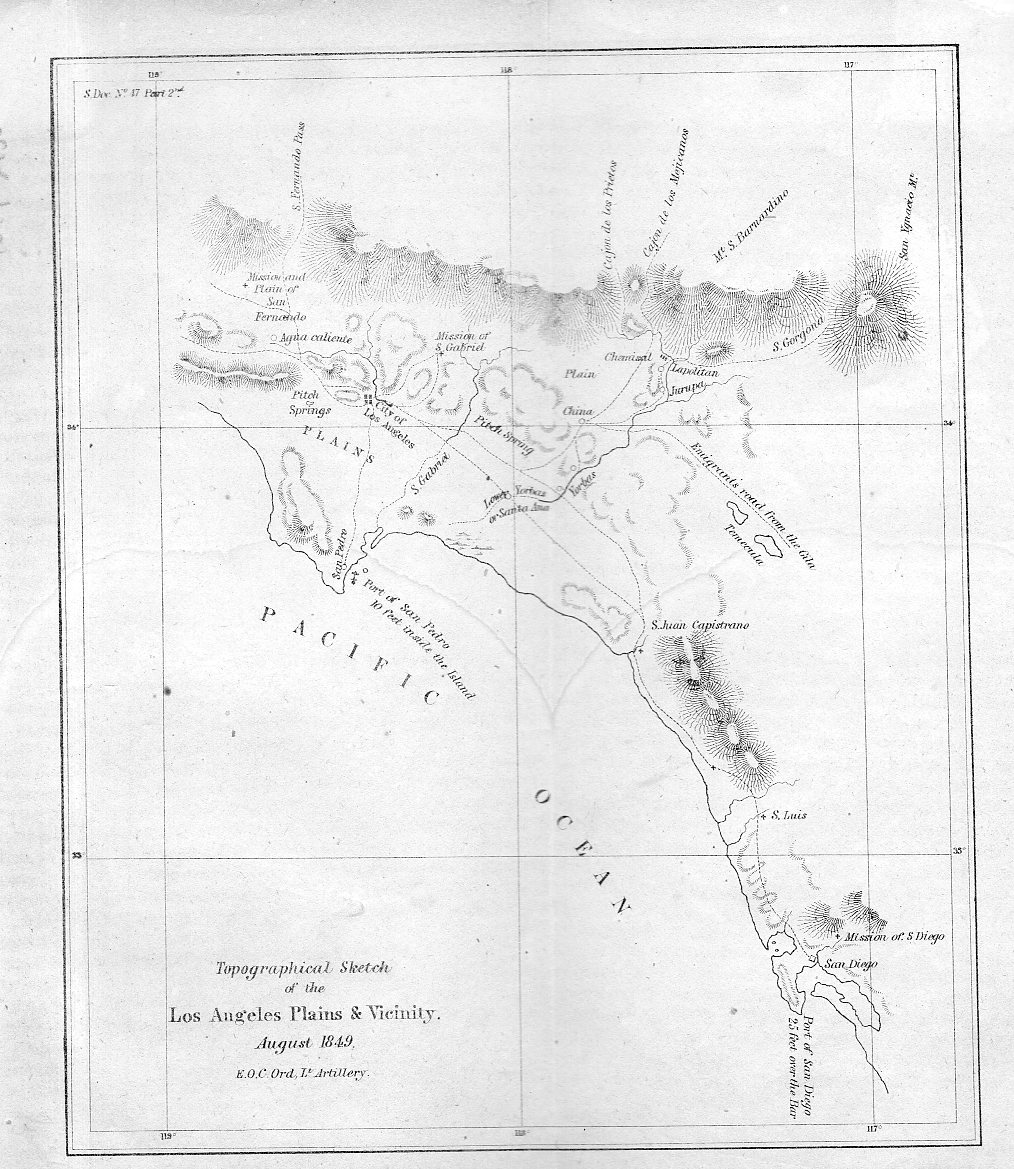
    Well, one is a map and the other is a view, but that is harder to say in a title. They are extremely early for what they are. The first item1, depicted just below, is a map drawn by the accomplished Edward Ord of (mostly) the entire Los Angeles Plains, reaching down to San Diego in the south and up to the“Mission and plain of San Fernando”  in the north. It is a small but important map, one of the very first scientific maps of the region. It is a military map of the area–drawn just after the American conquest–and it is also a gold rush map.  It appeared as one of the illustrations in the first significant scientific work on the California gold rush: Philip Tyson’s Information in Relation to the geology and topography of California, which was published in 1850.  

    • (All of these items are available for purchase via the blog’s bookstore, here.)

    Los Angeles 1850917

    From the first scientific rendering of Los Angels in 1850 comes the first view of the city–it is tiny by the modern standards of a small time but here in 1855 it was fairly well seasoned and developed, with at least 100 structures.  The first L.A. bird’s eye view appeared in the great survey of possible routes for the transcontinental railway called the USPRR Surveys (or the U.S. Pacific Rail Road Survey2).

    Los Angeles 1855918


    Notes:

    1. See this interesting popular story on the map in  Los Angeles Magazine  http://www.lamag.com/citythinkblog/citydig-the-los-angeles-plains-plainly-sketched/

    Also if you’re interested in reading Ord’s correspondence regarding the map see here in The Army Surveys of Gold Rush California: Reports of Topographical Engineers, edited by Gary Clayton Anderson, Laura Lee Anders

    2. The fuller title: Explorations and Surveys for a Railroad Route From the Mississippi River to the Pacific Ocean…Report of Explorations for a Route…Near the 38th and 39th Parallels of North Latitude .. Volume V , Washington: GPO, 1855. 


  • A Very Sympathetic Statement on the American Indian, 1880

    JF Ptak Science Books  Quick Post

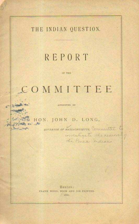
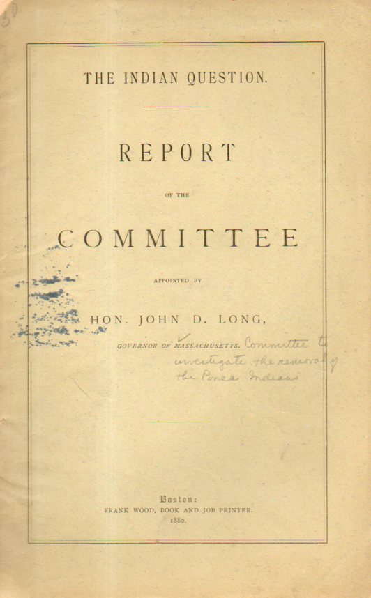
    Indian question576The fighting end of the American Indian Wars was coming to an end when this pamphlet was published in 1880.  When I opened it I fully expected to see the issue of the “questions” of the American Indian being Indian control, or the “problems” of Indians retaining reservation lands now much in demand by settlers, and so on. As it turns out, this report was a very sympathetic investigation of the problems that the Indians were having. The “Indian Question” was a big one–why were the Indians  being so hideously treated?  


    Some of the discussion presented in the pamphlet included section headings like  “unsuitable reservations”, “the way the government robs the Indian”, “evils of the present system”, “Indian children equal to the white in capacity”, “rapid advancement of Indians”, “robbery of property of Indians”, “gross mismanagement and cruel treatment of Indians, “the punishment of murderers of Indians” (which the pamphlet records as “none”), “violation of treaties by the U.S. government”, “inexcusable neglect of Indian Department”, and such.   Pretty impressive.

    Here’s the entire document from the Internet Archive–it is well worth at least a browse. 

     https://archive.org/stream/indianquestionr00indigoog#page/n10/mode/2up

    Notes

    1. LONG, John D. The Indian Question, Report of the Committee appointed by Honorable John D. Long, Governor of Massachusetts. Boston; Frank Wood, 1880.  8vo, 26, 47pp.  Original wrappers, institutional stamp on rear wrapper from the Library of Congress; U.S.  Geological Survey rubber stamp on back of the title page


  • An American Exodus

    JF Ptak Science Books  Post 2244

    LAnge migrant detail

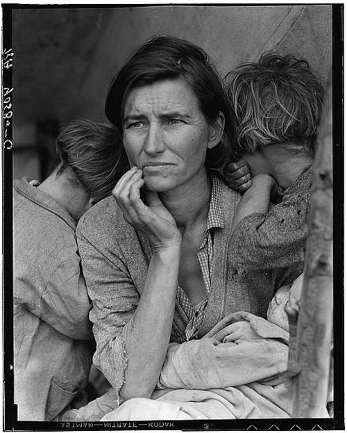
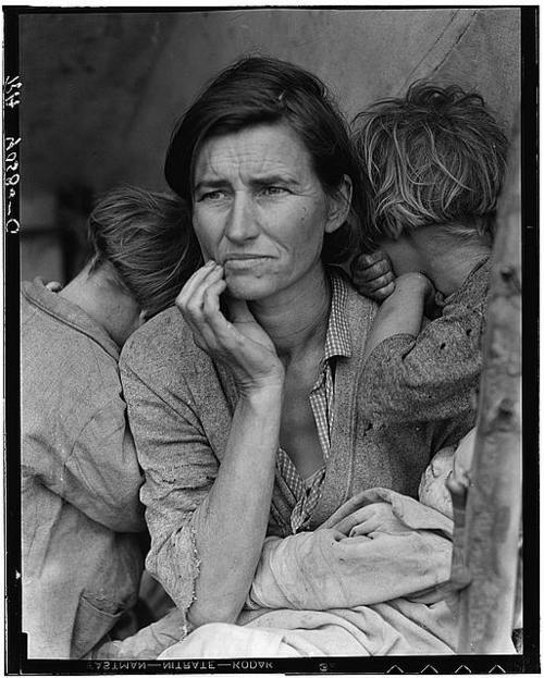
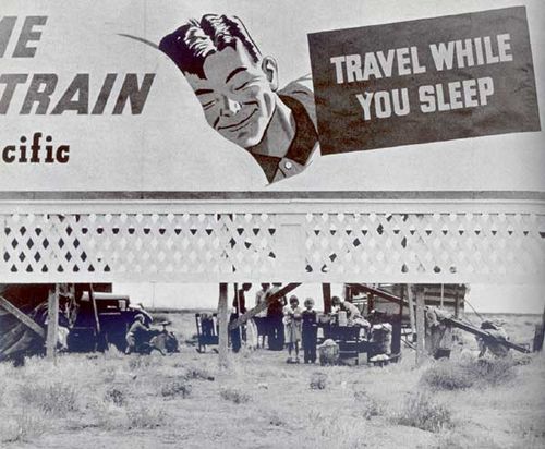
    Everyone knows this image: the Madonna of the American 1930’s, the Migrant Mother, a photograph made by Dorothea Lange, a photographer for the Federally-funded Farm Security Administration. Lange was still very new to the FSA project when she made this photograph in the spring of 1936. On the tail end of a month-long road trip she was nearing the end of her day when she spotted a hand-lettered sign “Pea-Pickers Camp” by the side of the road. Lange briefly considered stopping but went ahead, questioning her judgment continuously for the next 20 miles, when she finally turned around to find the turn-off for the camp. She drove down the dirt road and found a ramshackle assembly of tents, one of which contained “an exhausted mother sitting forlornly with her children”. Lange spent only 10 minutes with the woman, making five exposures. She learned that “the crops had frozen, and the woman and children were living on vegetables scavenged from the fields, and the few birds that the children managed to catch. The mother could not leave; she had sold the tires from her car”.  It was published almost immediately and quickly became one of the great iconic images of the Depression, as well as for the American century.  
    Lange migrant mother

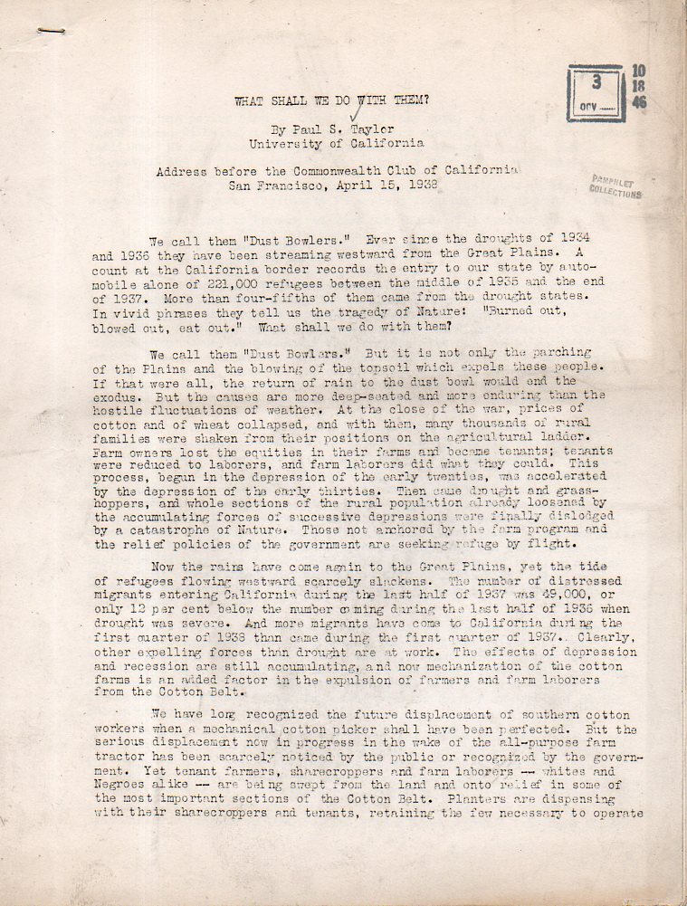
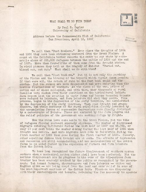
    I was thinking about this because of a typewritte, offset-printed pamphlet I bought written Paul S.Taylor, “What Shall We Do With Them” ( an address before the Commonwealth Club of California, San Francisco, April 15, 1938)–the “Them” being the dustbowler, the migrant workers, the disposed.  Paul Taylor was at this time three years into his marriage with Lange—he was a progressive thinker and a FSA operative who helped Lange land her job and was a part of an extraordinary team of very expansive ability that documented a pivotal period in American life. He was also co-creator with Lange of their great documentarian centerpiece of the 1930’s, An American Exodus, a Record of Human Erosion, which was published in 1939, the same year as the publication of The Grapes of Wrath and the release of the Wizard of Oz and Gone with the Wind. (Two years later–1941–James Agee (text) and Walker Evans (photographs saw their long-developing Let Us Now Praise Famous Men was published.)

    In this pamphlet Taylor gave testimony on migrant workers and nearly the height of the Depression—he was an expert, having traveled and lived among them and written academic papers on what he found. He outlined possible answers to the question, which had mainly to do with stability, which of course was the primary concern for the many of thousands of individuals and families who were once-stable but now very mobile, not having place to live or places to go. Taylor thought that opening dams and supplying irrigation and affordable government-owned houses would be the first of many steps to take to relieve the widespread suffering.  In all of the alphabet-soup programs uundertaken by the Roosevelt administration, none were nearly as “successful” in ending the national social erosion as the events that were to unfold less than a year later.
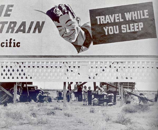
    Lange travel sleep

    Dorothea Lange “Three Families, 14 Children” US 99 San Joaquin Valley, California, November 1938. An American Exodus
    Taylor dustbowl092

    Notes:

    Lange describes her encounter with the Migrant Mother as follows:

    “I saw and approached the hungry and desperate mother, as if drawn by a magnet. I do not remember how I explained my presence or my camera to her, but I do remember she asked me no questions. I made five exposures, working closer and closer from the same direction. I did not ask her name or her history. She told me her age, that she was thirty-two. She said that they had been living on frozen vegetables from the surrounding fields, and birds that the children killed. She had just sold the tires from her car to buy food. There she sat in that lean- to tent with her children huddled around her, and seemed to know that my pictures might help her, and so she helped me. There was a sort of equality about it”. (From: Popular Photography, Feb. 1960).
  • The Newspaper Frontier, 1880: Cutting Texas (Almost) in Half

    JF Ptak Science Books   Post 2240

    The idea of the frontier in American history has been around for quite some time, made famous and mostly-invented (and closed) by Frederick Jackson Turner in 1893, and expanded, imagined, enticed, magnified, micro-analyzed, and  generally messed with ever since.  There have been all sorts of frontiers introduced into the study of the birth, expansion and filling-up of this country, from the very earliest colonial periods of Indian frontiers, “far-western” river frontiers of the Connecticut, Delaware, Hudson (!) and Susquehanna, to the Appalachian frontier of the early western reaches of the colonies, to the transportation frontier, the slavery frontier, the gold and mining frontier, the gun frontier and so on.  

    TExas newspaper

    I’ve got another bit to add:  the newspaper frontier.  

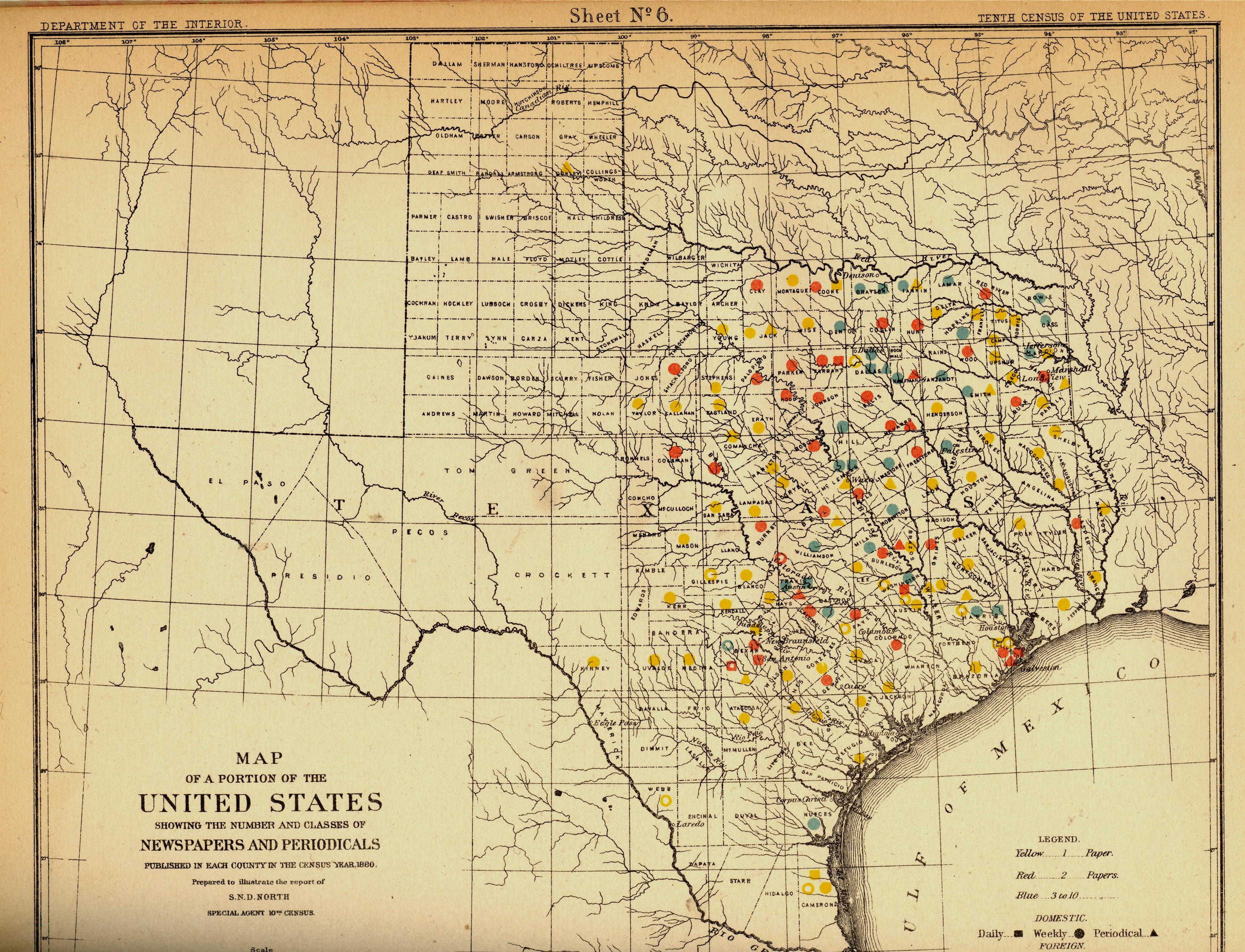
    I just happened upon a volume of the US Census of 1880, with a special report by S.N.D. North entitled History and Present Condition of the Newspaper and Periodical Press of the United States…and published in 1882.  What provoked me was the map of Texas newspapers for 1880.  It very clearly, and like no other map of its kind, delineates a fantastic line/frontier between the Texas with newspapers and the Texas without newspapers. We see very clearly that the frontier of the newspaper stops fairly abruptly (and wonderfully) at the 100th meridian, with only two newspapers in all of the rest of Texas found beyond that point (and those just barely beyond the 100th.  And it’s the 100th meridian that mostly marks the vertical middle of the country, running through North and South Dakota, Kansas, Nebraska, the Texas/Oklahoma borders, and so into Texas—if you folded this map vertically in half it folds virtually on the 100th meridian.  An odd bit, it is, half of the country and then approaching half of Texas. 

    I should report that the newspapers west of the 100th meridian were in Kinney County (population 4,440) with the Fort Clark News (established in 1880, at exactly the year of census) and Donley County (population 160, with the monthly Clarendon News and a 50-cent annual subscription rate).  The newspaper development also sort of followed the frontier fort development, almos tall of which (but four) were east of the 100th. 

    Of course the population and easier-natural-resources are located east of this point, I know, but it is still quite a jolt to see the line of newspapers get drawn in the sand so vividly.  There isn’t anything else quite like this so far as the newspapers go, except, a little, for Florida, where the line gets drawn north and south, splitting the peninsula roughly in half, the southern part holding only five counties at this point..  But it is a much more robust image for Texas given the number of newspapers that were being published—280 periodicals and newspapers for Texas versus 45 for Florida, with 11,374 in the entire country*—so that the difference between the have-newspapers and haven’t-newspapers in Texas is that much more vivid. 

    Texas needed more papers:  there were 1.5 million people living in the massive state in 1880, almost twice as many as there were in 1870, and almost half of what there would be there in 1900. That was another story, entirely—even in 1880, which is only 130 years ago, there were only 270,000 people living in the entire state, not even close to half of the county population of Pinelas today.I’m just enjoying the surprise of the straight-edge frontier in Texas. 

    The deal too was that Texas wasn’t at the top of the lisst for average area for each publication per square mile, with each periodical providing coverage for 936 miles. But that again is for Texas east of the 100th meridian–throw in the rest of the state, and that number skyrockets. (There were 13 states with a higher mileage distribution than Texas, topped by Indian Territory,m with basically nothing, with each paper servicing an area of 21,000 square miles.  

    Also, Texas’ 225 counties had 119 counties publishing newspapers and/or peridoicals, compared to the national figures, which were 2,605 counties and 2,073 publishing papers.  

     *Just for the sake of comparison, the number of newspapers and periodicals per state for 1880 was as follows: Illinois, 1017; New York, 1411; Pennsylvania, 973; Ohio,  774; New Jersey 215.  Also, oddly, the average circulation of the Florida and Texaspapers was roughly the same: 1,282 for Texas and 1306 for Florida (with an average for the country at 4137). 


  • Everything John Brown Owned in 1842

    JF Ptak Science Books   Post 2235


    John BRown

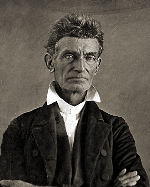
    Long before John Brown led his armed Abolitionist revolt, he was–like many people on the inner edge of the frontier–trying to make his way in the world at a host of different businesses, some of which did well, some not.  He had a farm, operated a tannery, raised sheep and cattle, a bit of this and that, a man with a big family (he would have 20 children in his life) who absolutely had to make some money one way or the other. Some of these enterprises involved loans, which when combined with the Panic of 1837 and the Crisis of 1839 put the man under water.  He was so deeply done that by 1842–at the age of 42–John Brown was bankrupt.

    I’m writing about this now because Rebecca Onion published (in her excellent Slate Vault blog) a list of all of the worldly possessions of Brown and his family, collected and listed out by order of federal bankruptcy laws.  The resulting list is heartbreaking and hopefully, and probably representative of a broad-spectrum slice of American semi-pioneer daily life about what the working family owned at mid-century somewhere along the speedily disappearing frontier.

    What appeared to me first was the worn and worn out material, all listed in workman-like observational undertones, especially in the housewares and daily life category:  “6 feather beds old and poor”, “3 tables old”, “5 chests old”, “6 pots cracked”, “6 bedsteads old”, “4 wooden pails old”, “2 earthen ware crocks broke”. There was the broken stuff, and then just the inexpensive:  the 75-cent writing desk, 50-cent washtub, the pepper mill for a quarter, three soup bowls for a quarter, the pot hook for a skinny dime, and so on.

     Most of the value of the family was in the livestock and food stores, mostly because there was so much that could be done with that, and by every/anyone.  Though even there are found some shriveling disappointments: the 75-cent nail hammer, the 12-cent inkstand, and the 25-cent pitchfork (“work needed to be done on same”).

    The listing of possessions was complete–also found here under guided supervision was the clothing of the family in their house as well as what everyone was wearing; and for a large family, there wasn’t much at home that wasn’t already being worn. “2 overcoats – 5 coats – 10 vests – 12 pairs Pantaloons – 26 Shirts 10 Womens & Girls dresses – 3 Skirts – 2 Cloaks – 4 Shawls – 8 Womens and childrens aprons – 5 pairs of Boots – 3 pairs of Shoes – 13 pairs of Socks & Stockings – 7 Stocks & Handkerchiefs – 4 Bonnets – 1 Hat 5 Palmleaf Hats – 8 mens & Boys cloth caps – 1 Fur cap – & 1 Wool cap.”

    It is the children’s clothing that is really hard to read about.  

     Photographs of the original documents as well as transcriptions are available here


  • Dancing at the Edge: Yosemite, 1890’s

    JF Ptak Science Books   Quick Post

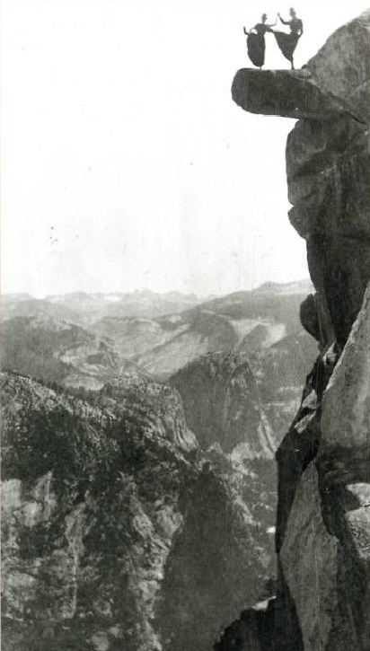
    These are remarkable photos of folks standing at the edge of the world in Yosemite National Park.  They were made by George Fiske, a New Hampshire boy who left for San Francisco and moved to Yosemite at age 44 in 1879. He worked there for decades, producing beautiful and iconic work before running out of steam after the turn of the century, and in the end committing suicide in 1918 because as he said he lost interest in being alive.  

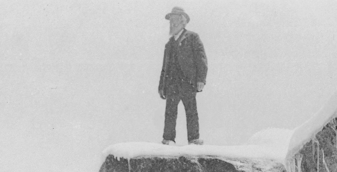
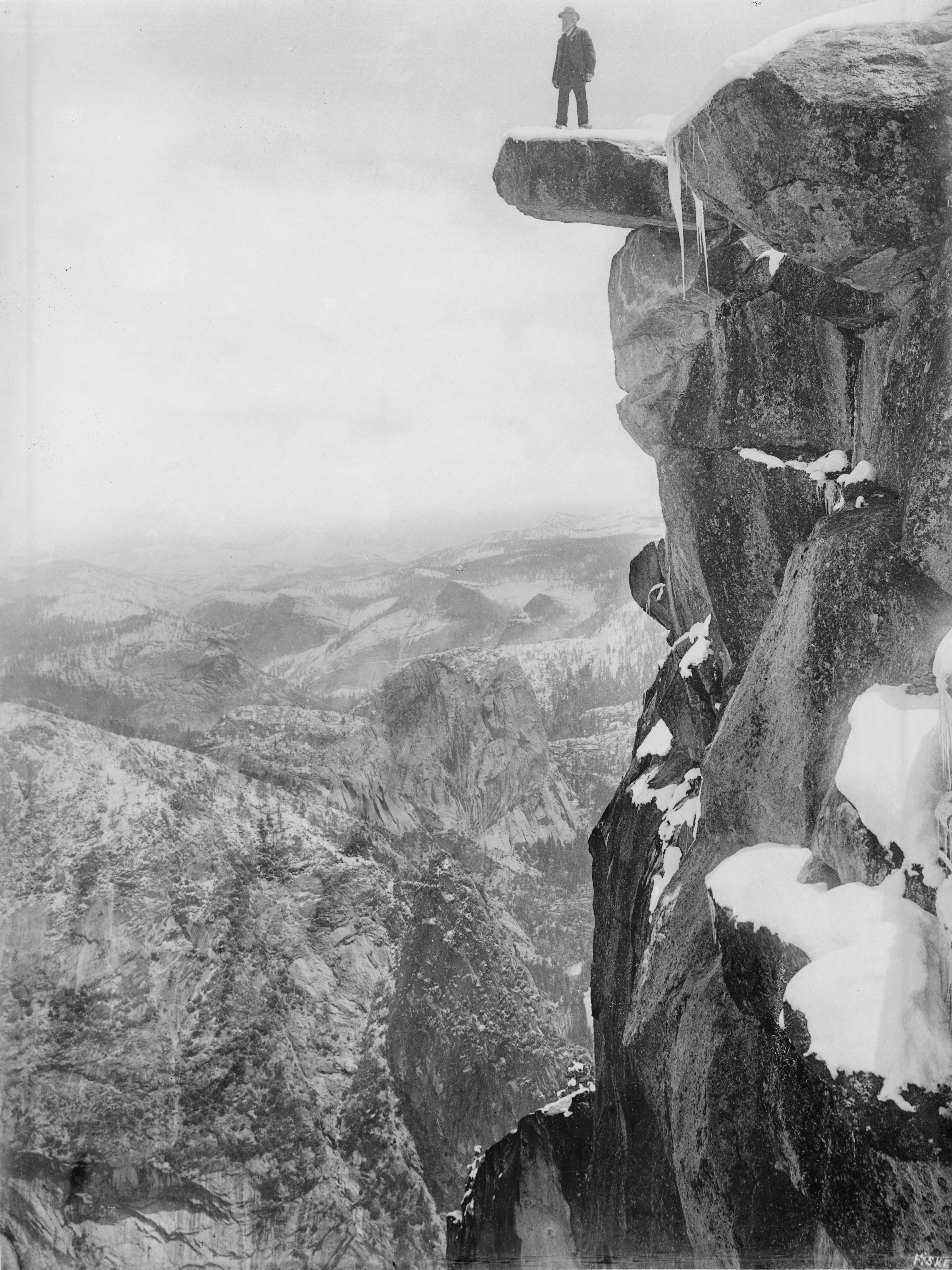
    I came to Fiske today because of the dancing ladies, hanging out at the edge of the overhanging lock, a photo made by him in the 1890’s at Glacier Point in Yosemite. That led me to another photo that Fiske made of his co-author Galen Clark, made at the same place some years later at the same famous spot, in 1910.  

    Detail of the dancing ladies, 1890’s:

    WOmen--dancing on ledge detail

    And the full image:

    WOmen--dancing on ledge

    And a clearer image Galen Clark:

    Women yosemite Galen_Clark_on_Glacier_Point_in_Yosemite_National_Park,_ca.1900_(CHS-1207) detail

    Women yosemite Galen_Clark_on_Glacier_Point_in_Yosemite_National_Park,_ca.1900_(CHS-1207)

    [Image source:  wikipedia ]

    Notes:

    James Mason Hutchings, In the Heart of the Sierras (1888), with many illustrations including a number of photos by Fiske. Great digital copy at yosemite.ca.us here. 

    Galen Clark, The Yosemite Valley (1910) with more photographs by Fiske.


  • A Classic Depression-era Photo Printed on 180-Year-Old-Paper

    JF Ptak Science Books   Post 2170

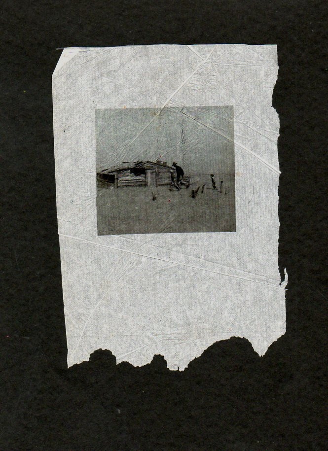
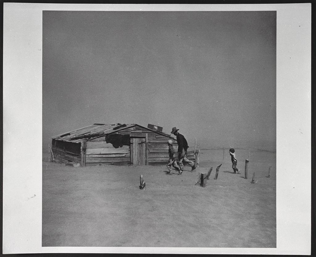
    I’ve experimented a little in presenting photographic images on a slightly different medium, and the results are interesting,  Take for example Arthur Rothstein’s classic 1936 “Father and Son” (actually, the “son” should be a plural, as there are two little kids rushing in the photo): I’ve used a 25 meg file and printed (lasered) rather small on a piece of antique tissue-guard paper–the paper, from 1830, is fantastically light, yet very strong for its remarkable thinness. The result of the modern, small Rothstein printed on the 180-year-old paper looks “believable” in its own odd way.

    The manipulated-printed effort:

    Rothstein--maniulated886

    And the instantly recognized original:

    Rothstein full image


  • An Eloquence on the State of Indian Affairs, and Alcohol, 1871

    JF Ptak Science Books  Quick Posts

    [Electronic source here.]

    In the Report of the Board of Indian Commissioners for 18711 I found the following report of a meeting held between General S.J. McKinney (Superintendant of Indian Affairs for Washington Territory) and Chief Napoleon at the Tulalip Reservation in Washington Territory:

    “Napoleon, the Chief, came forward with much and laid before…a bunch of split sticks, saying ‘these represent the number of Indians killed by white men in the past year, all Indian chiefs, fifteen of them, and yet nothing has been done by the government to the white men who killed them. They killed them by selling them whisky. I do not speak of them because I have a bad heart, but because I want you to know what kinds of men live about us. The whites now scare all of the Indians, and we wonder when they will kill all of us.’”


  • “The Cost of Indians to the U.S.”

    JF Ptak Science Books   Quick Post

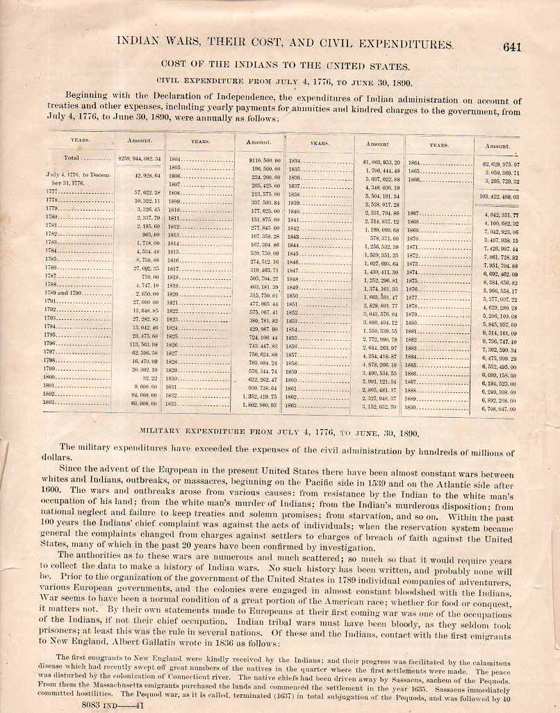
    I came across this very interesting page in the phenomenal work produced as a part of the U.S. Census, Report Indians Taxed and Indians Not Taxed, printed in 1894 as part of the 11th Census of 1890. (The full text is available at the Internet Archive, here.)  It is a dispassionate recollection of monies spent on “Indian administration on account of treaties and other expenses, including yearly payments for annuities and kindred charges to the government”, from 1776 to 1890, noting that “the military expenditures have exceeded the expenses of the civil administration by hundreds of millions of dollars”.  Indeed–$250,000,000 19th-century dollars (or something on the order of 5 or 10 billion dollars in today’s money). Certainly monies that went to “satisfy” treaty obligations or to support Indians driven from their land and life would have been a fractional amount of the overall expense. 

    Indian expenses799

    Details, below: