A Daily History of Holes, Dots, Lines, Science, History, Math, Physics, Art, the Unintentional Absurd, Architecture, Maps, Data Visualization, Blank and Missing Things, and so on. |1.6 million words, 7500 images, 4.9 million hits| Press & appearances in The Times, Le Figaro, Mensa, The Economist, The Guardian, Discovery News, Slate, Le Monde, Sci American Blogs, Le Pont, and many other places… 5000+ total posts since 2008.

Category: Maps, Cartography, History of Mapmaking

  • “Children Who Work on the Nation’s Crops” (1942)

    JF Ptak Science Books  Quick Post   Overall Post 5128

    IMG_5329

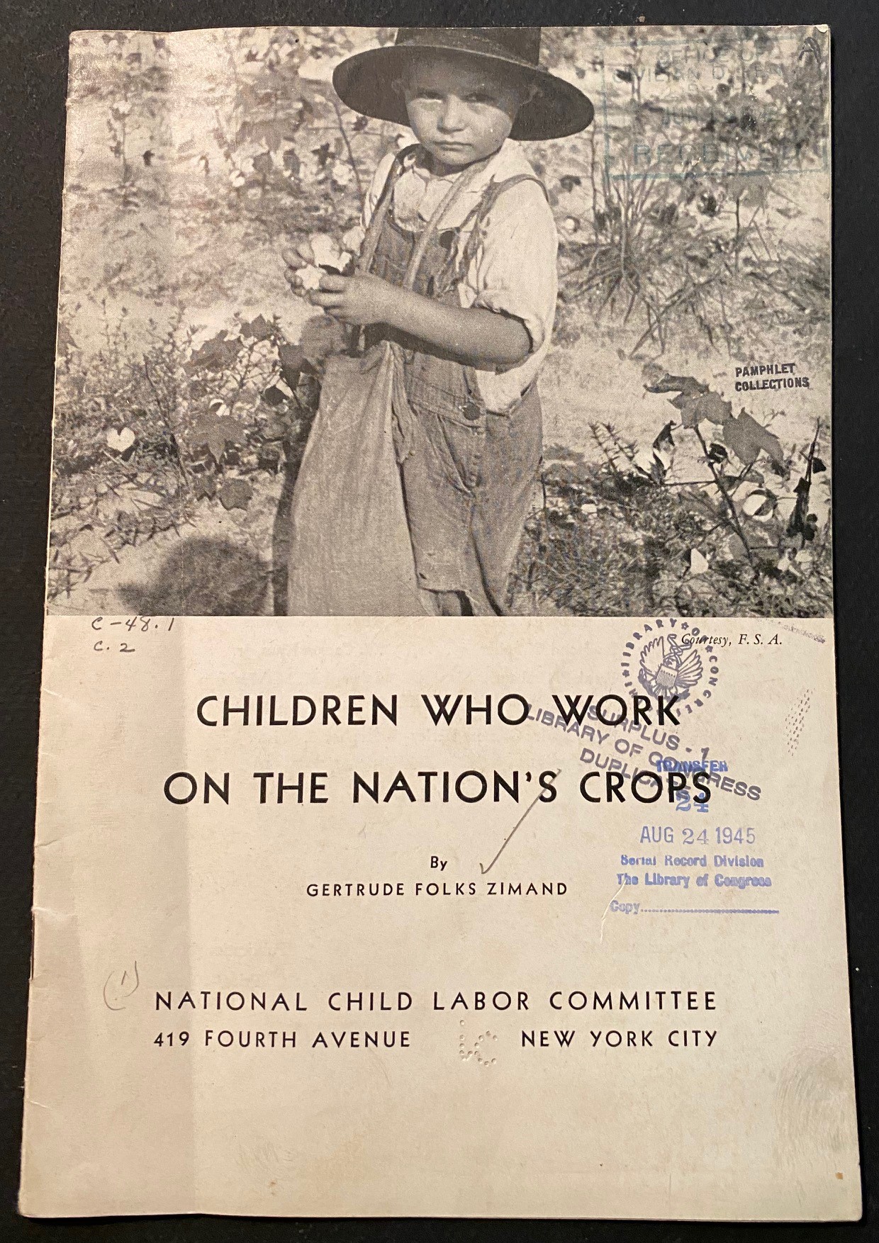
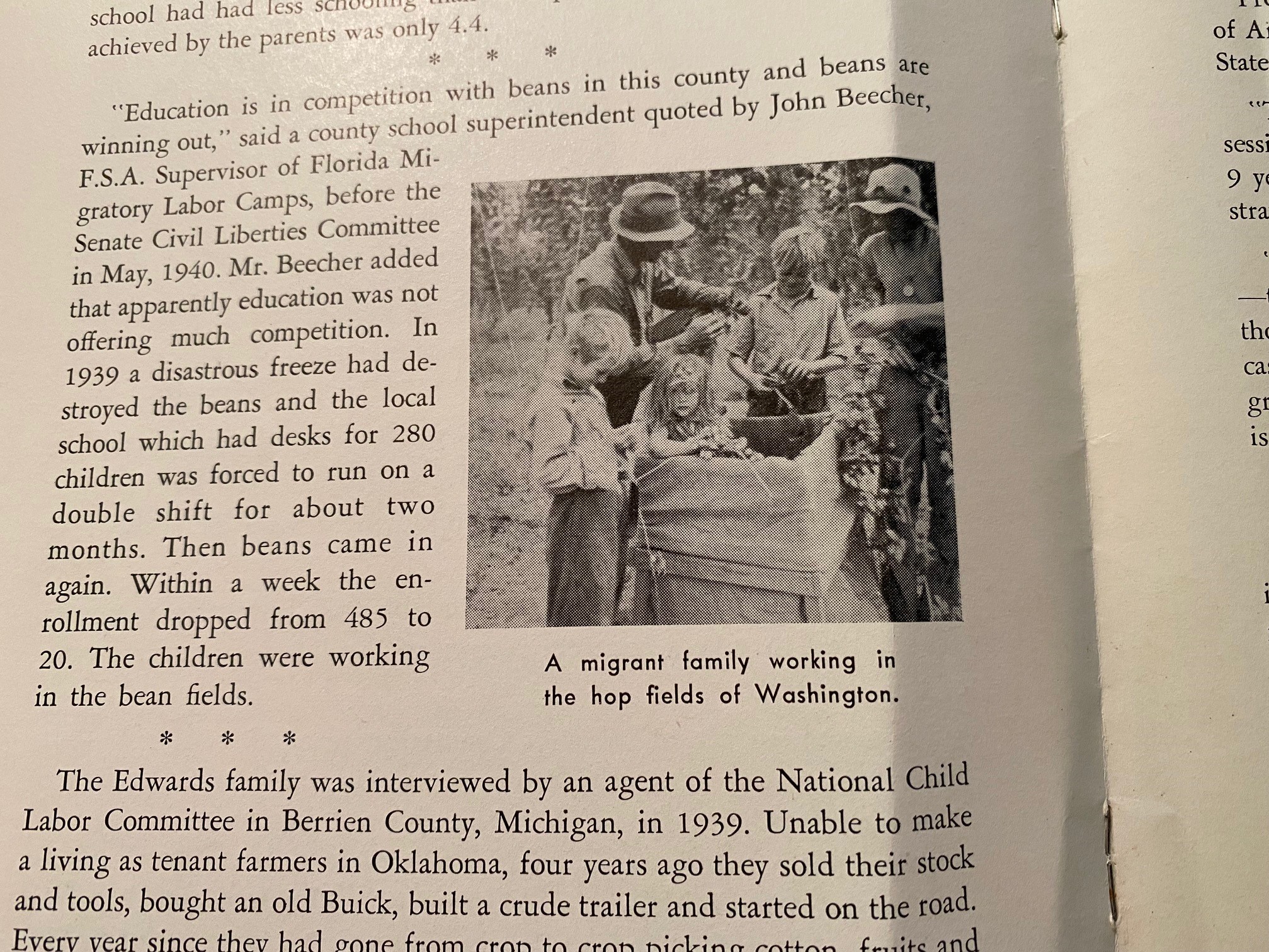
    This is a substantial indictment and attack on the loose laws (where they actually existed) regarding child labor in the United States, specifically regarding kids working in the fields.  If you scroll down you can see what laws were applicable to what states, and there were plenty of states that had virtually no regulations on children laboring in the fields, being part of a migratory family.  I’ve reproduced here some of the most significant bits from the pamphlet as well as all of teh photos–the photo images aren’t exactly Jacob Riis, but they’re getting there. In any event Ms. Zimand was making a very strong case and presenting an embarrassing expose on the use of child labor in the U.S. just at the beginning of the U.S. overt military involvement in WWII.  


    [Source: ZIMAND, Gertrude Folks. Children who work on the nation’s crops. New York City, National Child Labor Committee [1942] [National Child Labor Committee. Publication no. 384., 9″x 6″, 19pp. Photo illustrations.]


    IMG_5331


  • Another Episode in the History of Blank and Empty Things

    JF Ptak Science Books   Quick Post (A small but useful part of the History of Blank and Empty Things series)

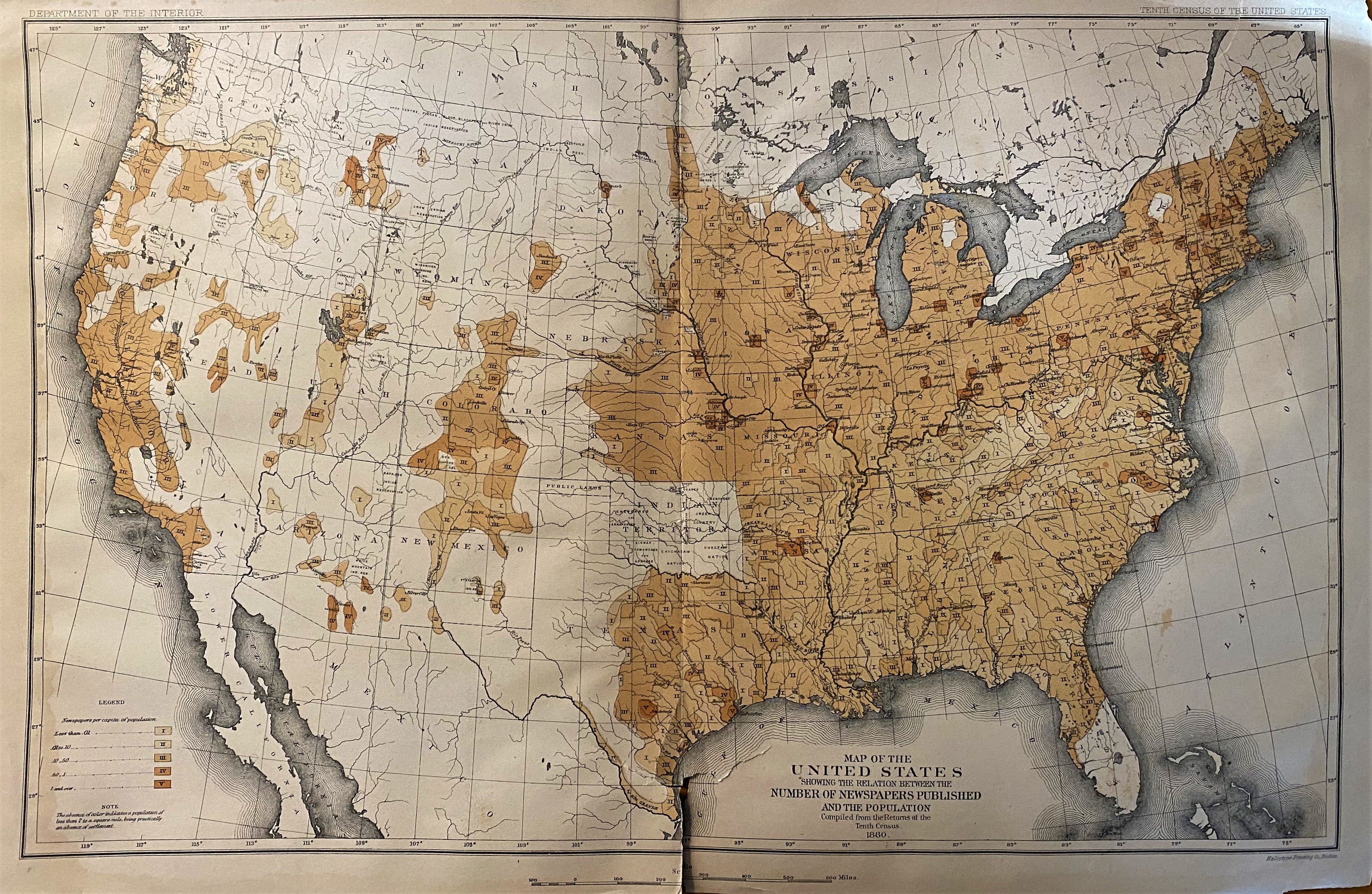
    This wide expanse of white and unmodified map space exhibits the more-or-less total absence of daily (or weekly) newspapers in the West and Far West of the U.S. in 1880.  The measure of the gradient colors depict the “newspaper per capita of population, the “absence of color indicate a population of less than two people to a square mile, being practically an absence of settlement”. making up about a third of the country.  

    Source: History and Present Condition of the Newspaper and Periodical of the United States, by S.N.D. North, U.S. Tenth Census Report (1880), printed 1884.  

    IMG_2885


  • Things-out-of-Place Department: Old Maps in Space

    JF Ptak Science Books  Quick Post

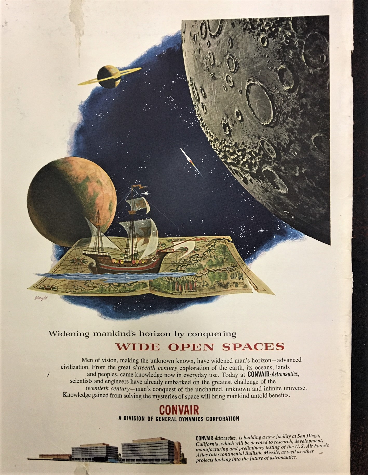
    IMG_2246This is just a short, funny little bit here–I can’t remember noticing an antiquarian map being used as part of the design or decoration based on extraterrestrial objects.  I guess that’s why this image struck me so quickly as being unusual…I just can’t recall another image like it. I mean, this isn’t exactly a towering visual achievement, and in many ways it is ordinary, except that (I think) it isn’t. Anyway, I share it with you now (the source being the Scientific American, July 1957):


  • Delightful Maps of the IRT, NYC, 1923.

    JF Ptak Science Books   Quick Post

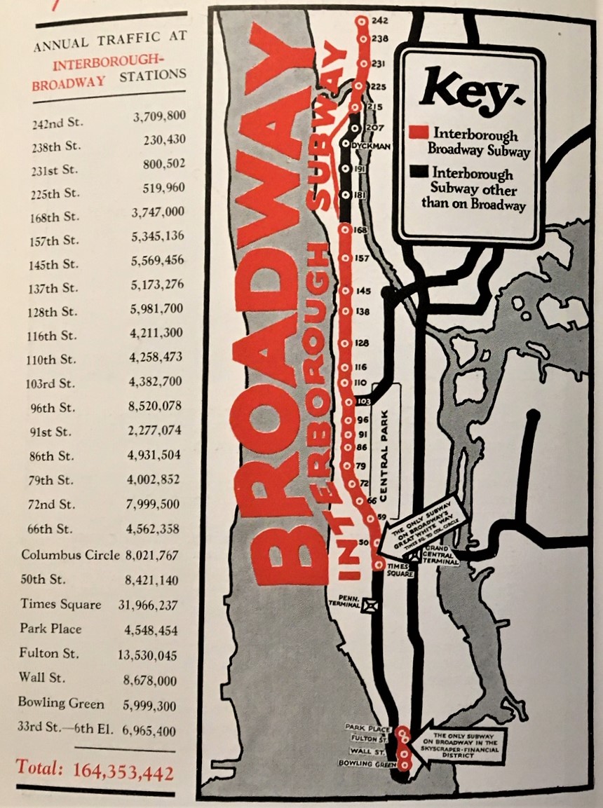
    I’ve just found this delightful little publication beautifully extolling the possible advertising advantages of the Interborough Subway and Elevated Lines of New York City, Artemas Ward’s New York’s Rapid Transit Traffic in the Graphic, from 1923. It really does present the numbers and highlights them with some unusual and bright maps of the subway system. This was the IRT (the Interborough Rapid Transit system), which was a private concern that operated from 1903 until 1940, when it was purchased by NYC.  This subway system in general was, well, entirely different from the one that I traveled 1968-1974 or so, back when you could barely see through the car windows because they were so heavily coated with graffiti…Anyway, I’ve  reproduced  most  of  it  below as there are no copies of the pamphlet in any library according to WorldCat.    The design of the first one–with the giant “Broadway”–is terrific.                                                              IMG_2100 (1)


  • A Tragic Map of an Empty Place (1825)

    JF Ptak Science Books  Post 2893

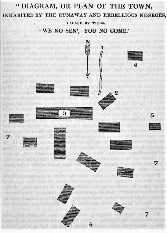
    Nypl.digitalcollections.510d47da-7455-a3d9-e040-e00a18064a99.001.wIn the history of maps of blank, empty, and missing places this map1, published in 1825, is one of the hollowest, and saddest of 19th c US-centric image: it is a heartbreaking map of an empty, abandoned village of peacefully-living runaway slaves in Jamaica, in about 1825.

    The name of the town, extraordinarily, was “We No Sen, You No Come”.  It meant, basically, that the slaves living there would not leave their town, wouldn’t seek anything from the outside, would not interact, would not interfere; in return, they didn’t want anyone visiting, coming to them. interfering in any way; just wanted to be left alone, to live.  And from the account of this supportive, understanding and sympathetic publication, that is exactly what these people had done for eleven years.

    [Image source–please see Notes below]

    But then something happened.  The owners of the enormous estate wanted the “banditi runaways” gone.  The slaves evidently had 200 acres under domestication, hidden in the far reaches of an enormous 100,000 acre estate.  The “hunting party” left heavily armed, accompanied by 250 troops, as well as “confidential and baggage negroes”.  (The term “baggage negroes”, as impossible as it might seem today, was a well-worn, heavily used term through the 18th and mid-19th centuries.)  They approached the small town and encountered a very slight resistance, something like a guard, and killed them.  Retreating somewhat after the initial attack, the scouting party returned, and then found the village completely empty.  (Some reports say that there was more limited fighting, with casualties on both sides; some say that there were more slaves killed.) After whatever happened happened, though, the return to the little village found it abandoned, with everything still in place.  The members of the village had “disappeared”.  Or at least I hope that they did, and didn’t get “disappeared”, men, women and children all, as in the famous Floridian “Negro Fort” case and Andy Jackson.  Perhaps these people were fortunate to actually escape. 


  • A Sociological Map Made for and by Hoboes (1870)

    JF Ptak Science Books   (An earlier post, expanded)

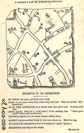
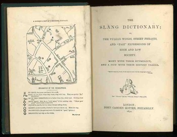
    Hobo mapThis is the frontispiece to the delightful work with the luscious title of The Slang Dictionary; or, the Vulgar Words, Street Phrases and Fast Expression of High and Low Society… printed in London by John Camden Hotten, in 1870.  It is a hobo or “cadger” (“a  mean or vulgar fellow who would rather live on other people than work for himself”)  map (or the map of “a tribe of vagabonds”) of Maidstone, in Kent, drawn by a “screever” (a sidewalk chalk artist who normally would draw religious images for money), and showing the various chalked and etched signs that the hoboes (“and other mendicant marks”)  would leave for one another, being a key to the town, for what was practicable, safe, dangerous, and the like.

    Recorded antiquarian hobo and tramp symbols like these are really quite rare, given their ephemeral nature to begin with; of course the need to record these obscure signs by polite society was not on a high order.  There are many indications that signs such as these existed, but not many illustrations.  For example in the book The Triumph of Wit; or, Ingenuity Display’d in its Perfection, edited by John Shirley. (1724), as well as works by Holyland and Borrow there is a description of English gypsies and their travels, and a short description of their use of boughs and sticks, set out for each other, so that a duplication of effort by different bands or families would not occur.

    (The figure of the woman, wonderfully named “3/4 Sarah”, probably connects this Sarah to a sort of popular dance.)Bloghobo_a199_2

    Hotten also published the following interesting and title-bending work in 1874:  THE ORIGINAL LISTS OF PERSONS OF QUALITY;  EMIGRANTS; RELIGIOUS EXILES; POLITICAL REBELS; SERVING MEN SOLD FOR A TERM OF YEARS; APPRENTICES; CHILDREN STOLEN; MAIDES PRESSED; AND OTHERS WHO WENT FROM GREAT BRITAIN TO THE  AMERICAN PLANTATIONS 1600-1700, WITH THEIR AGES, THE LOCALITIES WHERE THEY FORMERLY LIVED IN THE MOTHER COUNTRY, THE NAMES OF THE SHIPS IN WHICH THEY EMBARKED, AND OTHER INTERESTING PARTICULARS.


  • A Chinese Kingdom in North America (1753)

    JF Ptak Science Books  Quick Post

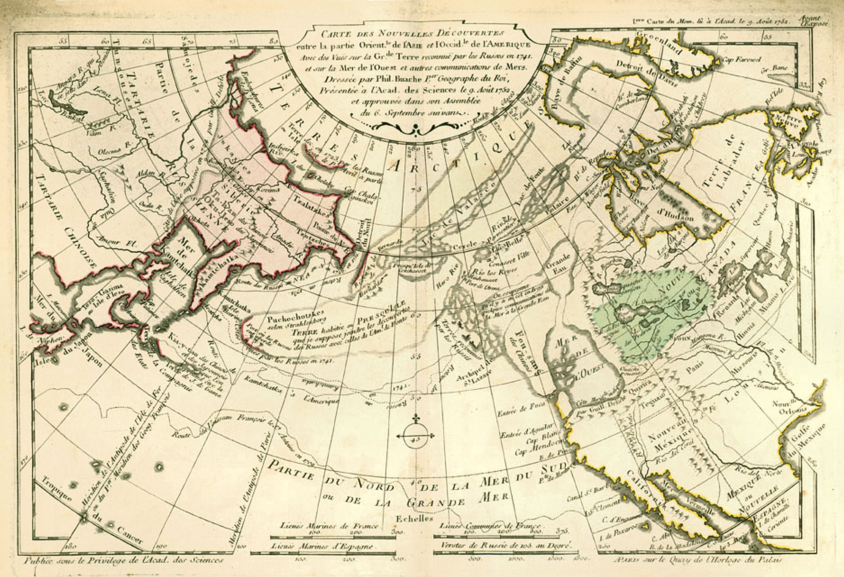
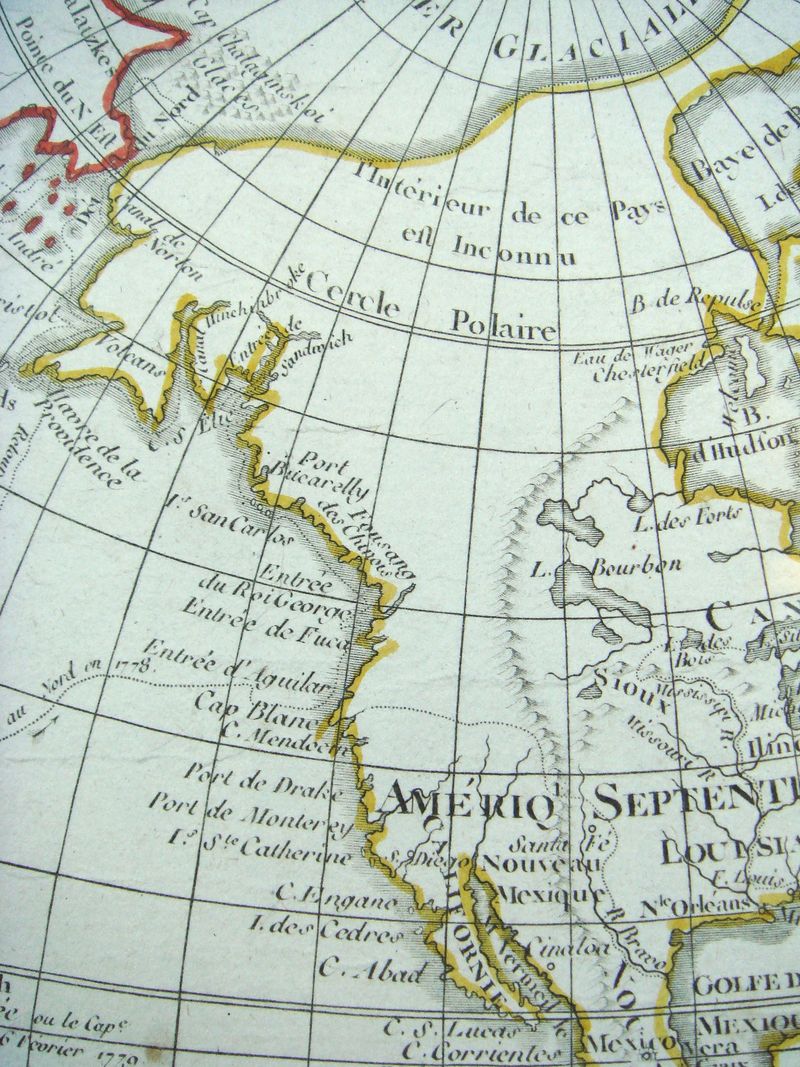
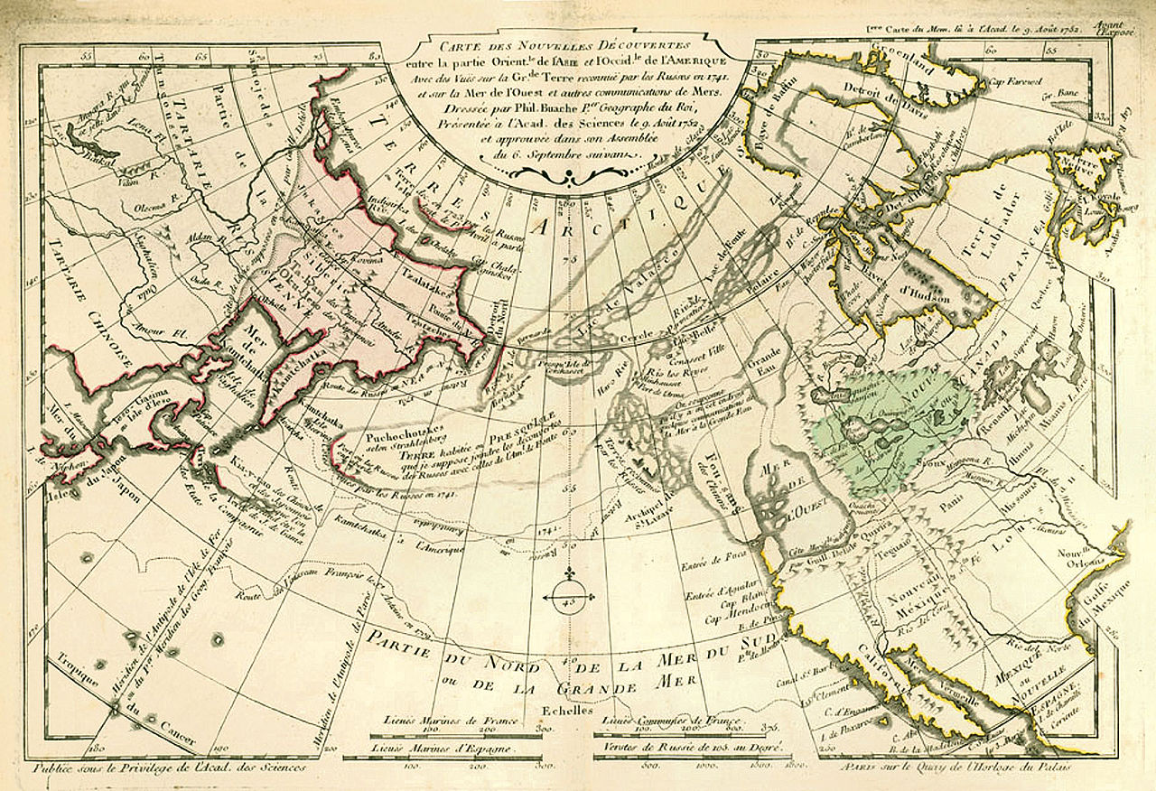
    Here’s a good example of the mapping of a non-existent entity: the Kingdom of Fusang, or the Chinese/Fusang people, located in British Columbia/Washington state, appearing in the considerable Philippe Buache’s map, Carte des Nouvelles Decouvertes…(1753).  It is a wonderful map that also has a lot of suggested possibilities of realities in the not-much explored Pacific Northwest of North America.  What we see appearing above the huge landmass of “Californie” (mostly the entire west coast of the present-day U.S.) is the island-like “Fou-sang des Chinois”.  This area stretches from about the 47th to the 59th parallels, and is contiguous to another hypothesized entity, the “Mer de l’Ouest”, which is an enormous body of water about the size of Hudson Bay. This is also connected to another very large body of water, the “Grande Eau”, which in turn has connections leading to the Atlantic ocean, thus forming the much-hoped-for and dreamed-of Northwest Passage.

    Fusang three

    • Click to clarify and enlarge

    Source  https://en.wikipedia.org/wiki/Fusang#/media/File:Buache1753Map.jpg

    I’m not faulting M. Buache whatsoever in telling this little tale of prospective Geography–he produced (for his time) an excellent map of not very well understood and distant places. 


  • The First Meteorological Map (Created by Edmund Halley) 1686/7

    JF Ptak Science Books   Post 2831  History of Lines series

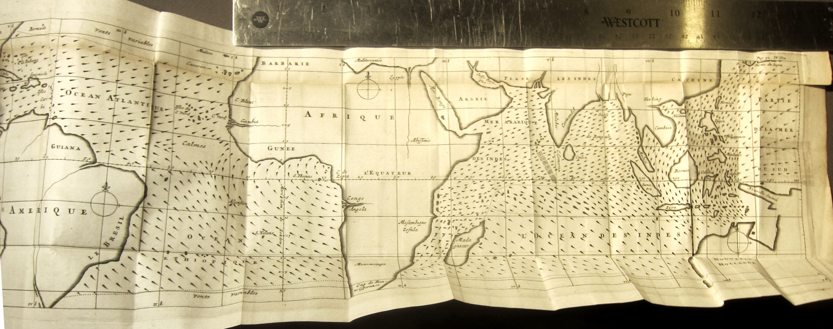
    Fresh on the heals of a post a few days ago on Athanasius Kircher’s great map on ocean currents is this famous 1687 map by Edmund Halley1–it is recognized as the first meteorological map ever printed, and depicts the trade winds:

    Halley _4_

    This is the French translation of Halley’s “An Historical Account of the Trade Winds, and Monsoons, Observable in the Seas between and near the Tropicks, with an Attempt to Assign the Phisical Cause of the Said Wind,” that appeared several months earlier in the Philosophical Transactions of the Royal Society (1686, in issue no. 183).

    Here is a summary of the map from the Princeton University site dedicated to thematic maps:


  • The Gulf Stream in 1678

    JF Ptak Science Books   Post 2831

    Kircher gulf stream074

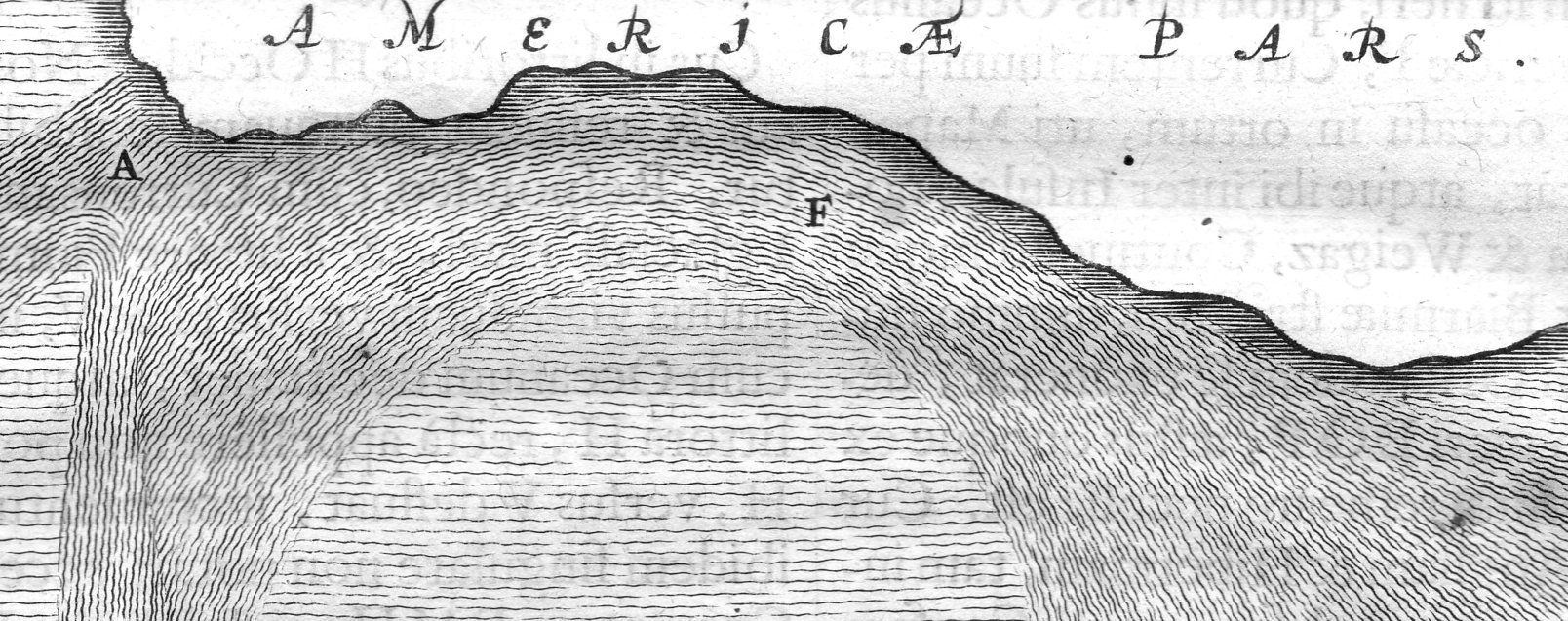
    This is one of the earliest depictions of what we know today as the Gulf Stream, and it appears one among many wonders in Fr. Athanasius Kircher’s Mundus Subterraneus (1678). The map appears about a century before the first map to truly distinguish the Gulf Stream (the B. Franklin/Folger map of 1768-1785) and shows the remarkable activity that must have come with the acquisition of the data necessary to show on even this popular map.  Given that the data was necessarily spotty at this early period the Kircher effort was largely theoretical (and for what it was worth he likened the currents to something similar to blood moving though the body, which at least put to use the work of William Harvey).   (Eberhard Happel is on a similar wavelength as Kircher with the currents map, and published his map a few years later, though he was mainly a science popularizer who “relied” heavily upon the Kircher map and was nowhere near to being Kircher’s intellectual rival–his map is still interesting given its very heavy lining and beauty.)

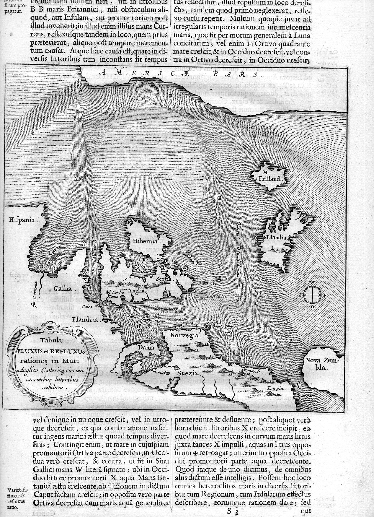
    • Tabula Fluxus et Refluxus rationes in Mari Anglico…
    • The map measures 7 3/4 x 7 3/4″ on a 14 3/4 x 9″ sheet, being folio 141/142. 

    This is a detail of the larger map (below) with a East-West orientation for bottom-to-top, making  the northern North American coastline along the top of the map, with the European coast from Spain to Denmark, and then hopping over to the Nordic countries, and of course with England and Ireland, and lonely Iceland. 

    Kircher gulf stream073


  • A Map of Prostitution AND “Negro” as a Nationality (1913)

    JF Ptak Science Books  Post 2813

    There were two big surprises in this 1913 work1 on prostitution in Portland, Oregon–I mean, aside from the normal “surprises” and “unexpecteds”one expects from an early 20th c study on the sex trade. (If someone wanted to do a version of The Deuce as Portlandia Nights 1913 this report would be atomic material.) The book runs 200 pages and for the time is filled with unusual social history, snapshot observations, interviews, police involvement, data of all shapes and sizes, and that sort. The book is fairly comprehensive–all things considered–and the efforts are distributed to the following sections: “A Report on the Social Evil, as affecting places of public resort and accommodation; hotels, apartment houses, rooming and lodging houses”, pp 4-81; “On the Legal and Police Aspects of the Social Evil”, pp 81-122; “A Report on the Juvenile Aspect”, pp 123-164; “Report on the Economic Aspect”, pp 165-202; “Report on a Segregated District”, pp 203-216.) Overall it is a survey of the grand scheme of prostitution (the “Social Menace”) in Portland as it existed in one section of the city (Irving Street-Hall Street-23rd St-Harbor line). It investigated 547 buildings/rooming houses and found 98 to be “moral”, 431 to be “immoral”, and a balance of 98 falling into a gray-ish “doubtful” category. 

    • This post is based on a copy of this report that I have here–there is something online text at Hathi that has a slightly different title but looks to be the same that you can enjoy here: https://catalog.hathitrust.org/Record/100641247

    The report surfaces some fascinating info: for example, there is a section on interviews with proprietors of the erstwhile hardly-vanilla hotels, which includes a number of very colorful quotes, including one “madame” from a bawdy house on Sixth Street, who claimed “Portland is the best town on the coast for a sporting woman to make money in.” Other madams agree! There are interviews with “sources of vice” (“grills, chauffeurs, pool rooms, messenger boys newsboys…”), police, civil service, hotel folk, that sort..  A good standard example of a description of one of the bawdy houses reads: “Hotel [unnamed and with no street address identified] Taylor Street. Shabby place of 46 rooms. Run by man and woman, who occupy front rooms, one of which the woman uses as a parlor, the other as a bed room for immoral business. Three prostitutes work for management, paying one-half of their earnings from bed money. Liquor sold.”

    The “study of the docket”  is a listing of occupations of prostitutes, arrests, charges, fines, and wages paid the prostitute; there is a section on “testimony” in which the sex worker tells her story, and another section on the general living conditions in the bawdy houses. The last section in the publication deals with “segregation”, though the type of segregation here has nothing to do with race, and simply means that there would be a set-aside space for sex businesses in Portland.

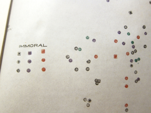
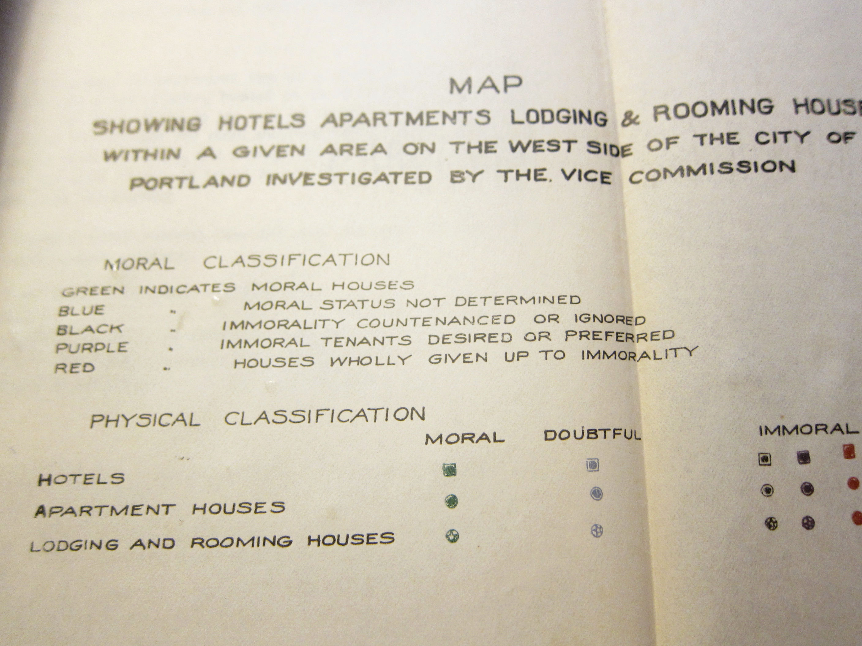
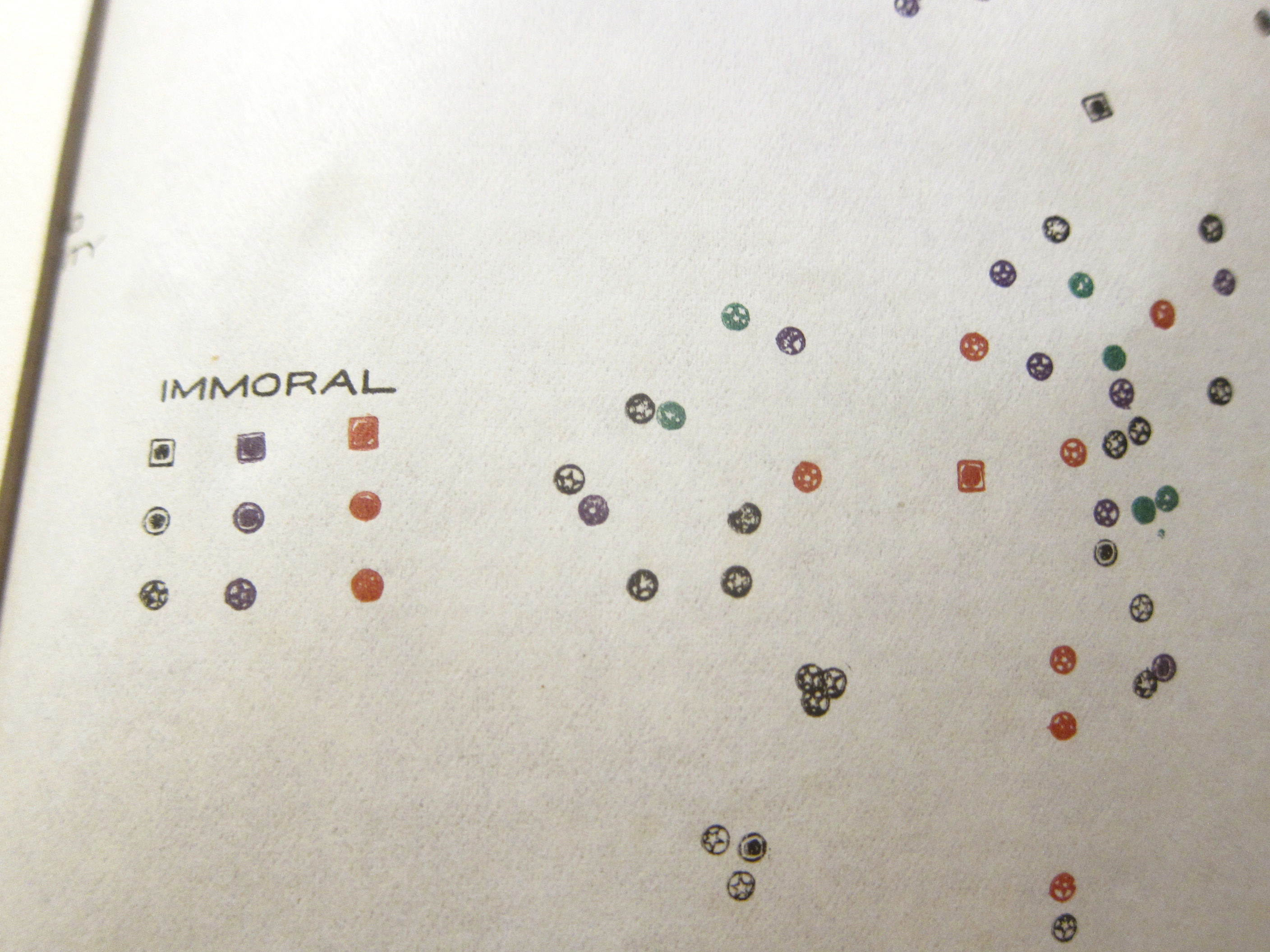
    So, the first surprise: there is also a very daring and fascinating map in the first section of the report which identifies hundreds of the Social Evils establishments. They are classified top-to-bottom in the following way: “Moral houses”, followed by “Moral status not determined” and then steeping into “immortality countenanced or ignored”, to “immoral tenants desired or preferred”, and then finally to “house wholly given up to immorality”. The odd thing about the map is that it seems to be overlay, meaning that the details of the actual geographical part of the map are left out and there is no underlying map on which this skeleton map is laid (as published). The map isn’t quite a “map” as much as it shows approximate vicinities and coagulations of these establishments in relation to one another and confined to that one particular part of Portland. I guess that leaving out the exact addresses was a preventative measure to squash the possible plans of some enterprising people to use a detailed map as a Guidebook to Portland Houses of Ill Repute.  
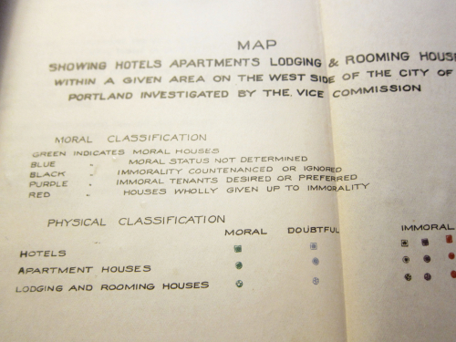
    Portland Vice Map
    Portland Vice Map

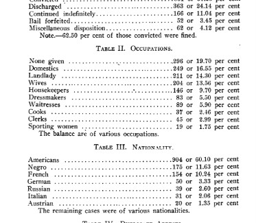
    The second major unexpected surprise: on page 96 there is a listing of nationalities of prostitutes arrested—in the accompanying table the leading nationality is “American” followed by “Negro” and then “German”…which seems to me that U.S. Citizenship is being denied to African Americans on the basis of race, and that, evidently, “Negroes” are not American citizens. And according to the law in the state of Oregon in 1913, “Negroes” were not even allowed to migrate to the state, stated as such right in the Oregon constitution—a law that was not addressed and eliminated until 1924. I suspect that African Americans were illegally in the state and thus, somehow, had their rights of citizenship in the USA stripped away. Or perhaps this was the work of a racist editor, or author, or someone;; one person, one small group, that instigated this classification. Or maybe it was someone ignorant who just go the whole thing wrong and which was subsequently missed by the editor. I don’t know. All I can say about this is that this is the first time I’ve seen African Americans introduced in a statistic post-1865 as citizens of the U.S. who were deemed to be not so. 
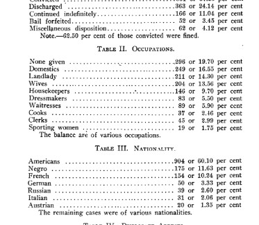
    Negro Nationality

    Notes:

    1. Talbot, Henry Russell. Report of the Portland Vice Commission to the Mayor and City Council of the City of Portland, Oregon.. Portland, 1913. 9”x 6”, 216pp. Original stiff wrappers. Provenance: Library of Congress via the Washington DC Public Library.