A Daily History of Holes, Dots, Lines, Science, History, Math, Physics, Art, the Unintentional Absurd, Architecture, Maps, Data Visualization, Blank and Missing Things, and so on. |1.6 million words, 7500 images, 4.9 million hits| Press & appearances in The Times, Le Figaro, Mensa, The Economist, The Guardian, Discovery News, Slate, Le Monde, Sci American Blogs, Le Pont, and many other places… 5000+ total posts since 2008.

  • A Remarkable Map of Concentration Camp Satellite Camps

    JF Ptak Science Books   Quick Post

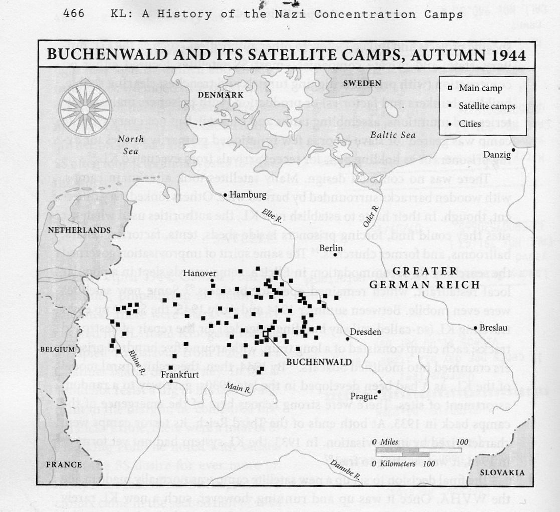
    I just started reading Nikolaus Wachsmann’s KL, a History of the Nazi Concentration Camps, published this year by Farrar, Straus, Giroux, a daunting and promising 864-page overview/history of the Nazi killing complexes.  The very first thing I found when I opened the book–incredibly–was this map, showing the satellite camps supporting Buchenwald. “Just” Buchenwald.  It was shocking. 

    Kl

    I knew about the support camps, but I must say I never knew how many, how so many, there were of them.  Evidently, according to Prof. Wachsmann, there were more than 77 satellite camps for Dachau main camp, and that overall there were probably around 560 (page 464). This was completely unexpected.

    I’ll report further on this book when I actually read it–for the moment, though, I wanted to share this devastating map.  

  • Outsider Effort on the Gases of the Cosmos, 1883

    JF Ptak Science Books  Post 2488

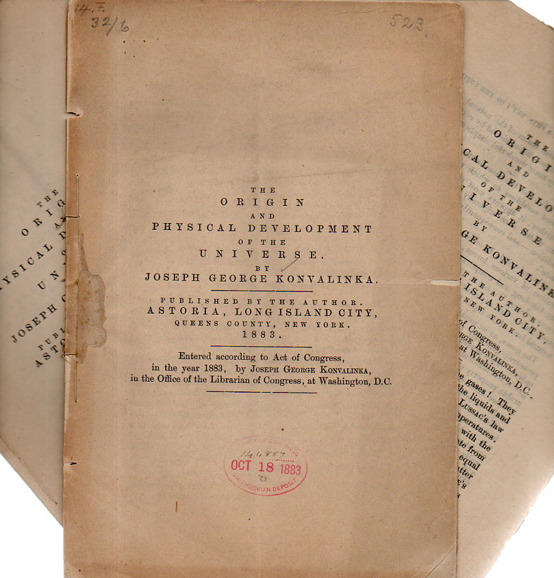
    I was researching a writer named Joseph George Konvalinka, who was the author of an Outsidery slimery called, The Origin and Physical Development of the Universe (1883). We travel through his interpretations of our physical stuff, and find that he was a curious man who seemed to be interested in his fair chunk of creation. Unfortunately his observations are not terribly clear, and he was willing to write about many of his conclusions before coming to any that were well-formed or supportable by scientific evidence. 

    Konvanlinka 3173

    For example, in section–which is actually a paragraph–on “Sun-Spots” describes the Sun as “not standing still” but “travels in a certain direction within the space of our solar system”, which is not a very scientific thing to say.  On the origin of “organic life” on Earth, the author asks himself the question and responds by not answering, but says that “all of mankind, which forms the basis of organic life, makes but a very thin cover upon the dead barren crust of Plutonic rocks” that form a “thin crust” on the surface of the Earth. And then something happens with carbon, hydrogen, oxygen, and nitrogen–which the author identifies as “all gases”–and they make vegetables and animal life.  

    And so on it goes. The interesting thing is how much ground Konvalinka covers in the fourteen pages of the pamphlet–and the curious thing is that I happen to have three copies of this semi-non-existent work, one for each eye and a spare. And for as thoughtful as he is, it seems to be almost entirely a self-contained gedankenexperiment, free from outside influence, and nearly entirely free from reference.  He wrote an earlier work in the 1860’s, and was still writing in the 1890’s (in a series referenced as his scientific memoirs), which includes a long section on aerial aviation and a proposal for a flying machine. Unfortunately he claims that flight was “a mystery” and described birds as floating in the air, which isn’t a good thing to have as a basis for understanding flight.  But he does offer several succinct and well-annotated patent-like drawings of his flying machine, which happened to be very squat, very heavy, and human powered.  

    Reading his work gives me the impression that he was an autodidact who I assume did not have the chances at an advanced education or perhaps access to the books necessary to understand physical systems that could have helped him form better foundations for his ideas. He wrote in interesting areas–and managed to have the finished efforts printed–and I can’t help but like the man because of his active mind.  


  • When a “War” with 25 Million Dead is an “Incident” (1938)

    JF Ptak Science Books   Quick Post

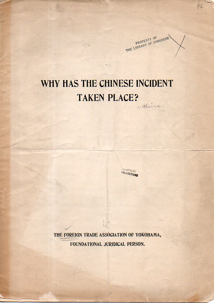
    Why Has the Chinese Incident Taken Place?  published by the Foreign Trade Association of Yokohama, “Foundational Juridicial Person”, 1938. is is an extreme appeasement in extremis for the Japanese invasion of China. This hearts/minds campaign begins with the very title, which calls the Japanese war against China (already a year underway) an “incident”.

    If an “incident” it was then a very deadly one–actually, it was probably the most deadly one in the history of civilization. Fought from 1938-1945, this war (the Second Sino-Japanese War) cost China more than 3,000,000 soldiers killed and wounded–and then the astonishing numbers of something on the order of 20 million civilians killed.  (Japanese lost about 2.2 million soldiers killed and wounded.)

    The main thrust of the argument is that “greedy” Chinese politicians have constructed an “imaginary” enemy in Japan in order to unify their country. And then it goes downhill from there.  The Japanese among other things was “endeavoring to develop China in various branches of civilization and economic industries, thereby extending the bounty f modern civilization to the masses”.  Them there is the “fighting Communism part that comes into play in the next very long paragraph. 

    Chinese Incident171

     This is a formidable example of the Big Lie, introduced to modern social demagogues on a wide scale by Adolf Hitler in Mein Kampf (telling a lie enormous enough and often enough so that the popular thinking interprets it as a truth because nothing so incredible and far-fetched a lie could be told and be expected to be believable). 

    ·Posted by :

    ·in:

  • Waking Up in the Field During the U.S. Civil War

    JF Ptak Science Books Quick Post

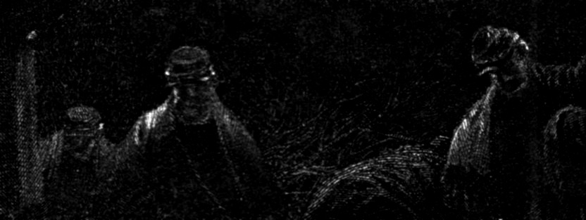
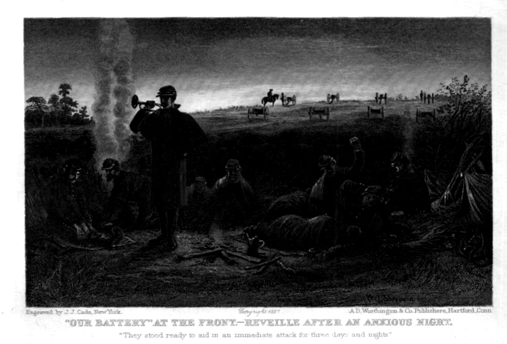
    I found this engraving today in a small stack of Civil War images, and was taken by the small figures that lived inside it, particularly those standing behind the bugler. They were being called after a night without sleep, or fitful sleep; perhaps they endured a barrage themselves that night, or expected one; or perhaps they will engage in the morning. Whatever happened overnight was done, and the Sun was breaking over the long rising hill in the background, illuminating four canons and their artillery trucks, the several soldiers attending them (with one on horseback).

    The bugler sounds reveille, and the soldiers are in different stages of wakefulness. No one seems to show any emotion, one way or the other, happy to have the night over or dreading the coming day.  

    REvelry detail

    This is a detail from the steel engraving below, published in 1892 (and dated 1887):

    REvelrie large176

    ·Posted by :

    ·in:

  • What Did Sailors in the U.S. Navy Make in 1820?

    JF Ptak Science Books  Quick Post

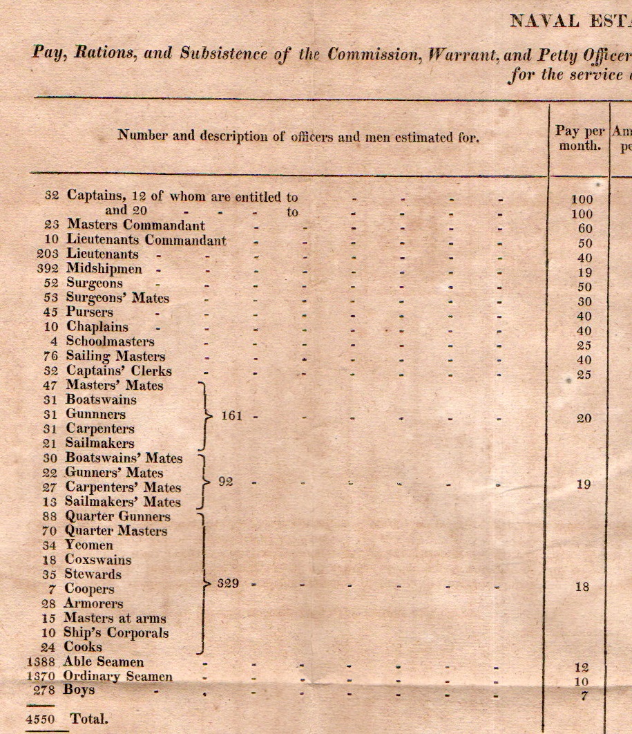
    This is one of those fascinating bits that you come across that in the moment are just thrilling, but overall really doesn’t have anywhere particular to live in your memory.  Still, it was curious to find this data on the positions and pay to the members of the U.S. Navy in 1820 and to see the amount and distribution of pay, and to see the aggregates.

    The pay ranges (for example) from $100/month for (52) Captains, $50/month for ( 52) surgeons, $40/month for (10) chaplains, $20/month for (21) sailmakers, $18/month for (24) cooks, $12/month for (1388) able seamen, $10/month for 1370 ordinary seamen, and $7/month for (278) boys.  

    Naval pay177

    [Source: can’t remember. This is a detail from a  loose, folding sheet from a U.S. government document from 1820, probably looking at the finances of armed forces, or some such.]

    So it looks as though the total pay for U.S. naval personnel in 1820 (excluding “rations”, which I believe included food and housing allotments) was $867, 578.00 (or pretty close to that) for 4,550  sailors/etc., which is about $200 per year per person, on average.  41% of that total outlay went to the 3,158 able and ordinary seamen, who composed 71% of the total naval force.  So it looks like if your removed the pay for “boys” then the highest paid officer made about ten times what the lowest paid seaman made, which by today’s standards is pretty corporate-responsible (a la Ben & Jerry’s).

    I’m not yet finding what a carpenter/laborer would make in salary for that year for comparison, but I will add that here later.  


  • A Good Reminder About What Slavery Was (1863)

    JF Ptak Science Books  Quick Post

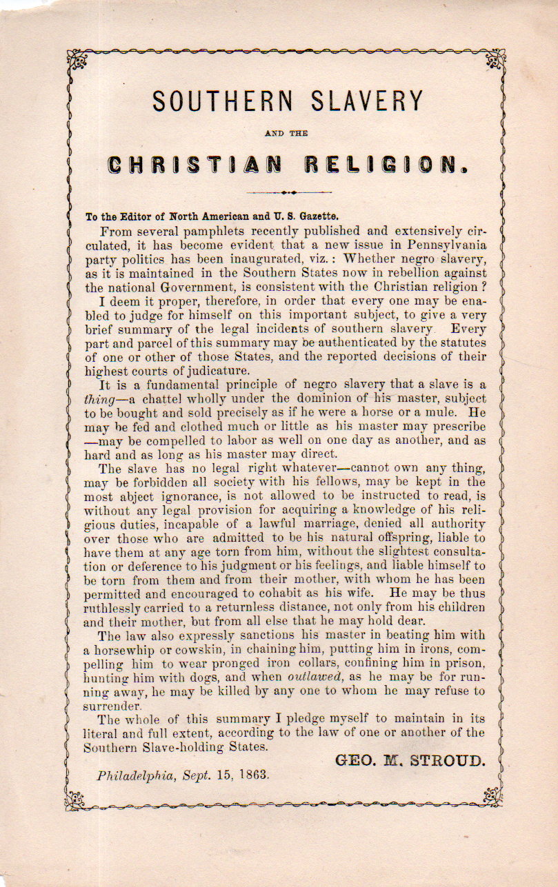
    Slavery christian position178

    With all of the recent discussion about the efficacy of displaying the Confederate battle flag and the curious discussions about what the Civil War was, um, “about” (mostly the old and tired and semi retro-historical States’ Rights vs. Slavery argument), I think it would be interesting to have a look at what George M. Stroud wrote regarding slavery and Christianity.

    The medium is a simple broadside/handout, about 8×5 inches, only, and was published in Philadelphia on September 15, 1863.  There’s a lot in those six paragraphs, and it is well worth a read.  (Note:  “negro” appears here uncapitalized, as was the practice to ensure a further inferiority of the race–“Slavery”, on the other hand, is capitalized.  “Negro” would not appear in capitalized form in common use until the 1930’s.)

    Stroud was a legal expert on the issue of slavery and delivered devastating and accurate reports on the slave laws and treatment of slaves in twelve-holding states. This one leaflet is I suspect about as good a summary of slavery on 20 square inches of paper as can be, 

    “Stroud’s Slave Laws had extensive influence upon national legal thinking on the issue of slavery. In a blanket survey of slave codes of the period, he analyzed the statutes of twelve slaveholding states. Stroud’s book exposed to the world, through its publications in 1827 and 1856, the diabolical nature of legal enactments throughout the South that debased both African people and those who held them in bondage.”–from the Black Classics Books, http://www.blackclassicbooks.com/strouds-slave-laws-george-m-stroud/

    And from the Internet Archive is Stroud’s great classic of 1856,  A Sketch of the Laws Relating to Slavery,   https://archive.org/details/asketchlawsrela00strogoog

    ·Posted by :

    ·in:

  • Map of Slave Sales, Washington, D.C., 1836

    JF Ptak Science Books    Post 2490
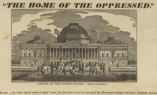
    Slavery DC capitol[Source: the Library of Congress, http://www.loc.gov/pictures/item/2008661294/]

    This is one of those graphics that tells an impossibly large story, too much for a short post like this, too much for a single book–it is a Grand Canyon of a story, a story about something so big that its gargantuan nature is self-evident.

    I meant to include this in yesterday’s post on a 200-word summation of slavery in an 1863 broadside by George Stroud, but it is better posted apart from anything.

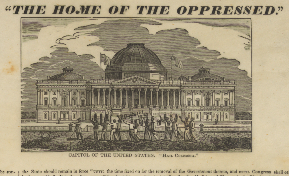
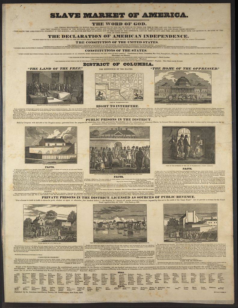
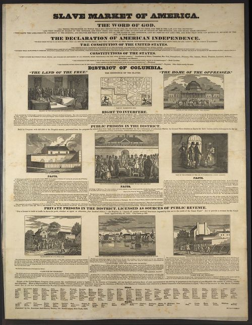
    This is a shocking document.  It is big (64x48cm) and probably when it was pasted up on the side of a building or a fence or distributed with a newspaper that it must have stiffened its readers. The work is called Slave Market of America, and it is an indictment of the system of slavery, layering the institution of slavery on top of the great documents of U.S. history and portrays its practice on the background of the nation’s capital. 
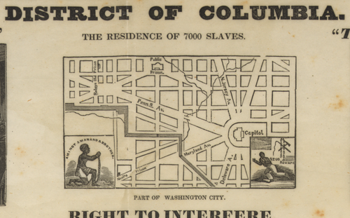
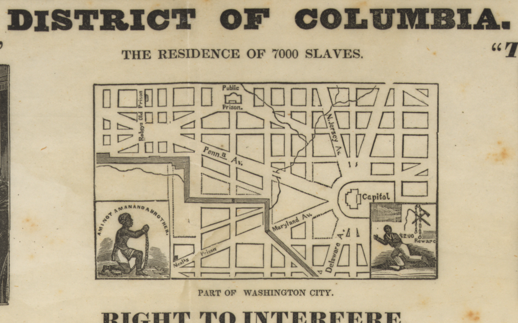
    Slavery DC map[Source: the Library of Congress, http://www.loc.gov/pictures/item/2008661294/]

    The inset map is one of the few from this period to identify the locations of slave establishments.  Here they are identified as “prisons”, which is what they were, but more accurately they were places to hold slaves during the slave sale process which would take place nearby. So the “prison” wasn’t necessarily for law-breakers, but more so for holding the slaves as they were sold as property the ownership being transferred from seller to buyer. 

    And it was not only the slave owners and auctioneers making profit from this–there was also the support industries, like taverns and hotels and restaurants that provided the necessary infrastructure for such business to be conducted.  The D.C. slave market was larger than the District–since it was situated between the two slave-holding states of Maryland and Virginia, it became a natural location for sales of slaves for the region. 

    I’m not going to say very much here and just let the broadside do the talking.

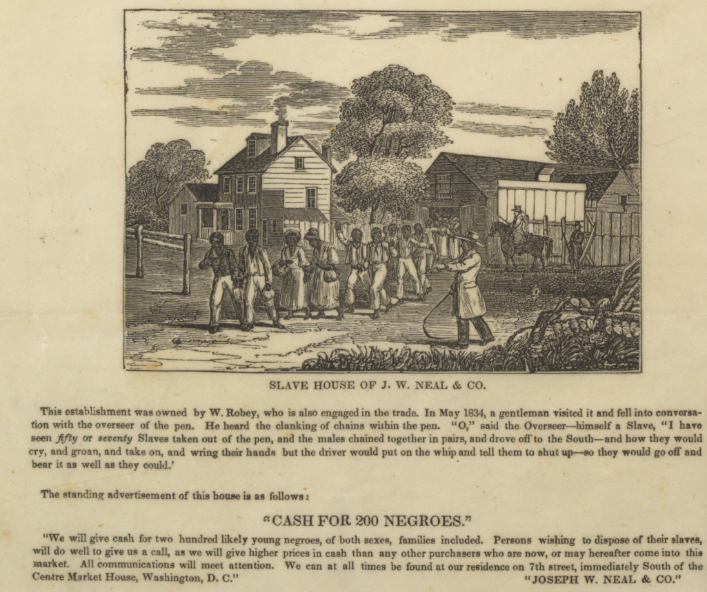
    And the inset from the bottom of the broadside illustrating the Neal Slave House:
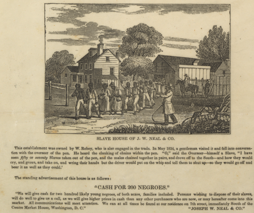
    Slavery DC Neal slave house[Source: the Library of Congress, http://www.loc.gov/pictures/item/2008661294/]

    These are all details from:
    Slavery dc broadside[Source: the Library of Congress, http://www.loc.gov/pictures/item/2008661294/]

    “Summary: A broadside condemning the sale and keeping of slaves in the District of Columbia. The work was issued during the 1835-36 petition campaign, waged by moderate abolitionists led by Theodore Dwight Weld and buttressed by Quaker organizations, to have Congress abolish slavery in the capital. The text contains arguments for abolition and an accounting of atrocities of the system. At the top are two contrasting scenes: a view of the reading of the Declaration of Independence, captioned “The Land of the Free,” with a scene of slaves being led past the capitol by an overseer, entitled “The Home of the Oppressed.” Between them is a plan of Washington with insets of a suppliant slave (see “Am I Not a Man and a Brother?” no. 1837- ) and a fleeing slave with the legend “$200 Reward” and implements of slavery. On the next line are views of the jail in Alexandria, the jail in Washington with the “sale of a free citizen to pay his jail fees,” and an interior of the Washington jail with imprisoned slave mother Fanny Jackson and her children. On the bottom level are an illustration of slaves in chains emerging from the slave house of J.W. Neal & Co. (left), a view of the Alexandria waterfront with a ship loading slaves (center), and a view of the slave establishment of Franklin & Armfield in Alexandria.”–[Source: the Library of Congress, http://www.loc.gov/pictures/item/2008661294/]
  • Atomurbia II: Expanding on the Dis-Utopian-Dystopia (1951)

    JF Ptak Science Books    Post 2491    Part of the series History of Atomic and Nuclear Weapons

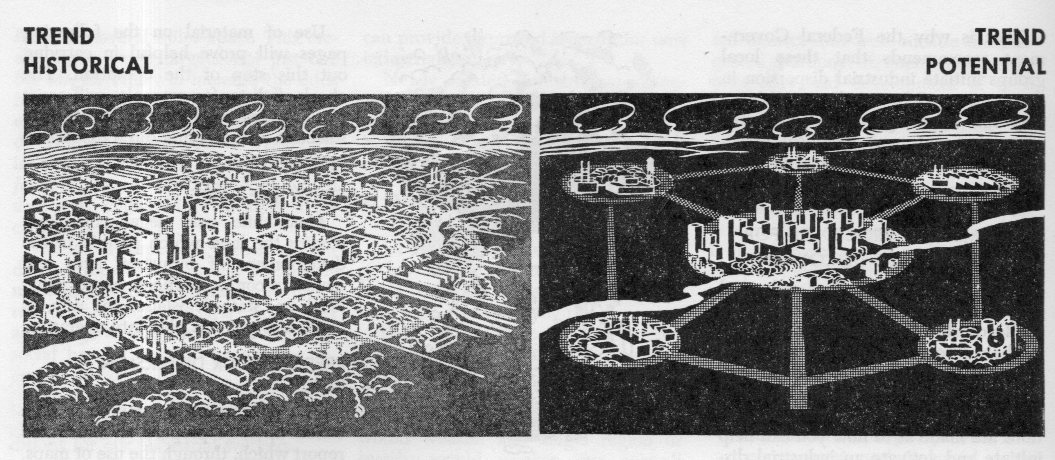
    Earlier in this blog in 2010 there appeared a post called “Atomurbia: Responding to Atomic Threat by Moving Everyone Everywhere, 1946“–it turned out to be very popular, being about the dispersal of the U.S. population centers to thwart nuclear attacks.  (I’ll repeat: it was about the plan to redistribute the population and industry and appropriate infrastructure of the United States of America.)

    Atomurbia II179

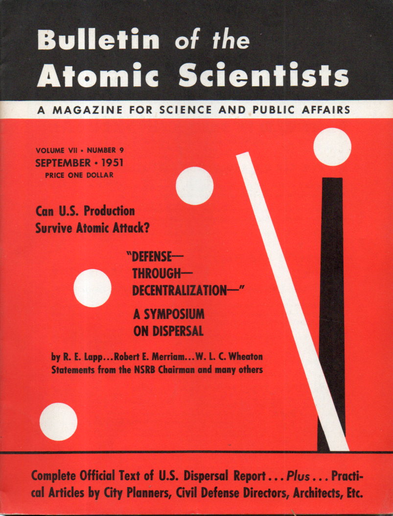
    It was of course (as Somerset Maugham would say in “The Three Fat Women of Antibes”) an Enormous Situation, involving (basically) moving everyone everywhere.  The term was “dispersion”, and the planners of such plans meant it–and I’ve come across it again–unexpectedly–in another issue of the Bulletin of Atomic Scientists for September 1951.

    You may recall that this is the journal that keeps a doomsday clock ticking off the minutes on its front cover showing the advance or retreat from the Midnight of Armageddon.  On this issue the clock is at three minutes to midnight, though I think that the greatest distance from the zero hour was ten minutes to the hour–so for decades the clock has been very close to striking the doomed hour without much relief.  

    In this issue of the Bulletin nearly every article is dedicated to the idea of dispersion (at that point under the auspices of the National Security Resources Board) and the creation of a federal program to directly oversee dispersion (the National Defense Dispersal Administration (NDDA)). And people are talking about moving around cities and people and industry as though it wasn’t that big a deal, though I must admit I haven’t seen any cost or time estimates in this source.  Moving the populations centers of the U.S. to a more “garden city” idea involves so much effort and expense it seems almost impossible to contemplate actually paying for all of it.  (And we haven’t begun to talk about how people and essential personal are actually ‘enticed” to leave their surroundings, nor is there any talk about the property rights of the owners of all of that land that is to be built on.)

    As much as Frank L. Wright’s “Broadacre City” seems to be a lead balloon so far as actual implementation goes for size and scope, this type of “dispersion” idea would be of gargantuan, orders-of-magnitude bigger/costlier than what Wright was talking about. At least in this department Wright was thinking in terms of a utopia; the dispersion business was more like a dis-utopian-dystopia, or something, no matter how these authors attempted to green-up and de-slum their proposal.

    I am mostly making this post for the image at the top of this post(from page 268 of the Bulletin), which fits nicely with those others posted in the earlier Bulletin article (reproduced in the link above). 

      Atomurbia II180

    ·Posted by :

    ·in:

  • Civil War Maps with an Unusual “Drowned World” Perspective (1861)

    JF Ptak Science Books   Quick Post

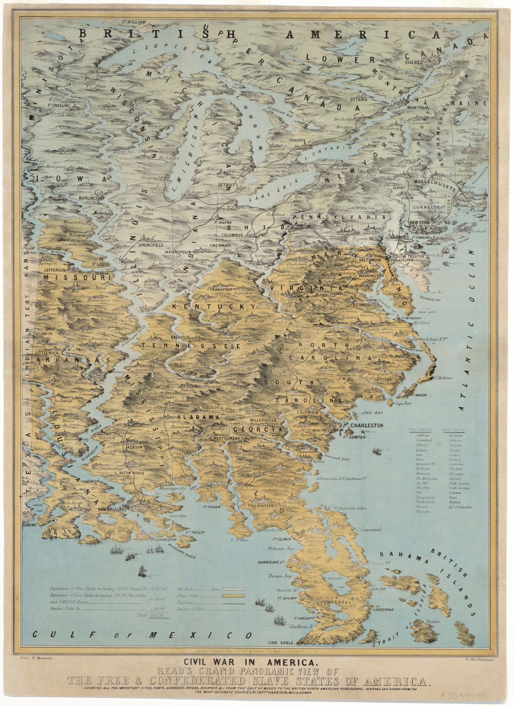
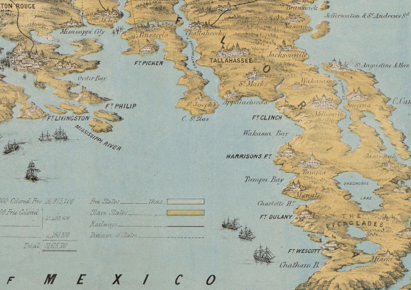
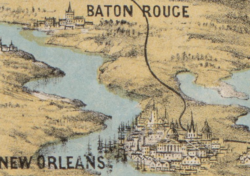
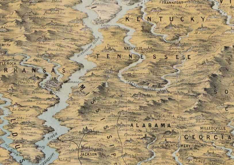
    The cartographer responsible for this unusual map successfully emphasized the rivers and mountains of a region–so much so that they are mostly completely out of perspective/scale to the other elements of the map.  The effect is magical.scary/startling in some ways, especially when you look at the detail for places like Florida and points along the Mississippi River. They remind me of J.G. Ballard’s The Drowned World, particularly with Florida, which look to be mostly submerged.  I know what the cartographer was trying to achieve in establishing the importance of natural boundaries, but this was probably a little overboard, so much so that he may have lost the “c” in “cartographer”.

    Here’s a clickable version of the map, with some zoom capacity:

    Maps-_Civil War--unusual perspec large[Source (including all details, below): Library of Congress, http://www.loc.gov/item/2014589394/]

    • Civil War in America : Read’s grand panoramic view of the free and confederated slave States of America : showing all the important cities, forts, harbours, rivers, railways &c. : from the Gulf of Mexico to the British North American possessions, 1861
    • Read’s grand panoramic view of the free and confederated slave States of America

    It seems as though I have seen something similar to this reckoning what the Florida “coasts” would look like according to global warming trends in the next century:

    Maps--Civil War--Unusual persp  FL

    Of all the city profiles the one for New Orleans looks a little like it could be accurate, if for no other reason than for the large number of ship masts:

    Maps--Civil war--Unusual Persp New Orleans

    The Mississippi looks mighty indeed–if this was drawn to scale the river would be 50+ miles wide in many areas:

    Maps--Civil War--unusual perspective MS river

  • The Savage Stain: Slave Ownership Map in the U.S., by County (!) 1860/1.

    JF Ptak Science Books  Quick Post

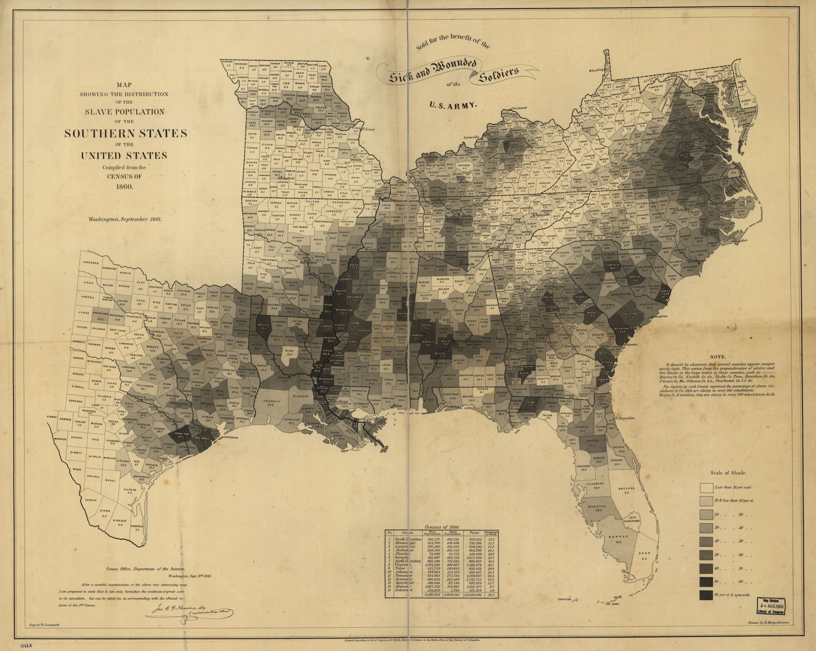
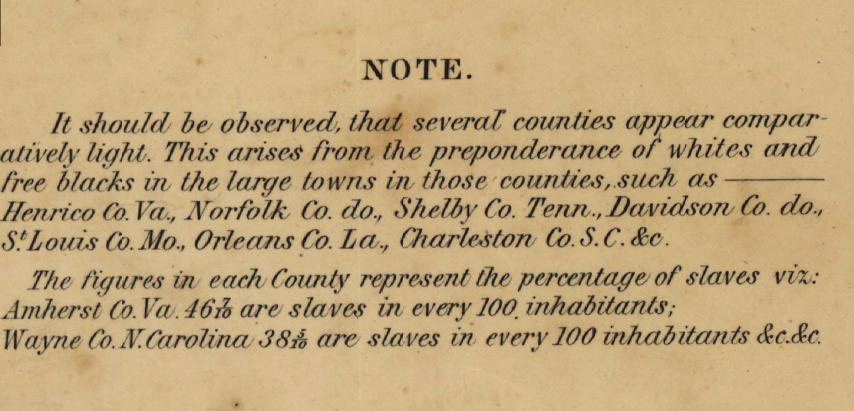
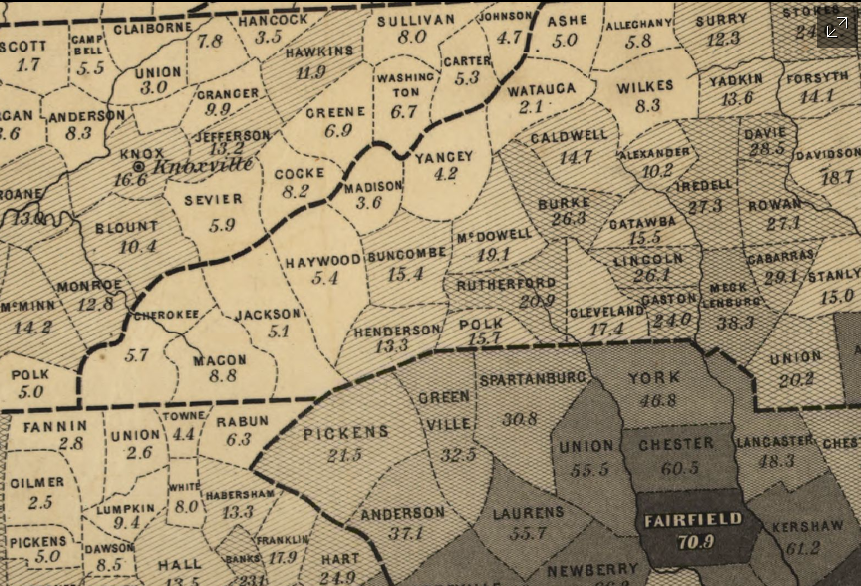
    Continuing several posts on slavery made here over teh last few days is this extraordinary map depicting slave ownership in the U.S. on the county level (!) based on data from the 1860 census and then published in 1861. Titled Map showing the distribution of the slave population of the southern states of the United States. Compiled from the census of 1860, I find it an enormous success in putting all of this data on one piece of paper, especially since the proportion of slave ownership is depicted also in shades of gray so that a visual impression of the state of slavery in this country can be seen and comprehended almost instantly.  

    The image below is clickable and expandable; mega files are found at the originating site of the Library of Congress (link follows).

    Map--slavery 1860 full

    [Source: the Library of Congress: http://www.loc.gov/resource/g3861e.cw0013200/]

    Map--slavery--detail note

     And a detail:

    Map--slavery--detail of map


    Adolph Von Steinwehr

    Hergesheimer, E.
    Hergesheimer, E. (Edwin)

    “Scale ca. 1:3,000,000.-  LC Civil War Maps (2nd ed.), 13.2-  “Entered according to Act of Congress, A.D. 1861 by Henry S. Graham.”-  “Sold for the benefit of the sick and wounded soldiers of the U.S. Army.”-  “Census Office, Department of the Interior, Washington, Sept. 9th, 1861. After a careful examination of the above very interesting map I am prepared to state that it not only furnishes the evidences of great care in its execution, but can be relied on as corresponding with the official returns of the 8th Census. [Signed in facsimile] Jos. C. G. Kennedy, Superintendent.”-  Map indicates by gray patterns, the percentage of slaves in each county. “It should be observed, that several counties appear comparatively light. This arises from the preponderance of whites and free blacks in the large towns in those counties. . . The figures in each county represent the percentage of slaves. . .”–Library of Congress website  http://www.loc.gov/resource/g3861e.cw0013200/]

  • Found Art in Books: String & Maritime Law, 1849

    JF Ptak Science Books  Quick Post

    FYI–there have been about 90 posts to this blog since June 1, which is a lot more than you can see in the “Recent Posts” column at left.  You can check them out by clicking on the “Archives” column on the left.

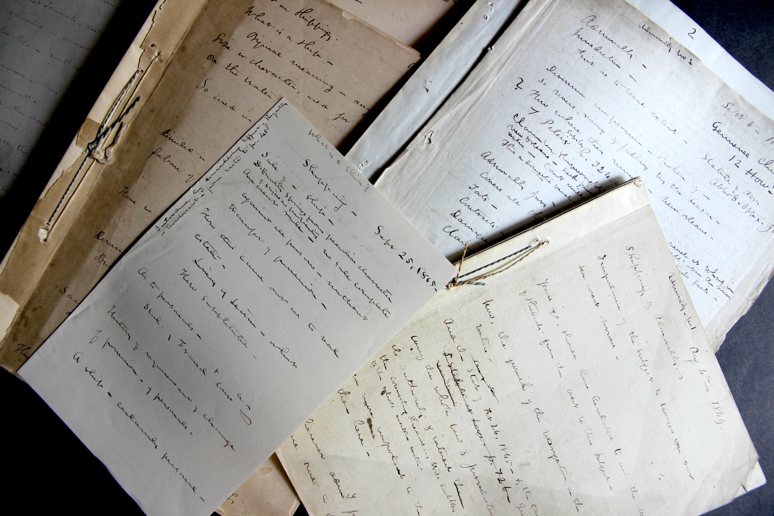
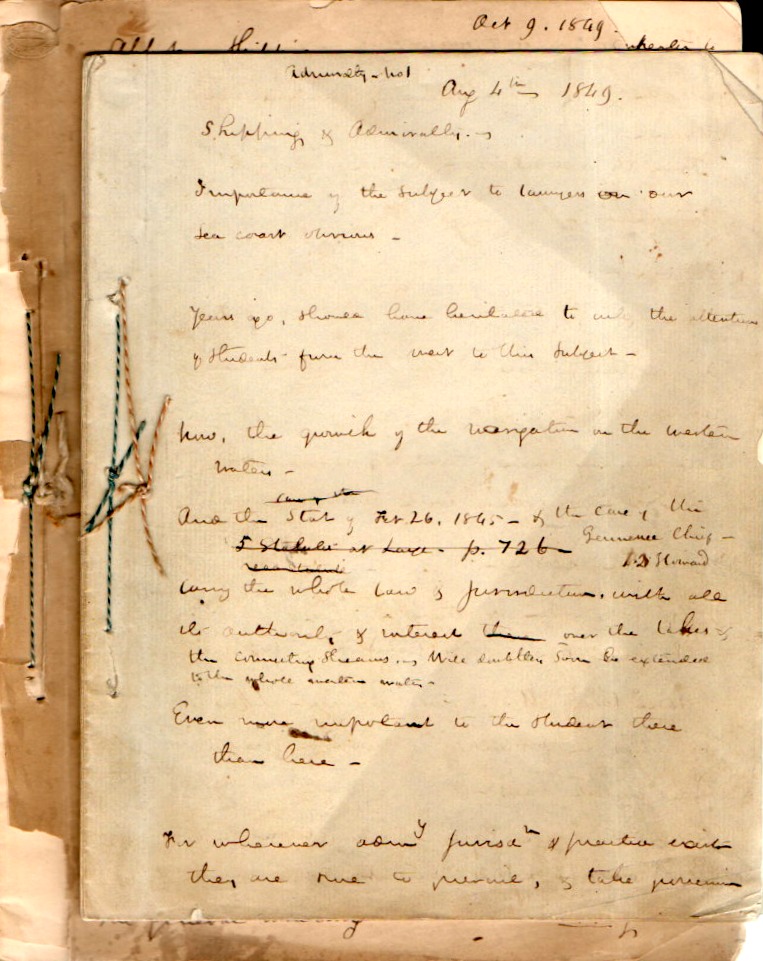
    Admiralty lecture notes string

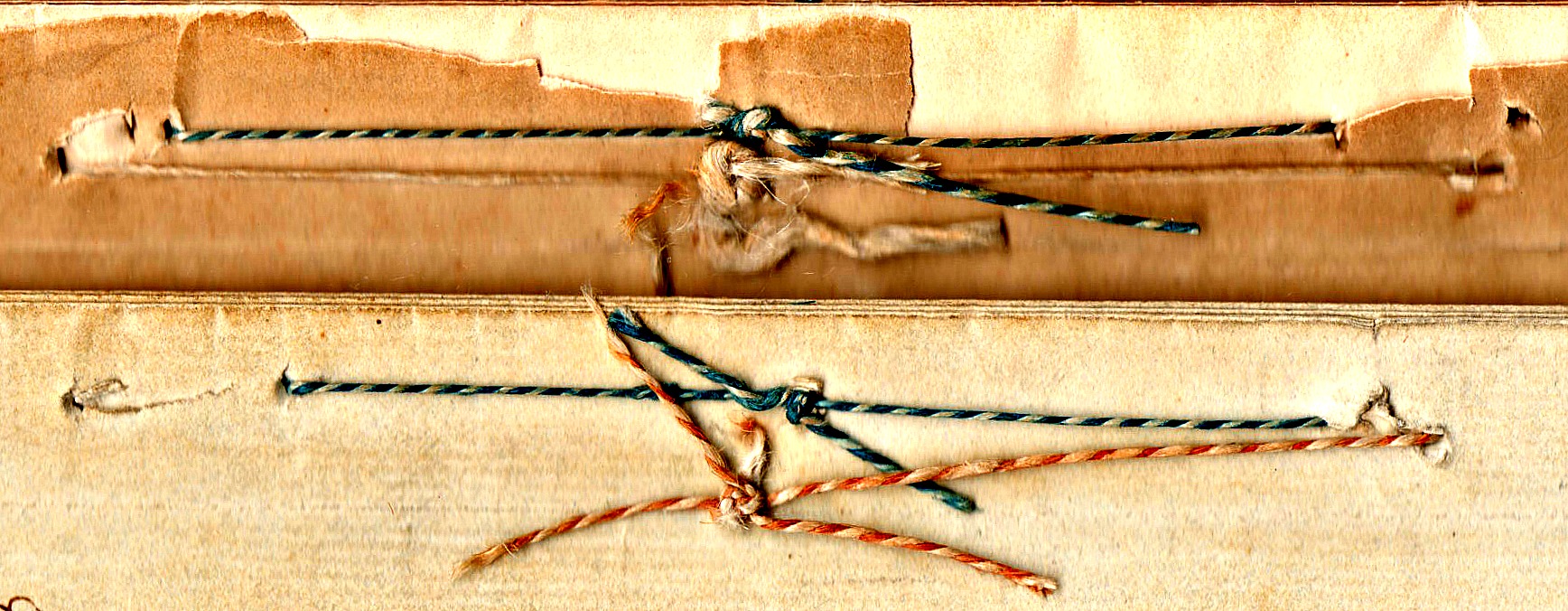
    The odd thing about this “find” this morning is that only yesterday I was asking a question regarding what I saw (or imagined) to be the equality of vessels in maritime law and how interesting it would be to have those laws transferable to land. That said, in clearing out a backlog in one of the bookcases I found a series of lecture notes on admiralty law from 1849.  Clearly they belonged to a lecturer in the subject, as there are broad statements on involved topics, with room to spare in going from one subject to the next–these are not “notes” in the sense that someone would lecture by reading from them; they are the notes of a person for moving through time inside of a lecture, references for what needs to be covered. With this the case most of them are too advanced for me to make much sense of….but there was plenty there to distract and attract–perhaps the least of that is the string used to tie everything together.  

    Admiralty notes _3_

    • You can actually buy this archive at the blog’s bookstore, here.  

    The stuff of old books can be very attractive in their own way–just the fact that they have made it in this relatively now-fragiler form is remarkable. (I am certain that these will make it hundreds of years more if cared for, or simply ignored, because that is what most books with do.)  In any event I find the found bits like this to be fascinating. 

    Admiralty lecture notes181

    ·Posted by :

    ·in:

Recent Posts

Archives

Categories