JF Ptak Science Books Post 1817
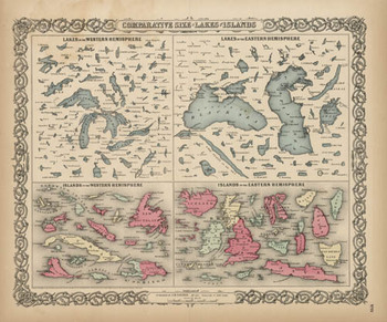 1856 may have been the first time that these 150+ lakes and islands of the Western and Eastern Hemisphere were ever been printed on the same page and in the same scale exclusive of their associative land masses and placed contiguously, side-by-side. They were, of course, seen in a common perspective before on any world map, but I think that this is the first year in which the islands and lakes of the world were displayed without oceans and land masses, and the effect is a little odd. If you take away the color and the text the image takes on a very definite biological flavor (I keep thinking of that tiny bone in the ear for the small lakes…) In any event it is far easier to compare these features without the distractions of the non-lakes and non-islands clouding and confusing our perspective fields.
This was also the beginning of the heyday of publishing comparative this-and-that in atlases: from 1840-1880 or so was the period in which the majority of descriptive comparatives were published. This is when you would see comparatives of the lengths of rivers and the heights of mountains and waterfalls beautifully displayed in atlases. I don’t know what happened after then, but the publication of this sort of data really fell off, with the heights of mountains/lengths of rivers stuff relegated to filling the empty areas in double-hemisphere world maps 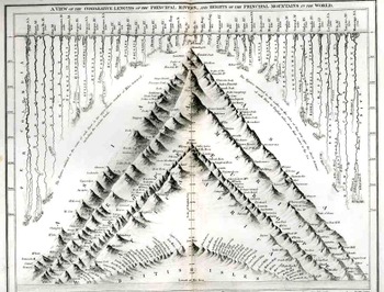
Here’s a relatively early image of this type called “A View of the Comparative Lengths of the Principal Rivers and Heights of the Principal Mountains in the World”, published by Orr & Smith in London (1836), featuring 44 rivers and a hundred or so mountains. It is a lovely and graphically pleasing work, and an early effort in displaying the dissected river and mountains in such a forensic-like way. 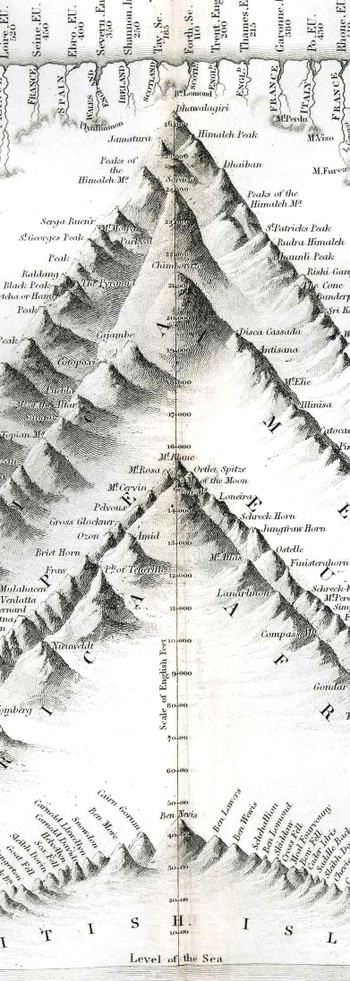
This I think is my favorite genre of specialty map, and I plan to write on them in great detail (and heavily illustrated) in just a bit; but, for now, I’d just like to surface this map by George Colton, and admire it, and try to imagine the kind of impact it must’ve had on people back there in 1856 who were seeing this sort of data displayed so for the first tine. It would have been a huge revelation to see the lakes and islands compared side-by-side; it was a fresh, new idea, and an insight in how to look at things in general.
