JF Ptak Science Books LLC Post 897
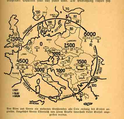
I’ve written twenty or so pos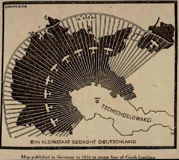 ts here about (mostly) graphical propaganda of World War II, and most of that coming from the Axis (and mainly Nazi) end. A popular theme among this limited exposure seems to be the Germany-surrounded meme: Germany under attack from all sides: massive attacks being directed by the British from air and sea,
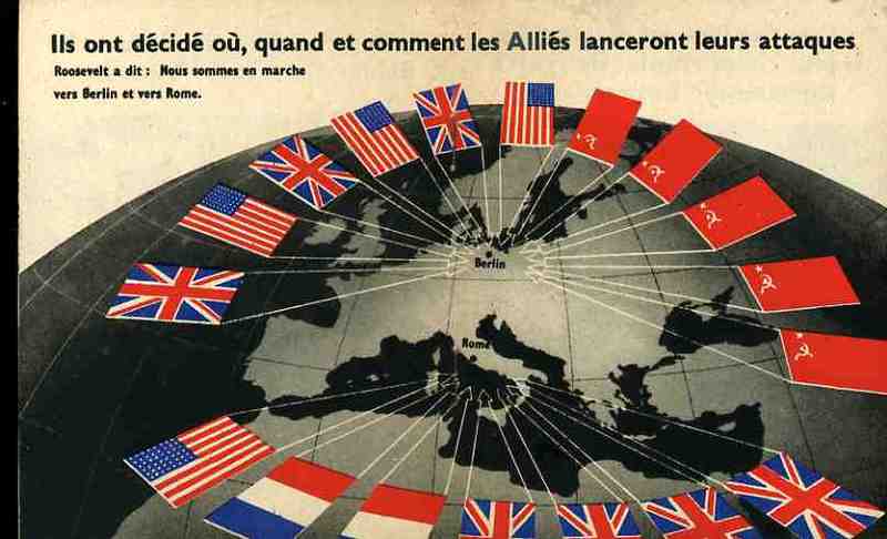
airstrikes coming in from thousands of planes in Czechoslovakia, Poland moving on the ground and in the air to invade south-eastern Germany, retaliation mounting from the French, and on and on. And somehow when all of this is presented in cartographical form to the average reader, and when it is presented over and over again, the propaganda must take its toll.
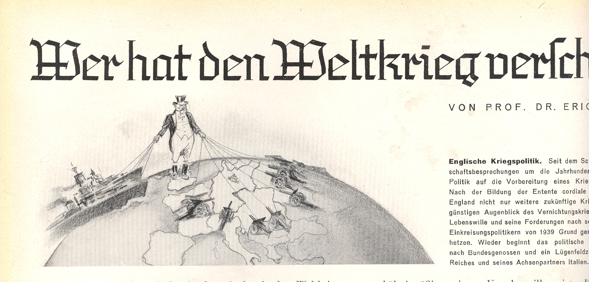
 Tonight’s installments come from the Illustriete Zeitung (Leipzig), and were printed just before and just after the start of the general hostilities of WWII (meaning the invasion of Poland, and not the actions against Austria or Czechoslovakia, and not the war in the east beng waged against China by Japan).The first comes in the 27 July 1939 issue–featuring a remembrance of WWI on the cover, showing a devastated field of battle with a spanking-new heavy dagger thrust into the heart of the field–and shows John Bull pulling strings of an advancing/attacking navy in the one hand while the other controls a firing network for cannons facing Germany based in its contiguous-bordered countries. (The image was created by the prodigious Richard Lipus and titled “Englishe Kriegspolitik”.)
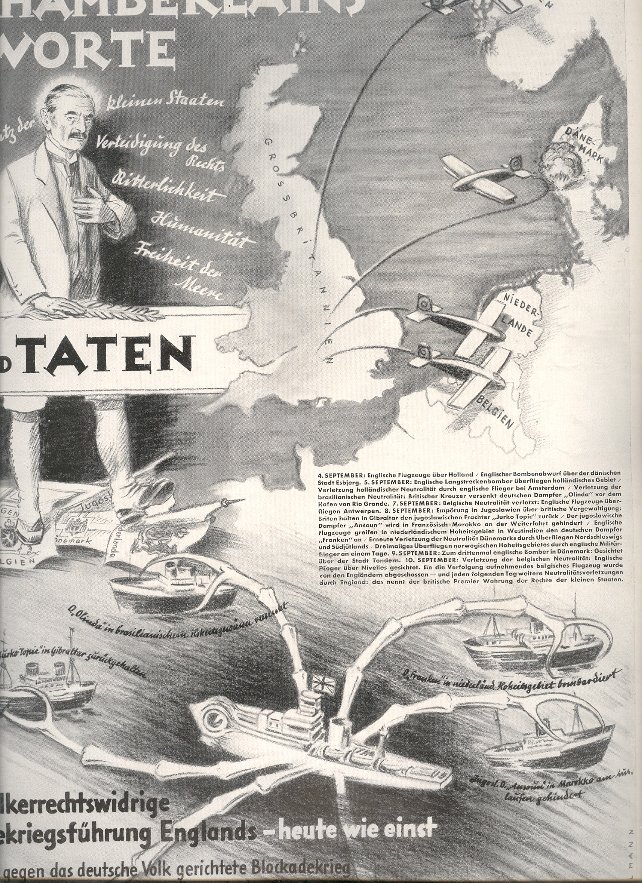
The second piece was published just after the start of the war (21 September 1939) and attacks Neville Chamberlain (contrasting words and deeds) and his “treacherous” involvement with neutral countries.
Not particularly virulent, these maptoons undoubtedly helped to form a Nast-ian image in the commonplace psyche of the German people about the treacherousness of the Brits and of their dire situation of being surrounded by potent and threatening enemies.
Some of the other posts on this blog relating to WWII propaganda:
Maps
as Propaganda https://historyofideasblog.com/thesciencebookstore/2008/08/maps-as-propaga.html
Maps
of the Polish “Corridor” https://historyofideasblog.com/thesciencebookstore/2009/09/propaganda-in-maps-the-polish-corridor-1939.html
Maps
of Naval Disaster https://historyofideasblog.com/thesciencebookstore/2009/05/jf-ptak-science-books-llc-post-624-the-admiralty-regrets-to-announce–was-for-years-the-standard-beginning-to-an-offici.html
Anti-Nazi
Propaganda https://historyofideasblog.com/thesciencebookstore/2009/08/antinazi-propaganda.html
Nazi
Propaganda and the Threat From
https://historyofideasblog.com/thesciencebookstore/2008/08/propaganda-maps.html
Humanitarian
propaganda for Allied families with family members who were POWs https://historyofideasblog.com/thesciencebookstore/2008/09/humanitarian-pr.html
Nazi
Germany and Scaring the Will to War (
Nazi-directed
scare tactics published in English https://historyofideasblog.com/thesciencebookstore/2008/08/nazi-propagan-1.html
The
Luftwaffe and RAF present their (graphical) popular cases https://historyofideasblog.com/thesciencebookstore/2008/09/graphical-and-a.html