JF Ptak Science Books Post 226
I’ve made a number of posts about Nazi propaganda maps and thought that this was perhaps time to surface something that represented an Allied effort in the use of maps in hearts & minds campaigns–in this case it was in French obviously and distributed in occupied France. . (Note:as is the case with may of the items that I feature on this blog, the following pamphlet comes from a collection that I bought of the Library of Congress. It was called, simply, “The Pamphlet Collection and was 90,000 items strong. Or weak.. There was no real organizing principle save for the fact that they were all categorized in some strange way and housed in 2,400 alphabetically-arranged document boxes. They also hadn’t been touched since about 1948. What makes the “collection” so spectacular to me is that the majority of the pamphlets in it just don’t show up in any collections, anywhere. It seems natural to surface these things and publish them to the web where they can be either appreciated or forgotten–but at least they’ll still be available for as long as electrons move).
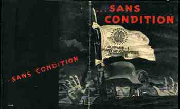
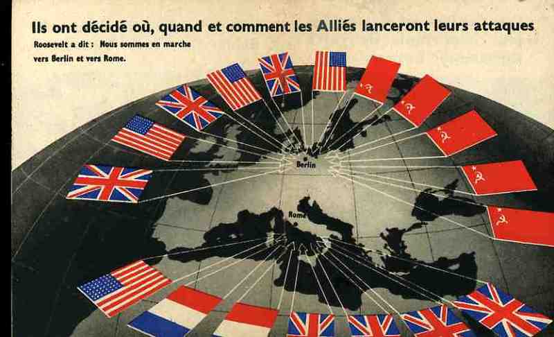
The occasion for the publication was the meeting at the Anfa Hotel in January 1943 in Casablanca (in the French Protectorate of Morocco) between Churchill, Roosevelt and De Gaulle (Stalin deciding he was too busy with the Nazi invasion to attend. The full trio of the Americans, British and Russians would meet later in November at Teheran). The Casablanca Conference mapped out the Allied strategy for the rest of the war while trying to figure out how to help the Soviets. The map blatantly relates the closing of the collar around the shrinking neck of the Nazi nation, especially with what was seen as the impending defeat of the German forces in Russia. I suspect that the pamphlet was really published after the massive surrender of German troops at Stalingrad at the end of January–this would explain the forward motion of the red flags. The pamphlet cover calls now for the unconditional surrender of the German forces called for in Casablanca. The text explains to the French reader that the downward spiral and defeat of Germany was inevitable, and that nothing less than complete and unconditional surrender would be acceptable. In any event the images and the map were completely understandable, even without language, calling quick and immediate attention to the new and true and positive developments in the war.