JF Ptak Science Books Post 624 Blog Bookstore
Propaganda Series # 14 (See listing below)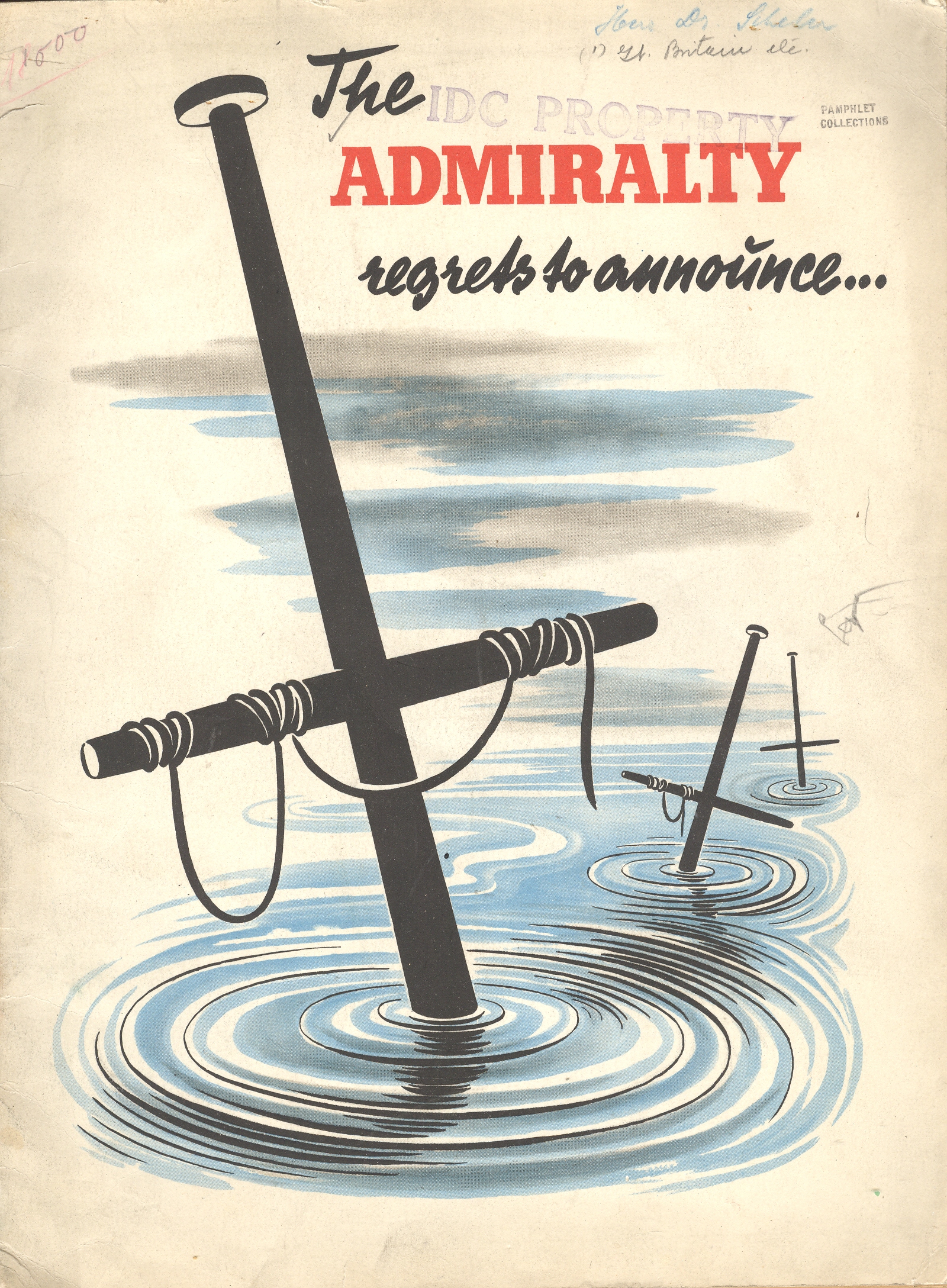 The Admiralty Regrets to Announce… was for years the standard beginning to an official British announcement concerning the loss of ships and sailors. The phrase is used as the title to this work (by an unattributed writer known only as “an expert”) to immediately introduce the reader to the failings of the British navy. It is of course a piece of Nazi propaganda, issued some time in 1941. (My copy is he U.S. copyright deposit copy and is stamped with a transfer date of September 1942; the pamphlets reads to me as though the U.S. had not yet entered the war.) The great strengths of the German air force and navy are extolled and the failings of the British mercantile elaborated at great—and sometimes greatly imagined—lengths. The booklet was published in French (except for the title) and answers its own repetitive question: “quelle est donc la situation relle de la marine commerciale anglais?”
The pamphlet’s 32 pages (illustrated with 2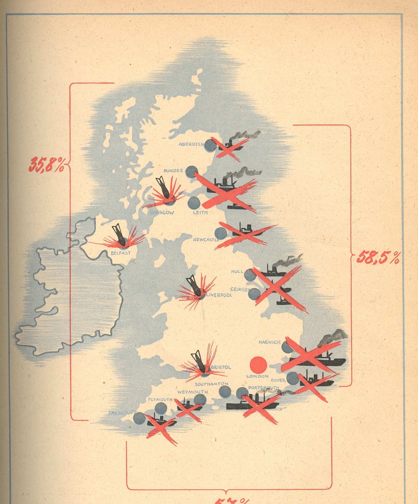 4 photographs of various blow-ups and bombings, plus one graph and three maps) are dedicated to winning the French hearts and minds, trying to convince the conquered population that there really wasn’t any help coming, and that the British could not even supply themselves with the necessaries to run a country, let alone a war.
In the map at right we see the ports and shipping centers that were bombed by the Luftwaffe (with London located by a big red dot). Another map shows the stockade-like presence of the Nazi navy securing its impregnable wall against the arrival of foreign trade and supplies to Britain.
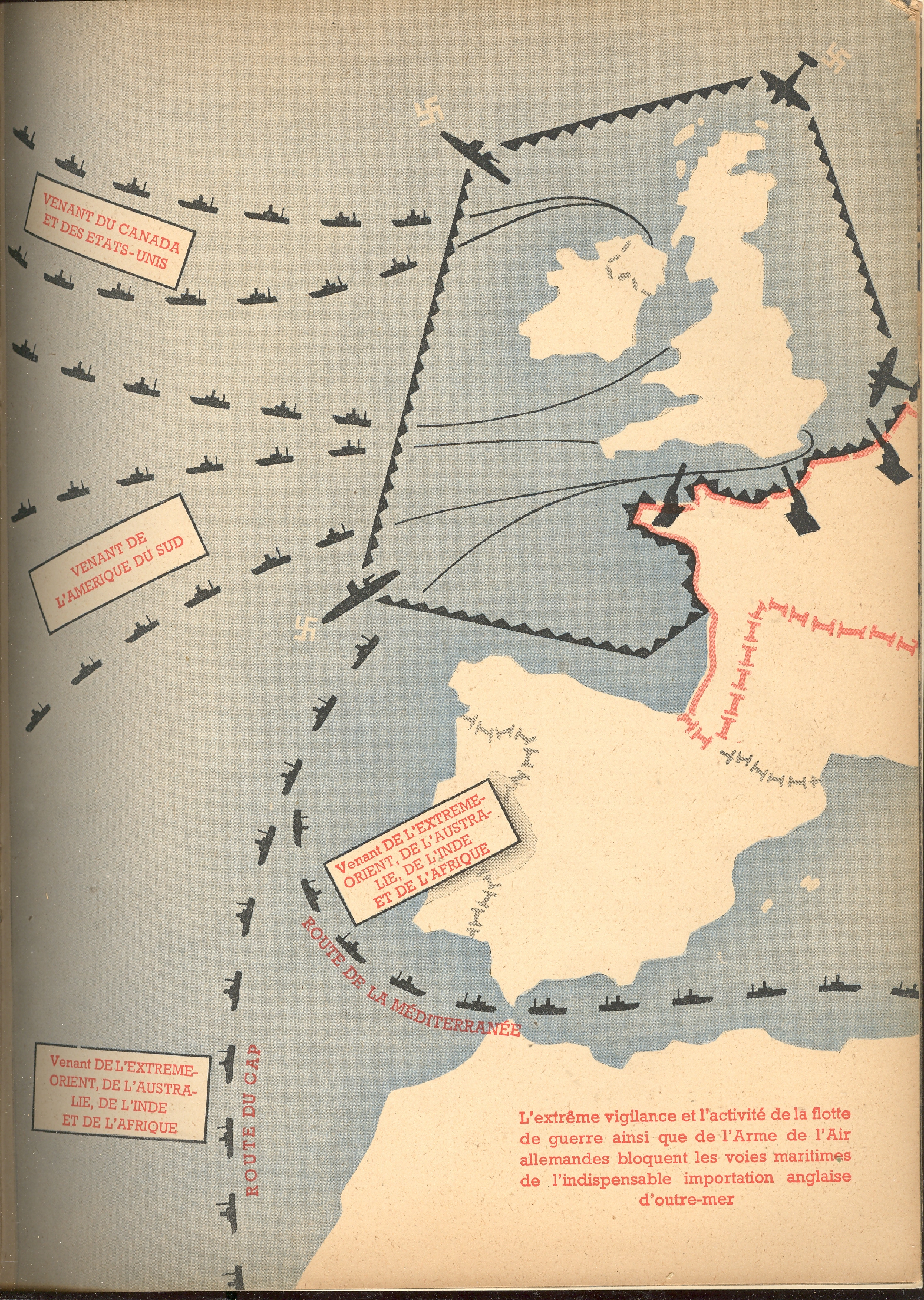
This post is one of a series on propaganda maps which occasionally appear in this blog. Like Thomas Nast political cartoons and war photography, a map can instantly and overwhelmingly display not only data but sentiment as well. The maps published in this pamphlet by the Nazis are were certainly immediately understandable to just about anyone, French-reading or not, literate or not–the images needed no words, especially when surrounded in the text by vicious images of German military might. Ov errun or not, Petain-ized as it was, France was still offering aid to its allies and resistance to the Germans–the more minds that could be won over with propaganda of this sort meant one less to have to worry about as an active enemy.
A Listing of Some our the Propaganda-related posts in this Blog
Nazi Propaganda: Scaring the Will-to-War, 1935
Maps as Propaganda: the Nazi’s Use of Maps in the Hearts and Minds Campaign in Occupied and Holland and France, 1943
The Propaganda of Restricting Infomration: Dorothea Lange’s Photos at the Japanese “Relocation” Camp, Manzanar, 1942
Psychological Warfare--Aerial Propaganda Leaflets and Surrender Tickets, WWII.
Maps as Propaganda: the Turning of the Tide, January 1943
Humanitarian Propaganda–Hope for those at Home, September 1944.
Nazi Propaganda: Scare Tactics in a Hearts and Minds Campaign, 1940
A Propaganda Effort Equating the New Deal and Nazism, 1935: the Power of Willful Forgetting
The Atomic Bomb: 6 August 1945. Propaganda Leaflet Dropped on Japanese Cities
The Polish “Threat” to Germany, 1939: Nazi Propaganda on the Perceived Polish “Invasion”
Propaganda Maps #2: the Nazis. the Big Lie, and Cartography
Graphical Display of Data: the R.A.F. and Luftwaffe Present Their Cases, 1938-1940