A Daily History of Holes, Dots, Lines, Science, History, Math, Physics, Art, the Unintentional Absurd, Architecture, Maps, Data Visualization, Blank and Missing Things, and so on. |1.6 million words, 7500 images, 4.9 million hits| Press & appearances in The Times, Le Figaro, Mensa, The Economist, The Guardian, Discovery News, Slate, Le Monde, Sci American Blogs, Le Pont, and many other places… 5000+ total posts since 2008.

  • The Belgian Collector of Life, 1918

    JF Ptak Science Books  Quick Post                

    Part of the World War I  Photography series
    WWI Sniper198

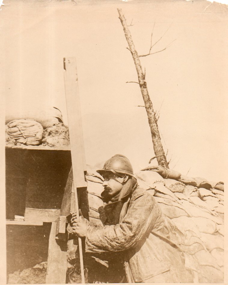
    This is an excellent example of appreciating images in context.  The photograph seemed line an ordinary image of a soldier peering through a periscope on action ahead of his trench, in some miserable battlefield, somewhere in Europe, 1918.  The image is the product of a photographic pool, the photographers working in semi-unison to produce acceptable images to be used in publications illustrating the war.  The images could not be too terribly graphic, and must not relate any useful military intelligence–they would pass through the hands of very active censors whose job it was to slightly inform the reading public and to also keep morale high, a difficult balancing act.

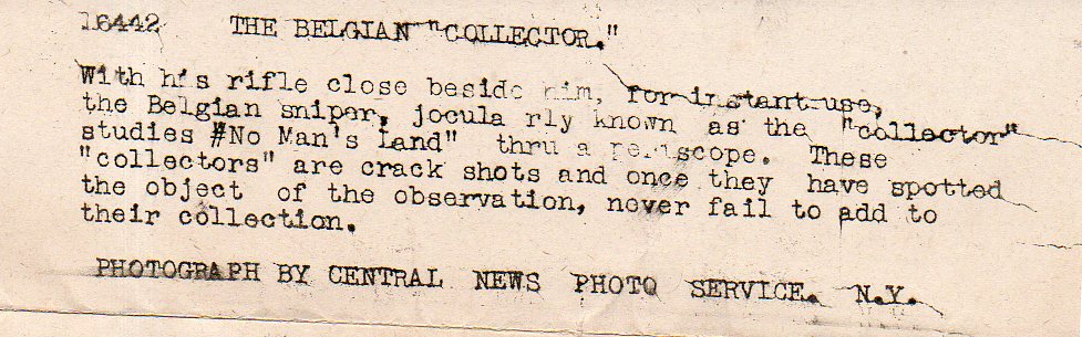
    And so I thought my thoughts. Until I turned the image over–it was stamped “Photo by Central News Photo Service”. It was also accompanied by a typed caption, the bit of text that was to be the standardized caption for this photograph when and if it was used by a magazine or newspaper.

    The title is “The Belgian Collector”. 

    The Belgian collector was a sharpshooter. He would scan the field looking for any unfortunate who might have left themselves exposed.  Then he would shoot at them. Collect them.

    In a  sense, “collect” like “John Fowles The Collector, only killing them with a rifle.

    But that was his job. And it was war. And if he was on your side, then you’d want him there.  

    I found “the collector” name to be poetical, and chilling.  
    WWI Sniper det199

    So, combining the context with the image in this case was a truly sensational thing.  

    The original photo may be purchased from this blog’s bookstore, here.
    ·Posted by :

    ·in:

    — —
  • Women in the Kingdom of Clothing, 1918

    JF Ptak Science Books   Quick Post

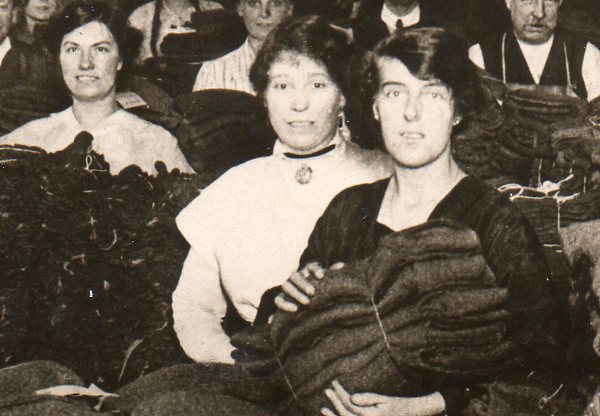
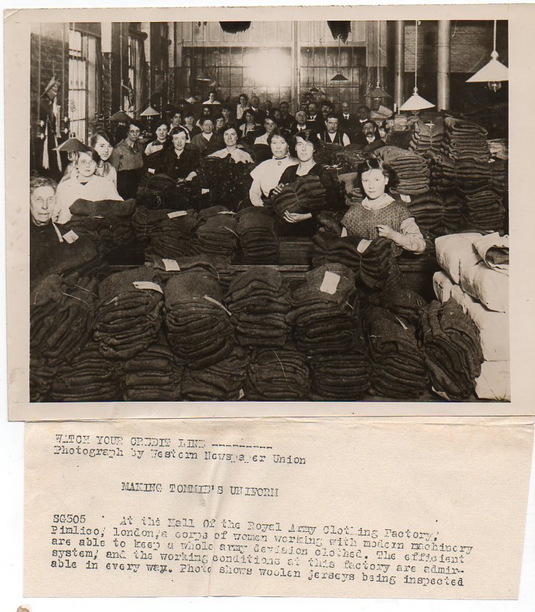
    This is another in a long series of posts on my collection of WWI news service photos–there’s 75 or so up already though mostly in the WWI photography part of the blog’s bookstore.  Mostly the images were very heavily controlled by censers as to what content was allowable or not, and there was also very strict control of access to battlefield actions.  Simply put there was a long hearts & minds campaign of positive reinforcement exercised by allied high command in controlling wartime images–with the deaths of tens of millions of people there was simply no room to be let for any chance illustration of the great bleakness of this war to escape a censor’s detection.  Imaging the war would come in due course, but not necessarily during the fighting; and the coverage wasn’t necessarily “imaginative”, as it tended to be more exclusive and myopic. 

    This photo is pretty upbeat, full of positive energy and life, and shows a group of female volunteers in a sea of clothing, having created the articles they are now folding the jerseys for shipment.  The faces are fresh, inviting, full, hopeful. 

    WWI--e--women pants683
    WWI--e--women pants det682

    The original photograph is available here.

    ·Posted by :

    ·in:

  • Graphical Display of Data–Profiles of British Destroyers, 1949

    JF Ptak Science Books  Quick Post     

    Display of Quantitative Information series.

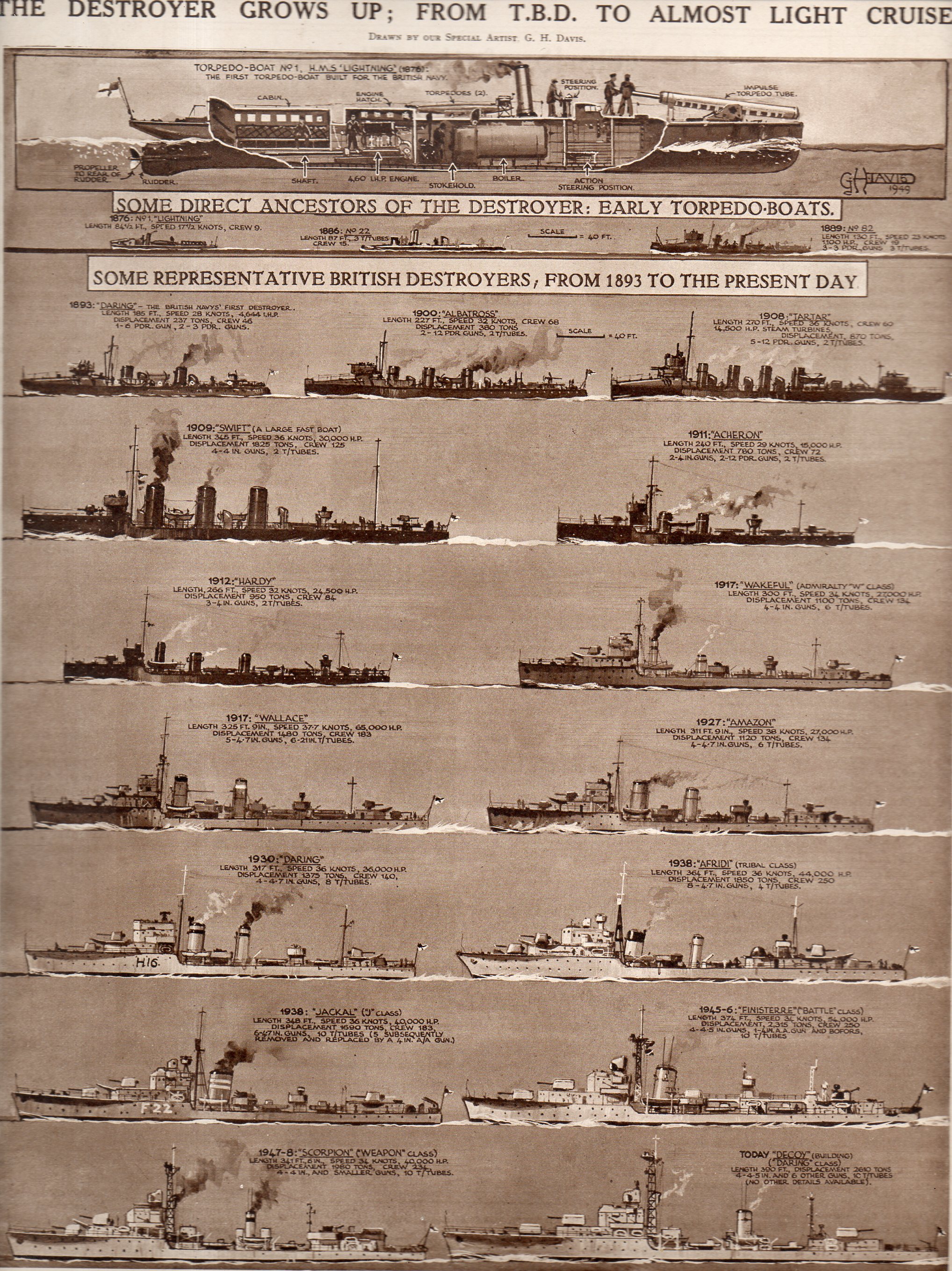
    I found this interesting and lovely display of empirical data, and I like it quite a bit, even though it really isn’t a good example of a graphical display of information.  The chart was intended to show the differences in the profiles of British destroyers, and not much more.  The image appeared in The Illustrated London News, April 23, 1949.  

    Hic--the Destroyer191

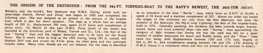
    And the text:

    Hic--the Destroyer text192

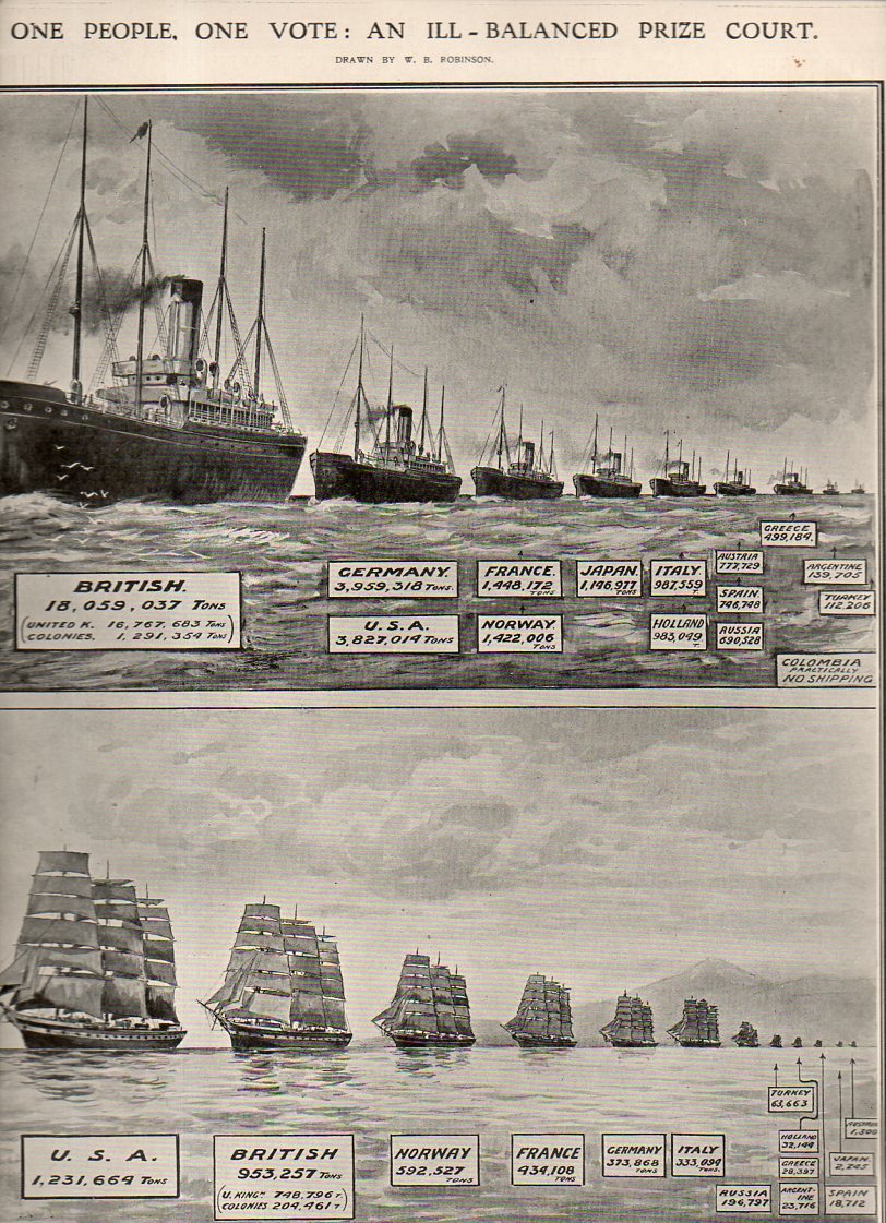
    Then there’s this (below) a good graphical representation of the size of fleet strengths, steam and sail, appearing in The Illustrated London News  for January 28, 1911, just a few years before the start of WWI:

    Graphic fleet size193

  • The Tools of a Scientist, 1700

    JF Ptak Science Books    Quick Post

    Friedlein941

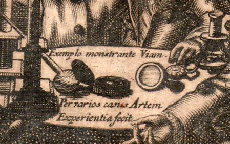
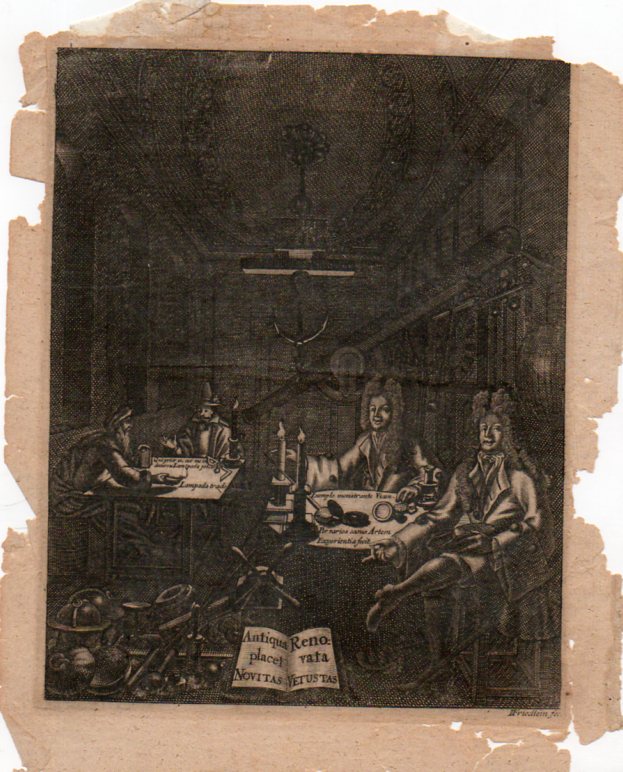
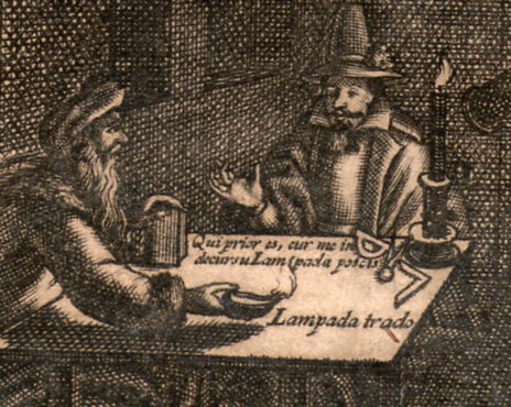
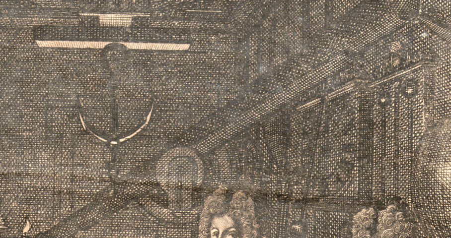
    This is an image of a  philosopher’s cabinet, an engraving (on copper?) by “I. Friedlein fec”, who was actually Johnann Friedlein, an emigree from North Germany to Denmark, and who worked ca. 1680-1705. It shows the tools of the trade for someone working in natural philosophy (the name “scientist” would not come into use for another 150+ years or so) and is an interesting insight into a small, polite gentleman’s club for experiment and investigation.

    Friedlein938

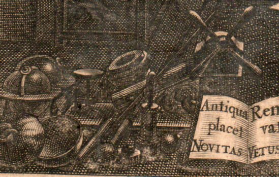
    The men surround a decent collection of scientific instruments–I can locate a compass, dividers, oil lamp, magnifying glass, compass, microscope  (at the right elbow of the figure on the right), terrestrial and celestial globes,  a (large) clock, barometer and various weights and scales.  And behind it all looms a fairly large refracting telescope (is it 6 six inches?) which also has mounted alongside of it a smaller sighting telescope. 

    Friedlein939


    Friedlein940

    Friedlein942

    Nyt dansk kunstnerlexikon: bd. Indenlandske kunstnere (fortsættelse …)by Philip Weilbach:


  • Smash the 7th Column–U.S. WWII Home Front Propaganda

    JF Ptak Science Books   Quick Post

    7th column214

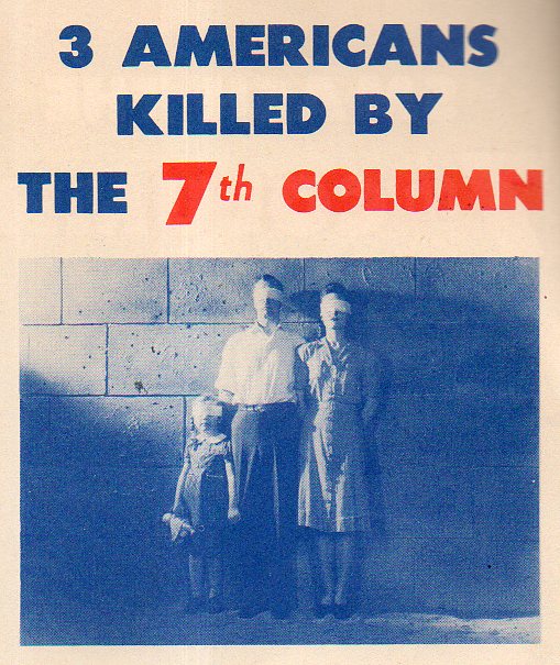
    No, this family wasn’t killed by a firing squad, but according to the pamphlet they might as well have been.  By the 7th column.

    The 5th Column is the army of spies and saboteurs infiltrating a country; the 6th Column helps this action along, (according to Webster’s):  “the aggregate of persons in a country at war who assist the subversive activities of the fifth column by defeatist talk, the spreading of rumors, and other activities that weaken resistance or appease the enemy”.  

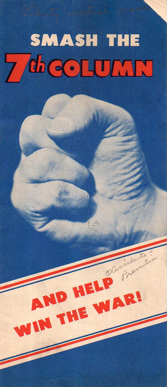
    The 7th column was carelessness–and evidently this was a push to roll back the tide of accidental death and injury in the U.S., something that was particularly important during wartime.  According to this tract 102,500 Americans were accidentally killed every year, with another 350,000 becoming permanently disabled and 9,000,000 being injured.  “We must stop burning down our factories” says the author, for these injuries and deaths would be along the same lines (in some fashion) of the U.S. being bombed. 

    7th column cvr215

    This seems as though it could have been an effective tool in getting the view across of fighting the sub-rosa enemy of carelessness in wartime.

    ·Posted by :

    ·in:

  • Salvage! (1943)

    JF Ptak Science Books

    00-blog-Oct 25 salvage922

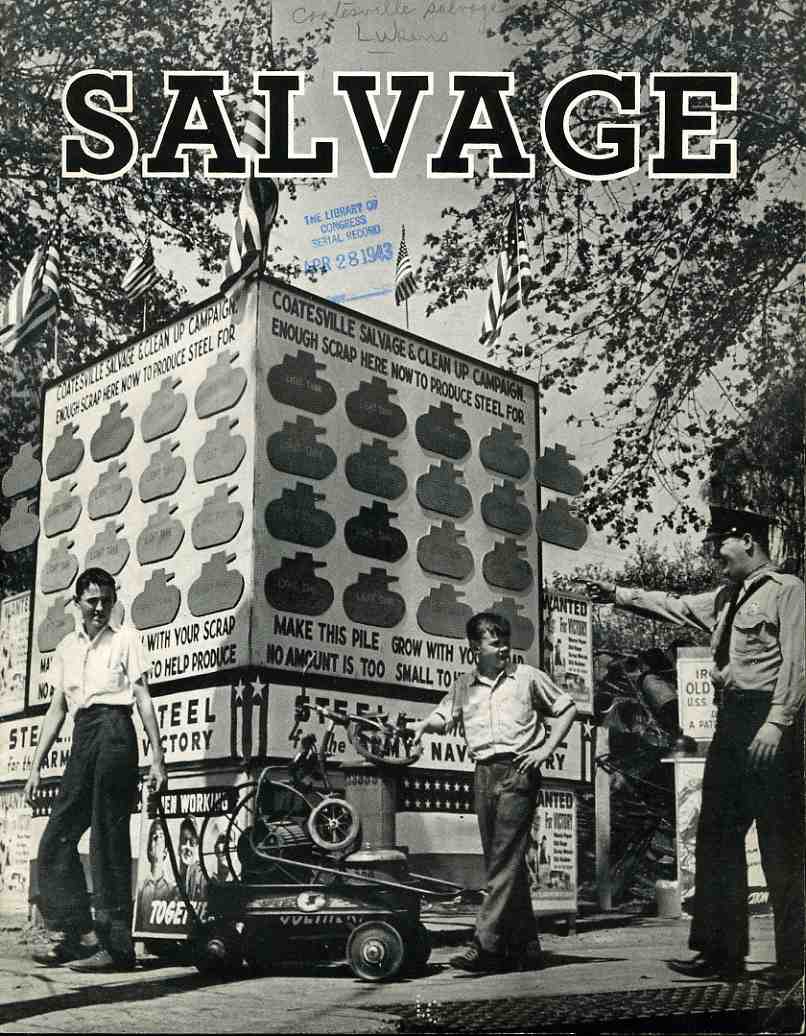
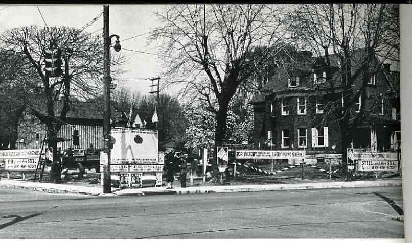
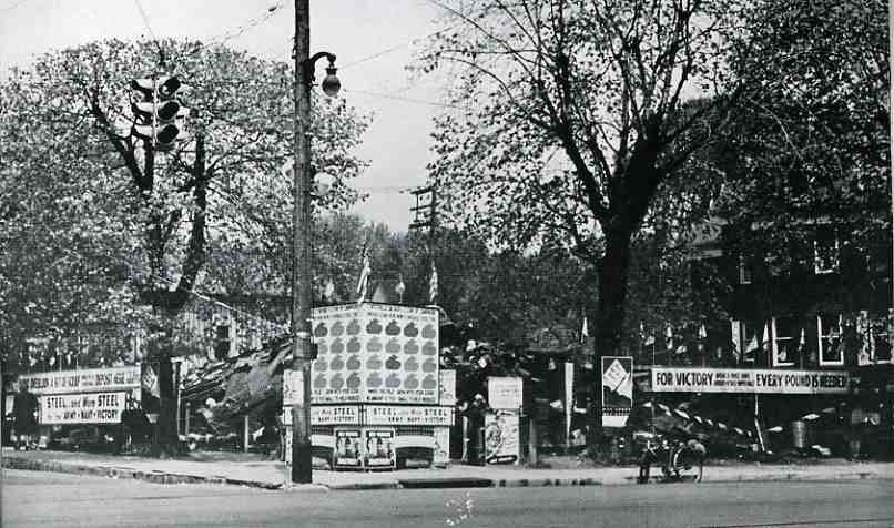
    Now for an example of something fantastic: Salvage (1943) is just brilliant!  It is a superb  design, getting its inelegant point elegantly across to the reader, making the collecting of junk  a bona fide war effort, triumphant, superior; it delivers the message gorgeously.  Who wouldn’t want to rush out and look for some metal scrap and bits and grow a neighborhood junk yard so that the community could build a tank?  Certainly these two boys–under the watchful guidance of a smiling cop in a black tie–couldn’t resist, and from the looks of the progress billboard behind them, nor could anybody else in the neighborhood, as the community collected enough metal junk for 14 tanks.  (Or at least pieces and chunks for fourteen tanks.)

    The community was Coatesville, Pennsylvania, and they certainly did their collecting-best.  The two photos below show (top) the scrap yard after two days of collecting, and (bottom) the end of the campaign two months latter.

    “One pound of fat contained enough glycerin to make a pound of black powder, enough for six 75-mm shells. Twenty three hundred old nylon stockings contained enough nylon to make one parachute.
    Thirty thousand razor blades contained enough steel to make fifty 30-caliber machine guns.”   (Lingeman, Richard R. Don t You Know There Is a War On? The American Home Front, 1941-1945. New York: G.P. Putnam’s Sons 1970, 254-55).  When you have an entire town doing this, you can build tanks; when you have millions of people throwing together to collect this “junk”, then you get part of a war effort.  It is also part of a giant propaganda hearts/minds machine, especially for the U.S., which was (and I use this word with some hesitation) cushioned from the effects of the war by two oceans–it reminded people who hadn’t contributed a life to the war that there was actually something tangible going on, and that they could do something to help.  It kept peoples’ minds in the game.  Rubber was another big concern, as was silk (the controlling exporter of both coming largely from overseas, and in the case of silk, the exporter was Japan.)  Of course there was the introduction of synthetics for both silk and rubber, but the point in fact was that there was indeed a shortage, and the donated and salvaged stuff was necessary. 

    Here’s a beginning picture for the burgeoning community scrapyard:                                                                                                                                             00-blog-Oct 25 salvage before923

    Some interesting works relating to salvage drives:

    Barringer, Edwin C. The Story of Scrap. Washington D.C:Institute of Scrap Iron & Steel Inc., revised edition, 1954.

    Cohen, Stan. V for Victory: America’s Home Front During World War II. Missoula Montana: Pictorial Histories Publishing Co., Inc., 1991.

    And afterwards:

    00-blog-Oct 25 salvage after924

    Hoopes, Roy. Americans Remember the Home Front: An Oral Narrative. New York: Hawthorn Books, 1977.

    Lingeman, Richard R. Don t You Know There Is a War On? The American Home Front, 1941-1945. New York: G.P. Putnam’s Sons, 1970.

    O’Neill, William L. A Democracy at War: America’s Fight at Home and Abroad in World War II. New York: The Free Press, 1993.

    And here’s one I’d like to see (the cover of):

    Wolf, Howard. The Story of Scrap Rubber. Akron, Ohio: A.
    Schulman, Inc., 1943.

  • Glorious Book Cover Design

    JF Ptak Science Books   Quick Post

    Follow Me on Pinterest


    I’m introducing some of the images from my 3,500-item Pinteret collection.  The following is a subset of the Department of Book Cover Design. The original sources for the images can be found in the links in the Pinterests categories.  

    74e6956b8e877bab0ca65f8461df2185


    Ed66b32b61e17c28d118c520384c08bf

  • Camouflaged Manhattan–a Map of Nationalities, 1895

    JF Ptak Science Books    Post 1343–expanded

    Frederick Erastus Pierce (1878-1935), is the creator of  The Tenement-House Committee Maps, with two maps on one sheet, showing the densities of Manhattan populations (on top) and the distribution of nationalities (at bottom) which was published in Harper’s Weekly for 1895.1 

    And a detail:

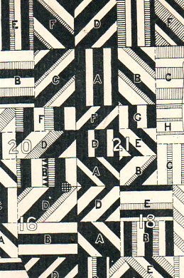
    Manhattan nationalities110

    The distribution of nationalities exhibited in this half-crazy quilt of varying blocks and densities reminds me a lot of the “razzle dazzle” camouflage used in WWI, as seen here:

    http://upload.wikimedia.org/wikipedia/commons/3/3d/SS_Empress_of_Russia_1918_cropped.jpg

    actually appiled on a ship, as well as this interesting artistic representation of the practice by Edward Wadsworth, Painting of Dazzle-ships in Drydock, 1919:

    File:Dazzle-ships in Drydock at Liverpool.jpg

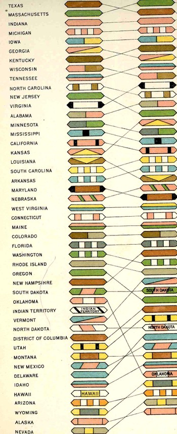
    This sort of display of information has been around for quite a while–perhaps no example mor edistinctive than that found in the U.S. Census volumes for the 1880 census, a small detail of a chart showing the rise and fall of the populations of American states and territories over ten censuses (see an earlier post on this blog regarding this census atlas):

    Blogaugust_24_statesd_detail442_2


    [Please note–the images I’ve used for the post here–save for the details ahown above–are those for the copy at the Library of Congress.  My copy is actually a little nicer than these; I’ve used the LC images because the  map is just too big for the scanner.] 

    Text on verso:

    There’s a significant amount of crowded, complex information exhibited here, some somewhat more successfully than others.  The population density map is pretty straightforward.  The distribution of nationalities, however, is another story–there are eleven groups followed here, each given a bit of a confusing flavor, given that the representations are done in black-and-white.  Its difficult data to present, especially considering that the groups shown could vary block-to-block, and that the population of Manhattan at the 1890 showed 76% with foreign-born mothers and 40+% of the city foreign-born themselves.  (It should be noted that only the groups with 2/3 of the base of any particular zone has bene plotted.)

    Detail of bottom map:

    Much of this population–a good chunk of the city’s 1.9 million people–were housed in tenements, a pre-high-rise pre-elevator version of the highrise.  They were six or seven story walk-up buildings that were narrow (usually about 25-35 wide) and long (100-125+ as an average). There were 10-14 rooms per floor, and were generally packed with families.  A massive expose on the tenement house was photographically depicted in “The Tenement House Exhibition of 1899”, the un-pretty picture described below by Lawrence Veiller in Charities Review   in 1901: 

    “It has shown, step by step, the different changes that have taken place in New York tenement houses, and by means of 1,000 photographs has illustrated nearly all the evils of the present tenement-house system. Special emphasis has been laid upon the terrible evils of the dark, unventilated airshafts, which are the chief characteristic of the present type of buildings. There are over forty-four thousand tenement houses in the boroughs of Manhattan and the Bronx, and in the year 1899 about two thousand new tenement houses were erected. These, as a rule, are built on lots twenty-five feet wide by one hundred feet deep, and are planned to accommodate four families on a floor. The buildings are six or seven stories high, and each floor generally contains fourteen different rooms.”

    “Only four of these rooms on each floor have direct light and air from the street or the small yard. The other ten open on a narrow “air-shaft,”which is a well hole closed at both ends, seldom more than five feet wide, when between two buildings, and often only two feet six inches wide, varying in length from forty to sixty feet, and being generally from sixty to seventy-two feet high.”

    “The first of the accompanying illustrations represent a typical airshaft. As usual, it is closed at both ends. It is two feet ten inches wide, forty-eight feet long, and seventy-two feet high. Forty-two windows open upon it, the sole source of light and air to the rooms. Rents in this building run from$10 a month for three rooms to $17 for four rooms. The baby’s bathtub is hung out of the window because the rooms are so small that there is no place to keep it inside. The shaft is only a little wider than the tub.”–Charities Review, 10 (1900-1901), 19-25.

    Mr. Pierce did a commendable job in exhibiting some difficult quantitative stats in a fairly restrictive medium. 

    Notes:

    1.  The map sections are entitled: No. 1. Map of City of New York showing densities of population in the several sanitary districts, June 1, 1894 . And No. 2. Map of City of New York showing the distribution of Principal nationalities by sanitary districts.  On verso: text, two smaller maps “Map of the of City of New York”, showing density of population by wards, and then an unrelated but interesting  A bird’s-eye view of the Cotton States and International Exposition, Atlanta, Georgia; image of C.A. Collier, President and Director-General of the International Cotton State Exposition.  2 maps : on 1 sheet ; 14 x 48 cm. and 17 x 48 cm.

    ·Posted by :

    ·in:

  • Buck Rogers and the Failure of Imagery in WW-Last, 1946

    JF Ptak Science Books  Post 2246  [Part of the series on Atomic Weapons]

    Atomic war buck rogers683
    Atomic war buck rogers685
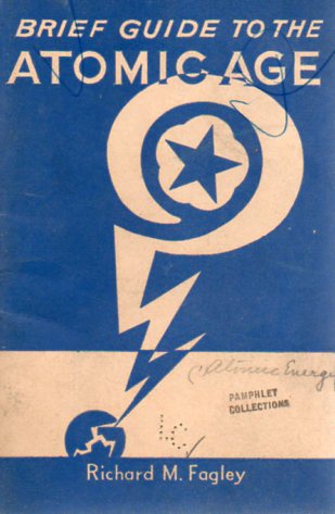
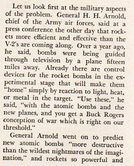
    Richard Fagley–author of Brief Guide to the Atomic Age, 1946– took a sleepy, elementary side step through the coming decade or so in the future of atomic weaponry.  The thing is, he got a bunch of it right.  But where he took a wide and missed turn, where he misunderstood the power of atom weapons, was that they would provide the future us with a “Buck Rogers” style of war.

    Now of course in 1946 the Soviets hadn’t developed a Bomb, but anyone who knew anything knew that it would be just a matter of time before they did.  Smart estimates were coming in at a decade or more–few people were prepared for the Soviet announcement in 1949 that they had achieved that goal

    Fagley missed the impact of atomic warfare of the future not on his own accord–he was quoting someone who knew far more and knew better–General Hap Arnold, the Commanding General of the U.S. Air Force.  But as it turns out, Arnold really didn’t have the vocabulary or this discussion, and couldn’t really estimate the “effectiveness” of the use of the new weapons. 

    Atomic war buck rogers684

    So far as I know, Buck Rogers didn’t have weapons like atomic bombs, at least I think in his original appeaarance as Anthony (and later “Buck”) Rogers in Armageddon 2419, back in 1928, when he made his first appearance. As it turns out Buck was born in 1898, and owing to a mining disster breathed in some radioactive gas that put him to sleep until the 25th century. He wakes up in a very jaundiced post-Yellow-peril world in which America has been defeated by the “Mongols” of the East (who had beaten the “Russian Soviets” who had in turn had conquered Europe), wherein begins his mighty struggle to get America back on its feet and defeat the great menace.  The idea of Rogers becomes very popular in popular culture, and he moves from this story into many other print versions, getting movies and a radio show (from 1932-1947) in the process. Somewhere in there is where he acquires his atomic pistol (called “U 235”), though the thing necessarily does not come close to what the real stuff would bring in the very near future.

    In Fagley’s war of the future there wouldn’t be many survivors, though his vision of the massive atomic bombing outcome seems not very proximate to what the horrible coarseness of what the real thing could be–perhaps because that amount of destruction was still unimaginable when the pamphlet was being written in 1946. Buck Rogers didn’t have the vocabulary for such enormous power and mass destruction, either. In any event, words to describe the coming possibility of vast annihilation just didn’t seem to be at hand in 1946–the words and ideas, and the weapons, would soon (in the Ulam-Teller hydrogen bomb, 1951) be at hand to flesh out the possible true-to-life nightmares of the nuclear future. Even in a 25th century armageddon, old Buck’s idea of power and devastation couldn’t come close to imagining the power of the real thing.  

    Buck Rogers Will Wake Up In A 3D Future image


  • The Floating Eden of Allendale, South Carolina

    JF Ptak Science Books  Post 2247

    Allendale motor court

    (From the Passion of Former Days site–with many more Very Highly Colorful examples of motel advertising postcard art, here.)

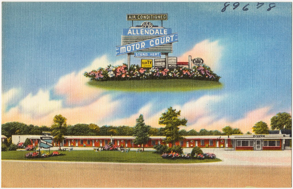
    Slate Vault‘s Rebecca Onion shared a great post from the Passion of Former Days site, a feature of colors-not-found-in-nature color postcards from the 1950’s or so.  They are all striking, and striking in one form or another above being simply striking, but the most striking for me was the Allendale Motor Court’s floating Allendale Eden.  It is, in its thrift-store-velvet way, a sublime image, a late Renaissance woodblock image depicting normality and piety and an expression of what could come for the obedient and penitent, the promise of the rewarded afterlife (as seen in so many images published in the first 50 years after Gutenberg), lifted from that dusty sleep and re-imagined on this linen-backed postcard promising a happy sleep removed from a dirt road in deep South Carolina. 

    Above all else, whatever it is in this floating paradise, it is all air conditioned. And heated with steam. And with a telephone.  And a “Room TV” (thanks to Linda Anderson for that clarification!)

    And today:

    Allendale motor court today

    The town has seen better days. It is a small place–3 square miles–and has a population of 3,800, down from 4,000 a decade ago.  The tough part is that the median income in Allendale is $16,000, and the per capita is just $10,000, making for a very hard go.  About 60% of the town’s under-18 population lives under the poverty line, as does 41% of the population in general. This makes it a poor city in a poor county of a poor state–S.C. ranks 48th in per capita income in the country ($34,000 against a national average of $42,000).[Source] Another site listing S.C. counties and places shows Allendale at 348th in 368 listed areas in the state, with Allendale county coming in at 43rd out of 46 counties for per capita income.  

    Nearly a third of the town is single-mother households.  That is a hard life.  I don’t know what the percentage of children in town that figure represents–that is, how many of all of the town’s children are being raised in single-parent households…but the number seems big.  Bigger than the big number that is the national average, where something approaching 30% of all American children are being raised by single parents.  

    Somehow this is so even though the University of South Carolina Salkehatchie campus is located there–a public school with an enrollment of 1100 and an academic staff of 57.  Evidently it does not draw much income for the town. 

    Part of this problem surely are the sky-high unemployment figures for the town, which topped out at 22% in the years following the 2008 Disaster.  Today unemployment stands at about 10%, far above the national avergae of 6.6 (whatever)%  There is no telling what these Allendale numbers mean, not knowing how many people simply fell out of the queue for work.  The numbers sound mean and nasty.  

    The floating Eden I think has not been seen in Allendale for quite some time–or at least since Route 95 skirted the town and made one of the major north-south arteries–Route 301–a thing of the past. Or passed.  301 goes through Allendale and in pre-95 times there was quite a tourist trade.  I called the newly-expanded library in Allendale and the librarian I spoke with confirmed this. She did tell me though that for as small a place as Allendale is that they get 150-200 patrons a day, which is about 5% of the town’s population, which is pretty high traffic, per capita.  She was very enthusiastic about her town, and I commmend her for it. “We’re expecting great things to happen in Allendale” she said. And I wish every good thing for her.  


  • A Town for Escaped Slaves–Surrounded by Livestock & Swamp (1862)

    JF Ptak Science Books   Post 2248

    The “Port Royal Experiment” established in 1862 by the Union Army at Mitchelville, Hilton Head Island, Beaufort County, South Carolina for freed slaves was certainly a very interesting  and perhaps life-saving idea for many freed slaves.  Well, the “freed” slaves weren’t really that–they escapes their servitude when the Union Army took control of Hilton Head and surrounding areas early in the war on November 8, 1861.  The island became a staging area for Union forces and was fortified–it also attracted the attention of escaped slaves,m who by 1862 had sought a form of asylum there, numbering around 600.  They were not exactly welcomed to the island, as there were prejudices against African Americans in the Union ranks as well–in fact some needed protection as the lower low-lifes among the Northern ranks stole from the escaped slaves what little they had.  In any event, it was a difficult situation, with no clear way of dealing with the new ex-slave population from a legal.administrative point of view.  These ex-slaves were considered as ‘contraband” of war, and my early 1862–on Hilton Head at least–the solution was found in establishing a town for them.


    Mitchellville

    The town was created by and  named for Kentuckian and Major General Ormsby M. Mitchel–he wouldn’t survive the year, dying of yellow fever in Beaufort S.C., and then buried in Green-Wood Cemetery in Brooklyn (and as it turns out his marker is not far from my mother’s mother’s family.  Furthermore he is the O.M. Mitchel I know from the history of astronomy, his life before the military and before his country needed him.  He wound up at the troubled Albany observatory right before leaving for the war).  

    Mitchelville was necessary and perhaps it was even sufficient for the time–certainly it had its share of trouble during the war, and then with ownership of land issues after the war, and so on. 

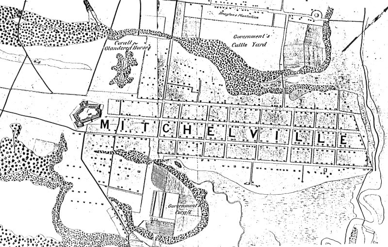
    What struck me about this map was the placement of Mitchelville.  

    It was mostly surrounded by poop.

    Situated on a cotton field–some of the slaves who lived there used to work those same fields for the land owner who directed the Confederate unsuccessful defense of the island–the town had a huge swamp to its south, with a ‘government corall” just west of that; the northern boundary of the town was a large “government cattle yard”, and the to the west was a fort and horse coral.  And then to he east was the ocean.  Hot, swampy, and mostly surrounded by cows and horses, the town doesn’t look particularly appetizing.  On the other much larger hand, the people living there were no longer slaves.  

Recent Posts

Archives

Categories