A Daily History of Holes, Dots, Lines, Science, History, Math, Physics, Art, the Unintentional Absurd, Architecture, Maps, Data Visualization, Blank and Missing Things, and so on. |1.6 million words, 7500 images, 4.9 million hits| Press & appearances in The Times, Le Figaro, Mensa, The Economist, The Guardian, Discovery News, Slate, Le Monde, Sci American Blogs, Le Pont, and many other places… 5000+ total posts since 2008.

  • The Hell Bomb, 1951

    JF Ptak Science Books  Quick Post

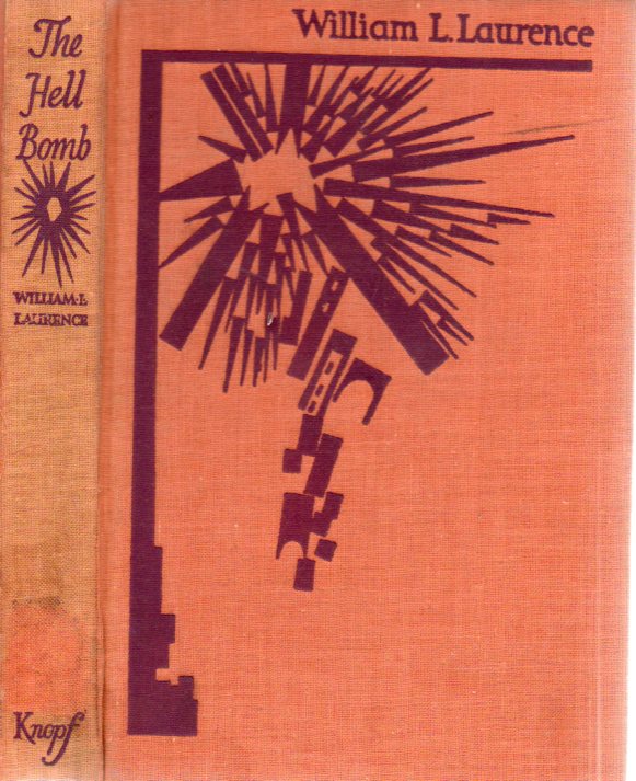
    I kept this book mainly for the cover art, though the writer–William L. Laurence–did a commendable job of looking at the Hell Bomb (the hydrogen bomb) and provided a useful chronology at the end of the book for attempts at nuclear control.  Laurence was a science writer for the New York Times and was also the official historian of the Manhattan Project–he was also about the first person to write for a mass audience on the coming of what he would eventually coin “the atomic age” in a 1940 NYT article1.  

    Hell bomb386

    The book is agile but also a very slight read with not much detail, published without a single footnote, and without a bibliography, sort of like a long newspaper article.  One thing is for sure though–he was right about the “hell” part. 

    Notes: 

    1. “Vast Power Source in Atomic Energy”. New York Times. May 5, 1940

    Here’s an interesting article on the popular reception of the possibilities of atomic power if not an atomic weapon, found in the NY Times, 1938-1940:  http://ansnuclearcafe.org/2013/11/26/excitement-about-u-235-as-coal-competitor-circa-1939-1940/

    ·Posted by :

    ·in:

  • A Bestiary in Maps?

    JF Ptak Science Books   Post 2351

    In the history of cartography besides the construction of map-y maps there are maps that stray beyond the strict geographical diction of necessity, some of which edify the data and others which creatively explain or decorate it.  There are unusual maps of hobo travel, the Garden of Eden, Hell, Heaven, moles, hair growth direction, slavery, suffering, invasion routes, time, prisons, aliens, population density, disease, education,  paved roads, trolley, electric lights, sewers, fire damage, and on and on, some of which are created in a way to make the map more identifiable and to also make it, well, fun, or at least more accessible.  Then there are maps whose explication or decoration or alliteration have little to do with the geographical reasons for the map existing in the first place. And this leads us to today’s post.  

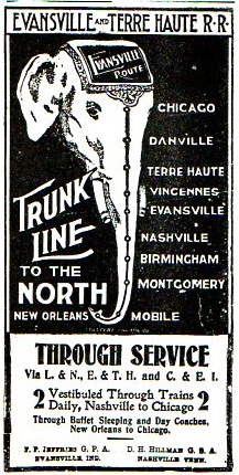
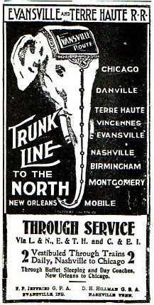
    I think it certainly possible to assemble a bestiary of maps–maps that take the qualities of an animal, or animals…I’ve seen a number of maps that show distributions of animals without taking their forms, and a lesser number representing a geographical area by an animal, but I do think it is possible to wrangle together not only the bestiary but also nearly an entire alphabet of animal maps.  That will need a little work.  For the start of it we have the following: 
    Map--trunk line367

    [Source: the Confederate Veteran, volume 11, 1903, page 184.] This needs little comment except to say that it is interesting and that it shows up in an interesting publication.

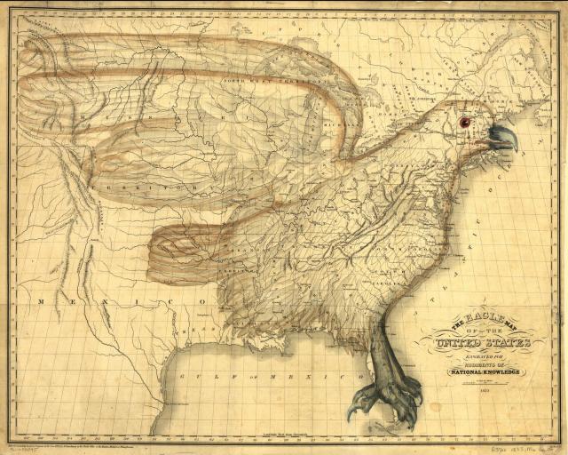
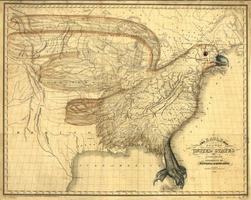
    Next is a great and rare classic, I.W. Moore’s 1833 map incorporating an eagle into the design of the early Republic, from  the Library of Congress (here):
    Maps Eagle America

    The full text of the book in which it appears here (At Archive.org) and the cumbersome text relating to the map (on pp 244-249) is included below in the notes section.  

    There are also the advertisement/comical efforts like the Porcineographic map of the U.S. of 1876:

    This porcineograph

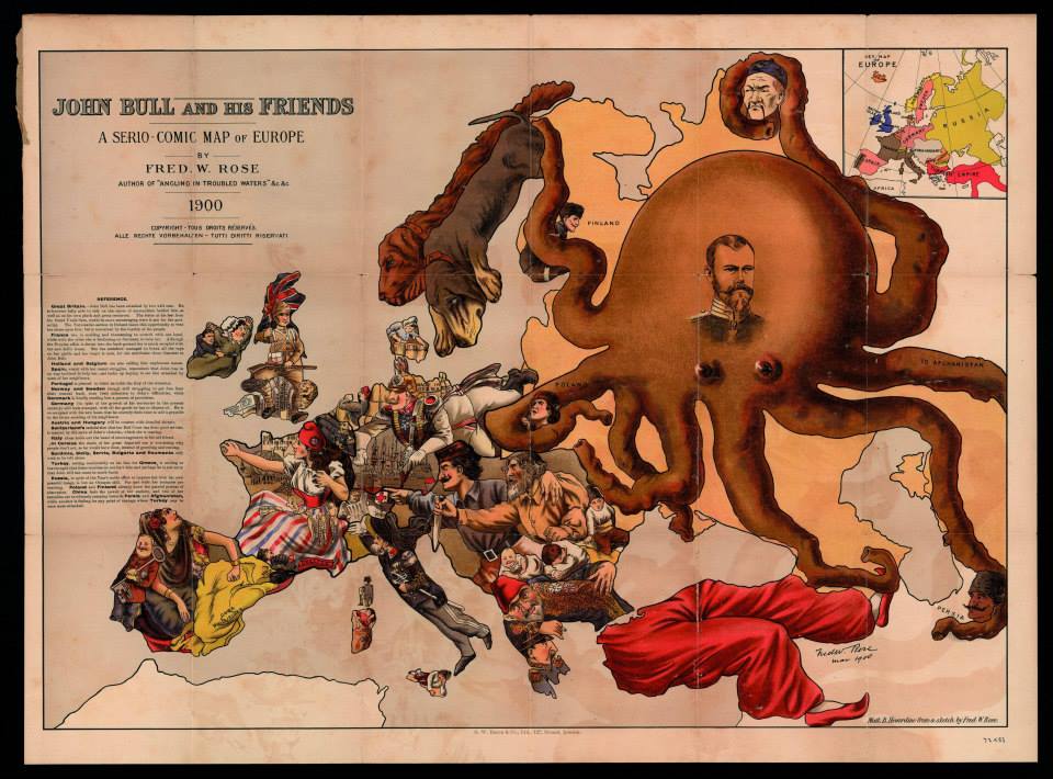
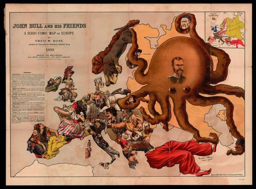
    And the Russian octopus map,  John Bull and His Friends. A Serio-Comic Map of Europe By Fred W. Rose…printed in 1900, and found at the Yale University Library Digital Collections, here:
    Europa c

    [With thanks to Mark Dylan Sieber‘s Les Curiosites de Cartes, whose Twitter feed started this interest.]

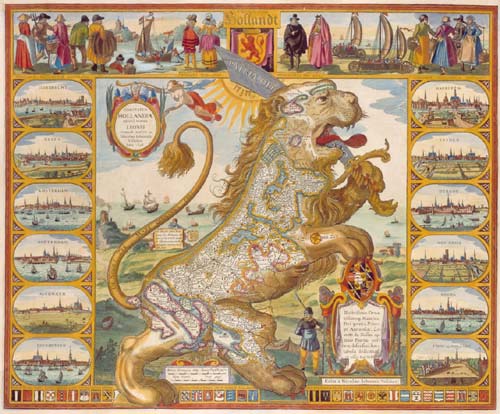
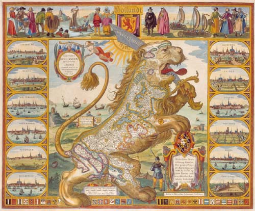
    There are also more maps in a “series” similiar to the Leo Belgicus:
    Leo belgicus

    [Source: Wikipedia, here.]

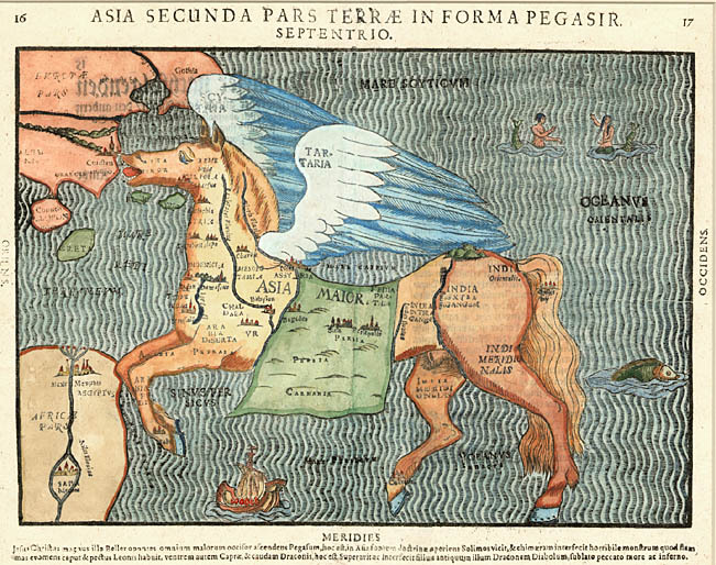
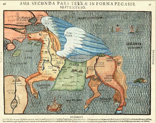
    And then there’s the mythological part, with Pegasus, with Heinrich Bunting’s  Asia Secunda Pars Terrae In Forma Pegasir (1581):
    Maps pegus

    [Source: Barry Ruderman’s mapselling blog, here.]

    Well, this is a start, anyway, covering Elephant, Lion, Octopus, Eagle, Pig, Horse..  It may be a long haul…

    Notes:

    CHAPTER XXXIX. 
    
    THE EAGLE MAP. 
    
    On presenting to the public a map upon the con- 
    struction here imperfectly exhibited, if an apology 
    be not necessary, perhaps at least, some notice of the 
    origin of the idea, and some of the reflections of the 
    author upon it, may not be misplaced. 
    
    The first sudden impress of the form of the figure 
    upon his attention, was under a combination of pe- 
    culiar circumstances. A map of the United States 
    happened to hang upon the wall of his apartment, 
    upon which a dim lamp light was reflected. The ef- 
    fect of the light, in the particular position in which it 
    was accidentally placed, seemed, as reflected from the 
    various colourings of the map, to cast a shade over 
    the state of Maine, and to mark a kind of separation 
    between it and the adjoining territory. The close 
    connexion of this state, as, always, under a common 
    view, necessarily combined with the great general 
    ground plan of the Union, he conceives to be the 
    principal reason why the notion of the figure has not 
    before been apprehended. 
    
    On its first presentation, he was disposed to discard 
    the idea, as merely a sportive play of the imaginar 
    tion, unworthy of notice. The figure, however, once 
    impressed, could not be eflaced from the imagination; 
    but was ever afterward in view when his eye happen- 
    ed to glance on a map, till he was at length induced 
    to give the subject a share of consideration, regarding 
    its possible usefulness and moral bearing. 
    
    Arguments which presented in favor of construct- 
    ing a map embracing the plan of the figure, appeared 
    conclusive with relation to the youth engaged in the 


    THE EAGLE MAP. 245 
    
    study of the geography of our country. Those argu- 
    ments were founded upon an apprehension of the in- 
    creased facility with which lessons may be impressed 
    and retained upon the youthful memory, when the 
    aid of figure, adapted with a tolerable degree of accu- 
    racy to the subject of study, can be resorted to. To 
    this opinion it is presumed teachers in general will 
    readily yield their accord, without further remark 
    upon the questions of Why? or Wherefore? 
    
    When extending his reflections further, the recollec- 
    tion was of course present, that the figure of the eagle 
    was the figure adopted by our national councils, as our 
    national badge. In this point of view, the coincidence 
    appeared as a circumstance peculiarly striking. A fur- 
    ther singular and surprising coincidence presented it- 
    self, in the circumstance that the bird is placed in a 
    position perfectly correct, with respect to a corres- 
    pondence with the lines of latitude and longitude; no 
    variation from the common principles of constructing 
    maps being required, to place it in a natural position. 
    
    As the subject has occasionally occupied a further 
    extension of thought, a variety of serious moral reflec- 
    tions have occurred to the mind of the author, in 
    which he is not disposed to anticipate his intelligent 
    readers, who are altogether capable of reflecting for 
    themselves. He will, therefore, under this head, con- 
    tent himself with offering a supposition of a single 
    example, illustrative of the manner in which visible 
    objects, as they stand associated in the mind with 
    ideas of order or deformity, may possibly be more or 
    less productive of moral effects. 
    
    If, from a selfish, or misguided policy, the citizens 
    of any one state, should propose to separate their in- 
    terests from the interests of the Uiiion, and claim a 
    right to withdraw from the general connexion, the 
    ugly chasm which would be produced by carrying 
    their design into effect, would be aptly represented 
    by supposing a line of separation drawn round the 
    seceding state, and admitting its whole internal de- 
    clinations, and even its very name, to be blotted out 
    21* 


    246 THE EAGLE MAP. 
    
    from the eagle map of the United States, — the signs 
    and notices, of all the delightful alternations of river, 
    mountain, hill, and plain — of cities, the seats of com- 
    merce and refinement — of villages, the abodes of in- 
    dustry and social enjoyment — of the rural residences 
    of friends whom we love — all shrouded, in a shade 
    of gloomy, impenetrable darkness — and then observ- 
    ing the distortion which would be thus effected, in the 
    beautiful figure before us. Thus, might not a moral 
    repugnance be strengthened, against the open or in- 
    sidious attempts, of artful, designing men, who might, 
    for some ignoble or selfish end, be disposed, by de- 
    ceiving their fellow citizens, to attempt a disorganiza- 
    tion of the republic? 
    
    In the common representations of the eagle as the 
    American ensign, an allusion seems to be generally 
    intended to a martial spirit; and it is therefore repre- 
    sented with an aspect of fierceness, and in an attitude 
    prepared for war. Here, on the contrary, having 
    possession of the whole country, and no enemy to 
    contend with, it is designed to appear as the placid 
    representative of national liberty, and national inde- 
    pendence; with an aspect of beneficent mildness, and 
    in an attitude of peace. 
    
    It is therefore to be conceived of, as having be- 
    come wearied and disgusted, with the oppressions, 
    perpetual discords, and tyrannizing of power over 
    right, prevailing from age to age in the old world, 
    and as having, in consequence thereof, taken its flight 
    across the western ocean, in search of a resting place; 
    where its administration of equal rights might be duly 
    appreciated and respected. 
    
    Having arrived at the shores of this western world, 
    and taken its aerial circuits with the continent under 
    review, it appears as though arresting its flight — its 
    wings raised with a graceful, natural, and easy curve, 
    as relinquishing their hold on the buoyant atmosphere 
    —and its feet extended, as in the act of gently settling 
    on the rocks of the Florida reef, to exercise a benign 


    THE EAGLE MAP. 247 
    
    presidence over a territory equal to the length and 
    l)readth of its own shadow. 
    
    Thus it appears as overshadowing the whole ex- 
    tent of the United States and territories, excepting the 
    state of Maine, and the home of the natives in the 
    distant regions of the west. The citizens of Maine, 
    it is presumed, will not be offended at the impossibi- 
    lity of comprehending their department in the Union, 
    within the regular form of the figure, when we assign 
    to it the appellation of the cap of liberty, attached to 
    the eagle's head. 
    
    The present small map, is supposed to be sufficient, 
    in its internal delineations, to serve the purposes of 
    illwstrating the subjects of the volume which it ac- 
    companies. It may also serve to impart a fair gene- 
    ral idea of the design of the figure. Yet it has not 
    the least pretension to showing a specimen of the 
    elegance, with which the combined circumstances of 
    coincidence of figure, and geographical utility, are 
    capable of being represented. By an enlargement of 
    the scale alone, the proportions of the figure would 
    be presented to the eye, with a general aspect greatly 
    improved. 
    
    It is contemplated to issue, simultaneously with 
    the present volume, proposals for publishing by sub- 
    scription^ an eagle map of the United States, upon a 
    large and liberal scale; to be executed by the ablest 
    artists in a superior style; and intended to furnish an 
    appropriate ornament, to decorate our halls of legis- 
    lation, judicature, literature, and science, with the 
    library of the retired gentleman, the office of the law- 
    yer, and the retreats of the farmer, manufacturer, and 
    merchant. It is conceived that the ornament would 
    be likely to be viewed with peculiar interest and gra- 
    tification, because of the circumstance of containing, 
    in correct proportion, a representation of our beloved 
    country. 
    
    In the large map proposed, much of the common 
    minutia will be omitted in the engraving, in order to 
    show the figure with greater advantage and beauty. 


    248 AGRICULTURE. 
    
    All the most important items, will, however, be re- 
    tained, and the place of the smaller supplied by a 
    neatly printed and bound accompanying volume of 
    references; so arranged, as to render all the usual pur- 
    poses of a map of the United States complete. In 
    exchange for the omitted minutia, will be engraved, 
    the regions of our different mineral and vegetable pro- 
    ductions, with various other interesting and ornamen- 
    tal delineations, never heretofore presented in similar 
    works. 
    
    
  • Devastation and Capital

    JF Ptak Science Books  Quick Post

    Sumatra391

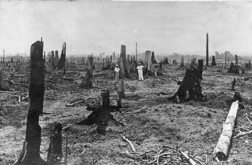
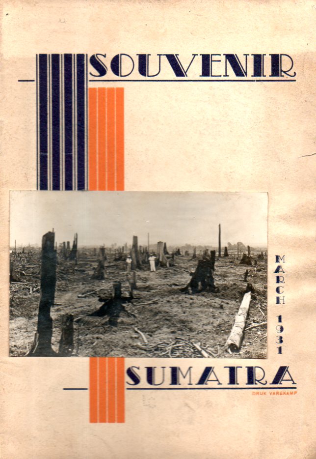
    The history of exploration and capitalism and imperialism and conquest for much of its history is a fleshed-out skeleton based on misery and temptation and ruin. There are of course many images of he background to fortune of the beauty that hard-fought money has brought. It is interesting to look though at the scenes  when the wizards draw back the curtain to history, accidentally or not, even in such inauspicious locations as this pamphlet, a minor work on the rubber industry in Sumatra. 

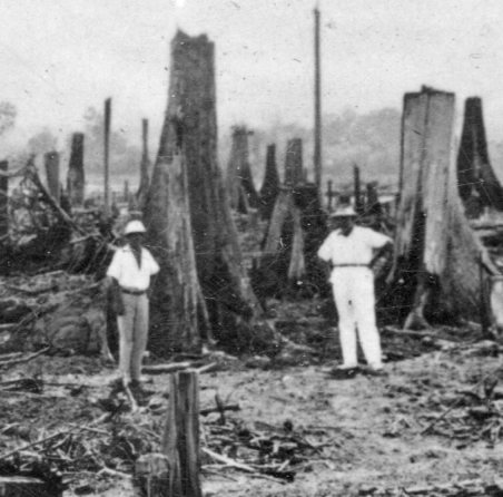
    The photograph of the decimated and routed forest is one of pride, ca. 1931-style, a mark of progress, development, industry, capital.

    Sumatra387

    There were millions of acres under cultivation at this point, with (according to the figures quoted in the pamphlet) more than 320,000 workers/laborer-peasants doing the heavy lifting, the vast percentage of these being from China and Java.  There is also a mention of the worker agreements that would get them to Sumatra, noted as “penal sanctions”–the practice required people to work for three or five years and if they somehow forfeited that agreement they would be imprisoned and sentenced to further labor when released.  It was a vicious enterprise. 

    But as strong as this was it must have undoubtedly been a manifestation of an even wider form of societal control, such as worker society existed there, living under the domination of the plantation owners.  

    In any event the photograph on the cover was a prideful thing that today would be seen as usurious and representative of some deep tragedy. In short: nothing new. 

    Sumatra390

    ·Posted by :

    ·in:

  • Finding Unseen Things In and From the Air

    JF Ptak Science Books

    Seeing more deeply--air weather det853

    Finding the hard-to-find, the invisible, the “hidden”, is an essential aspect of, well, mostly everything.  Whether it is Newton separating light with a prism to find its constituents, or Hooke investigating the formerly quasi-real microscopical world to reveal worlds within worlds, or Galileo using his telescope to quash the ideas of the unaided-eye-visible night sky as an unaltering perfection of creation, or Roentgen seeing through his wife’s skin, or Fraunhoefer finding the complex spectrum, or Henry Draper determining a chemical constituent of the sun, or the invention of the zero or negative numbers or subtraction, of finding Black Holes or other planets or the remnants of the Big Bang, or (Kandinsky) finding the nonrepresentational aspect of art, or Duchamp finding in an upturned urinal that art had no boundaries…the list goes on and on.

    One aspect of this “finding something in nothing” business that is interesting to look at because it is so local and discernible–and recent–is in air navigation and detection.  And I’ll do this using a series of excellent illustrations from The Illustrated London News, all of which are from the 1927-1938 period. 

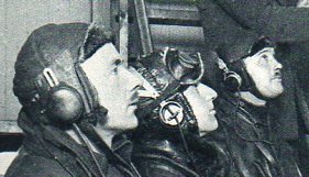
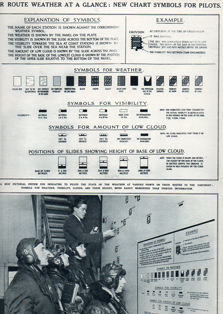
    The first is relatively simple, at least simple from here in the year 2014, which shows four pilots being briefed on weather conditions with a aerial chart for conditions along intercontinental routes.  The placement of these symbols represented a vast improvement over the earlier systems of readying pilots for what weather lay ahead, if indeed there were any communications at all.  This represents an early look at a codification of conditions and expectations for air travelers–a display of new and important data in 1927. 

    Seeing more deeply--air weather852
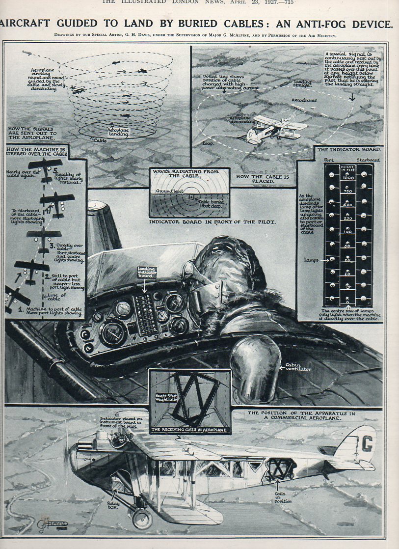
    Next is a brilliant device for assisting pilots to land in foggy and dark conditions–actually on how to find the ground safely.  In 1927 (again) a RADAR-like system was put into place on aircraft that involved receiving the signals of an ac-pulsed buried electrical cable that surrounded an airport.  The receiver (seen here on the flight panel of the pilot in an open-air cockpit) would be read to reveal proximity of the airport, the pilot making wider and then closer spirals in descent until his was basically within the buried airport cables and thus able to land.

    Seeing more deeply-anti-fog855
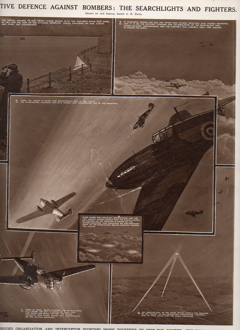
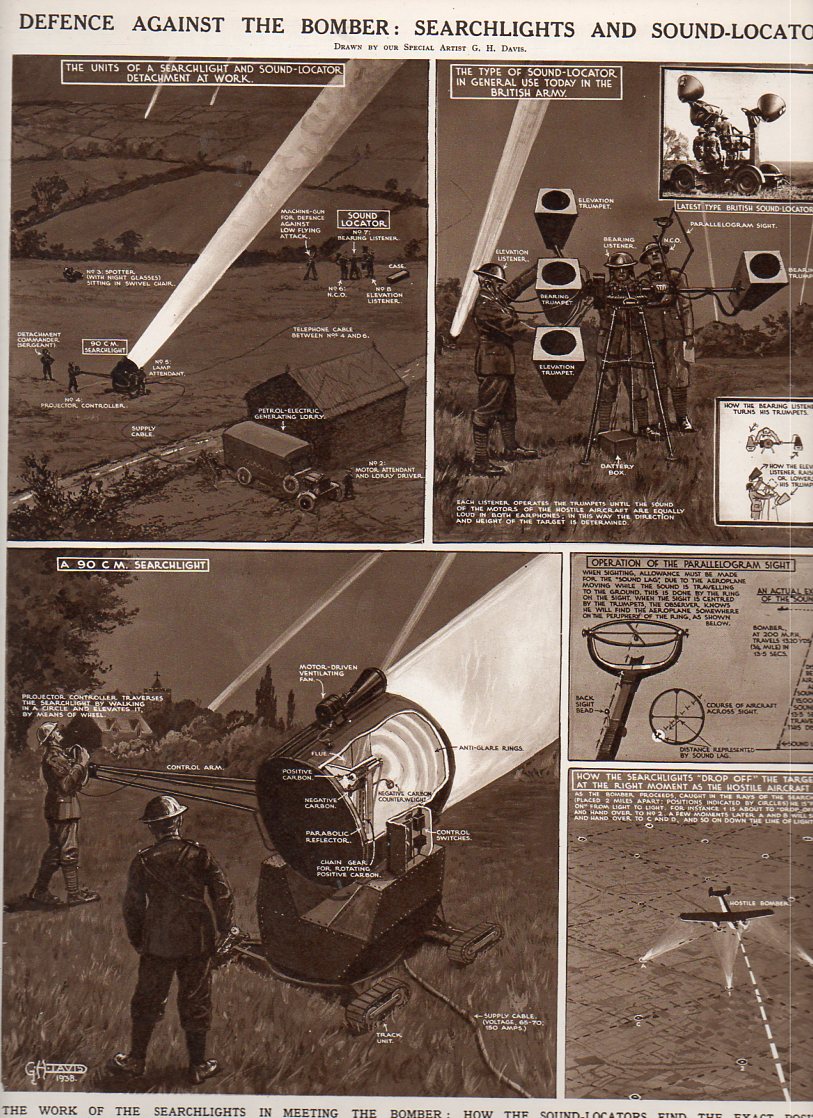
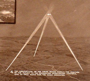
    Prior to WWII RADAR1 was somewhat functional but still in development, and as we see in this set of 16 July 1938 illustrations, the key methods for finding enemy aircraft at night (in order to shoot it down of course) was an audio-visual method, using “sound-locators” to find the approaching bombers and then spotlights to illuminate and track them to their destruction.  

    Seeing more deeply-searchlight856

    Seeing more deeply-defence against bomber854

    These images represent some idea of the state of the art of being able to find things–like the ground at night or approaching enemy aircraft–in the 1927-1938 period, all of which would be drastically changed in just the next two years.

    Seeing more deeply-searchligh detail857

    NOTES

    1. RADAR was coming very close to being developed in the early 1930’s–and in 1935 the process of experimentation and implementation was at a peak.  The development of this new technology was an international property, though perhaps no one owned it more in this period than the British, with Watson Watt giving his experimental ideas on RADAR to the Air Ministry on 12 February 1935 in a secret report titled “The Detection of Aircraft by Radio Methods”. Int his years alone there was feverish work being done by  Rudolf Kühnhold (Scientific Director at the ‘Kriegsmarine  Nachrichtenmittel-Versuchsanstalt) who in 1933-1935 established a RADAR-hunting company called Gesellschaft für Elektroakustische und Mechanische Apparate, or “GEMA”; there was also elements of the Royal Navy, Telefunken, Standard Elektrik Lorenz, Philips Company’s  (of Eindhoven, Netherlands) Natuurkundig Laboratorium, the Research Office of Nippon Electric Company, and even in the Soviet Union (until the key figures involved were murdered in Stalin’s purges–this one distinguished from others and referred to now as The Great Purge– of 1937), the French Compagnie Générale de Télégraphie Sans Fil (CSF), and  the Italian Regio Instituto Electrotecnico e delle Comunicazioni (RIEC, Royal Institute for Electro-technics and Communications) to name a few.  The United States of course had been long working on the project, at least since 1922 at the NRL, with considerable private (and federally funded) work done by RCA

    .
    Whipping ahead into WWII a very significant “battle of the beams” began between the U.K. and Germany, especially during the Battle of Britain, involving countermeasures, espionage, propaganda and false-positives in regards to the use and development of radio-based tracking and detection–the U.K. particularly making use of this technology in a wide-spread air defense system.  But it was in the United States in 1940 (and really by the U.S. Navy) that RADAR got its name (for RAdio Detection And Ranging) as well as its great impetus for development and deployment.

    ·Posted by :

    ·in:

  • Geometry of Art and Life

    JF Ptak Science Books  Quick Post

    “And it was then that all these kinds of things thus established received their shapes from the Ordering One, through the action of Ideas and Numbers.”[Plato, Timaeus ]

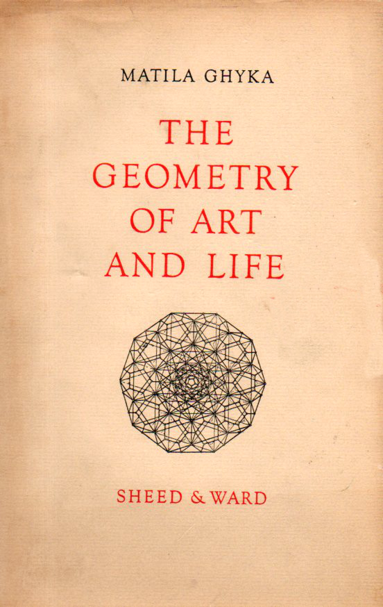
    Just a quick comment here about Matila Ghyka’s The Geometry of Art and Life, published by Sheed and Ward in 1946.  It is a beautifully-designed book, skinny even though it is 176pp (not long not short), and well and interestingly illustrated.  It addresses math and art, or math in art, finding recurrent spatial proportions there, and in music, with the maths being at the center of the creative and imaginative process.  The author goes further and dips into these themes in life/biology (that’s the “Geometry of Life” part), where he trods in familiar antique and old grounds of the Golden Section of logarithmic spirals, and then finds himself in a very interesting position in  chapter VII’s “The Transmission of Geometrical Symbols and Plans”. I’m not so sure that I like the book as a complete work, but the parts make for some very good reading.  

    Ghyka393

    ·Posted by :

    ·in:

  • What Everything Sold for in the Armory Show, 1913

    JF Ptak Science Books  Post 2352

    Between 17 February and 15 March 1913 there occurred in the huge building at Lex between 25th and 26th streets in NYC–the monumental International Exhibition of Modern Art at the armory of the Sixty-Ninth Regiment, the Fighting 69th (so called by Robert E. Lee), the “Fighting Irish”, the famous Armory Show, the Armory Show.  This was the first large public exhibition of modern art in America, and even though the 69th regiment had seen five wars (at least, so far as I can tell), the armory itself hadn’t really seen one, until 1913, when battle lines were drawn among the Cubists and within and without the confines of the modern” part of modern art, the sensitive honor of the nature of art laid bare.  

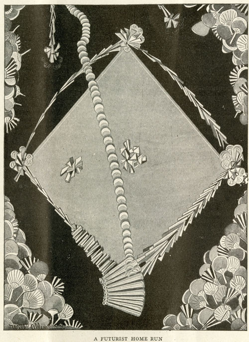
    FuturistHomeRun-LIFE2[Source: the New York Historical Society’s excellent 100th anniversary celebration of the Armory Show,   armory.nyhistory.org.]

    The most legendary of the most public battles fought here was probably over Maestro Duchamp’s Nude Descending a Staircase (1912), presenting itself as a shocking state of a-stairs, creating whimsical diversions even amongst the cognoscenti who found their way down every avenue for diversion and especially derision. (Check this fine site celebrating the 100th anniversary of the show, listing and displaying many of the most famous of the cartoons published taking a swing against art and Duchamp here http://armory.nyhistory.org/category/artworks/)

    But my reason for stopping here with the Armory Show today is a chance find in Steven Watson’s Strange Bedfellows, the First American Avant-Garde (Abbeville 1991) where on page 168 is a data box stating:

    • “Total Sales:  $44,148 ($30,491 for works by European Artists, $13,675 for works by American artists.”

    …which I found extraordinary.  Even using the Bureau of Labor Statistic’s CPI calculator this figure gets bumped up to the buying power of somewhat more than $1,000,000 in 2014 dollars, it is still incredibly shy of anything approaching any aspect of the financials of the art world.  Here was the greatest collection of artists (perhaps?) of modern times under one roof with their works offered for sale for nearly a month and only $44,000 was generated, with only a third of that going to American artists.  

    When you consider some of the individual successes at the show–Redon collecting $7000, Cezanne $6700, Wilhelm Lehmbuch  $1600, Edward Kramer $1675–you have four artists collecting more than a third of the total sales, leaving $27,000 to be shared by the rest of the exhibitors. (This is a very impressive and long list, some of names of the blockbuster of blockbuster shows shown below, via a Wiki article on the exhibition http://en.wikipedia.org/wiki/Armory_Show.)

    And then when you consider that some 1600 pieces of art were exhibited, it leads me to the conclusion based on these bits of data that not all that much was sold at the monster show. 

    Now of course $44,000 was a lot of money in 1913, though it was still not very much money at all actually spent in a creative/explorative/appreciative manner.  The total was about 100 times the average salary of an American worker (about 400/year).  TO put things in perspective, the total sales at the show in terms of 100 times the average American yearly income would be about $5,000,000 which is still a tiny percentage of what the enormous sum could be had these pieces of art been for sale in 2014.  

    In short, really, the difference in the numbers is so vast that they are almost without meaning sop far as comparison goes between 1913 and today.  That said, I still find it extraordinary.

    By the way, Duchamp sold four pieces for a total of $972, according to Mr. Watson.  

    Notes: 

    ·Posted by :

    ·in:

    —
  • Explosives as a Civilizing Force (1930)

    JF Ptak Science Books   Quick Post

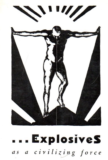
    This is the very striking cover design for a pamphlet written by Dr. Julius Klein (the assistant secretary of commerce) produced by the Institute of Makers of Explosives (103 Park Avenue, NYC, who of course made a large play for blowing stuff up as a positive driving force in the history of civilization.  And they are right in many cases, obviously, but the images and title taken out of context are very provocative. 

    Explosives civilizing423

     Dr. Klein starts off by disabusing the reader of the “bad press” of explosives:  “a good many of us, I imagine, labor under a misapprehension about the explosives industry…we conceive of explosives as an instrumentality of havoc.  But that conception is utterly wrong.”  Utterly?  The man does have a point of course,  which he explains in subject headings like “Dynamite the Liberator”, “Many Unusual Uses”and “Explosives Release Raw Materials”  But “utterly”?  Its a real piece of heavily worked propaganda that makes the case for the economics goodnesses and misunderstood destructive values of TNT. 

    ·Posted by :

    ·in:

  • 1 Over 1 & the “Rule for All Time Past and Future”

    JF Ptak Science Books  Post 2353

    That is a provocative title, or chapter heading, but that’s how it appears in a pamphlet I’m reading right now, a juicy thing that can lead to a memory palace of ideas…until you start reading the para below the head, when things get both more crystalline and fuzzy.

    John Alexander Henderson, a lightning calculator and professor of math at Delaware College in New York, produced this sprightly pamphlet eponymously titled Henderson’s United States Intellectual and Practical Lightning Calculator, the Unity and Decimal Method, which he published in St. Louis in 1879. (It is followed a few years later in another edition with a hundred new pages.) 

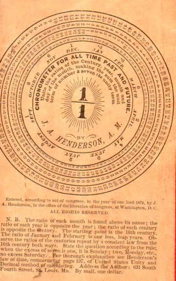
    What Mr. Henderson is getting at is a calculator for reducing a date to find out the day of the week a particular date falls on, from the 1st century to the 99th.  On the back cover of this pamphlet he provides a tickler for this enumerating device, which is explained in another publication (Henderson’s United States Unity and Decimal Method of Calculating). 

    Calculatort mental425

    And so in order to calculate the day of the week on which, say, November 26, 2014, occurs you would you the dial above as follows, but first an explanation of what is on the dial face:

  • The “Where, When, and How” of Attacking Berlin (1943)

    JF Ptak

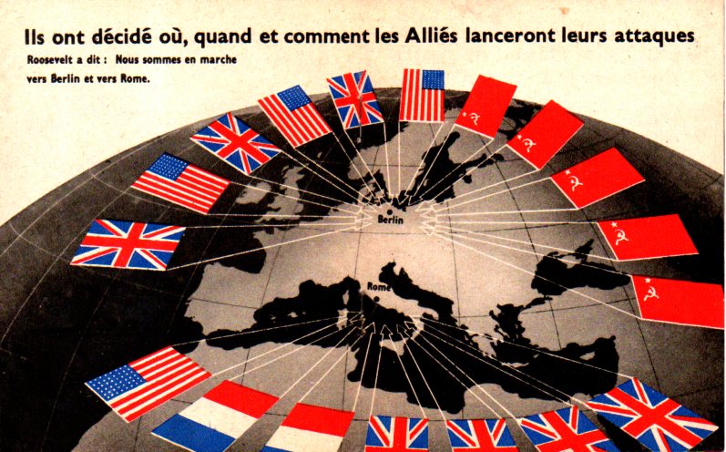
    I found this arresting map in a tiny publication called …Sans Condition, which was published in the first half of 1943. The publication is only 12 pages long but has a number of evocative images of Germany being bombed and lines of German POWs, in general a propaganda piece for French-speaking folk (which was printed god-knows-where) produced deep in the war and at a time when the tide has about turned on the Nazi regime.  

    The title of this post is the title of the map,  “Ils ont decide ou, quand et comment les Allies lanceront leurs attacques”–and you don’t need to know French to know what it says.  

    Map Berlin attacked426

    And the cover, which is basically “Surrender Without Condition”:

  • The Fabulously Thorough Instructional on Using a Telephone, 1946

    JF Ptak Science Books   Quick Post

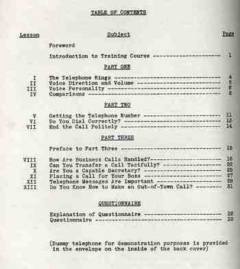
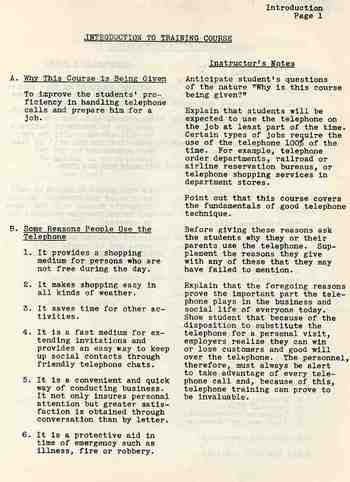
    Yes, this elegant, oversized, well written 1946 pamphlet explains in fabulous and excruciating detail how to use the telephone–and it does indeed come with a two-part heavy paper telephone receiver for the reader’s practice. It is packaged in an envelope in the back of the pamphlet with a large drawing explaining how to put the two pieces together.   The work is just so fulsome, wholesome, forthright, exacting and thorough that it just makes the casual reader stop in their tracks to applaud the effort of explanaion.  For example, it isn’t until page 13 that we get to pick up the receiver (and listen for the dial tone). I’ve reproduced some of the table of contents to give an idea of the extent of the telephone usage. 

    Ballistics_049

    What brings this so close to being from out of the science fiction past is that the booklet is ten years older than your narrator.  Atanasoff’s ABC, Bell Labs Mark II, Bletchley’s  Colossus, and Harvard’s Mark I machines existed, television was begnning to explode and half-doom radio for all time, and telephones were on their semi-last-leg of exploding their way into more American homes and businesses.  But somehow, here on the verge of the greatest electrical revolution in history, we were getting instructions on how to pick up the telephone.  But I’m really not complaining here, not at all–its just the nexus of the “how to listen for a dial tone” and the coming of the ENIAC one year after this pamphlet is published that is so startling.

    Even so, this instructional is more complete and (of course) better written than any of the computer manuals that came with any of the machines that I’ve purchase in the last 30 years. It is a thing of great and supra-obvious beauty.

    This is another example of a small job done Very Correctly.

    Blogsept3_tele489  

    Blogsept3_tele490


    ·Posted by :

    ·in:

  • Poland and WWIV

    JF Ptak Science Books   Post 2354

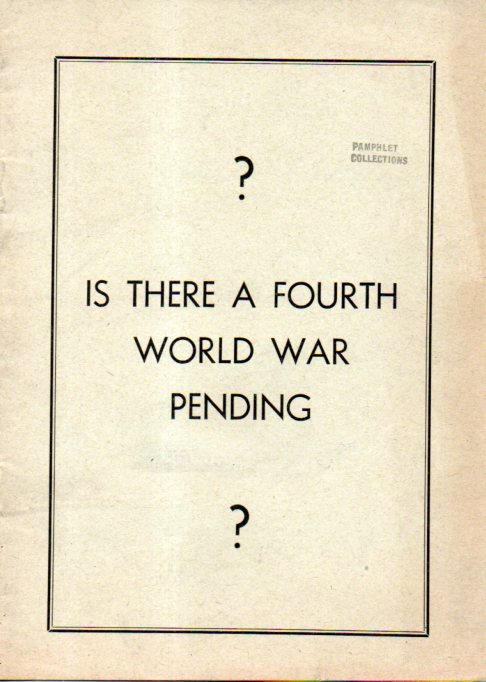
    Fourth WOrld War428

    This pamphlet certainty has entry to the evocative Fantastic and Improbable Pamphlet Covers Collection, though I was a little stumped by not being able to make it reveal itself to me with a short effort.  It was written by J. Kmicic and from what I can see was probably published during WWII, though there is no publishing information and nothing in the text to hang a firm date on. (There is a periodicals reception stamp in it from November 1946 fro the periodicals division of the Library of Congress, but that doesn’t mean it was accessed right after publication, though it does put a limit to how old it isn’t.)  As it turns out the keys to WWIV is Poland. That a very strong and heavily armed Poland would be the cornerstone of a defense of the West in the East, that the further the extent of a strong Polish eastern border reached the greater the play “of our Western culture will extend”.  Kmicic makes the case that it if Poland were stronger then it could have resisted Napoleon (evidently WWI), and the Kaiser (making WWI into WWII) and Hitler (WWII=WWIII).  The WWIV part is murkier because there isn’t a clue so far as I can tell that the author knew what happened to Poland when the Nazis fell and the Soviets moved in.  Had that been the case, the call for having a strong and unified Poland would probably not have been played so heavily.  A “Mighty Poland”, Kmicic writes, means “freedom for all smaller nations of Europe” and therefore “the impossibility of world war”. There are a few things that I’ve missed no doubt in my speed-read, but I was just after the cover, anyway.

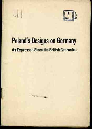
    Hitler and Company tied to sell the idea of an aggressive Polish nation, that the attack launched on 3 September 1939 was a preventative  measure to stop the advance and attack of Poland against Germany.  Not too many people believed it–at least outside of Germany–but Hitler tried it out, anyway. And why not? When most of everything he said was grounded in The Big Lie, why not pile it on?  The great the untruth, the more impossible it is, and the ore you say that you believe it to be the case, the more of a possibility exists for others to believe it, too–because who in their right mind would say something so insane about something else that is equally unbelievable? Therefore, the insane statement much be so.  That’s part of The Big Lie.

    See Polish Designs on Germany, here 

    Blogsept_1_poland476

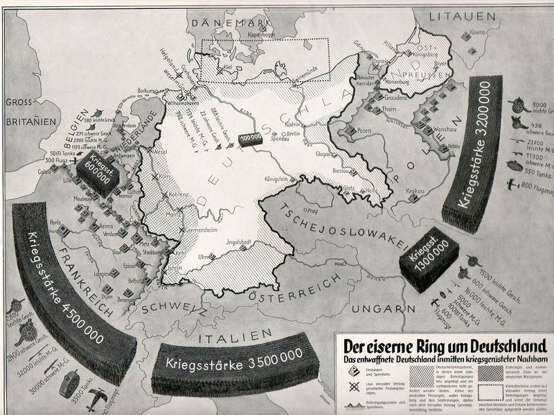
    And another attempt at winning hearts and minds, this from 1933 (here):

    Nazi Prop surrounded538

    ·Posted by :

    ·in:

    — —

Recent Posts

Archives

Categories