JF Ptak Science Books Quick Post
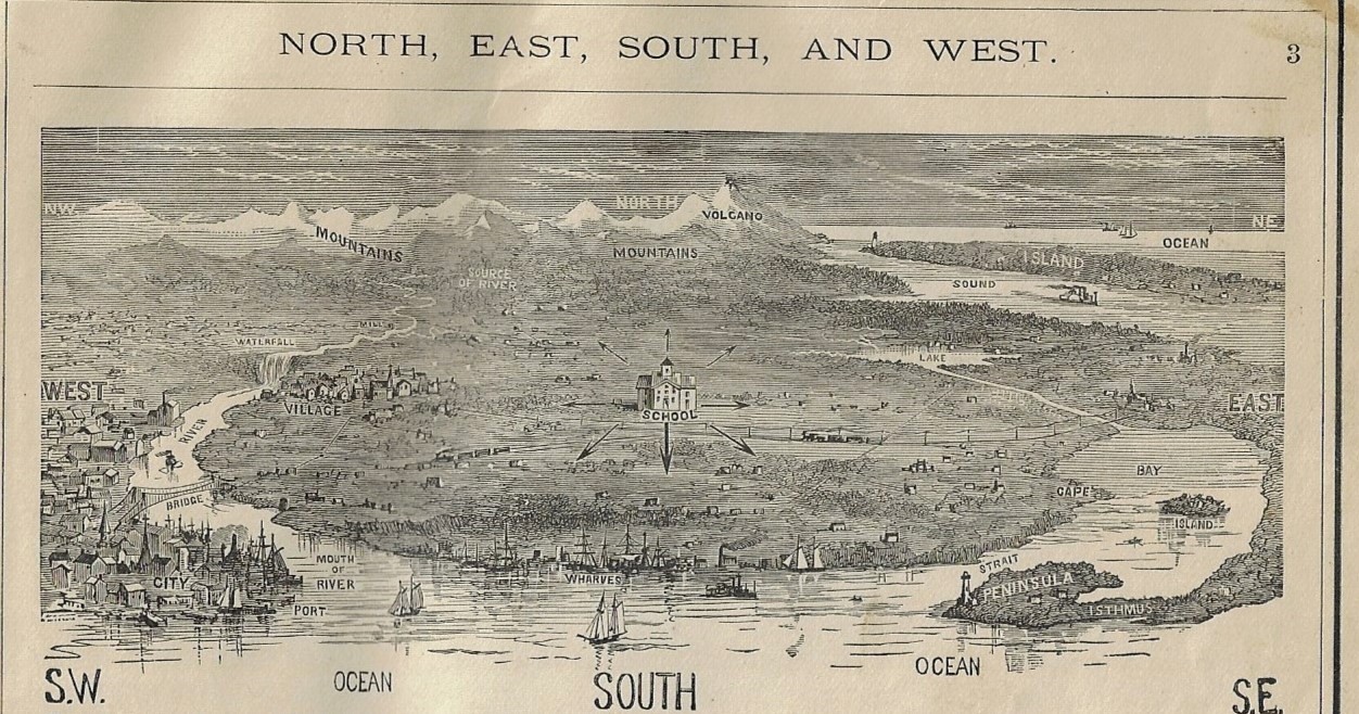
 Knowing of my interest in antiquarian children’s art, a new friend sent me a 19th century school geography which sports several tattoos of artistic efforts made by small hands. The canvas is the book, and the artwork (and annotations) were occasional scribbles and doodles that speak to the overall essence of kid art, and which have more or less looked the same-ish for centuries. (The subjects will change, but the manner seems to me to remain constant.) In this case the child chose James Moneith’s Elementary Geography (1889) to work in and on, and it is here in the opening pages that we see the exacting placement of “school”. As much as I am interested in the Found Art in this book, I’ve gotta say that this printed image was nearly as surprising–it is also one that I do not recall seeing, even in these popular multi-editioned geography textbooks. The image graphically displays a dozen or two of the central words in the study of geography, and at the center of it all, with directional arrows point all the way around, was “School”. You can’t really argue much with that.