JF Ptak Science Books Quick Post
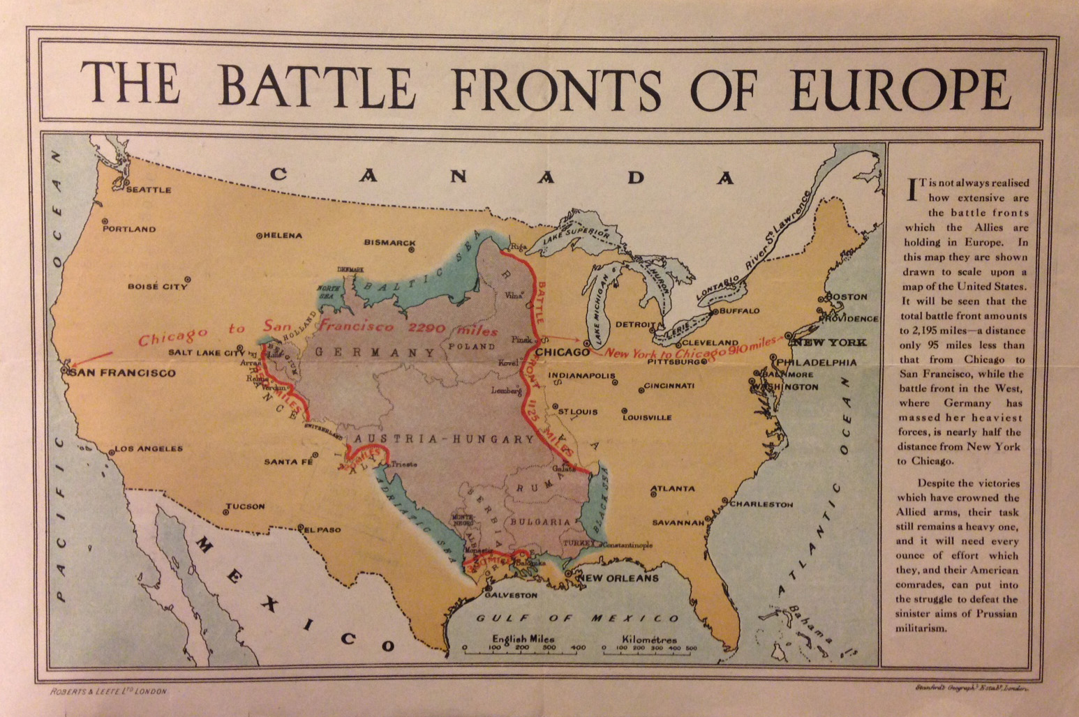
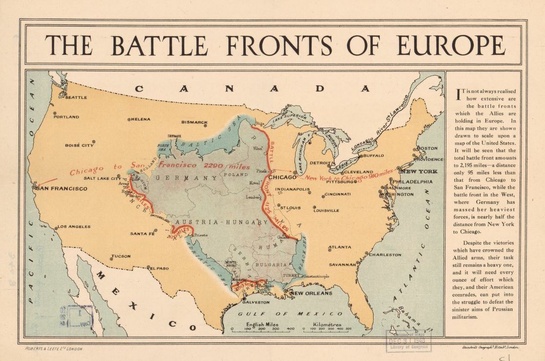
The battle fronts of Europe (by Stanford’s Geographical Establishment, printed ca. 1917) is a useful contextualization of the major battlefields of Europe placed within a map of the U.S., showing the relative distances and differences in relation to a geography that Western Hemisphere folks might better understand. Much of the fighting was taking place in an area about the size of the middle third of the United States, which I am certain gave many readers back then (and probably now) some pause and insight. As you can see, the areas of action work their way from the Baltic across the upper Eastern Front, crossing Austria-Hungary, Romania, Bulgaria and a bit of Turkey, then west to the Adriatic and north along the Austria-Hungarian border to the Western Front of France and Germany and Belgium, all fit correct and proper into the land from the Mississippi into the Great Plains. There were about 95 million people alive in the U.S. at that point, and I’ll guess that maybe 20% lived in this Battle Front swath–that means that the dead and wounded from the war would be at least equal to the entire population of the U.S. covered by the battleground map.
 [Click to enlarge and clarify.]
“London : Stanford’s Geographl. Estabt., [1917 or 1918]. London : Roberts & Leete Ltd, [1917 or 1918].”
Source: Library of Congress, https://tile.loc.gov/image-services/iiif/service:gmd:gmd5:g5701:g5701s:ct007679/full/pct:25/0/default.jpg