JF Ptak Science Books Quick Post
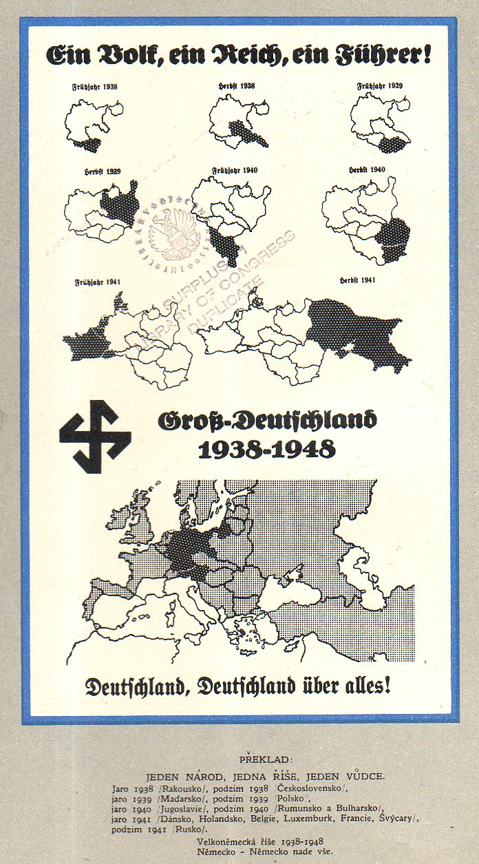
Čtyři léta války v mapách (“Four Years of War…in Maps”), published in London, ca. 1943, is a Czech-exile publication showing the development of the war in a number of very striking maps. The maps end at the publication of the pamphlet–except of course, for the 1948 map. The culminating interest though shows the Nazis surrounded, and put to the final test–it is the first map I list, below, even though it was about the last map in the pamphlet. It is a rare thing, this pamphlet, and it does not show up in the usual places. There are only seven copies located in the WorldCat/OCLC, all in top-notch libraries: NYPL, Yale, Harvard, Harvard Law, UC Berkeley, Oxford, and Nanterre.
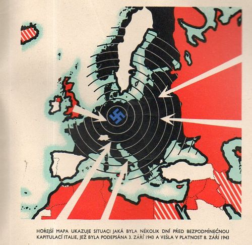
An overall view of the progress of German war conquests: