JF Ptak Science Books Quick Post
I came upon this table of the heights of structures while looking for another chart showing the heights of mountains and the lengths of rivers, with the lengths of rivers nestled between the mountains in an upside-down pyramidal mountain form in the sky–yes, it is a striking design. In the attempt of not finding a good copy that could be downloaded and shared there was however success in the serendipitous find of the following print:
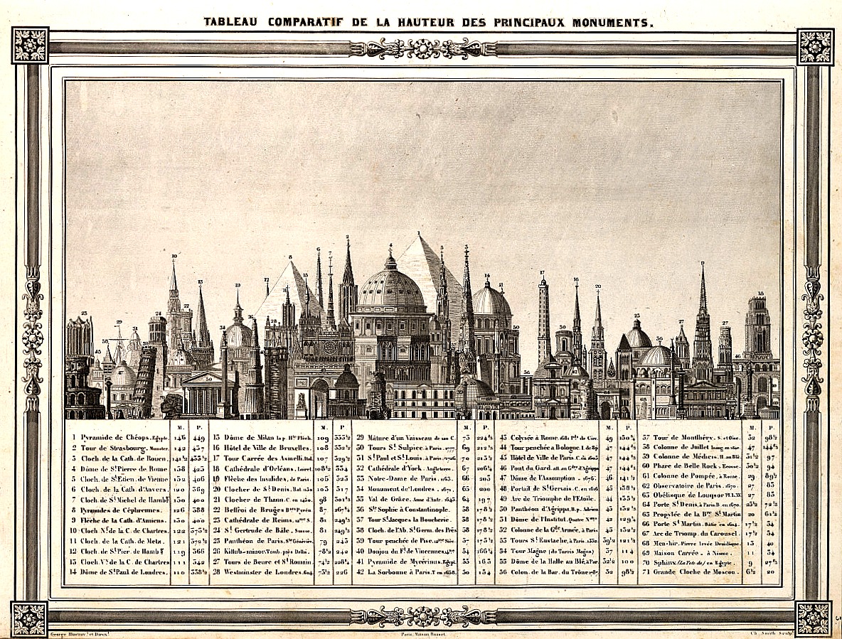
SOURCE: I was happy to find this at the tumblr account of Atlas of Affinities: http://atlasofaffinities.tumblr.com/image/76306197926 Barbie du Bocage, “Tableau Comparatif de la Hauteur des Principaux Monuments”, 1852.
The color isn’t quite right but that came as a result of manipulating the sharpness and clarity (and contrast) to make the legend somewhat more legible than in the original, which wasn’t a very chunky scan. In any event there is a clearer image if you click on this, and I’m pretty sure that all of the numbers and structures are reasonably legible.