JF Ptak Science Books Quick Post
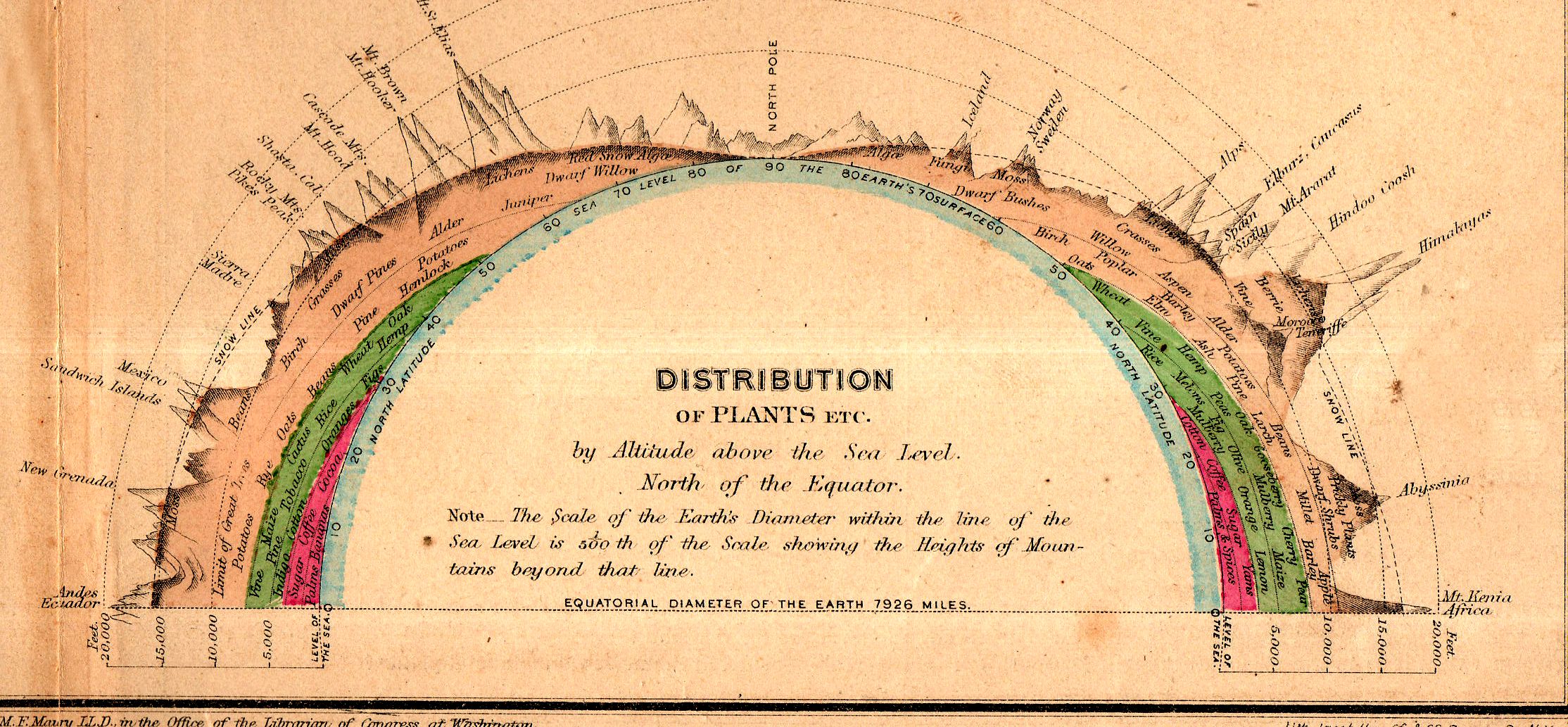
This fine little inset appears in “Chart of Principal Vegetable Growths and Chief Staples” from Matthew Fontaine Maury’s Physical Geography, a classic work for schools, which was printed in 1873. Maury is considered to be the father of U.S. oceanography (The Physical Geography of the Sea (1855), was the groundbreaking work) and was a real pioneer in several areas. This did not exclude his adventures on behalf of the Commonwealth of Virginia and the Confederate States of America, where he served as Chief of Sea Coast, River and Harbor Defenses, among other things. Maury had a complicated relationship with the idea of slavery, attempting to eradicate slavery (and slaves) by removing the institution and perhaps the owners and their plantations to the Amazon basin.
This small inset (above) measures 6×2.5″ in the original on a 13×10″ map, and shows the elevations at which certain trees and plants are found. It is an ingenious display, and depicts about 60 different samples. (The print in the map is about 1mm tall, by the way.)