JF Ptak Science Books Quick Post
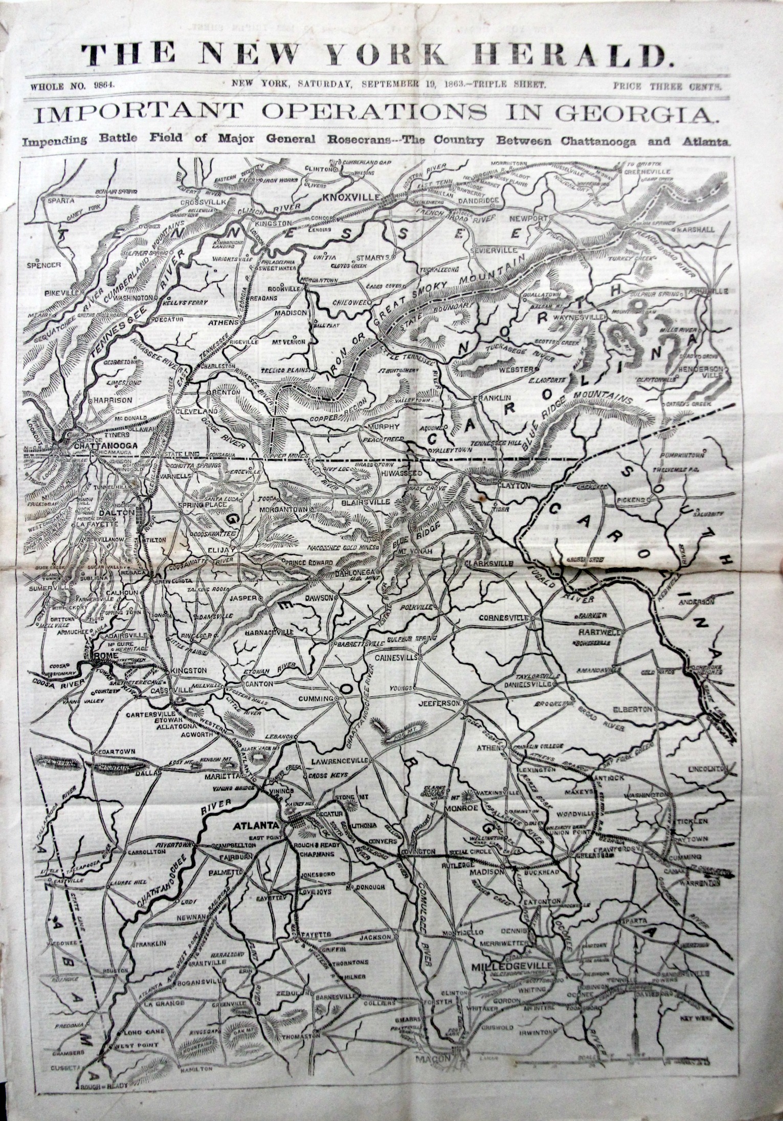
The “Impending battle” here in the sub-head of this issue of the New York Herald that I picked up recently was Chickamauga.
I doubt many knew what was coming.
The map fills the entire front of the paper and is 24 impressive inches tall. It moves from the Clinch River east across Greeneville/Knoxville to Asheville, then south to Milledgeville, and across the state west nearly to Alabama, and north to Atlanta, west to Rome, and then north again to Dalton and Chickamauga.
General Rosecrans had made his move south-east days before, and the battle was actually engaged the day before, on the 18th; on the 20th, it would be over, Bragg and the Confederates with a major victory that would be overturned in the next two months by U.S. Grant. There were more than 36,000 casualties on this field of battle, the second highest amount of the Civil War next to Gettysburg that occurred two months earlier.
The map was waiting to be filled in. With more.