JF Ptak Science Books Quick Post
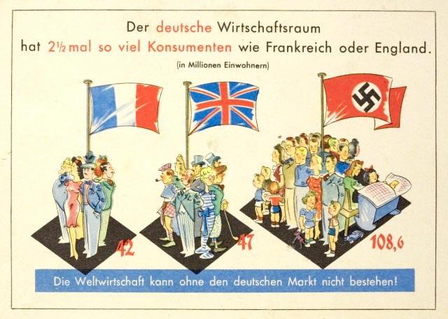
This is a piece of Nazi propaganda showing relative population densities for France, England, and Germany in the 1930’s, showing that Germany was far more ‘crowded” than the other two countries, and that the necessity for conquering other countries for “living space” was justified. A poor argument believed by millions. (I should point out that the German’s Germany is the only one featuring children (eight including an infant in a pram), and that the Brits are shown in a creaky/slouchy fashion.) It certainly got the point across–you didn’t even have to read to understand the message.
[Source: http://www.authentichistory.com/1930-1939/4-roadtowar/1-germany/]