JF Ptak Science Books Post 2338
[Image source: Boston Public Library, here.]
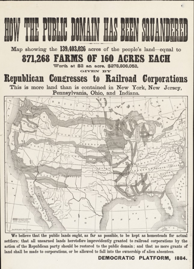
This propagandistic political broadside and map had an influence in the thinking of voters in the 1884 presidential election–and in fact it was mostly wrong. That “wrongness” was perpetrated for the Democratic Party at the expense of the Republicans, and held influence for dozens of years in helping to form the idea that the Republicans gave away huge chunks of American land to railroad companies in corrupt deals.
The map: How the public domain has been squandered, map showing the 139,403,026 acres of the people’s land – equal to 871,268 farms of 160 acres each, worth at $2 an acre, $278,806,052, given by Republican Congresses to railroad corporations , published by the Rand, McNally & Company, Chicago, 1884, is the culprit.
Well, some healthy percentage of those land deals were rigged/crooked–but not nearly all; and in fact there were huge sums of money raised by the government in granting enormous land offerings to the railroad companies, who were also monetarily encouraged to continue making their ways west. There were definitely multiple aspect in all of this.