JF Ptak Science Books Post 2020 
Part of the series on the History of Blank, Empty and Missing Things
I stumbled upon this fantastic leap into science affliction, an attempt to display the absolutely enormous idea of draining the Earth of all water revealing its ultimately rocky structure. And this in the relatively young modern cartographic days of 1694.
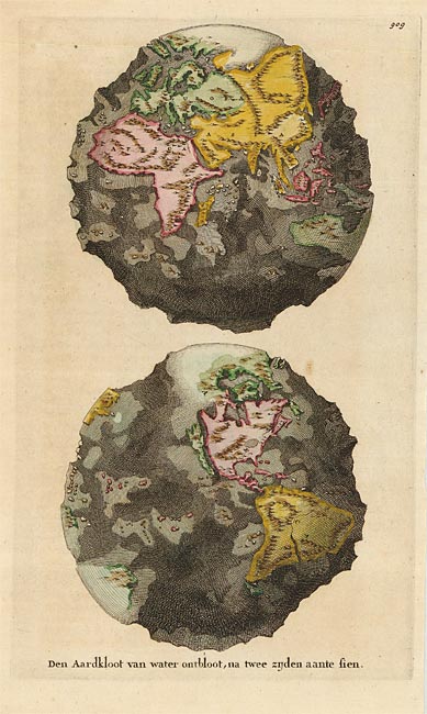
This map (“Den Aardkloot van water ontbloot, na twee zijden aante sien”, published in Amsterdam in 1694 by Wilhelm and Jan Goeree in a Dutch edition of the expansive and imaginatively suggestive cosmo-theo-geographical work, Telluris Thoeoria Sacra) reveals the half-believed idea of California being an island was we can clearly see the enormous canyon separating it from the North American mainland. On the other hand, the “opposite” (in a way) belief takes place in the north, showing a large and towering land mass at the North Pole.
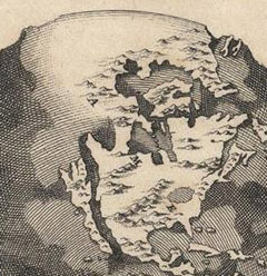
All-in-all, given the state of geographical knowledge for the unseen stuff of the Earth, this was an excellent attempt to reveal the structure of the globe. Sure, the depths of the oceans are a little off, the idea and the attempt to depict it was an extraordinarily interesting display for the time, especially with limited hard data. This is even a more-remarkable series of observations considering the theoretical framework in which all of this was taking place.
Burnet (1635-1715) poured out his pounding heart into the pages of his sacred history, teaching people about the structure and history of the Earth with generally little or unsuccessful regard to science–but no matter. (Burnet did try to figure out where all of the water came for the flood, which is a great question. It is impossible for it to come from a natural rain of any sort, and Burnet probably came to the conclusion this the answer for the flood couldn’t come from the surface of the Earth. So to keep things in compliance with his faith, Burnet established that the water necessary for the flood came not from the surface of the sphere, but below it, in the hollow Earth which was actually filled with water.) This was a work of structured faith and a belief system, and wasn’t seen as much more than that except to the initiated. But a resulting map of the structure of a waterless Earth seems to me a more powerful piece of imaging than an Earth simply covered by water.
[Black and white image source Barry Lawrence Ruderman Rare Maps, here.; color version from Oldmaps.com, here]