A Daily History of Holes, Dots, Lines, Science, History, Math, Physics, Art, the Unintentional Absurd, Architecture, Maps, Data Visualization, Blank and Missing Things, and so on. |1.6 million words, 7500 images, 4.9 million hits| Press & appearances in The Times, Le Figaro, Mensa, The Economist, The Guardian, Discovery News, Slate, Le Monde, Sci American Blogs, Le Pont, and many other places… 5000+ total posts since 2008.

A Fine Graphic: “A Table of the Cheifest Cities and Towns in England”, 1600

JF Ptak Science Books   Quick Post

Here’s a rather remarkable and ingenious display of information and distance usually reserved to show the structure of the solar system.  A Table of the Cheifest Cities and Towns in England, printed in London in 1600, the work of an anonymous thinker, utilized the standard and generally universal salient for the planets to show distances of cities and towns from the center of the British universe, London.  
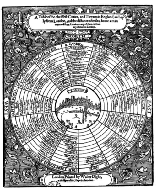
Source: Doug Eskew, “Coriolanus and the Paradox of Place”, here.

Recent Posts

Archives

Categories