JF Ptak Science Books LLC Post 1001
This odd, semi-naïve “outsider-esque” map is found in George
Wernher’s (d. 1567) De admirandis Hungariae aquis hypomnemation depicts
an intermittent lake region of the Inner Carniola region of Slovenia—more precisely it shows the “disappearing” lake of Cirnitz,
which is near the town of Otokh. The map
(which is oriented west/east
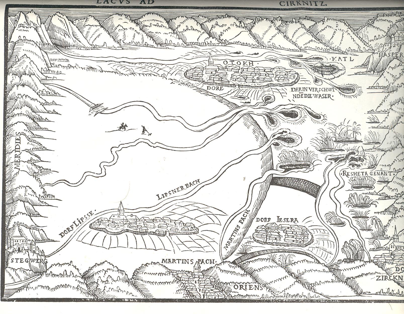
at top/bottom) I think is showing the lake when it
is “disappeared”. What happens evidently
is that when the water table rises it causes the groundwater and underground streams
to also rise, seeping through the limestone lake bed and rising through caverns
and sink holes; it becomes a periodic lake, though the appearance and disappearance
of the water has been the subject of wide mytho-specuilation for the folks who have
lived in the region for the last few thousands years.
and according to some old gazetteers that I’ve consulted would actually be
surrounded by the lake from time to time.
To further enunciate this the cartographer seems to have included cultivated
lands around these towns–no doubt the resulting soil would’ve been rich I nutrients. Also the eight rivers that feed the lake are
shown here, ending at this time in small lakelets.
attracted me enough to write this post—the main point of interest is at the center
of the map. There, standing to the right
of the horse and rider is a man working with a rake. 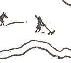
These are the only two human figures in the
map, and one of them is holding a rake.
Probably the person, along with the horse-and-rider and the small lake-bed
bridge across one of the rivers were included to hammer home the point that the
lake was gone, and that someone might be farming it.
figures like this that appear as “fillers” in maps and prints. These people have made a number of appearances in this blog, such as
in the case of the first photograph of a human
being. Well, actually, it is the first photograph that just happens to capture
a human in the emulsion. Since the exposure time was so terribly long for
this image to be made, the moving people and horses and carriages on the
street, all of the city-life bits, were necessarily spectral, and mostly invisible, in the photograph. Only the
stationary
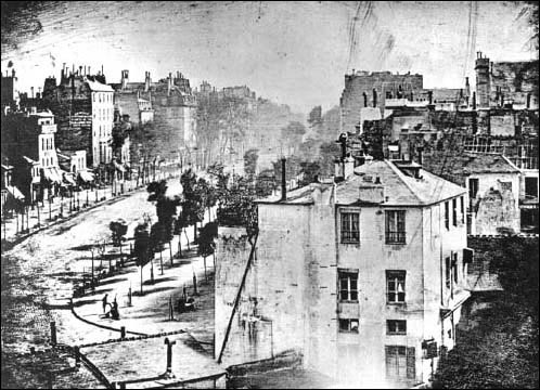 items were captured, and the only people captured here were two
figures in the foreground, doing something or other (shoe shine?) that made
them still for at least five minutes–long enough for their anonymous but
famous photonic impressions to be captured.