JF Ptak Science Books LLC Post 504
In 1830 when Amos Eaton, filling up his chair and burning
the midnight oils in his home in
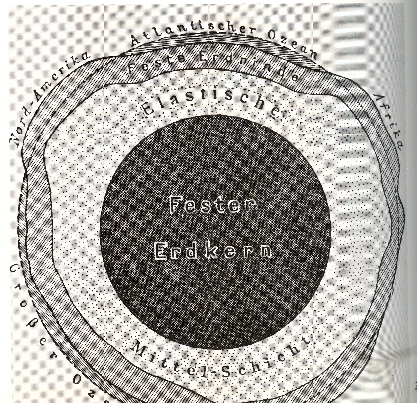
insides of the earth He had but little direct evidence to go on, and the publications on the topic of the center of the earth were left to speculation not much better then than science fiction (a term which had not been invented yet; neither for that matter had the word “scientist”).
A very careful observer, Eaton applied what he knew about the strata
of the earth to a theory of how the landforms of the upper/outer mantle
were formed. (
theorist and observer: some of his
students include the following Big Names (for which many buildings on university
grounds are named for ): James Dwight
Dana (geologist, zoologist), James Eights
(Antarctic
explorer), Asa Gray
( greatest 19th c American botanist), James Hall
(first New York State Geologist), Joseph Henry
(developed electromagnetism, all-around smart guy who
communicated with everyone, secretary of the Smithsonian and so on.)
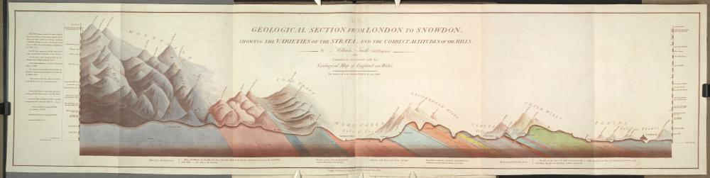
He applied the discoveries of stratum of William Smith (1759-1839, the “father of English Geology”) drawing on a number of maps of his, such as “Strata
Identified by Organized Fossils. : Containing Prints on Coloured Paper of the
Most Characteristic Specimens in each Stratum” of 1815 and “Geological section from
strata, and the correct altitude of the hills” of 1815 (pictured below), plus much else.
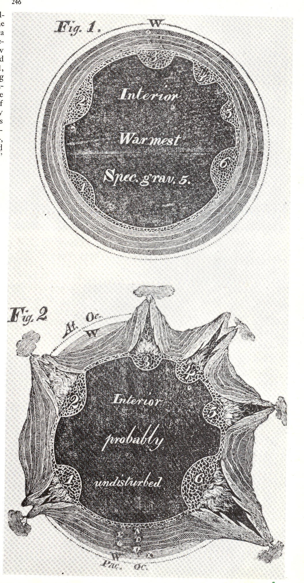
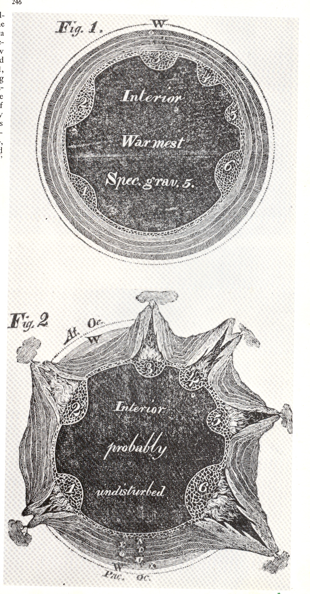
These two images (left) of cross-sections of the earth appeared in Eaton’s Geological Textbook, (1830). The top shows the earth in perfect harmony and in cross-section, depicting the strata in six layers beneath a calm and palcid ocean. There was trouble though located inside the six bulbous bulbs on the interior of the innermost strata: as we see in the second image, the six bulbs, filled with 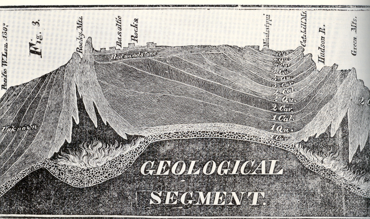
“combustible material”, combusted, forming volcanoes and such, thereby parting the waters and forming the continents. It was some pretty good thinking for the time. But what attracted me to these images was the labeling of the interior of the newly-exploded earth, “interior probably undisturbed”, and blank beyond that point. a dark, blackish mass, unknown and from where Eaton sat, unknowable. But Eaton did do an extraordinary job in trying to imagine this stuff, piecing things together from the geological record in those pre-Darwin, pre-Lyell days. The woodcut at right appeared in the same publication as that above–this incredible rendering depicts the entirety of North America in profile, which was a vast leap of faith, an image so severe in its accomplishment that it is difficult today to realize how shocking it must’ve seemed to the readers of 1830. I believe this was the first time a true geological cross-section like this was attempted–again to see an X-ray (pre-dating that discovery by 65 years by the way) of the earth and to have it be not so terribly bad (compared to today) was just a phenomenal achievement
________
Just for the record, Smith’s map of the London area–which presages the Eaton map somewhat–appears below: