JF Ptak Science Books Post 2677
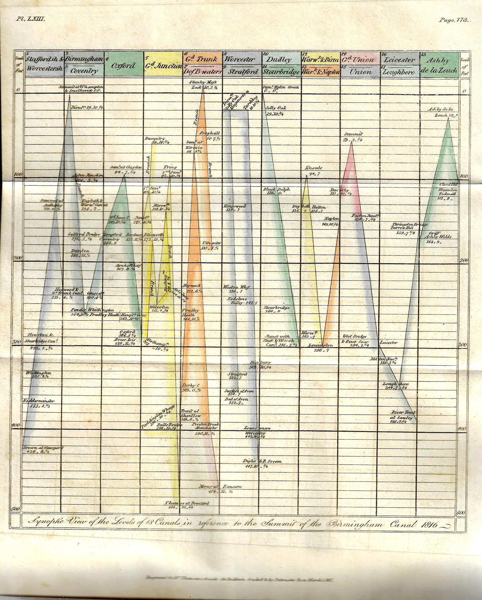
There have been perhaps 150 posts on this blog relating to data visualization and the elegant display of information–this one, found by chance yesterday while browsing, is really pretty early for its type of accomplishment. The image relates heights of canals in the Midlands, and is one of three illustrations for Samuel Galton’s “On Canal Levels” which appeared in Thomas Thomson’s Annals of Philosophy; or, Magazine of Chemistry, Mineralogy, Mechanics, Natural History, Agriculture, and the Arts1 in the first half of 1817. The article is illustrated with three plates, including a curiously interesting graph of canal lengths, a cross section of “the line of canal from the river Mersey at Runcorn Gap to the River Thames at Brenford, with the Branch to Paddington Wharfs”, and finally a glorious hand-colored plate (“Synoptic View of 18 Canals in reference to the summit of the Birmingham Canal, 1816”).
Galton (1753-1832, of Birmingham) was Quaker arms manufacturer (a not-uncommon occurrence in my experience) and the grandfather of the polymath Francis Galton, a successful industrial who was active in the Lunar Society. This short paper is basically a collection of data, and he presents it in an interesting and provocative way–this in relation to the cross section and graph, which are early means for the time in expressing quantitative data in a more easily-managed and comparable form. (Galton wrote: “It occurred to me several years ago that the lockage of canals and their plans and sections would afford the means of ascertaining with a considerable degree of comparative precision the relative height or level of all the places immediately situated upon those canals which communicate with one another and that in consequence a number of fixed points would be obtained from which the relative level of any objects in the vicinity of those canals might be more conveniently measured…”)
- (Apologies for the unevenness in clarity of the sans–the book in which they appear is tightly bound, and I didn’t risk opening the book beyond necessary for fear of damaging it. That said, if you click and expand the images are a lot sharper….)