JF Ptak Science Books Quick Post
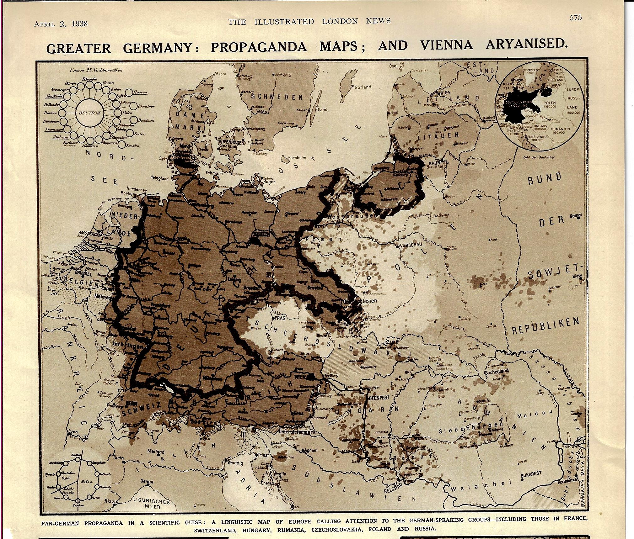
[Image: The Illustrated London News, p 575, April 2, 1938.]
The title and the date of this map pretty much tells at least the partial story of the beginning of WWII. The “Aryanized” Vienna (Wien) shows up with the rest of Austria as German-speaking but also outside the boundaries of Germany, even though the Anschluss Österreichs occurred about three weeks earlier. “Pan Germany” was still figuratively so, in spite of the absorption of Austria. Prague sits nearly surrounded by Germania irredentia, and of course Czechoslovakia was next, with Germany beginning the theft of the country that October, and then only about a year after the appearance of this article, Hitler was giving a speech at Prague Castle, also declaring Bohemia and Moravia to be the Protectorate of Bohemia and Moravia. This linguistic map certainly portrayed the gaping maw of the Nazi Kraken, Germany declaring that these actions was a natural right in the protection of Germans-outside-Germany.