JF Ptak Science Books Quick Post
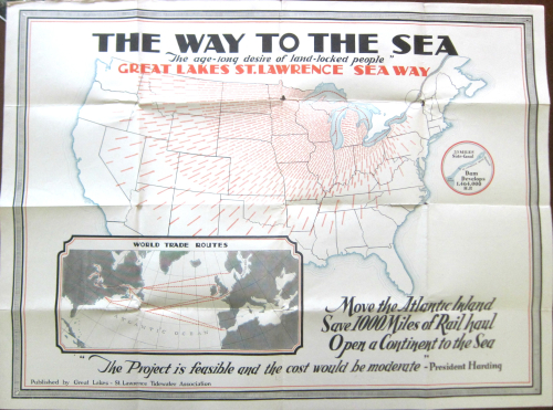
Here’s an arresting image: the arrows of transportation interests directing themselves inward, inland, to the Great Lakes, ca. 1923. The map is a bit of advertisement–a “convincer”–to send more economic traffic through the Great Lakes and of course the Great Lakes–St. Lawrence Seaway. Somehow it was making more sense to the writers of the copy for this idea to send freight from Virginia and Pennsylvania and New York away from the coast and up to the lakes, even though that would triple or quadruple the shipping times for those goods. Some of this makes sense, some doesn’t. Anyway, the resulting map is quite a piece of work–but I do think they should’ve let the Atlantic coast stay where it is.