JF Ptak Science Books Quick Post
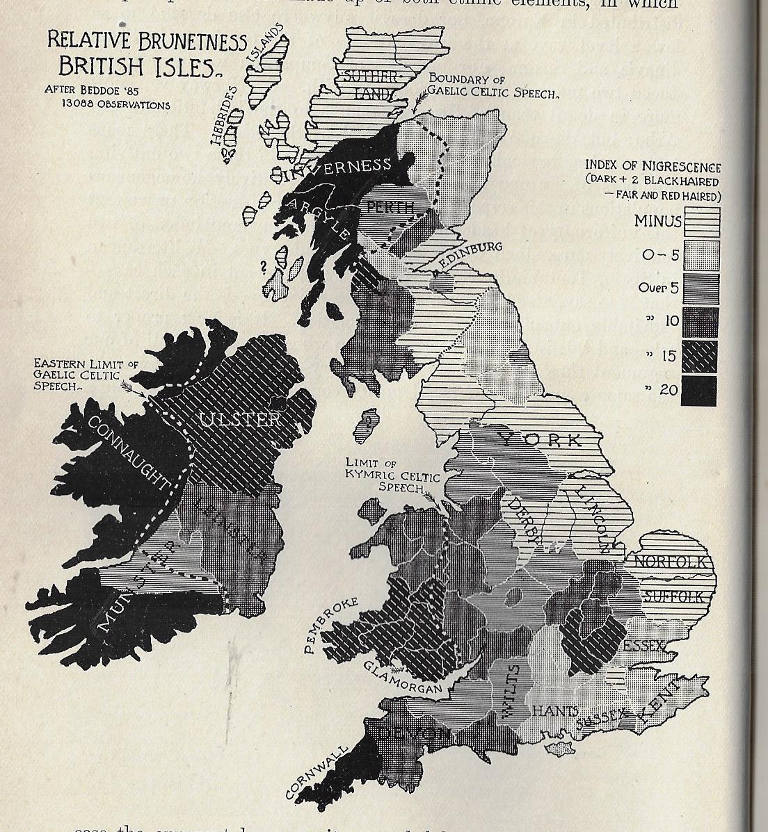
I must say that I’ve never seen a map of “Relative Brunetness” before finding this one, today. It occurs in a little bit of a wincing article by William Ripley (Ph.D., and assistant prof of sociology at (surprisingly) M.I.T) called “The Racial Geography of Europe”, and appearing in Appleton’s Popular Science Monthly for December 1897. Here we see the “Index of Nigrescence”, which I take is a measure of blackness of the hair (in this case), with light to dark meaning, well, light-to-dark measures of hair, this taken from 13,000 observations. A few pages away comes a map of the stature of adult males in the British Isles, locating the averages between the gross average of 5’6.5″ to 5’10” and over.
I don’t have anything to say about the maps, but I thought that it was worth reproducing them.