JF Ptak Science Books Post 2746
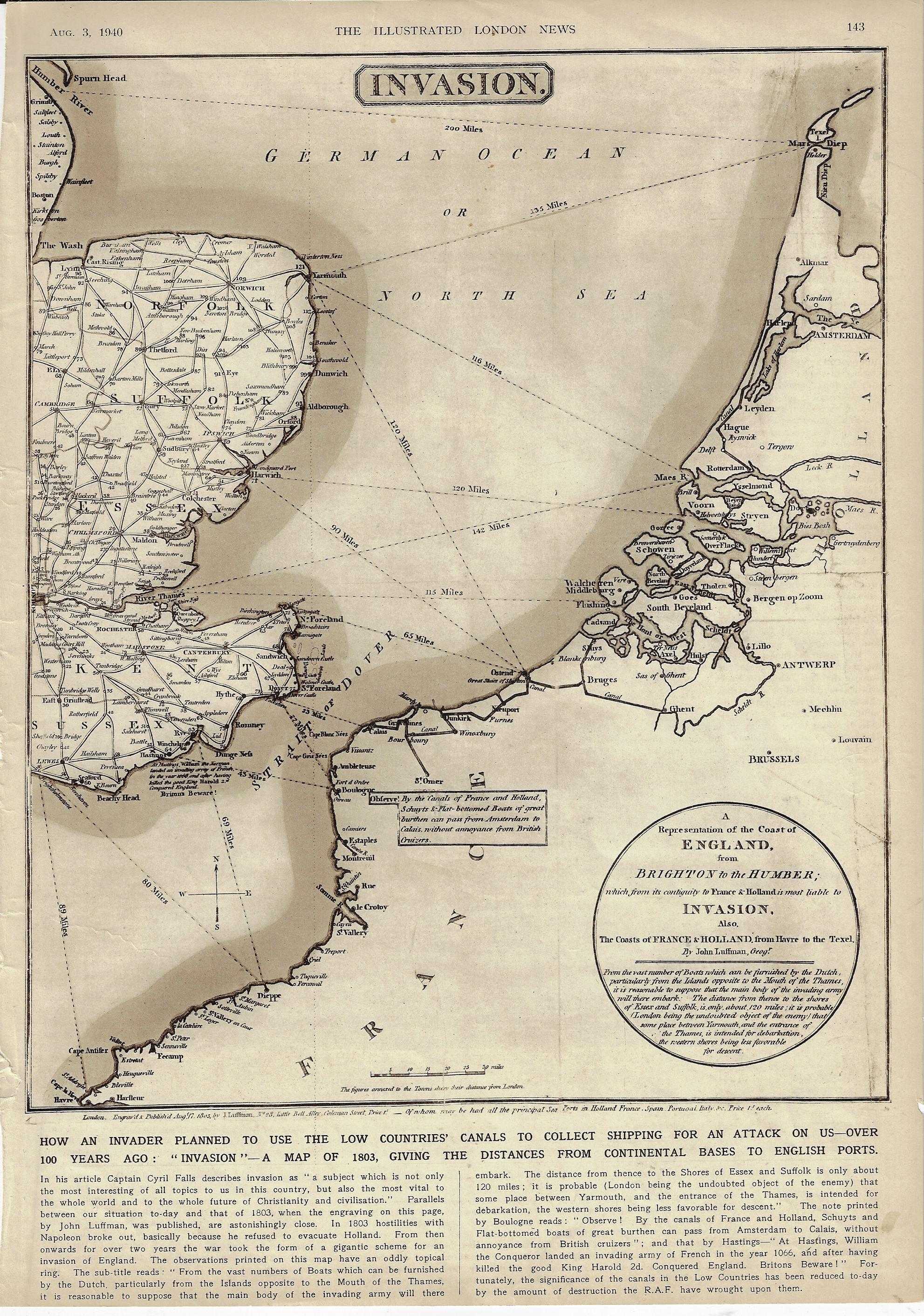
There have been many D-Days in the history military terminology, but for almost everyone it refers to the Allied invasion of Normandy on 6 June 1944. In 1803 when Napoleon was in high form and making his way through Europe there was a wide concern in England that he would attempt a cross-channel attack and invade the country. Which leads us to this map1 that I just found (again) in the Illustrated London News for 3 August 1940–the map entitled “Invasion”, showing the possible routes that the enemy might take in crossing the channel.
This was published at the time where the very real threat of invasion loomed like an angry low-ceiling mammatus cumulus, ready to break. Belgium, Luxembourg, and the Netherlands were defeated three months earlier, Dunkirk had just been sustained and the evacuation completed two months earlier; one month later, in July, the Battle of Britain had begun. It was not the French this time, but Germany–though the French had just weeks earlier surrendered without much fight and signed a disgraceful armistice with Germany, further weakening the very bad position of Great Britain. France was invaded in May and surrendered in June, an incredible collapse of what had just a few years earlier been Europe’s leading army, encamped behind the instantly obsolete Maginot Line. It would be another 16 months before the U.S. entered the war, and another 46 months before the Normandy Invasion would cement the endgame for the war in Europe. There was one gigantic good thing that happened in May–Winston Churchill became the Prime Minister.
Perhaps the editors at ILN sought to show the stoic Brits that they had been “there” (but now “here”) before, and nothing came of the Napoleonic threat. Of course there is almost no discussion of earlier attempts at invasion–though there is some fine print on the map quietly shouting “Beware Britons” about 1066 and all that.
The odd thing about this map–made by J. Luffman and published 17 August 1803–is that I haven’t been able to find it online. The mapforum group has a very interesting entry on Luffman as well as images of a different map showing a much greater area.2 And so here it is–perhaps I’ve missed the thing, somewhere, but I just haven’t been able to find it.
The Luffman map comes very close to concentrating on the WWII D-Day theater of operations, the map extending as far to the SW as Le Havre, which misses by just 10 miles the Eastern Task Force beachhead at Sword.
Notes: