JF Ptak Science Books Quick Post
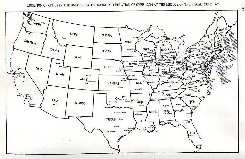
It is interesting to see in this found map that the U.S. was still a vastly under-citied place in 1920. This map (from the Statistical Atlas of the United States, compiled by Charles S. Sloane in 1924) created for the census of 1920 shows the locations of cities with populations of 30,000 and above. It is strikingly clear that once you move west of the Minnesota/Iowa/Missouri/Arkansas/Louisiana line, there are very few big cities. 38 in fact– and half of those in the two states of California and Texas. The rest are distributed fairly widely: six states had no cities >30k, three had one, two had two, and four had three. Other than that, there was a 1000+mile swath of land hundreds of miles wide spreading from central Texas to Oregon in which there were none of these cities.