JF Ptak Science Books Post 2137 One of a series of posts on the History of Blank, Empty,and Missing Things 
In the history of blank, empty, and missing things in maps there can be maps with large expanses of nothingness (as in the case seen here with the Bellman’s map from Lewis Carroll’s The Hunting of the Snark, an Agony in Eight Fits), maps with mostly everything that was to be expected to be expected but intentionally wrong (as with these propaganda maps of the Polish and Czech “threats” to Germany), maps with large expanses of nothing because there was simply so data to be displayed, and so on. And then there are the cases of perfectly good maps that are accurate and secure, but do not display what was thought to be there on the map but wasn’t because it really wasn’t there.
In the store that I maintained in downtown Asheville, North Carolina, I was often asked about what sort of Civil War action occurred around those parts. It is the sort of question that jumps out from maps showing troop movements during the war that you see on maps–maps without contour lines, or anything else that might show elevation. The answer to that question about Civil War battles here in the southern reaches of the Appalachians is that there was very little official action–and for the most part the reason for that is because there are in fact the Southern Highlands, and in the mid-19th century this very large region was just too bloody difficult to fight in or fight for.
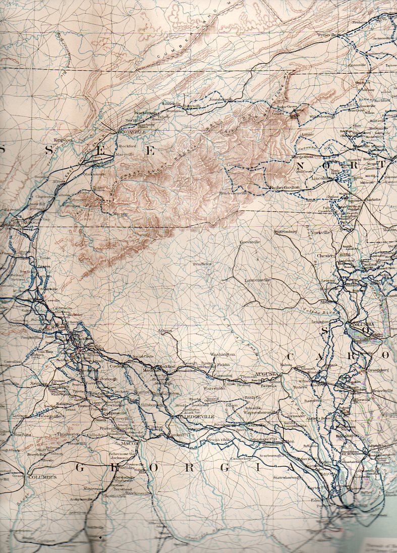
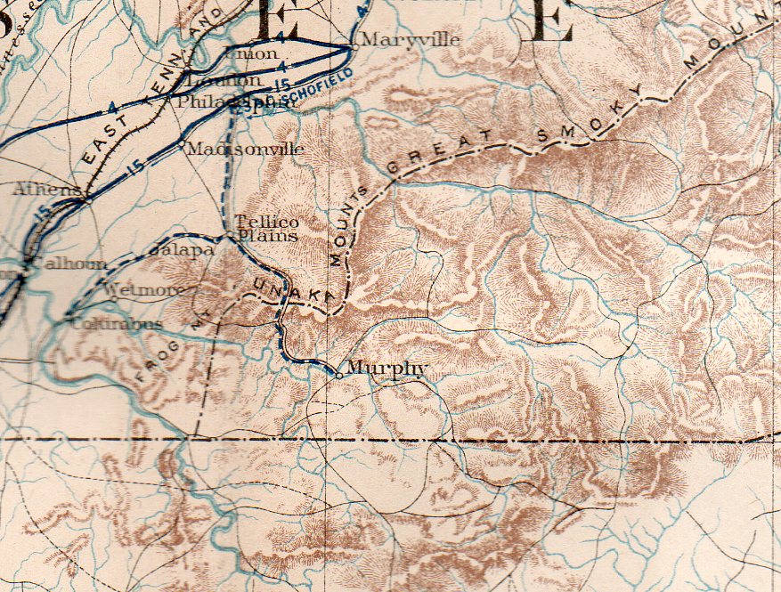
This all becomes cartographically apparent when you look at the region with maps that give you an idea of the terrain.
There is an amazing map that shows you the extent to which this land was inhospitable for combat. The Military map of the marches of the United States forces under command of Maj. Gen. W.T. Sherman, U.S.A. during the years 1863, 1864, 18651…., which was originally published in 1865 but more widely known for its inclusion in the Atlas to Accompany the Official Records of the Union and Confederate Armies2 (full text here) in 1895. As the map graphically shows, there are plenty of blu and gray lines depicting troop movements of the armies, though nearly all swarm around our mountainous region.

Apart from the difficult terrain, the mountains, and general inaccessibilty, there wasn’t all that much to fight for up here–and so, aside from some regional skirmishes and a lot of political and social conflict, they didn’t.
At least not until the very end of the war, in the Battle of Asheville, April 6, 1865, where about 1500 soldiers met each other about 750 feet away from where we used to live, three days before Appomattox. The action there was indecisive, though Asheville was not taken by Union forces.
And the detail:
Notes