JF Ptak Science Books Quick Post
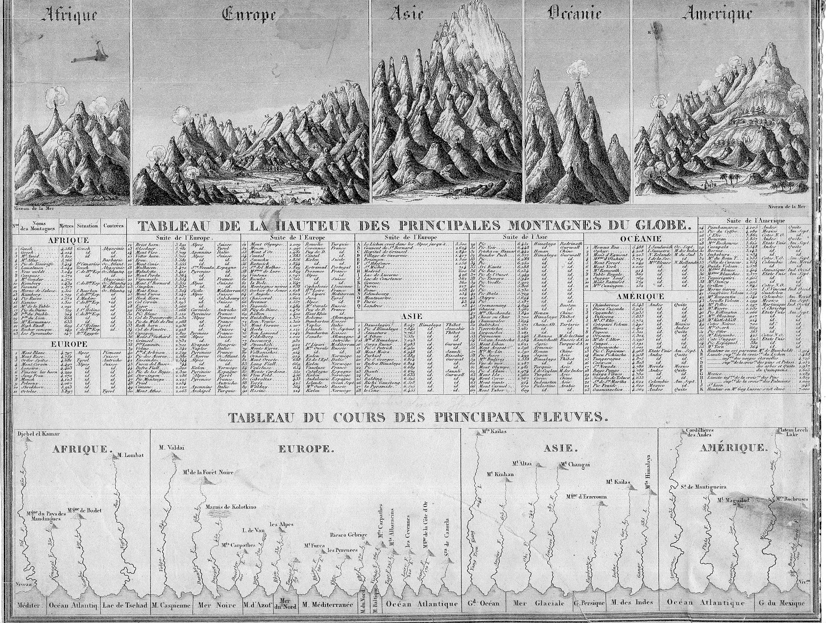
Generally the dozens of maps/charts showing the comparative heights of mountains and lengths of rivers maps that have come through the store part of this blog have been somewhat large–or at least larger than the present example, which may be about the smallest (at about 11×8″) detailed representative of this genre that I have seen.
“Tableu de la Hauteur des Pricnipales Montagenes du Globe” was published in Guillemin’s Atlas universel de Geographie Ancienne et Moderne, and published by Langlume in 1845. It is also at the beginning of the more-modern heyday for publishing maps and charts such as these. (The practice began modestly at the end of the 18th century, came into a high tide in the 1850’s/1860’s or so, and then pretty much disappeared by the 1880’s.)
There’s a lot of comparatively-displayed information presented on 88 square inches, including the lengths of 30 rivers and the heights of about 500 mountain peaks distributed over Africa, Europe, Asia, Oceania, and the Americas. And for as much imagery and data there is on this sheet, the whole is very nicely designed, a real success in the display of quantitative data.