JF Ptak Science Books Quick Post
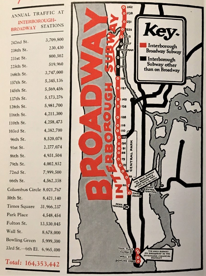
I’ve just found this delightful little publication beautifully extolling the possible advertising advantages of the Interborough Subway and Elevated Lines of New York City, Artemas Ward’s New York’s Rapid Transit Traffic in the Graphic, from 1923. It really does present the numbers and highlights them with some unusual and bright maps of the subway system. This was the IRT (the Interborough Rapid Transit system), which was a private concern that operated from 1903 until 1940, when it was purchased by NYC. This subway system in general was, well, entirely different from the one that I traveled 1968-1974 or so, back when you could barely see through the car windows because they were so heavily coated with graffiti…Anyway, I’ve reproduced most of it below as there are no copies of the pamphlet in any library according to WorldCat. The design of the first one–with the giant “Broadway”–is terrific.