JF Ptak Science Books Quick Post
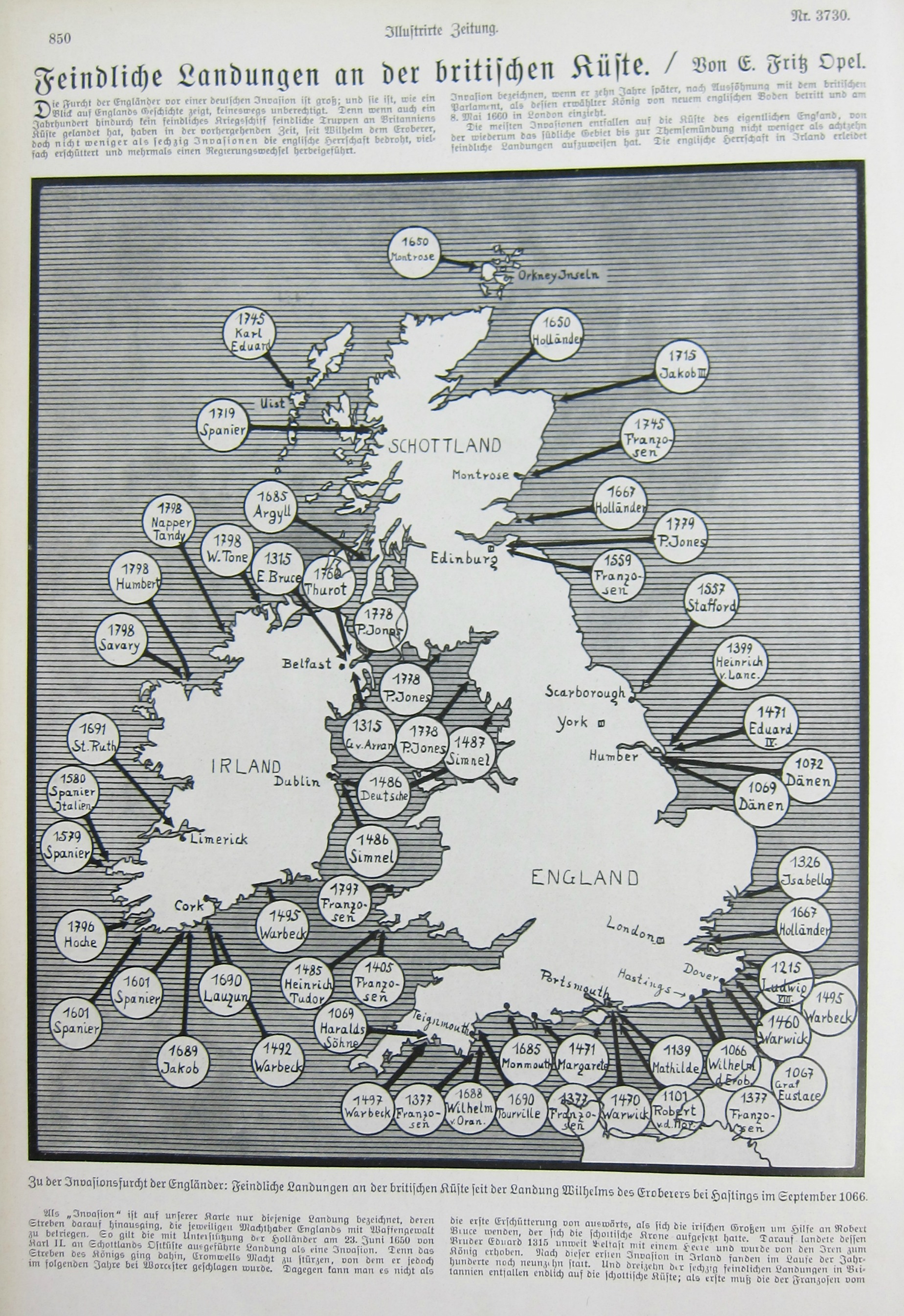
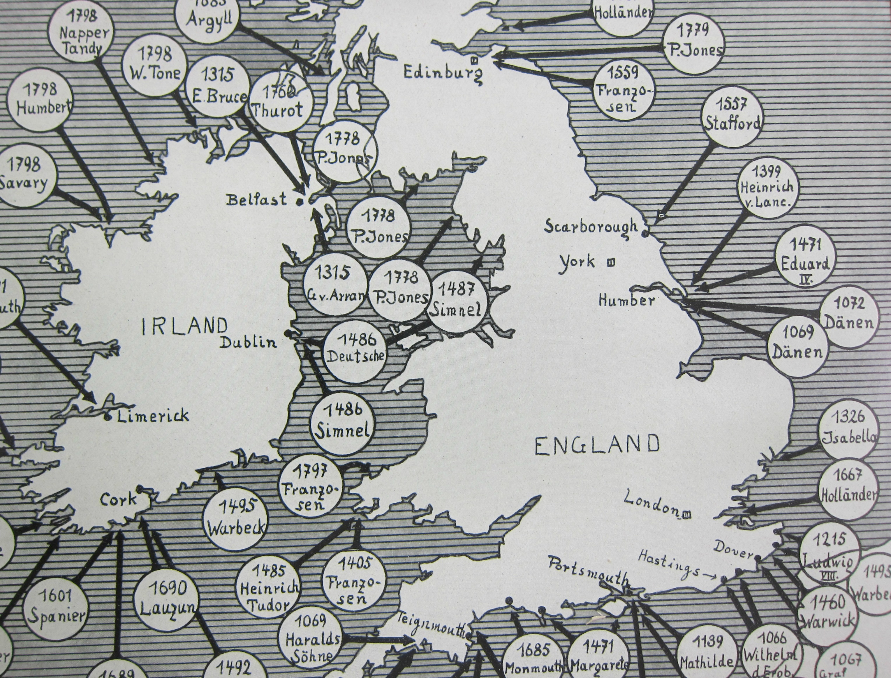
This piece of cartographic propaganda appeared in the fifth month of the war in the Illustrirte Zeitung (Leipzig) on Christmas Eve, 1914–it was in its way a vision of hope for the popular audience that this German equivalent of Life magazine reached. Perhaps it was a comfort to read that Great Britain and Ireland had been invaded before–many times–and that it might happen yet again; perhaps it was a comfort at a time when the realization dawning on tens of millions of people that This War would be over by Christmas, but it had really just only begun. Not much comfort though can be had in a piece of paper.
A detail:
And the full image: