A Daily History of Holes, Dots, Lines, Science, History, Math, Physics, Art, the Unintentional Absurd, Architecture, Maps, Data Visualization, Blank and Missing Things, and so on. |1.6 million words, 7500 images, 4.9 million hits| Press & appearances in The Times, Le Figaro, Mensa, The Economist, The Guardian, Discovery News, Slate, Le Monde, Sci American Blogs, Le Pont, and many other places… 5000+ total posts since 2008.

Author: JF Ptak

  • A High Achievement in Obstetric Art, 1781

    JF Ptak Science Books   Post 1473
    Anatomy bauldeqocue483

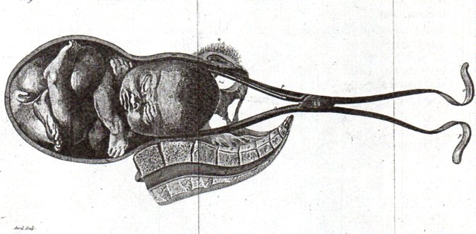
    One of the great thinkers in the history of gynecology was Jean Louis Baudeloque, whose 1781 book L’Art des Accouchemens was perhaps one of the most significant works in the history of obstetrics. This work was important not only for its great clarity and ease of explantion and control of its subject, but also for the exceptional illustrations.  I find them incredible not only for their spectacular detail but also for their control of blank space, a feat not easily accomplished…and I think a somewhat courageous approach to illustration during this era.
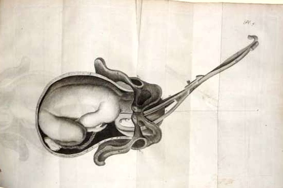
      Baudelocque

    For example, in the accompanying engravings (all of which are second generation and so are not nearly as sharp as the originals), we are left with a detailed image of only what was necessary for the explanation in the text, a terribly modern approach to illustration and clarity, so much so that it seems almost impossible that the image was made more than 230 years ago. 
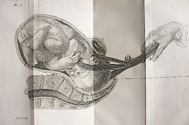
    Baudelocque 2

    Obviously the representation and the subject matter give away the age of the image, but certainly not the design or placement.

    Note:  It should also be pointed out that chief among Baudeloque’s contributions was his teaching career, during which he would instruct upwards of 150 pupils per year (mainly at the Ecole de Sante) in clear and precise terms on his approach to obstetrics, not the least of which was in the use of instruments such as the foreceps and pelvimeter, a distribution of a very useful information base which seemed to have spread exponentially as his students went out into the midwifery field. 

  • Archaeology of Bombing, 1913

    JF Ptak Science Books   Post 1472

    This is another in a longish series of posts on this blog on the archaeology of bombing, aerial bombing, and today’s installment comes from its earliest period.  The first air assault belongs to the Italians, who used the weapons from the air in bombing Tripoli in 1911, which they also found to be within the defensible scope of international law, even when used against a noncombatant population (which came on the heals of the Italian army’s massacre of civilians there).  Bombing from the air had happened earlier of course, but also entirely in fiction:  for example, Jules Verne bombed civilians in The Flight of Engineer Roburs (1886), and H.G. Wells had New York City in flames in The War in the Air (1908).
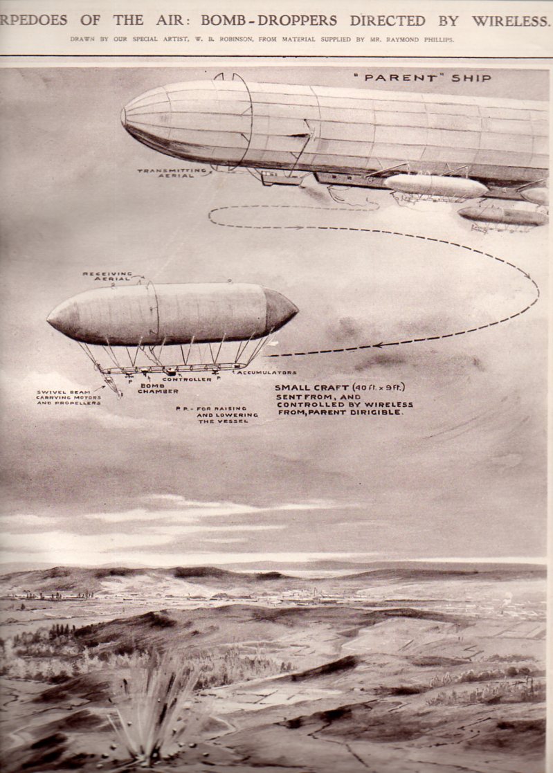
    “Torpedoes of the Air:  Bomb-Droppers Directed by Wireless”, a graphical story that appeared in The Illustrated London News on 6 September 1913, and drawn by W.B. Robinson, describes a sort of two-tier remote controlled aerial bombing arrangement of dirigibles.  The “parent” ship hosts a number of smaller dirigibles which are radio-controlled elements sent in to do the actual bombing, which allows for no human interaction with dropping the bombs and exposes only materiel to enemy fire.  (I should point out that each one of these early drones were 40′ long, making the parent dirigible something like 400′ in length if we are seeing about half of it in the illustration, and enabling the thing to carry perhaps 10 of these remote controlled units.  This dirigible would have been about as big as the monster Zeppelin LZ1.)

    Dirigibl e torpedoes481

    And this two years after this remarkable graphical display:

    Info display dreadnought237

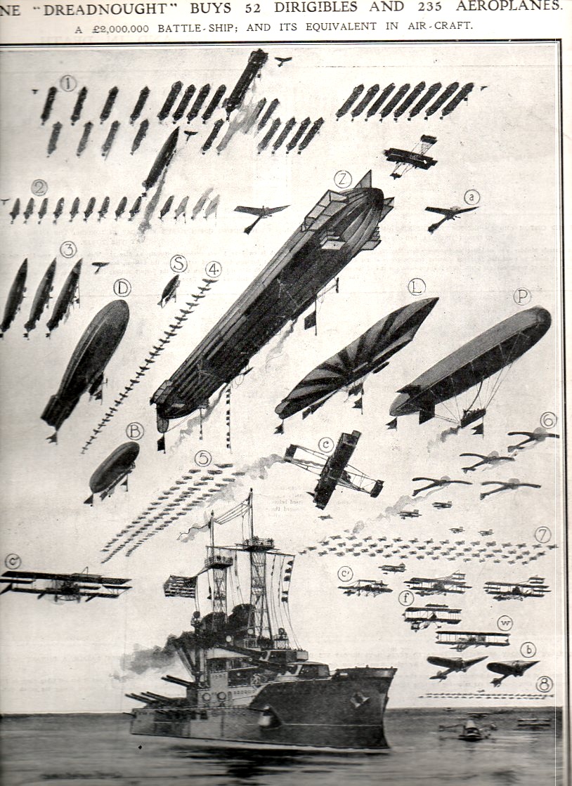
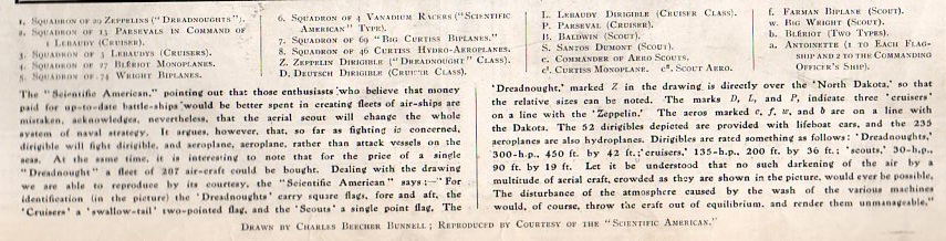
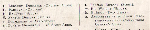
    There’s nothing quite so satisfying as seeing a representation of quantitative data like this where the graphical displays are flying.  “One Dreadnought Buys 52 Dirigibles and 235 Aeroplanes” is a full-page diagram appearing in the 3 June 1911 , making a very strong point that in the new air-age 2 million pounds for one battleship buys a lot of aircraft.  Of course this is a British journal and the ship is flying an American flag–the image originally appeared in the Scientific American just a short while before this publication, and so it also enumerates American and international aircraft, making for a lovely representation of a broad range of airplanes filling up the same sky.  (This image is available for purchase from our blog bookstore, here.)

    Info display dreadnought238
    Info display dreadnought239
    Info display dreadnought240


  • Black Soils of the Renaissance (from the Things-out-of-Place Department)

    JF Ptak Science Books   Post 1471

    It is interesting to see things as they aren’t, particularly when the time things were being what they weren’t was a long time ago.  An example of this appears in an earlier post here about the use of red skies in Renaissance painting, which was something completely unexpected to me, a spectacular use of beauty found in an alternatively beautiful place, a reminder of why it looks so odd to us to see a clock running backwards.

    Why does a clock run clockwise, anyway?  It seems to me that most other things that go ’round seem to do so “counter clockwise”, and seeing a clockface with the hands sweeping themselves backwards ticking off the minutes and hours seems antithetcal, even though the same function is being performed–its just happening in a slightly different manner. 

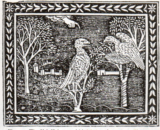
    And so to the question of the ground.  If skies can be red, why not the ground black?  Especially in wood engravings that are 500 years old?  No reason for it not to be so, especially when you’re working in black ink and nothing else but the suggestion of open, unused white spaces, with no midtones.  And once you think about it a little, the use of black as a ground color makes perfect sense, differentiating it from the sky. Its just that we don’t think of the ground in that way, and so when it appears it seems quite out of place its a bit of a shock–but then we get over it, nearly instantly. And so the fortress of normalcy fails.

    Here’s a few examples of Black Soils of the Renaissance.

    “The Sick Vulture and his Mother”, from Aesop,  Vita Esopi, printed in Florence, 1508:

    Black soil 1471
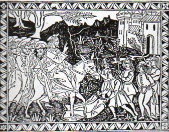
    “Christ entering Jerusalem”, from Bonaventura, Meditazioni sopra la Passione, printed in Florence, about 1494.

    Black soil 2472
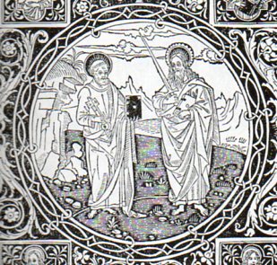
    Detail of the frontispiece to Epistolo e Evangelii, printed in Florence in 1495:

    Black soil 3473
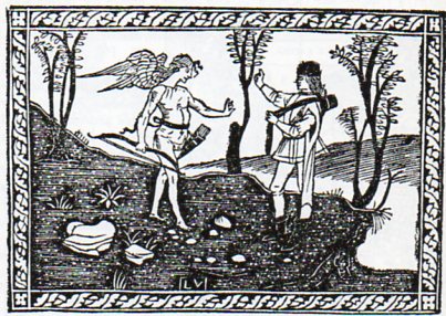
    Frontispiece to Frederico  Frezzi, Il Quadriregio, printed in Florence, 1508:

    Black soil 4474
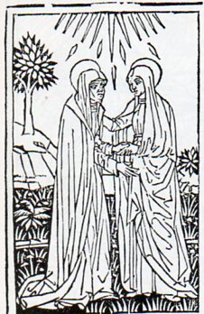
    Christophoro Landinus, Formulario di Epistole, “The Visitation”, Bologna, 1485:

    Black soil 5475

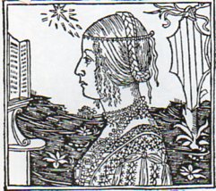
    “Damisella Trivulzia”, image from Giacomo Filippo Foresti, De Claris Mulieribus, printed in Ferrara, 1497

    Black soil 5476 Black soil
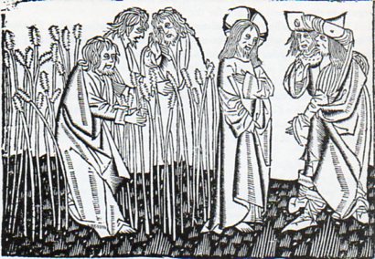
    Ludolphus de Saxonus, Levenons Heeren, “Disciples Plucking the Ears of Corn”, printed in Delft, 1488.

    Black soil 5477

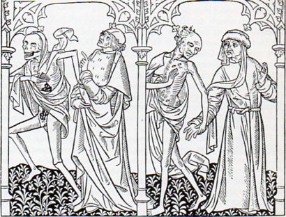
    The Danse Macbre des Hommes, printed in Paris by Couteau and Menard, showing Death visiting the astrologer and the bourgeoise, 1492. 

    Black soil 5478
    There are no doubt many more, but these willl do for now.

    Did anyone mention the Solids in Uccello?


    ·Posted by :

    ·in:

    — —

  • Backwards Atlas?

    JF Ptak Science Books   Quick Post

      Atlas470
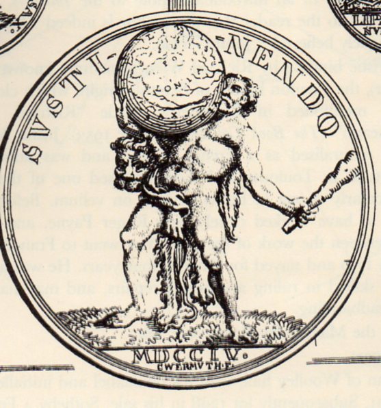
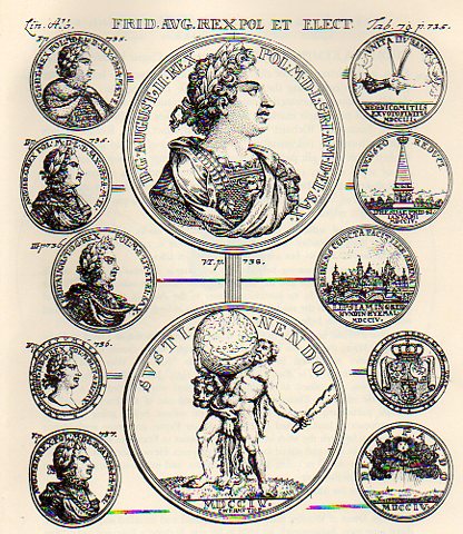
    I found a rather unusual image in this sniffy but no doubt very useful book on heraldry.  On the reverse side of a medal shown below (“Augustus II D.G. Rex Pol M. D Lit. D. Sax. I.C.M.A.”, or declouded it is August II, D.G., King of Poland, Grand Duke of Lithuania, Duke of Saxony, Julich, Cleves, Berg, Angria, and Westphalia) we see a compromised image of Hercules, the only time that I can remember seeing him balancing the sphere on his chest.  It looks very uncomfortable. 

    Atlas469

    Originally Atlas was supporting a sphere representing the sky, a punishment that he stand on the Earth and support the Heavens so that the two did not meet.  Over modern time Atlas has been given a new burden to bear, and generally it is that of the Earth rather than all creation. 

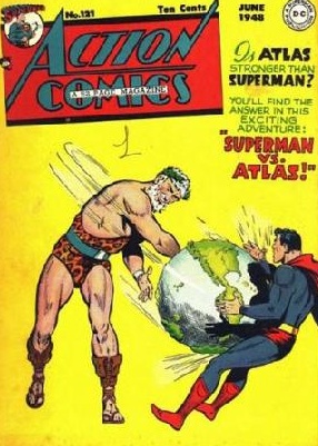
    Of course if we went looking a little further to see what else Atlas might be doing with his burden, there is the following:

    Atlas
    where for ten cents it would have been possible to see the outcome of this epic battle; but since I can’t spend the ten cents here, we’ll never know.  It is interesting to see the representations of the mountains on the globe–given their bumpiness I’d say that their scale would relate to those peaks being 50 miles high.

    And just for the sake of it “Atlas” became associated with a colletion of maps bound in a volume in  Antonio Lafreri’s  Tavole Moderne Di Geografia De La Maggior Parte Del Mondo Di Diversi Autori (1572) not because he employed the word first, but rather because he used an image of Atlas on the book’s title page–the first use of he word comes a little later in the work of Gerald Mercator. 


  • Really, Really Big Plans: Filling in the East River and Parts of NYC Bay, 1911-1916

    JF Ptak Science Books   Post 1470

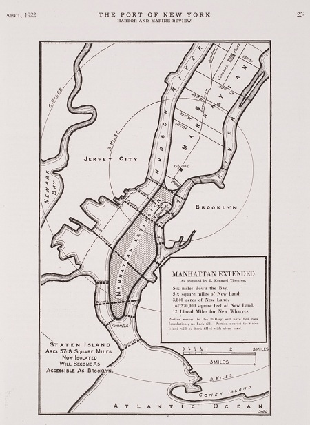
    Last week I wrote a post on  Herman Soergel’s  plan for extending the landmass of the countries around the Mediterranean Sea by damming the straits of Gibraltar, lowering the sea and irrigating the Sahara–an original, interesting but not very good idea, filled with briney cultivation and racial politics. In the past on this blog I’ve written about other city plans–and in particular, for New York City–that have involved floating Manhattan into the harbor, or filling up large chunks of the Narrows, or floating the city on an enormous anti-gravity platform, and so on. Some of those plans were real, some science fiction, and some were plainly beyond both.  The plan presented above is another monster, but at least this one could work, if not for the doing of it, and the expense. And the will.

    NYC Really Big
    But the bottom line, according to the engineer doing the thinking on this project, Kennard Thomson, would supposedly net the city a cool billion dollars after everything was said and done, and that would be 1916 dollars–that was equal to about 5% of the American GDP (!) in 1916, which would be about $400 billion in terms of 2010 GDP.  I’m not sure how Thomson came up with this very big/very round number, though it must have been done for effect–I can just imagine him standing before a smokey room filled with civil engineers talking about his massive plan for enlarging NYC and throwing out the billion-dollar figure, watching the cigars glow red in exhaled disbelief.

    Thomson did know what he was talking about–he was a busy (and “leading” according to the NYT) Manhattan civil engineer of stature, working on the Canal Barge and being the principal engineer for the Municipal and Singer buildings, for example–and his project seems to be well within the scope of possibility.  Their sensical aspects however are, well, questionable. 

    Here’s the story–around 1911, while examining proposals to repair and extend New York’s wharves, Thomson came upon the idea–a magnificent, fabulous idea–of adding new wharves by adding new lands to the city.  In short, the overall plan was to fill in the East River (!!) and reclaim the new land for city living,  dam Hell Gate,  construct a New East River (from Flushing to Jamaica Bay),  extend the tip of Manhattan Island from the Battery to within a quarter-mile of Staten Island (!), create a new 40-square-mile island between Sandy Hook and Staten Island, extend the Jersey shoreline, add two new Manhattan-sized appendages to the east shore of Staten Island, and more.  All of this would be connected by various new bridges and roads and tunnels, as well as a 6-track elevated railway that would circumnavigate the city.  The purpose of all of this would be to add 100 miles of new docks, an enormous amount (“50 square miles of reclaimed land”) of new land and the capacity for NYC to house 20+ million people, all of which would be worth a billion dollars. 

    Thomson really meant “really” in the title for the proposal. There have been reclamation projects undertaken in New York Bay since then of course, and I think that virtually all of what Thomson talked about could be done.  I think it would be a very interesting project for a class of some sort to undertake an estimation of what such a thing would cost today (and I would guess to duplicate the idea in real terms now would take up a sizable chunk of the GDP).  Maybe all of this will make sense at some more future point. 


  • Maps of Imaginary Places, Part III–a Preliminary Listing of Images

    JF Ptak Science Books  Post 1469

    “To wander in an empty cave / Is fruitless work, ’tis said: / What must it be for one like me / To wander in his
    head?”–Selected Letters of Lewis Carroll, 5t, to Margaret Cunnyghame.

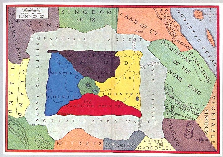
    This is part of a developing thread on the mapping of imaginary places–primarily in work that is done before, say, 1900. There’s much more imaginary cartography in the 20th century than in the entire history of cartography preceding it, and 1900 jsust happens to be a nice arbitrary cut-off date which also coincides with L. Frank Baum’s map of his The Wonderful Wizard of Oz. 

    And so what follows is a simple list, a familiar placeholder for the cumulative list which will soon follow.


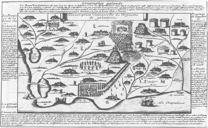
    Voyage au Rayaume de Galanterie (1652), by Delphine Denis. ( In:  Espaces classique, volume 34, numéro 1-2, hiver 2002, p. 179-189.  Source here.)

    Maps imagination galantrie

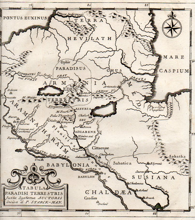
    Map of the Location of Eden,  1785:

    Eden 2358

    The mostly-imagined coastline of Australia, one of the earliest speculations on the place, ca. 1593:

    CORNELIS DE JODE Novae Guinea
    (Novae Guinea. From the Speculum Orbis Terraum published in Antwerp in 1593, by Cornelius de Jode.  The first landfall in “real-life” wouldn’t be made their until 1605/6, and so the speculation on the existence of Australia was fancifiul and based mostly on hearsay, unsubstantiated data and hope.)
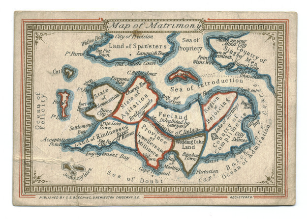
    Map of Matrimony, chromolithographed ca. 1870:
    Aps imagination  z matrimony

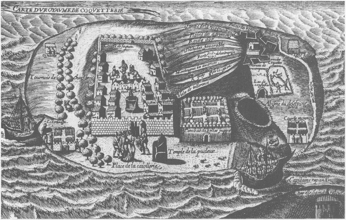
    Map of the Kingdom of Coquetterie
    Maps Imagination--royaume de Couquetterie
    Royaume de Coquetterie, by J. Sadeler.
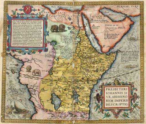
    Kingdom of Prester John
    Maps Imagination map_prester_john_by_ortelius_1572
    Map of Prester John’s realm, by Abraham Ortelius (1527 – 1598), 1572.  The kingdom of Preser John was supposed to be that of exiled Christians surrouned by non-believers, set in Central Asia, or norther Africa, or India, or Ethiopia.  Bordering such places as Paradise and the Fountain of Youth, and ruled by a descendent of one of the Three Magi who was wealthy and benevolent, this place was an object of much travel and considerable expectations. 
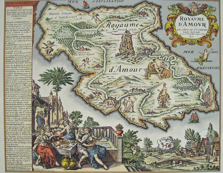
    Royaume d’Armour, by J. Sadeler, ca. 1659. 
    Maps imagination carte-du-royaume-damour
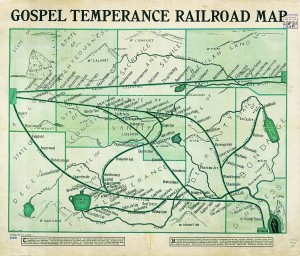
    G. E. Bula, “Gospel Temperance Railroad Map” (1908), unearthed by Frank Jacobs at Strange Maps.

    Gospel Temperance Railroad Map


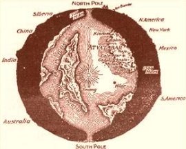
    Map of interior world, from “The Goddess of Atvatabar” (1892) Maps Imagination Z Atvatabar
    by William Bradshaw:


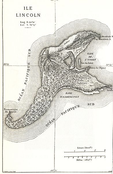
    Map of Isle Lincoln, from Jules Verne Mysterious Island, 1874:

    Maps imagination Z mysterious island

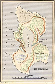
    And another from Verne: Two Years’ Vacation (Deux ans de vacances), Chairman Island:

    Maps Imagination Z  Chairman Island
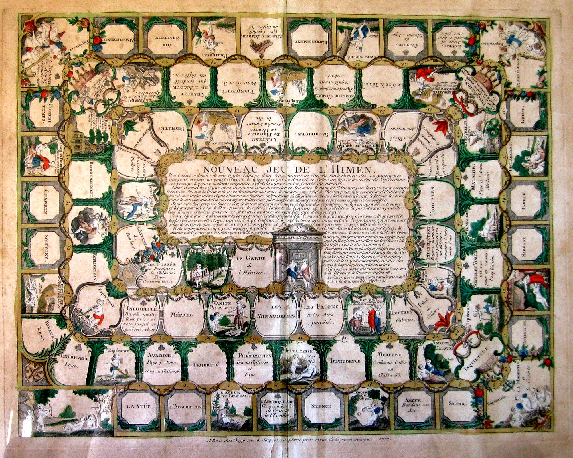
    Nouveau jeu de l’Himen

    Maps Imagination Himen
    Complete description here.

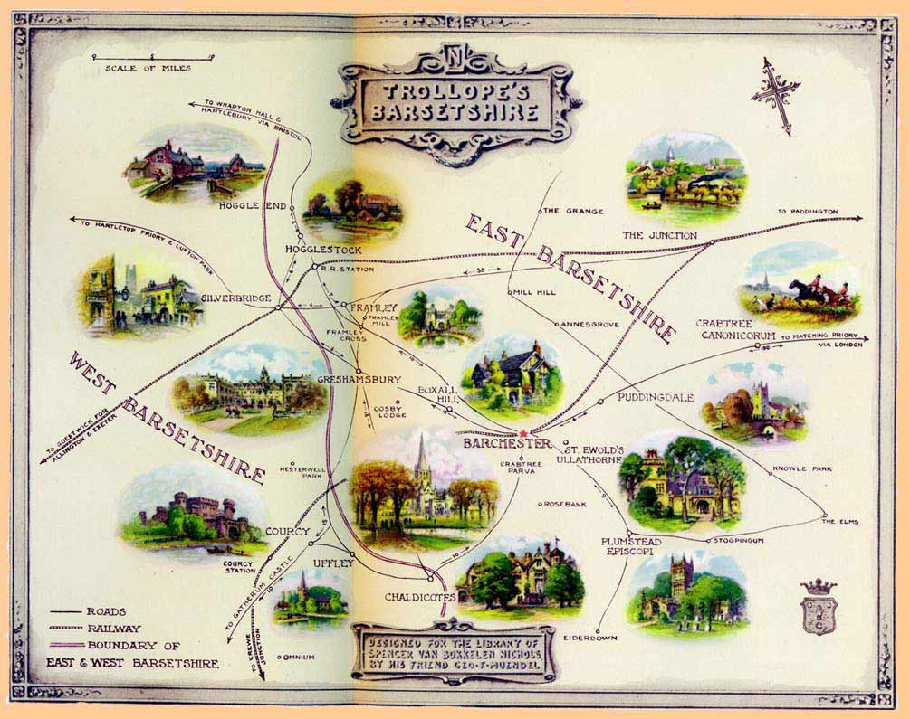
    Barsetshire, from the novels of Anthony Trollope:

    Maps Imagination Z  Trollopes

    the-road-to-success


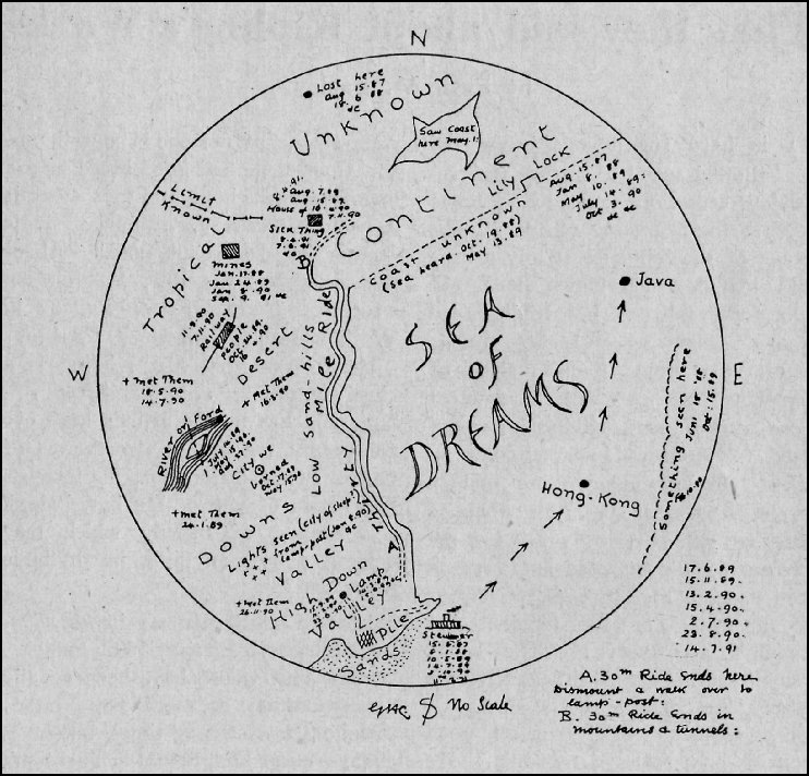
    Rudyard Kipling’s (George Coattar’s)  map of the Sea of Dreams from the “Brushwood Boy”,

    Maps Imagination  Z  brushwood_map_800

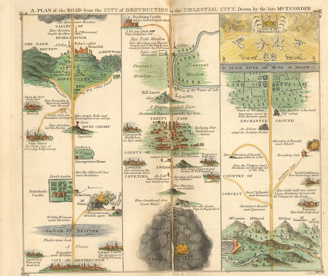
    Pilgrim’s Progress, 1840.

    photo
    The engraving is Thomas Conder’s, originally printed in A. Hogg’s 1778 edition.

    Map of Oz, or at least the first map of Oz, as it appeared in L. Frank Baum’s book The Wonderful Wizard of Oz in 1900:

    Maps of Imagination Z  Oz-and-surrounding-countrie

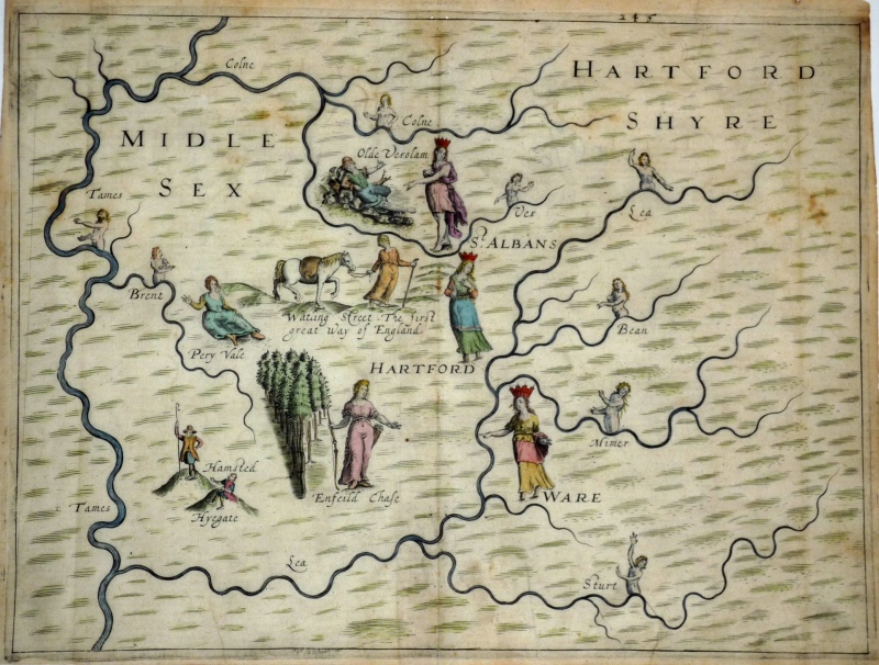
    Michael Drayton’s  (1563-1631) love-poem to England and Wales, the Poly-Oblion (published in 1612), mapped the reaches of the two countries and decorated them with allegorical iamges–it seems to me that the images were given far more work an understanding than the maps, which come off as outlines and suggestions of the real thing. (The maps were interestingly the work of one of the earliest British mapmakers, William Hole.)

    Map of Imagination-Michael-Drayton-s-PolyOlbion-c-1613

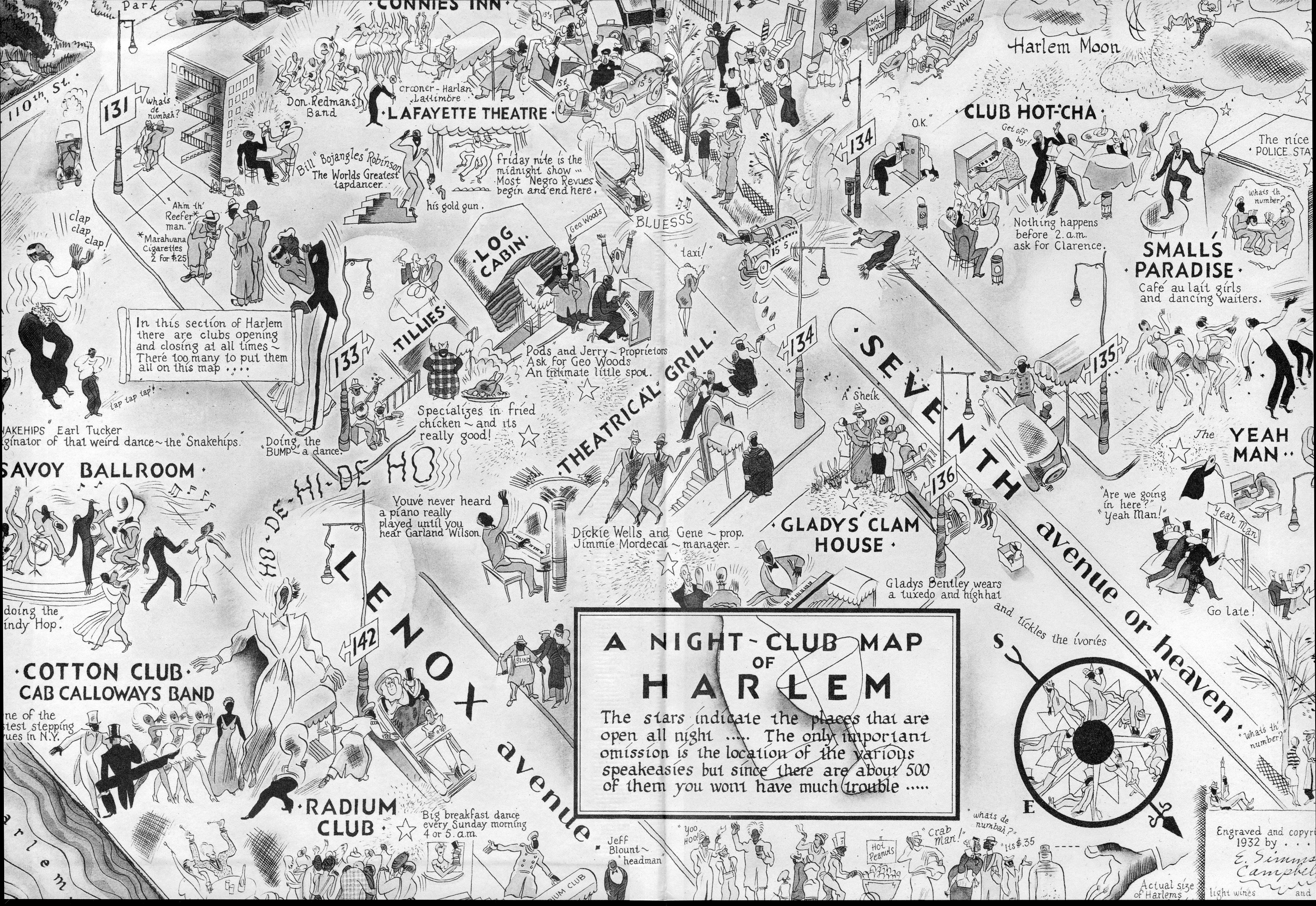
    Map of Harlem Nights, 1932, a fantastic map of a real place and real people and real happenings that I just couldn’t leave alone.  It doesn’t belong here–I just like it. 

    Maps imagination harlem


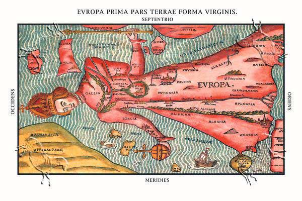
    Heinrich Bunting, 1581. 

    MAPS iMAGINATION eUROPA pRIMA buNTING vIRGIN

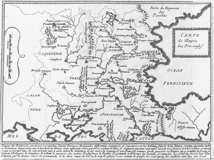
    Map of the Empire of the Precieuse, 1652.

    Maps Imagination Carte de l’Empire des Precieuses,

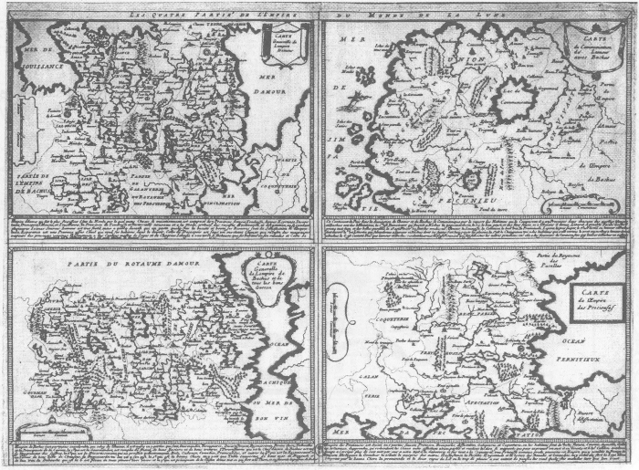
    Les Quatre parties de l’Empire du Monde de la Lune

    Maps Imagination Les Quatre parties de l’Empire du Monde de la Lune

    Clover-leaf map of the world, 1581, a wonderful map designed to increase the savoir faire of the mapmaker Heinrich Bunting’s hometown of Hannover, which appears at the center of the map.  I have a map somewher here that depicts world trade and the importance of Knoxville, Tennessee–the only city depicted on the map.


  • Breakfast, Bunks and Books in the French Foreign Legion, 1913

    JF Ptak Science Books   Post 1467

    Parachute bomb456 b
    The French Foreign Legion is legionary, or legendary, something that is famous in and of itself.  It was formed 180 years ago to help keep the peace in Algeria (which the French massively mess-up) and the rest of the now-disappeared French empire.  That corps of soldier had been composed of an ask-no-questions, never surrender, blood-in-the-sand, hardened and escaping individual. 

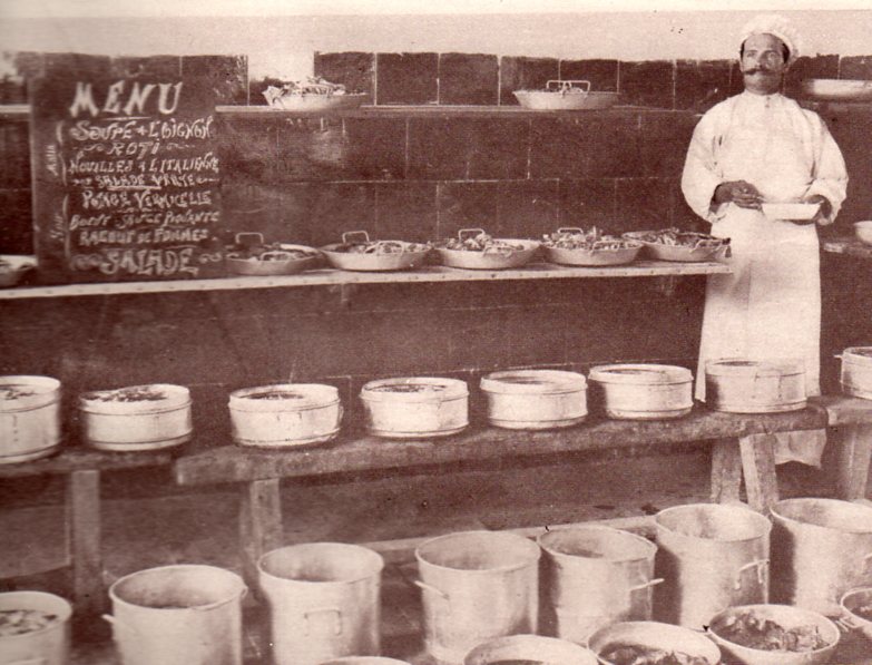
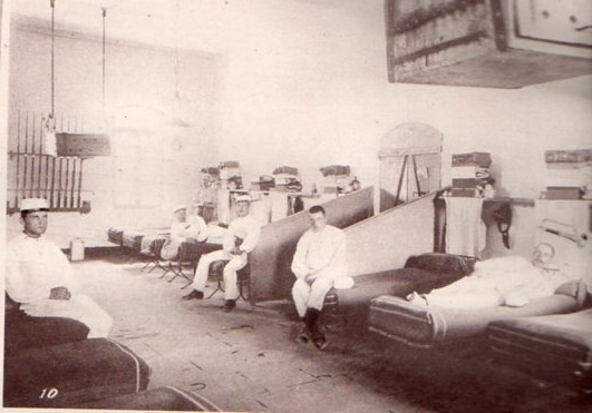
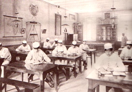
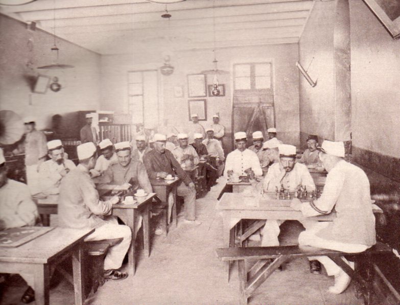
    If a photograph is worth ten thousand words, I’m not sure what story these pictures tell of the Legion.  No doubt these are the best faces in the best spots at the best angles in the best light kind of photographs, and don’t really seem to tell any bit of the story of the French Foreign Legion that one would expect.  But this was evidently not a real documentarian’s divulge that took place here in a double-page spread of the jam-packed issue of The Illustrated London News for 6 September 1913. But perhaps it was–perhaps there was a reading and writing room, and perhaps the barracks were kept clean and light and airy–certainly that would be good for the morale of the fighting man, but just not for our expectations.  

    And truth be told the menu for breakfast looks pretty good.  Whether or not this was a standard fare is impossible for me to say.   The cook (who looks proud enough to be a chef) could make a person want to pull up a chair to the table.

    Parachute bomb456

    These are the sleeping quarters, which look bright and clean, though the racks look pretty narrow, like not that much more wide than a good set of shoulders:

    Parachute bomb459
    And of course the read and writing room, complete with a small library–the tables look very shiny…

    Parachute bomb458
    And the game and recreation room, where I see some tea and chess–I’d be very interested to know what the framed documents on the rear wall were all about.

    Parachute bomb455
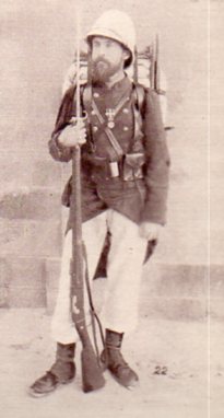
    And one of the men, someone with 15 years’ service:

    Parachute bomb457


  • History of Falling: Parachutes as Aerial Minefields and Pilots’ Escape Vehicles

    JF Ptak Science Books  Post 1466

    Lots of these images have to do with walking and falling, walking and falling at the same time, walking and catching yourself from falling over and over again, but in general that walk is only one step, so far as parachutes go. 


    The parachute has certainly been around for a long time–from ancient times if you squint your eyes hard enough–though it appears that it was in the Renaissance that the idea was taken more seriously as a practicable thing:  at  least it was first depicted then.  Here for example is a form of falling that was seen as flying (Homo Volens or Flying Man), in this depiction of parachute-use by Fausto Veranzio  Fausto (1551–1617) in his book of technological marvels called Machinae Novae (1595).  Of course Leonardo left a footprint here as well, and before Veranzio.

    File:Homo Volans.jpg

    More convincing and potentially beneficial parachutes were constructed for balloon escapes/aviator descents in the 19th century, as seen with the work of André-Jacques Garnerin (1769-1823), who was the inventor of the frameless parachute (a framed version seen below).  

    File:First parachute2.jpg

    And in all that time of development through the nineteenth century, it still took another eight or nine years or so after the Wright’s flights to have employed the idea for pilots of the modern airplane.  There was a series of varied “firsts” of leaving an aeroplane by parachute in 1911 and 1912, the earliest of which involved the pilot of an aircraft to fly with his parachute in his lap, then throwing the whole thing from the plane with the pilot following. Parachute history during this time, like 1910-1920, is a little complicated, filled with fits and starts, mostly not very successful, and most of them of a quality and dependability to make you want to land your aircraft even if you were flying only smoke and flame.

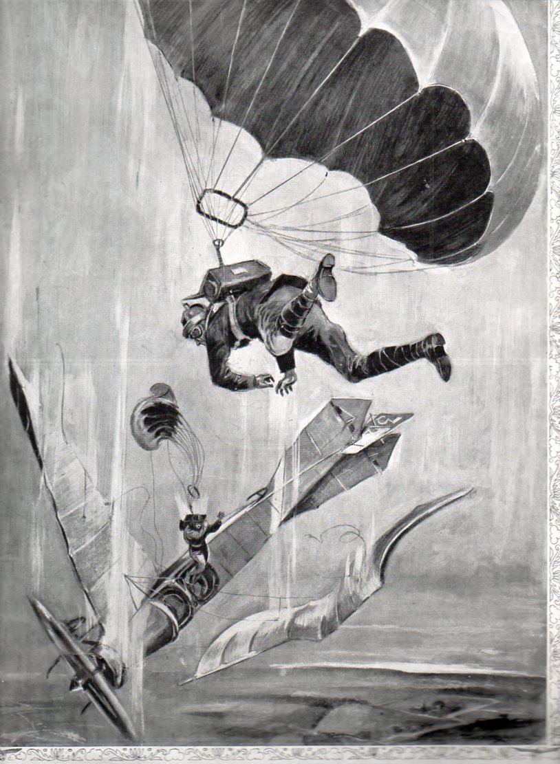
    The image below seems to depict the 1912  exploits of the American and British inventors who at about he same time developed a parachute that could be worn in a box on the aviator’s back, contained in a box with a removable panel.  It was a very heady development, and the whole idea–seen here in the pages of The Illustrated London News for 28 September 1912–must have seemed like science fiction to the casual reader, the caption beginning

    Parachute bomb454

    “…our illustration appears to be somewhat fantastic…”  The ripchord, one of the most important elements of a parachute, didn’t get introduced into the fray until about 1916, and the real utility of the parachute doesn’t seem to be developed until 1920 or so.  In the meantime, the whole business of flying was pretty much being done without a safety net, so to speak. 

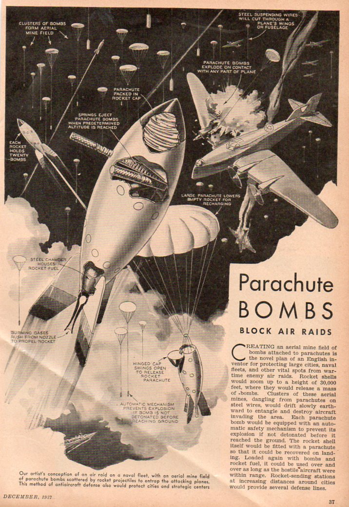
    But what I realloy wanted to get to in this post is something that did look “somewhat fantastic” to the readers of its day, as it does to me now:  parachute bombs.  As a late-night, five-martini idea it looks great, especially in 1937.  But the fact of the matter is that it does look like a bar stool plan similar to barrage balloons if barrage balloons were smaller, higher, fell and had bombs.  One element of surprise though may have been what would happen to the great percentage of these bombs that were fired above and floated back down to Earth with their warhead still attache to the parachute and unexploded.  The article states that the warhead would be disabled

    Parachute bomb453

    before it hit the ground, but then what?  I suspect that there would be thousands of these buggers littering the land/cityscape, which means that there would have to be an equivalent of an ambulance corps riding around finding, collecting and hauling these things off.  Seems like a non-started to me.  Plus there would be far more effective anti-aircraft elements developed very soon after this, not to mention the terribly significant mathematical and technical developments that would go into the fire control issue of the weaponry. ( But that’s another story, another long story, dealing with how to get aircraft out of the air–there’s some very sophisticated AA weaponry produced during WWI, s decade and a half before these parachute bombs, that would seem to make these things a bad afterthought.)


  • Louis Turner’s Review of Published Work on Nuclear Fission, 1934-1940.

    With a List of Turner’s References (Below)

    JF Ptak Science Books    Quick Post

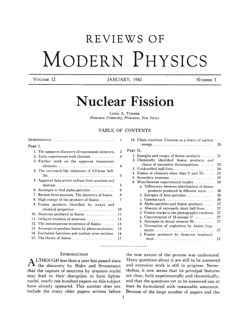
    I’ve found this article1 by physicist Louis A. Turner to be very helpful over the years.  He was an I-was-there guy (and actually an I-am-here guy) who wrote a stuccato article on the history of nuclear fission which was top heavy in references, and did so in 1940, just before the clamp came down on publication on the topic.  Certainly there are other more modern efforts in this area that are far more detailed, but few have managed to do so good a job in as limited space as Turner, which the fabulous John A. Wheeler recognized as a “great and timely” review2.

    Notes:

    1. Louis Turner. “Nuclear Fission.”  Lancaster:  American Physical Society,  1940. An article in the  Reviews of Modern Physics, vol 12/1, January 1940, pp 1-30  of an issue of 85pp   Original orange wrappers.  Fine condition.  Also contains articles by Seaborg and Zwicky.   

    2.  J.A. Wheeler, “Fission in 1939, the Puzzle and the Promise” Annual Reviews, 1989. 

    The original article can be purchased through our blog bookstore, here.

    Turner fission
    His 133 references can be read as a succession of one-line histories of the subject (barring the permissions to reproduce the entire article):

    1. E. Fermi, Nature 133, 898 1934.
    2. E. Amaldi, O. D’Agostino, F. Rassetti and E. Segrè, Proc. Roy. Soc. A146, 483 1934.
    3. I. Noddack, Zeits. f. angew. Chimie. 37, 653 1934.
    4. O. D’Agostino and E. Segrè, Gaz. Chim. Ital. 65, 1088 1935.
    5. I. Curie, H. von Halban and P. Preiswerk, J. de phys. [7] 6, 361 1935; C.R. 200, 1841 1935; 200, 2079 1935.

    ·Posted by :

    ·in:

    —

  • Death Comes for the Book(printer & seller), 1499

    JF Ptak Science Books   Quick Post

    Death444
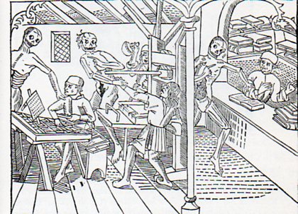
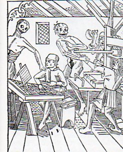
    This is intended to be a short mini-post on the end of printing, and the end of bookselling, such as we know it, or knew it–this image comes from 1499 (Le Grand Danse Macabre, Lyon), and tells us that death to these occupations is nothing new.  Of course when we speak of the death of the book nowadays we’re discussing something different–the death of the printed format.  But here in this print, which is also the first depiction of a mechanized book press, we see ironically that Death has come to claim its operators, or at least two of them.  The inkman in the background, the yelling third of a departing party of two, is spared for the time being.  Just as the reader is for the first time seeing this machine, they are also seeing Death in its in grim glory snatching away the machine’s main operators. 

    Death445

    The image and the functions of the people working the press are well described in the excellent history of all things books at the Bookn3rd website, here. 

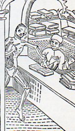
    Here’s Death coming for the bookseller–at least the man was reading at the time of the departure.  This is also a very early depiction of a book store, which again as the first visual information on such a place to the reader is wrapped around the visitation of the Great Inevitable. 

    Death446
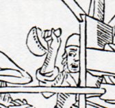
    The inkman, in thr background, screaming/shocked. 

    Death447