A Daily History of Holes, Dots, Lines, Science, History, Math, Physics, Art, the Unintentional Absurd, Architecture, Maps, Data Visualization, Blank and Missing Things, and so on. |1.6 million words, 7500 images, 4.9 million hits| Press & appearances in The Times, Le Figaro, Mensa, The Economist, The Guardian, Discovery News, Slate, Le Monde, Sci American Blogs, Le Pont, and many other places… 5000+ total posts since 2008.

Category: Militaria

  • A Great Work of Artistic Display of Quantitative Data–German Losses in the Battle of Britain (1940)

    JF Ptak Science Books   Post 346 (from 2009)–extended

    This tremendous display is half of a double-page spread that appeared in The Illustrated London News for 7 September 1940.  It was meant to bolster the civilian population of Britain during the time of the German attacks, shoping that “Over one thousand Nazi aircraft (were) brought down over Great Britain in …20 Days…” The artwork, drawn by Bryan de Grineau, actually depicts 1000 planes, and accurately depicted ones at that.   What the graphic doesn’t tally though are the airmen losses, which would be considerably more than the 1000 aircraft:  for example, of the aircraft involved in the sustain air-invasion of England, the  Dornier 215’s had a crew of four, Dornier 17’s three, Heinkel 111’s four, Messerschmitt 110’s two, and Junkers 88’s three.  Thus  there were thousands more airmen lost, a commodity that the Nazis could little afford. 
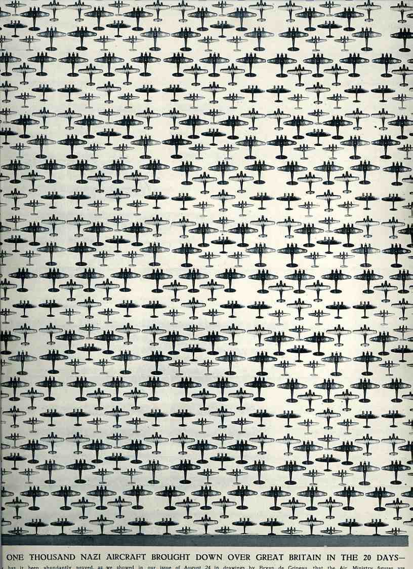
    00-blog--Oct 29 battle britain Nazi planes952

      (This continues a thread on The Battle of Britain and also a post on “What 185,000 Planes Looks Like”).
     The results of the battle (and if you take a look at this earlier post for the full narrative), in terms of aircraft and humans, were,  for Great Britain: 1,023 fighters: 376 bombers, 148 coastal command aircraft  for a total of 1,547 aircraft and  544 pilots and aircrew killed.  There were also 27,450
    civilians killed and 32,138 wounded.  The Germans lost 873 fighters and 1,014
    bombers for a total of 1,887 aircraft and  2,500 pilots

    I find this visual display of quantitative data beautiful and compelling–and overwhelming in its way.

    The Battle of Britain was fought primarily from 10 July to 31 October 1940, so by the time this image was published the Brits had been able to turn the tide of Hitler’s plan.  (The air strikes wouldn’t really end until the Nazis turned their attention to the Soviet Union in Operation Barbarossa in May 1941.)  And that plan, named Luftschlacht um England, was to overtake and destroy the British capacity in the air, for as long as the English had command of the airspace there would be no way that the Nazis could force an invasion by land/sea (at least in the minds of the Oberkommando der Wehrmacht  and Hitler).  And so the Nazis failed–it was their first major defeat, and, especially, with the turning of attention east, it was a pivotal point of the war. 
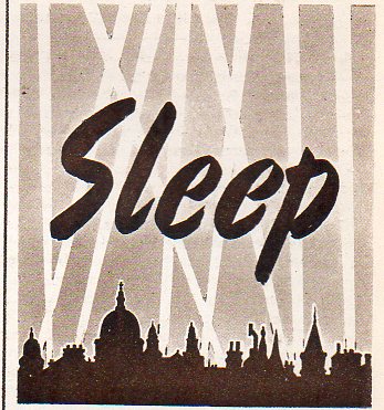

  • Sleep Aids for the Blitz, 1940

    JF Ptak Science Books   Post 2211

    Blitz sleep026

     Part of the winning-the-war effort in Great Britain in 1940 came with the expense of proceeding with as many normal bits of life as possible while still being bombed.  When this advertisement appeared in the Illustrated London News for 23 November 1940 the Battle of Britain–fought already for months and killing 24,000+ civilians (and wounding 30,000+)–had largely turned the corner though it would continue nearly half-way into 1941, with the more than 3,000+ civilians killed on 19 December 1940. It was in this issue that images from the Blitz at Coventry (from 14 November) are shared for the first time in this magazine–it was not the first raid on Coventry by any means, but it was perhaps the most infamous.  It was the belief at the time that continuous bombing of civilian populations (that is, “area” vs. “precision” bombing, which was theoretically outlawed in various forms by the Hague conventions of 1907 and again in the 1920’s and the Geneva conference on disarmament in 1932) would reduce the enemy’s will to fight–recognizing these rights of civilians in wartime was as little followed as the suspected moral-busting/war-ending reasons for the bombings were wrong.  

    Ads in the Illustrated London News were not very heavy at this time, and this was hardly the only ad making reference to the war–there were in fact a number of them using the war as a background to selling a product that really had nothing to do with the war effort.  For example, “Lorola” sold  a skin cream with a war-ish flavor, and Harmer’s was advertising stamp collecting as a way to understand the war.  There are others, like “Chilprufe”, who advertised their underwear “for national service”, which was partially true, as well as Players and Churchmans selling tobacco and cigarettes–mostly though those advertising goods for the war effort were so, like Burberry’s “RAF equipment”, Austin Reed for officers’ clothing, Hector Pave for “winning service” officers’ uniforms, Nicolls of Regent Street for ARP service coats, and the like.  Johnnie Walker had big color back cover ads, but they usually featured something war-related, like a war bonds booklet on a tray along with two glasses of Johnnie (neat).  Gunniess had a more humorous approach, for example, featuring an opened bottle of the great nectar and an empty used glass, with a taped notice “opened by censor” on the bottle. From my reading of LIFE during this time, the ads using the war as backdrop for non-war-effort goods in that magazine were far more common than those in the ILN–there were far fewer of those sorts of ads in LIFE by 1944, however.  

    ·Posted by :

    ·in:


  • Public Service and the War Production Board, 1942

    JF Ptak Science Books  Post 2173

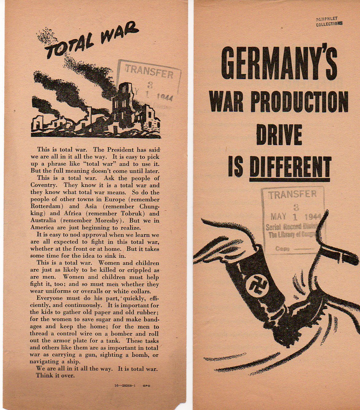
    The War Production Board (WPB)–the entity responsible for printing the leaflets below–was instituted 16 January 1942 as a federal effort to direct U.S. wartime production and allocation of essential commodities.  And time. The WPB centralized the effort to convert some peacetime industry to wartime production, as well as direct the production of existing wartime industries in the manufacture of critical goods, and rationed or prohibited the manufacture of other material that could possibly hinder the war effort.  Thus the WPB rationed things like sugar, heating oil, plastic, gasoline, paper, rubber, nylon and metals of all descriptions; it also controlled large swaths of the workforce, restricting wages and benefits as well as prices.   It was an essential element of fighting the war, and brought necessary control to an economy and industrial base that needed organization for what would become a total war.        

    War Production Board265
    Instituting a war-production base for American industry allowed production to ratchet way up, producing (for example) multiples more aircraft more in 1943 than in 1941:   1940, 6k aircraft; 1941, 19k; 1942, 47k; 1943 85k; 1944, 56k; 1945, 46k.  Also there were enormous production advancements for total shipping tonnage (reaching a wartime production total of 33 million tons), across-the-board huge increases in coal and iron ore (and especially in crude oil), and on and on.  The U.S. was able to mobilize itself and take advantage of its enormous natural resources, industrial base and civilian workforce in what was essentially an unreachable island economy, forming what was actually an unbeatable combination of war goods production. (Plus of course there was the atomic bomb, which is another story, but which also only could have been produced in the U.S., given the enormous quantities of energy and material needed to begin its production.)     

    ·Posted by :

    ·in:

    —

  • Rare Technical Report on the V1, January 1945, Reprinted in Full

    JF Ptak Science Books   Quick Post

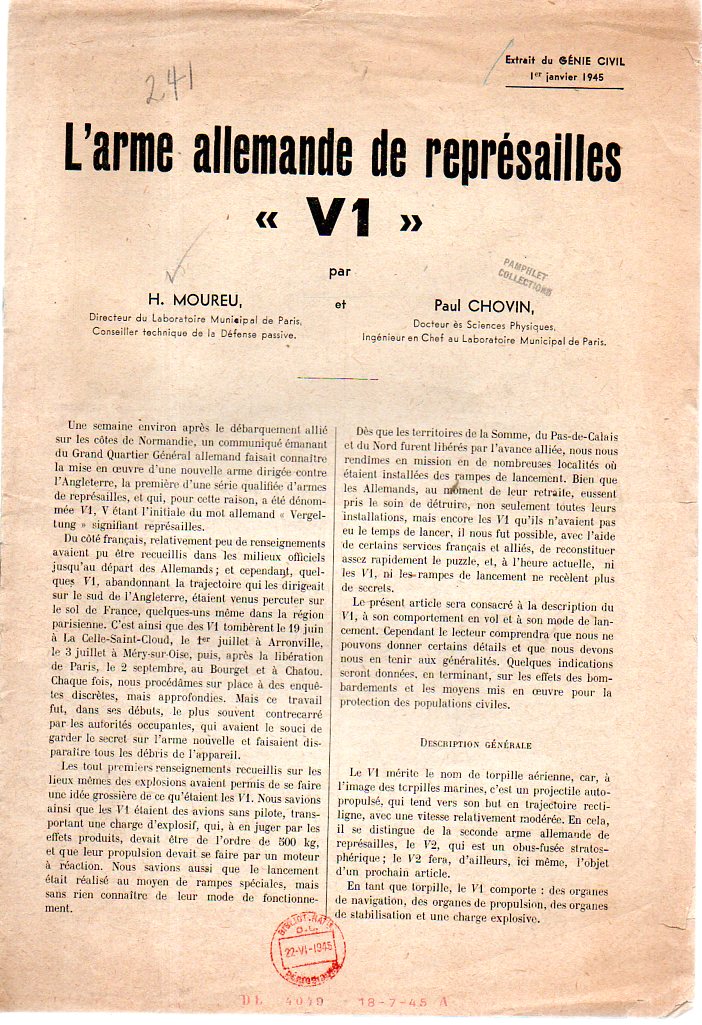
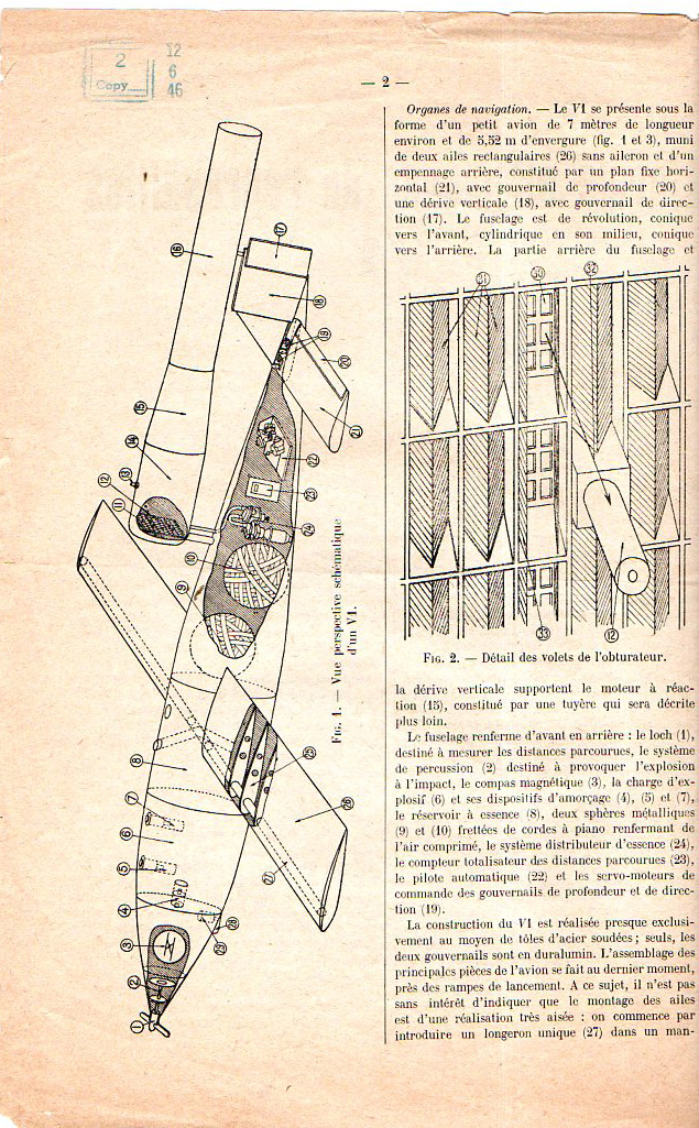
    I found this unusual report in the Library of Congress Pamphlet Collection stash here in the warehouse–surprised that it was printed, and surprised that it was printed in Paris in January 1945.  Paris had been liberated by this time, but I wasn’t so sure how much of this sort of technical data would have been liberated during the last stage of the war.  Of course the Germans were past the V1 with the V2, but, still, I thought it the data was unusual to find reprinted in a technical journal (Genie Civil, 1 Januar 1945).

    [Moreau, Henri (1893-1978) and Paul Chovin.  “L’arme allemande de represailles V1”, offprint from Genie Civil, 1 January 1945.  9×6 inches, 8pp, printed in Paris (newly liberated from the German army 25 August 1944) in early 1945.]  And for some reason there are no reprints of this available in libraries worldwide, or so says the OCLC/WorldCat catalog.

    I’ve reprinted the document below in its entirety. Some of the text runs off the side of the scanner, but that is the best I can do in scanning the pamphlet without taking it completely apart. 

    V1519
    V1521

    ·Posted by :

    ·in:


  • A Map of Nobody Marching Through the Southern Mountains, 1865

    JF Ptak Science Books   Post 2137  One of a series of posts on the History of Blank, Empty,and Missing Things 
    Follow Me on Pinterest


    Civil war--mil map sherman asheville188

    In the history of blank, empty, and missing things in maps there can be maps with large expanses of nothingness (as in the case seen here with the Bellman’s map from Lewis Carroll’s The Hunting of the Snark, an Agony in Eight Fits), maps with mostly everything that was to be expected to be expected but intentionally wrong (as with these propaganda maps of the Polish and Czech “threats” to Germany), maps with large expanses of nothing because there was simply so data to be displayed, and so on.  And then there are the cases of perfectly good maps that are accurate and secure, but do not display what was thought to be there on the map but wasn’t because it really wasn’t there. 

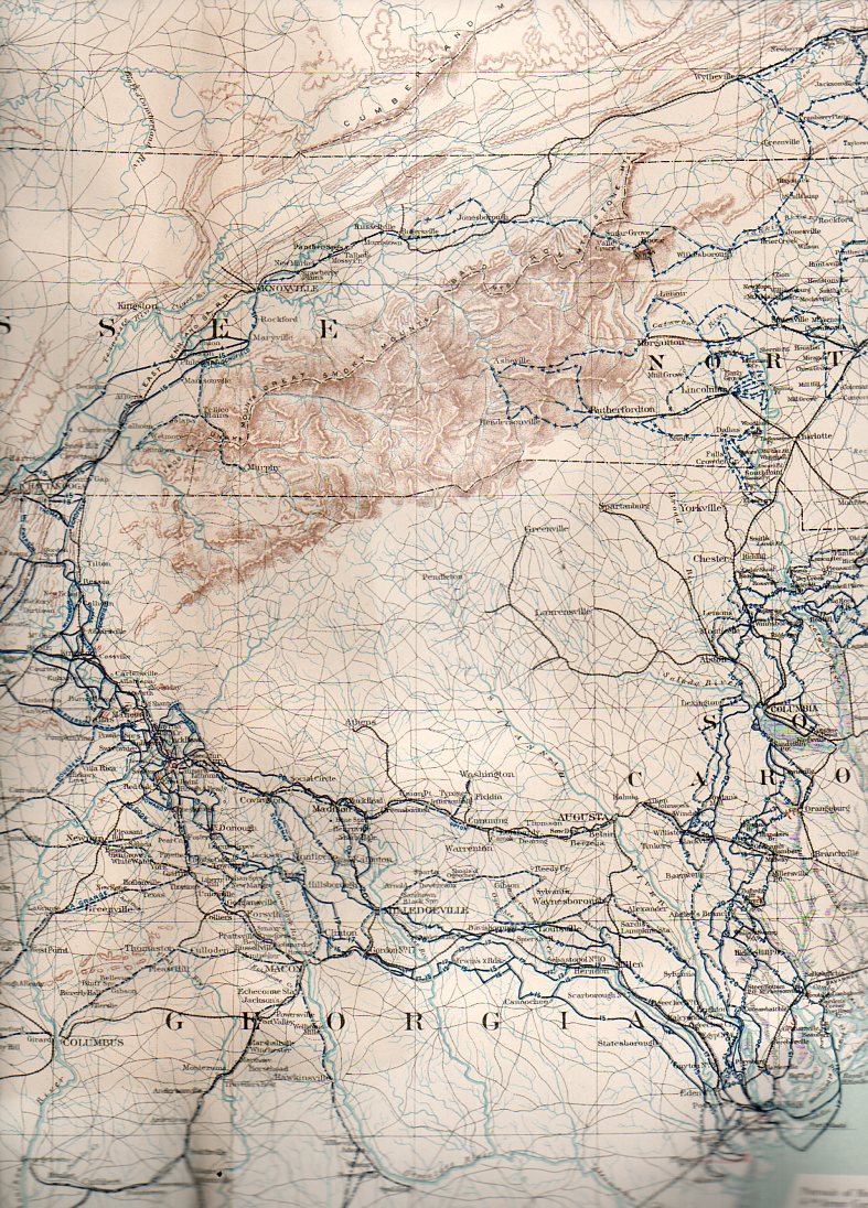
    In the store that I maintained in downtown Asheville, North Carolina, I was often asked about what sort of Civil War action occurred around those parts.  It is the sort of question that jumps out from maps showing troop movements during the war that you see on maps–maps without contour lines, or anything else that might show elevation. The answer to that question about Civil War battles here in the southern reaches of the Appalachians is that there was very little official action–and for the most part the reason for that is because there are in fact the Southern Highlands, and in the mid-19th century this very large region was just too bloody difficult to fight in or fight for. 

    This all becomes cartographically apparent when you look at the region with maps that give you an idea of the terrain. 

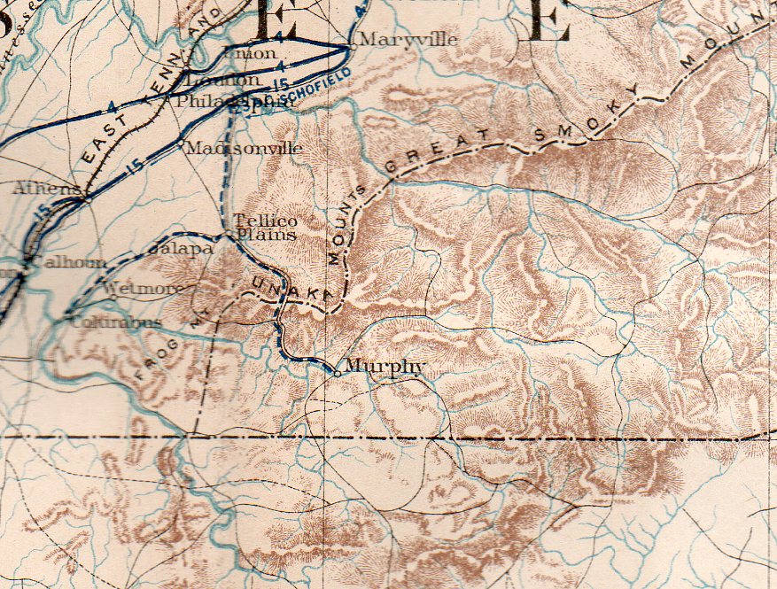
    There is an amazing map that shows you the extent to which this land was inhospitable for combat. The Military map of the marches of the United States forces under command of Maj. Gen. W.T. Sherman, U.S.A. during the years 1863, 1864, 18651…., which was originally published in 1865 but more widely known for its inclusion in the Atlas to Accompany the Official Records of the Union and Confederate Armies2 (full text here) in 1895.  As the map graphically shows, there are plenty of blu and gray lines depicting troop movements of the armies, though nearly all swarm around our mountainous region.

    http://farm6.static.flickr.com/5247/5281408282_bdec02e5a4.jpg

    Apart from the difficult terrain, the mountains, and general inaccessibilty, there wasn’t all that much to fight for up here–and so, aside from some regional skirmishes and a lot of political and social conflict, they didn’t.

    Civil war--mil map sherman asheville188

    At least not until the very end of the war, in the Battle of Asheville, April 6, 1865, where about 1500 soldiers met each other about 750 feet away from where we used to live, three days before Appomattox. The action there was indecisive, though Asheville was not taken by Union forces.

    And the detail:

    Civil war--mil map sherman asheville189

    Notes


  • Civil War Maps by the Great Mapmaker of the Confederacy, Jed Hotchkiss

    JF Ptak Science Books  Quick Post

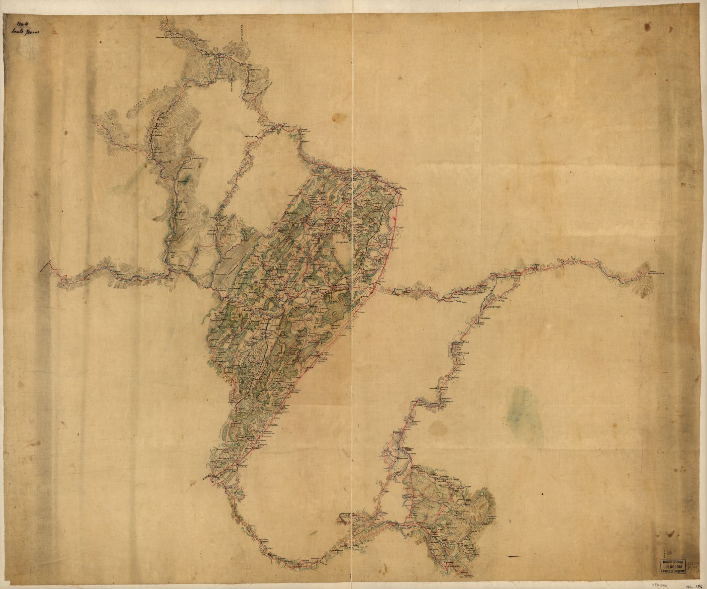
    I was searching for the “Make Me a Map of the Valley” map, the Stonewall-Jackson-directive map, that was made to devastating effect by the Confederacy’s leading cartographer, Jedediah Hotchkiss.[More on Hotchkiss here from the Encyclopedia of Virginia.] I saw this on display at the Library of Congress years ago–it is an enormous thing, about 22 square feet and more than 7 feet long (or tall, as it was displayed vertically then), filled with minutiae and just a splendid map of great detail put to extreme use by General Jackson (and Lee, and others).   The LC has the Hotchkiss Collection, their “jewel in the crown” of the Civil War maps there, and there is a great amount of it on display on the LC website.  The Big One, though, is not there in full.  I copied a few of some of the maps most interesting to me, and at the bottom is a link to the other 120 or so maps online by Hotchkiss.  

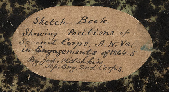
    Hotchkiss sketchbook cover copy

    [Above:  title for one of Hotchkiss’ workbooks, Sketch book of Jed. Hotchkiss, Capt. & Top. Eng., Hd. Qrs., 2nd Corps, Army of N. Virginia : [Virginia], “Shows general maps of northwestern Virginia and parts of
    Montgomery County, Maryland, with some showing roads, troop movements,
    and the names of some residents…”

    “The Hotchkiss Map Collection contains cartographic items made
    by Major Jedediah Hotchkiss (1828-1899), a topographic engineer in the
    Confederate Army. Hotchkiss made detailed battle maps primarily of the
    Shenandoah Valley, some of which were used by the Generals Robert E. Lee
    and Thomas J. “Stonewall” Jackson for their combat planning and
    strategy. Several of the maps have annotations of various military
    officers, demonstrating their importance in the military campaigns…”–from the LC site.  A good, long essay on the collection by Clara LeGear appears elsewhere on the LC site, here.

    All maps are expandable after being opened.

    Map of the Shenandoah Valley from Harrisonburg to Mt. Jackson, with
    topographical detail along the principal roads from Thornton’s Gap to
    Swift Run Gap and along several valley roads in northwestern Virginia:

    Hotchkiss mt jackson


  • Some Famous Military Pigeons

    JF Ptak Science Books  Post 2124 

    Follow Me on Pinterest


    Several years ago I purchased part of an archive of David Katcher, who was the founding editor of the journal Physics Today.
    Before that, several years before that, in 1945, David Katcher was Lt.
    Katcher, serving as a correspondent/writer in the public relations
    office of the U.S. Army Headquarters of the Western Pacific (GHQ
    USAFPAC). There’s a 6-inch stack of paper here with what seems to be his
    (and associated) mimeographed offprints of the daily grind of running
    the PR department of the Army in the Philippines, which, taken as a
    whole, is pretty interesting, showing the concerns and trials of the
    Army in reestablishing the government and infrastructure of the
    country.  Some of the individual reports/publications are stand-alone,
    straight-up fabulously interesting things, and so far as I can
    determine, have not been published anywhere else.  These two examples
    are both related to the subduing of the last remnants of the Japanese
    Army still fighting in the dense nether lands of northern Luzon, the
    Philippines, fighting after the surrender had been made (14 August 1945)
    and  signed (formally, on the USS Missouri, 2 September) , fighting after the war had ended.

    And in all of this comes this unexpected item, dated 1 October 1945, from “Headquarters. United States Army Forces Western Pacific, Public Relations Office, APO 707, General Release 56–Manila” and which–in the midst of the end of the war and the dropping of two atomic weapons–concerns a brave and battle-distinguished and heroic pigeon, “Blackie Halligan”. 

    “Blackie carried a number of messages to this location, one of which was
    extremely important because it gave the location of some 300 Japanese
    troops. He carried out this message despite being badly wounded. Word of
    his accomplishment reached General Patch, Commander of the American
    Division, who made a special trip to the loft where he decorated
    Blackie. Later, Blackie saw action at other islands in the Pacific.”–CECOM Historical Site, U.S. Army, source.

    Sometimes, in the midst of great loss in the throes of great victory, in the balance of stories great and true and tried, the small story of sacrifice may be the perfect antidote for large needs. 

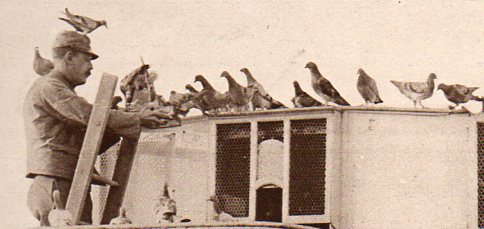
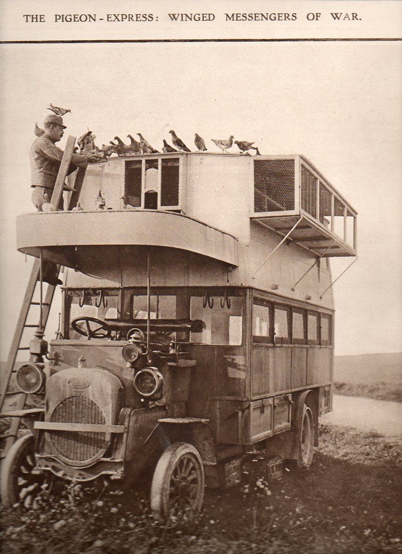
    There is of course a long history to the pigeon in war, and frankly I was surprised to find this story in 1945. Most of the famous pigeons of war come from the First World War:(the image below coming from The Illustrated London News for 2 October 1915):

    WWI--e---pigeon truck det644

    WWI--e---pigeon truck643

    ·Posted by :

    ·in:

    —

  • The Camera Obscura at War, 1885

    JF Ptak Science Books  Quick Post

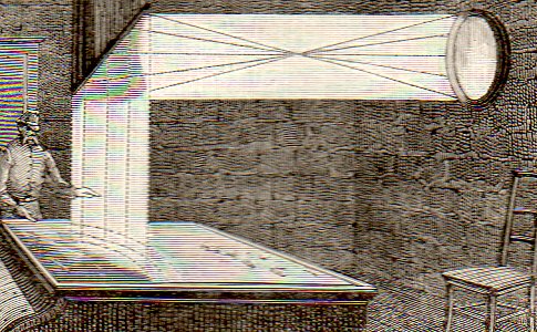
    I’m fairly well certain that I have never seen an image of a camera obscura being used for military purposes–until today.  I found “The Camera Obscura in Torpedo Work”, in the great scientific journal Nature, for 26 February 1885, pp 389-340.  Here’s a detail:

    Poker592
    the full article follows.  It makes sense, kind of a cyber-tool, a steampunk hologram in a way. And there it is.

    If you’d like to own the original article you may purchase it via our blog bookstore.

    ·Posted by :

    ·in:

    —

  • Richmond’s Libby Prison in Chicago

    JF Ptak Science Books   Post 2082
     
    Follow Me on Pinterest

    Confectionary connections to interesting bumps in history wind their ways along many unusual paths.  One such story is that of physician/scientist/collector Hans Sloane (1660-1753) and his introduction of chocolate into England (as a result of a field expedition he took to Jamaica)–his involvement with chocolate was minor compared to everything else he did in his life, but the introduction of chocolate to coffee houses in London was not.  In any event it was his massive and superior collection of natural history samples, archaeological artifacts, and much else, that became the basis for the British Museum–the collections purchased from his estate for 20,000 pounds at the time of his death. 

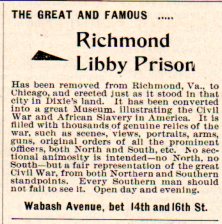
    Another example of a weirder candyland adventure is that of Charles Gunther (1837-1920), who was the driving force of moving the infamous Confederate Libby Prison to Chicago in 1893 to house his own collections of Civil War memorabilia and other interesting and Mondo Bizarro things. (He claimed to have–on exhibition–the original skin of the serpent from the Garden of Eden, complete in some sort of original frame decked out in Egyptian gibberishglyphics.) Here’s an ad that appeared in the Confederate Veteran‘s first year of publication in 1893:

    Libby436

    I wouldn’t use the term “great” here–and I’m pretty sure that the word is being misused here in 1893 as well.

    The prison was actually a converted tobacco factory, the buildings of which were constructed from 1845-1852, and located in central Richmond at Main and 25th Streets. Poor Luther Libby–a Mainer–came into possessions of the buildings for his business, which was subsequently seized by the Confederate government at the beginning of the war and converted into a hospital/officer’s prison before it became the symbol of mistreatment and deprivation and harshness.  (Mr. Libby had nothing to do with the prison per se–he was just the last person with his name on the buildings.  He outlived the prison-with-his-name-on-it by 15 years–12 years if you count the use of the building to house Confederate leadership after the end of the war.)

    Gunther collected big stuff, the biggest being the prison. He purchased it and had it dismantled, shipped up to Chicago, and then reassembled (with the help and advice of the prestigious architecture/design firm of Burnham and Root) where it operated as a museum from 1889-1895. Sensing a brighter future for the property, Gunther dismantled the building selling off chunks of it as souvenirs, and built a convention center on the site, filling the need for meeting space from the burning of the Chicago Coliseum in 1897.

    This post could have gone another way very easily, winding up in the Things Out of Place Department–Libby in Chicago, the Statue of Liberty in Paris, London Bridge in Arizona, a duplicate Earth in the sky above the Earth,and so on–perhaps this on another day. 

    On the Libby Prison relics from Chicagohistory.org 


  • Big Time Big Bombs–Great Infographic, 1917

    JF Ptak Science Books   Quick Post 
     
    Follow Me on Pinterest

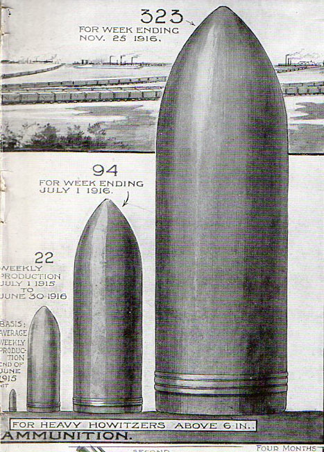
    I don’t often see graphical displays of quantitative data utilizing quite so many images of shells, even when the image is comparing ammunition production.  This striking example is found in The Illustrated London News for July 15, 1917. 


    Bombs994