A Daily History of Holes, Dots, Lines, Science, History, Math, Physics, Art, the Unintentional Absurd, Architecture, Maps, Data Visualization, Blank and Missing Things, and so on. |1.6 million words, 7500 images, 4.9 million hits| Press & appearances in The Times, Le Figaro, Mensa, The Economist, The Guardian, Discovery News, Slate, Le Monde, Sci American Blogs, Le Pont, and many other places… 5000+ total posts since 2008.

Category: History of Lines

  • The History of Lines: Representing the Unknown (1828)

    JF Ptak Science Books   Quick Post

    The History of Lines series

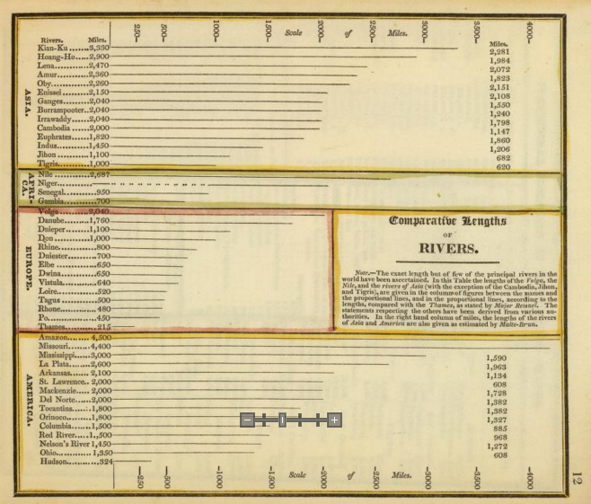
    This is another entry in a series of posts on maps and the representation of quantitative data, this one being early in the development of this genre of imagery.  The map (a little guy at 5×7″) is from An Atlas Accompanying Worcester’s Epitome of Geography, published in Boston by Hilliard, Gray & Co., in 1828. 

    Comparative River Hilliard detail

    [Source: Images of the Hilliard map found at David Rumsey’s map website, here: http://www.davidrumsey.com/luna/servlet/s/xz62g8]

    In the 46 river lengths displayed here, 45 have distinct measurements; one–the Niger–does not, or almost does.  The indistinct and suggested delineation shows what was know of the river, and what wasn’t, with bits on either side of the middle section (reached and surveyed by the fabulously-named Mungo Park, 1771-1806, at the turn of the century). Much of the Niger wasn’t well known at this point, though it had been plotted in part since antiquity–with all of that the overall length was well approximated (very close to its nearly-2500 mile length, the main river in West Africa).  The line/dot combination was an honest approximation of displaying the river’s length, and not often seen.  
    Rivers comparative Hilliard


  • The Somerset Coal Strike, 1922/3

    JF Ptak Science Books   Quick Post     History of Lines series: Strike Lines

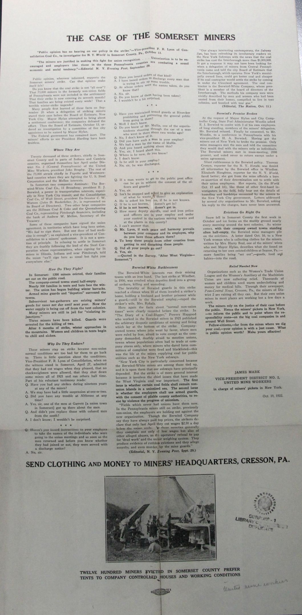
    This is a rare broadside (about 24″ tall) seeking household items and money for the relief of the striking workers of the hard/tough/brutal Somerset Mine strike of 1922-3.  The miners struck for union representation from the United Mine Workers against the Berwind-White Company, which ran a very tight ship, evidently. The miners for Somerset lived in a classical company-town existence, with their pay being mostly entirely absorbed by the company via rent for company-owned houses, stores, food, water, and so on, all aspects of life controlled by the employer who/which retrieved the salary of its underpaid workers by controlling all aspects of the workers’ lives. So the miners struck for representation from the union for more money and management resisted, especially since it would cost them profit during a year that saw coal production falling by a third.  So the strike began and lasted from 1922 to 1923, during which Berwind-White employed scabs and security and thugs to intimidate and control their workers, evicting 1200, sending hundreds of families into a Pennsylvania tent life for the winter, stopping the flow of water, and general thuggery.  The strike ended unsuccessfully in 1923, though the union came in by 1933. 

    Reading this summation and plea is a heartbreaker, and will no doubt make a person appreciate the idea of unions, especially in the U.S.A. of the 1920’s/1930’s.  


    Coal strike somerset

    ·Posted by :

    ·in:

    —

  • History of Squares-within-Squares

    JF Ptak Science Books   Quick Post

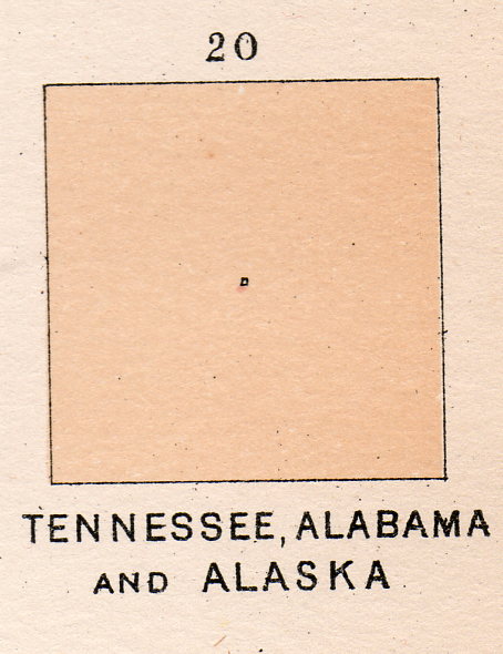
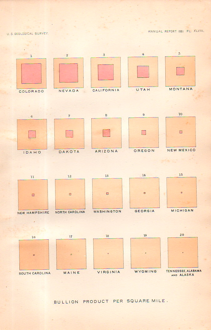
    This square-within-a-square appears in a table of squares in several pages of square collections. They represent “Bullion product per capita” for U.S states and territories, and published in the U.S. Geological Survey Annual Report for 1881 (plate XLIX).  The “bullion” is silver bullion, and as we can there twelve leading states for silver production worth discussing before the rest become melded into one solid whole in square 13.  It is a beautiful display, in its pre-non-representational-art sort of way.  Kandinsky was still more than 30 years away from calling this sort of thing “art”, and the representation itself was 95 years after the first graphic displays to convey info (in Playfair’s Commercial and Political Atlas of 1786)and still, it is very captivating in a simple, squarey sort of way. 


    Squares, history of141


    Squares, history of140


  • History of Lines: Chronology of European History, ACE 14-1813

    JF Ptak Science Books  Quick Post      History of Lines series

    MAPS--PANTOGRAPHY 4 DETAIL158

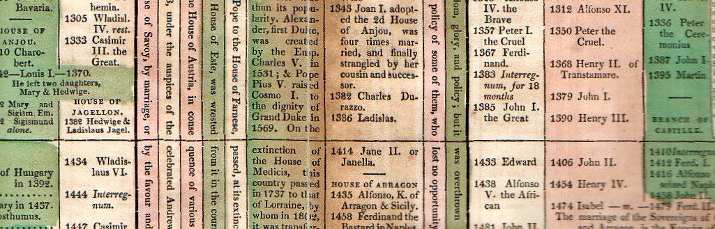
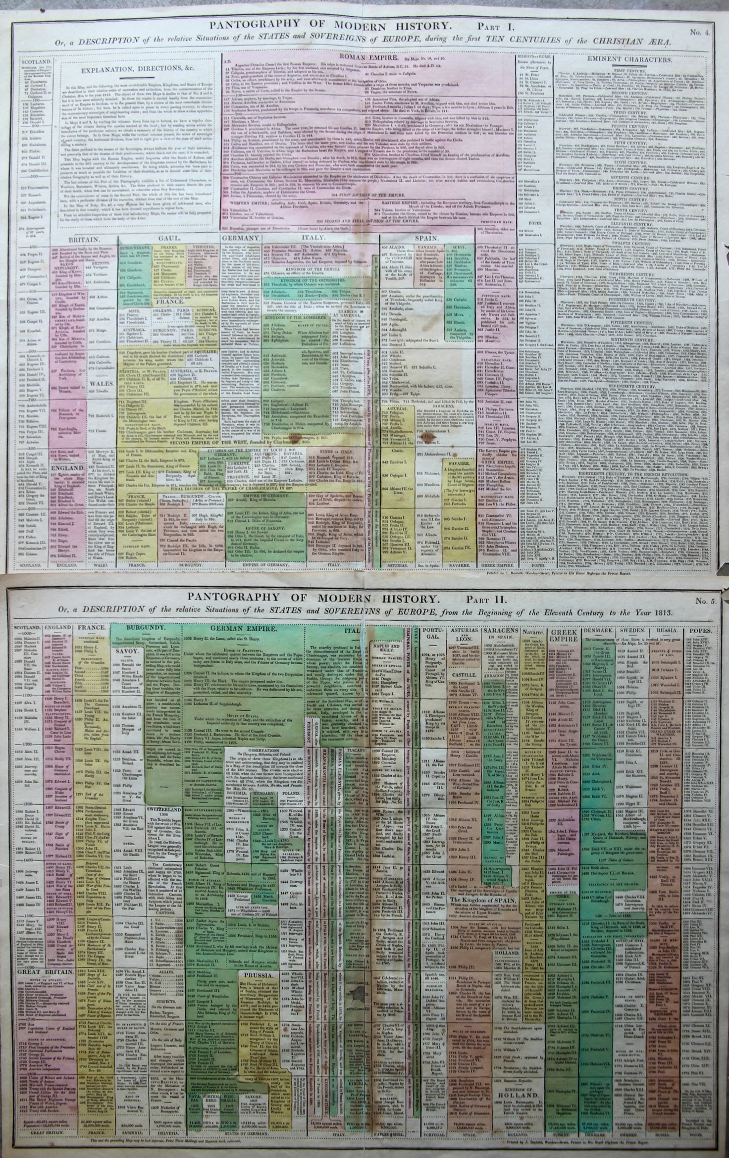
    The “Pantography of Modern History” packs a lot of information into a relatively small space, surveying a good chunk of the history of the West from the year 14 to 1800.  (It is very similar and may be a pirated English version of a French effort that I describe in this post, earlier on this blog.) The sheets are 16×20″ making the full pantography 32×20″ or so–I reckon that there are about 1000 data points on the four square feet or so of paper.  There are some descriptions of events but most of the effort is keeping the ruling heads in order.  This version is a little easier to follow than the French because the design is somewhat sparser, making the bits easier to discern.

    Maps--Pantography _3_

    I’m a big fan of this sort of data display.  

    • Published in Lavoisne’s Complete ….Geographical Atlas, printed by J. Barfield,  1815. “Pantography of Modern History. Or, a Description of the relative Situations of the States and Sovereigns of Europe, during the first Ten Centuries of the Christian Era” Accompanied by “… from the Beginning of the Eleventh Century to the Year 1828”. 

  • Multiple-Maginot and the “Floating Wall of Fire” (Romania, 1940)

    JF Ptak Science Books    Post 2430
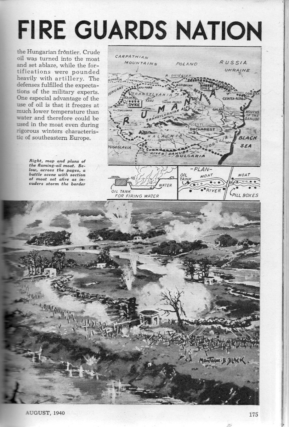
      Fire wall872Fire wall871

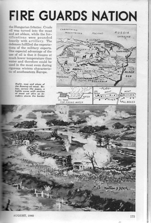
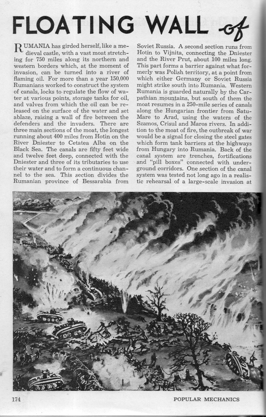
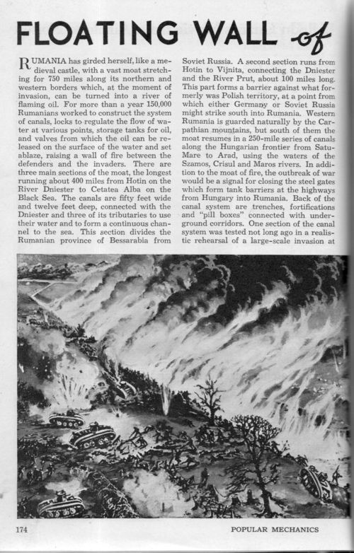
    In August 1940 Popular Mechanics reported on another example of cloudy thinking on the coming world of warfare–the “Floating Wall of Fire” of Romanian defensive consideration.  The article tells the story of how Romania “girdled itself, like a medieval castle, with avast moat stretching for 750 miles….which, at the moment of invasion, can be turned into a river of flaming oil”.  The canals which make up this open-pit Maginot line were 50′ wide and 12′ deep, the longest of them running some 400 miles, the combined efforts of the big dig meant top protect the country from invasion from Hungary, Poland, the Soviet Union, Yuoslavia, and Bulgaria–and of course from Germany which at the time could advance from a number of different positions.  There were also hundreds of gun emplacements facing the pit, I guess to fire on whomever if they decided to try and break through/over the moat, which would have been flooded with crude oil and set ablaze when invasion occurred.

    The problem of course was that even a year after the Blitzkrieg in Poland with the combined assault by land/air forces the lesson had not been learned here–unless of course the flames were 20,000′ high.  And obviously the river of fire would last only so long–depending on available amounts of crude oil I wonder how long they determined the wall of fire could be maintained?  A day?  A week?  (I know that from controlled burns of oil spills that in one case some 16,000 barrels of floating oil was burned off in a controlled burn in about four hours–it seems to me that if there was an invasion front that was miles wide and striking at numerous point along a 100-mile front that…well, the problems are obvious.)

    Could anyone have expected an invasion force to arrive and then once confronted by a burning moat turn back and retreat?  

    In spite of fulfilling expectations during a “rehearsal of a large-scale invasion”, it seems very highly dubious that anyone could really have been comfortable with the first line of national defense being fire in a long hole.  

    [It should be mentioned that after the once-neutral-ish Romania settled into its relationship with the Axis that the worst single-mission air losses for the U.S. Army Air Force occurred in the bombing of petroleum facilities in the area of Ploiesti, Romania, on 1 August 1943. In an unsuccessful attempt to damage the flow of petroleum to Axis forces, Operation Tidal Wave targeted this location but with devastatingly bad consequences, with 53 aircraft and 660 servicemen lost in the action.]  


  • On the Origins of Ripples (1883)

    JF Ptak Science Books     Part of the series on the History of Lines

    Seems like an easy topic–it isn’t.  

    Perhaps there are no more “basic” a collection of lines than those made in sand, either at the beach, in water, or in the desert, created by water or wind, changes to the surface of a mass at the intefave of the fluid.  They seem to be about as basic as things can be, line-wise, or at least in lines that can be found in nature and not made by humans.   These lines are called “ripples”, and ripples have numerous names and classifications.  Not  many, though, in 1883, where I found this lovely article in Nature by Charles Darwin’s son, George.  (This is a shorter version of a 25-page earlier paper “On the Formation of Ripple-mark in Sand,”  In the Proceedings of the Royal Society, November 22, 1883, vol. 36.)

    It  is a wonderful thing this thinking on the movement of sand, and dirt, these wave-formed ripples, created in forms straight, sinuous, cantenary, lingoid.  It also is followed closely in by George Darwin’s article on the formation of mudballs (volume 27, page 507). Who could not but read an article like that? 

    Also it brought to mind his father’s Power and the Movement in Plants, and specifically a letter to the editor of Nature in the April 28, 1881 issue of Nature, “The Movements of Leaves” in response to bright light…)

    ·Posted by :

    ·in:


  • History of Lines–Straightening out the Thames

    JF Ptak Science Books   Quick Post

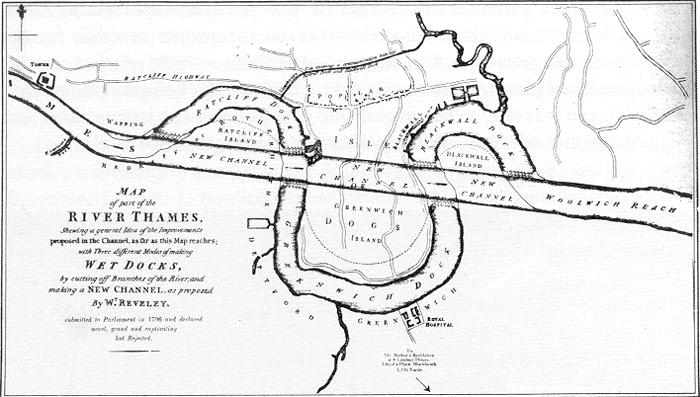
    The architect Willey Reveley straightened out curves and curved out straight lines. 

    Thames River straightening

    Source: Wikimedia. 

    As we can see here he had the idea of constructing a straightaway through the three famous bends of the River Thames in East London.  The straight part would be used for commerce while the bends would become docks and yards.  

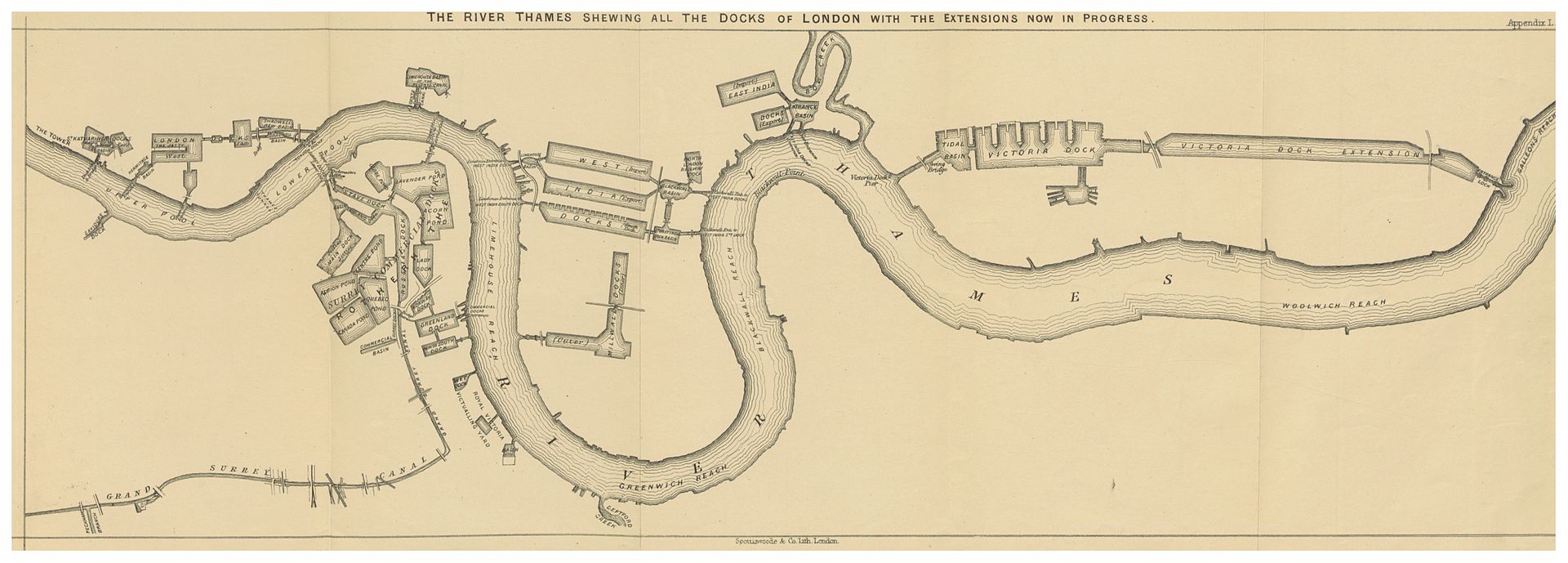
    Another vision by Reveley is seen below, from page 113 of Alexander Forrow’s The Thames and its Docks, a Lecture (London), 1877 (the full text available at the Internet Archive):

    River thames 2Source:  Wikicommons 

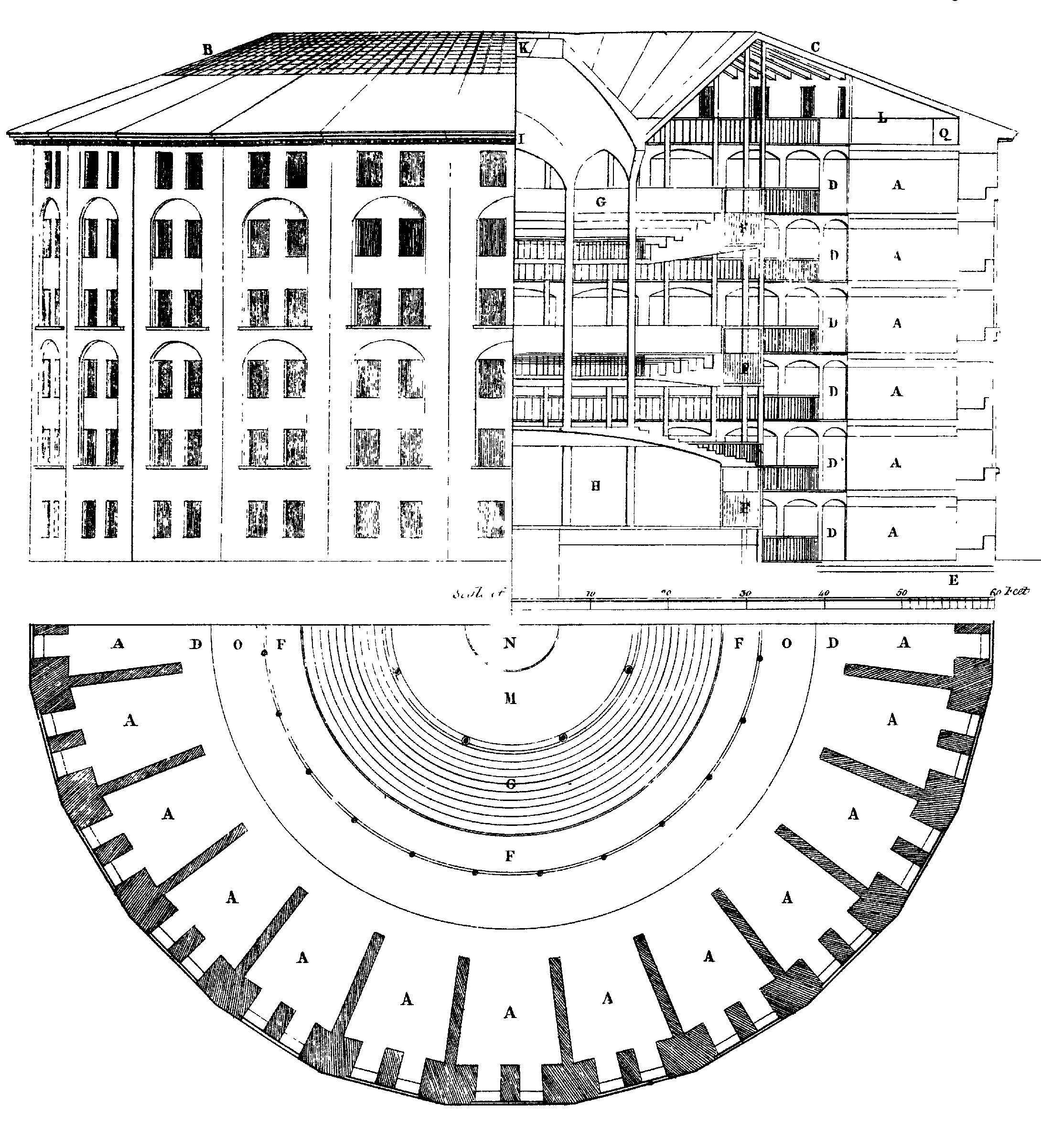
    With all of this straightening-out of the river thinking going on in Reveley it is interesting to see that when he applied his brain to the the world of very straight lines as they exist in prisons that he went the other way–following the idea and commission by Jeremy Bentham, Reveley created plans for a circular prison. Bentham’s Panopticon was an idea that wouldn’t leave Bentham and occupied at least one small part of his brain throughout the 1790’s–I’m not sure where in Reveley’s head the idea lived, but it didn’t live there for long, as the architect died at a very young 39 in 1799. Bentham (born in 1748) lived until 1832, and never did see his Panopticon constructed. (Then again, he may come to see it if someone showed it to him, as his head has been preserved as an on- and off-again display at University College…)


    File:Panopticon.jpg

    Source:  http://upload.wikimedia.org/wikipedia/commons/1/11/Panopticon.jpg


  • Tubes, Pipes, & Sheets. And Some Nazi History.

    JF Ptak Science Books   Quick Post

    My experience with technical and industrial product catalogs (1900-1950) is that they have the potential for superlative or at least challenging design. Such is the case for the following catalogs issued by Mannesmann Export of Dusseldorf.  The designs are unexpected, sharp, colorful, heavy, and anything but the spareness of its product. The catalogs below were all issued in the 1950’s. 

    Tubes pipes636

    ·Posted by :

    ·in:


  • Confirmation of Einstein’s Theory of General Relativity, 1919

    JF Ptak Science Books    Quick Post

    “It is concluded that the sun’s gravitational field gives the deflection predicted by Einstein’s general theory of relativity.”

    I’ve bumped into a famous piece of phsyics history, a semi-popular report on the verification of the Einstein theory of general relativity. The article is “Eclipse Photographs Verify Einstein’s Prediction” adn is found in  Popular Astronomy (published in Northfield Minnesota, volume 28, 1920, the issue for January, #1, 1920, with the notice appearing on pp 69-70.) At about the same time there appears the famous and deciding report by F. W. Dyson, A. S. Eddington, and C. Davidson, “A Determination of the Deflection of Light by the Sun’s Gravitational Field, from Observations Made at the Total Eclipse of May 29, 1919” which appeared in the Philosophical Transactions of the Royal Society of London. Series A, Containing Papers of a Mathematical or Physical Character for 1920 (pp 291-332). This is the integral report on  which Popular Astronomy reports on for a more general astronomy readership.

    This report repeats the famous finding: “It is concluded that the sun’s gravitational field gives the deflection predicted by Einstein’s general theory of relativity.”

    ·Posted by :

    ·in:

    —

  • History of Lines series: the Geometry of Cannon-Fire (1812)

    JF Ptak Science Books   Post 2369

    Cannons ha003
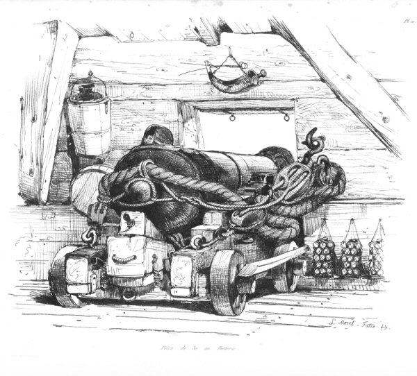
    There were many integral components to firing a cannon on a ship, not the least of which were the Powder Boys, the small, young, semi-strong kids who would run the gunpowder from a below-decks armory to whatever gun deck was needed.  It was a relatively simple procedure, filling up a longish tube (cannon  derived from the Italian  cannone–or large tube–which came from the Latin canna from the Greek  kannē , meaning something like a reed or any similar hollow thing) with gunpowder and then cannonball/shot and then wad, then causing the gunpowder/propellant to ignite and throw the ball.  Basically, that was it, though you needed to maintain the cannon, aim it, and so on (don’t forget to first swab the bore from unexploded gunpowder so you don’t blow things up!).

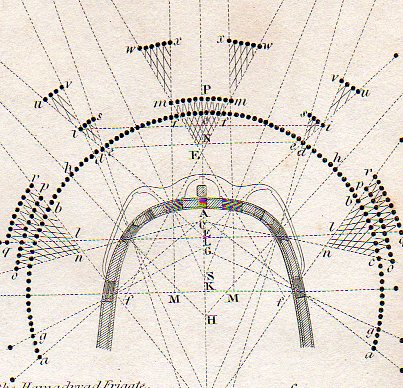
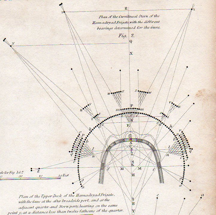
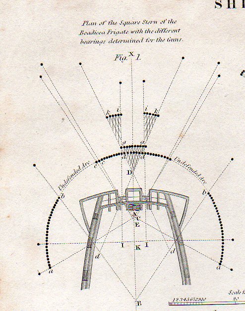
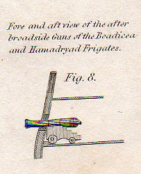
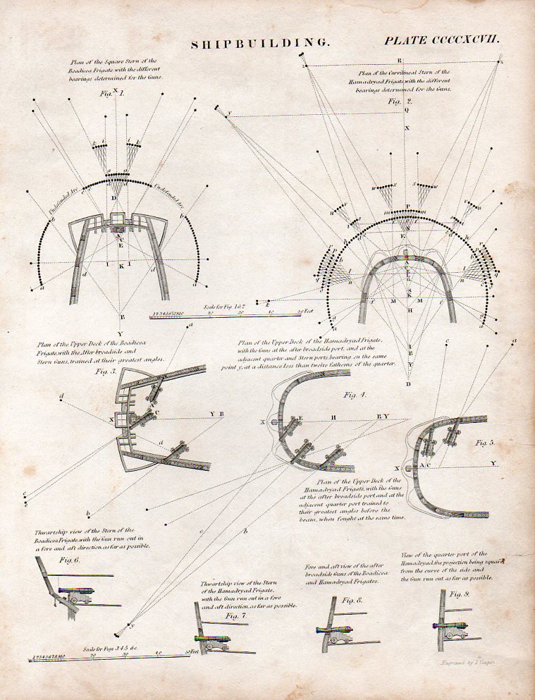
    The (first)  image above of found modernist/semi-dadaist artwork comes form 1812 and was found in Rees’ Encyclopedic Dictionary from the article on “Shipbuilidng”   and illustrates the ways in which the stern of a ship can be outfitted with cannons–actually, the sterns of the HMS Bodiceae (28 18-pounders)  and HMS Hamadryad  (36 guns). Also by this time cannons had been carried on naval ships for nearly four hundred years, while the first cannons appeared on the ground in Europe another few hundred years before that. 

    Cannons ha002


    In the third detail (below) we see the coverage of the four cannons placed in the stern of the Bodicae, mainly pointing out its weaknesses, showing the undefended arc, which comprises about 1/3, or about 60 degrees of the defensive posture.  The Hamadryad on the other hand shows 100% coverage of the 180+ degrees of attack possibilities shown, along with secondary and teriary areas of fire coverage covered by more than one gun.

    Cannons b004 

    A fine,tiny detail from the full engraved sheet:

    Cannons little005And the full sheet:

      Cannons001

    This is pretty much all that was needed to fire a cannon, except the men of course.

    File:Antoine Morel-Fatio pl10.jpg