A Daily History of Holes, Dots, Lines, Science, History, Math, Physics, Art, the Unintentional Absurd, Architecture, Maps, Data Visualization, Blank and Missing Things, and so on. |1.6 million words, 7500 images, 4.9 million hits| Press & appearances in The Times, Le Figaro, Mensa, The Economist, The Guardian, Discovery News, Slate, Le Monde, Sci American Blogs, Le Pont, and many other places… 5000+ total posts since 2008.

Category: Maps, Cartography, History of Mapmaking

  • Pale Horses and the Lake of Fire: a Map to the End of the World

    JF Ptak Science Books LLC  Post 649  Blog Bookstore

    There are, in my experience, very few antiquarian images
    depicting the end of the world in which we see the entire globe exploding or in
    pieces or in flames. This sort of image gets more play in the 20th
    century, especially after 8 August 1945, but prior to that it is really very
    scarce.  I own a few images that appear
    in the 17th and 19th centuries, and another from 1929 (Das Weltbild which show a “giant ice
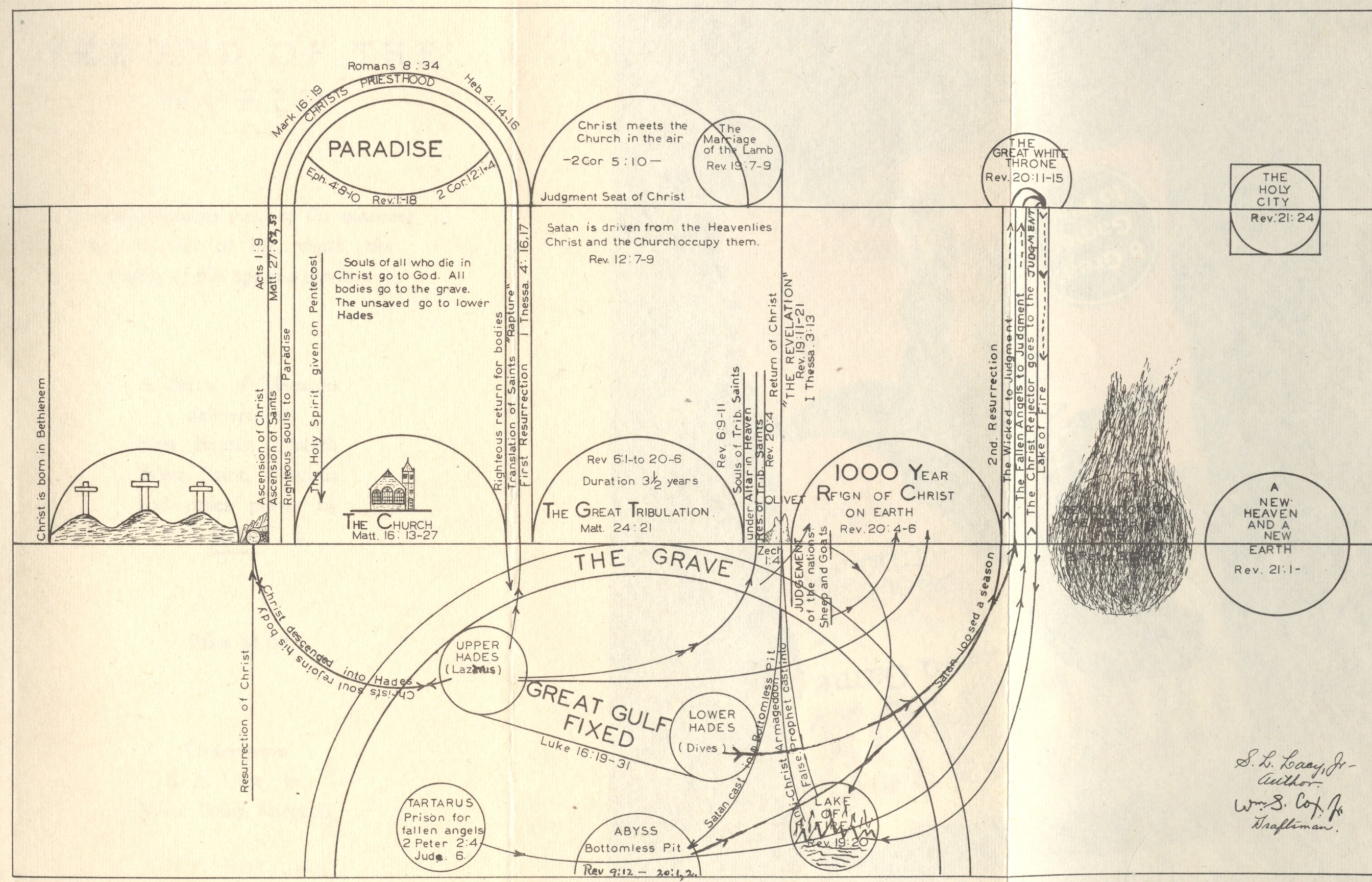
    ball” colliding into and completely destroying the earth). .  Then there is this new find, S.L. Lacy’s The End of the World, (necessarily) self-published
    in West Point, Virginia, in 1941.  It is a short and stocky, and bound in orange
    wrappers—its spine title (The End of the
    World
    ) begs the casual reader to pull it from the shelf. It’s a simple
    book—studying the Bible prophecies and revelations on the end of all things—and
    it annoys and is insulting but doesn’t disappoint.
    Blog--jun 13 end of the world

    I
    started to breeze through the book (back-to-front as always) and opened the
    book to Chapter XIII, finding this delicious chapter heading:  “The Chronological Order of Final Things”,
    this being a full page pre-PowerPoint summation of the time-shrinking fireball
    that is rolling inexorably towards us all. 
    To say that one is able to put a period at the end of the world’s flow
    of time, that someone is able to identify the point in the future where the
    future is no more, is “presumptive”–this in the most understated
    fashion as to offend even the highest of high-Victorians’ sense of restrained
    propriety.  Wrapped in a comfortable
    Christian chrysalis of pre- and post-apocalyptic religious certitude, Mr. Lacy
    delivers his interpretation of biblical prophecy for the coming of the end,
    hustling it to the front of the religious line of things to come.

    It seems that in 1941 the end was beginning, and Lacy saw
    all of the images implied by prophecy that were necessary to announce the
    glorious final days of broad retribution. This includes the list if the ten
    things indicating “the sign of The Times”, one of which (Number 5)
    was “The Automobile” and another (Number 7) was “Increased
    Knowledge and Travel” (announced by Nathum 2: 3,4 and old dependable
    Daniel. 12:4, respectively.  There’s
    nothing that doesn’t fit into Daniel’s visions or revelations, though Mr. Cash
    has certainly made a lovely song of them.) 
    When everything fits perfectly into a predictive model with no possibility
    of falsification (or of proof or disproof), then the model has no validity
    outside of a belief system in itself. Very tidy.
    Blog--jun 13 end of the world det

    It is an annoying, cloying minor treatise, promising little
    more than The Lake of Fire awaiting almost all of us, even the sleeping dead,
    who would be scraped from their graves to be spit into this burning
    tragedy. 

    Lacy does a lot of inspired interpretation and
    philosophizing, much of which he doesn’t seem to bother separating from
    biblical quotations—I don’t think it is intentional, just bad writing.  A random
    find in Lacy’s thinking dislodges the following  nugget:

    “Satan is in the atmosphere above the earth, with access to
    heaven and earth with a circumscribed power over the atmospheric elements and
    the earth including the inhabitants”. 

     Oh dear.

    But enough of this nonsense. What brought me to this work is
    the folding schematic map at the front of the book.  It is a slightly complex jumble of
    semi-circles and circular reasoning, and I have no interest in straightening
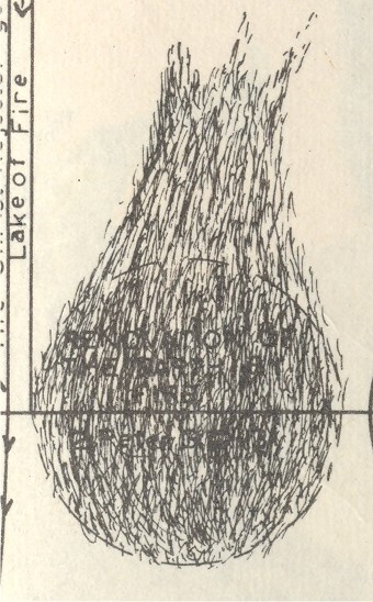
    out this jumbled linguine. What has my interest is the dissolving Earth part of
    the diagram, a part of the dead earth that comes between Calvary 
    and Heaven-on-Earth.  What makes this
    image different from the others though is that the Earth reappears—different from
    its former self having been vanquished and cleansed by all consuming fire, but
    the Earth nevertheless.  Or something
    like it.  Or nothing like it. 


  • Blank and Missing Things: a Map of Missing People of Central Europe and Russia, 1881

    JF Ptak Science Books LLC   Post 636  Blog Bookstore

    The History of Blank, Missing and Empty Things (Thread, #45)

    “Heaven and earth were one form…. (then they were separated
    from one another…)”

     In ancient times the representation of the gods and beliefs
    was handed from one writer or storyteller to the next, on and on, changes here
    and deletions there, for many generations. 
    This practice was possible (necessary?) because there really wasn’t a
    solitary scripture to follow (as in the Koran or the Bible) and no priestly
    class to guard and cherish a particular strong story line in all of its barbed
    details.

    Juden_1881  

    There are of course bits that have survived intact for
    millennia.  One of these is this fragment
    from one of Euripides’ lost plays (only 20% or so are complete), The Wise Melanippe, and begins a
    statement of cosmogony that states the creation of all things.  The separation of heaven and earth has always
    stuck with me, because this separation begins with Euripides with the creation
    of the world seems to continue on its way with mini-separations of all things
    over the course of time—like the cosmological world-bearing turtles—all the way
    down.  I’m not sure how or who exactly
    did this heaven-rending, or to what force it owed its being:  evidently the Presocratics tended to
    depersonalize the actions of the gods and grant their actions to natural
    forces, so the issue with the heaven-separation business may well have been a
    motive force rather than a god.  Anyway
    it’s the tearing apart, the removal, the separation phenomena that got my
    attention to begin with, and one which has stayed with me, though I’m sure that
    Euripides didn’t have that sort of violent rending in mind while describing the
    birth of the earth.

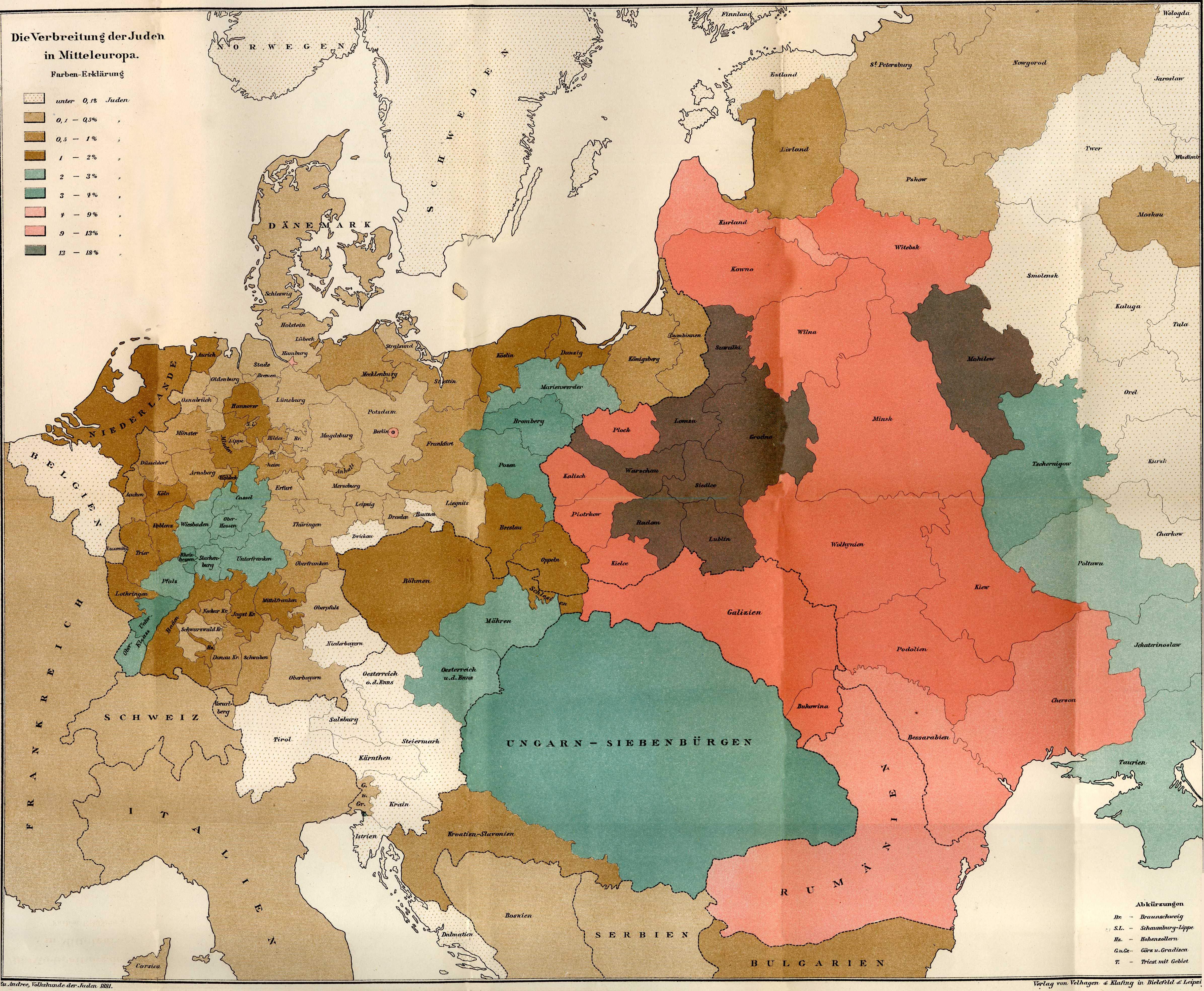
    And so it is with this map* showing the concentrations of the
    Jewish people in Europe  in the late 19th
    century. Between the time of the publication of this map—1881—and the beginning
    of the Nazi regime in  Germany
    in 1933, there were many persecutions and Pogroms and deportations of the
    Jewish people.  Nothing prepared anyone
    for the concentration camps and the systematic extermination of that people
    between 1935 and 1945.  What this map
    shows is the distribution of the Jewish people (by percentage of the total
    population) before they were eviscerated: 
    the difference between this map in 1881 and the map of 1945 would be completely
    different.  The Jews were gone:  killed. 
    Some deported.  Others
    escaped.  But they were basically torn
    from Europe  in the cruelest manner so that in
    almost every case the only indicators of their existence were shadows. 

    There are large-scale maps of this sort of evidence for
    other groups of people in their pre-Euripidean tearing from
    their home:  maps showing the locations of Indian tribes
    in North America (pre-Columbian, 17th
    century, 19th century, they’re all telling pretty much the same
    devastating story) is one good example of a slender category.  There aren’t maps for the mass extermination
    by starvation created by Joe Stalin, or the millions murdered by Pol Pot or Mao.  There are of course more small-scale,
    localized maps depicting the results of forced relocations or devastating war
    or drought or hunger or floods.  But few,
    I think, take such a compelling x-ray of a people’s past on a continental scales
    such as this. 

     *”Die Verbreitung der Juden in Mitteleurope”  found in  Richard Andree’s , Volkskunde der Juden…,  Verlag von Velhagen & Klefirg in Bielfeld und Leipzig:  1881. 


  • Nazi Propaganda and the Battle for Europe, 1941: the War at Sea

    JF Ptak Science Books  Post 624   Blog Bookstore 

    Propaganda Series #  14  (See listing below)
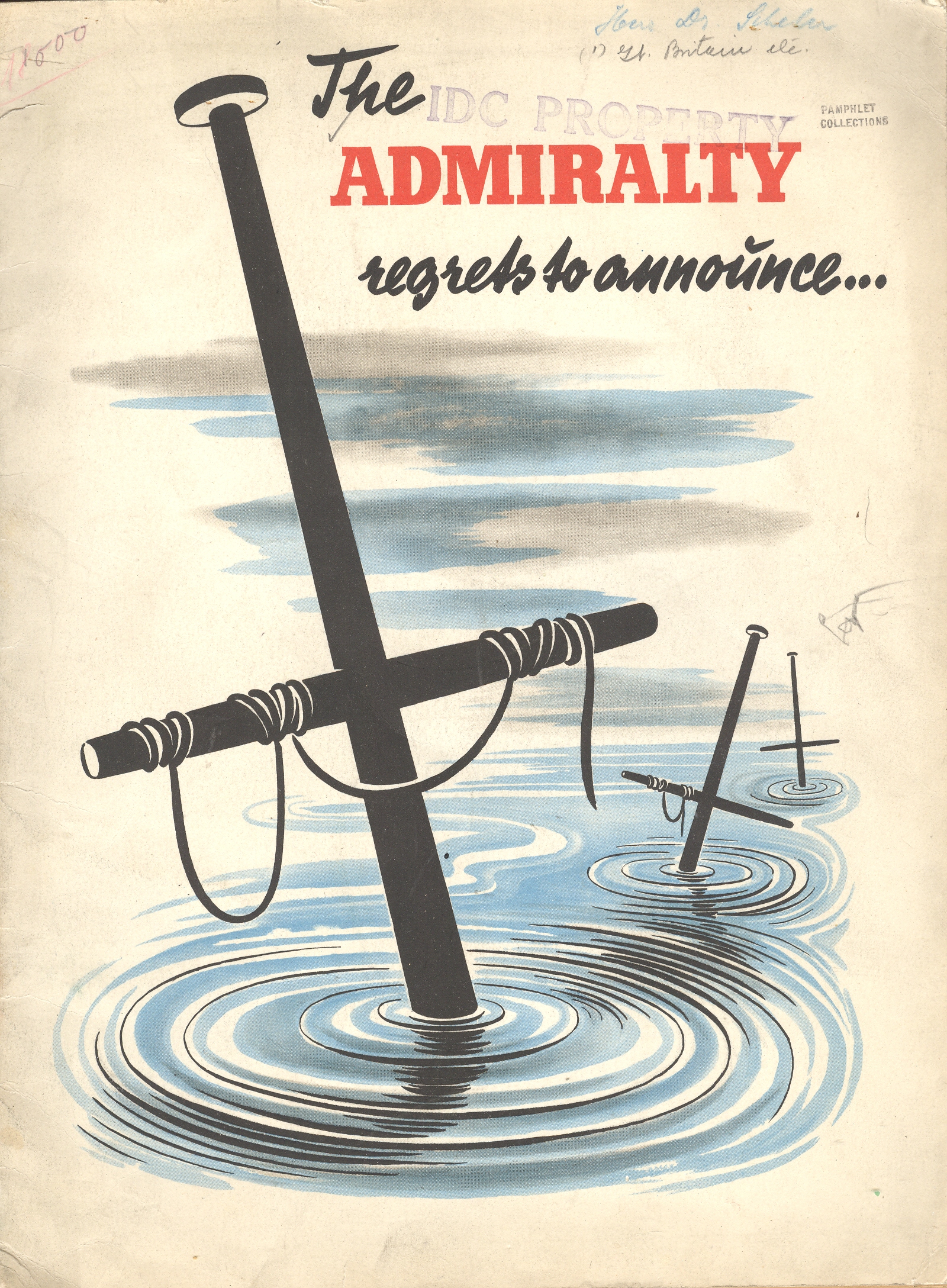
    Blog--May 24--regrets The Admiralty Regrets to Announce… was for years the standard beginning to an official British announcement concerning the loss of ships and sailors.  The phrase is used as the title to this work (by an unattributed writer known only as “an expert”) to immediately introduce the reader to the failings of the British navy.  It is of course a piece of Nazi propaganda, issued some time in 1941. (My copy is he U.S. copyright deposit copy and is stamped with a transfer date of September 1942; the pamphlets reads to me as though the U.S. had not yet entered the war.)  The great strengths of the German air force and navy are extolled and the failings of the British mercantile elaborated at great—and sometimes greatly imagined—lengths.  The booklet was published in French (except for the title) and answers its own repetitive question: “quelle est donc la situation relle de la marine commerciale anglais?”

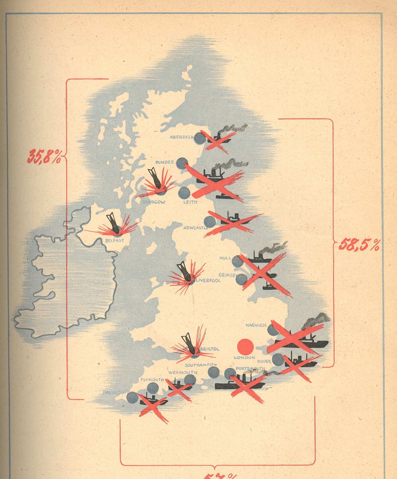
     The pamphlet’s 32 pages (illustrated with 2Blog--May 24--map14 photographs of various blow-ups and bombings, plus one graph and three maps) are dedicated to winning the French hearts and minds, trying to convince the conquered population that there really wasn’t any help coming, and that the British could not even supply themselves with the necessaries to run a country, let alone a war.

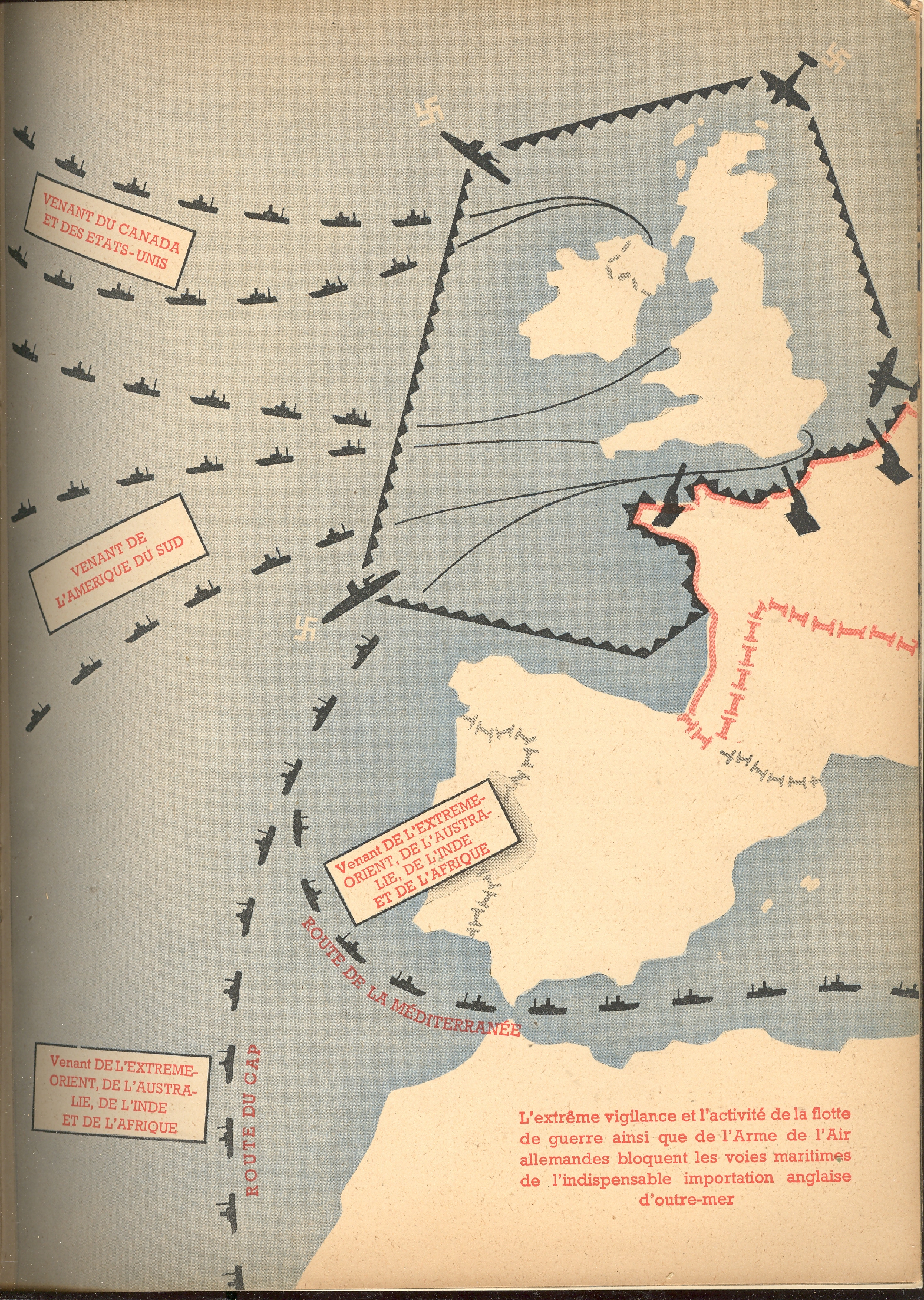
    In the map at right we see the  ports and shipping centers that were bombed by the Luftwaffe (with London located by a big red dot).  Another map shows the stockade-like presence of the Nazi navy securing its impregnable wall against the arrival of foreign trade and supplies to Britain.  

    Blog--May 24--map2

    This post is one of a series on propaganda maps which occasionally appear in this blog.   Like Thomas Nast political cartoons and war photography, a map can instantly and overwhelmingly display not only data but sentiment as well. The maps published in this pamphlet by the Nazis are were certainly immediately understandable to just about anyone, French-reading or not, literate or not–the images needed no words, especially when surrounded in the text by vicious images of German military might.  OvBlog--May 24--map2 001errun or not, Petain-ized as it was, France was still offering aid to its allies and resistance to the Germans–the more minds that could be won over with propaganda of this sort meant one less to have to worry about as an active enemy.

    A Listing of Some our the Propaganda-related posts in this Blog

    Nazi Propaganda: Scaring the Will-to-War, 1935

    Maps as Propaganda: the Nazi’s Use of Maps in the Hearts and Minds Campaign in Occupied and Holland and France, 1943


    The Propaganda of Restricting Infomration: Dorothea Lange’s Photos at the Japanese “Relocation” Camp, Manzanar, 1942

    Psychological Warfare--Aerial Propaganda Leaflets and Surrender Tickets, WWII.

    Maps as Propaganda: the Turning of the Tide, January 1943


    Humanitarian Propaganda–Hope for those at Home, September 1944.

    Nazi Propaganda: Scare Tactics in a Hearts and Minds Campaign, 1940

    A Propaganda Effort Equating the New Deal and Nazism, 1935: the Power of Willful Forgetting

    The Atomic Bomb: 6 August 1945. Propaganda Leaflet Dropped on Japanese Cities

    The Polish “Threat” to Germany, 1939:   Nazi Propaganda on the Perceived Polish “Invasion”


    Propaganda Maps #2: the Nazis. the Big Lie, and Cartography


    Graphical Display of Data: the R.A.F. and Luftwaffe Present Their Cases, 1938-1940


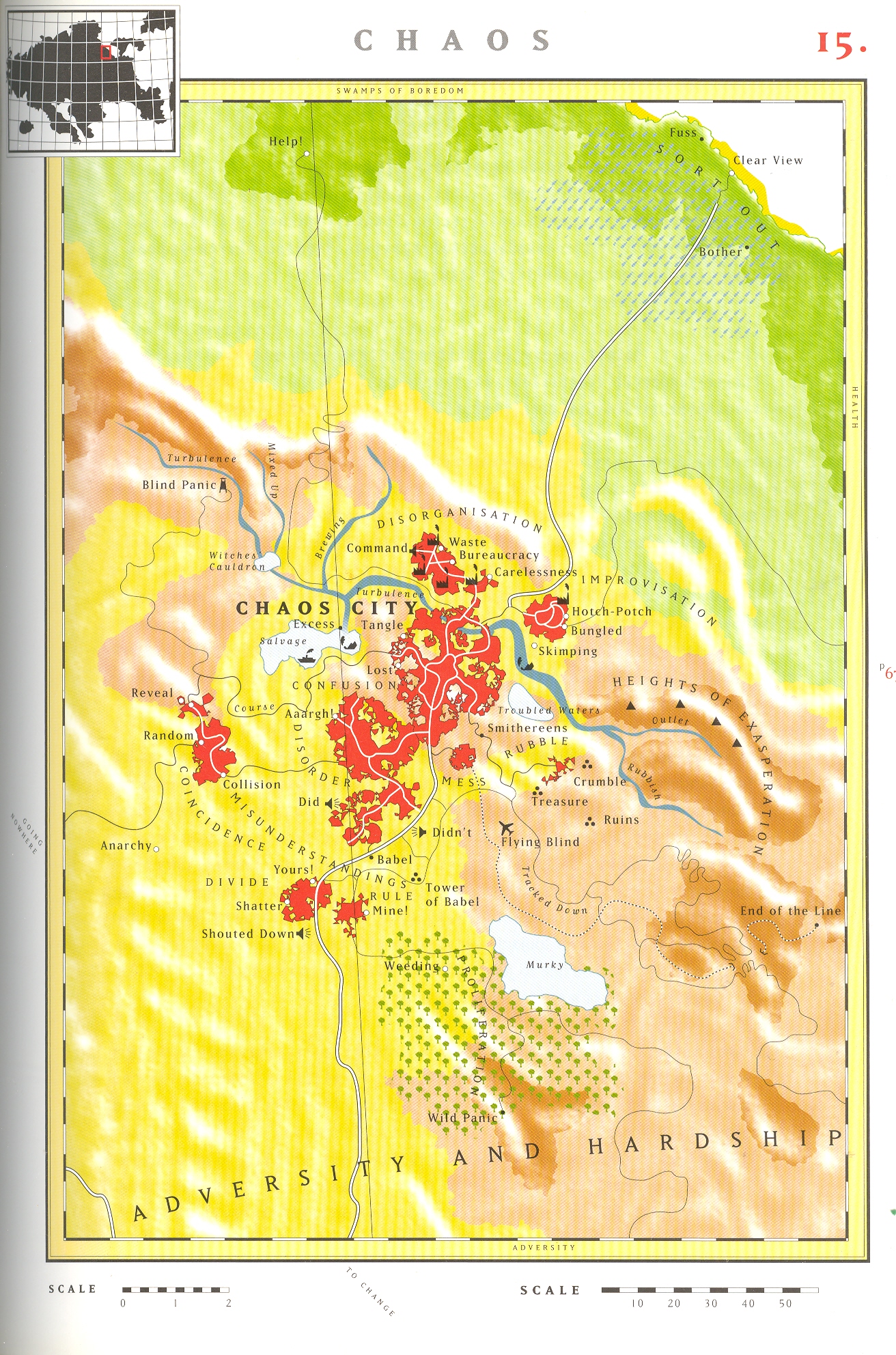
  • Locating Chaos (Addendum): The Land of Chaos in the “Atlas of Experience”

    JF Ptak Science Books LLC  Post 571 and a half

    The ink on my last post hadn’t really dried when my wife, Patti Digh, said that she had seen another a map of Chaos.   And of course she was right–it was sitting happily in the beauty-bending The Atlas of Experience by Louise van Swaaig and Jean Klare.  This is a most unusual work, using familiar mapping skills and general topography to create geographic landscapes for lands of ideas, concepts and emotions. They provide maps for Secrets, Knowledge, Bad Habits, Home, Boredom (my favorite!), Health, Stream of Ideas, The Isles of Forgetfulness, Passion, Mountains of Work, Growth, The Void, Adversity, Chaos, Adventure, Haute Cuisine, Pleasure, Change, Mortality, and Elsewhere (my second favorite).  This just a damned lovely book. 

    Chaos atlas


  • Things out of Place Department: the Moon

    JF Ptak Science Books LLC  Post 505

    Blog--things out of place
     This is a short entry in the “Things out of Place”
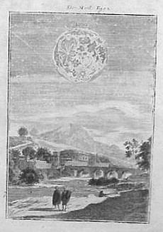
    department.  The image is lovely enough,
    and the depiction of the Moon is excellent, especially given the time of publication,
    which was 1683.  The Moon though, of course,
    is enormously out of proportion with the setting—I’m not sure why it needed a
    setting at all, but it has one, and it is odd. 
    The work is that of the prolific Manesson Mallet, who published this
    engraving as one of 677 in his massive Description de l’Univers, which appeared
    in five volumes.  I’m also not sure of
    how Mallet came to such greatness and capacity, as he started out his life
    (1630-1706) as a simple foot soldier under Louis XV, rising and rising in
    promotion and ability over the years until he became the chief inspector of
    forts.  He also wrote military books,
    including the three volume Les Travaux de Mars ou l’Art de la Guerre
    (1684), which he was somehow able to accomplish in the year after publishing
    his magnum opus.

    I really couldn’t figure out where to put his image, categorically speaking that is–it sort of fits into the small Extra Earth series, simply because the extra earths are big and way out of proportion.  But this is not “extra”, and not the earth, but it is out of proportion and belongs in the sky; and, taken out of context, the image is very unusual, in a naive surreal kind of way…


  • Blank and Missing Things #31: Missing Earth

    JF Ptak Science Books LLC     Post 504


    Scan0001
    In 1830 when Amos Eaton, filling up his chair and burning
    the  midnight oils in his home in Albany New York, was figuring out the
    insides of the earth  He had but little direct evidence to go on, and the publications on the topic of the center of the earth were left to speculation not much better then than science fiction (a term which had not been invented yet; neither for that matter had the word “scientist”).  
    A  very careful  observer, Eaton applied what he knew about the strata
    of the earth to a theory of how the landforms of the upper/outer mantle
    were formed. (Eaton (1776-1842) was as influential a teacher as he was a
    theorist and observer:  some of his
    students include the following Big Names (for which many buildings on university
    grounds are named for ):  James Dwight
    Dana
       (geologist, zoologist), James Eights
     (Antarctic
    explorer), Asa Gray
    ( greatest 19th c American botanist), James Hall 
    (first New York State Geologist), Joseph Henry
    (developed electromagnetism, all-around smart guy who
    communicated with everyone, secretary of the Smithsonian and so on.)

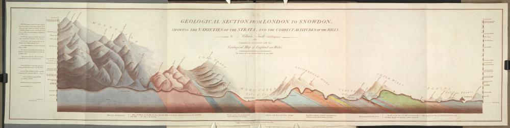
    He applied the discoveries of stratum of William Smith (1759-1839, the “father of English Geology”) drawing on a number of maps of his, such as “Strata
    Identified by Organized Fossils. : Containing Prints on Coloured Paper of the
    Most Characteristic Specimens in each Stratum” of 1815  and “Geological section from London to Snowdon; showing the varieties of the
    strata, and the correct altitude of the hills” of 1815 (pictured below), plus much else.  

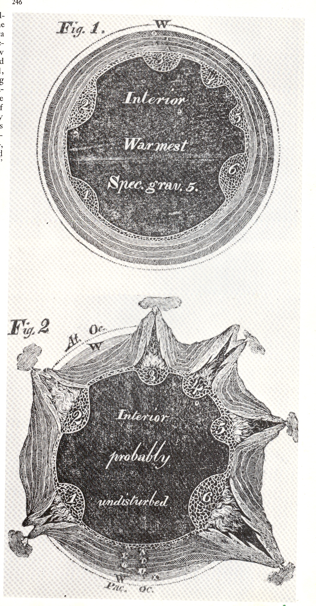
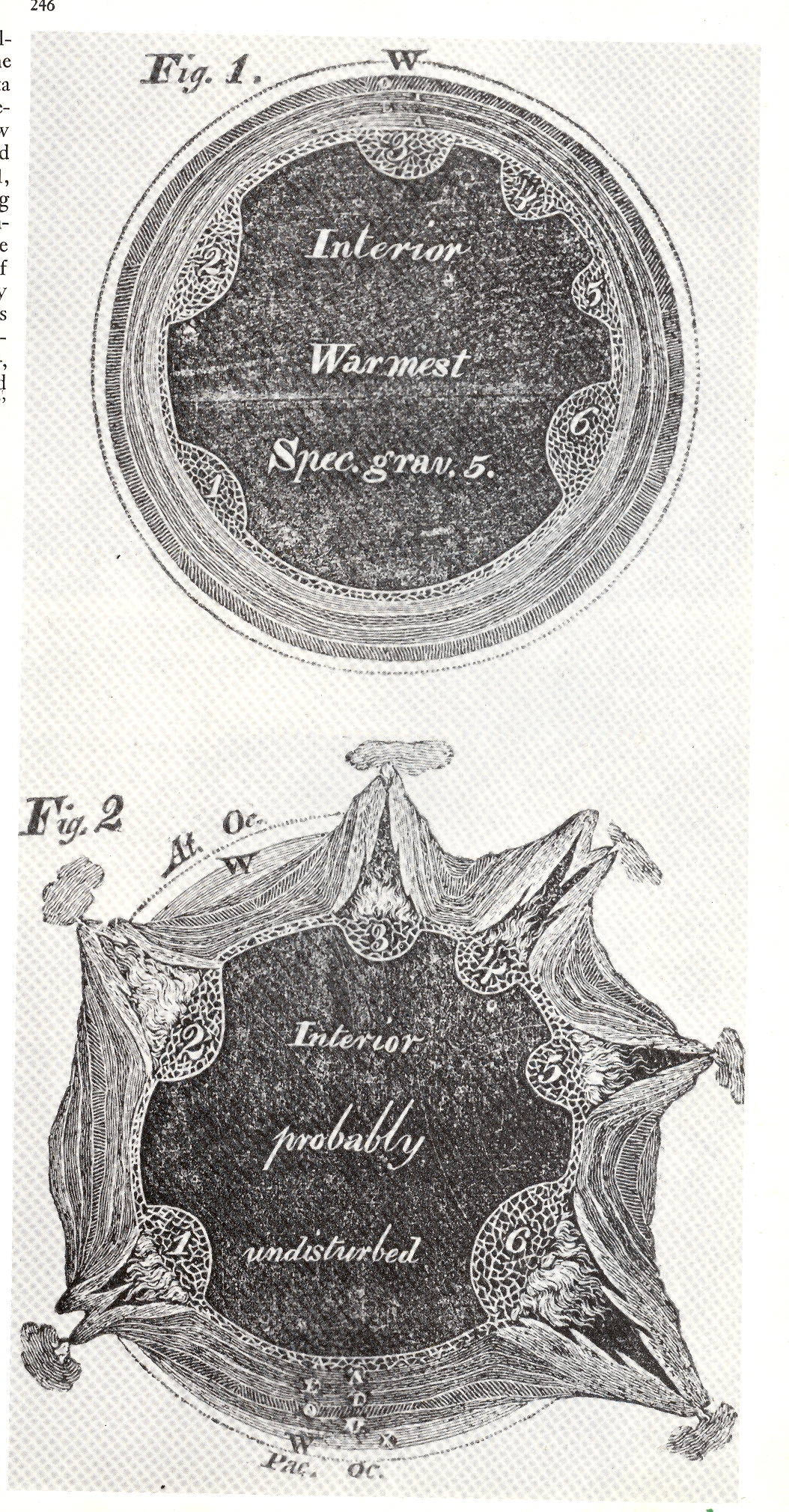
    These two images (left) of cross-sections of the earth appeared in Eaton’s Geological Textbook, (1830). The top shows the earth in perfect harmony and in cross-section, depicting the strata in six layers beneath a calm and palcid ocean.  There was trouble though located inside the six bulbous bulbs on the interior of the innermost strata:  as we see in the second image, the six bulbs, filled with
    Scan0003
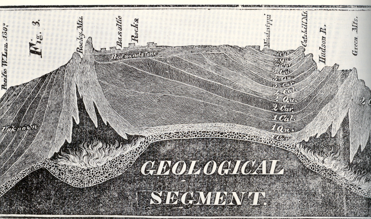
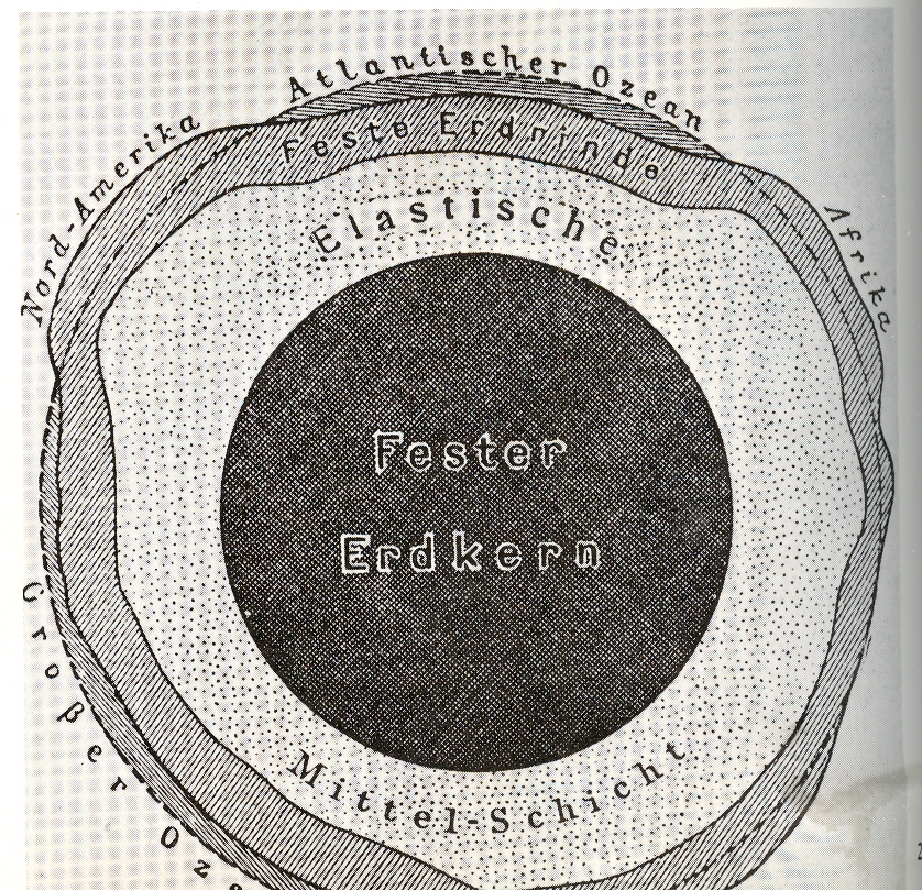
    “combustible material”, combusted, forming volcanoes and such, thereby parting the waters and forming the continents. It was some pretty  good thinking for the time.  But what attracted me to these images was the labeling of the interior of the newly-exploded earth, “interior probably undisturbed”, and blank beyond that point.  a dark, blackish mass, unknown and from where Eaton sat, unknowable.  But Eaton did do an extraordinary job in trying to imagine this stuff, piecing things together from the geological record in those pre-Darwin, pre-Lyell days.  The woodcut at right appeared in the same publication as that above–this incredible rendering depicts the entirety of  North America  in profile, which was a vast leap of faith, an image so severe in its accomplishment that it is difficult today to realize how shocking it must’ve seemed to the readers of 1830.  I believe this was the first time a true geological cross-section like this was attempted–again to see an X-ray (pre-dating that discovery by 65 years by the way) of the earth and to have it be not so terribly bad (compared to today) was just a phenomenal achievement

    ________

    Just for the record, Smith’s map of the London area–which presages the Eaton map somewhat–appears below:

    Blog--earth nothing smith


  • Highpoint of Northern Renaissance History and Cartography: Olaus Magnus, 1565

    JF Ptak Science Books LLC  Post 467


    0 blog jan 08 magnus366
    Olaus Magnus
    (Swedish historian and geographer,
    born. at Skeninge, Sweden, 1490; and died at Rome., 1558) wrote the legendary
    and Renaissance-high-point  Historia
    delle genti et della natura delle cose setentrionale…
    (“Historia de
    gentibus septentrionalibus”, and translated as  “Olaus Magnus Gothus’, the Upsala Archbishops’, history of the nordic
    people’s different manners and camps, also about the wonderful
    differences in customs, holy practices, superstitions, bodily
    exercises, government and food keeping; further on war, buildings and
    wonderful aids; further on metals and different kinds of animals, that
    live in these neighbourhoods “) published in Rome,
    1555 (as well as Antwerp, 1558; Basle,
    1567; Frankfort, 1618, and also in translation
    in German (Strasburg and Basle,
    1567); Italian (Venice ,
    1565); English (London,
    1658); and Dutch, (Amsterdam, 1665)).  It was mostly a response to earlier histories
    treating the geography, fauna, flora and general history of Scandinavia, which
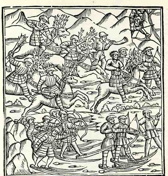
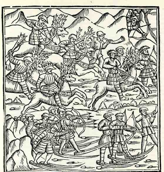
    Magnus found to be wanting, wrong and fanciful. (The image to the left,  a mixture of fact and fiction, does depict snowshoes for about the very first time in a printed book.) 
    His own book, the Historia, corrected and strangled many earlier wrongs and
    fanciful affronts committed by other authors.  It is still seen as a useful book on Scandinavian mythology and folklore, along with some interest in the origin of the material that Magnus contributed from his own imagination when sources went wanting.  

    Blog--magnus

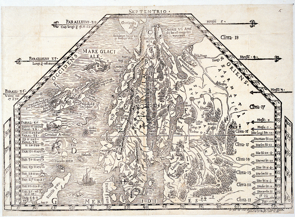
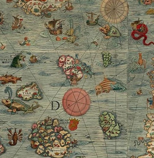
    Magnus’ map of the great northland was a fantastic achievement, its
    stature undeterred by the liberal use of sea monsters and other
    fanciful creatures.  The detail in the coastlines (as well as the depiction of currents between Iceland and the Faroe Islands) as well as interior
    features make these among the most detailed maps of the north yet
    printed in the 16th century.

    Blog magnus map


  • The Air Bridge to Nowhere: the Friendly Skies, Chicago to Moscow, 1944

    JF Ptak Science Books LLC  Post 449

    0 blog dec 29missing men327
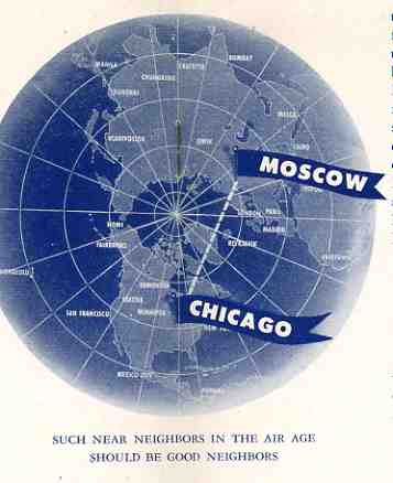
    This hopeful and terrifically unbalanced homage to wistful loveliness of the Soviet Union, The Businessman’s Stake in American-Soviet Friendship,
    by Harland Allen, was published in Chicago in 1944, and seems to me a
    small prayer for what the post-war world might bring about.  Allen
    forced the then-popular economic thought that the people dangling from
    the visor of Uncle Joe Stalin’s cap were money angels rather than
    Russian corpses, and that the air lane shown in the trans-polar map at
    right would soon be filled with American exports headed to Moscow.
    (Little did he know that in  a decade this line would be the distance
    traveled by ICBMs, or close enough to it.)  At least that seems to be
    the hope here, Stalin forcibly melted into the Big Board, the Soviet
    Union trading on the DOW as CCCP (Inc.).

    The small pamphlet
    received some spirited review support from the Northwestern University
    School of Law, the Des Moines Register and Tribune,the Society for the
    Advancement of Management, the Meadville Theological School, and Laird
    Dell Attorney at Law. And that’s about it. But these were ripe times
    for this sort of pro-Soviet thought:  after all, dozens of millions of
    Russians had been killed in the fight in the East against their former
    Nazi allies, and without all of that blood sacrifice I have no doubt
    that the war would’ve lasted for some years to come.*  The U.S. had a
    powerful ally in the Soviet Union regardless of what had happened there
    in the 1930’s and regardless of their attack on Finland and regardless
    of their Pact with Hitler–from 1942 onward they would hinder and halt
    the Nazi army and nearly ground the whole thing down to a nub, crushing
    the German capacity to fight in the west. The atomic bomb was to be
    untried until July 1945, and the outcome of the war was not yet known. 
    Love for the Soviet Union was high in the sky at this point, FDR making
    many airy and superior statements about our new ally, while the rest of
    the propaganda machine was lubed and oiled for the coming fight.  LIFE
    magazine went so far as to pronounce Lenin as “perhaps the greatest man
    of modern times” and that the NKVD was analogous to the FBI.  Even old
    anti-Soviet hawks like MacArthur publicly pronounced their admiration
    for the new regime.  (George Patton famously did not.)

    Back to
    our pamphlet: aside from some romantic vision of the Soviet Union,
    Allen maintained that the U.S. needed to deal with the CCCP because of
    its enormous army (which he did not want to annoy and fight) and its
    impending “mastery o the air”–it would be better to trade and make
    money than it would be to make war.  Allen pointed out that some of the
    problems of Americans dealing with the political system in the Soviet
    Union were inadequate reports on what he described as the country’s
    economic “principle of national planning“. .(I hardly know what
    George Orwell might’ve said about the supremely understated summation
    of the Soviet system as “national planning” and the fruitless and
    embarrassingly weak attempt at  controlling language to describe the
    monstrously repressive regime.)  He continues:  “Journalists have been
    positively fearful of open-minded reporting in Russia lest they get
    tagged–or tarred–with the familiar epithet “communist”, and then goes
    on to describe the similarities of the “two great peace-loving
    peoples”. 

    And so it goes, on and on in this pamphlet–it just
    isn’t worth going into any further than this.  The euphoric sheen of
    pro-Soviet sentiment and appreciation wore thinner as the war
    progressed, truer feelings becoming more exposed as the German army
    retreated westward, reproducing the famous Minard chart of Napoleon’s
    disappeared army in a war 130 years earlier.  The endgame for European
    real estate, fumbled badly by the dying FDR at Yalta, brought out the
    cardboard smiles between the US and the Soviet Union, relations
    strained to the point that the military employment of the atomic bomb
    was in some not-minor sense made to bridle Soviet intentions.

    But that was still two years hence for Mr. Allen, who I guess couldn’t see into the future that far, even if his work was heralded by the Des Moines Register.  He just didn’t do a very good job of withstanding the test of time, even though that test ended in 1946.


  • Skinny IV: the American Empire 1940

    JF Ptak Science Books LLC  Post 420

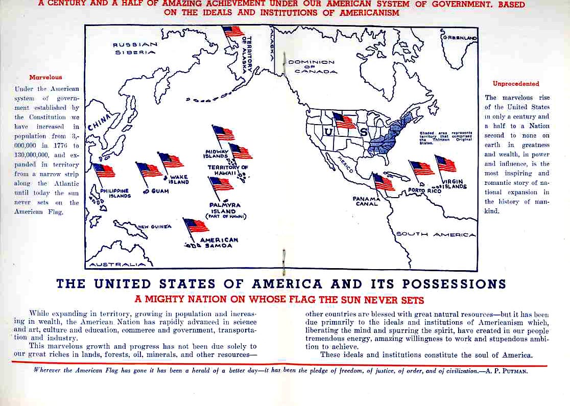
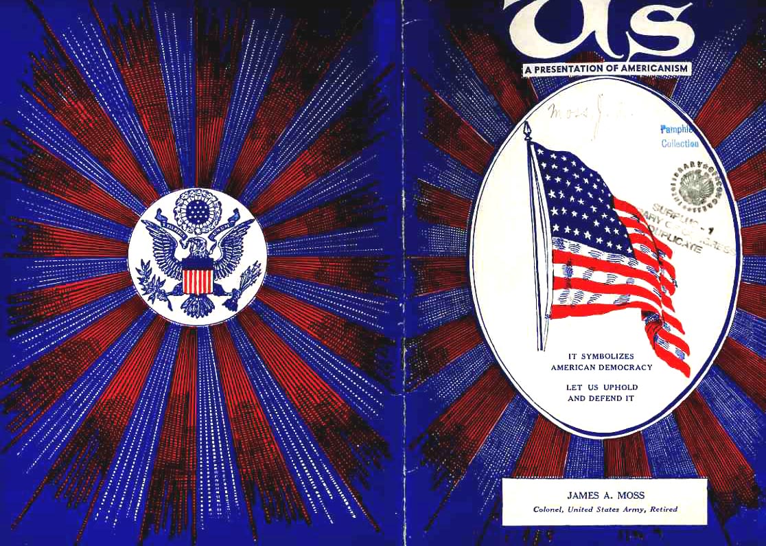
    0--ebay---dec empire205 This map of the American Empire, “a might nation on whose flag the sun never sets”, appeared in an odd little publication called US, a Presentation of Americanism, published in 1940 by the United States Flag Association.  The author, Col. James A. Moss, was adjectively gifted, or affected, never having met one he didn’t like or couldn’t use.  The pamphlet drips red, white and bluey drippings–on this map spread alone we see unimaginative and repetitious uses of the words  “amazing”, “marvelous”, “unprecedented” and so on. 

    Yet for all of this multi-colored ink and trying adjectives, the Empire, or empire, as described by Moss really wasn’t so much, once you added up all the square miles.  Actually, if you take away Alaska from this mix, all of this external property doesn’t add up to more than Texas; if you subtracted the very problematic size of the Philippines, these properties wouldn’t cover North Carolina*.  Now so far as “empires” go, this isn’t much–they’re lovely places to land planes, though, or refuel ships (in earlier days)–but when the foreign conquests don’t add up to 5% of the general land mass, an “Empire” it isn’t.  Perhaps if one of those flags was on Australia (sorry!), well, then, that would make a stiffer claim for the E-word (or I-word, actually, as in Imperium).  Roman, Persian, Ottoman, British, Assyrian, Spanish, Byzantine, Median/Mongol, Athenian, Akkadian, Russian, Celestial--these are empires (whole alphabets of them), in power, land, influence.  America could’ve really have been an empire in 1945 had it the stomach and hadn’t been exhausted of the whole idea of war–thank goodness it didn’t happen. Running amok and all. I’m happy to think of this Skinny Empire of the United States in 1940–Fat Empires generally are killers.

    Some of the other Skinny Posts:

    Skinny III:  Skinny Water. An Extremely Thin Shower Apparatus, 1888.

    Skinny II: Morals, Class Warfare & Letting Someone Else Pick up your Dropped Fork

    Skinny (I) Tech–Swimming, Sitting and Smoking Thin (Really Thin)

    *There are simple ways of determining this exactly–adding up columns of figures in the Statesman’s Yearbook will satisfy this need, but I think that my guess gets us to the point to within a comfortable margin. 

    0--ebay---dec empire206


  • Cartograms of the Obama Victory: What “Normal” Maps Don’t Show

    JF Ptak Science Books LLC  Post 355

    I woke up this morning feeling good for the first time in my life about the results of a presidential election here in the United States.  In my living memory, the characterizations of the occupiers of the big chair in the Oval Office have been less than fulfilling:  the ruined greatness of LBJ, the actual and interrupted possibility of evil of Richard Nixon, the tight-lipped raisin-eyed confusion of the deceptive Jerry Ford, the bittersweet and limited Jimmy Carter, the addled incompetence and intellectual insolence of master storyteller RWR, the bookmarked-thin-never-finished-book of Old School George Bush, the Falstaffian and could’ve-been-great-but-spoiled Bill Clinton (killed in the end by viciousness and republican lust), the unutterable and poisonous George Bush redux.  The people sent up to run against them have been less than illustrious in many cases:  Hubert Humphrey, Walt Mondale, John Kerry, Al Gore (though with Mr. Gore, known as “Al God” to the other kids at  National Cathedral , would’ve been  a better choice for the chair than George Bush; but then again, a warm stain would have been better too, so faint a praise is that…there is little doubt though that we’d have several trillion dollars more in the economy and wouldn’t have affected the lives of hundreds of thousands of American military families or “disrupted” the lives of millions of Iraqis.) But late last night, when Iowa went to Obama, I felt the possibility of pride and probability of accomplishment creeping into even my cynical soul-shadow.  I also have little doubt that a man of this calibre surrounded by a forceful whirlwind of readiness will also be able to attract excellent minds to the administration–something I think that was sorely lacking (for the greatest part) in the last administrations. I know absolutely that everyone else in the world was ready for Obama; I’m glad that the United States followed suit. 

    And how big a win was this?  How many people supported the Obama ticket? 

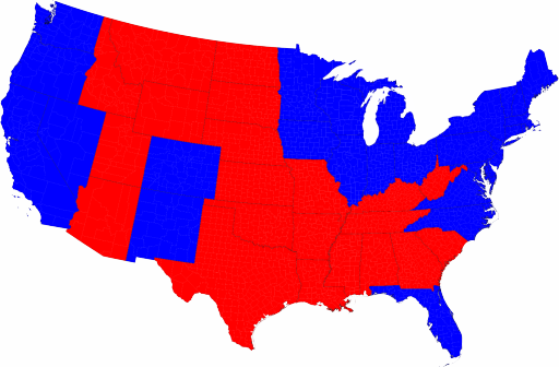
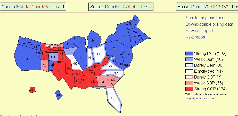
    A simple map showing results of voting by state doesn’t tell that much of the story:

    000--election--simple state map

    000-Nov 5 part 2Looks very red to me. 

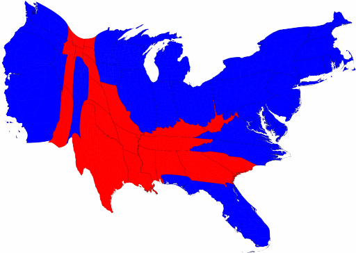
    However, when you use an electoral college cartogram (a map with a thematic variable, where the area of the map is representing something other than simple geography and a place on the globe) to display the same results the visual representation of the same data changes dramatically, we you can see (and this image can be clicked for a more detailed view):

    (The following image is from the interesting and clearly written website of Mark Newman, Department
    of Physics and Center for the Study of Complex Systems, University of
    Michigan.  He also has published a “real world” atlas of cartograms that more vigorously display quantitative information–outside of an atlas of imaginary places, this is exactly the sort of book that should be present in every classroom in the United States. ) The population cartogram from Newman’s website offers another interesting aspect of the election results, depicting a solid but relatively thin control of much of the South (inexplicably and stupidly referred to over and over again by the pundits on CNN as “the Confederacy” (!?)), along with a stubborn reed of red that extends from the northern to southern border and which pretty much follows the cattle trail of the Hat Creek Outfit from the Great American Novel Lonesome Dove (by Larry McMurtry, which is also to a lesser degree the path of the Goodnight-Loving Trail.                                                                                                      

    000-statepopredblue512

    The net result, I think, is that the Obama victory was decisive, and has a huge tailwind, a mountain of support.  It seems that there is very little doubt that the people of this country were ready for something very different than what has been here for eight long years.