A Daily History of Holes, Dots, Lines, Science, History, Math, Physics, Art, the Unintentional Absurd, Architecture, Maps, Data Visualization, Blank and Missing Things, and so on. |1.6 million words, 7500 images, 4.9 million hits| Press & appearances in The Times, Le Figaro, Mensa, The Economist, The Guardian, Discovery News, Slate, Le Monde, Sci American Blogs, Le Pont, and many other places… 5000+ total posts since 2008.

Category: Information, Quantitative Display of

  • Invading England with 50,000 Planes (1908)

    JF Ptak Science Books    Post 2764
    Blogaeroplane_2

    Some of the most striking things in my collection/store/accumulation are the hundreds of images that portray data for display purposes–even more so, those that use a vernacular setting to put some anthropomorphic breath into a statistic.

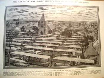
    The print that we’re looking at here appeared in the 19 December 1908  issue of The Illustrated London News and is entitled “The Futility of Herr Rudolf Martin’s1 Plan of Invasion by Aeroplane”, and reports on a possible German invasion scenario of Great Britain that was delivered in Berlin on 2 October 1908. This fantastic piece of  artwork by Hermanus Willem Koekkoek (1867-1929) graphically depicts what the author maintained was the impossibility of a German force to invade England by landing 50,000 flying machines and 100,000 men on the Kentish coast of England–undoable because “of the impossibility of finding landing-room (for the planes) and cover for an army on aeroplanes. The artist depicts a small town and what I guesstimate to be 60 planes in the air and 75 or so on the ground, leaving it to the imagination of the reader where the other 49,875 might go. He DOES make a point, and very vividly. 
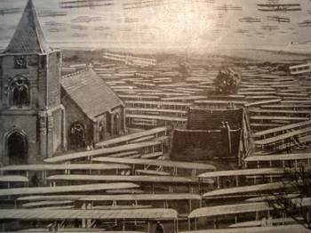
    Blogaerooplanedetail “Nothing could show better the futility of Government Councillor Rudolf Martin’s idea that Germany could construct 50,000 flying machines for 50-million pounds…and land 100,000 men on the Kentish coast from Calais within half an hour.” I would imagine that this illustration drove the point home to the folks who didn’t actually bother to read anything about the Martin defense plan. (It was in a similar way that Thomas Nast was able to control public opinion and sway political refuge and protection away from Boss Tweed. Tweed famously boasted that he didn’t care what the newspapers said about him because his power base didn’t read–he might’ve been and probably was correct here, so Nast took after Tweed via the political cartoon, and big too, and frequently; and the cartoons, even if the people looking at them couldn’t read, told the whole story graphically, and it was this that brought an end to Tweed more than anything else.)

    In 1908 Martin gave an interview to the Daily Mail in which he outlined another plan by which he felt Germany could launch 3,500 “specially design” airships (I’m guessing dirigibles) and land 350,000 (!) men in England in a half-hour. This evidently whipped itself into a frothy aeroplanitis in 1909, despite such efforts as this graphical reasoning by the ILN to dispense with the unreasonable fears.

    The airplane flown by the Wrights (the first powered heavier-than-air flight) occurred barely six years prior to these frantic events.  Their invention was still fresh (and basically “foreign”, as the Brits lagged well behind the other major powers in flight until WWI) and understandable in a way that the fears were not understandable, not really, because of the newness and exotic aspect of the possibly-threatening invention. Also it should be noted that the first heavier-than-air airplane crossing of the Channel didn’t take place until the next year, by Louis Bleriot, who claimed a 1000-pound prize for being the first to do so. The first passenger wasn’t taken across until 1910, and the first airship didn’t make a flight across until 1915. So no doubt Martin was looking into a far off future, except that the planes were still mostly of Wright design. 

    • For a tour of the chronological history of the graphical representation of quantitative data as well as innovations in statistical and representational cartography, please have a look at Michael Friendly’s fantastic work at York University https://datavis.ca/milestones/index.php?group=1900%2B–it is an historical site the way it should be done, complete with all the trimmings, as well as the usually-absent but very important citations to the original articles used in the chronology. 

    Notes:

    1. I don’t know much about Mr. Martin at all except that in Richard P. Hallion’s Taking Flight, Inventing the Aerial Age, from Antiquity to the First…. (pg 298) we find Martin being mentioned among other “popular authors” as Verne, Wells, Kipling, and Fawcett as being somewhat responsible for forming the perception of future flight. Martin was also the president of the German Airship League and author of The Coming War in the Air.


  • Submarine Cross Sections

    JF Ptak Science Books   Quick Post

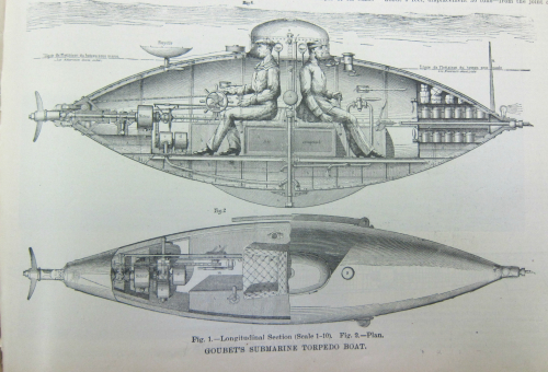
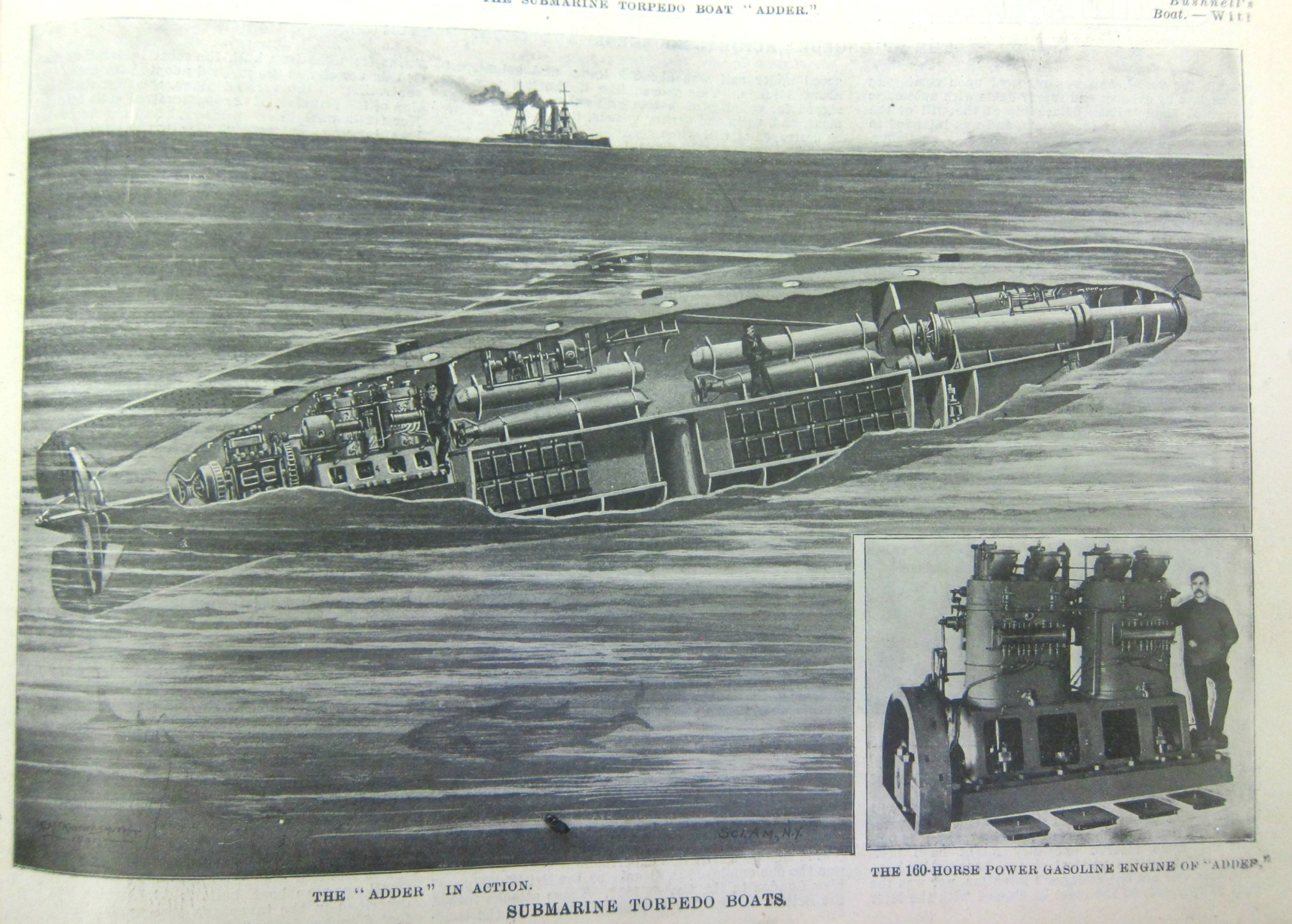
    This is a simple post adding to the collection of cross-section and cutaway images on this blog (see  https://historyofideasblog.com/thesciencebookstore/crosssections/ ). All of the images below are found in the February 15, 1903 edition of Scientific American Supplement: 

    Subnarine 4

    Subnarine 4


  • Alphabet Tubes (1895)

    JF Ptak Science Books  Quick Post

    I’ve written a couple of times on this blog on “tubes”, including tubular cars and ships, and of course pulp sci-fi adventures in tubular rocket ships, person intra-space tube propulsion systems, x-ray tubes, vacuum tubes, “tubes of uranium, and that sort, tubes as tubes. Plus there was the “extended tube”, like telescopes, canons, boilers, vacuum tubular whatzis of the future, plus the extended idea of the tube as an open-ended shaft and tunnel (there must be an opening on both ends otherwise you have a “hole”, which has its own category).  In these side tube researches I’ve never encountered the idea or phrase “alphabet tube”, until today. 

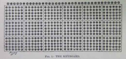
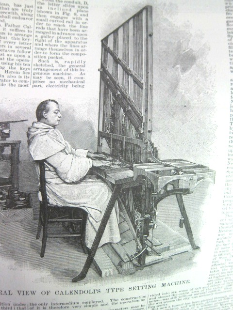
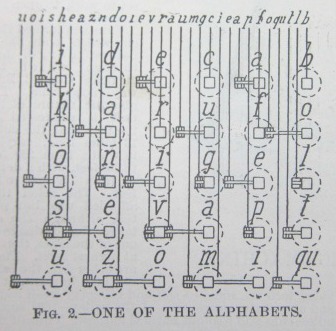
    The Domincan priest Father Vincenzo Calendoli invented (between 1893 to 1895) an unusual and seemingly-simple-but-hardly-so linotype machine that was seen by some as “the typsetting machine of the future…”(–C. Cochrane, American Printer and Lithographer, vols 21-23, 1896). The image below shows Calendoli in serene concentration seated at his machine which looks like a cross between a small Jacquard loom and an odd harpsichord (emphasis on the harp). And what Calendoli is concentrating on is this, his keyboard:


    Sci AM Mega typesetter _2_

    Sci AM Mega typesetter _3_

    The Scientific American Supplement  (1895, pp 16055-16057) illustration is reproduced exactly in an uncommon publication called the Rosary Magazine, (1895)–exact, with the exception of the additional caption: the writer annotates it by identifying the “checker board”, “inclined wire and galleys”, and the indescribably beautifully-named “alphabet tubes”! The explanation of what this tube is is far less interesting than its title–tubes filled with type–though the machine overall was extraordinary.


  • Cross Sections of Parisian Work Life, 1852-1883

    JF Ptak Science Books  Post 2753

    One of my favorite escapes on this blog is writing about cross section and cutaway images, scenes that show multiple levels, inside and out, peeling away a bit of facade to show the working stuff underneath. Buildings are particularly interesting, especially when it shows what people are doing inside of them, and to that end I’m sharing three good examples, two from 1883 and a third somewhat earlier, from 1852. 

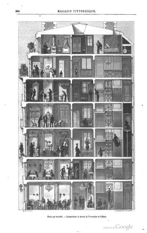
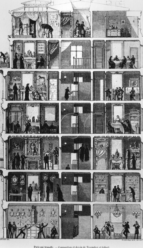
    The first two images are from Le Magasin Pittoresque, volume 51, printed in Paris in 1883 (located on pp 383-6), where we are instructed that  it is not the beautiful and classical Paris that we are to piece-apart but rather the Paris that works–that’s the true Paris, “le vrai Paris”, not the “real” Paris that plays, “Paris qui s’amuse”. It is working Paris, the article states, that is the Paris worth studying.

    The cutaway structure is said to represent one of those of Rue Auber or Avenue de l’Opera, or some such, a standard building of its time, housing businesses and trades.  On the first floor is the cafe complete with flaneur (or “saunterer”), and traders and “industrialists”; there is a restaurant above that, and then an “elegant milliner” on the next. Then comes “un grave personnage” which is perhaps an attorney, and above that a fashionable tailor. Next come the children in a geometry class, and then at the top floor, rooms for a worker and a servant (as the description allows). 

    Cross section paris house 1883 le_magasin_pittoresque_page_2


    The next structure we are told could’ve been on St. Denis.  On the ground floor we find a fencing and dance master, two related peas in a related pod, coupled with another good pairing above, where we see a watchmaker and a bookseller. (“L’art et l’industrie font bon voisinage, comme pour montrer l’influence que l’un a sur l’autre”.) Next occupying a whole floor is a dealer in art and trinkets (“bibelots”); above this, an unhappy scene on the left featuring a dentist. On the next floor we find happier surrounds, showing a toy maker and a music instructor; further on, we see a group of women working a quilt or some such; at top, there is a photographer, and to the right two small rooms for the working folk.   

    Cross section parisian building 1883

    [Image source: Blog Histoire Geo  https://pierrickauger.wordpress.com/2018/01/27/diverses-vues-en-coupe-dun-immeuble-parisien/ Full text available at Hathi Trust https://catalog.hathitrust.org/Record/012224156] 

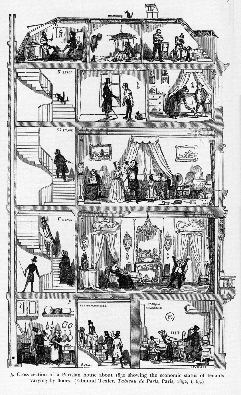
    The third example is another fine slice of Parisian city life, from Edourad Texier’s  Tabelau de Paris, printed in 1852. This may be a little more whimsical than the other two, if for no other reason than the whole assortment is topped off by what may be a laughing cat.  


    Cross section Texier tableau de paris 1852

    I couldn’t find full text for this one so I’m just free-wheeling, but it doesn’t take much to interpret the scenes. On the ground floor on either side of the entrance we have, I think, a couple of gents who may be taking too much liberty with the cook and concierge. The first floor is evidently first class–we see some well dressed and evidently bored people–or at least they look so compared to the folks downstairs. Above them is a well-to-do family, someone making enough to afford good clothing and toys and artwork and a mother-in-law. The smaller and cramped rooms start above here, with a scene of a down-and-outer being presented a bill no doubt for collections presented to a man with nothing in his room save a bag of his possession; across the hall a humble couple entertain their dog. In the attic/garret we find two artists amusing/inspiring one another, while at the far end a family seems to be in desperate times. In between these two is someone on the floor underneath an umbrella, no doubt a philosopher. And again, on top of it all and perhaps in editorial, a laughing cat.

    Cross section Texier tableau de paris 1852

    [Image source: Blog Histoire Geo  https://pierrickauger.wordpress.com/2018/01/27/diverses-vues-en-coupe-dun-immeuble-parisien/  Full text availabe at Hathi Trust https://catalog.hathitrust.org/Record/012224156] 


  • How to Straighten the World’s Tallest Chimney (1860)

    JF Ptak Science Books   Quick Post

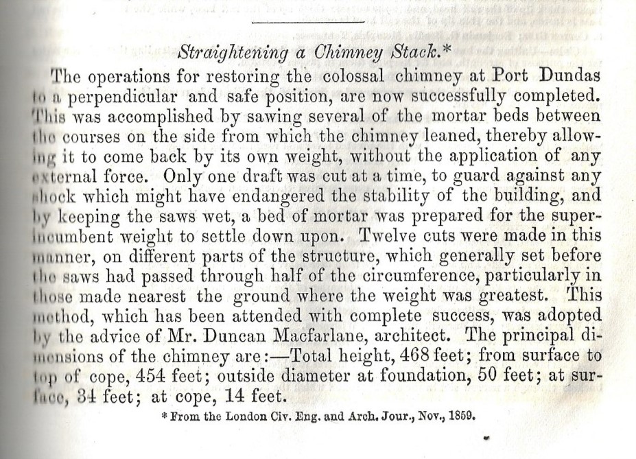
    JFI 1860 straightening chimneyThe running title at the top of the page in the Journal of the Franklin Institute (September 1860) reads “Straightening a Colossal Chimney Stack”, which attracted my immediate attention. It was constructed in 1859 in Port Dundas, near Glasgow, Scotland, and evidently needed some help in being straight-out perpendicular. The chimney was 454′ tall, and the tallest in the world–it was also one of the tallest masonry structures in existence. And it needed straightening. 

    “The tallest chimney was built at Port Dundas, Glasgow, Scotland, 1857 to 1859, for F. Townsend. It is the highest chimney in the world, (454 feet,) and one of the loftiest masonry structures in existence. It is, independent of its size, one of the best specimens of substantial, well-made brickwork in existence.”-­September 8, 1895, Page 17, The New York Times Archives

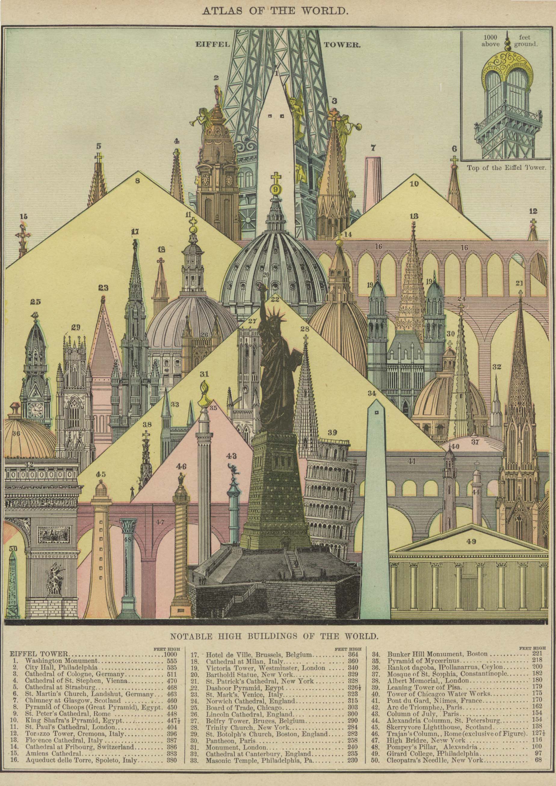
    The structure turns up in this delightful illustration of the world’s tallest structures in  Rand, McNally & Co.’s Universal Atlas of The World. Edition 1896 (as #7):

    Dataviz tallest buildings


  • Data Visualization of Air Force Bomber Strength, 1937

    JF Ptak Science Books   Quick Post 

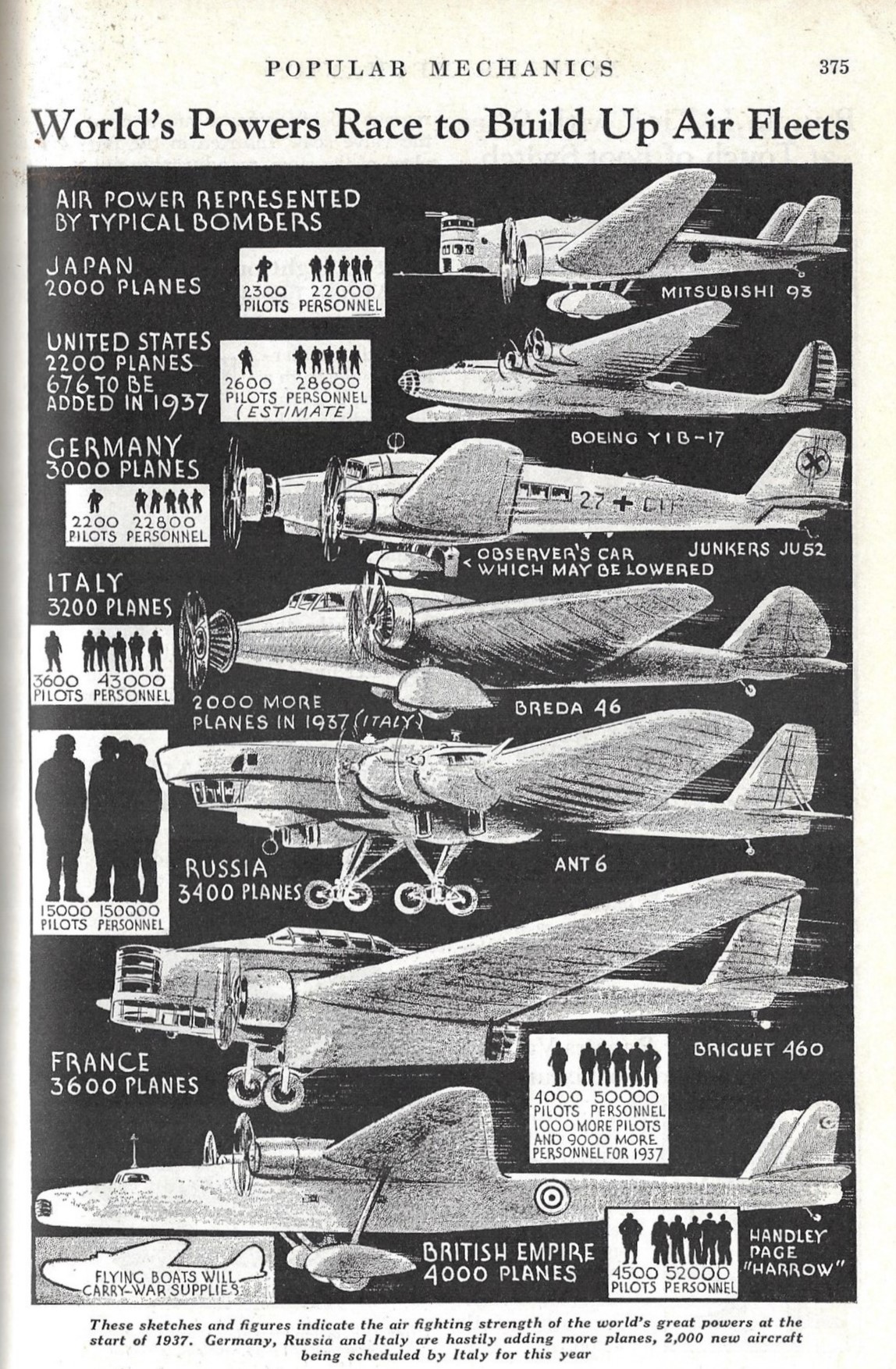
    What caught my eye in this piece of data visualization were “bomber” types and the date (1937). First of the seven aircraft six are bombers—the German Junkers JU 52 was a transport aircraft. The year here is 1937, which makes it more than two years past Hitler’s 26 February 1935 repudiation of the treaty of Versailles, in which it was announced that among other things the Nazis would re-arm and stop paying war debts. Theoretically then the would have been no German air force before 1935, except of course that pilots were being trained sub rosa both in German and the Soviet Union—that means that the Luftwaffe (founded in 1935) would have started from nothing and appeared on the world stage two years later with the 5th largest air force of the global powers (ahead of the U.S. And Japan). This graphic appeared in September 1937, just four months after the Nazi Condor Legion delivered its much-publicized bombing against Guernica in the Spanish Civil War. So why are we being shown a transport aircraft in this analysis? [Several have shared now that the Junkers was also used as a bomber–thanks!]


    Pop MEch 1937 Dataviz airfroce

    Source: Popular Mechanics, September 1937. 


  • A View of the “Zones of Animal Life” (1889)

    JF Ptak Science Books  Quick Post

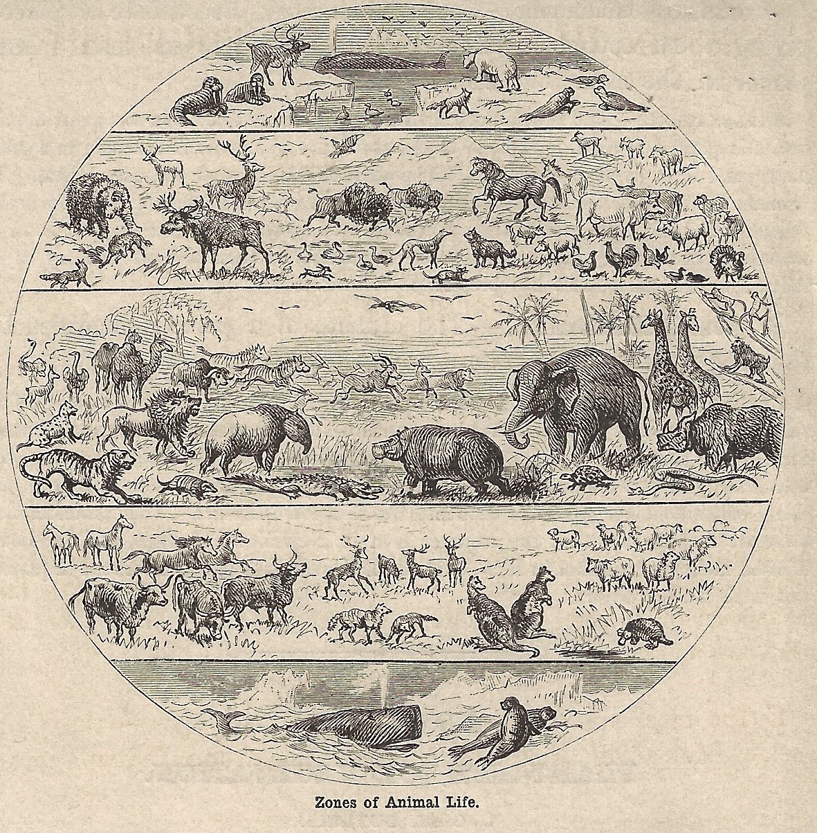
    Here’s is an interesting bit of data display, showing the distribution of animal life in torrid, temperate, and frigid zones. It is relatively small, 4×4″ or so, and is found in James Orton’s  Comparative zoology, structural and systematic, published in New York by Harper and Brothers in 1889, (pg 389). 

    Maps zones of animal life


  • Comparing Building Heights: the US Capitol, Statue of Liberty, and Trinity Church, in an Unexpected Chicago Skyline (1894)

    JF Ptak Science Books  Quick Post

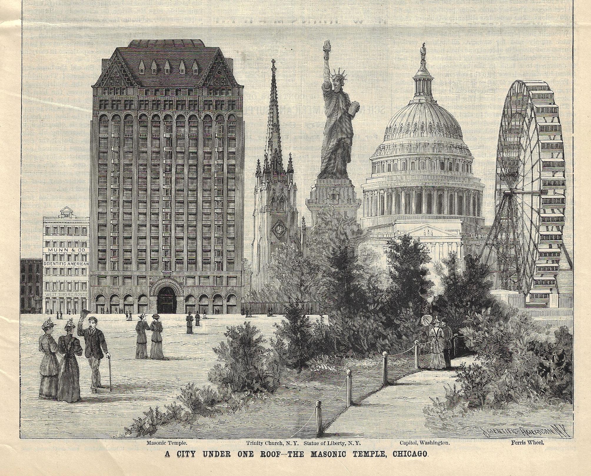
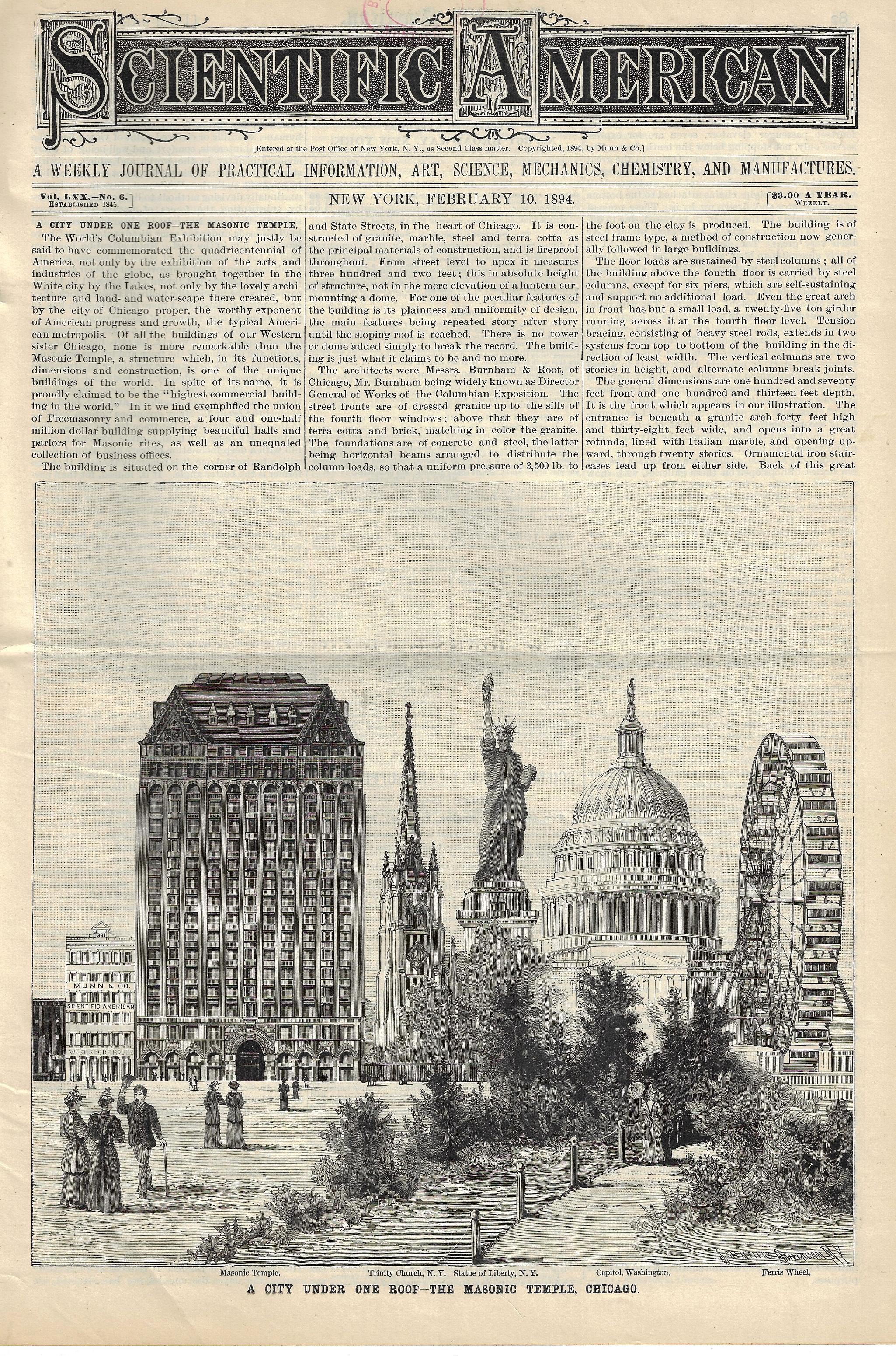
    In the several comparative heights of buildings images that have been posted to this blog in which buildings are compared to other buildings (and not enormous loaves of bread, or ears of corn, and so on) it turns out that many of them are set in a generic or fanciful landscape. Few that I can recall compare one building to several others in situ, as it were, using the area in which the building of note exists–and the example below yet again is one of those created landscapes. The building is the Burnham and Root Masonic Temple, in Chicago, and when it was built it was right in the heart of the city, without a field in the foreground. When completed in 1892–just in time for the Columbian Exposition–it was the tallest commercial building in the world, and also one of teh world’s tallest structures. The editors of the Scientific American commissioned this comparative, showing the new building (302′ high) in relation to the great Ferris Wheel in Chicago (288′), the U.S. Capitol (288′), the Statue of Liberty (301′), and Trinity Church (284′). Just for the sake of it the artist included the Broadway offices building for the Scientific American printer, Munn & Co., to the left of the Masonic Temple.  

    I have basically nothing to say about the building, not knowing it at all, and am just passing along this fine comparative image. (There are numerous pages devoted to this structure online.)  

    Source: Scientific American, 10 February 1894. 

    Sci Am 1893 dataviz detail

    Sci Am 1893 dataviz comparative height


  • The Fossil Record of Duchampian Motion–an Early Image in Spatial Time (1884)

    JF Ptak Science Books   Post 2747

    MArey May 1884_2_

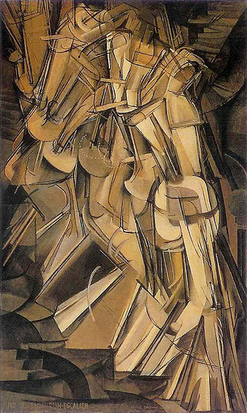
    This is one of those times where science precedes art–that’s the least significant aspect of this image, as the folks seeing it in 1884 couldn’t see into the future didn’t know that they were looking at what may pass for prehistoric fossil record of Duchamp’s 1912 Nude Descending.  The Duchamp would cause trial and occasional outrage in much of the artworld due no doubt to it challenging aesthetic–I don’t know what the readers of the Compte Rendus thought when they saw this image, but I suspect it did not involve evaluating its artistic impact.

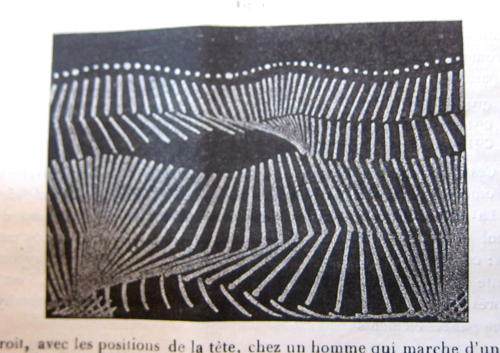
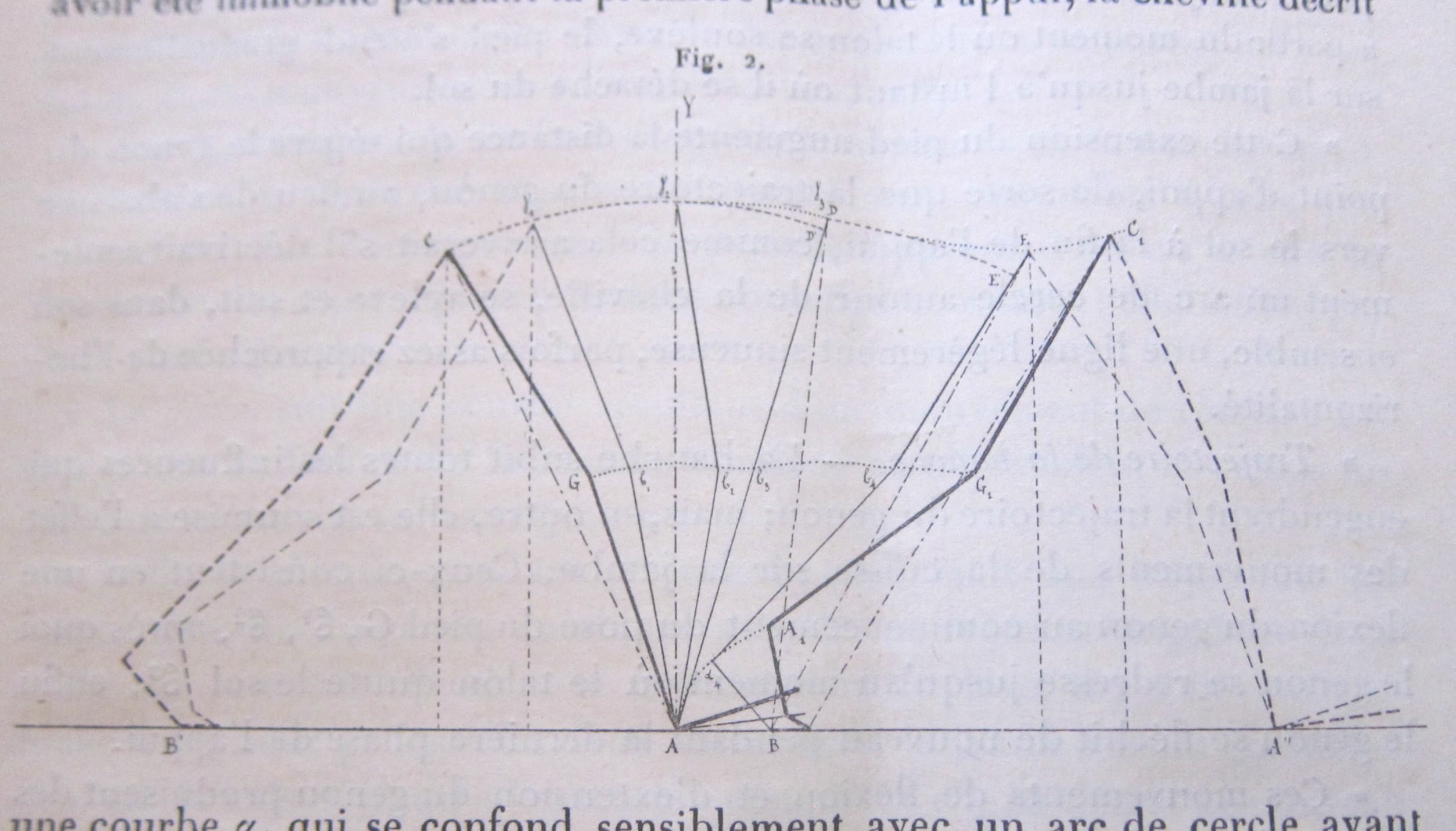
    This is the work of Etienne Marey (who has made a number of appearances on this blog), a very smart and versatile guy who would go from physiology to cinematography to aerodynamics in the course of his life and be a leader/pioneer in each field.  Marey published this “strobophotograph” in his article “Analyse cinematique de la marche” in the Comptes Rendus on 19 May 1884–this was a brilliant effort in the analysis of human locomotion by making a dozen or two exposures on a single photo sheets of a reflective-outlined walking figure. This was different from Marey’s birthyear and deathyear buddy, the other motion picture pioneer, Eadweard Muytbridge (1830-1904 for both). Marey introduced his “chronophotography” and studied aspects of movement and motion that had been dispersed to human history because of the inability to observe and record them–with Marey, that issue necessary for the beginning of real scientific discourse was to a large extent solved. 

    Duchamp_-_Nude_Descending_a_Staircase

    Marcel Duchamp’s Nude Descending a Staircase, 1912, via Wikicommons

     There are more applicable Marey images for the Duchamp–for example his series on a single sheet of a naked woman descending a short set of stairs–but the image above has more aggregated motion in a confined space sense to it, so I’ll stay with the sense-impressions than the more-visual ones. 

    And here’s Marey’s  modeling of the action:

    Marey May 1884

    In any event, I just wanted to pass on this quick note on some seldom-seen Marey images…


  • 269 Miles of Dead Soldiers

    JF Ptak Science Books  Quick Post


    The Illustrated London News
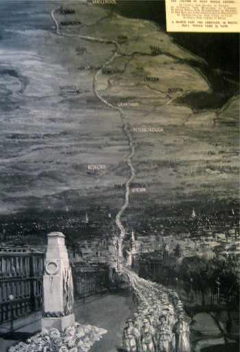
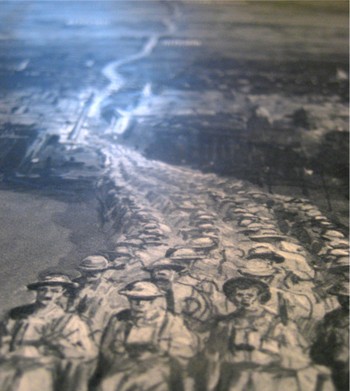
    published this very sobering image showing the general reader in London in 1933 the absolute strength and weight of the dead–and probably in a way that they had never seen before.  The image is entitled “In Memory of the 1,104,890 British Dead of the Great War”, and was drawn by D. Macpherson.  It very graphically represents all of the war dead of the British Empire for the period of the Great War of 1914-1918 (not to be called “WWI” or “The First World War” until after the second week in September, 1939, when there was a new World War from which the older one needed to be distinguished).  Depicted here are the dead as a line of men, four across, extending from London to Durhham.  The column passes from London through Hitchin, through Bedford and Peterborough and Grantham, past Sheffield and Leeds and York, and then on to Durham.  An extraordinary column of the war dead: 900,000 of the dead were not soldiers at the beginning of the war, but they sure died that way, and this map shows them all in a line, marching from  a point 269 miles distant.

    This line of dead soldiers would be 2,690 miles long including all military deaths for the war; 5,380 miles for all deaths overall. 


    Blogmarch

    Blogmarching_2