A Daily History of Holes, Dots, Lines, Science, History, Math, Physics, Art, the Unintentional Absurd, Architecture, Maps, Data Visualization, Blank and Missing Things, and so on. |1.6 million words, 7500 images, 4.9 million hits| Press & appearances in The Times, Le Figaro, Mensa, The Economist, The Guardian, Discovery News, Slate, Le Monde, Sci American Blogs, Le Pont, and many other places… 5000+ total posts since 2008.

Category: Maps/Diagrams of Imagination & Ideas

  • A Glorious if Not Accurate Map of Ocean Currents 1675

    JF Ptak Science Books   Quick Post

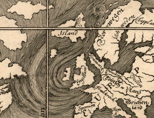
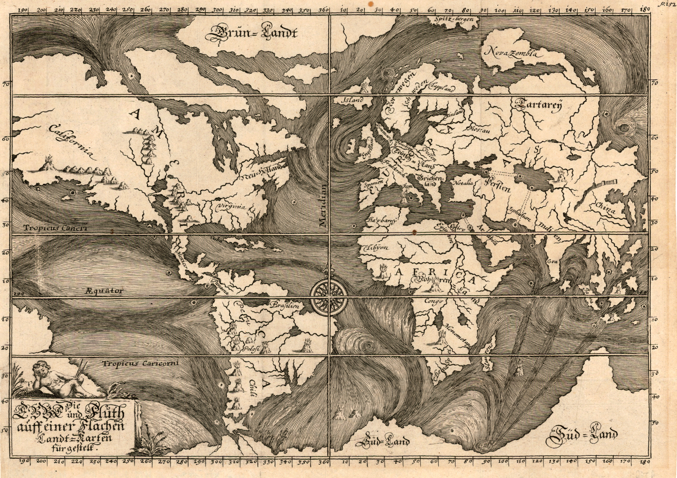
    I’m interested in this fabulous map,“Die Ebbe und Fluth auff einer flachen Landt-Karten fürgestelt” by Eberhard Werner Happel.  Happel’s  (1647-1690) map was a very early thematic effort at depicting the course of the currents of the oceans, and may or may not have been very heavily dependent upon the work of Athanasius Kircher, who produced a remarkably similar map, but a few years earlier.  

    Map ocean Heppel 1675[Source: Pirnceton University http://libweb5.princeton.edu/visual_materials/maps/websites/thematic-maps/quantitative/hydrography/hydrography.html

    Happel was a polymath much in the line of Kircher, and as gifted as he was (producing novels and popular works on the natural sciences in a number of books numbering many thousands of pages) he was not at the Kircher-level of polymath. Perhaps he was more on the line of a sub-Robert Burton (Anatomy of Melancholy) though not quite there, either. He did an extraordinary amount of writing in his slim 43 years, though not necessarily at the highest level of intellectual achievement (as with the other two). 

    In any event, the map is beautiful.

    And the details of high artistic forms:

    Map ocean Happel 1675 b

    and so:


  • When U.S. Forces Occupied Los Angeles (1848)

    JF Ptak Science Books    Quick Post

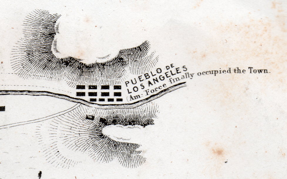
    Battle Los Angeles 1848926[Detail of a one square inch area in the original.]

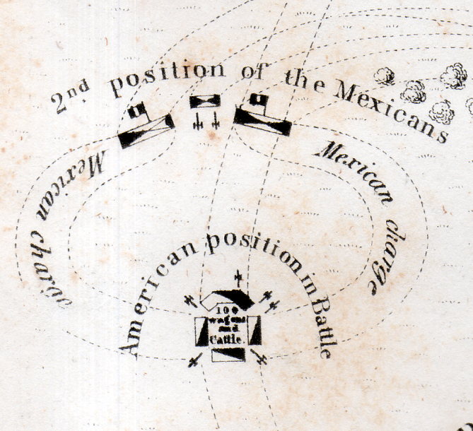
    This lovely map has a few tiny bits of unexpectedly weird details–I mean they’re historically accurate and all, it is just that removed and presented apart from the context of the rest of the map the details take on a peculiar–and attractive–surreal quality.

    Battle Los Angeles 1848927[Detail of a one square inch area in the original.]

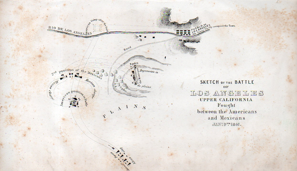
    The map is a Sketch of the Battle of Los Angeles Upper California fought between the Americans and Mexicans, Jan 9, 1847, and published in 1848. The map depicts the grounds of the Battle of the San Gabriel River, a victory for the United States, which resulted in the retaking of Los Angeles from the Californos a couple of days later, on January 10.  

    Full explanations of the battle can be found in a number of places, but this one is pretty concise and clear. 

    ,Battle Los Angeles 1848925

    Origin:  EMORY, W[illiam] H[emsley] (1811-1887). Notes of a Military Reconnaissance, from Fort Leavenworth, in Missouri, to San Diego, in California, Including Parts of the Arkansas, Del Norte, and Gila Rivers…Made in 1846-7, with the Advanced Guard of the “Army of the West.” Washington: Senate Executive Document No. 7 [30th Congress, 1st Session] Wendell and Van Benthuysen, Printers, 1848.  (13 x 22.2 cm; 5-1/8 x 8-3/4 inches). A bit of foxing, otherwise a good copy of this map.  

    This map is available from our blog bookstore, here.


  • The Illogical in Pursuit of a Logical End–a Note on the Snark.

    JF Ptak Science Books   Post 2537

       "Just the place for a Snark!" the Bellman cried,
              As he landed his crew with care;
         Supporting each man on the top of the tide
              By a finger entwined in his hair."

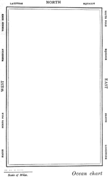
    So opens the semi- and fully-immortal The Hunting of the Snark. an Agony in Eight Fits, by the fully-and-not-partially-immortal Lewis Carroll, which (if it can said what the book is about) is about eight guys whose professions all begin with a letter “b” plus a beaver in search of a Snark.   In the second of eight Fits that comprise this lyrically nonsensical poem, we encounter a map of the route of possibilities taken by the group, this being in the charge of the Bellman. This is not only the finest map illustrating a Fit that exists, it is also (as I’ve stated earlier in this blog) one of the most beautiful maps ever published. It is a beautiful map of nothing, showing nothing, and marking the route of nothing.  Perfect for the Snark story.

    The Bellman himself they all praised to the skies-
    Such a carriage, such ease and such grace!
    Such solemnity too! One could see he was wise,
    The moment one look in his face!

    He had bought a large map representing the sea,
    Without the least vestige of land:
    And the crew were much pleased when the found it to be
    A map they could all understand.

    “What’s the good of Mercator’s North Poles and Equators,
    Tropics, Zones, and Meridian Lines?”
    So the Bellman would cry: and the crew would reply,
    “They are merely conventional signs!

    “Other maps are such shapes, with their islands and capes!
    But we’ve got our brave Captain to thank”
    (So the crew would protest) “that he’s bought us the best-
    A perfect and absolute blank!”
    Snarkmap

    Sometimes there is nothing so fine as something that beautifully illustrates the nothing that isn’t there, and this lovely map, unencumbered of all of the elements and details that define the mapness of something,  perfectly explains the origin of its need.

    The Snark evidently occurred to Carroll while he was out walking on one bright summer day, on a hillside–actually, it was one line of poetry, and it wound up being the closely line of the book.

      In the midst of the word he was trying to say,
              In the midst of his laughter and glee,
         He had softly and suddenly vanished away—-
              For the Snark was a Boojum, you see.
    
                       THE END

    So we had those eight guys and a beaver, setting out from points unknown and going to places not seen.  

    This was all started by that string of poetry that entered Carroll’s head on his walk.  He didn’t know what it meant, and didn’t know where it was going; he did however set out to figure it out for himself.  (“I know not what it meant, the; I know not what it means, now…”1) I find it such a lovely thing that Carroll would spend so much time trying to retrieve the intellectual evidence of where this line came from.  And what his investigation revealed was The Hunting of the Snark.  And at the end of the day, Carroll was no closer to knowing what a Snark was, in spite of all of the writing and commentary and criticism.  Throughout the rest of his life Carroll insisted that he didn’t know what the poem meant, though it could have meant something.  It was supposed to have been a work of nonsense and illogic, but I think it fits with the rest of his work on nonsense and the logic of it, so my best guess is that there was nothing quite so logically in his works as the reach of the illogical in pursuit of a logical end.  

    • Full text of the Snark, here, via Project Gutenberg. http://www.gutenberg.org/files/13/13-h/13-h.htm  Also a pdf with illustrations:  http://www.archive.org/stream/huntingofsnarkan00carruoft#page/n27/mode/2up

    Notes:

    1.  This line occurs in Morton Chase’s Lewis Carroll, a Biography, published by Macmillan in 1995, p 404.

  • Unusual Maps: US Financial Impact on the World, 1929

    JF Ptak Science Books  Quick Post

    Map finance 1929251

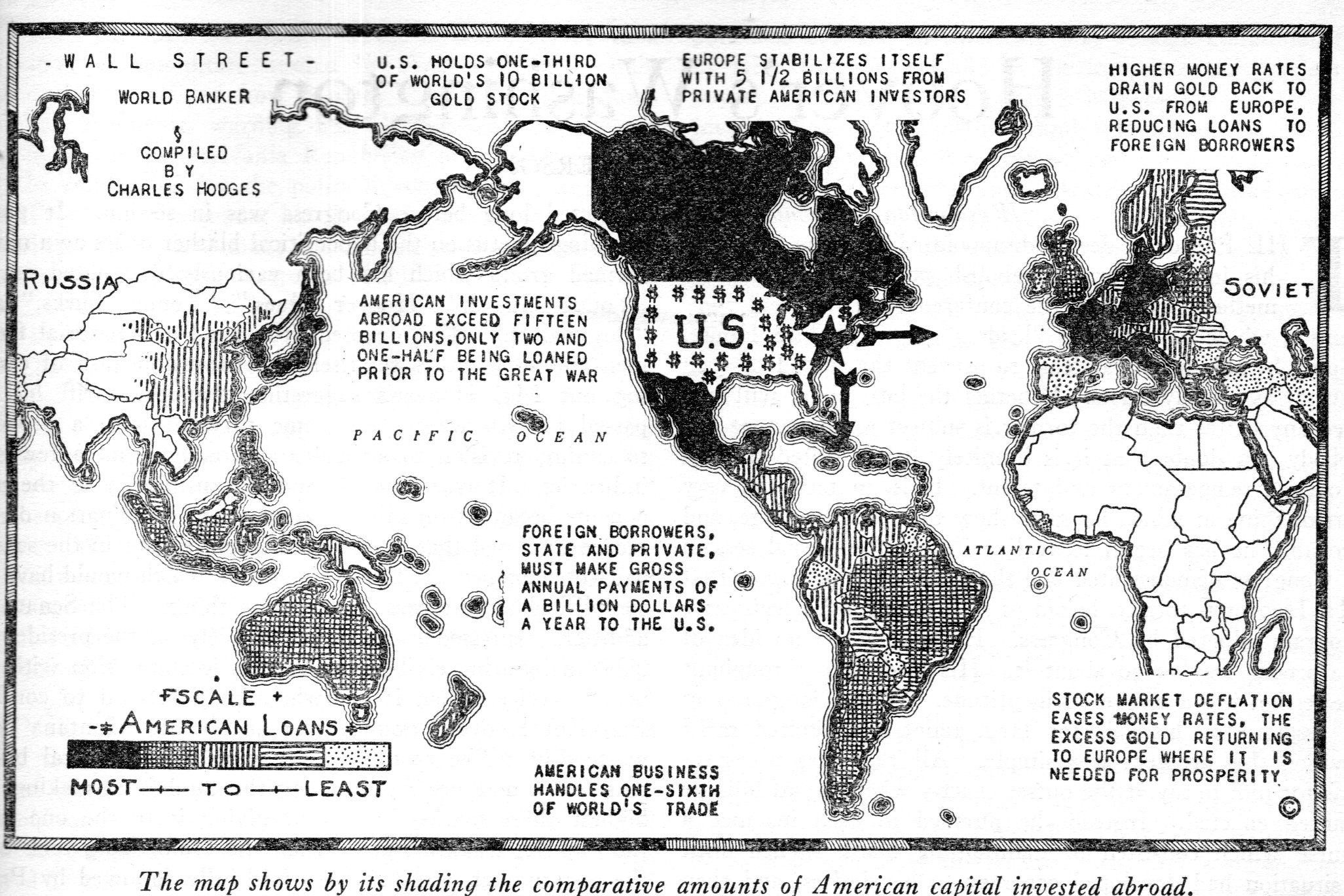
    By the time this map of U.S. foreign investments appeared in The Nation on December 4, 1929, the Wall Street Crash was 41 days old.  The giant ride to the top had pretty much dissipated by August 1929, and there was the beginning of the decline in September and October. October 24th was the beginning of the Great Crash–the 25th brought a glimmer of hope with buy-backs; but this was followed by Black Monday (the 28th) and then the bottom fell out of the bottom the next day (Black Tuesday, October 29).  There were some small fits and starts–at least enough for the columnists at The Nation to declare that the recovery had begum, as seem in a few articles in October–but they were sorely mistaken. 

    In any event, I haven’t seen this map before, and I thought to share.  


  • A Map of Future Military Conquest by Japan, 1933

    JF Ptak Science Books  Quick Post

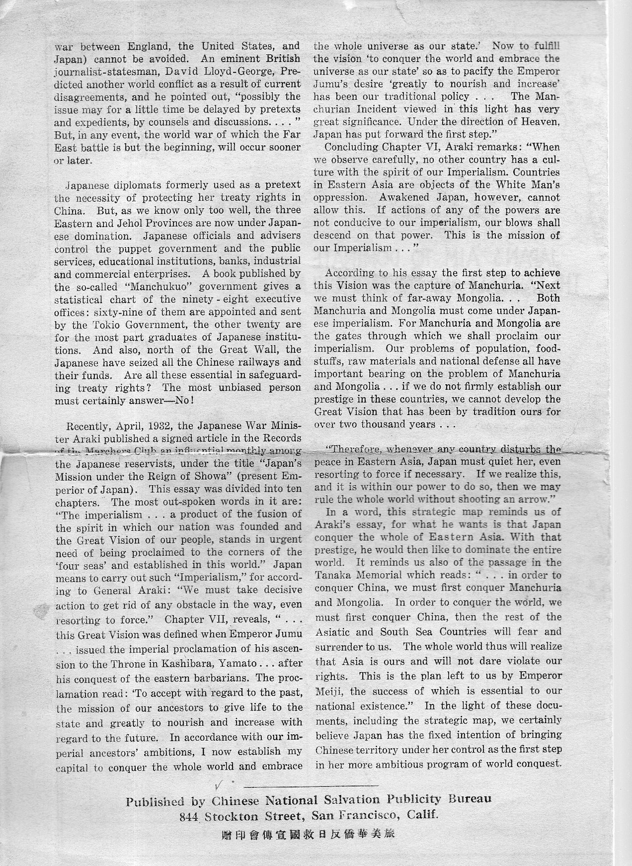
    I do not unfortunately have much information on this very interesting (and to me unexpected) map, nor do I know very much about the history of Japanese militarism and planning 1925-1935–I do though want to at least post/share it for interested parties.

    Ja[pan map200 Ja[pan map201

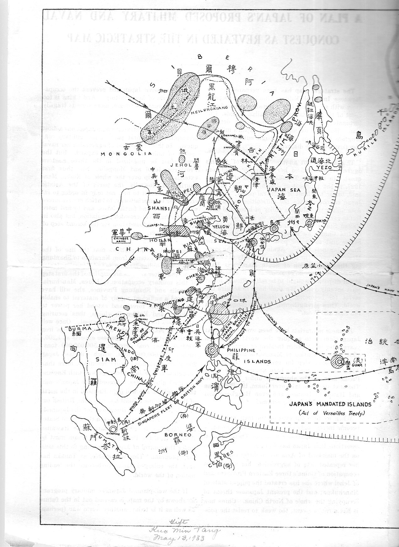
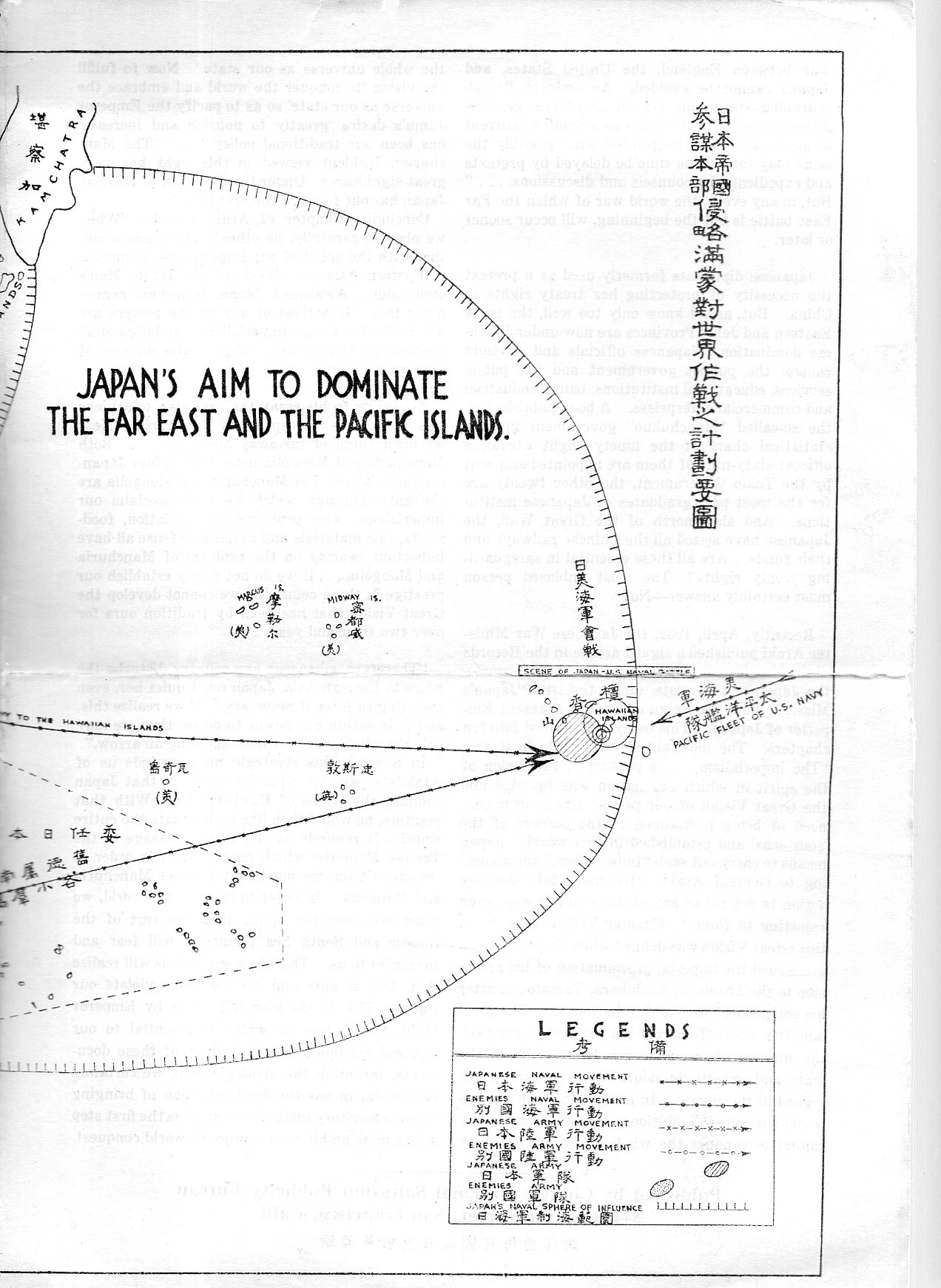
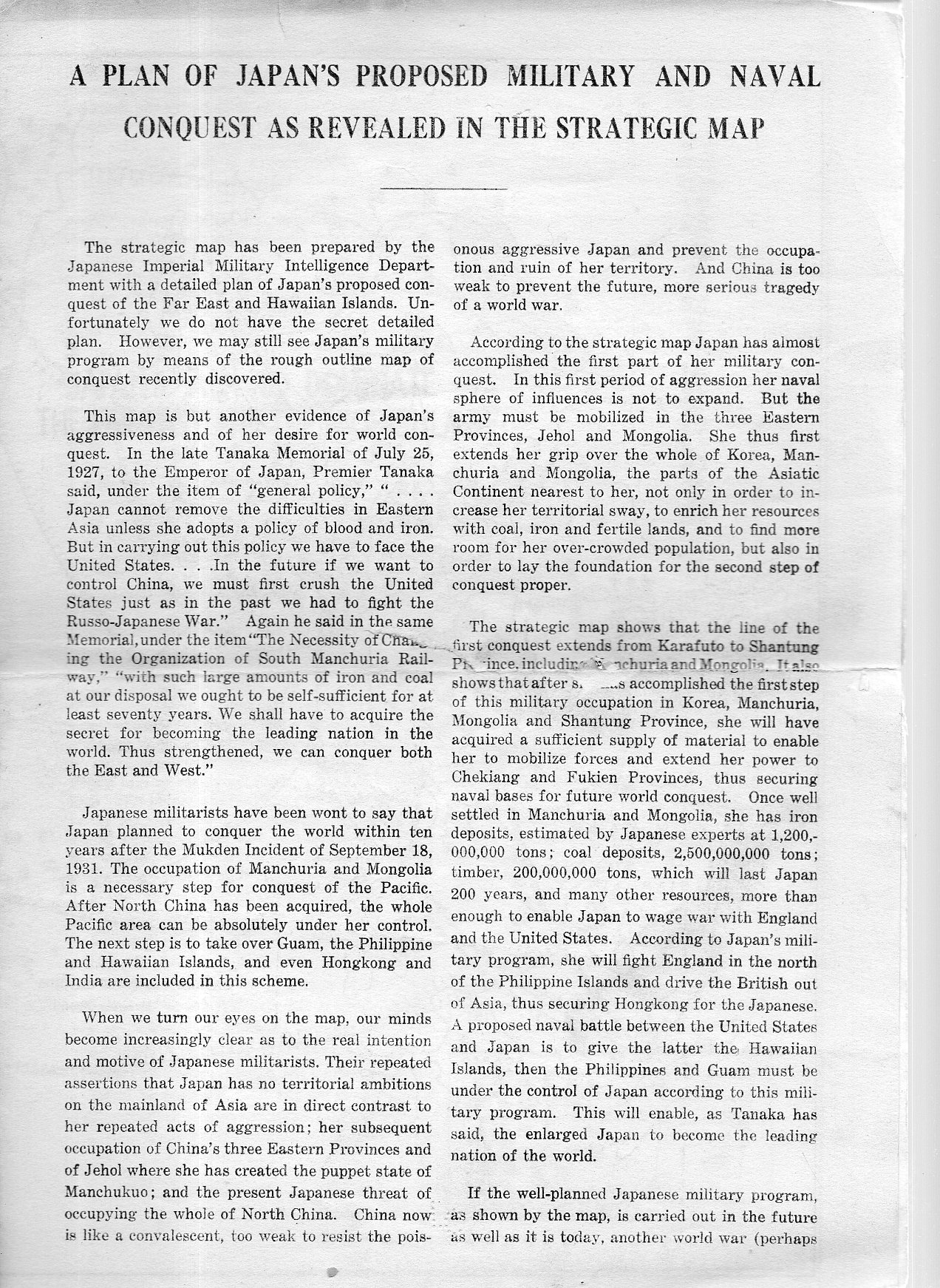
    A Plan of Japan’s Proposed Military and Naval Conquest as Revealed in the Strategic Map appears no later than 1933. The single-sheet folded pamphlet contains two pages of text along with the middle two sheets of the map, “Japan’s Aim to Dominate the Far East and Pacific Islands”. The document was part of a very large collection I bought of the Library of Congress, and according to the pencil notes on the pamphlet it was sent to the L.C. by the “Kuo Min Tang” on May 13, 1933.  (It was curious to see the KMT referred to as though it was someone’s name, rather than a political party begun in the People’s Republic of China in 1894.)

    This is a piece of anti-Japanese propaganda coming from the KMT, and it is published by the Chinese National Salvation Publicity Bureau (844 Stockton Street, which looks today like it is the Sun Yat-Sen Memorial Hall) in San Francisco,  After all, the Japanese had been savaging around in China on and off since the First Sino-Japanese War at the end of the century, and then again heating things up in the early ‘thirties with the Japanese-instigated the Shanghai War and the invasion of Manchuria–the Chinese no doubt were seeking allies wherever they could them.  

    There are a lot of lines of conquest on this map, encompassing nearly all of South East Asia.  The largest sphere of “influence” extends all the way to the Hawaiian Islands, where the Japanese would take the islands by a “naval battle” with the U.S.  

    I’ve checked WorldCat for other copies and found only one mention–same thing for the internet.  

    This map is available for purchase via the blog’s bookstore, here.  

    Full text follows:

    Ja[pan map198

    Ja[pan map199


  • A Child’s Manuscript Map of the U.S.A., ca. 1875-1880

    JF Ptak Science Books  Post 2274

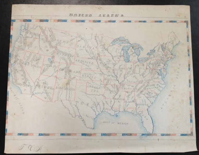
    It is difficult to find children’s art from the 19th century–original work, printed work, published work.  Very difficult–perhaps even more so for the published work than the manuscript.  It is easy to understand why: first, the children would need access to paper and pencil or pen and ink–items that had some cost, that were not inexpensive, not available to the vast majority of children. Their work was ephemeral, produced on slate, or in horn books, or in charcoal on a wall, or in dust.  Then, if the children did manage to record their creativity, then it would have to survive a generation of possessionship within their own lifetimes–to survive from the first part of the 19th century, the paperwork would have to survive five generations or more, 150+ years of house cleanings.  Tough odds.

    That is why it is also a little special when I come across larger manuscript works that have survived against these odds. 

    Maps US ms

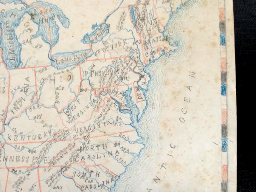
    This map of the United States isn’t so simple as it seems–although there are no major cities located in any states, many rivers are, as well as mountain ranges.  The coastlines get a very nice treatment with recessive blue lines, giving the map a certain dimensionality, and the lettering of the states is also distinctive, with the terminals of the letters in the state names ending with dots or lines.  

    Map US ms det

    I’d guess that the map was done around Centennial time, 1876 to the mid-1880’s, the biggest clues being the inclusive of Wyoming (which sets a date after 1868) and the large Dakota Territory, which would become North and South Dakota in 1889.  

    As maps by kids go, this one is fairly large at 12×15″–it is about the largest single sheet artwork that I have in a 150-odd pieces of antiquarian children’s art collection…also I wonder about how the kid in 1880-whatever got her/himself such a large piece of paper to work with, as it seems to me to be not a simple task.  


  • “The Body as Army and Navy”, 1921–Mechanical Images of Sensory Capacity

    JF Ptak Science Books  Quick Post


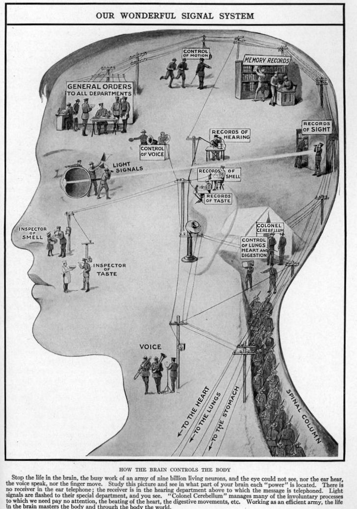
     These creative displays are found in Marion Florence Lansing’s The Wonder of Life (volume 11, Supplementary), published in 1921.  They represent a somewhat humanized-but-roboticized/automated approach to displaying he control of the senses, which seems to have been a developing style in the 1920’s giving the popular cultural appearance of mechanical people (the term “robot” appearing for the first time in this same year in Karel Capek’s play R.U.R.). The images also appear, appropriately enough, in the chapter titled “The Machinery of Our Bodies”. 

    Map of the senses


  • Children and Labor, 1910-1920

    JF Ptak Science Books  Quick Post


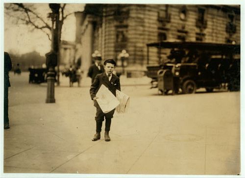
    Newsboy

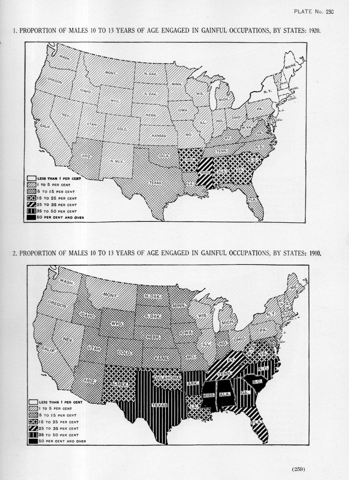
    Welcome to the not-too-distant past, the era of my grandmother, when in 1910 50% or more of 10 to 13 year-old boys in Mississippi, Alabama, and South Carolina were working, and working at real jobs.  There does seem to be a remarkable change in the employment situation in the next census of 1920.  

    [The maps below appear in Statistical Atlas of the United States, prepared by Charles S. Sloane, published in Washington, 1925, plates 230 and 232.]

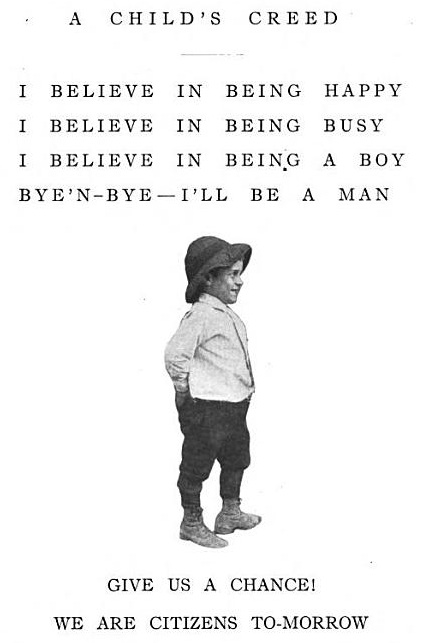
    See some earlier posts on child labor: 

    among others…

    Maps employment children238

    Child work--childs creed


    Maps of the proportion of females 10 to 13 years of age engaged in gainful occupations, 1920:


  • 37 Miles from Mexico *and* 27 Miles from Poland

    JF Ptak Science Books   Quick Post

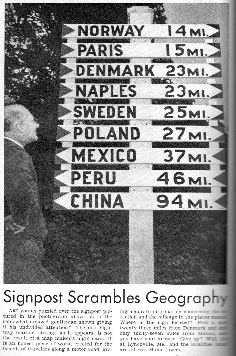
    The answer is “yes”, the sign is real; the question though is where does it work? 

    Road signs235

    [Source: Popular Science Monthly, July 1940.]

    The location, according to the article, is Lynchville, Maine, which is about 50 miles northeast of Portland.  


  • A Myopic Map of Christian Leadership in China, 1938

    JF Ptak Science Books   Quick Post

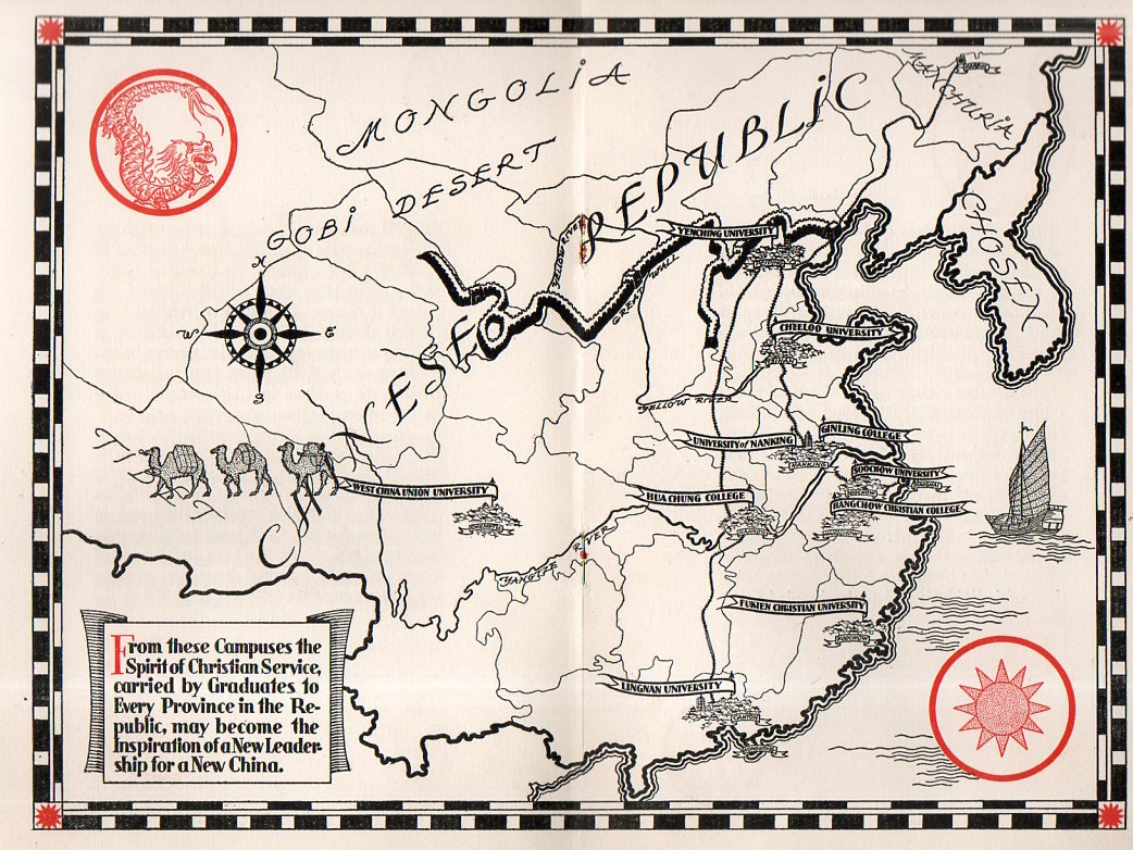
    I found this very unusual map of China in a pamphlet entitled Higher Education’s Century of Progress in China, published for the Associated Boards for Christian Colleges in China in New York City in 1938.  This is well into a solid decade of internal political turmoil in China, coupled with years of dealing with an invasive Japan, and all rolled up in 1938 with the first few years of an all-out Sino-Japanese War (the second one, the first occurring at the end of the last century). This war wasn’t necessarily a war between two opposing armies–it was also a war between the Japanese army and the people of China. This was highly demonstrated from December 1937 to January 1938 with the massacre and mass rapes committed against unarmed combatants in the Republic of China’s capital city, Nanjing/Nanking prior to its occupation–this is known as the Rape of Nanking, and is so known for very secure reasons. There was also a devastating flood of the Yellow River.  

    In a series of decades of difficult years, 1938 was particularly difficult year for China. 

    That said, this pamphlet discusses the “century of progress” in China by Christian missionaries, and the “birth and development of Christian education there”.  The situation in China in 1938 for this pamphlet was that there were 300 million illiterate Chinese–“it is a situation that challenges the Christian world!” so it reads. Perhaps what this meant was that they could not read the Bible until they were taught how to read it.

    And that was the extent of the recognition of what was going on in China.  To capitulate the interests of history those who generated this work included a map of China that included almost no detail except for Christian colleges.  

    China Christian map204

    It must have felt very comfortable for the Associated Boards for Christian Colleges in China to have published this pamphlet in 1938, having the China situation well in hand, snug in the comfort of a real or imagined pew, the issue and morality of its optics unchallenged by reality.