A Daily History of Holes, Dots, Lines, Science, History, Math, Physics, Art, the Unintentional Absurd, Architecture, Maps, Data Visualization, Blank and Missing Things, and so on. |1.6 million words, 7500 images, 4.9 million hits| Press & appearances in The Times, Le Figaro, Mensa, The Economist, The Guardian, Discovery News, Slate, Le Monde, Sci American Blogs, Le Pont, and many other places… 5000+ total posts since 2008.

Category: Maps/Diagrams of Imagination & Ideas

  • The Coming Storm: a Map of the French “Drole de Guerre”, September, 1939

    JF Ptak Science Books   Post 2582

    This orderly and  semi-pastoral bird’s-eye view of the earliest part of the war in the west of WWII appeared in The Illustrated London News on September 30, 1939, three weeks or so after the Nazi attack on Poland.  The foreground shows about 40 km of the front from the river Nied to the Saar and south to Saarburgken, with the Siegfried Line in the distance.  The map shows the region into which 40 French divisions advanced from September 7-16, meeting little resistance from the outnumbered German troops who by and large fell back to more defensible positions. 

    Not much happened.

    This period of the war has often been referred to as the “Phony War” due to the lack of action, though it wouldn’t seem so “phony” if you were killed in the process, as thousands were.  Winston Churchill referred to it more as the “Twilight War”, which is far more appropriate–and this no doubt more meaningful to Churchill int he light of the HMS  aircraft carrier “Courageous” being sent to the bottom by Nazi torpedoes with the loss of more than 500 sailors…there was certainly not a bloody thing “phony” in that. 

    The French referred to this period as the “Drole de Guerre”, which they really shouldn’t’ve done–their Saar offensive of mid-September being stunted and odd, came to a halt, and the troops called back to the doomed Maginot in October. 

    The Twilight War continued until late April, and then in May, it was certainly all over, as the Nazis attacked Belgium, Luxembourg, and the Netherlands. And then of course came France.  In just about the same amount of time that the Saar Offensive occupied, the Germany advanced and forced France to surrender, the curtain coming down on June 22.   Calm before the storm, and all that–the rest of the war was more storm before the storm, until there was storm no more.
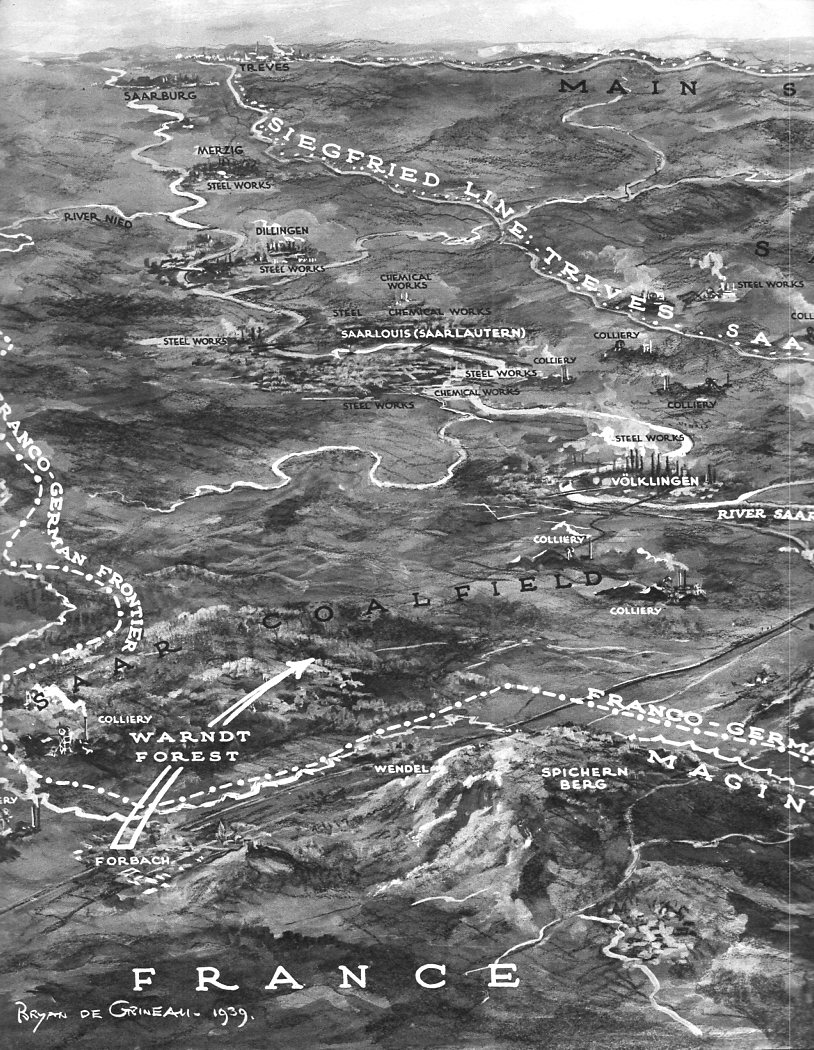
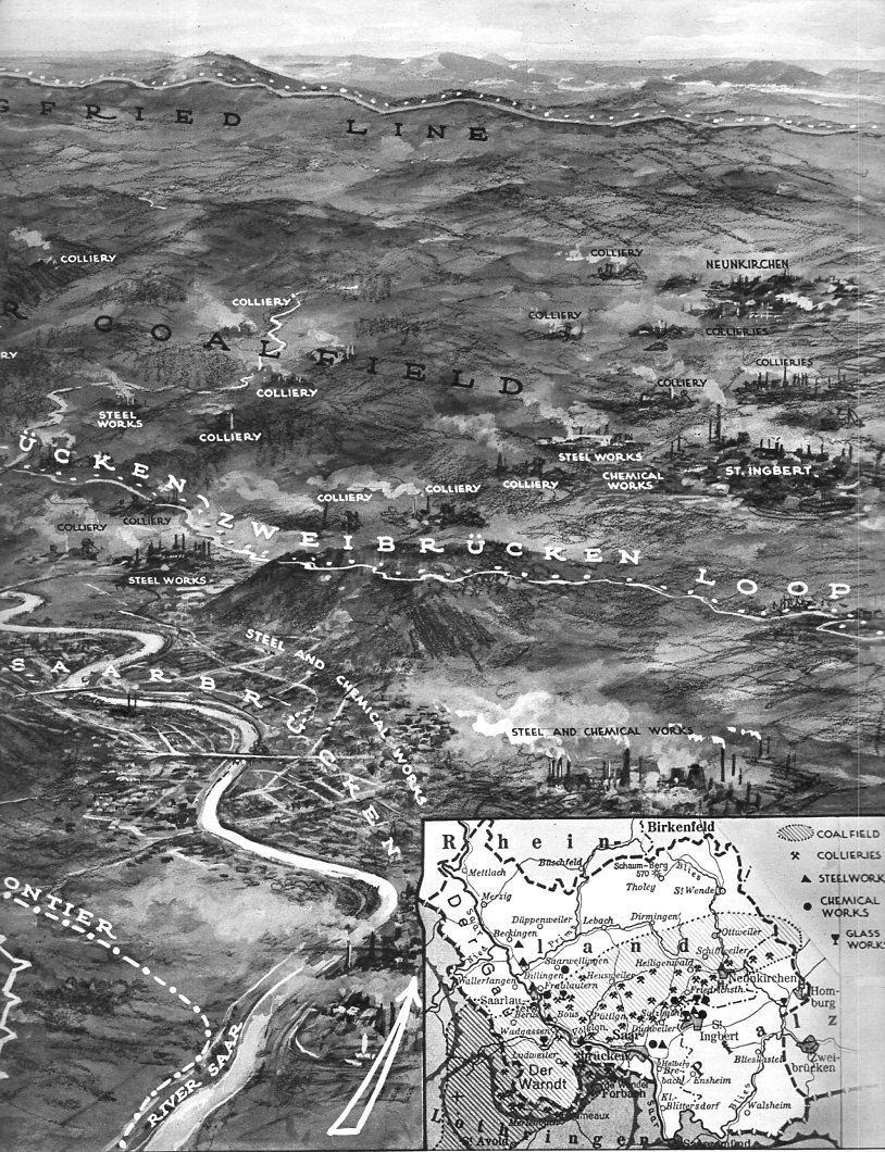
     

    Siegfried line _1_375 Siegfried line _2 _380


    And the text accompanying the maps:

    Siegfried line _1 text_376

    Siegfried line _2  text b_379


  • WWI Editorial Cartoons–More Editorials Than Cartoons (1918)

    JF Ptak Science Books  Post 2581

    Judge magazine (1881-1947) was a U.S. satirical weekly that for several decades published insightful/devastating political cartoons of the highest caliber. (Judge was a sort of knock-off of Puck magazine, started by writers and cartoonist/artists dissatisfied with that fine journal; Judge itself was done in in the same way after a fashion–Harold Ross, who served as editor of Judge for a few months in 1924 went off and started his own magazine, The New Yorker, which slowly and then rapidly cleaved away readership and talent from Judge until Judge was no more.)

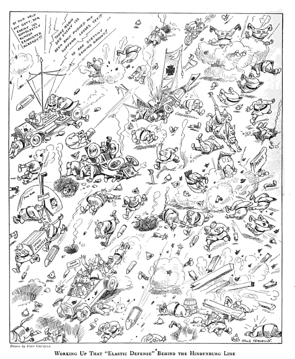
    It seems to me that when leafing through a volume for 1918 that Judge published more cartoons and sketches relating to World War I than cartoons for any war that I have seen in any magazine. I’m not that familiar with Judge relative to other magazines, and was very surprised to see that nearly every page has some sort of illustrated war content.  In the issue for October 12, 1918–just four weeks before the end of the war–I found this image:

    WWI cartoon 1918 GruelleIt is complex and at first looks to be very layered, but I think that it turns out to be not so, that it is flat, and uni-dimensional, and not very satirical–it is however very pointed, and barbed, and makes its case very quickly, in a sort of way that makes you begin to chuckle until you realize just what the content is.  The work is by artist/illustrator/designer John (Johnny) Gruelle, who in the same year introduced the world to his creation of Raggedy Ann (patenting the design a few years earlier, in 1915, https://www.google.com/patents/USD47789.)

    [The Judge was located at 225 5th Avenue, the Renaissance-style 13-story building converted into condos where the active selling price is about $2,670/sq foot1, or about 3.5 million/unit, somehow making this property worth a combined $600 million or so.]

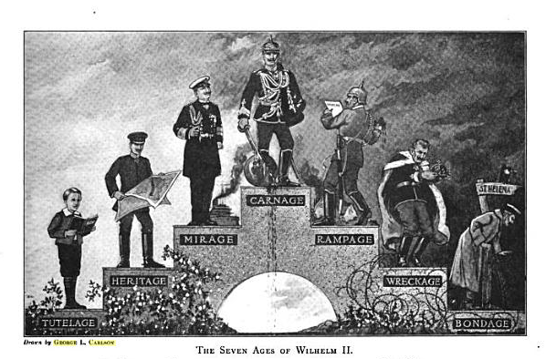
    The very next page comes this condemnation of the German leader Kaiser Wilhelm II, employing the very well worn “Ages of Man” scenario:

    WWI cartoon K Wilhelm

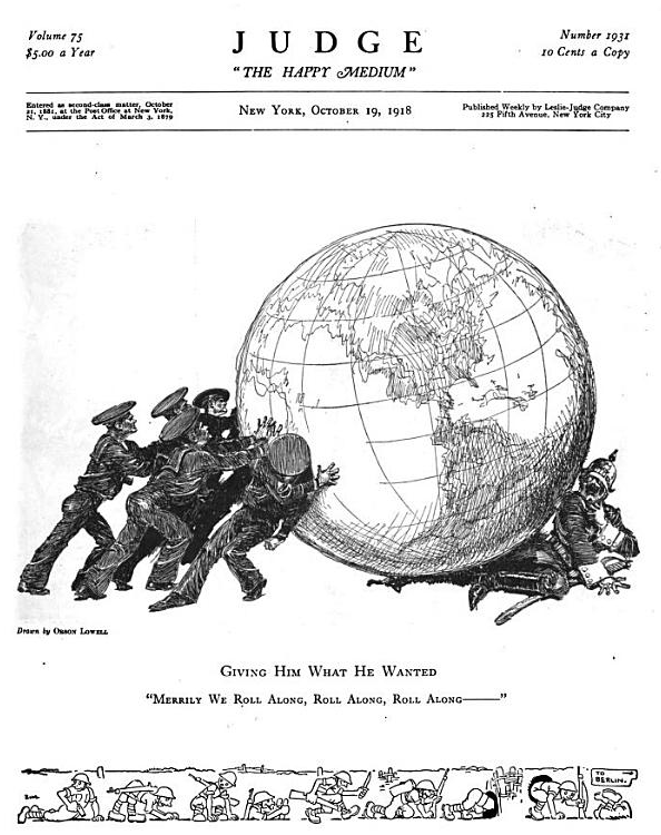
    And just a few pages later, another interesting image, this one being another entry in this blog’s collection of images of the world used in advertising/cartoons:

    WWI World Map

    There were many more war-related illustrations in these few dozen pages, with these three having the most appeal and greatest impact–pretty good stuff spread out over just two or so square yards of magazine pages.

    Notes:

    1. See http://streeteasy.com/building/the-grand-madison


  • A World Map of Heavy (1922)

    JF Ptak Science Books  Quick Post    Part of the Maps/Diagrams of Imagination & Ideas series

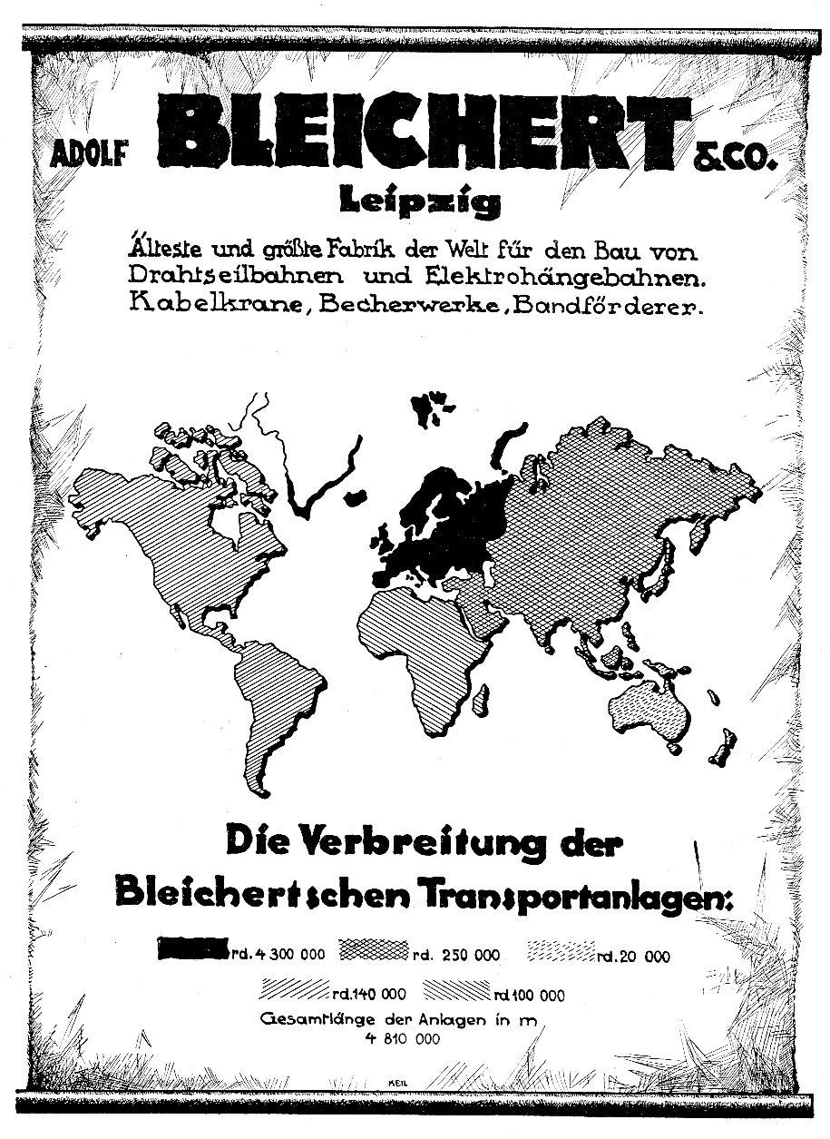
    There have been dozens of posts on this blog about odd/unusual maps, including a number in a sub-category of world maps used in advertisements. This one, for the Adolf Bleichert Company of Leipzig, showed the reach of the company’s distribution of some of their major products, like cable cars, cranes, tramways, elevators, and the components for them. The map, typeface, and general design have a heaviness to them corresponding to the very heavy metal that the company produced.  The ad appeared in the August 22, 1922 issue of Illustrirte Zeitung (Leipzig), and occupied the entire cover of the news-weekly. 

    Map of cable370


  • On the Heightiest Heights of Traffic Height

    JF Ptak Science Books  Quick Post

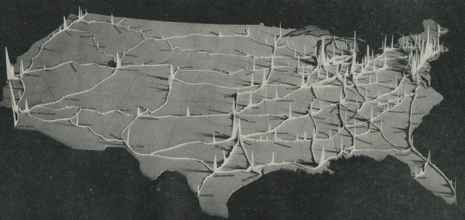
    I found this fabulous map of concentrations of U.S.A. (1944) traffic flow somewhere in the hinterlands. When I started to research its origin I found that the background and story of the map and its source is dealt splendidly by Eric Fischer in a 26-photo Flickr set here: https://www.flickr.com/photos/walkingsf/albums/72157632238833323 


    Map height of traffic

    Map height of traffic

    [Source: Interregional Highways: Message from the President of the United States Transmitting a Report of the National Interregional Highway Committee, Outlining and Recommending a National System of Interregional Highways, January 12, 1944.]


  • Nazi Propaganda and the British “Trade War”, 1940

    JF Ptak Science Books  

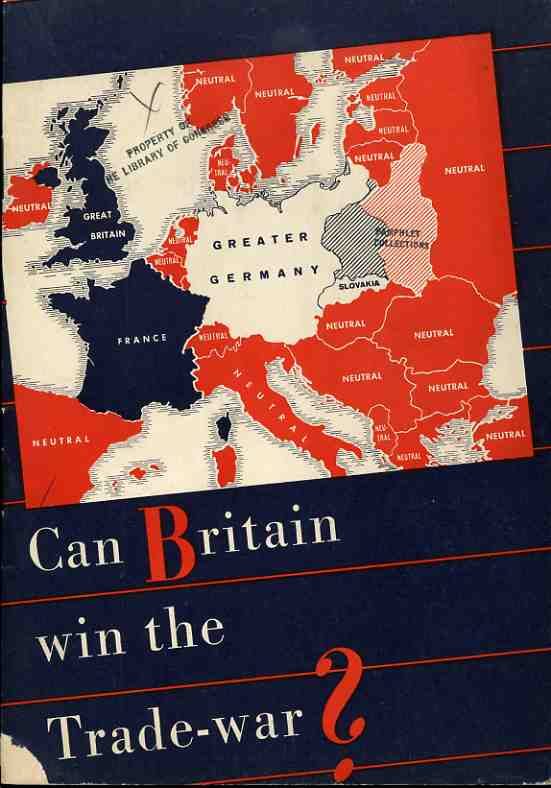
    The Nazi propaganda office published this effort (printed in August 1940) with every intent of making it seem as though it was produced in the U.K. as a sober reconsideration of fighting against the Germans, casting much of the argument in terms of economics. It was a relatively soft-sell effort in a hearts-and-minds campaign, hitting its target audience with reminders of how alone everyone on the British Isles were in the hard summer of 1940.  
                                                                   
    Nazi Propaganda Map  Can Britain win trade war


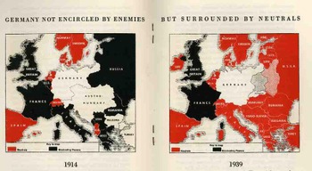
    These two maps compare the economic and trade situation of 1914 and 1939, from the Nazi perspective.  In 1914, the British, “as a preliminary condition for the success of the hunger-Blockade, only achieved, however after four years if struggle during which Britain was to sustain heavy losses”.   They announce with exclamation (!) that for 1939 there was:

    “a totally different situation! The encirclement of Germany miscarries, leaving way for the expansion of Germany, and the way for her trade with neutral countries, especially with the Balkans and Russia…thus is the blockade against Germany a hopeless enterprise”.   

    The Nazis’ state that “Britain…energetically refuses to admit the hopelessness of her winning this trade war and tenaciously grasps upon all kinds of unfounded rumours…”, all the while refusing to discus the bombing of Britain or any other aspect of military war

    Blogaugust_26_nazi_prop_2_map450                                                                                                                                                           

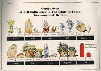
    After a dozen pages of making the case against the British position in being able to take care of itself, there is this folding quantitative display, making a diametrical-pictorial presentation of the British failings.  The Nazis show that they overpower the British in the ability to supply itself with grain, flour, meat, cooking fat, cheese, eggs, sugar and vegetables–in every area, in fact, except for fish. 

    Blogaugust_26_nazi_prop_food454

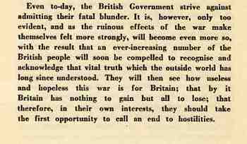
    This is the summation of the pamphlet, the last paragraph, asking the Brits to just give it up and quit their fight. 

    Blogaugust_26_nazi_prop_text452


  • Now *That’s* a Front-page Newspaper Map…(1863)

    JF Ptak Science Books  Quick Post

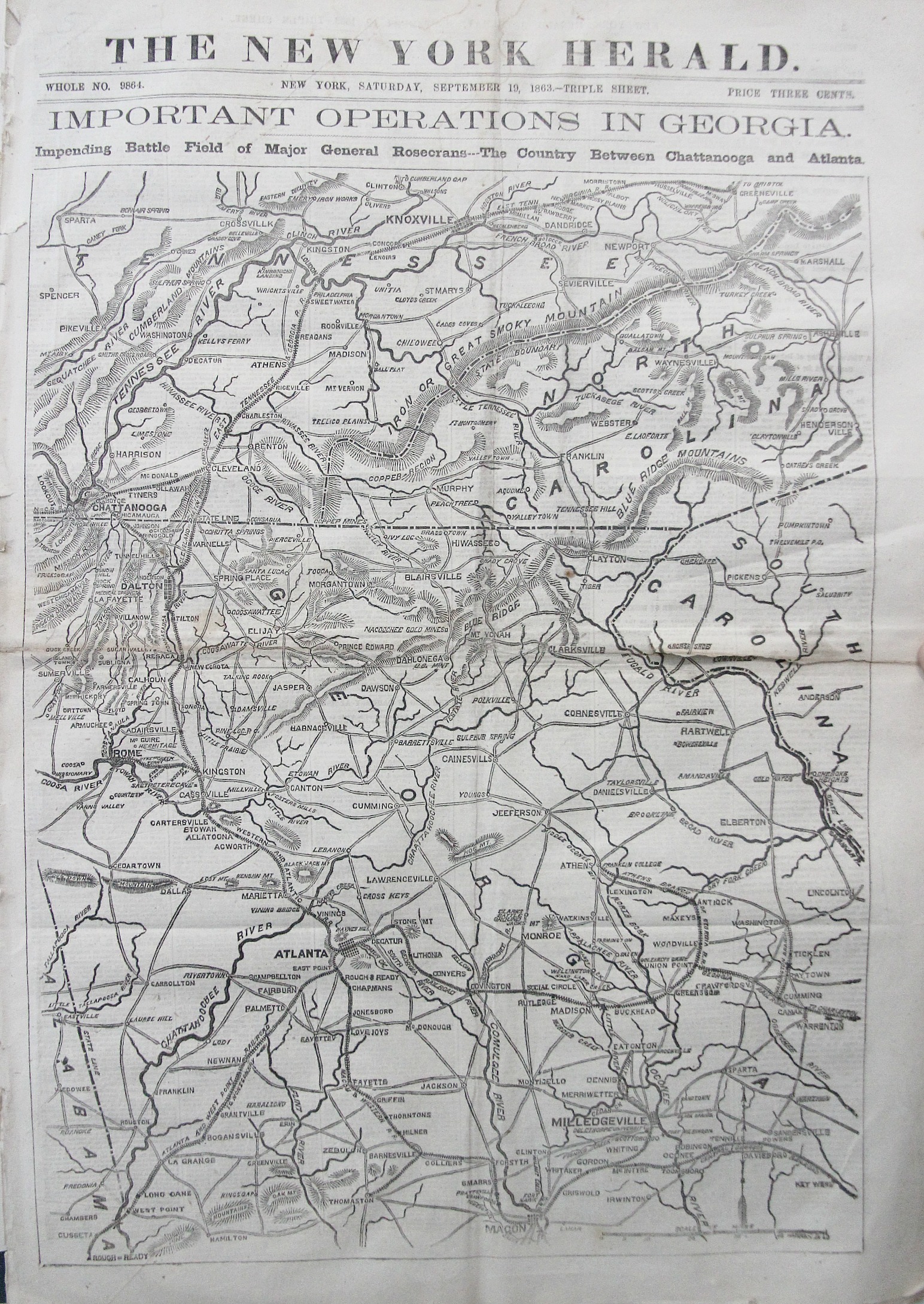
    Georgia map

    This fine map popped out at the warehouse today–the New York Herald, September 10, 1863, with a fantastic full-page/front-page map of the theater of war in Georgia (and southern Tennessee and south-western North Carolina), back when newspapers were newspapers.  But the map centers on Georgia, and comes just a week before the second bloodiest battle of the war at Chickamauga. (The town appears right underneath the label for “Chattanooga”.)

    My own Hendersonville appears at the extreme east portion of the map in North Carolina, just north of the South Carolina line.  Most of the mountains seem to not make a very formidable entrance on this map (though Cold Mountain is seen just to the north-west of Hendersonville), and I think it is somewhat deceiving.  I’ve driven the mountains a lot in Western North Carolina and often thought of slogging around the region in the foothills, avoiding all of the mountains that I was driving through which really didn’t show up on this map.  There’s a reason that there wasn’t that much in the way of conflict in this region of WNC, northern SC, and eastern Tennessee–of course there wasn’t much worth winning, but marching through the mountains would have been a major piece of bad country to go through.  

    In any event, this was a good map for northern and central Georgia, introducing northern readers to an advancing front of the war.  


  • An A to Z-ery of Love and its Associative Bits: the Map of Matrimony, 1879

    JF Ptak Science Books   Post 2568

    Rhinoceros nunquam victus ab hoste cedit–the rhino never turns away defeated from the enemy

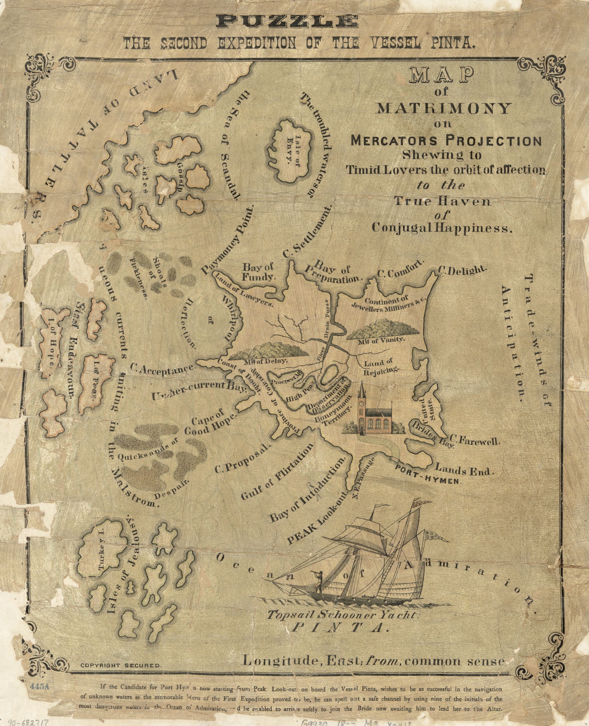
    And so we begin a look an an allegorical map1 of matrimony with an allegorical statement comparing marriage to a rhino–this is a first for me, and it may also be an original application of the epigram to (human) marriage.  I guess in the mind’s eye this looks as though it might be so, given there’s really no possibility of dealing with a charging rhino weather the Big Boy is charging in happiness or fear, anger or love–it is just going to get you.

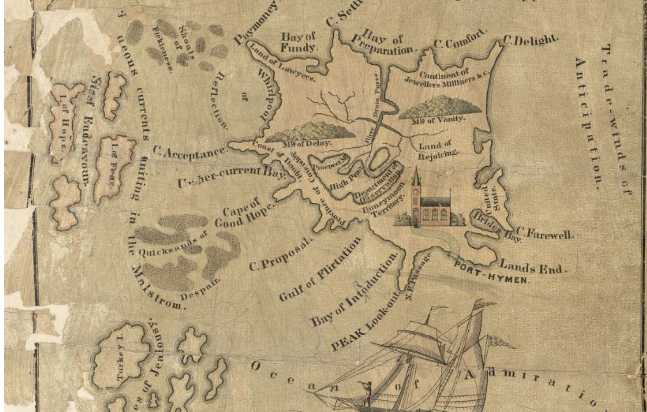
    The map has a little more guile than this, enumerating the good points of marriage along with some of the bad–surprisingly these states nearly fill an alphabet, which is pretty unusual given that there are only about 50 states and it covers 17 letters (with nothing at all for the last four letters). 

    And so the carto-geographical indulgence of the alphabet of marriage: Acceptance, Cape of; Brides Bay; Comfort, Cape of; Delight, Cape of; Envy Point; Fickelness, Shoals of; Hope, Cape of Good; Introduction, Bay of; Jealousy, Isle of; Lawyers, Land of; Observation Point; Paymoney Point; Reflection, Whirlpool of; Scandals, Sea of; Tattlers, Land of; Undercurrent Bay; Vanity, Mount of.  


    Map of Matrimony[This is clearer when expanded. Source:  the Library of Congress http://www.loc.gov/resource/g9930.ct003856/]

    And the full version:

    Map matrimony large

    Notes

    1. Map of Matrimony on Mercators projection shewing to timid lovers the orbit of affection to the true haven of conjugal happiness. (In upper margin: Puzzle : the second expedition of the Vessel Pinta.)


  • The End is Near for You: Germany, May, 1945

     JF Ptak Science Books   Quick Post

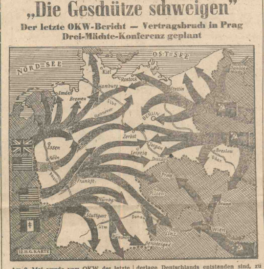
     This incredible map appeared in the May 19, 1945 issue of the Kolnischer Kurier,  It was published in Koln, in German, for Germans, but was printed and distributed as news and propaganda by the advancing U.S. Army.  It is remarkable that at the tail end of the final  offensive there were such forward-thinking people planning in terms like this, dealing with a newly-conquered enemy and trying to organize the thoughts of the population.  

    [The first twelve issues of the Kolnischer Kurier were published by the Americans; the rest of the newspaper (issues 13-62, 1945-6) were published by the British.]

    The map leaves little to the imagination except for what total defeat might bring:

    Kolnischer map

    [Kolnischer Kurier map, 19 May 1945, via Veri Josef Weber  http://veriweber.de/der-pulverdampf-hat-sich-verzogen/]

    The newspaper was extraordinarily, reporting on the Tötungsanstalt Hadamar/Hadamar Euthenasia Center in 1945, the Bergen-Belsen trials at Luneburg in September 1945, the Nuremberg trials (November 1945-September 1946), and much else.  Deserving a separate mention is a piece by Thomas Mann on the German concentration camps published nearly on the day of German surrender–Mann makes explicit, personal claims that all Germans are responsible for the atrocities of the concentration camps.  (Mann would make a radio address on May 8th exactly on the German soul and the concentration camps, and culpability, and blame, and the morality of  the war.  


  • A Glorious if Not Accurate Map of Ocean Currents 1675

    JF Ptak Science Books   Quick Post

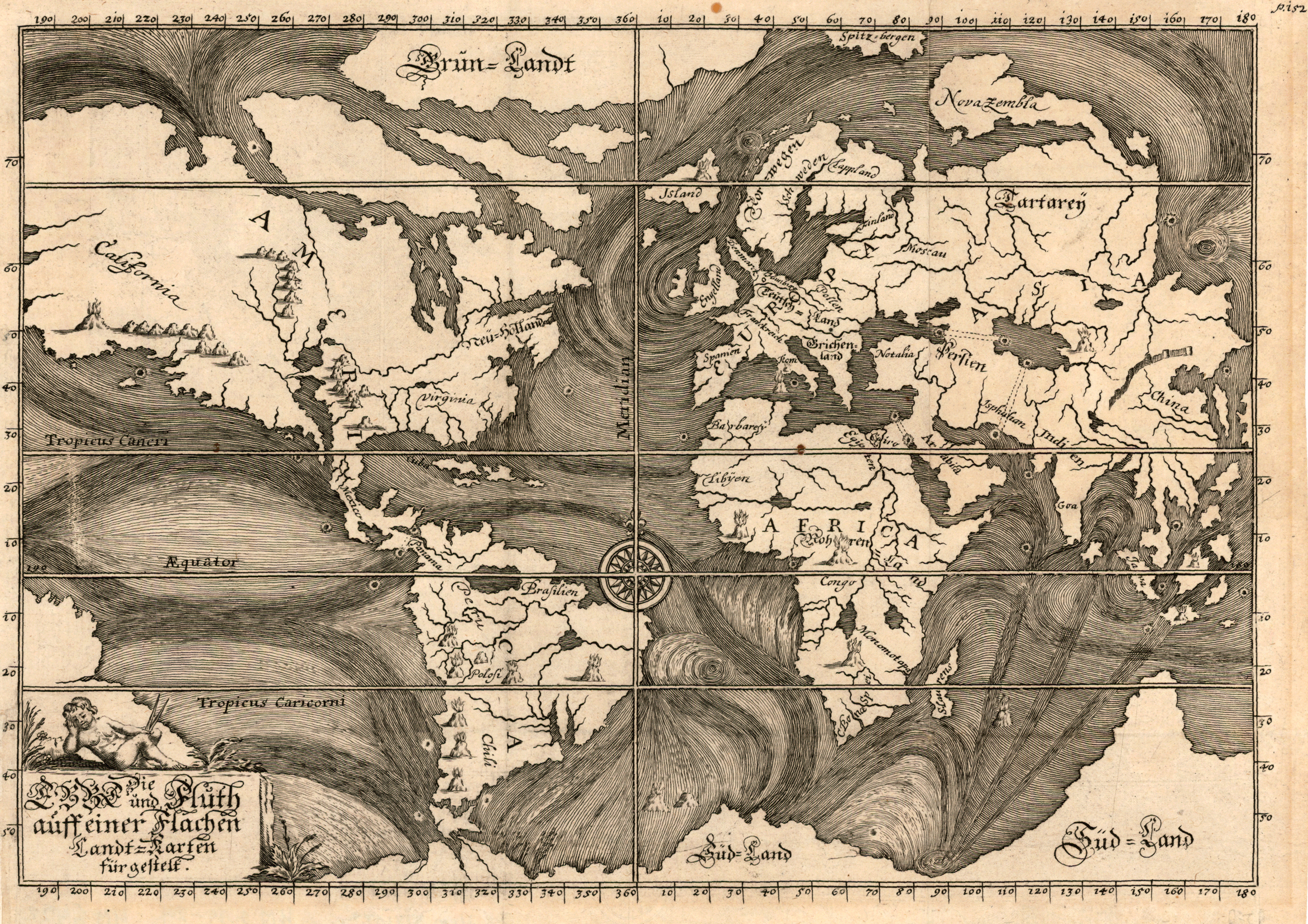
    I’m interested in this fabulous map,“Die Ebbe und Fluth auff einer flachen Landt-Karten fürgestelt” by Eberhard Werner Happel.  Happel’s  (1647-1690) map was a very early thematic effort at depicting the course of the currents of the oceans, and may or may not have been very heavily dependent upon the work of Athanasius Kircher, who produced a remarkably similar map, but a few years earlier.  

    Map ocean Heppel 1675[Source: Pirnceton University http://libweb5.princeton.edu/visual_materials/maps/websites/thematic-maps/quantitative/hydrography/hydrography.html

    Happel was a polymath much in the line of Kircher, and as gifted as he was (producing novels and popular works on the natural sciences in a number of books numbering many thousands of pages) he was not at the Kircher-level of polymath. Perhaps he was more on the line of a sub-Robert Burton (Anatomy of Melancholy) though not quite there, either. He did an extraordinary amount of writing in his slim 43 years, though not necessarily at the highest level of intellectual achievement (as with the other two). 

    In any event, the map is beautiful.

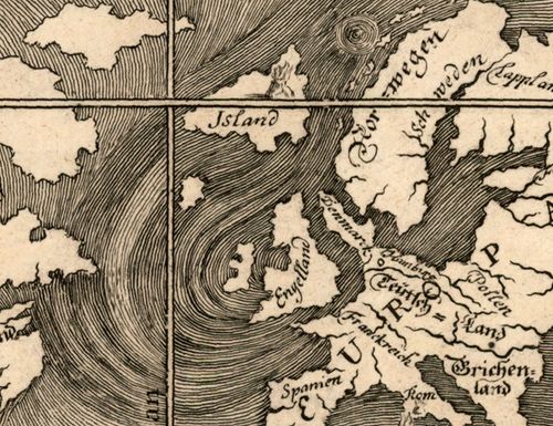
    And the details of high artistic forms:

    Map ocean Happel 1675 b

    and so:


  • When U.S. Forces Occupied Los Angeles (1848)

    JF Ptak Science Books    Quick Post

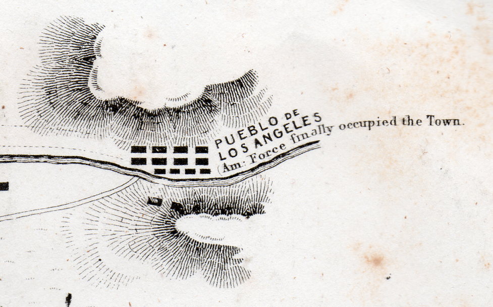
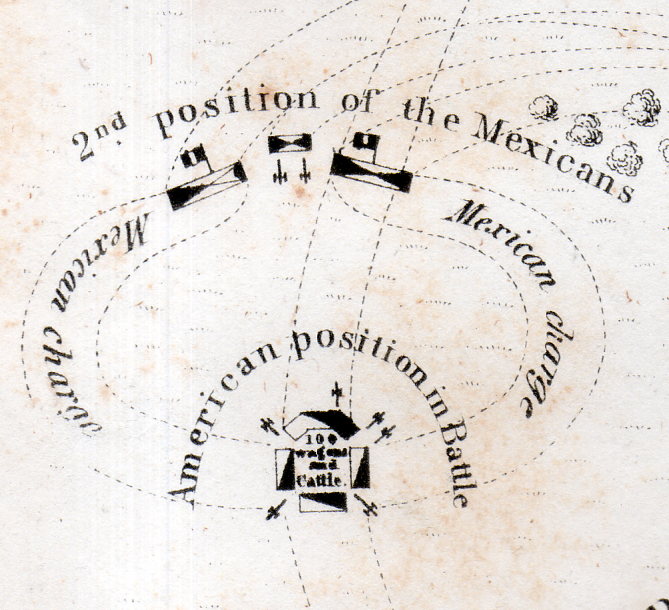
    Battle Los Angeles 1848926[Detail of a one square inch area in the original.]

    This lovely map has a few tiny bits of unexpectedly weird details–I mean they’re historically accurate and all, it is just that removed and presented apart from the context of the rest of the map the details take on a peculiar–and attractive–surreal quality.

    Battle Los Angeles 1848927[Detail of a one square inch area in the original.]

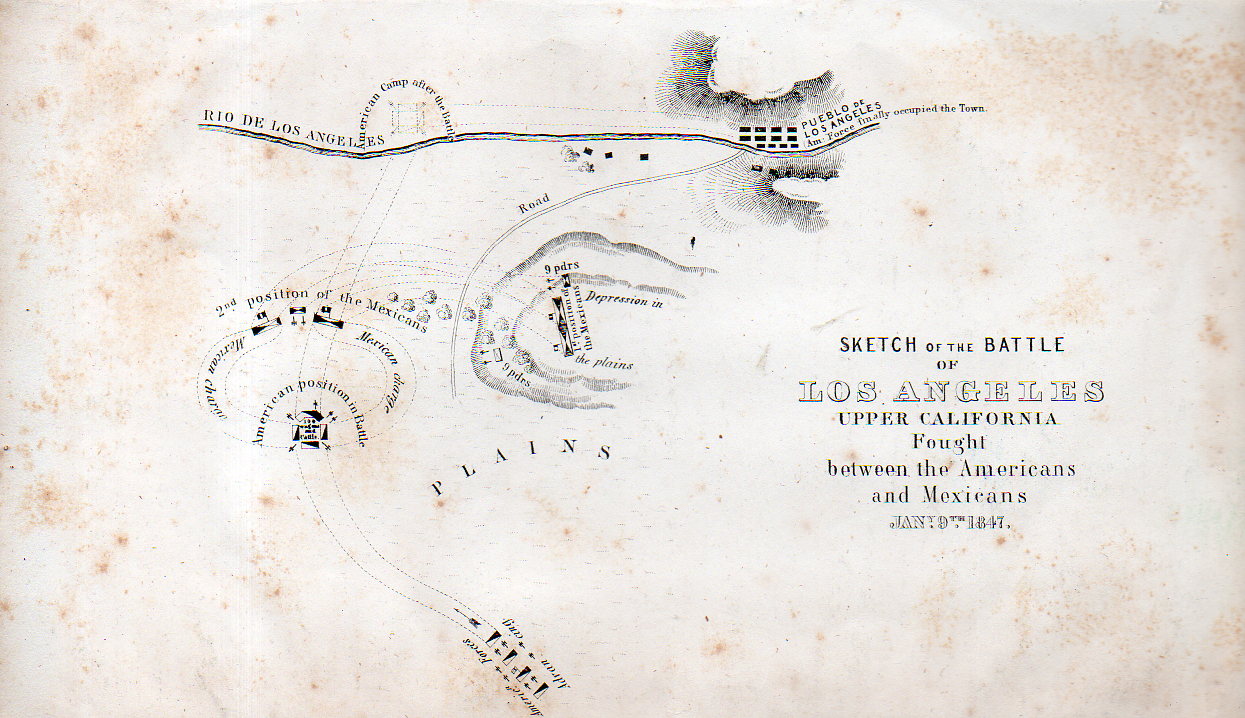
    The map is a Sketch of the Battle of Los Angeles Upper California fought between the Americans and Mexicans, Jan 9, 1847, and published in 1848. The map depicts the grounds of the Battle of the San Gabriel River, a victory for the United States, which resulted in the retaking of Los Angeles from the Californos a couple of days later, on January 10.  

    Full explanations of the battle can be found in a number of places, but this one is pretty concise and clear. 

    ,Battle Los Angeles 1848925

    Origin:  EMORY, W[illiam] H[emsley] (1811-1887). Notes of a Military Reconnaissance, from Fort Leavenworth, in Missouri, to San Diego, in California, Including Parts of the Arkansas, Del Norte, and Gila Rivers…Made in 1846-7, with the Advanced Guard of the “Army of the West.” Washington: Senate Executive Document No. 7 [30th Congress, 1st Session] Wendell and Van Benthuysen, Printers, 1848.  (13 x 22.2 cm; 5-1/8 x 8-3/4 inches). A bit of foxing, otherwise a good copy of this map.  

    This map is available from our blog bookstore, here.