A Daily History of Holes, Dots, Lines, Science, History, Math, Physics, Art, the Unintentional Absurd, Architecture, Maps, Data Visualization, Blank and Missing Things, and so on. |1.6 million words, 7500 images, 4.9 million hits| Press & appearances in The Times, Le Figaro, Mensa, The Economist, The Guardian, Discovery News, Slate, Le Monde, Sci American Blogs, Le Pont, and many other places… 5000+ total posts since 2008.

Category: Information, Quantitative Display of

  • Displays of Info You Probably Don’t Need: Advertising Methods (1892)

    JF Ptak Science Books,  Quick Post

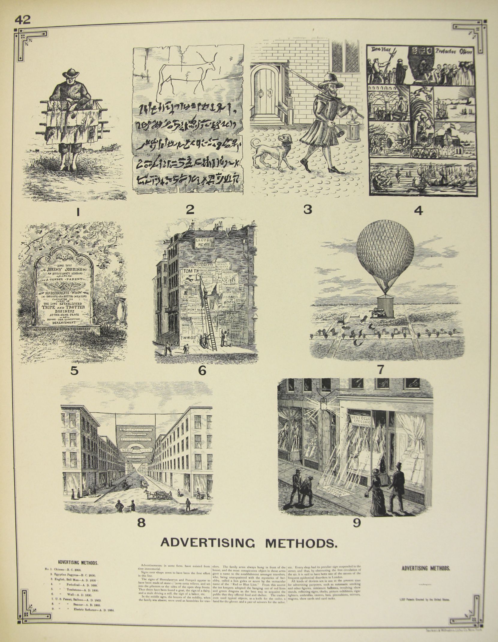
    Benjamin Butterworth, the Commission of Patents, produced in 1892 a superb work on the history of state of technical achievement in the U.S., The Growth of Industrial Art. The “art” part of the title actually referred to the creation-as-art of industry/technology more so than the design aspect of it, though the two are pretty closely related.  There were 200 plates of illustrations for inventions for windmills, mails, screws, cork, bicycles, harvesters, threshers, glass makers,, ice harvesters, cigar manufacturing, sweeping, telephones, telegraphy, and so on, in more than 150 categories.   Among these images some of my favorites are for advertising apparatus and means.  For example, in the historical timeline below we find in #7 an automated flying leaflet distributor, and according to the text it was (unlikely) patented in 1862:

    Advertising MEthods

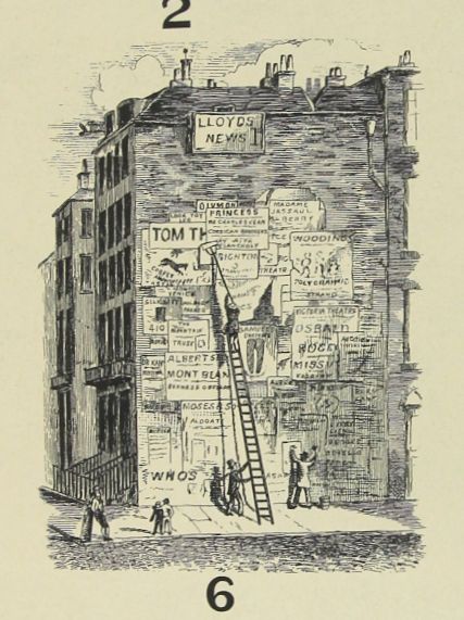
    #6 is cringeworthy, showing the very common practice of covering optimally-placed buildings with billboards–I’ve seen numerous early-ish images (19th c) showing large swaths of buildings on busy streets nearly entirely covered by ads.  

    Advertising Methods detail

    From Internet Archive, the full text with illustrations can be found here:  https://archive.org/stream/growthindustria00Unit#page/n9/mode/2up

    Text from the illustrations:


  • 1/580,000th of the Shells Fired in WWI

    JF Ptak Science Books    Quick Post

    This striking photo shows the shell casings for one day’s worth of bombardment by the U.K., at a position somewhere in France, 1916.  I reckon that there are 3,000 105mm shell casings in this photo, which for one day’s work is a lot.  Throughout the course of the war it has been estimated that there were about 1.75 billion artillery shells fired, which makes this pile about .0000001% of the total; another way of looking at this number is that it would take about 580,000 of these piles to equal the 1.75 billion figure.  It is a vast number, and vast numbers are hard to understand in a daily language.  

    WWI Project !05 mm shells single day

    [Image source: RarehistoricalPhotos.com http://rarehistoricalphotos.com/shells-creeping-bombardment-on-german-lines-1916/]


  • Artistic Optics: Beautiful Shadows

    JF Ptak Science Books   Post 2521

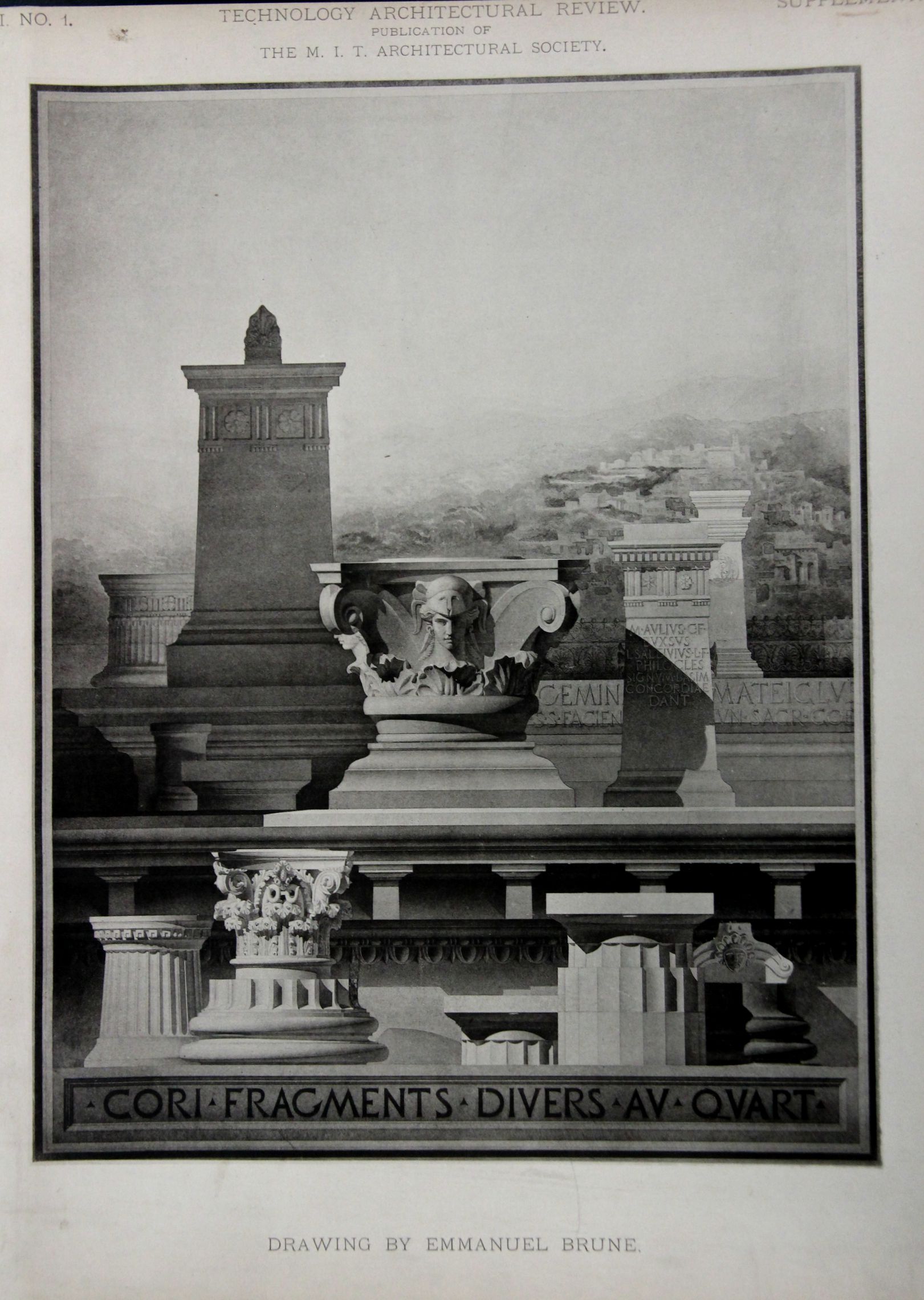
    “Let us leave our old friend in one of those moments of unmixed happiness, of which, if we seek them, there are ever some, to cheer our transitory existence here. There are dark shadows on the earth, but its lights are stronger in the contrast. Some men, like bats or owls, have better eyes for the darkness than for the light. We, who have no such optical powers, are better pleased to take our last parting look at the visionary companions of many solitary hours, when the brief sunshine of the world is blazing full upon them.”–Charles Dickens, Pickwick Papers, page 518.

    Architecture frammenti shadows MIT

    If I were on the Moon I think I would miss the obscurity of shadows–while being partially obscuring, they also enable highlight and brilliance in the place not in shadow. This is the controlled darkness of Goethe, who also found the production of color in the intersection of light and shadow. In the sciences ennumerating the optical art of shadow there is probably no one as poetic as Goethe on this subject, at least before 1900. The great master of optics, Isaac Newton, wrote on shadows (that is a pretty good title for an essay!) with seering insight but of course with no visual-literary poetry of any kind whatsoever, as a matter of fact his “‘Enumeratio linearum tertii ordinis” (“Enumeration of lines of the third order, generation of curves by shadows, organic description of curves, and construction of equations by curves) which was originally printed as an appendix to  Optics (and then published in Opuscula) was like a black hole of poetry, anti-poetic–except of course for the staggering genius that went into it all.  

    And so these dreamy thoughts were brought out by this not-so-simple study of frammenti, found in the volume 1/1 of MIT’s first architectural journal, Technology Architectural Review, published in 1887.  These shadows are excellent–there’s a lot going on in these layers of differentiated light.  

    • Check of other bits on this blog on shadows by entering that word int eh Google search tool.  

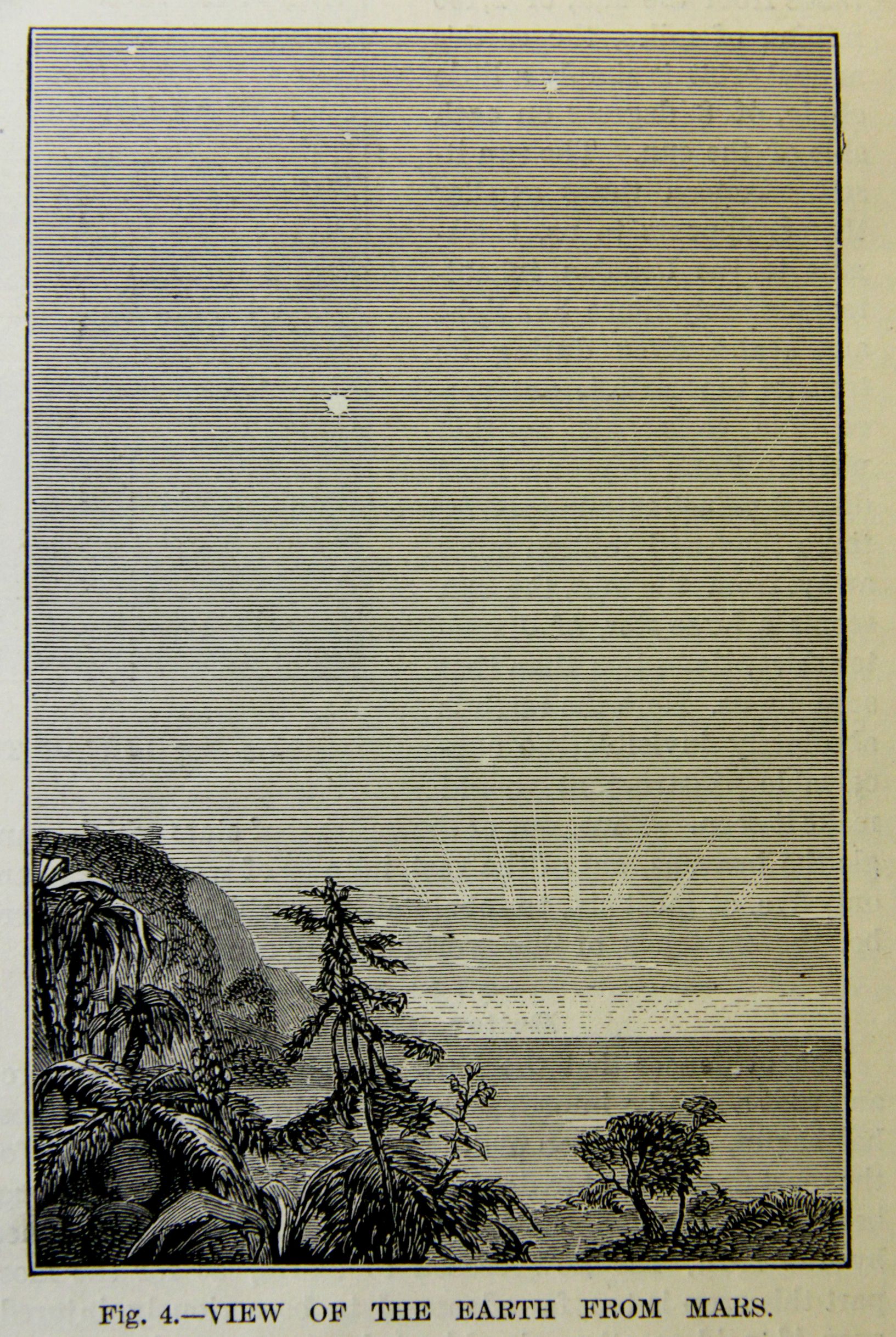
  • Extraterrestrial Skies and Landscapes Depicting the Earth, 1877

    JF Ptak Science Books  Post 2520
    Earth from other Planets MArs

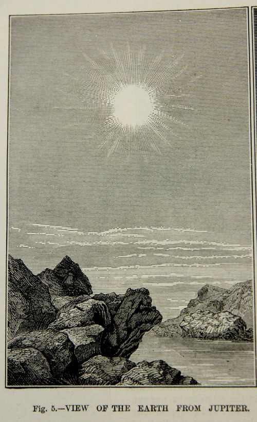
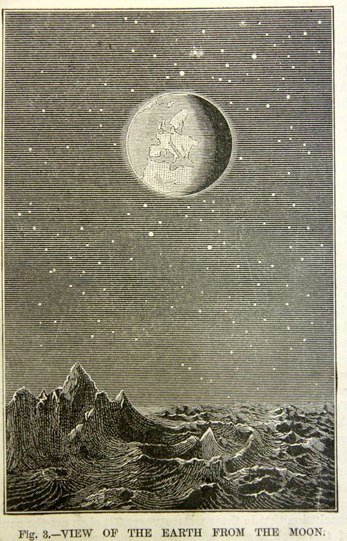
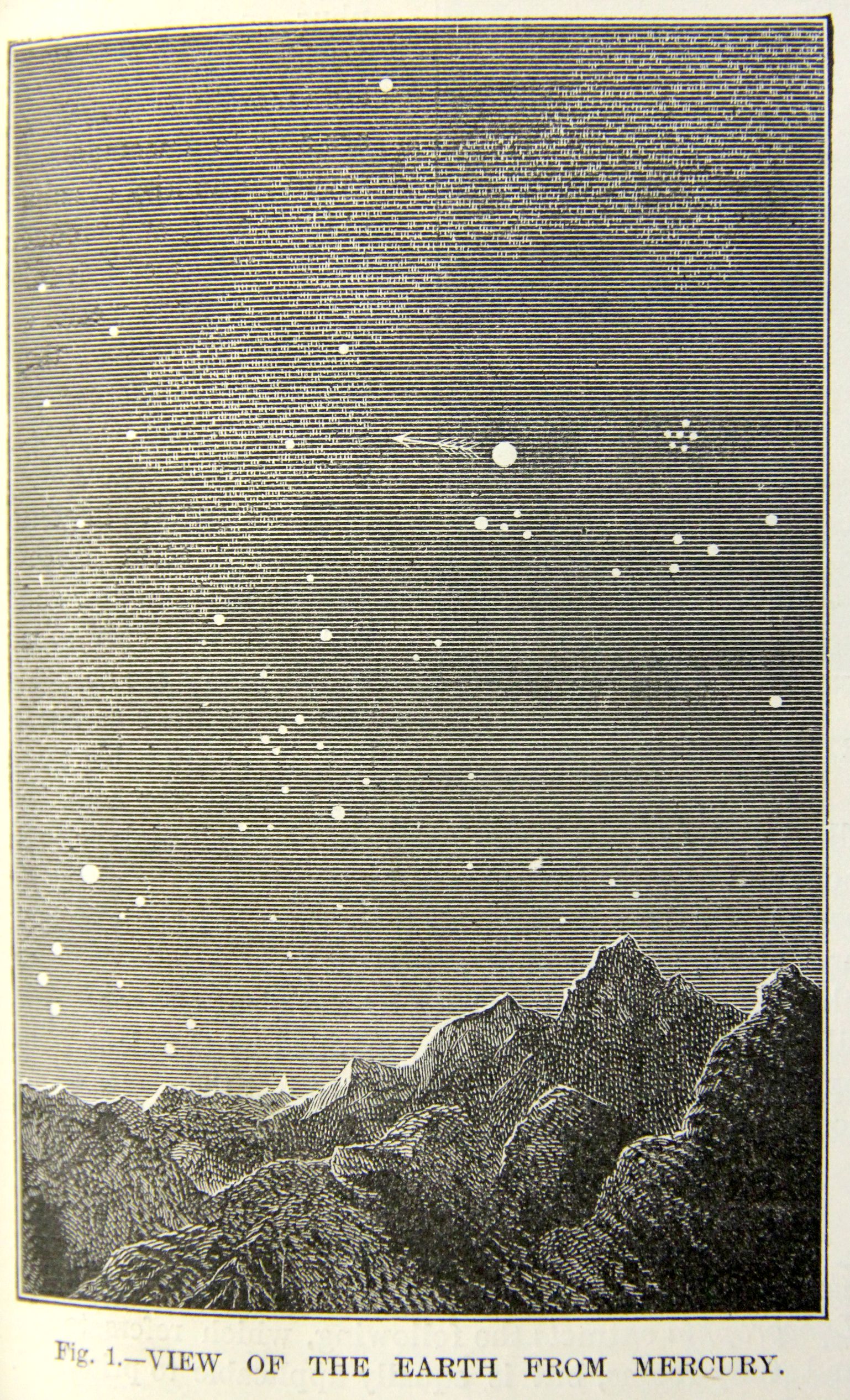
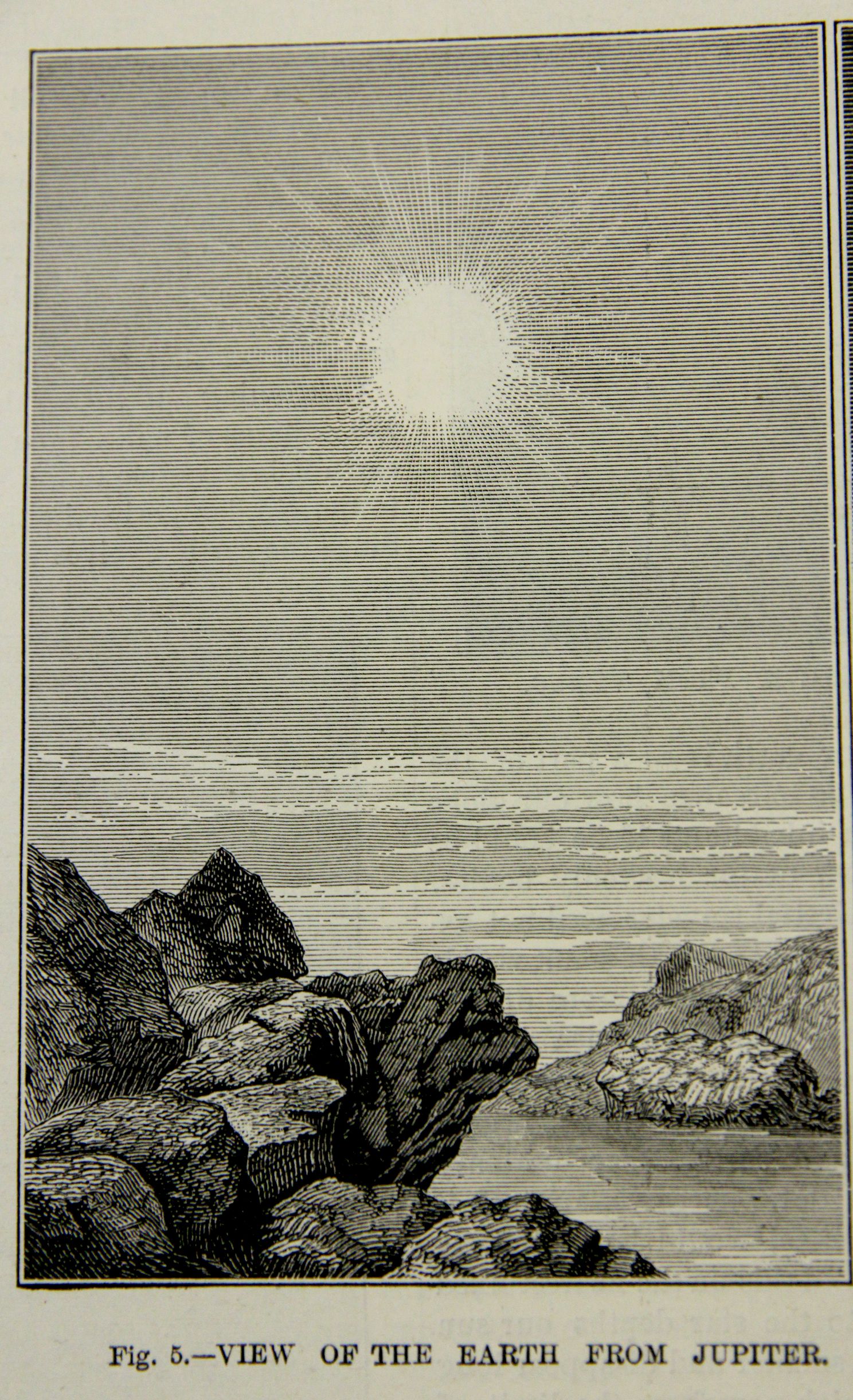
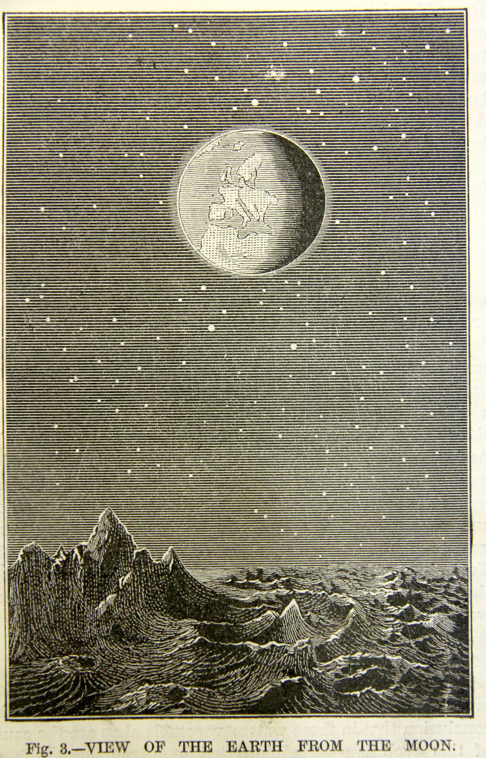
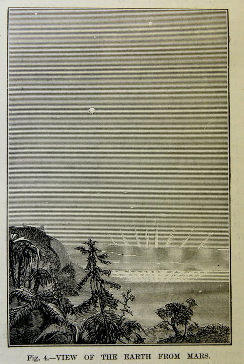
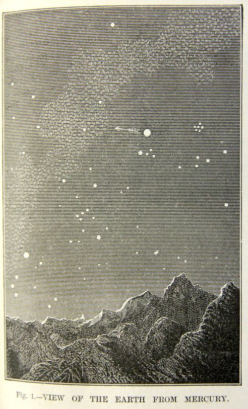
    I was struck by these images of the Earth as seen from other planets (and the Moon) in our solar system, mainly because I had associated at least one of them to Camille Flammarion (1842-1925), who I thought originated the view.  But that is not the case, evidently, as this Scientific American article appears November 23, 1877, and the Flammarion book in which it appears (Astronomie Populaire) was not published until 1880.  This is interesting in general because views of the Earth from other exact locations in the solar system are not common at this point in the late 19th century, and as can be seen in the illustrations there were some enormous (?) leaps of faith, though I am not sure how long a jump it would take to show a vegetative Mars in 1877.  

    Certainly the depiction of the Earth from an unspecified distance and location was very highly practiced in the history of astronomy, stretching back many centuries, but there is very little found for depicting an extraterrestrial prior to 1900–seeing the Earth in the sky with boots-on-the-extraterrestrial-ground is very uncommon. 

    This is really just a somewhat-related smidgen of a larger discussion on the history of the plurality of worlds and life elsewhere in the universe, an idea that is ancient, reaching back to the Greeks, and comes into play here with the Earth-like environment of Mars pictured above.  These views are sympathetic to an idea of another set of observational eyes looking up at the Earth as Earthlings might do in looking at Mars, a very individualistic view of the night sky, making it personal by setting the event very close to the ground of the planet/Moon rather than a view that was set nearby in space.  This is also conducive to the imagination of 1877 for visualizing not only the existence of life elsewhere, but also of interplanetary travel.  

    The somewhat-odd thing here is that it seems as though the Scientific American article was published independent of the famous reports of Giovanni Schiaparelli1 (“direttore del R. Osservatorio astronomico di Brera in Milano” ) which appeared in 1877/8 following his historic observations of Mars at the 1877 opposition  and in which he used the word “canali” which would later be mis-interpreted/-used as “canals” (when it was intended as “channels”).   Schiaparelli adopted new terminology for his great adventures on the surface of Mars including “ocean”(“the names I adopted will in no way harm the cold and rigorous observations of facts”2) though he did not intend for them to be used literally.  (He had in fact used the word “canali” as early as 1859, a yer after Angelo Secchi had employed the term.) Also the great William Whewell had hypothesized the existence of oceans and mountains and the possibility of life on Mars earlier than that, in 1854; and Anthony Proctor contributed greatly to the life issue with his work and map (featuring continents and oceans) in 1867, so I think that the presentation of the Earth-friendly vision of the Martian surface in the Scientific American could well have been accomplished independently of the Schiaparelli observations of 1877.  The idea of organized and technological life took off shortly after this in a sort of Martian-life-mania3, quickly reaching great new heights in H.G. Wells’ War of the Worlds in 1897, when Martians needed to have their own very destructive look-see of their own extraterrestrial sky.  It wasn’t unti the 20th century, really, when it became more a more common/popular thing to see the Earth imagined from a viewpoint on another world.  

    All this said, I do not know when the first illustration like this–a view of the Earth in an extraterrestrial sky with surrounding landscape–appears in print.  

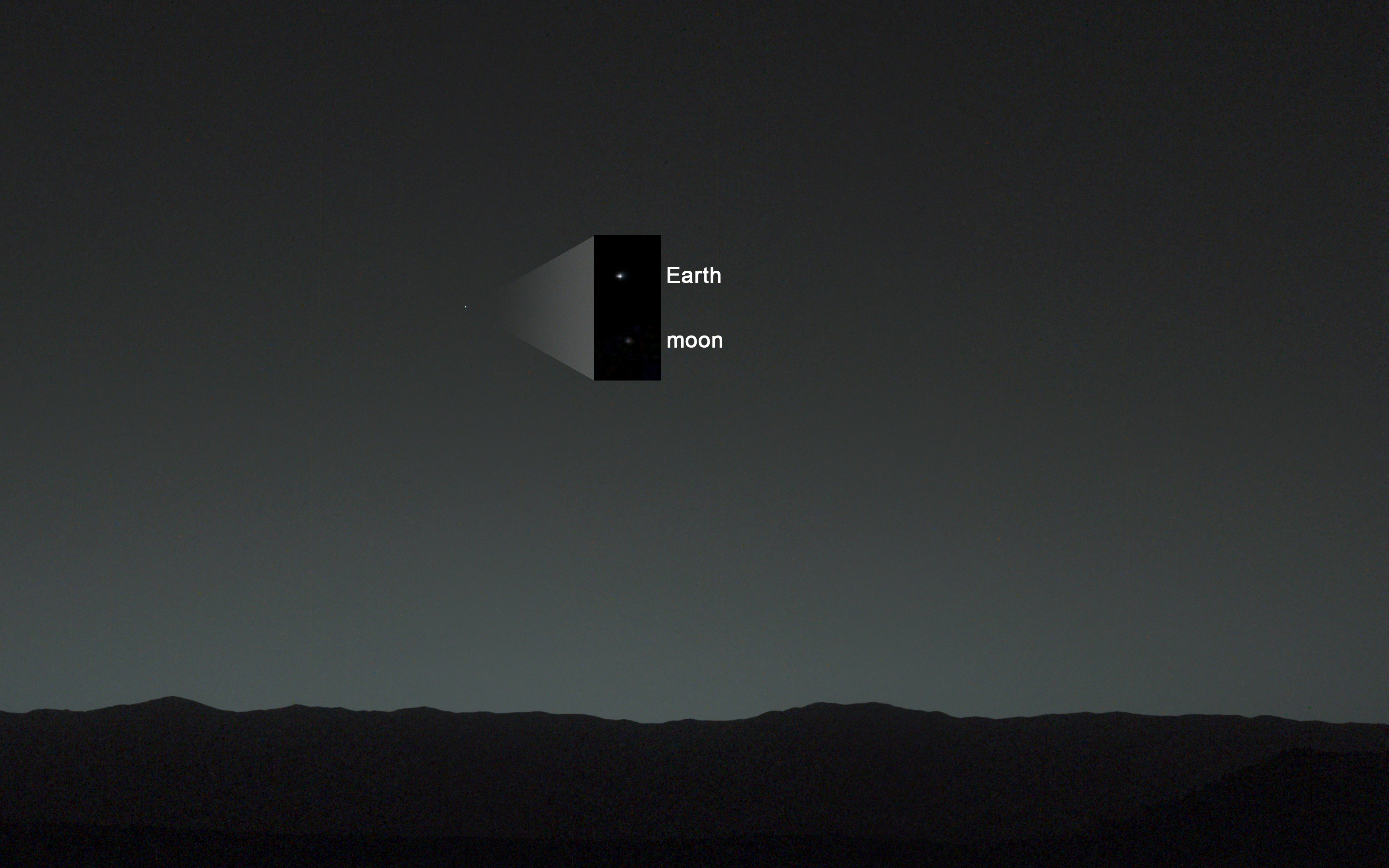
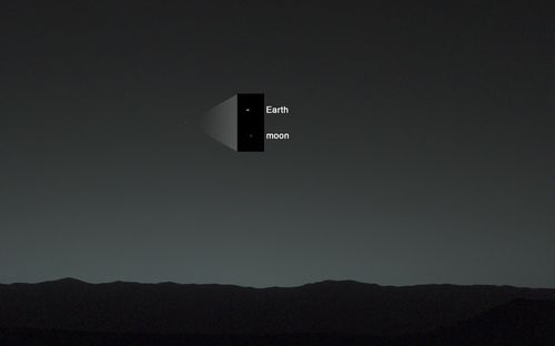
     A modern view, from NASA, Curiosity‍‍ , “first view of the Earth and the Moon from the surface of Mars(January 31, 2014)”:Earth from other planets  modern MArs
    [Source: http://photojournal.jpl.nasa.gov/figures/PIA17936_fig2.jpg]
    Earth from other planets Mercury

    And a very hospitable Jupiter:

    Earth from other planets Jupiter

    Earth from other planets Moon


    Notes:

    1.  G. V. Schiaparelli’, Atti della Reale Accademia dei Lincei: Memorie della Classe di sdenze fisiche, matematiche e naturali 3:2 (1877-1878): 3-13  The famous map by Nathaniel Green was published soon afterwards, Nathaniel E. Green, ‘Observations of Mars, at Madeira, in August and September 1877’, Memoirs of the Royal Astronomical Society 44 (1879): 123-40.

    2. Dictionary of Scientific Biography, volume 12, pg 161).

    3.  Not my term and a good one–found in K. Maria D. Lane, “Mapping the Mars Canals Mania….”, in Imago Mundi, Vol. 58, No. 2 (2006), pp. 198-211.

  • Striking Graphic: 1879

    JF Ptak Science Books   Quick Post

    Black Hand149[Source: Harpers Weekly, February 9, 1879]

    B.K. Bliss and sons came up with this idea to distinguish their ad, the one among many, on a full 16″x11.5″ page of Harper’s Weekly. The original is 1.75×2.25″, so it is rather small, but it swims sort of free and clear on the page of 30+ advertisements because of its high contrast. 


  • All U.S. License Plates, 1940–Certainly Someone Will Love This

    JF Ptak Science Books   Quick Post

    • [Please be aware that there were 75 blog posts and another 30,000 words made on this blog in June, 2015–check them out by going to the Recent Posts block at right]
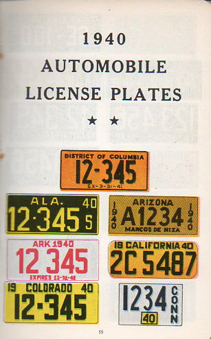
    I found these fascinating full-color plates from the dullish-sounding Manual for the Identification of Automobiles, (1940) and I know that someone out there in the vast land of the Interwebtubes will be very happy to see these images.  I was, and I have no pressing use for them.  

    Auto  license plates160


  • “Our Puny Earth!”

    JF Ptak Science Books  Quick Post

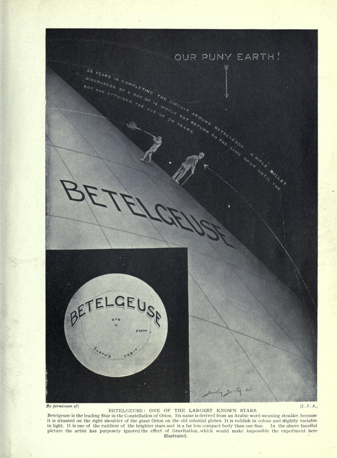
    Hutchinson’s Splendour of the heavens; a popular authoritative astronomy, by Theodore Philips and William Steavenson, was a splendid popular work filled with fine images, some of which were rather unusual.  One that I thought I had to share was the f=one below, which contains the first time that I have seen the phrase “Our Puny Earth!” in a non-comic book.  It is also a nice graphical display of data underneath the “puny Earth” bit–enjoy. 


    Astronomy  Betelgeuse[Source: Internet Archive,  https://archive.org/stream/hutchinsonssplen01philuoft#page/418/mode/thumb]


  • Paper Love–Moveable Paper Prints: the Protos Automobile, 1925

    JF Ptak Science Books  Quick Post

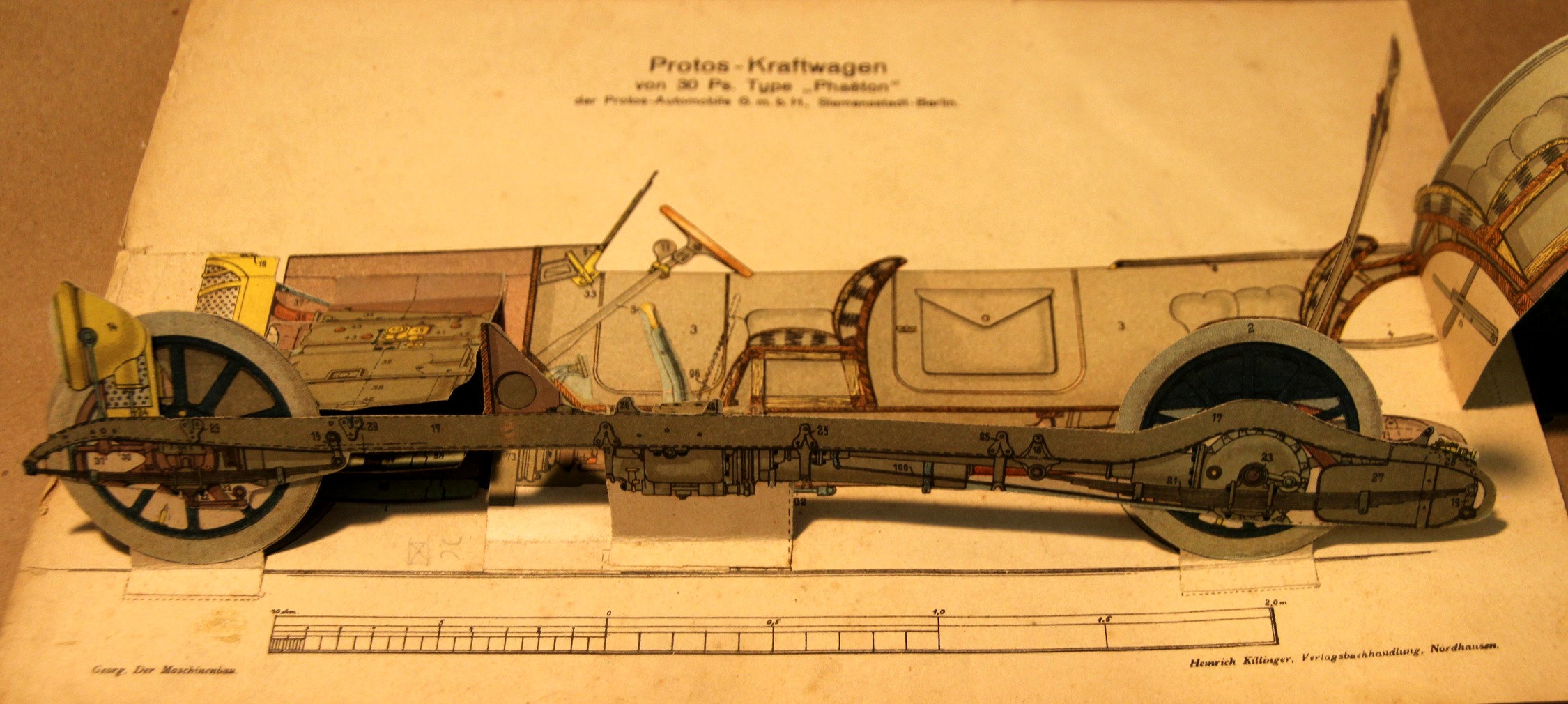
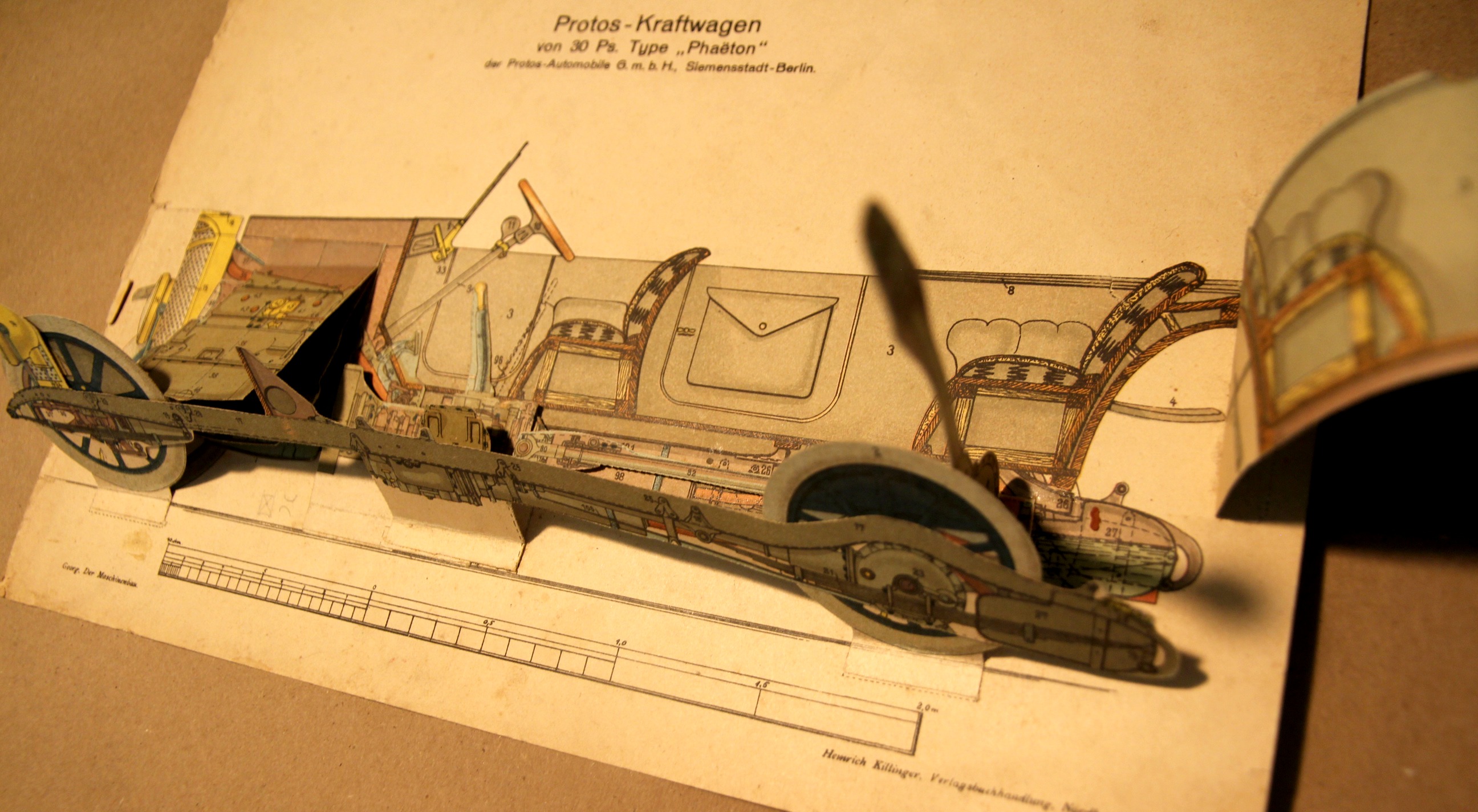
    The moveable book (flapbook) has long been interesting to me–unfortunate though that in my own fields they weren’t used very often. There are some very notable exceptions–early geometries would occasionally be published with many of the geometric illustrations made to pull out a little with the tug of a string to show you the construction in 3-D. Then of course there are the paper dissection manikins, where you can find nearly-life-sized paper anatomies with hundreds of movable/liftable flaps, and smaller examples of the body and specific organs that can be simple or not simple whatsoever.  These were time-intensive efforts, and in their own way they provided a sort of pre-MRI MRI by revealing the various layers of 3-D objects with 2-D tools–and they’re beautiful and captivating objects.

    (And this example is for sale at the blog bookstore, here.)

    Moveable_car_3

    This plate appears in Der Maschinenbau. Modelle.Zeichenerklärungen zu den Modellen des Werkes, by R. Georg, printed by Heinrich Killinger in Nordhausen in 1925.  The major detraction here is an old 5-inch tear that has been repaired verso with aacid-free tape, otherwise in nice condition. 

    The full image, “unmoved”:

    Moveable_car

    Moveable_car_2_


  • Small, Compact, Unusual Comparative Heights of Mountains Map

    JF Ptak Science Books   Quick Post–revisited and expanded

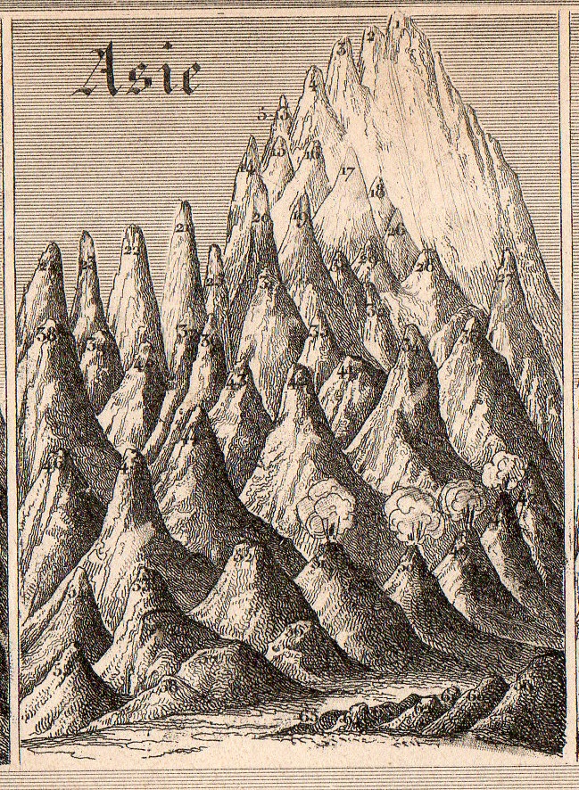
    Mountains small compact114[Small detail from the quantitative display, below; measures 2×2 3/4″.]

    • I wrote about this earlier on this blog but went back to it today to expand it a little and add to the illustrations–and to also place it in the for sale section of the blog. 

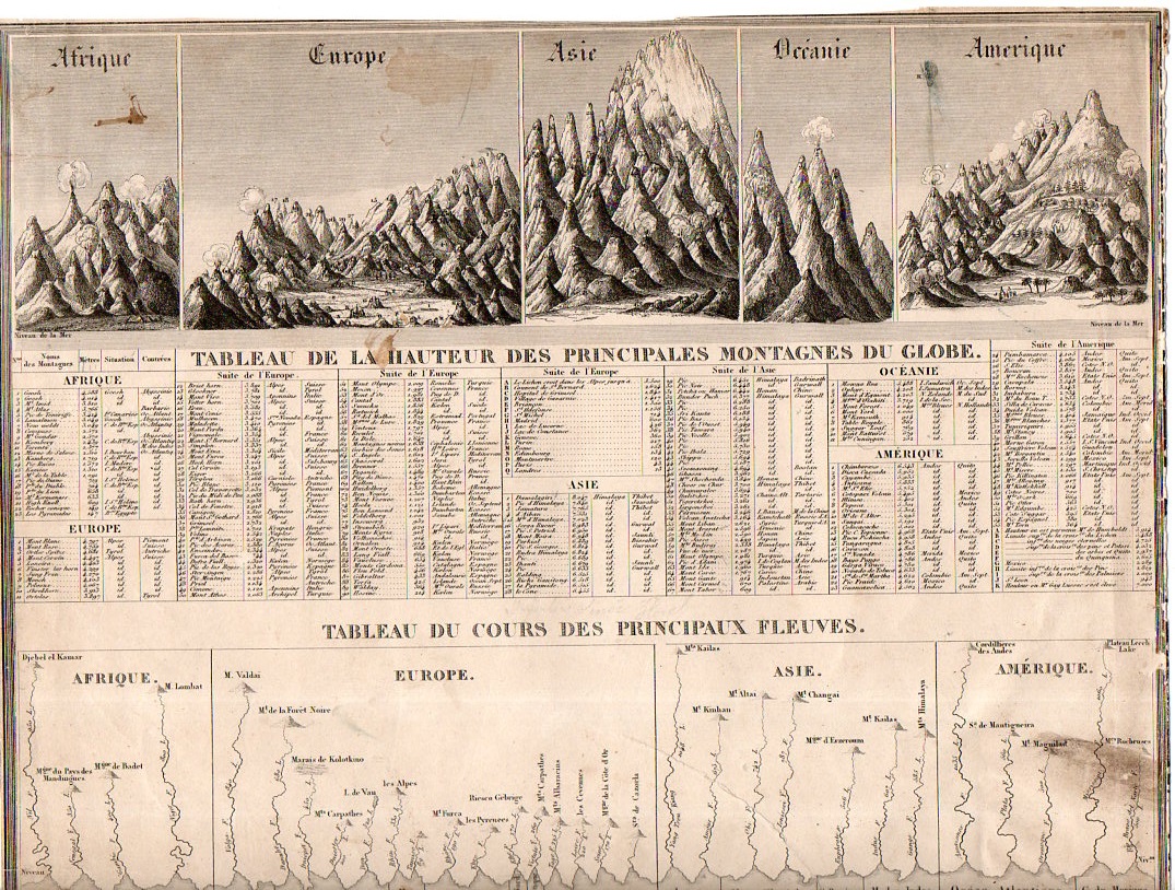
    Generally the dozens of maps/charts showing the comparative heights of mountains and lengths of rivers maps that have come through the store part of this blog have been somewhat large–or at least larger than the present example, which may be about the smallest (at about 11×8″) detailed representative of this genre that I have seen. 

    Mountains small compact113

    “Tableu de la Hauteur des Pricnipales Montagenes du Globe” was published in Guillemin’s Atlas universel de Geographie Ancienne et Moderne, and published by Langlume in 1845.  It is also at the beginning of the more-modern heyday for publishing maps and charts such as these.  (The practice began modestly at the end of the 18th century, came into a high tide in the 1850’s/1860’s or so, and then pretty much disappeared by the 1880’s.) 

     There’s a lot of comparatively-displayed information presented on 88 square inches, including the lengths of 30 rivers and the heights of about 500 mountain peaks distributed over Africa, Europe, Asia, Oceania, and the Americas.  And for as much imagery and data there is on this sheet, the whole is very nicely designed, a real success in the display of quantitative data.  


  • Big Paper History: 1806 Chronology of the Years 14-1800

    JF Ptak Science Books Post 2478

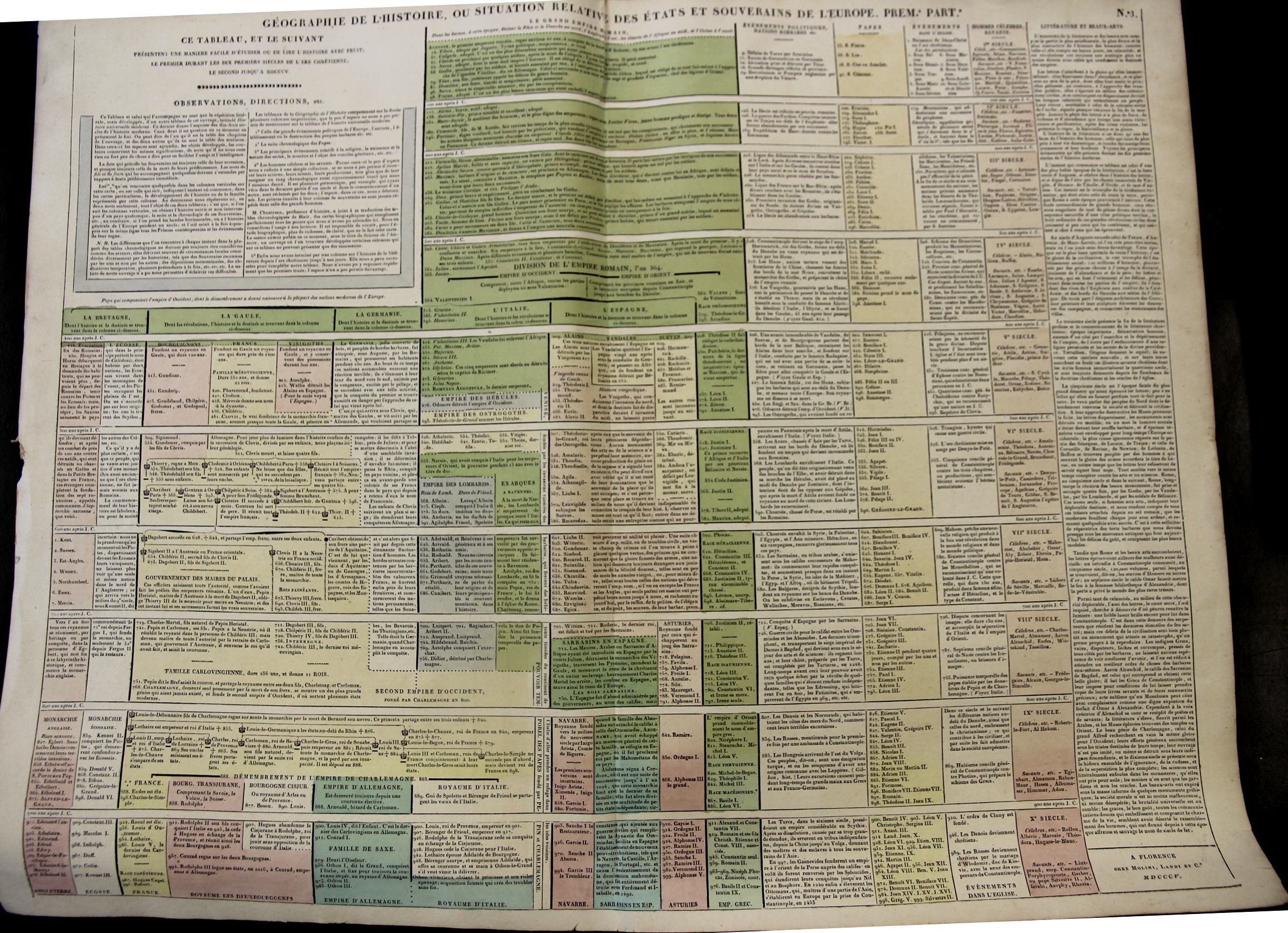
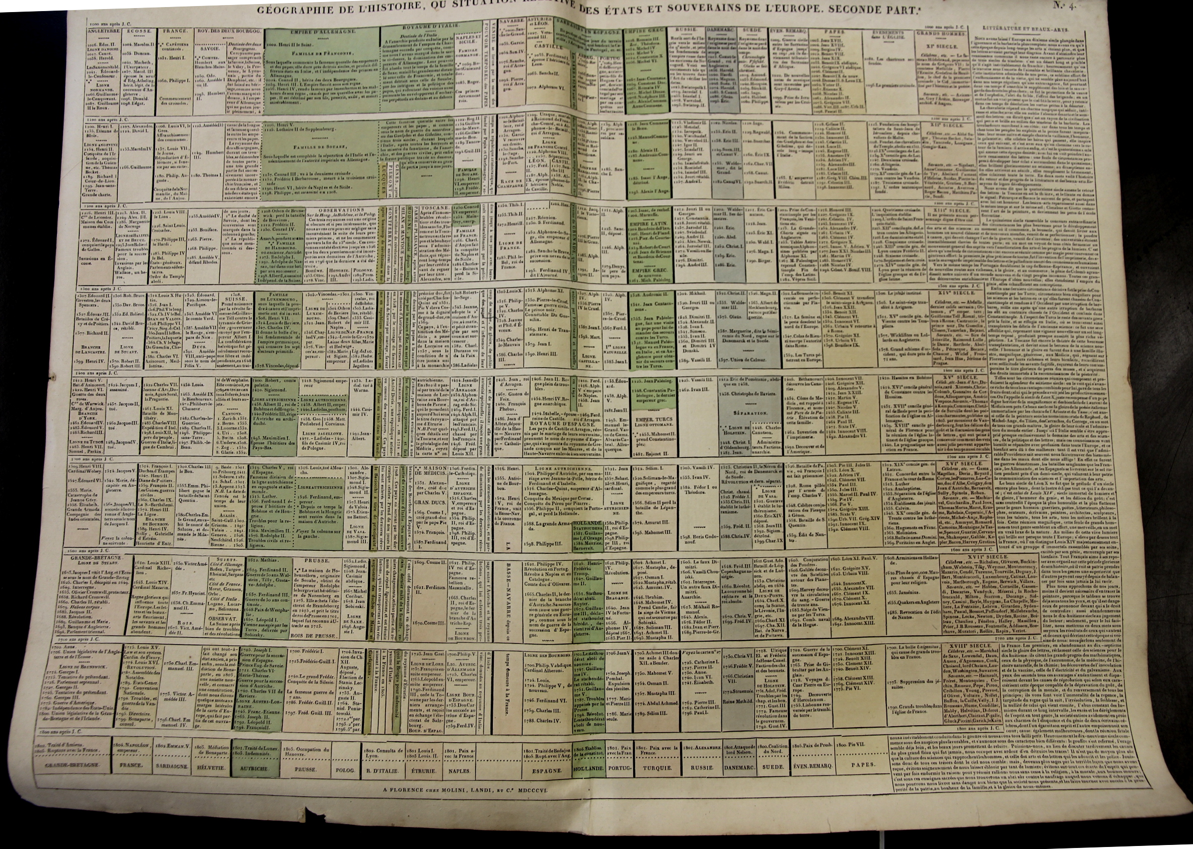
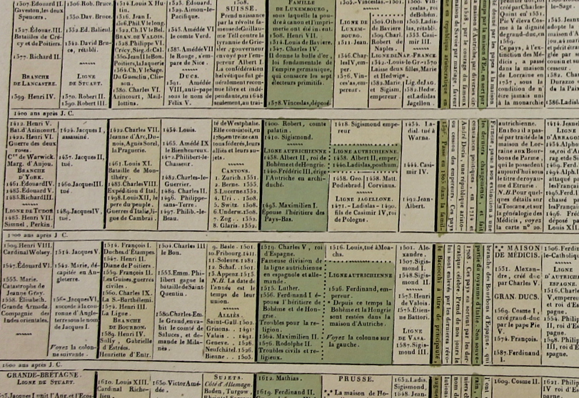
    Starting at the year 14 (ACE) with the reign of Augustus Caesar this large two-sheet chronology organizes the rulers of the Western world so far as it was known into the early 19th century. (“Geographie de l’Histoire. ou Situation Relative des Etats et Souverains de l’Europe (in two parts), published by Molini and Landi, in Florence, in 1806.) There are 15 major divisions from the year 400-1800, with a short bit at the top of the first chart covering the previous 386 years or so.  The columns show the rulers of reach century for Britain, France, Germany, Italy, Spain  (then subdividing as necessary). There is one column for the “nations barbares” that covers everyone else in about 2″ per century; there is another column for the chronology of Popes; one column for a general history of the Christian church, one column for celebrated and famous people, and then a final column for literature and the arts. 

    Maps_Chronology_LeSage_1_

    • You can own these!  Check them out on the blog’s bookstore, here. 

    At the very least the chart helps you keep your rulers straight, so to speak–it is also the sort of engaging display of data that if it was hanging up and accessible that people would read it all the time in passing. 

    The sheets are large (27×21″ or 68x53cm, and combined (as I have done in the past) they make a very imposing display 42×27″ (106x68cm).  The coloring (except for the odd darkish green) is fairly subtle but evident and useful in distinguishing the blocks of data at an easy glance. 

    Maps_Chronology_LeSage_2

    I’ a big fan of this sort of arrangement and display of data, trying as I used to in graduate school (and still do now) to fit the appropriate memory triggers on any given subject onto one sheet of 8.5×11″ paper.  It is a highly useful memory exercise, creating your own memory palace. 

    Maps_Chronology_LeSage_3

    These charts appear in A. Le Sage (Comte de La-Casas) Atlas historique chronologique et géographique ou Tableau général de l histoire universelle présentant un moyen sûr et facile de classer avec fruit tout ce qui s est passé depuis la création jusqu à Jésus Christ espace de 4004 ans….