A Daily History of Holes, Dots, Lines, Science, History, Math, Physics, Art, the Unintentional Absurd, Architecture, Maps, Data Visualization, Blank and Missing Things, and so on. |1.6 million words, 7500 images, 4.9 million hits| Press & appearances in The Times, Le Figaro, Mensa, The Economist, The Guardian, Discovery News, Slate, Le Monde, Sci American Blogs, Le Pont, and many other places… 5000+ total posts since 2008.

Category: Maps/Diagrams of Imagination & Ideas

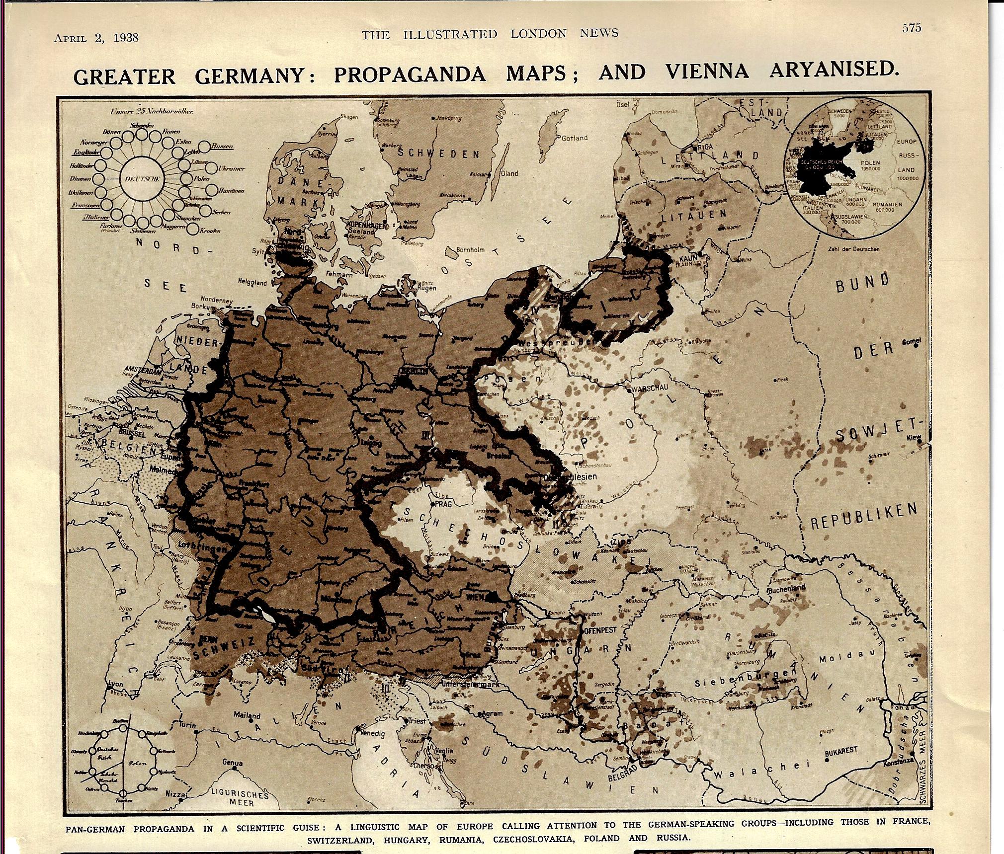
  • Propaganda Maps–a Play for Greater Germany, 1938

    JF Ptak Science Books   Quick Post

    Maps Propaganda German speaking 1938

    [Image: The Illustrated London News, p 575, April 2, 1938.]

    The title and the date of this map pretty much tells at least the partial story of the beginning of WWII. The “Aryanized” Vienna (Wien) shows up with the rest of Austria as German-speaking but also outside the boundaries of Germany, even though the Anschluss Österreichs occurred about three weeks earlier. “Pan Germany” was still figuratively so, in spite of the absorption of Austria.  Prague sits nearly surrounded by Germania irredentia, and of course Czechoslovakia was next, with Germany beginning the theft of the country that October, and then only about a year after the appearance of this article, Hitler was giving a speech at Prague Castle, also declaring Bohemia and Moravia to be the Protectorate of Bohemia and Moravia. This linguistic map certainly portrayed the gaping maw of the Nazi Kraken, Germany declaring that these actions was a natural right in the protection of Germans-outside-Germany. 


  • Lubricating the Machine–a Map of Domestic Sewage (1892)

    JF Ptak Science Books   Quick Post

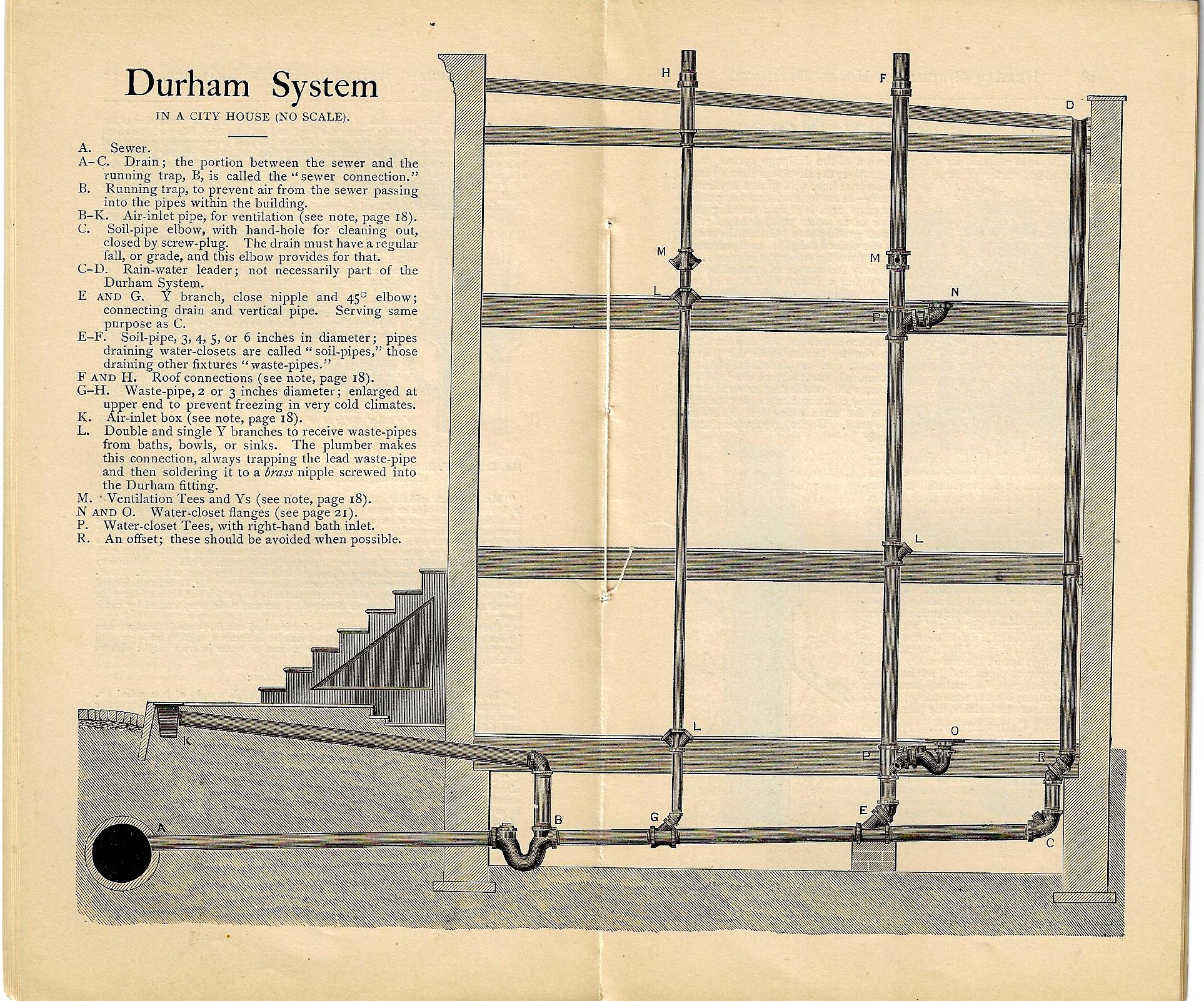
    You can’t have a Second Industrial Revolution without people living closely together, and you can’t have that without cities, and you have cities without water, and you can’t have any of that without a way of getting rid of the water and what all of those people were evacuating. And so the issue of “drainage” takes on a lot of powerful meaning–in getting rid of sewage, and rainwater, and a host of other things.  

    Now 1892 is already decades past the Second Industrial Revolution (as was indoor plumbing) and of course cities continued to grow, and so did the needs for plumbing in delivering the byproducts of consumption and maintenance of the city. The Durham system–manufactured in NYC–was one of these responses, and the image below shows a cross section of a multi-story structure with a several toilets, basically a map showing the flow of the exuded lubricant of the great machinery of the city.  That prose was a little purpley, but it is sorta true. 

    The Durham Patent System of Screw-Joint Iron House Drainage addressed this issue, manufacturing the pipe and all of the other necessaries, ready for you to install:

    Durham drainage _1_


  • The End of the War for Engalnd: Nazi Propaganda, 1941

    JF Ptak Science Books    Post 2694

    Blog--May 24--map2

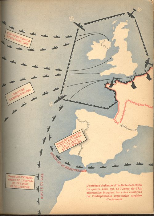
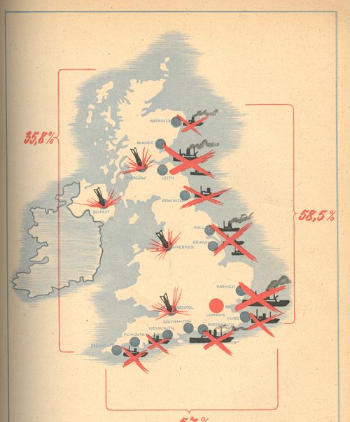
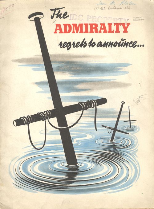
    The Admiralty Regrets to Announce… was for years the standard beginning to an official British announcement concerning the loss of ships and sailors.  The phrase is used as the title to this work (by an unattributed writer known only as “an expert”) to immediately introduce the reader to the failings of the British navy.  It is of course a piece of Nazi propaganda, issued some time in 1941. (My copy is he U.S. copyright deposit copy and is stamped with a transfer date of September 1942; the pamphlets reads to me as though the U.S. had not yet entered the war.)  The great strengths of the German air force and navy are extolled and the failings of the British mercantile elaborated at great—and sometimes greatly imagined—lengths.  The booklet was published in French (except for the title) and answers its own repetitive question: “quelle est donc la situation relle de la marine commerciale anglais?”

    Blog--May 24--map1

     The pamphlet’s 32 pages (illustrated with 24 photographs of various explosions and bombings, plus one graph and three maps) are dedicated to winning the French hearts and minds, trying to convince the conquered population that there really wasn’t any help coming, and that the British could not even supply themselves with the necessaries to run a country, let alone a war.

    In the map above we see the  ports and shipping centers that were bombed by the Luftwaffe (with London located by a big red dot).  Another map (at top) shows the stockade-like presence of the Nazi navy securing its impregnable wall against the arrival of foreign trade and supplies to Britain.  

    This post is one of a series on propaganda maps which occasionally appear in this blog.   Like Thomas Nast political cartoons and war photography, a map can instantly and overwhelmingly display not only data but sentiment as well. The maps published in this pamphlet by the Nazis are were certainly immediately understandable to just about anyone, French-reading or not, literate or not–the images needed no words, especially when surrounded in the text by vicious images of German military might.  Overrun
    or not, Petain-ized as it was, France was still offering aid to its allies and resistance to the Germans–the more minds that could be won over with propaganda of this sort meant one less to have to worry about as an active enemy.

    This is the back cover of the pamphlet, showing the final disposition of the British fleet:


    Blog--May 24--map2 001

    And the front cover:

    Blog--May 24--regrets


  • A Map with a Point (1943)

    JF Ptak Science Books  Quick Post 

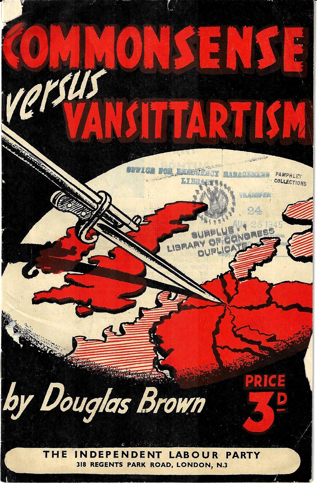
    I admit that did not look at this pamphlet (printed in 1943) to determine the conflict between “commonsense” [sic] and “Vansittartism” (which I had to look up1). Mr. Brown, the author, was a prominent Socialist, who advocated–in my peep at the last page of the pamphlet–reallocation of land/industry/transport/”banking” to the community and the abolition of private profit-making, and thus to the shout-whisper political argument becomes just a wisp of smoke in a shallow hole. The only reason I stopped here was the cover design, showing a strike to the northern part of Germany.  

      Book cover bayonette in Germany map

    Notes:

    1. From Merriam-Webster: “Vansittartism, doctrine holding that the conduct of German war leaders from the Franco-Prussian war on has had the wholehearted support of the majority of Germans and that Germany must be demilitarized during a protracted period of occupation and reeducation to insure against her undertaking further wars of conquest.”


  • A Detail of the Something in the Nothing (“Concerning the Deluge, and the Dissolution of the Earth.”)

    JF Ptak Science Books   Quick Post

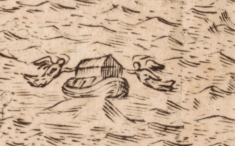
    There is a great and powerful image of nothing in Thomas Burnet’s The Sacred Theory of the Earth: Containing an Account of its Original Creation, And of all the General Changes which it hath undergone, or is to undergo, until the Consumption of all Things…printed in London ca. 1759, a hundred years after its first printing, in the glory and the magnificence of some very wide and biblical Bible thinking that was still in demand. I’m visiting the “dissolution of the Earth” section, here, showing the results of a very judgmental Creator taking aim at the whole of the Earth for its foul play, drowning everything and everyone for a lesson that could be learned only by the dead–save for a small group of related people and a bunch of animals in a wooden boat the size of which could not possibly have been built during this time period. I have pulled out this image of the ark, guided or protected or righted by a pair of faceless angels, keeping the ship steady on the top of Mt. Ararat. All around this boat are the peaks of other mountains, which for some reason are depleted of all living things, unless of course the image shows the waters receding, which is the route I would take if it were up to me to explain this. Noah ark ararat detail
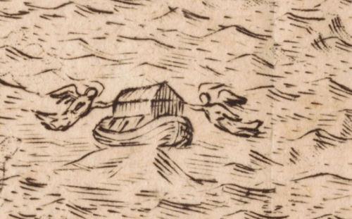
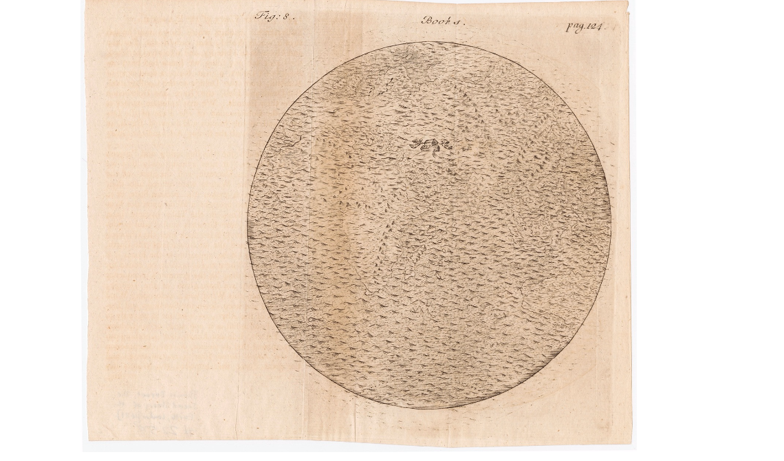
    This is a detail from the full engraving, below, which show the Earth completely covered by water–it would be an interesting thing to imagine as an actual physical process and what exactly would have to happen in order for such a thing to occur (and when you start to think of how, outside belief, this could come to happen, you have the makings of an interesting class):
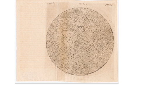
    Noah ark ararat

    If you expand the image the nearly-invisible continents shine through ever so slightly. I imagine that this would be a pretty scary image to show a kid, or to a believer who had doubts about the possibilities of a wrathful creator. In any event, this fits beautifully as a short post into this blog’s “History of Nothing” series, as we see a big image of near-nothing–just water.  (Did the fish drown?) Anyway, nothing was left except the boat. And landforms. And water, which evidently went somewhere. 

    This image was found at the wonderful and extraordinary P.J. Mode Collection “Persuasive Maps” hosted by Cornell University, here: https://digital.library.cornell.edu/catalog/ss:19343661   There are 800+ maps like this there–do not hesitate to visit and visit often–it is a fantastic place.  

  • Map of Rivers and Waterfalls, 1851

    JF Ptak Science Books  

    Maps Rivers Waterfalls981

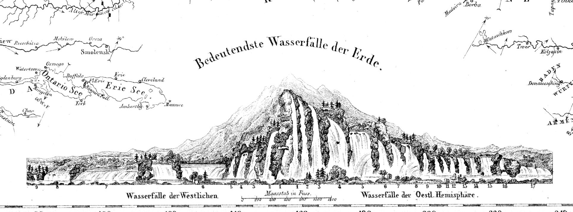
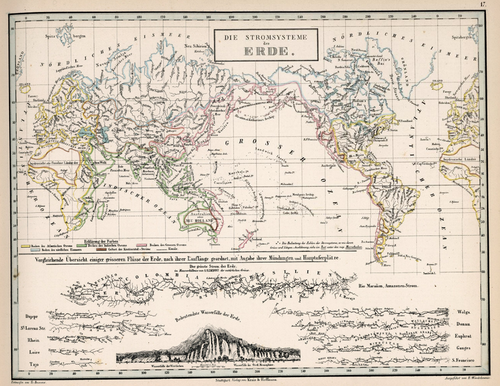
    • “Die Stromsysteme der Erde.”  In von Humboldt, Kosmos, 1851. 

    Before the Neil deGrasse Tyson version and update of Carl Sagan’s landmark television series, Cosmos, there was Alexander von Humboldt and his enormously influential book of the same title, printed in 1845-1862.  Well, von Humboldt’s (1769-18591) book was actually Kosmos when published in German, which is where it started its life (and which von Humboldt suffered mightily for in it English translation), and in which this map appears.  Von Humboldt was enormously studied and educated and of a high scientific mind over many subjects, one of those 19th century figures who seemed as though they could know everything, a polymath of high order (along the lines of Goethe and von Helmholtz and Thomas Young and others).  He was a meteorologist and biogeographer before those sciences existed; a naturalist, geographer, archaeologist, and explorer, a natural philosopher of magnitudes.

    Kosmos reflected his lifelong interest in order, and what he did was astonishing–he attempted to unifying the complexities of nature in one book (of five volumes), binding the various branches of science together in a cohesive whole, attempting to show how the laws of the universe acted here on Earth.  It was a very influential work, very progressive, a masterwork of scientific method.  Kosmos.

     Maps--River system


  • A Longitudinal View of Natural History, ca. 1876

    JF Ptak Science Books   Quick Post

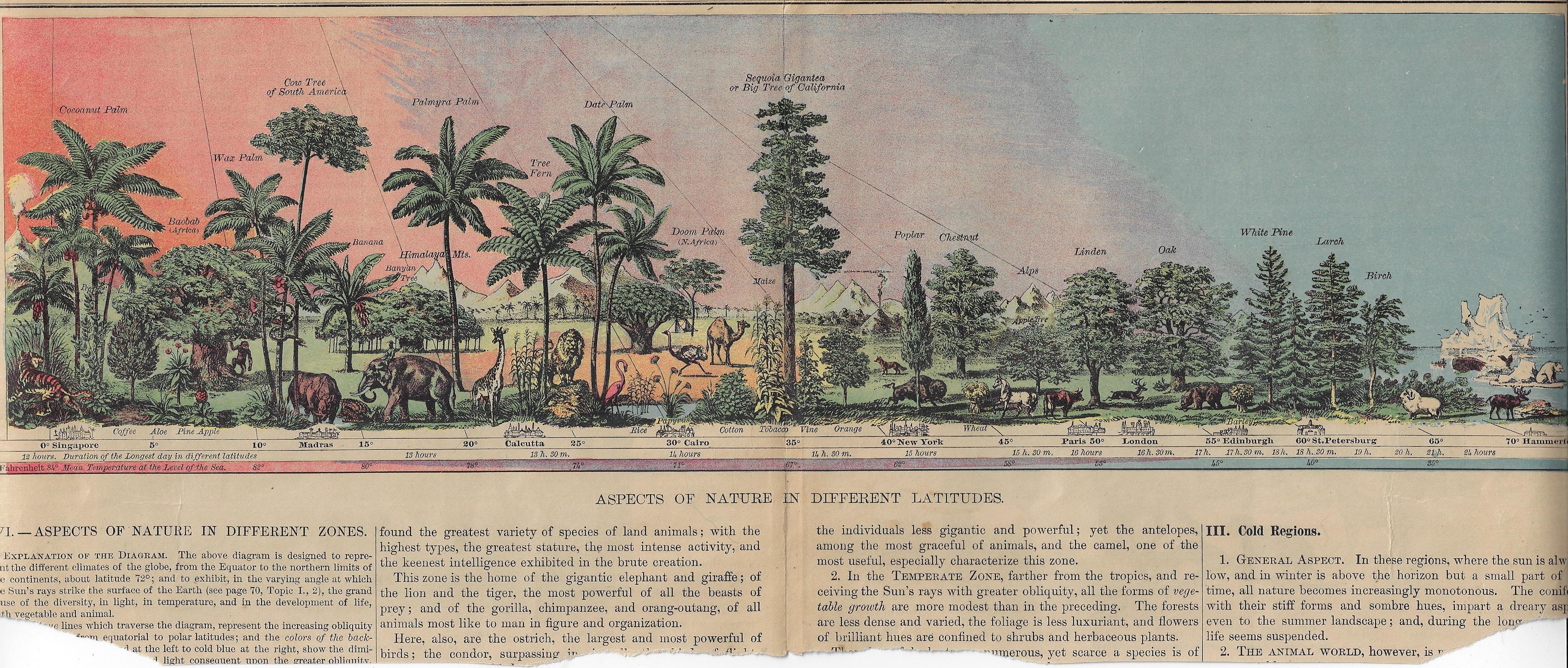
    This lovely image displays the natural history of limited flora and fauna at different latitudes, centering on the “Big Trees of California”. The original is about 17″ long and almost fits exactly on the big scanner, though some of the edges are left off–no matter, I think, as most of the image is available. Its source is a grade school textbook (probably seen as fairly advanced by modern standards) by Arnold Guyot, Physical Geography, and published ca. 1876–the image (or something very much like it) may have appeared in other contemporary texts, like Cornell’s Geography, though I’m not sure.  At any rate it is very nicely designed, and I enjoy the gradient of the sky. 

    [Click on the image for a good expanded view.]

    Map view of prehistoric times


  • An Exceptional Not-Very-Exceptional Map (1876)

    JF Ptak Science Books   Quick Post

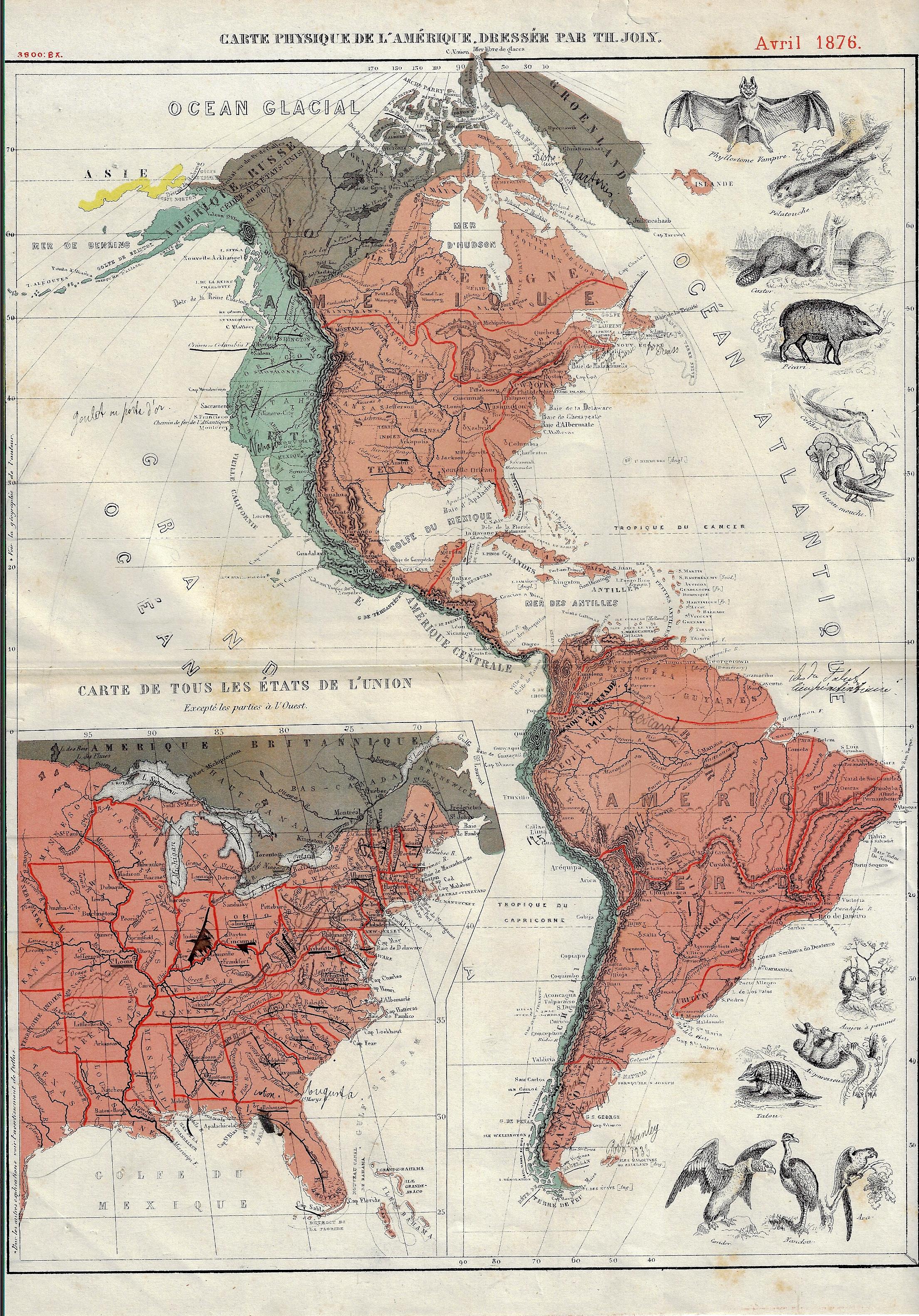
    I’m not sure what it is, exactly, that gives this map it unique flavor(s)–to my experience, it has an undeniable “difference”.  The map (“Carte Physique de l’Amerique…1” with a smaller inset map of the United States) was published in the U.S. Centennial year of 1876, and aside from the obvious imagery of the animals, there is also the exceptionally small typeface in the detail, the somewhat unusual color combinations (of rose, aqua, and brown), and the great amount of detailing done in red, all of which taken together is unusual to my experience.  That said, there is really not a lot of physical geography detail in the map outside of a good representation of rivers and some brief entries for mountains–and the ten animals.  


    US Map infographic animals

    Notes:

    1.  The full title: “Carte Physique de l’Amerique dressee par Th. Joly”, Avril 1876, and published in Grand atlas classique de Géographie Moderne, moyen-age et ancienne, contenant les figures des animaux et des plantes les plus remarquables de chaque pays, a l’usage de l’enseignement secondaire, printed in Bruxelles by A. Decq et J. Rozez, first published in 1871/2,  22,5 x 34,5cm.


  • Maps of Ancient Cities and Colliery Cross Sections (1877)

    JF Ptak Science Books   Quick Post

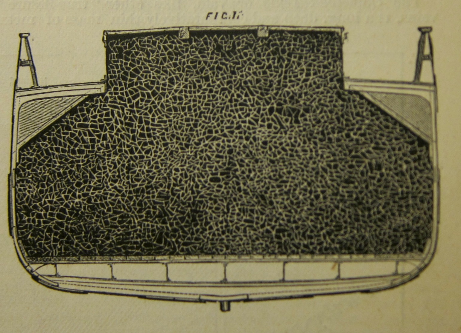
    One in a long list of tough jobs of the 19th century was that of the “trimmer”. These guys would be in the holds of coal transport ships, in the recesses and odd spots, whose job it was to shovel the coal into those far regions that would be missed in the loading process to ensure that as much coal is hauled as possible and to secure a stable cargo. They would be in a tough position, probably not well lighted, doing heavy work, and breathing a lot of coal dust. It was far from “easy” work, though it was pretty important that this work was done.  

    But as I saw in a Scientific American Supplement article for May 26, 1877, even these jobs were being released to a higher technology. In this case, that tech-boundary wasn’t so high. The solution in at least two cases of improved colliery loading was to make the hatches of the hold much larger so that coal could be distributed more evenly and reach all of those hard-to-reach spots.  And so the trimmer would lose his job to gravity.

    What I found most appealing though (as I slightly scared myself thinking about doing the actual work of a trimmer) was the cross section illustration for the article.  On close examination it may well be the skin of a large mammal in a dry place, or a road map of some ancient place with no legends, or any number of other things. The big brace of black is simply a cross section of the coal in the hold, but it does have a certain Found-Outsider Art quality to it.  

    Sci Am Supp 1877 Colliery gravi ty


  • Suggesting a Landscape–the Beauty of Contour Lines on Maps

    JF Ptak Science Books   Quick Post

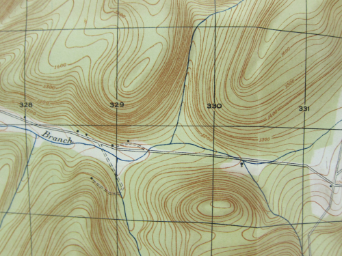
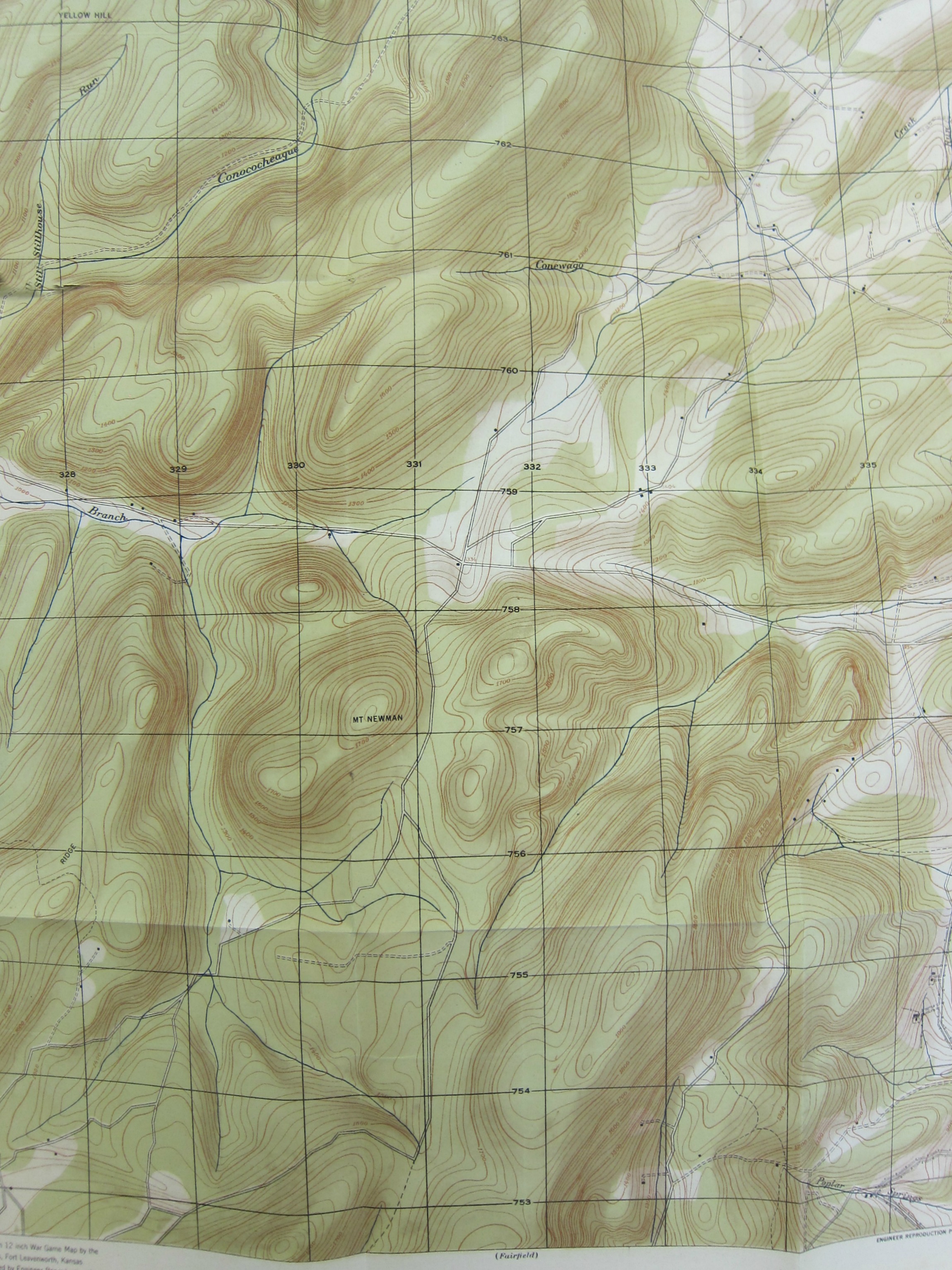
    There is a deep beauty in the imagery of maps with contour lines. This is found over and over again here, and tonight it rose from piecing together an enormous map of Gettysburg and its approaches.  Here is an example:

    Gettysburg map _detail 3_

    Source: A Map of Gettysburg and Antietam.  From: The Military Engineer, the journal of the Society of Military Engineers, published at the Mills Building, Washington, D.C., 1925-1927. 


    Gettysburg Map _detail 2_