A Daily History of Holes, Dots, Lines, Science, History, Math, Physics, Art, the Unintentional Absurd, Architecture, Maps, Data Visualization, Blank and Missing Things, and so on. |1.6 million words, 7500 images, 4.9 million hits| Press & appearances in The Times, Le Figaro, Mensa, The Economist, The Guardian, Discovery News, Slate, Le Monde, Sci American Blogs, Le Pont, and many other places… 5000+ total posts since 2008.

Category: Maps, Cartography, History of Mapmaking

  • 37 Miles from Mexico *and* 27 Miles from Poland

    JF Ptak Science Books   Quick Post

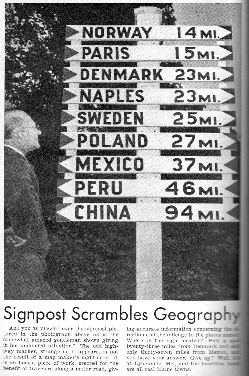
    The answer is “yes”, the sign is real; the question though is where does it work? 

    Road signs235

    [Source: Popular Science Monthly, July 1940.]

    The location, according to the article, is Lynchville, Maine, which is about 50 miles northeast of Portland.  


  • A Myopic Map of Christian Leadership in China, 1938

    JF Ptak Science Books   Quick Post

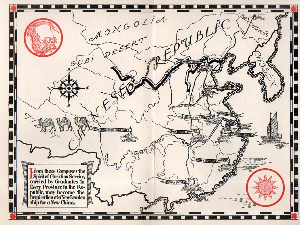
    I found this very unusual map of China in a pamphlet entitled Higher Education’s Century of Progress in China, published for the Associated Boards for Christian Colleges in China in New York City in 1938.  This is well into a solid decade of internal political turmoil in China, coupled with years of dealing with an invasive Japan, and all rolled up in 1938 with the first few years of an all-out Sino-Japanese War (the second one, the first occurring at the end of the last century). This war wasn’t necessarily a war between two opposing armies–it was also a war between the Japanese army and the people of China. This was highly demonstrated from December 1937 to January 1938 with the massacre and mass rapes committed against unarmed combatants in the Republic of China’s capital city, Nanjing/Nanking prior to its occupation–this is known as the Rape of Nanking, and is so known for very secure reasons. There was also a devastating flood of the Yellow River.  

    In a series of decades of difficult years, 1938 was particularly difficult year for China. 

    That said, this pamphlet discusses the “century of progress” in China by Christian missionaries, and the “birth and development of Christian education there”.  The situation in China in 1938 for this pamphlet was that there were 300 million illiterate Chinese–“it is a situation that challenges the Christian world!” so it reads. Perhaps what this meant was that they could not read the Bible until they were taught how to read it.

    And that was the extent of the recognition of what was going on in China.  To capitulate the interests of history those who generated this work included a map of China that included almost no detail except for Christian colleges.  

    China Christian map204

    It must have felt very comfortable for the Associated Boards for Christian Colleges in China to have published this pamphlet in 1938, having the China situation well in hand, snug in the comfort of a real or imagined pew, the issue and morality of its optics unchallenged by reality.


  • Revealing the Topo-not-so-Secret of Tibet

    JF Ptak Science Books  Quick Post

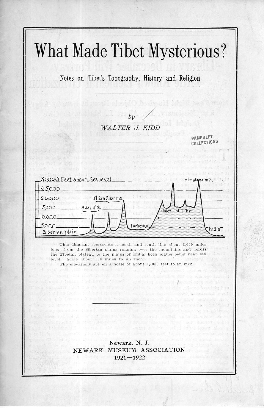
    Here’s a quick revelation that isn’t so secret or mysterious, answering the pamphlet’s title What Made Tibet Mysterious?  The answer has probably always been obvious for as long as anyone has known of Tibet–and it is displayed in the comparative graphic on the front cover:

    Tibet map202Of course there are many other mysterious parts that comprise Tibet, but the one that is most obvious has to do with location, and extreme location at that–this pamphlet cover takes care of that right away.  


  • A Map of Future Military Conquest by Japan, 1933

    JF Ptak Science Books  Quick Post

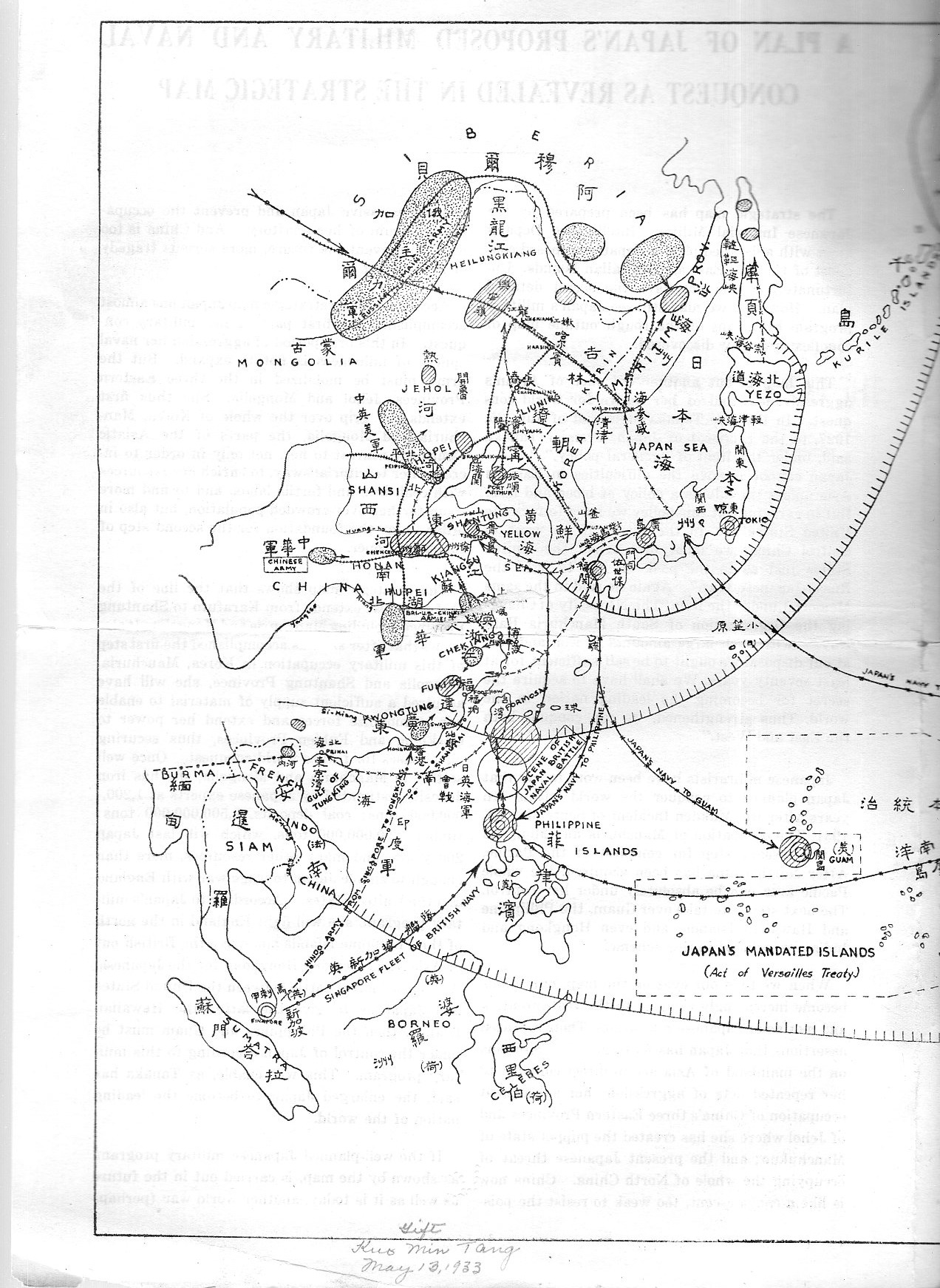
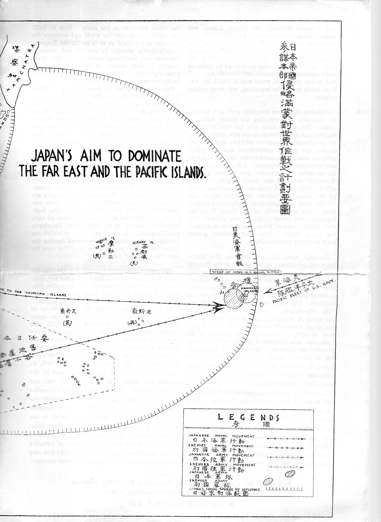
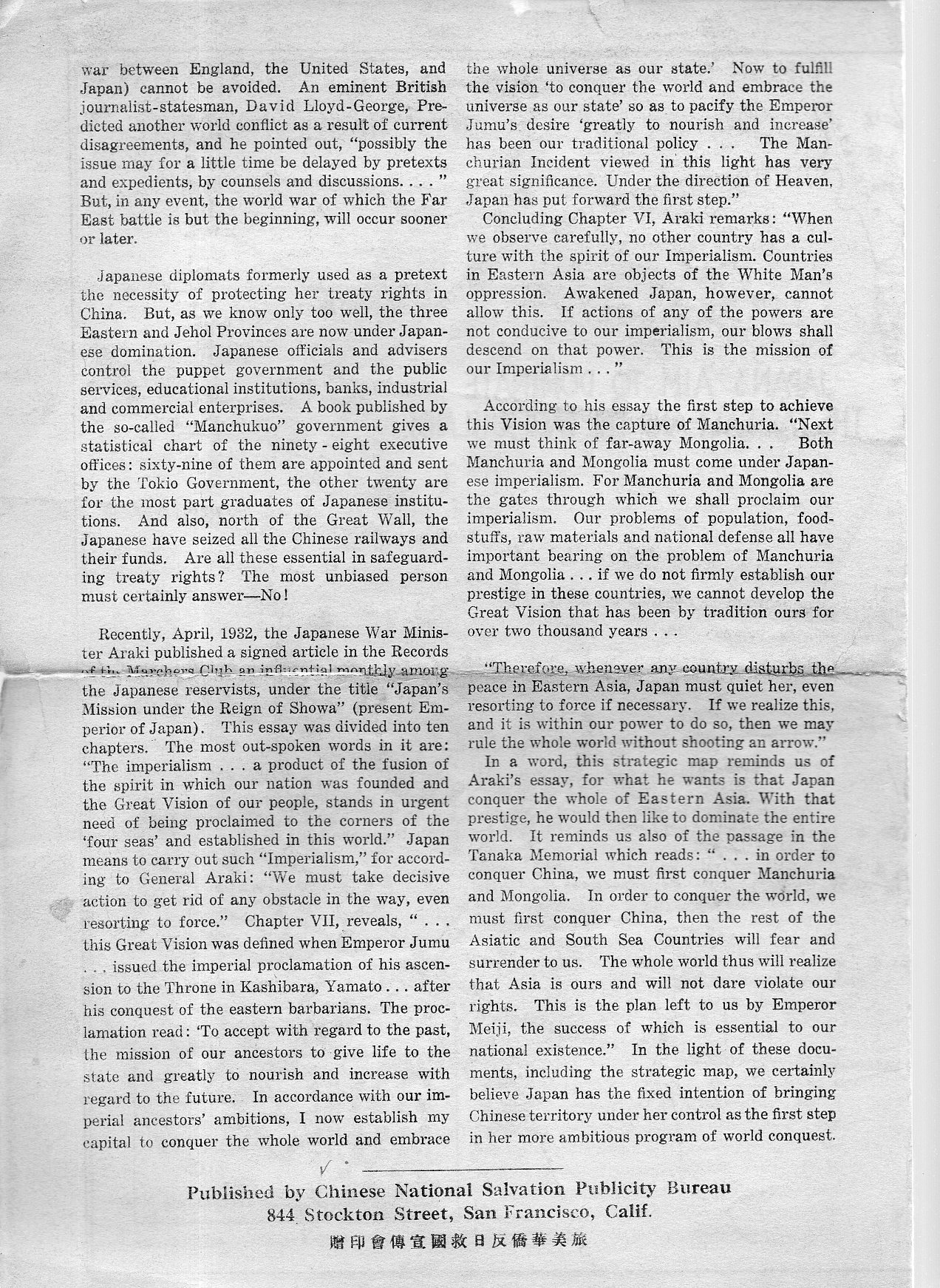
    I do not unfortunately have much information on this very interesting (and to me unexpected) map, nor do I know very much about the history of Japanese militarism and planning 1925-1935–I do though want to at least post/share it for interested parties.

    Ja[pan map200 Ja[pan map201

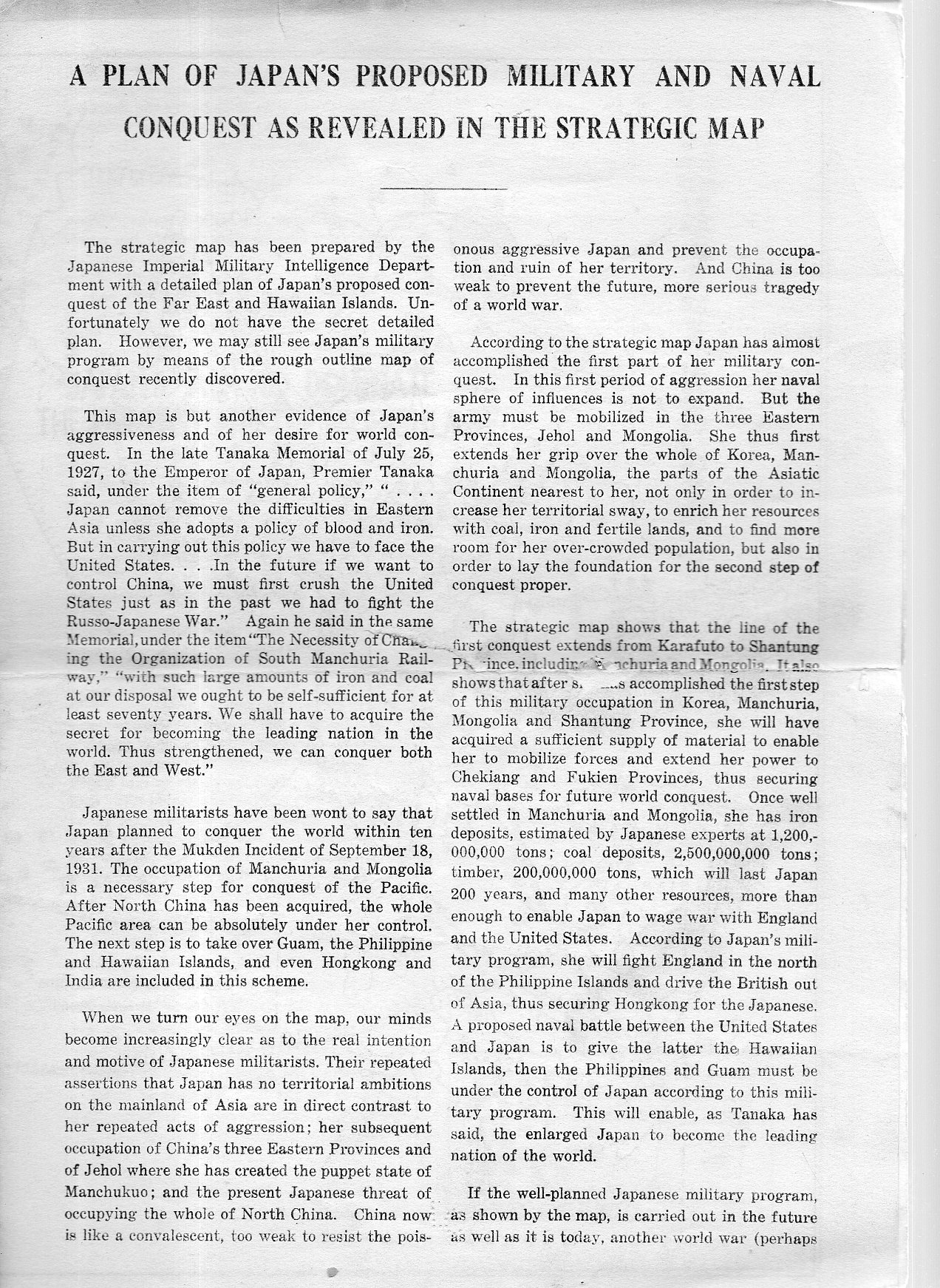
    A Plan of Japan’s Proposed Military and Naval Conquest as Revealed in the Strategic Map appears no later than 1933. The single-sheet folded pamphlet contains two pages of text along with the middle two sheets of the map, “Japan’s Aim to Dominate the Far East and Pacific Islands”. The document was part of a very large collection I bought of the Library of Congress, and according to the pencil notes on the pamphlet it was sent to the L.C. by the “Kuo Min Tang” on May 13, 1933.  (It was curious to see the KMT referred to as though it was someone’s name, rather than a political party begun in the People’s Republic of China in 1894.)

    This is a piece of anti-Japanese propaganda coming from the KMT, and it is published by the Chinese National Salvation Publicity Bureau (844 Stockton Street, which looks today like it is the Sun Yat-Sen Memorial Hall) in San Francisco,  After all, the Japanese had been savaging around in China on and off since the First Sino-Japanese War at the end of the century, and then again heating things up in the early ‘thirties with the Japanese-instigated the Shanghai War and the invasion of Manchuria–the Chinese no doubt were seeking allies wherever they could them.  

    There are a lot of lines of conquest on this map, encompassing nearly all of South East Asia.  The largest sphere of “influence” extends all the way to the Hawaiian Islands, where the Japanese would take the islands by a “naval battle” with the U.S.  

    I’ve checked WorldCat for other copies and found only one mention–same thing for the internet.  

    This map is available for purchase via the blog’s bookstore, here.  

    Full text follows:

    Ja[pan map198

    Ja[pan map199


  • A Child’s Manuscript Map of the U.S.A., ca. 1875-1880

    JF Ptak Science Books  Post 2274

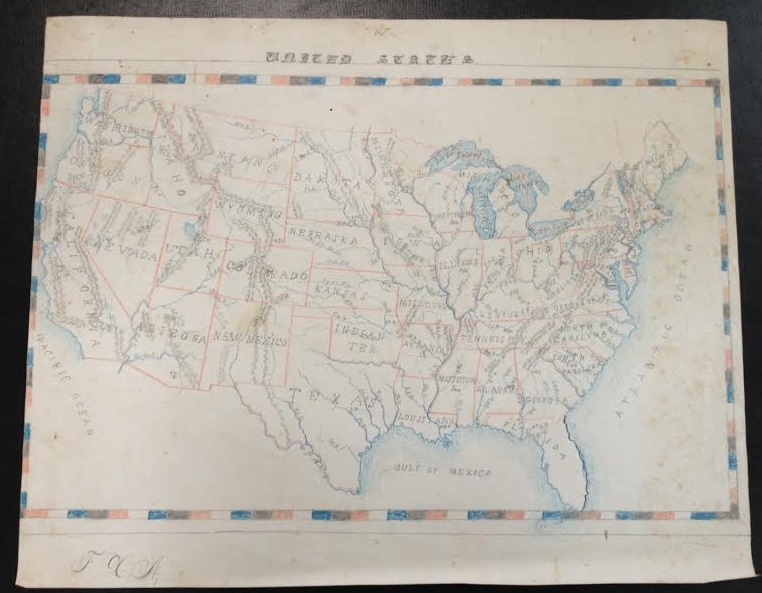
    It is difficult to find children’s art from the 19th century–original work, printed work, published work.  Very difficult–perhaps even more so for the published work than the manuscript.  It is easy to understand why: first, the children would need access to paper and pencil or pen and ink–items that had some cost, that were not inexpensive, not available to the vast majority of children. Their work was ephemeral, produced on slate, or in horn books, or in charcoal on a wall, or in dust.  Then, if the children did manage to record their creativity, then it would have to survive a generation of possessionship within their own lifetimes–to survive from the first part of the 19th century, the paperwork would have to survive five generations or more, 150+ years of house cleanings.  Tough odds.

    That is why it is also a little special when I come across larger manuscript works that have survived against these odds. 

    Maps US ms

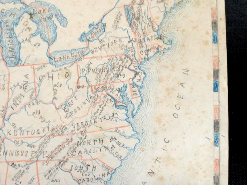
    This map of the United States isn’t so simple as it seems–although there are no major cities located in any states, many rivers are, as well as mountain ranges.  The coastlines get a very nice treatment with recessive blue lines, giving the map a certain dimensionality, and the lettering of the states is also distinctive, with the terminals of the letters in the state names ending with dots or lines.  

    Map US ms det

    I’d guess that the map was done around Centennial time, 1876 to the mid-1880’s, the biggest clues being the inclusive of Wyoming (which sets a date after 1868) and the large Dakota Territory, which would become North and South Dakota in 1889.  

    As maps by kids go, this one is fairly large at 12×15″–it is about the largest single sheet artwork that I have in a 150-odd pieces of antiquarian children’s art collection…also I wonder about how the kid in 1880-whatever got her/himself such a large piece of paper to work with, as it seems to me to be not a simple task.  


  • Road Map of Mud and Dust (1936)

    JF Ptak Science Books  Quick Post

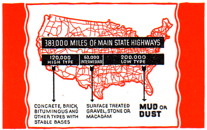
    What a simple and semi-magnificent map is this! A spaghetti map of the U.S. featuring road types, more than half of which were allocated as a “low type” of “MUD or DUST”. 

    Map of dusty roads040

    The map is in a disheartening and potentially numbing pamphlet on road improvement, which– had there been a simple cover for the work I would have quickly skipped by–however, the maps, data, and the lurking insomnia of boredom is perfectly hidden by this:

    Map of dusty roads041

    Holy cow!  This is marvelously striking–and just look at that “T”! 

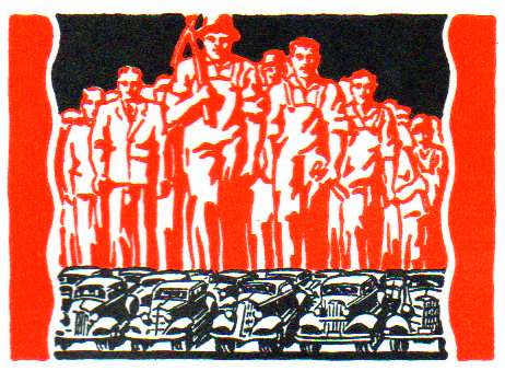
    In any event, the pamphlet is loaded with small woodcuts and graphics illustrating its point, which was to take Depression-available workforces and put them to work on repair of old and construction of new roads. 

    Map of dusty roads042The anonymous illustrator and/or designer certainly made a commendable and superior effort in making this fairly dry pamphlet, um, interesting. 


  • Early Map of Elevations of Plants and Tress, 1873

    JF Ptak Science Books   Quick Post

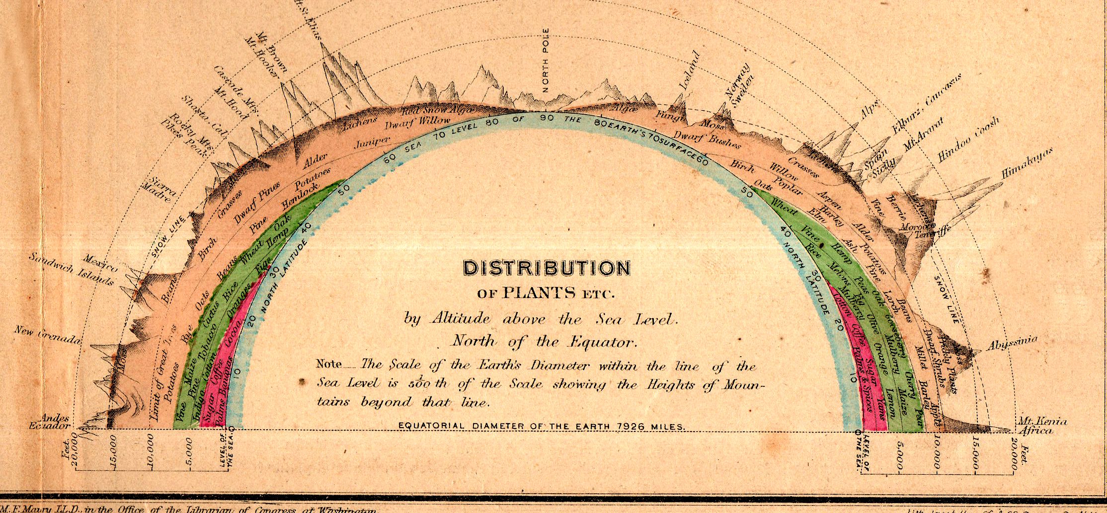
    Maps elevation maury161

    This fine little inset appears in “Chart of Principal Vegetable Growths and Chief Staples” from Matthew Fontaine Maury’s Physical Geography, a classic work for schools, which was printed in 1873. Maury is considered to be the father of U.S. oceanography (The Physical Geography of the Sea (1855), was the groundbreaking work)  and was a real pioneer in several areas. This did not exclude his adventures on behalf of the Commonwealth of Virginia and the Confederate States of America, where he served as Chief of Sea Coast, River and Harbor Defenses, among other things. Maury had a complicated relationship with the idea of slavery, attempting to eradicate slavery (and slaves) by removing the institution and perhaps the owners and their plantations to the Amazon basin.

    This small inset (above) measures 6×2.5″ in the original on a 13×10″ map, and shows the elevations at which certain trees and plants are found. It is an ingenious display, and depicts about 60 different samples. (The print in the map is about 1mm tall, by the way.)


  • A Smart Visual Representation of Terrestrial Land Mass, 1852

    JF Ptak Science Books    Post 2522

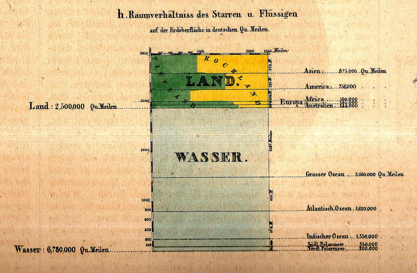
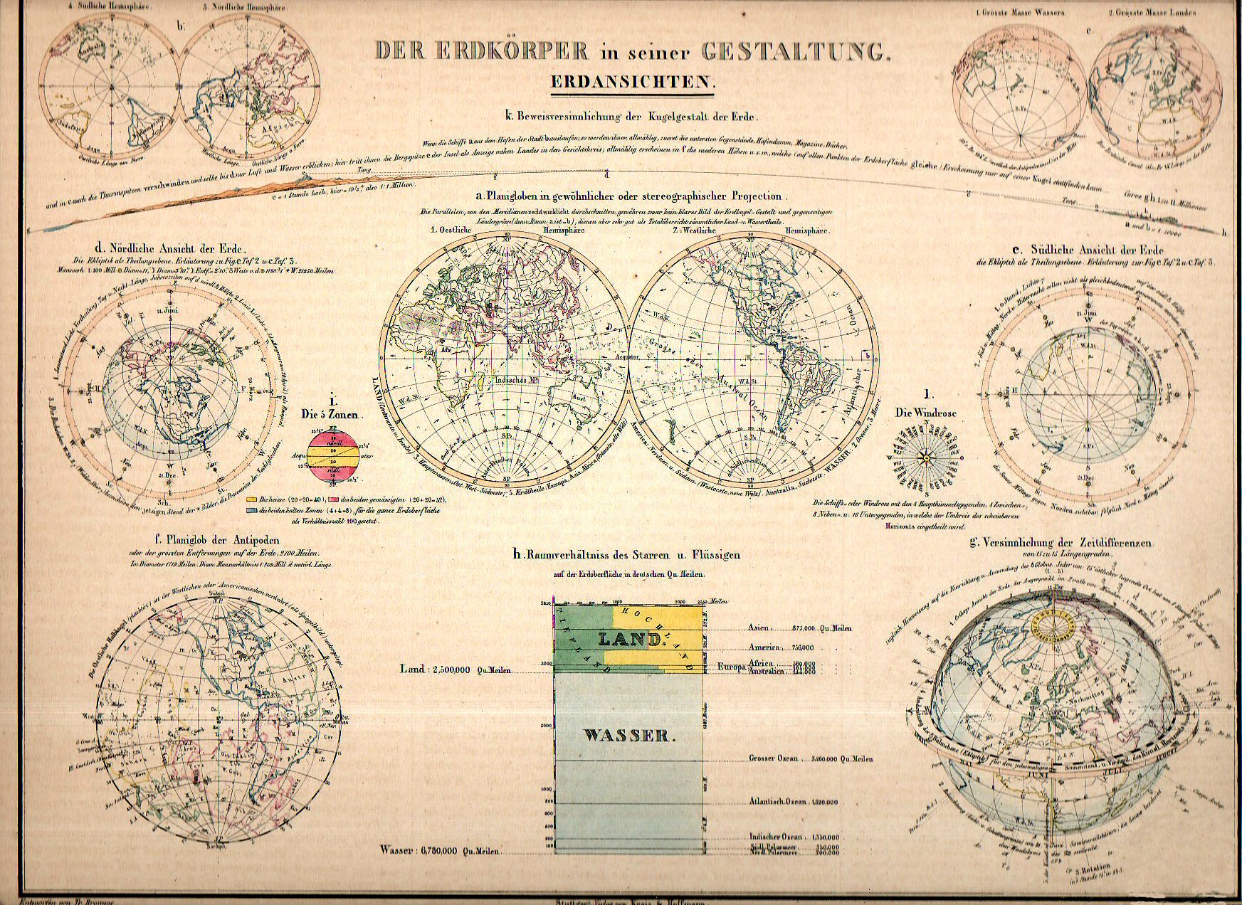
    Maps dataviz land wasser detail


    Before the Neil deGrasse Tyson version and update of Carl Sagan’s landmark television series, Cosmos, there was Alexander von Humboldt, and his enormously influential book of the same title, printed in 1845-1862.  Well, von Humboldt’s (1769-1859) book was actually Kosmos when published in German, which is where it started its life (and which von Humboldt suffered mightily for in it English translation).  Von Humboldt was enormously studied and educated and of a high scientific mind over many subjects, one of those 19th century figures who seemed as though they could know everything, a polymath of high order (along the lines of Goethe and von Helmholtz and Thomas Young and others).  He was a meteorologist and biogeographer before those sciences existed; a naturalist, geographer, archaeologist, and explorer, a natural philosopher of magnitudes.

    • The original of this map is available for purchase from the blog’s bookstore, here. 

    Kosmos reflected his lifelong interest in order, and what he did was astonishing–he attempted to unifying the complexities of nature in one book (of five volumes), binding the various branches of science together in a cohesive whole, attempting to show how the laws of the universe acted here on Earth.  It was a very influential work, very progressive, a masterwork of scientific method.  

    Sagan (and Tyson, soon) tried to explain what the universe was all about; 160+ years ago, so did von Humboldt, and for his time he came damned close to doing so, or as close as anyone could possibly come. 

    The fine little inset1 above (1×1.5 inches in real life) is an excellent display of water/land mass of the Earth, and is but one of eleven such images on this beautiful image (which appears in full, below): 

    Maps dataviz land wasser156


    Notes:

    “Der Erdkorper in seiner Gestaltung. Erdansichten. Entworfen von Tr. Bromme. Ausgefuhrt v. E. Winckelmann”, published in Stuttgart, by Verlag von Krais & Hoffman.  This map appeared in  the atlas of Alexander von Humboldt’s Kosmos, 1851.


  • Unusual WWII Maps by a Significant Soviet Intelligence Agent

    JF Ptak Science Books   Post 2517

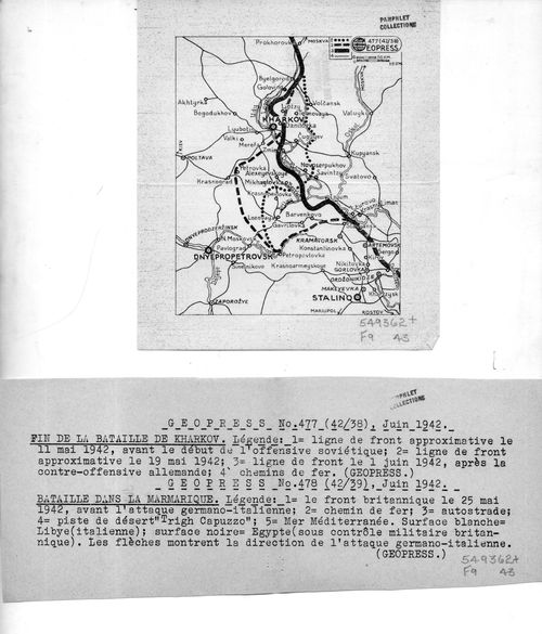
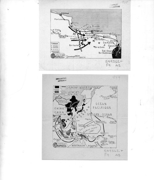
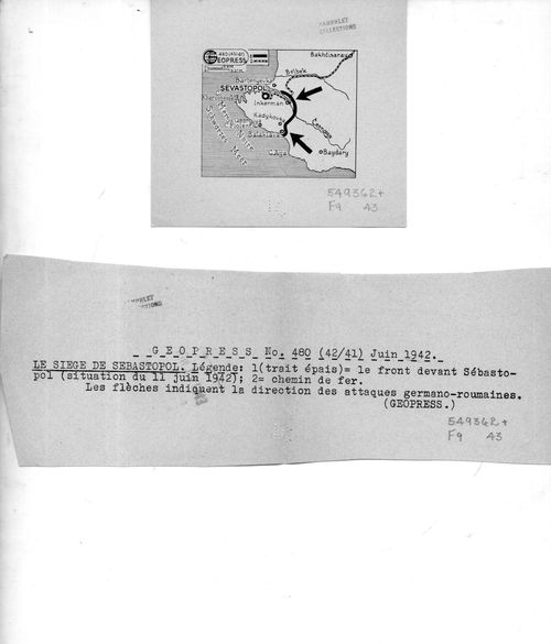
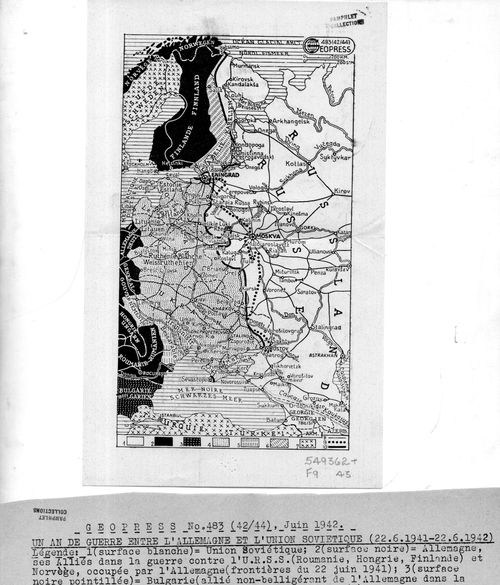
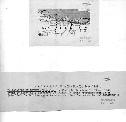
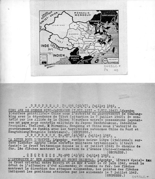
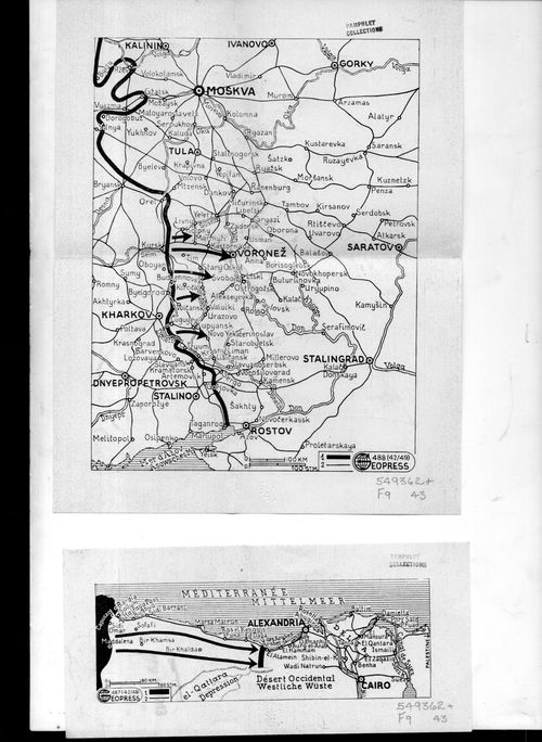
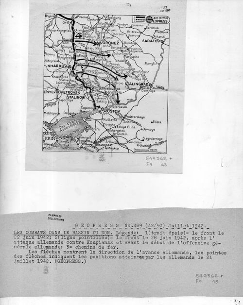
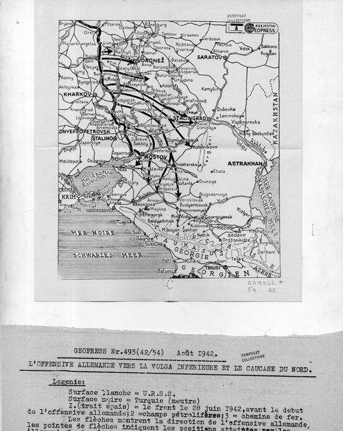
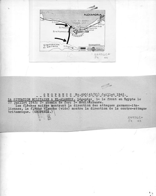
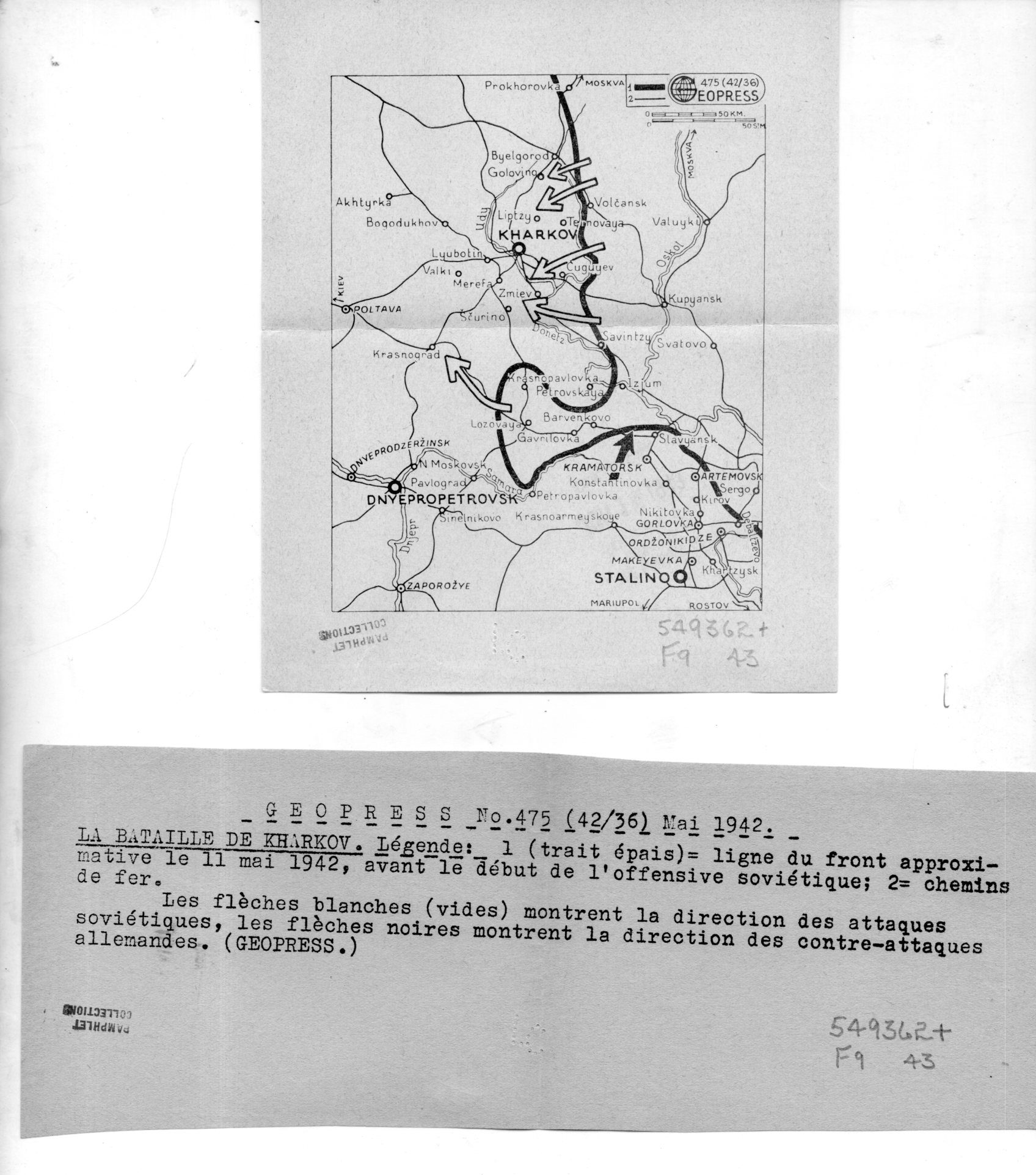
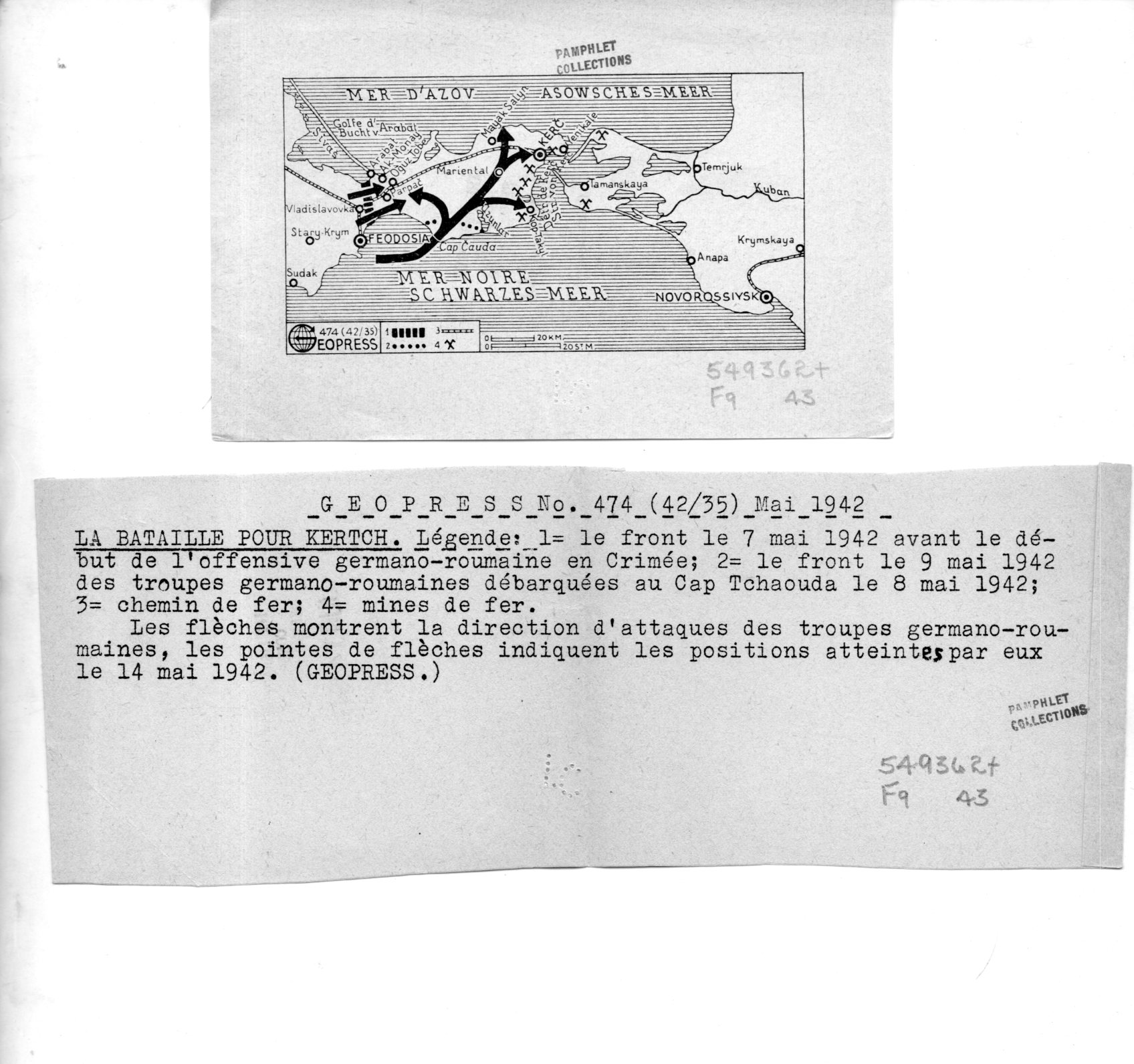
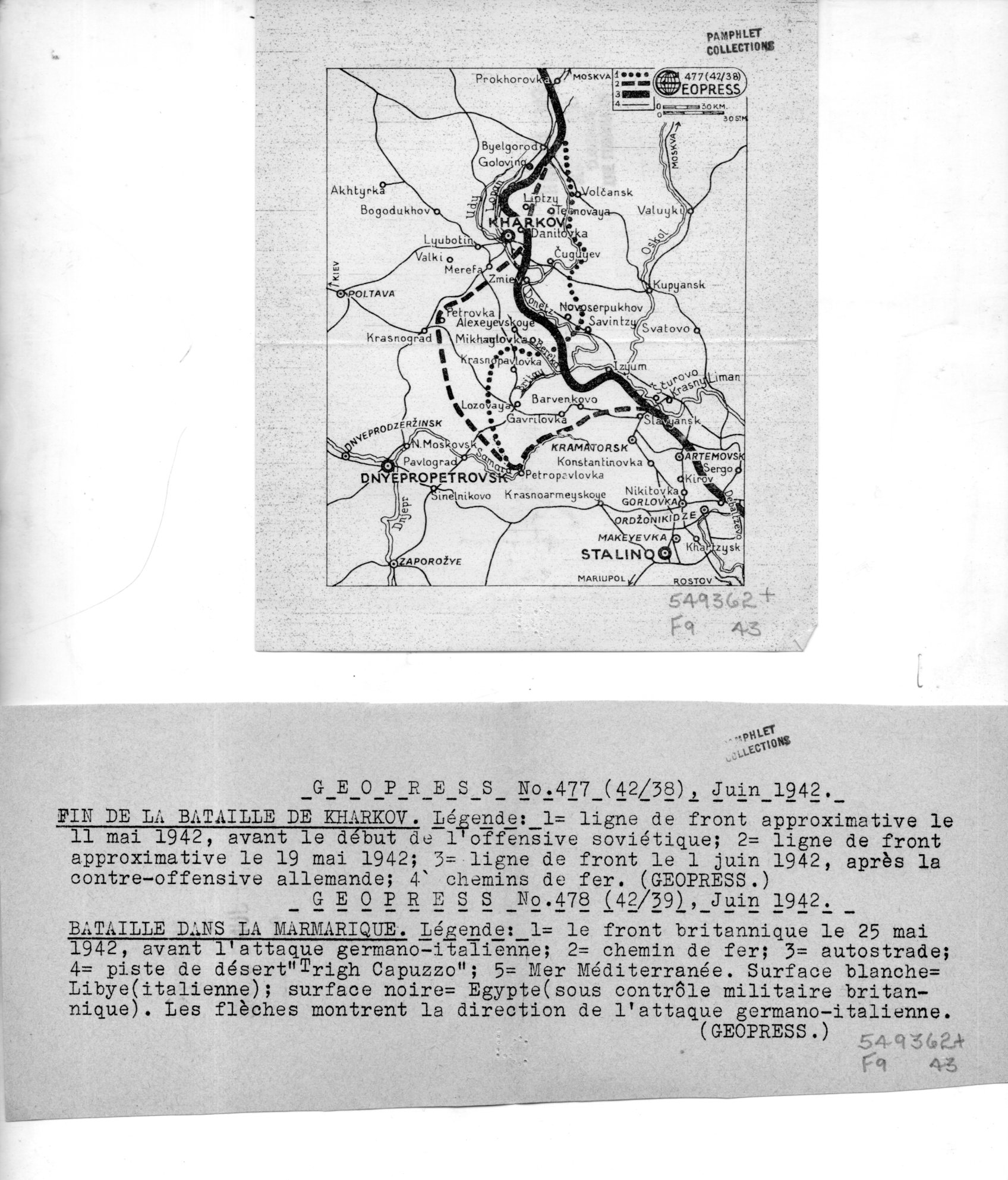
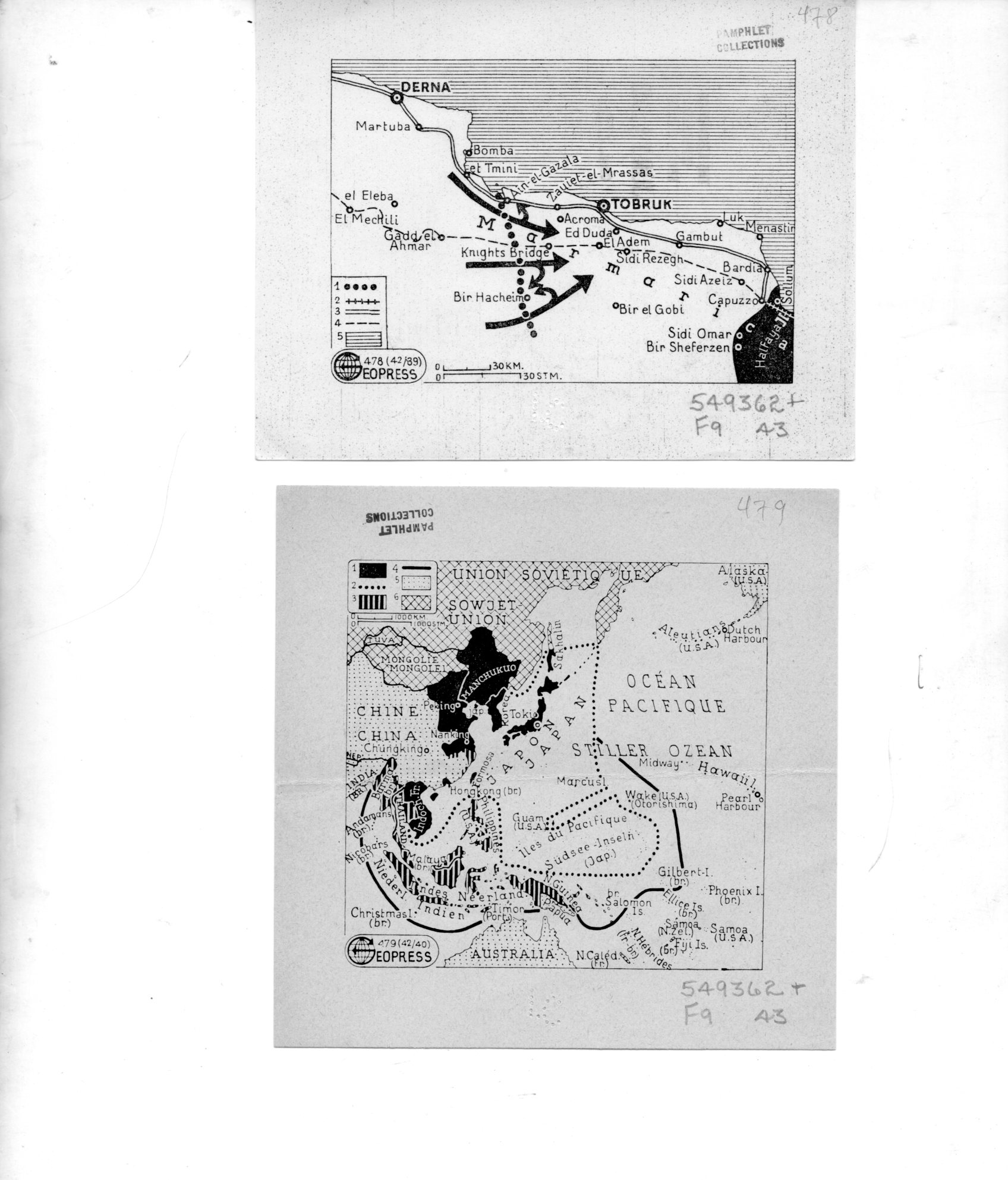
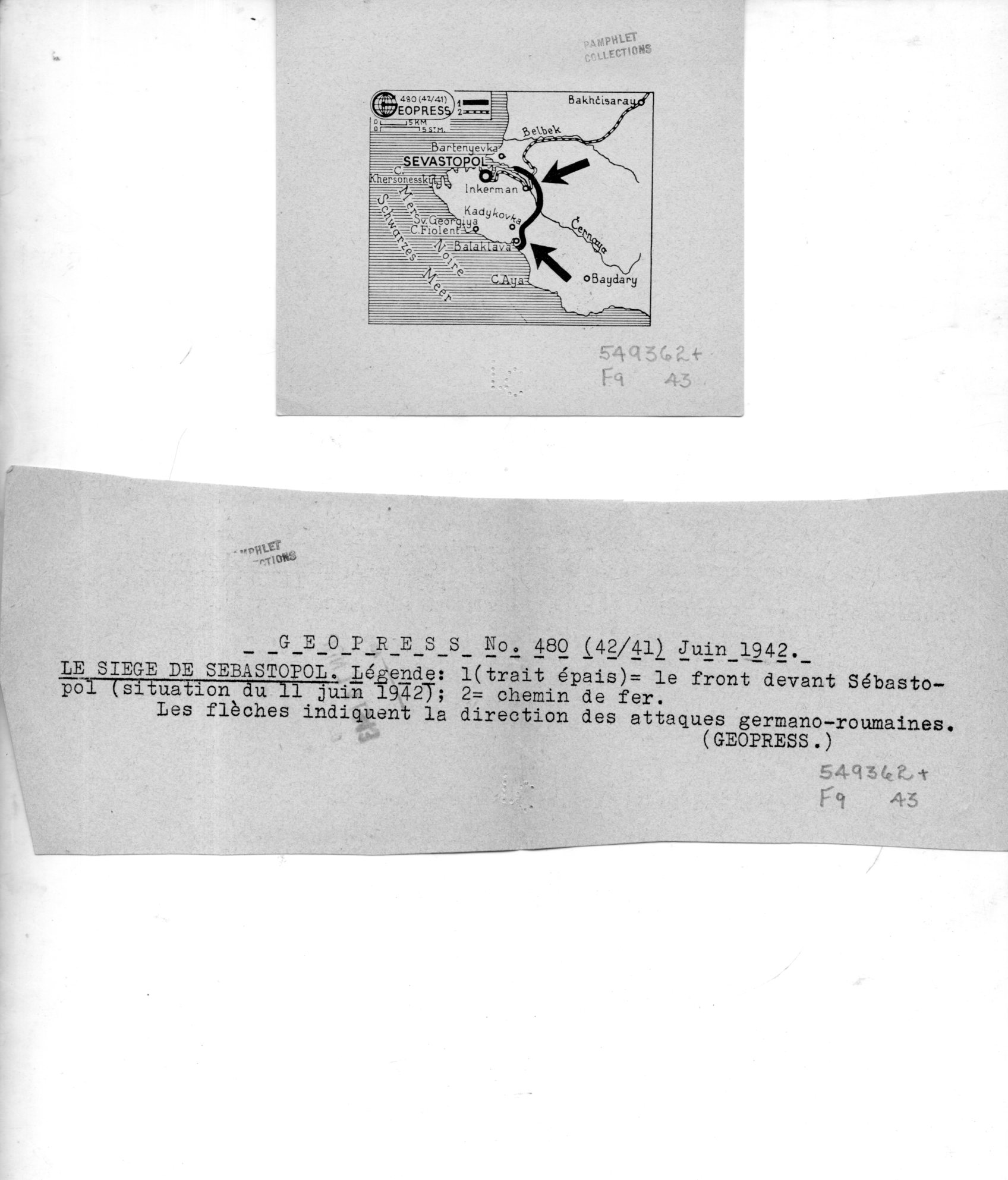
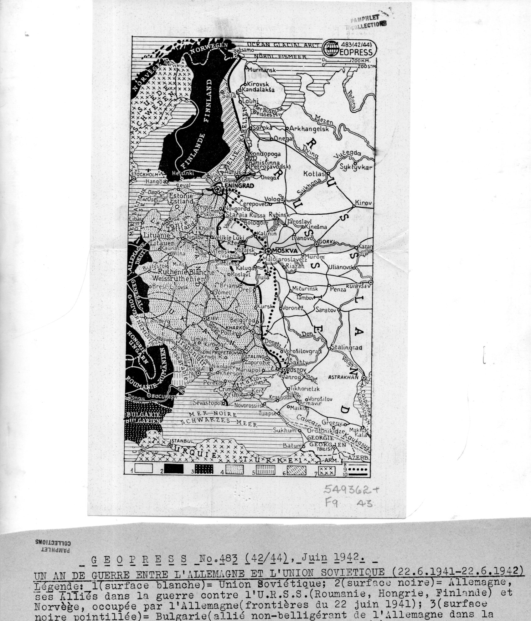
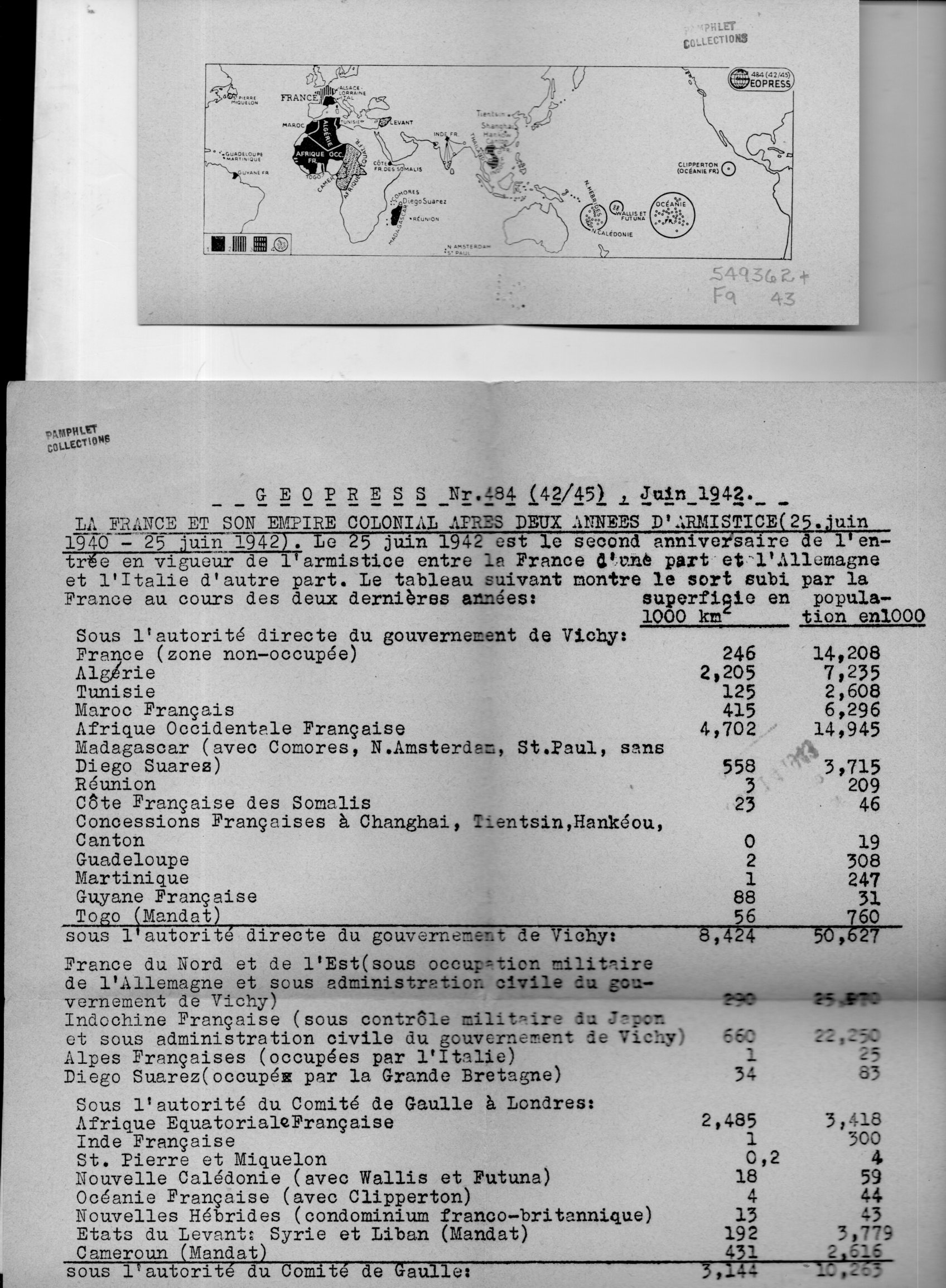
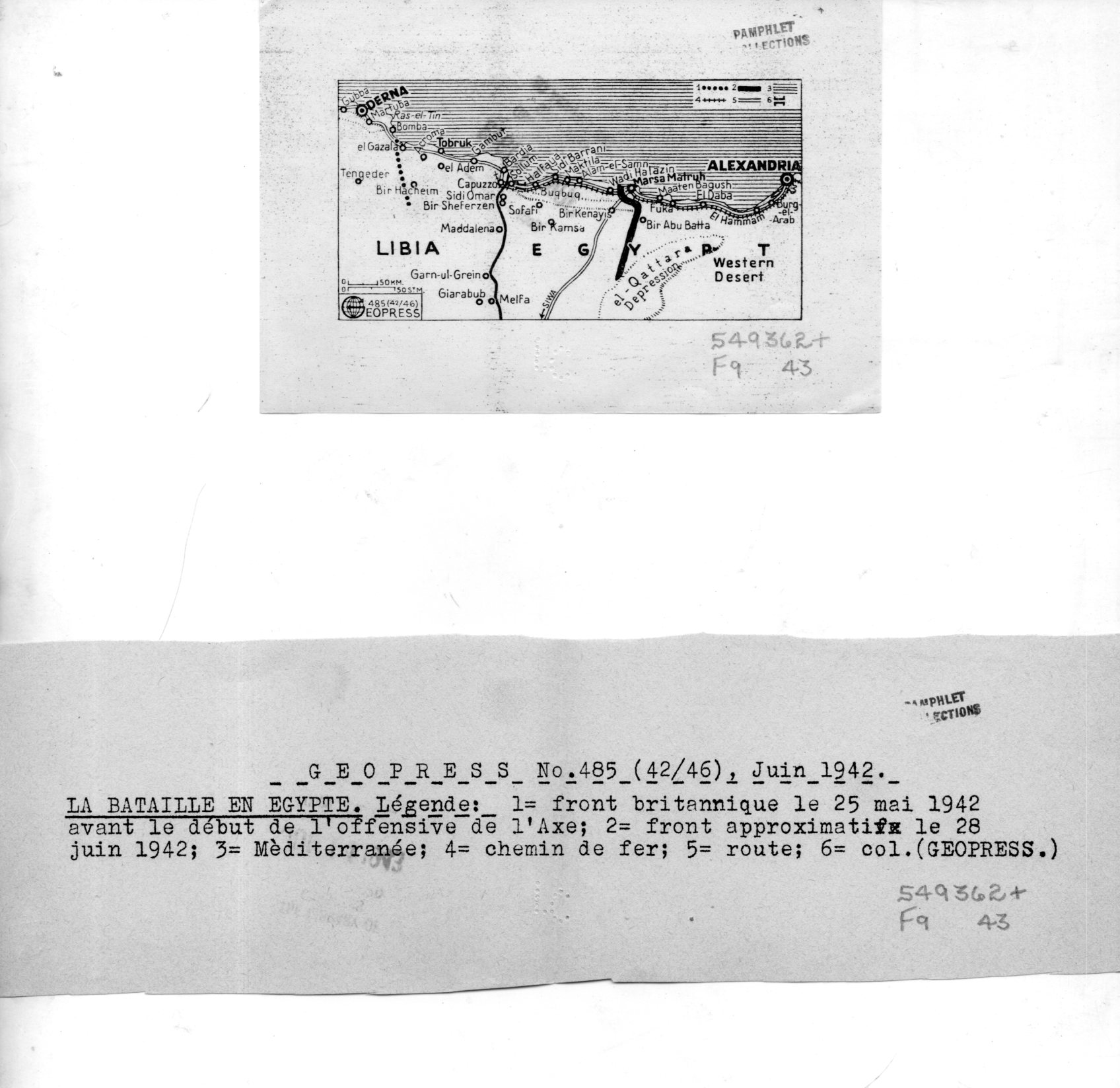
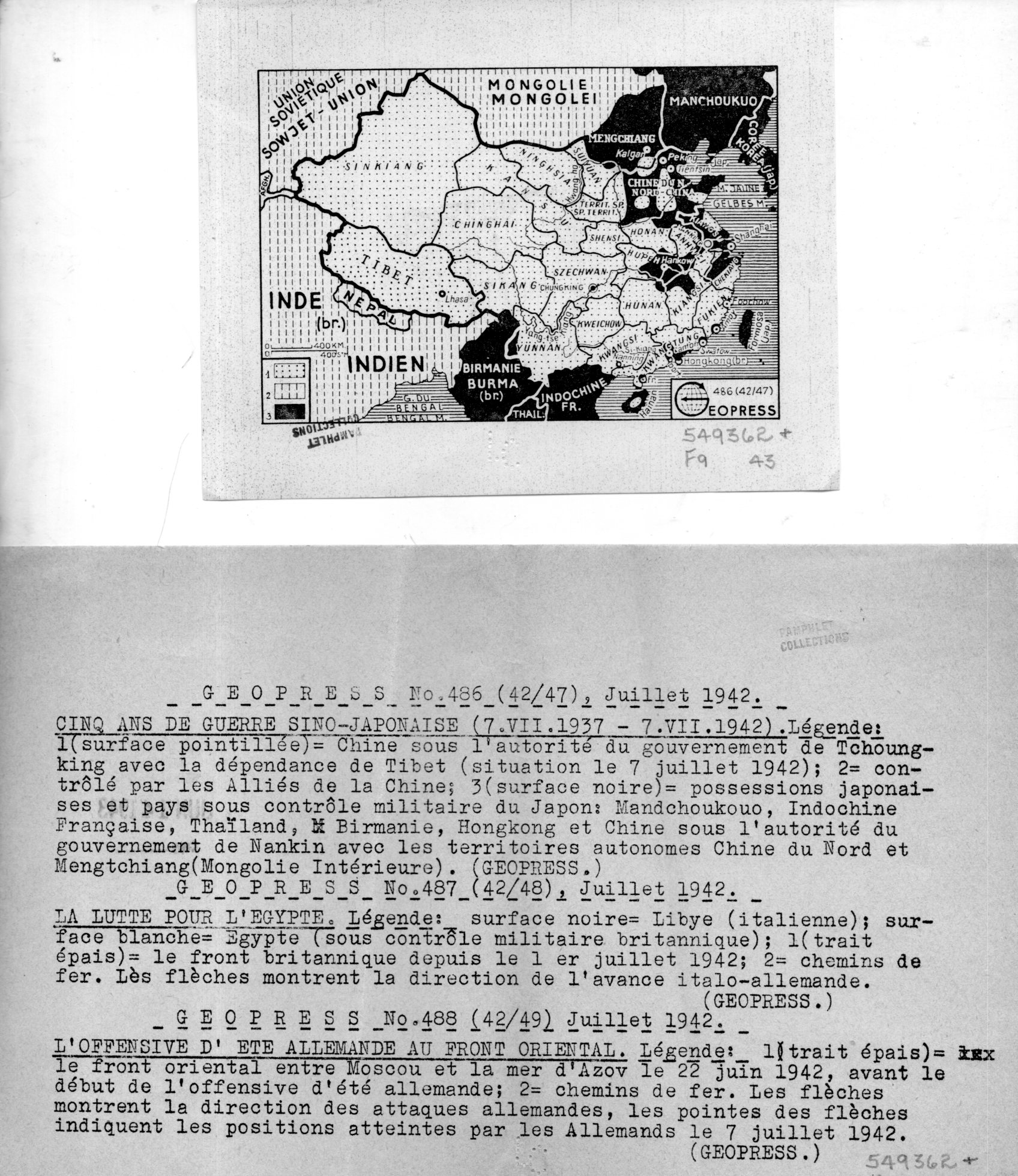
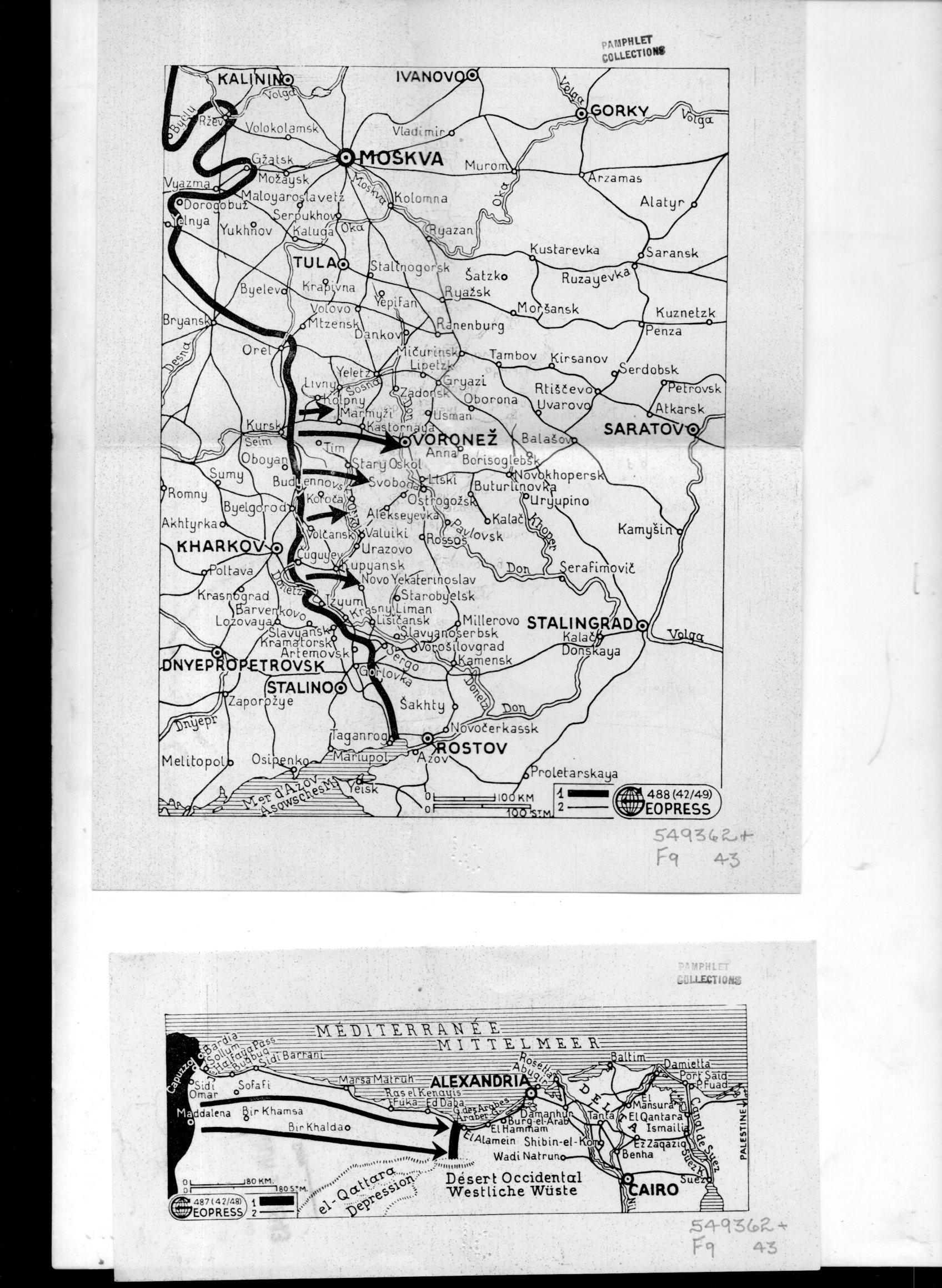
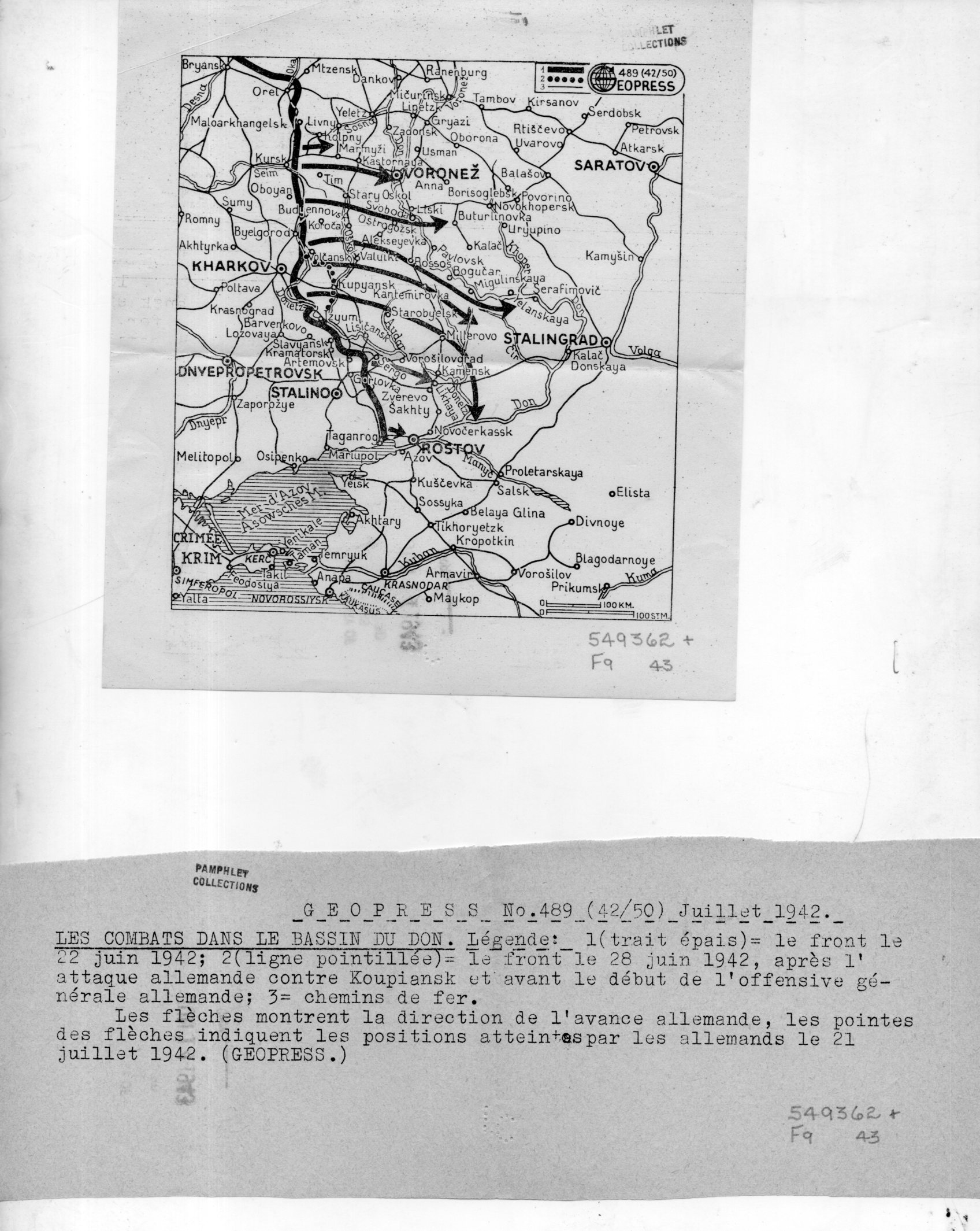
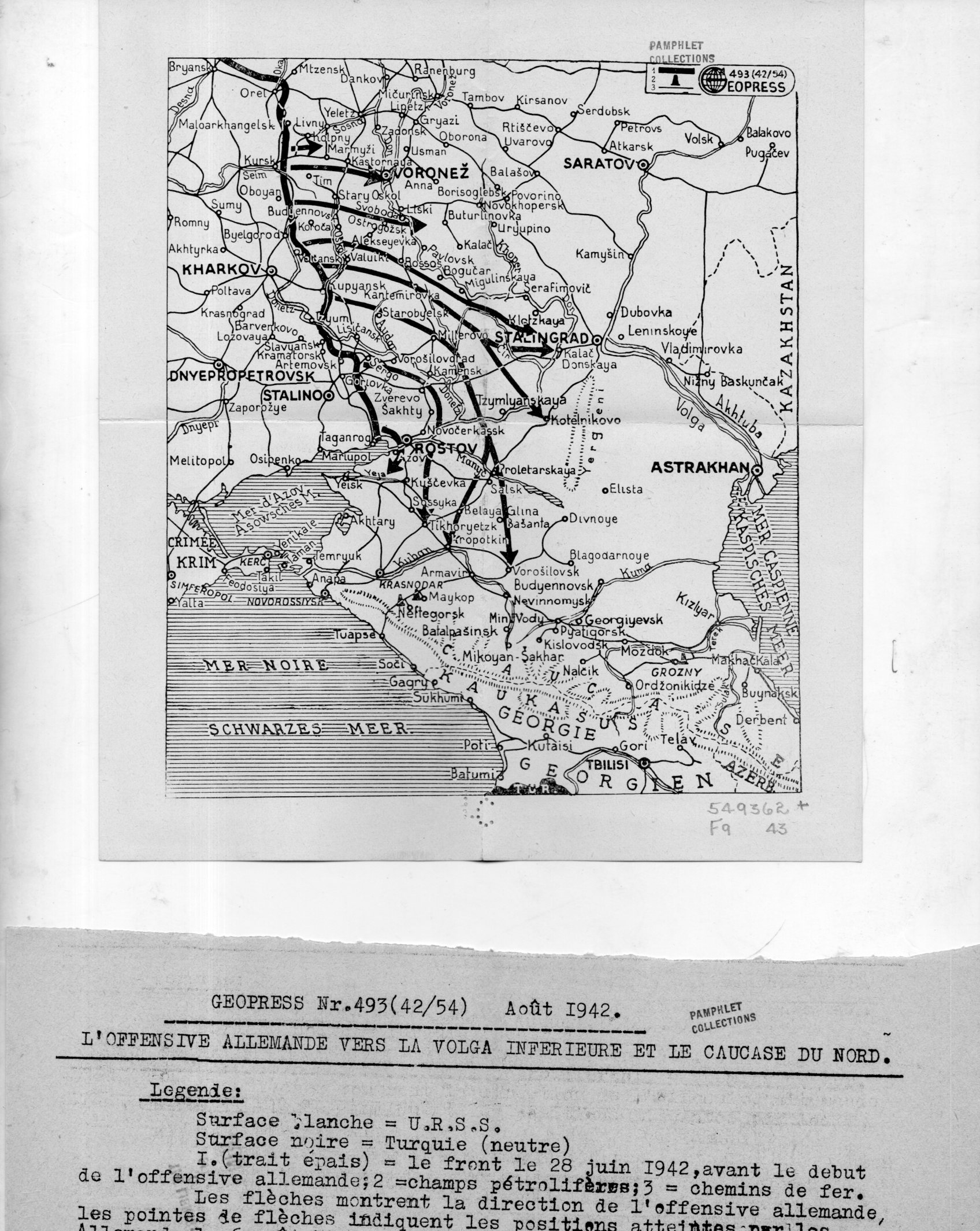
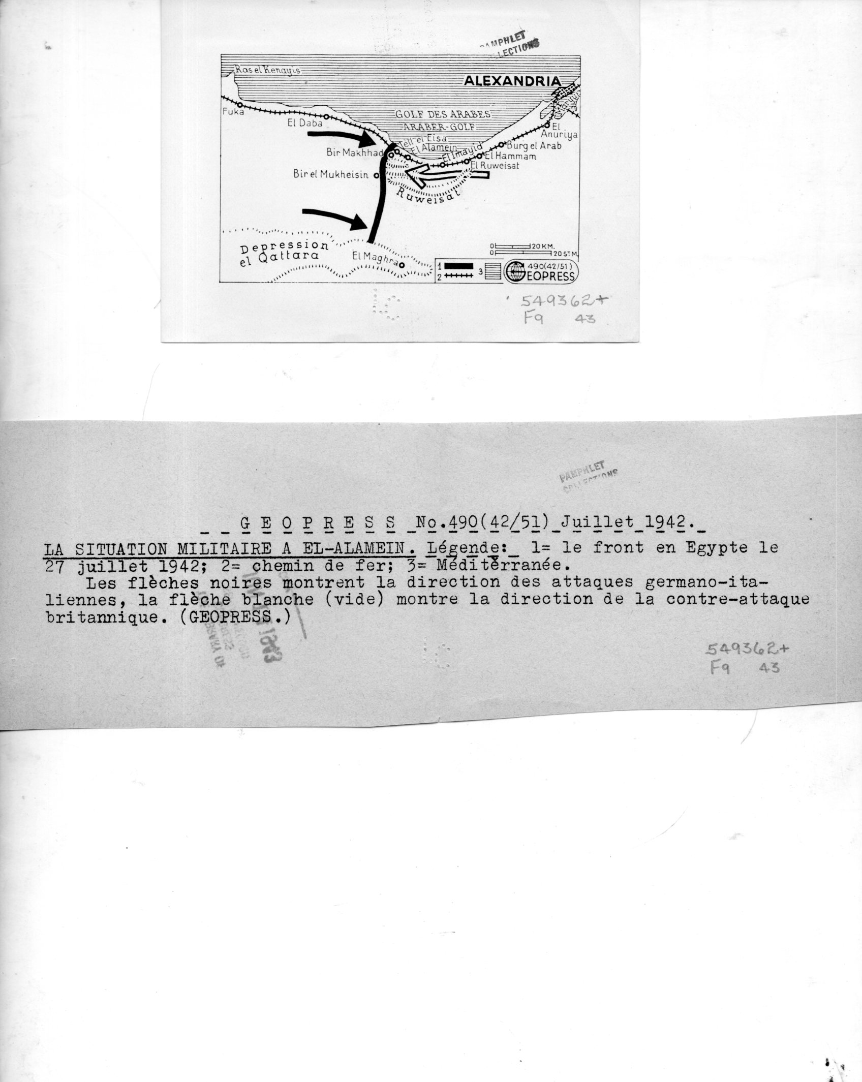
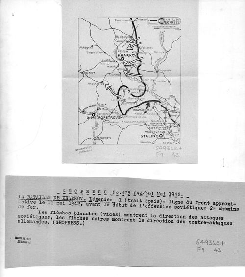
    I’ve found a number of interesting maps in the pamphlet collection here–these are highly unusual to my experience in that they were the work of a firm called “Geopress”, which was an active business and cover for a significant intelligence agent for the Soviet Union, operating in Switzerland, collecting data relating to German activities during WWII. There’s nothing I can add beyond the information that I quote extensively below from the CIA website on Rado–except that I cannot find images/examples of his Geopress work. So it seems the most efficient thing to do here is to simply quote the known sources and reproduce the images of the 18 maps and their accompanying texts.  
    Geopress _4_080

    As I said Rado operated Geopress as a news/cartographic service, and Rado was an accomplished cartographer, so the mans in and off themselves as maps are perhaps not a singular issue.  Their evident scarcity, however, does seem to be an issue. Also I do not understand why these maps are so small, some of which are just 1″x 3″; also the uneven;y cut/torn text sheets that are made to accompany the maps are also puzzling in their own way.  I do not understand the format–someone out there in Weblandia no doubt will.  

    All of the maps shown below are from 1942. They were received by the Library of Congress in June 1943 and stamped so on the backs of the maps.  (They lived for some time in the “Pamphlet Collection” at the LC before being purchased by me in 1998.)  

    The following quotes come from the CIA website, the Center for the Study of Intelligence, here:  https://www.cia.gov/library/center-for-the-study-of-intelligence/kent-csi/vol12i3/html/v12i3a05p_0001.htm]

     “Alexander (Sandor) Rado, Alexander Foote’s chief in the Swiss-based “Rote Drei” net that in 1941-43 supplied Moscow with detailed information on German order of battle… His activity in intelligence, mapping, and related fields has lasted nearly 50 years and may earn him a place in the pantheon of major intelligence figures of the times.”

    And this:

    “In 1936 or 1937, with Soviet funds and having a Swiss citizen as silent partner, Rado organized Geopress, a news agency specializing as Inpress had in maps and geographic background data. Geopress was more successful than Inpress because of better organization and the increased demand for news maps in the advancing shadows of World War II. As cover for an intelligence operation it proved ideal. Its normal activity—news collection and dissemination—provided justification for contacts with businessmen, officials, diplomats, journalists, and military leaders, some of whom became intelligence sources. It also justified a large volume of telephone and telegraph traffic, extensive postal business, and the maintenance of a courier system.”

    And so:

    “While building up his Geopress cover Rado also developed his sources, organized communications, and summarized for transmission the reports collected by his growing network. And he even found time to maintain through publications his image as an internationally known geographer.”

    And:

    “24 Feb. 1945.  During the German occupation of Hungary, (Rado) lived in Geneva where (he) published geographical maps for the Allied Governments until 1943; discovered by the GESTAPO and consequently his relatives in Hungary were murdered/ went with family to Paris in September 1944 and continued his work/summoned to Russia to report on his activities with the Free French Organization and left on 8 Jan. 1945 by special plane for Moscow/suspecting a trap, he got off the plane in Cairo where he remained/received no news from his wife in Paris and suspects that she might have been deported/he was formerly a Fellow of the Geographical Society in London, New York, Paris, Geneva, Rome and Washington, D.C.  OFFICE OF CENSORSHIP, Egypt, 11 April 1945.”

    [Again, the source for this and the above quotes:  https://www.cia.gov/library/center-for-the-study-of-intelligence/kent-csi/vol12i3/html/v12i3a05p_0001.htm]

    The maps:

    Geopress _3_079

    Geopress _6_082

    Geopress _7_083

    Geopress _8_084

    Geopress _10_086

    Geopress _11_087


    Geopress _12_088

    Geopress _13_089


    Geopress _14_090

    Geopress _15_091

    Geopress _16_092

    Geopress _17_093


  • A “What Is THIS?” Map of Manhattan (1938)

    JF Ptak Science Books   Quick Post

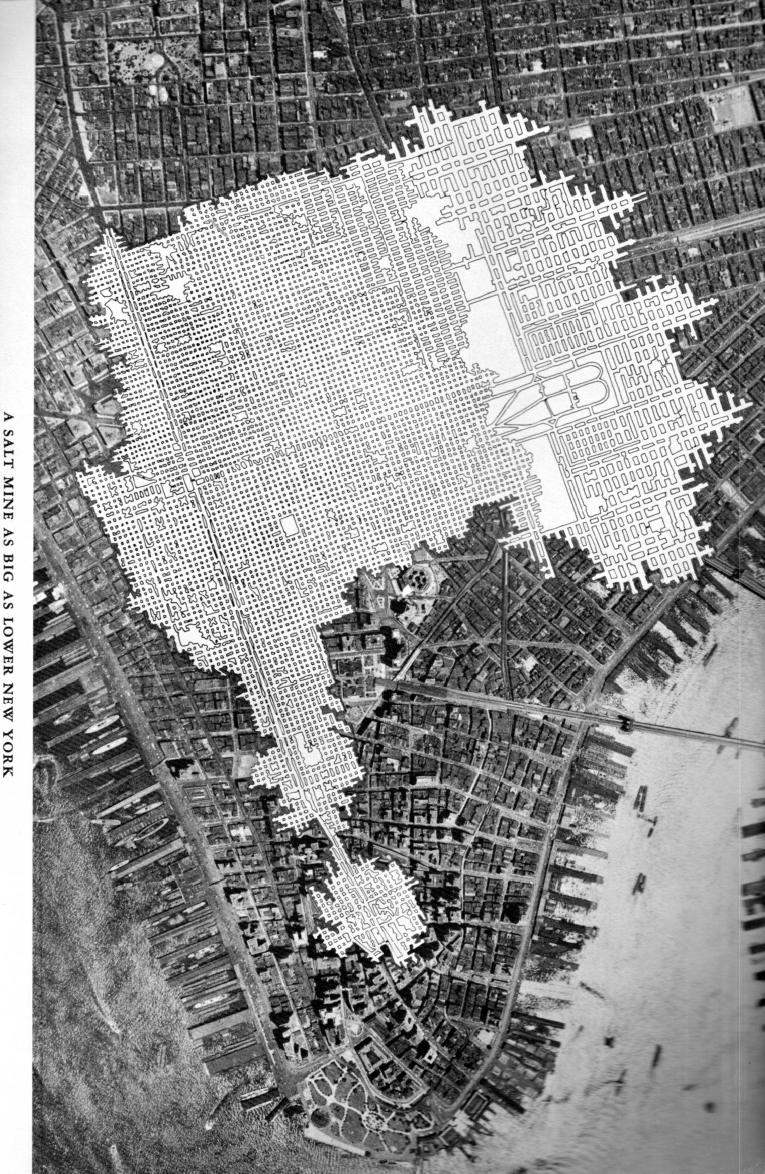
    The Chaco-like overlay in this map of midtown/lower Manhattan has a lot of creative opportunities in it–like showing a map of an enormous and  mysteriously removed Manhattan, or just-discovered earthworks that were somehow dug into bedrock, and so on.

    SALT map218

    But it isn’t. It is a salt mine comparative overlap using Manhattan as a unit if measurement.

    Talk about the “Great White Way”– this elaborate footprint of salt works, with its wide and short-ceilinged rectangular tunnels that are all illuminated white surfaces would challenge anything that Broadway (ca. 1948) offered. “A Salt Mine as Big as Lower New York” is an unusual map to my experience–of course there must be many of these maps available through the years by the companies that mined salt (and coal, and so on) but to my experience they are not often published for public consumption.  The map below is an exception, and simply depicts the rock salt mine at Retsof, NY, (“the largest in the world”).It appears in the unevenly-titled  Salt Empire of the Largest Producer of Salt in the World, and was published by the International Salt Company in 1935.