A Daily History of Holes, Dots, Lines, Science, History, Math, Physics, Art, the Unintentional Absurd, Architecture, Maps, Data Visualization, Blank and Missing Things, and so on. |1.6 million words, 7500 images, 4.9 million hits| Press & appearances in The Times, Le Figaro, Mensa, The Economist, The Guardian, Discovery News, Slate, Le Monde, Sci American Blogs, Le Pont, and many other places… 5000+ total posts since 2008.

Category: Maps, Cartography, History of Mapmaking

  • A Detail of the Something in the Nothing (“Concerning the Deluge, and the Dissolution of the Earth.”)

    JF Ptak Science Books   Quick Post

    There is a great and powerful image of nothing in Thomas Burnet’s The Sacred Theory of the Earth: Containing an Account of its Original Creation, And of all the General Changes which it hath undergone, or is to undergo, until the Consumption of all Things…printed in London ca. 1759, a hundred years after its first printing, in the glory and the magnificence of some very wide and biblical Bible thinking that was still in demand. I’m visiting the “dissolution of the Earth” section, here, showing the results of a very judgmental Creator taking aim at the whole of the Earth for its foul play, drowning everything and everyone for a lesson that could be learned only by the dead–save for a small group of related people and a bunch of animals in a wooden boat the size of which could not possibly have been built during this time period. I have pulled out this image of the ark, guided or protected or righted by a pair of faceless angels, keeping the ship steady on the top of Mt. Ararat. All around this boat are the peaks of other mountains, which for some reason are depleted of all living things, unless of course the image shows the waters receding, which is the route I would take if it were up to me to explain this. Noah ark ararat detail
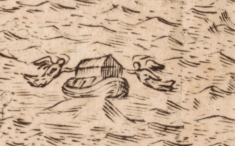
    This is a detail from the full engraving, below, which show the Earth completely covered by water–it would be an interesting thing to imagine as an actual physical process and what exactly would have to happen in order for such a thing to occur (and when you start to think of how, outside belief, this could come to happen, you have the makings of an interesting class):
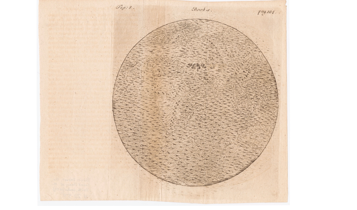
    Noah ark ararat

    If you expand the image the nearly-invisible continents shine through ever so slightly. I imagine that this would be a pretty scary image to show a kid, or to a believer who had doubts about the possibilities of a wrathful creator. In any event, this fits beautifully as a short post into this blog’s “History of Nothing” series, as we see a big image of near-nothing–just water.  (Did the fish drown?) Anyway, nothing was left except the boat. And landforms. And water, which evidently went somewhere. 

    This image was found at the wonderful and extraordinary P.J. Mode Collection “Persuasive Maps” hosted by Cornell University, here: https://digital.library.cornell.edu/catalog/ss:19343661   There are 800+ maps like this there–do not hesitate to visit and visit often–it is a fantastic place.  
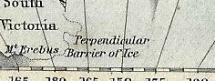

  • A True “Severance of the Sea”–the “Perpendicular Barrier of Ice”

    JF Ptak Science Books  Post 2689

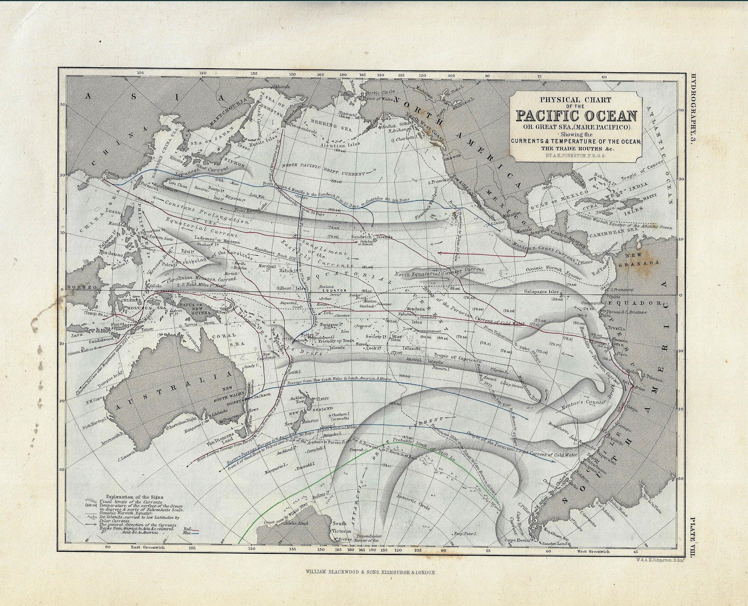
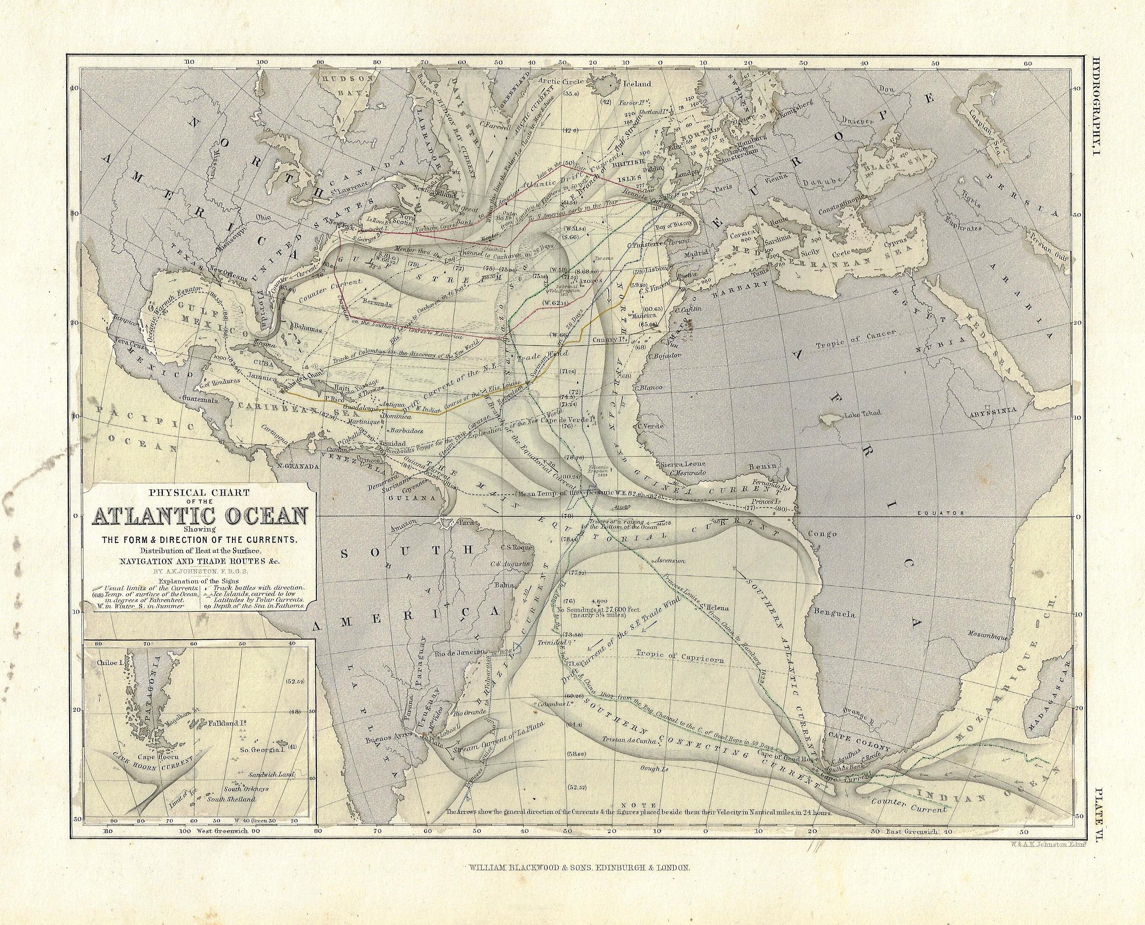
    These maps seems both simple and complex, orderly and chaotic. The truth of the matter is that there’s very little black ink on these sheets for as much information as they are sharing, and yet still look to be pretty deep in the data department.  They are maps1 of ocean currents of the Atlantic and Pacific Oceans, and show water temperatures, charts of historic voyages, lines of transportation along with how long the voyage would last, and other pieces of information. 

    Maps ocean currents pacific detail

    I’ve scanned these in some detail so that they can be enlarged so that the tiny text can be read. While I was looking over these beautiful lines, I found the following lines at the extreme south edge of the Pacific Ocean map, in Antarctica, under the wide “Antarctic Drift Currents”, just barely on the map next to South Victoria: “perpendicular barrier of ice”.  ANd no doubt they meant it. The phrase is cold and barren striking, so I went looking for it online, to see how often it may have been used–and according to google, it hasn’t been used very much at all. One result from the Geographical Journal, which reads:

    “The result of these two seasons exploration was the discovery of a pool of more or less open water some 600 miles in diameter between latitudes 68 and 78 bounded on the west by a stupendous range of ice clad mountains on the south by a perpendicular barrier of ice and on the east and north east and for the most part on the north by the main pack.”2

    This was in response to the approach of reaching the magnetic South Pole, but in addition to everything else, there was this perpendicular wall of ice that stretched for miles and miles, an unapproachable mass hundreds of feet high, after which stood mountain, which were much higher. 

    There are many pieces of data like this on these maps–take your time and enjoy them

    Notes:

    1. The maps are from Johnston’s Physical Atlas, printed by William Blackwood & SOns in London, ca. 1860-1870. (There were earlier editions of this map, beginning in 1852 it looks like, that were considerably larger. The present maps are 20x26cm.)

    2. “Renewal of Antarctic Discovery”, by John Murray, in The Geographical Journal, 1904, volume 3, page 28.

      Maps ocean currents pacific


    Maps ocena currents atlantic


  • A Map with a Point (1943)

    JF Ptak Science Books  Quick Post 

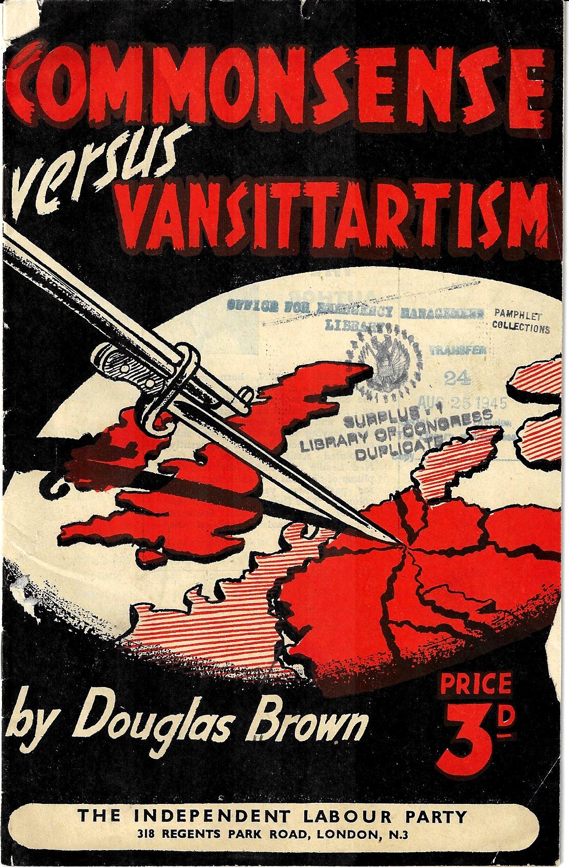
    I admit that did not look at this pamphlet (printed in 1943) to determine the conflict between “commonsense” [sic] and “Vansittartism” (which I had to look up1). Mr. Brown, the author, was a prominent Socialist, who advocated–in my peep at the last page of the pamphlet–reallocation of land/industry/transport/”banking” to the community and the abolition of private profit-making, and thus to the shout-whisper political argument becomes just a wisp of smoke in a shallow hole. The only reason I stopped here was the cover design, showing a strike to the northern part of Germany.  

      Book cover bayonette in Germany map

    Notes:

    1. From Merriam-Webster: “Vansittartism, doctrine holding that the conduct of German war leaders from the Franco-Prussian war on has had the wholehearted support of the majority of Germans and that Germany must be demilitarized during a protracted period of occupation and reeducation to insure against her undertaking further wars of conquest.”


  • A Map of Lakes and Islands, 1856

    JF Ptak Science Books   Post 2688

    Representing a collection of things on the same sheet of paper and doing so with everything being in the same scale seems to have been an invention of the 19th century–more specifically, this innovation may have been that of the architect Etienne Durand in the 1840’s. Durand would place the plans of various buildings in a collective all in the same scale–which was  a great thing because then the student or the viewer would be able to compare these images with a common denominator. (I guess that a person could make a case for J.J. Audubon that appeared in his iconic work, published just a few years earlier than Durand in 1837/8, as all of his birds were on the same scale because all of the 1,068 birds he included in his work were drawn life sized.)

    In any event this thought came to mind with the mostly-19thc practice of showing the lengths of rivers and the heights of mountains to scale in atlases, though especially with the representation of lakes and islands (and waterfalls!) which to my experience are much more uncommon sightings. All of this leads me to this fine work (below), which surfaced again this morning–a representation of lakes and islands on the same scale, and printed in 1856. I don’t know at this point how much earlier these things get for lakes/islands, but it seems that they wouldn’t be very much earlier than this.

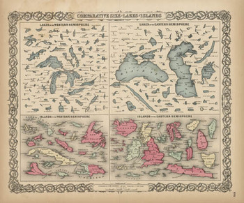
    Blogjuly_19_comparative_big_coltonSO, 18561 may have been tone of the earliest times that these 150+ lakes and islands of the Western and Eastern Hemisphere were ever been printed on the same page and in the same scale exclusive of their associative land masses and placed contiguously, side-by-side.  They were, of course, seen in a common perspective before on any world map, but I think that this is the first year in which the islands and lakes of the world were displayed without oceans and land masses, and the effect is a little odd.  If you take away the color and the text the image takes on a very definite biological flavor (I keep thinking of that tiny bone in the ear for the small lakes…)  In any event it is far easier to compare these features without the distractions of the non-lakes and non-islands clouding and confusing our perspective fields.
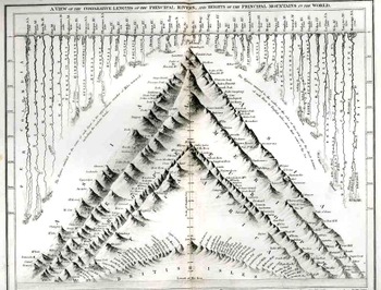
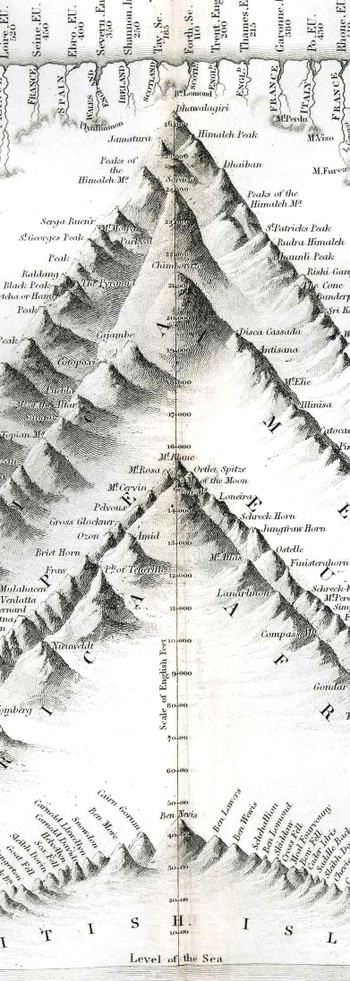
    This was also the beginning of the heyday of publishing comparative this-and-that in atlases:  from 1840-1880 or so was the period in which the majority of descriptive comparatives were published.  This is when you would see comparatives of the lengths of rivers and the heights of mountains and waterfalls beautifully displayed in atlases.  I don’t know what happened after then, but the publication of this sort of data really fell off, with the heights of mountains/lengths of rivers stuff relegated to filling the empty areas in double-hemisphere world maps.
    Blogjuly_19comparative_1836350
    Here’s a relatively early image of this type called “A View of the Comparative Lengths of the Principal Rivers and Heights of the Principal Mountains in the World”, published by Orr & Smith in London (1836), featuring 44 rivers and a hundred or so mountains.  It is a lovely and graphically pleasing work, and an early effort in displaying the dissected river and mountains in such a forensic-like way.
    Blogjuly_19comparative_1836_detail_

    This I think is my favorite genre of specialty map, and, for now, I’d just like to surface this map by George Colton, and admire it, and try to imagine the kind of impact it must’ve had on people back there in 1856 who were seeing this sort of data displayed so for the first tine.  It would have been a huge revelation to see the lakes and islands compared side-by-side; it was a fresh, new idea, and an insight in how to look at things in general.


  • A Scarce Piece on New Mexico History and a Forward-Looking View of Housing-for-All (1937)

    JF Ptak Science Books   Post 2679


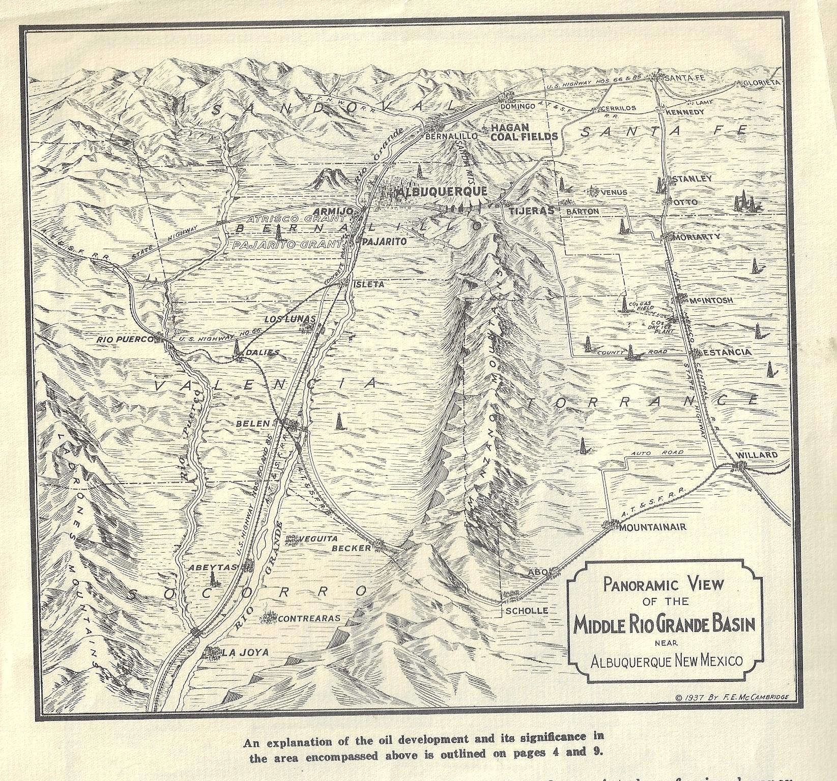
    I was working on this pamphlet for my bookstore (F.E. McCambridge.  [Oil and Gas Investment Property Prospectus] 
    Majestic Homes Realty Co., Denver,
    Colorado, 1937), an interesting-enough thing if for nothing but the maps.
    The brochure is really more about selling the possibility of becoming an energy maven selling property and its oil
    and gas rights in what could have been an oil/gas-right territory in Pajarito Spanish Grant, in New Mexico. The
    area of the grant seems in general to be about 15 miles or so southwest of Albuquerque, though the map in the
    pamphlet depicts a much wider area in the Middle Rio Grande Valley, around Albuquerque and south to La Joya.
    I can't find anything offhand about the success or failure of this venture, though not much seems to have
    happened. Evidently people seem to have moved into this area to get away from it all back in the 1970's--
    there is no running water or paved roads to speak of, and has pretty much nothing except for a great big
    sky and very inexpensive ground. (See http://www.sfreporter.com/santafe/article-7409-mexico-usa.html for
    the interesting story.)

    Then I came across something unexpected and even a little captivating. After checking WorldCat/OCLC for
    listings for the pamphlet (there were none) or other works by the author (ditto) I did find that the author
    came down on the right side of history in his opinions on the post-war housing crisis.


    Majestic Realty Birds eye


    Mr. McCambridge's venture seems to have struck dirt, though he comes up golden in his
    very forward-thinking appraisal of town/city planning. I found this in an obscure publication about the
    housing shortage at the end
    of WWII. While other builders were concentrating on mid- and upper-level
    housing in the
    coming building boom, McCambridge thought small and very inexpensive, homes enough
    for all budgets, "and homes for Negro occupancy should rank high in every postwar plan to house America":
    "As noted earlier, the same survey revealed that private builders expect to build 67 per cent of their houses to sell
    at prices between $5,000 and 510,000. Experience shows that the saturation point for that market is quickly
    reached and that the nation will never be well housed until ways can be found of building for families in the
    lower-income brackets." "One intelligent western builder remarked, in commenting on this survey, that the
    "determination of builders to concen- trate their efforts on higher-cost housing" seemed to be a "tragic truth":
    "It is exceedingly unfortunate that so many of the builders of the nation, seeking to escape from the
    war-required restriction and limitation orders, wish to employ their talent in other than the basic responsibilities
    of the industry they have so capably represented in the war job they are now completing Surely no program to
    rehouse America should be pro- mulgated other than one providing for all the people in proportion to their
    ability to purchase. Only by such a program can the re-employment of our returning veterans and displaced
    war workers be attained. Decent housing should be made available to every segment of our population, every
    in- come bracket; and homes for Negro occupancy should rank high in every postwar plan to house America1."

    I'm glad to have gone down this path for a little bit to find McCambridge's post-WWII story.
    1. Quoting F. E. McCambridge, in Tomorrow's Town (New York: National Committee on Housing, Inc., 
    June, 1945) in Robert Lasch, Breaking the Blockade, 1946, p 141.

  • Map of Rivers and Waterfalls, 1851

    JF Ptak Science Books  

    Maps Rivers Waterfalls981

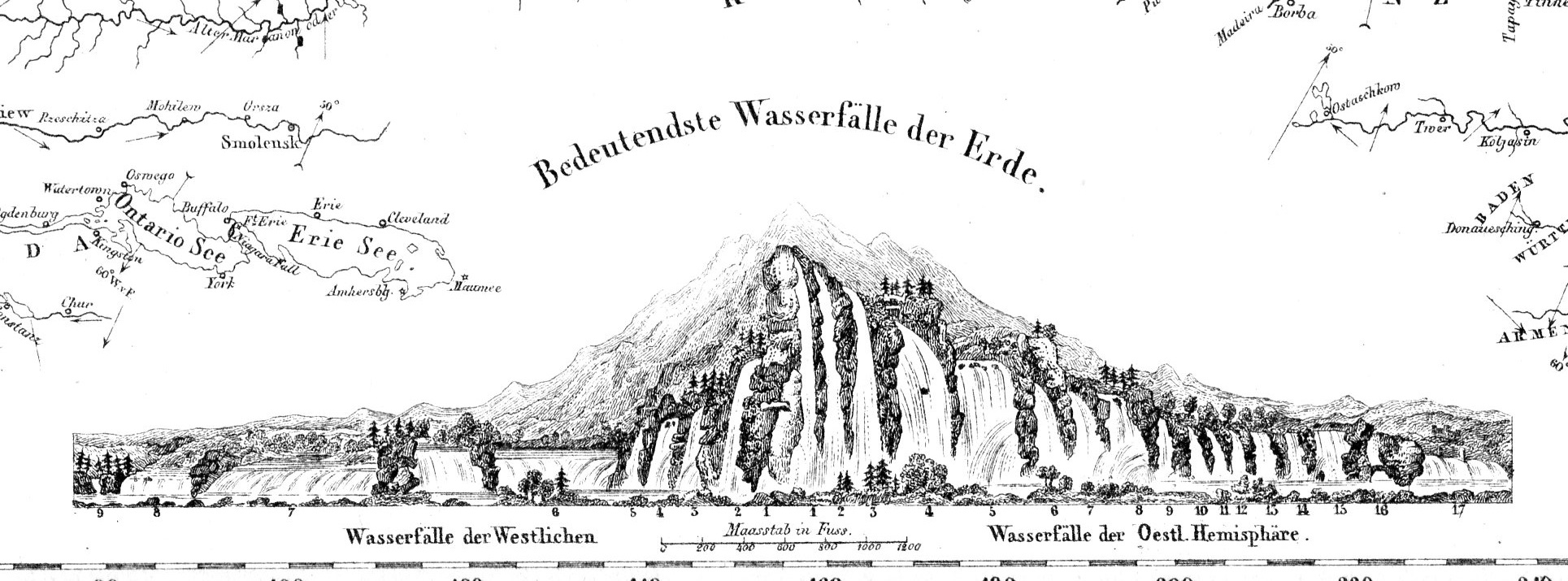
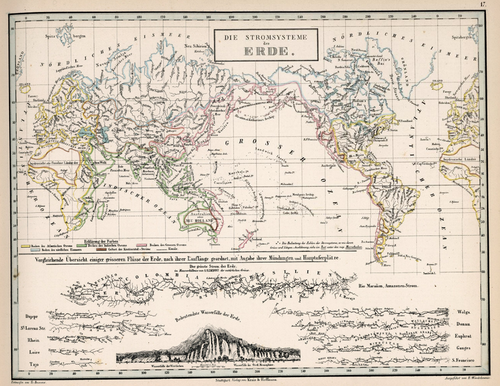
    • “Die Stromsysteme der Erde.”  In von Humboldt, Kosmos, 1851. 

    Before the Neil deGrasse Tyson version and update of Carl Sagan’s landmark television series, Cosmos, there was Alexander von Humboldt and his enormously influential book of the same title, printed in 1845-1862.  Well, von Humboldt’s (1769-18591) book was actually Kosmos when published in German, which is where it started its life (and which von Humboldt suffered mightily for in it English translation), and in which this map appears.  Von Humboldt was enormously studied and educated and of a high scientific mind over many subjects, one of those 19th century figures who seemed as though they could know everything, a polymath of high order (along the lines of Goethe and von Helmholtz and Thomas Young and others).  He was a meteorologist and biogeographer before those sciences existed; a naturalist, geographer, archaeologist, and explorer, a natural philosopher of magnitudes.

    Kosmos reflected his lifelong interest in order, and what he did was astonishing–he attempted to unifying the complexities of nature in one book (of five volumes), binding the various branches of science together in a cohesive whole, attempting to show how the laws of the universe acted here on Earth.  It was a very influential work, very progressive, a masterwork of scientific method.  Kosmos.

     Maps--River system


  • A Longitudinal View of Natural History, ca. 1876

    JF Ptak Science Books   Quick Post

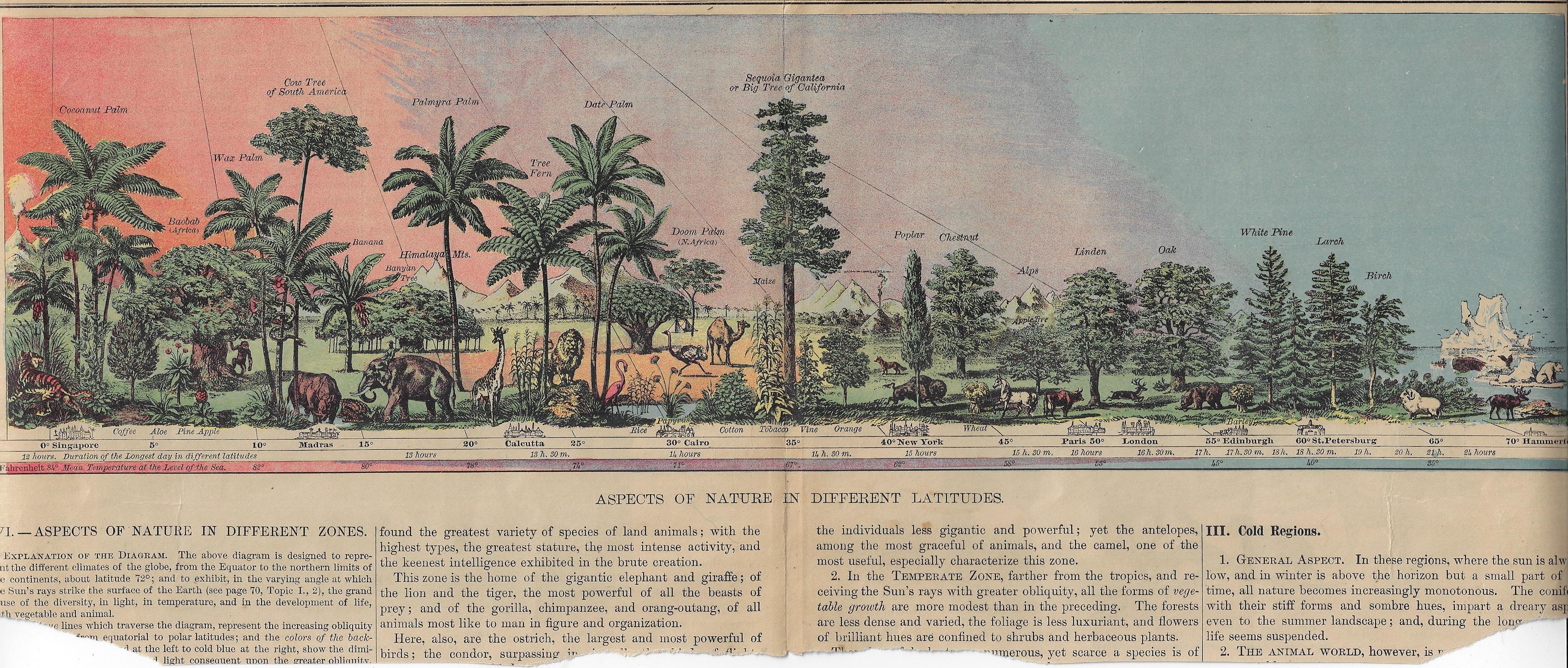
    This lovely image displays the natural history of limited flora and fauna at different latitudes, centering on the “Big Trees of California”. The original is about 17″ long and almost fits exactly on the big scanner, though some of the edges are left off–no matter, I think, as most of the image is available. Its source is a grade school textbook (probably seen as fairly advanced by modern standards) by Arnold Guyot, Physical Geography, and published ca. 1876–the image (or something very much like it) may have appeared in other contemporary texts, like Cornell’s Geography, though I’m not sure.  At any rate it is very nicely designed, and I enjoy the gradient of the sky. 

    [Click on the image for a good expanded view.]

    Map view of prehistoric times


  • An Exceptional Not-Very-Exceptional Map (1876)

    JF Ptak Science Books   Quick Post

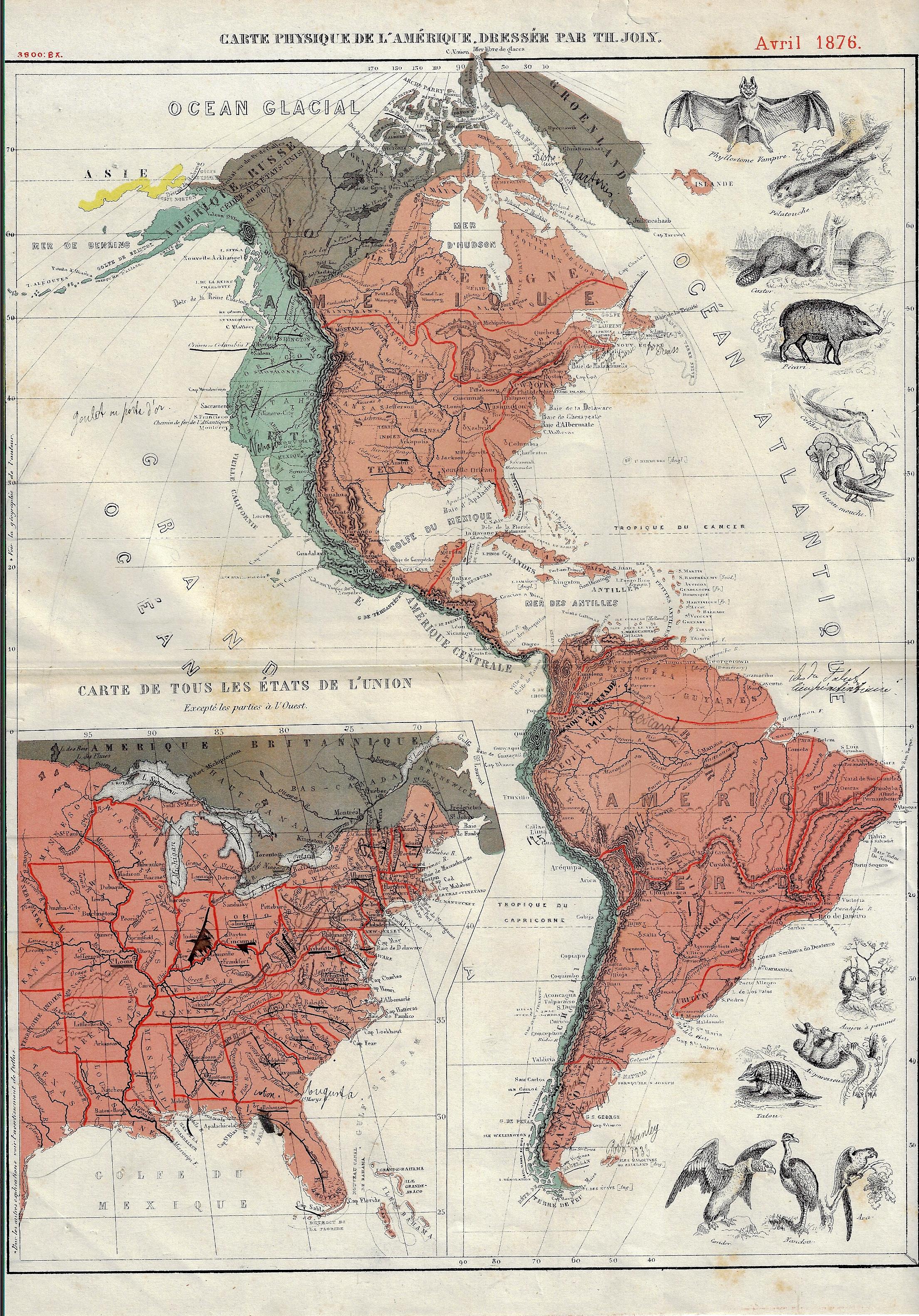
    I’m not sure what it is, exactly, that gives this map it unique flavor(s)–to my experience, it has an undeniable “difference”.  The map (“Carte Physique de l’Amerique…1” with a smaller inset map of the United States) was published in the U.S. Centennial year of 1876, and aside from the obvious imagery of the animals, there is also the exceptionally small typeface in the detail, the somewhat unusual color combinations (of rose, aqua, and brown), and the great amount of detailing done in red, all of which taken together is unusual to my experience.  That said, there is really not a lot of physical geography detail in the map outside of a good representation of rivers and some brief entries for mountains–and the ten animals.  


    US Map infographic animals

    Notes:

    1.  The full title: “Carte Physique de l’Amerique dressee par Th. Joly”, Avril 1876, and published in Grand atlas classique de Géographie Moderne, moyen-age et ancienne, contenant les figures des animaux et des plantes les plus remarquables de chaque pays, a l’usage de l’enseignement secondaire, printed in Bruxelles by A. Decq et J. Rozez, first published in 1871/2,  22,5 x 34,5cm.


  • A Very Early Geological Map of the Mountains of Europe

    JF Ptak Science Books  Quick Post

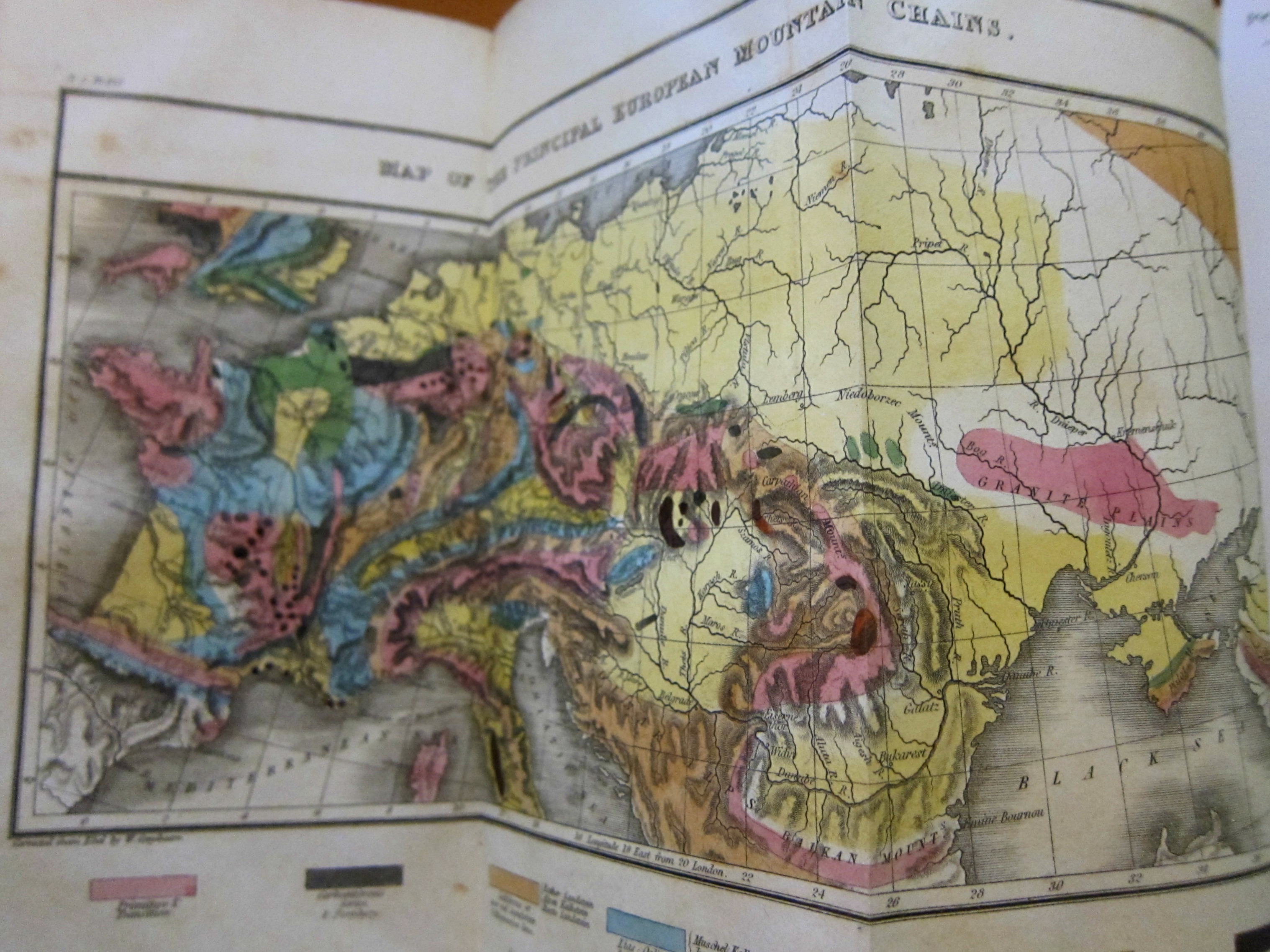
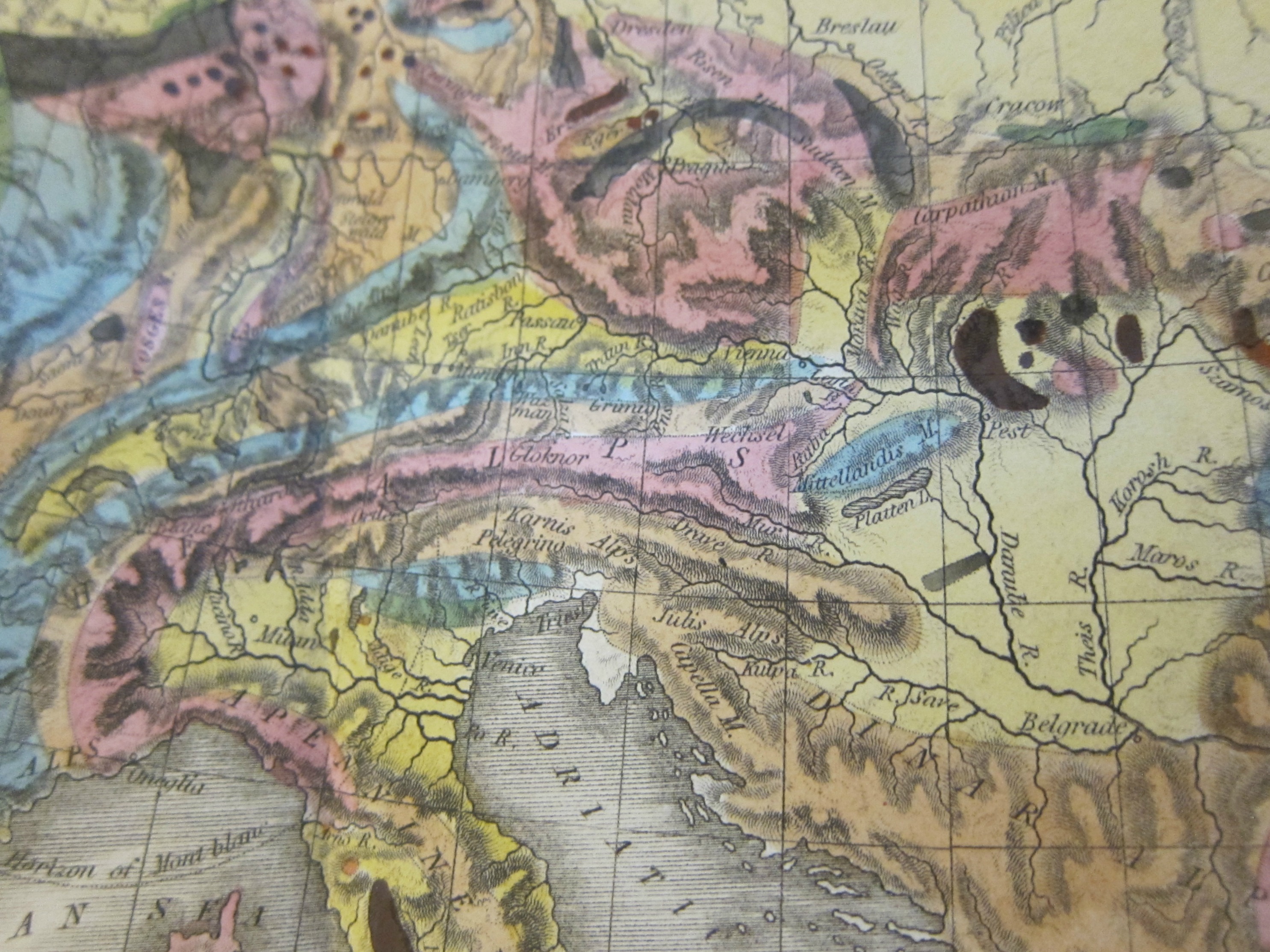
     This fine geological map, illustrating the long paper Memoir illustrative of a general Geological Map of the principal Mountain Chains of Europe, by the Rev. W.D. Conybeare (1787-1857), appeared in Annals of Philosophy, volume 22, 1823, (in multiple numbers for January, February, March, April, May, pp 1-16, 135-149, 210-218, 278-290, 356-359, and extending briefly into Annals of Philosophy, volume 23, September 1823, pp 214-219).  The article is extended and fairly comprehensive, being a review of the geology of the mountain ranges of Europe by region, and the map–engraved by Sidney Hall and colored by hand–although somewhat small is very concise and detailed, and appears only eight years after the landmark geological map of Great Britain by William Smith, considered to be the first detailed national-scale geological map (though there is an earlier though not as detailed work on the U.S. by William McClure in 1809). As Conybeare notes on pp 2-3 in this work the foundation of his map was based on the earlier work by Ebel on the geology of the Alps, as well as a smaller general and not much detailed map of the geology of the mountains of Europe in general, the beginning of which reaches back to 1808. He no doubt also relied on Buckland’s work on the Alps in 1821.  Conybeare added dramatically to the understanding of this aspect of European geology.  [See Bursting the Limits of Time: The Reconstruction of Geohistory in the Age of Revolution, by M. J. S. Rudwick, for an interesting look at geological mapping in the early 19th century.]

    Annals of Philosophy 1823 Mountain Map

    Annals of Philosophy 1823 Mouta9n map detail


  • Maps with a Message–WWI Advertisement with Map Propaganda

    JF Ptak Science Books   Quick Post

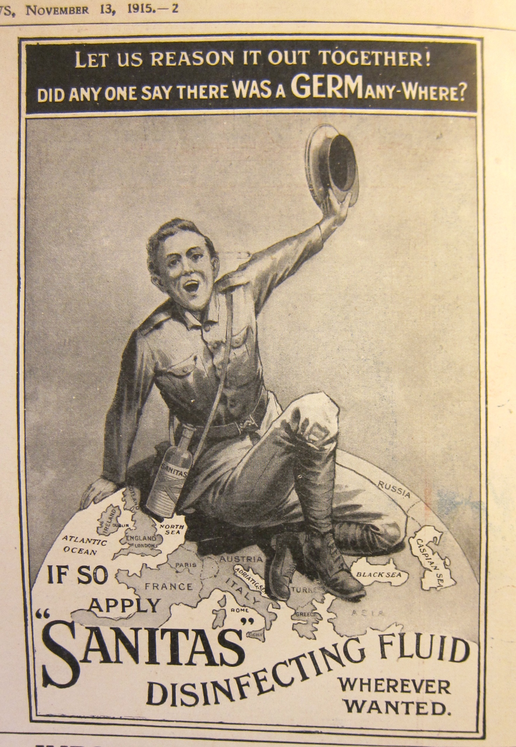
    This small ad for Sanitas (a non-poisonous”the disinfecting fluid”, composed of hydrogen peroxide and camphor as main ingredients) appeared in the quarter panel of the Illustrated London News on November 13, 1915, and told a definite story. Here we see a British soldier, sitting squarely on Germany, asking the reader “Did any one say that there was a GERM anywhere?” in a not-subtle connection between the German enemy and disease.  I hadn’t noticed this before, and so thought I would share…

    Maps WWI propaganda  Sanitas