A Daily History of Holes, Dots, Lines, Science, History, Math, Physics, Art, the Unintentional Absurd, Architecture, Maps, Data Visualization, Blank and Missing Things, and so on. |1.6 million words, 7500 images, 4.9 million hits| Press & appearances in The Times, Le Figaro, Mensa, The Economist, The Guardian, Discovery News, Slate, Le Monde, Sci American Blogs, Le Pont, and many other places… 5000+ total posts since 2008.

Author: JF Ptak

  • Newton, Tyson’s “Cosmos”, & Space Travel (1728)

    JF Ptak Science Books   Quick Post

    Newton canon

    [Image source for the above and below: Google Books, here.]

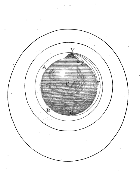
    We’ve been enjoying the Neil deGrasse Tyson Cosmos and are just now finishing the episode dealing with Newton, and the Principia, Edmund Halley, and poor Robert Hooke. One thing I wanted to footnote to this production was to share the original–not shown in the series though something very close to it does appear–of an image for Newton’s “cannon”. Though he actually doesn’t use the word “cannon” he does write on the motion of projectiles and the forces at which they are projected and the possibility of such a thing reaching a velocity great enough to send the thing into orbit.  The idea/gedankenexperiment and image appears early on in Newton’s A Treatise of the System of the World, which is the English translation (with corrections and some changes) of what was to be book three (De mundi systemate) of the Principia, and which was published in 1728, a year after Newton’s death. (On the title page the book is announced as “translated into English” but does not mention a translator/s, unknown as a certainty to this day but is supposed to be Andrew Motte.) 

    ·Posted by :

    ·in:


  • Striking Cover Illustration–Christ on a Swastika Cross, 1943

     JF Ptak Science Books   Quick Post

    Poster--100 million catholics dead449

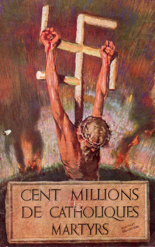
     Needless to say, the cover design for Cent Millions de Catholiques Martyrs   (published 1943) is very striking, and very unusual.  I’ve noticed the swastika/crucifix motif before, but not this bloody. Only six copies are located in WorldCat (and all quite good libraries, too, including the LC, Newberry, NYPL, Harvard, Stanford/Hoover, and WVU), so the pamphlet doesn’t seem to be very common at all.  

    ·Posted by :

    ·in:


  • Picking Up the Sagging Mississippi on a 2600′ Canvas

    JF Ptak Science Books   Post 2358

    Well, what was really being picked up was the canvas on which an enormous panorama of the Mississippi River was painted.  The work was that of New Yorker John  Banverd (1815-1891), a portrait painter who awoke with the notion of displaying the shoreline of the Mississippi River for its entire length. To that end he raised money (based on his painting income and investments) and set out with his $3000 in a skiff to paint the river, back in 1840.  According to a pamphlet that describes his effort (the full text of which is available at the Internet Archive, here), the effort took over 400 days–when his sketches were complete Banverd repaired to St. Louis where he built a wooden house specifically designed for him to transfer his sketches to an immense canvas.  The work was completed in 1846, at which point his work was 12′ high and 1500′ long–by 1848 the length of the work expanded to 2600′. (Banverd advertised his work as being “3 miles” long–that wasn’t the case, and that’s okay, because he had produced one of the largest paintings ever produced by a human.

    Panorama Bravasrd450

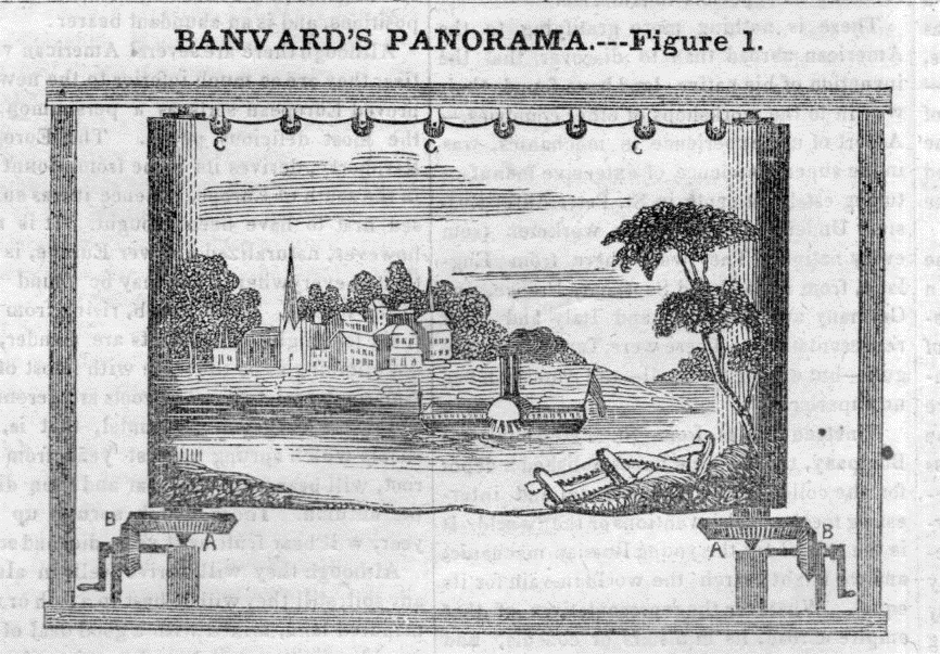
    The panorama (and diorama, and cyclorama, and other iterations of ‘raams) were a very  popular entertainment form, as popular as plays and other similar exhibits and spectacles, lasting deeply into the 19th century.  The Branverd panorama was on a large canvas that was advanced like a mechanism on a 35mm camera film advance–there were other sorts of displays, one of which kept the canvas static with the audience walking past it; others took place in a rotunda where the pano was on the walls of the structure and observers would be on a platform in the middle, where they would achieve a motion picture-like effect by turning slowly to see the entire image.  

    There were many panorama subjects, including subjects like Jerusalem, London, Rome, Lima, a journey down the Rhine, and so on.  The medium would take a fatal hit with the invention of flexible roll film and the accessibility of photography to the masses, the invention of the half-tone making it possible to reprint photographic images in newspapers and magazines, and other bits that could generate images from everywhere and cheaply.  

    The panorama was taken by Banverd on a tour of major cities where people would pay a fee to see the gigantic artwork displayed before them, shown segment by segment on a large frame with cranks that would roll/unroll/collect the painting before the audience, almost like a very primitive movie.  

    The image above is from The Scientific American for December 10, 1848, and shows how Mr. Branverd figured out a knotty problem with the display of his super-massive work. Unfortunately, at the end of the life of the canvas it was cut into smalkl fragments and sold–evidently none of it survives. 


  • “Hitler’s New Slavery”: Poland, 1941

    JF Ptak Science Books    Post 2357

    Poster--Slavery Hitler447

    I segregated this pamphlet long ago for its spectacular cover graphics and never read the thing–I did tonight, and as it turns out there’s a lot of info in the slim document.  First of all it was written in early 1941 by (Sir) Walter Citrine, a very long-time British trade unionist, and he took a pretty close look on the national level with the “ruthless” economic exploitation of Poland (done to “the absolute limit”) as well as what was going on in the working Polish nation in regards to the laborers and their families, writing an overview on the Polenerlasse or Polish decrees that woul dregulate the life of the nation

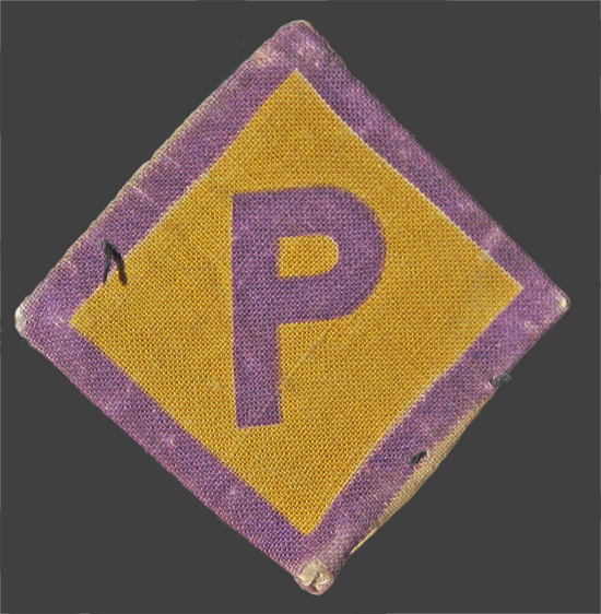
    Citrine writes about the agrarianization of Poland, the appropriation of all of Poland’s natural resources, as well as the deportation of “a million” men and women to work as slaves in Germany, where they were referred to disingenuously as Zivilarbeiter and forced to wear a  fabric patch “P” on a bright field of purple bounded in yellow on the front of their jacket/shirt.

    Polish worker[Image source: Wiki, here.]

    The lives of the workers were totally regulated, which I think is information that wasn’t yet available to Citrine. There was also a flow of propaganda aimed at separating Germans from Poles in social and especially sexual relations, the later termed a defilement of the German race (Rassenschande)  and a highly punishable offense.

    There is no mention here or anywhere else in the pamphlet how those numbers break down, and no mention whatsoever of Jewish persecution.  

    Citrine writes on the destruction of social legislation, of the complete dismemberment of unions, of the workers being forced to provide for their own highly-restricted rations of food, and the adoption of a servant/slave relationship of the country to Germany.  Bottom line for Citrine: Poland would be the model of a Nebenland, a stylus for the other European countries that would be conquered, and “used to convert all Europe onto a colony of the Great German Reich”. 


    ·Posted by :

    ·in:


  • On Building a Vertical City in the Grand Canyon and Covering It Up

    JF Ptak Science Books   Expanding an earlier post from 2009…


    Blog Dec 17 underground city

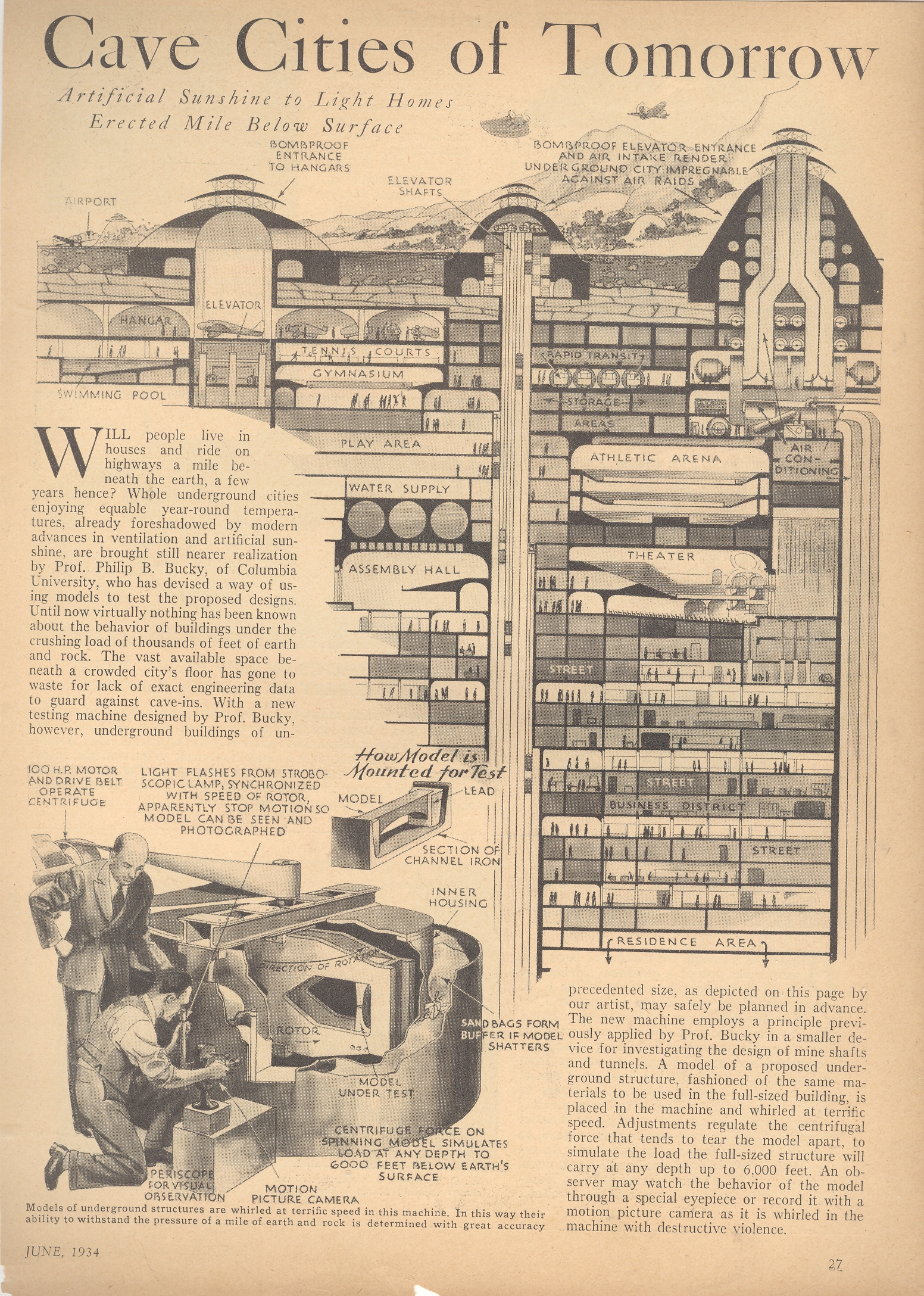
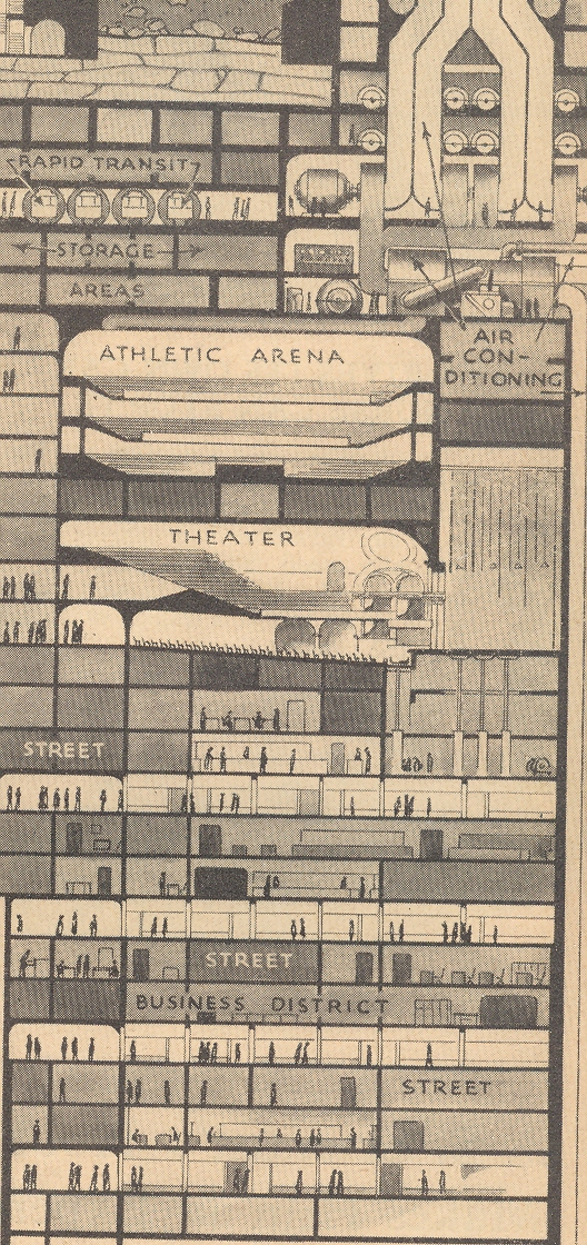
    I’m a sucker for cross sections, and this one has it all—nicely drawn, a glimpse into the possibilities of the future, and technoid removed from the realm of possibility.  This article appears in Popular Science Monthly for June, 1934, and presents the possibility of extending downward into the earth for future city development. (as a matter of fact, the fabulous  Modern Mechanix site has a similar story on display, asking the question “Are Skyscrapers Doomed?” for the same year, with the same engineers.) Well. It seems as though in this cross section that residences for people begin below the thirtieth floor, making living quarters starting at about 350’ down.  The story goes that it would be possible to dig these cities up to about 6,000 feet into the earth, which of course is a long way down.  Its difficult enough to drill an oil well hole to this depth; its difficult to imagine digging/outfitting/removing the earth from something—I’m not even sure what to call it—that was, potentially, thousands of feet deep and miles wide and long.   That’s playing with figures hundreds of billions of cubic feet. Of construction. Underground.  Well, I guess it wouldn’t be necessarily underground–it could be an excavated hole that is a mile or two wide and across and down, which would make the hole itself several times larger than the largest whole ever dug by humans, which is the Bingham Canyon Mine, a pit slope mine that is about .5miles x 2.5 miles. And then construction would begin after which the remaineder would be covered by earth.  

    Anyway, it is a big hole and a lot of construction, the volume of it at the beginner phases of say a cubic mile would be equal to the volume of 25,000 Great Pyramids or 5,400 Empire State Buildings.  It would be easier probably to build a vertical city in part of the Grand Canyon (or of course a “more modest canyon” and then cover it up–that’s an idea you won’t see in print too often. (I should poitn out that I’ve bumped into canyon-filling ideas every now eand then, one of my favorite truly-floated ideas being the one that would fill up Washington D.C.’s Rock Creek Park, which snakes its way north-south in the central part of the city.  Around 1890 the Federal government was trying to figure out how to best multi-task the area for parkland and roadway.  One incredible plan called for the creek, which in many places is bounded by some pretty steep embankments (25-75 feet or so) and extends about 8 miles north of downtown, to be filled in, leveled off, and paved over.  Now that  would’ve been a lot of dirt.  The final plan was perfectly fine and had a series of small roads snaking their way through the park, making it one of the nicest rides (Central Park-like) of any major metropolitan cities in North America.)

    Blog Dec 17 underground city det


  • A Bit of Book Sleuthing on a Cyclotron Manuscript (1938-1941)

    JF Ptak Science Books   Post 2356

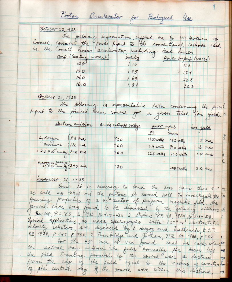
    Here’s an example of some book detective work that I get to do, a lot.  The book is actually a manuscript notebook, titled “Proton Accelerator for Biological Use” and kept by George W. Scott, jr., and written in a ledger book stamped “Haskins Laboratory”; the entries are from October 1938-April 14, 1941, and there’s 65 pages of entries of about 21,000 words.  It’s concise and analytical, first-hand experiences and observations, notes kept by an experimenter to himself on constructing this machine.  And the notebook came from the estate of Caryl Haskins, part of which I purchased years ago.  

    It turns out that the manuscript was fairly easy to figure out–tying everything up nicely in the end though wasn’t so easy. 

    The “proton accelerator” notes was on the construction of the M.I.T. cyclotron, which was the world’s first accelerator dedicated solely for meidical/biological use and a crucial instrument in the beginning of nuclear medicine.  

    Accelerator439

    ·Posted by :

    ·in:


  • There are No Van Goghs in Arles (?)

    JF Ptak Science Books   Post 2354
    Van Gog the crau

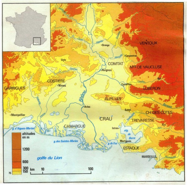
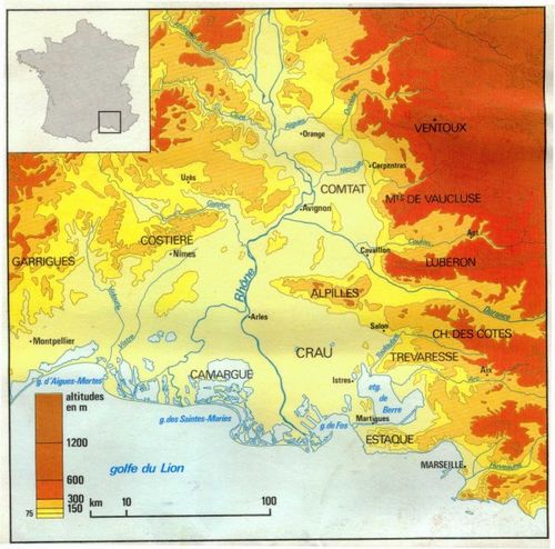
    “Average soil depth is 40cm overlying a 5 to 25 meter thick layer of impermeable conglomerate making the alluvial water table inaccessible to the roots of plants. Topography is extremely flat with rounded silicaceous stones covering 50% of the soil and protecting it from big temperature variations.”

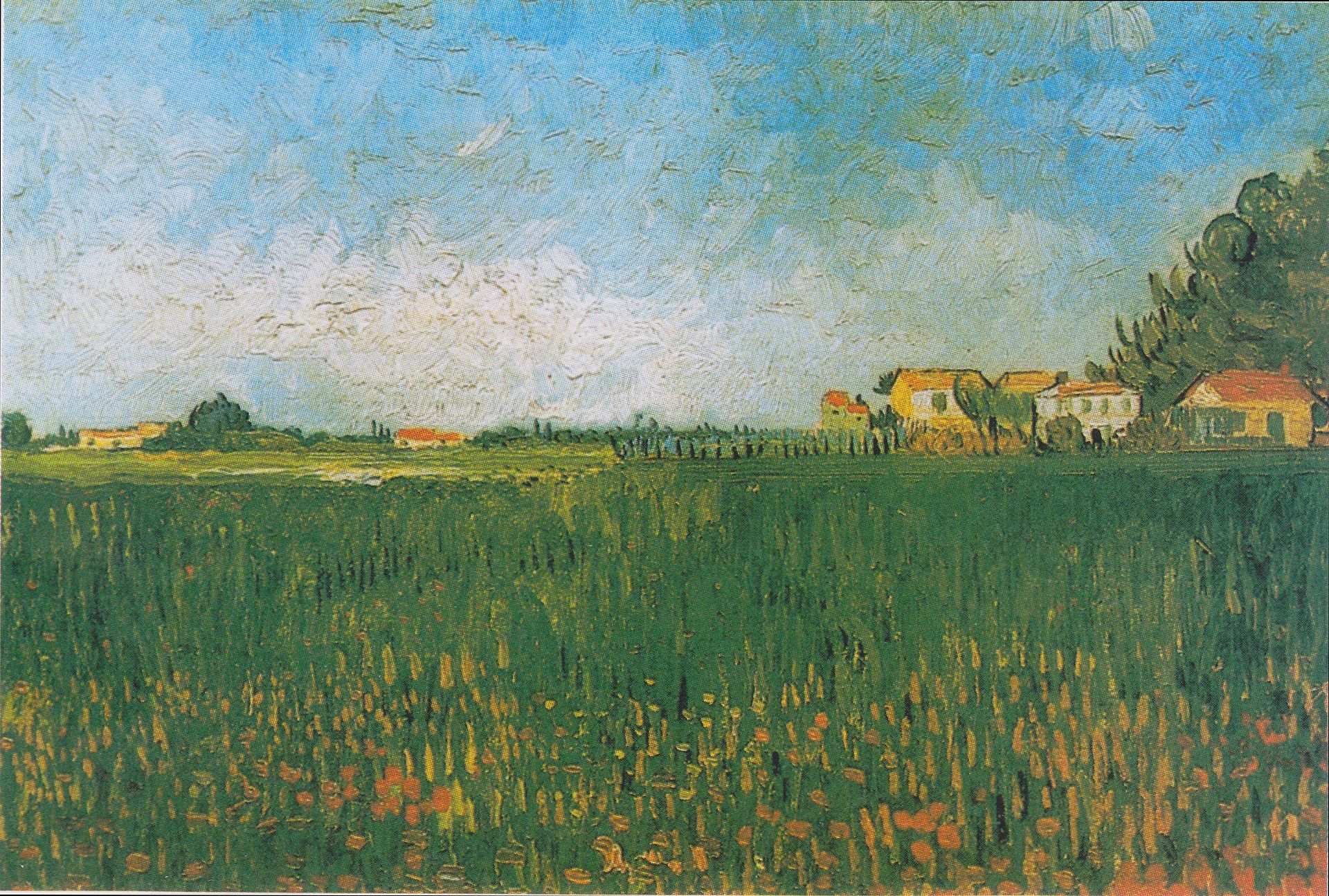
    And so goes the description of the soils in the Crau, the Plaine de la Crau, a massive flats/alluvial basin that is the home to fine hay and shepherds going back to Roman times, and a plains filled with flat earth and big sky, and light.  In the middle of it all was Arles and in Arles from 1888-1890 was Vincent van Gogh, who found the place extraordinary, and who there at the end of his life was at his most productive, imaginative, creative, visionary self.  The other side of that soil map above–as it pretty as it is and conveying as much information as it does–stands the solitary magic that van Gogh created there.
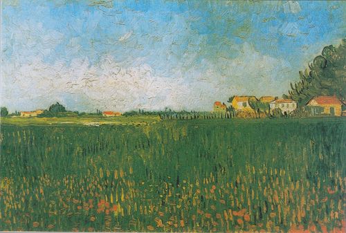
    Van_Gogh_-_Bauernhäuser_in_einem_Weizenfeld_bei_Arles.jpeg[Image source: Wikipedia]

    Here is van Gogh writing to Emile Bernard from Arles, Sunday, 15 July, 1888 on la Crau:

    Have made large pen drawings — 2 — an immense flat expanse of country — seen in bird’s-eye view from the top of a hill — vineyards, harvested fields of wheat, all of it multiplied endlessly, streaming away like the surface of a sea towards the horizon bounded by the hillocks of La Crau.
    It does not look Japanese, and it’s actually the most Japanese thing that I’ve done. 
    A microscopic figure of a ploughman, a little train passing through the wheatfields; that’s the only life there is in it. Listen, I passed – a few days after my arrival — that place with a painter friend.
    There’s something that would be boring to do, he said. I said nothing myself, but I found that so astonishing that I didn’t even have the strength to give that idiot a piece of my mind. I go back there, go back, go back again — well, I’ve done two drawings of it — of that flat landscape in which there was nothing but………. the infinite… eternity.
    Well — while I’m drawing along comes a chap who isn’t a painter but a soldier. I say, ‘Does it astonish you that I find that as beautiful as the sea?’ Now he knew the sea — that one. ‘No — it doesn’t astonish me’ — he says – ‘that you find that as beautiful as the sea — but I find it  even more beautiful than the ocean because it’s inhabited.’ —Source: van Gogh Museum, the Letter of Vincent van Gogh, here.

    It seems a little odd that of the 300 of the artworks that he completed during that time that none remain in Arles. Nor does the Yellow House and other pieces immortalized by van Gogh during this time.  The other side of that is much else has remained pretty much the same–including the asylum where he stayed for a year being treated for his not-to-be-discovered illness with the hopeful but shallow psychological methods of the day, and of course the Crau.  

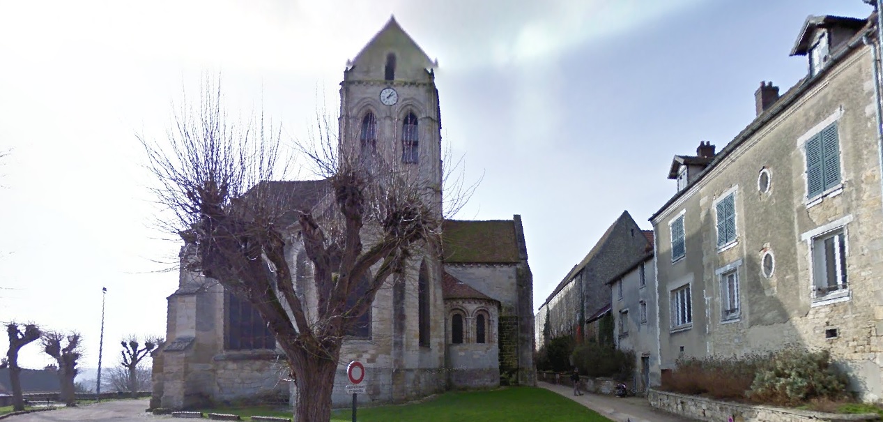
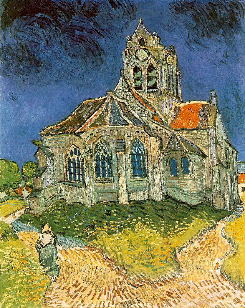
    In some ways it is a bit of science fiction for me to be able to walk via Google through so much of van Gogh’s life–for example, right up to the spot where he painted his “Church in Auvers-sur-Oise, View from the Chevet” just a month before he died in July, 1890:
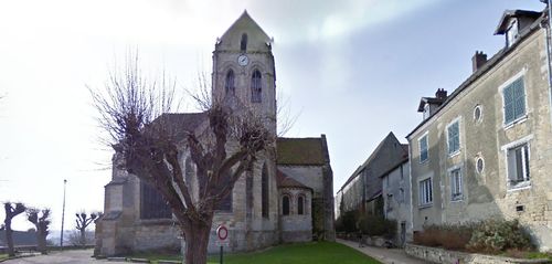
    Van Gogh Auvers

     And be able to compare it to the original:
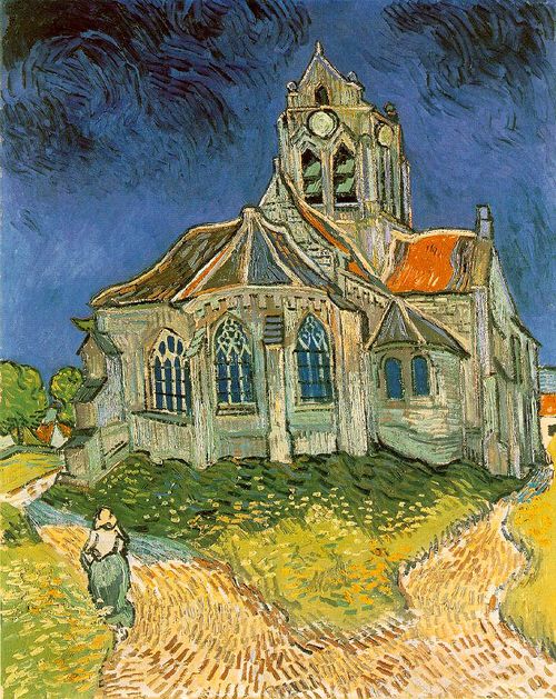
    Van gogh church[Image source, here, Vincent van Gogh and Auvers-sur-Oise]

    Van Gogh left Arles for Auvers in May of 1890, looking so much better and healthier that even Dr. Gachet thought that he might be cured.  However, that was not the case, and the sight of his brother in his own (lengthy) illness (Theo would die just months of Vincent) plus whatever else you might want to throw into the pot would lead to the path of his suicide. 

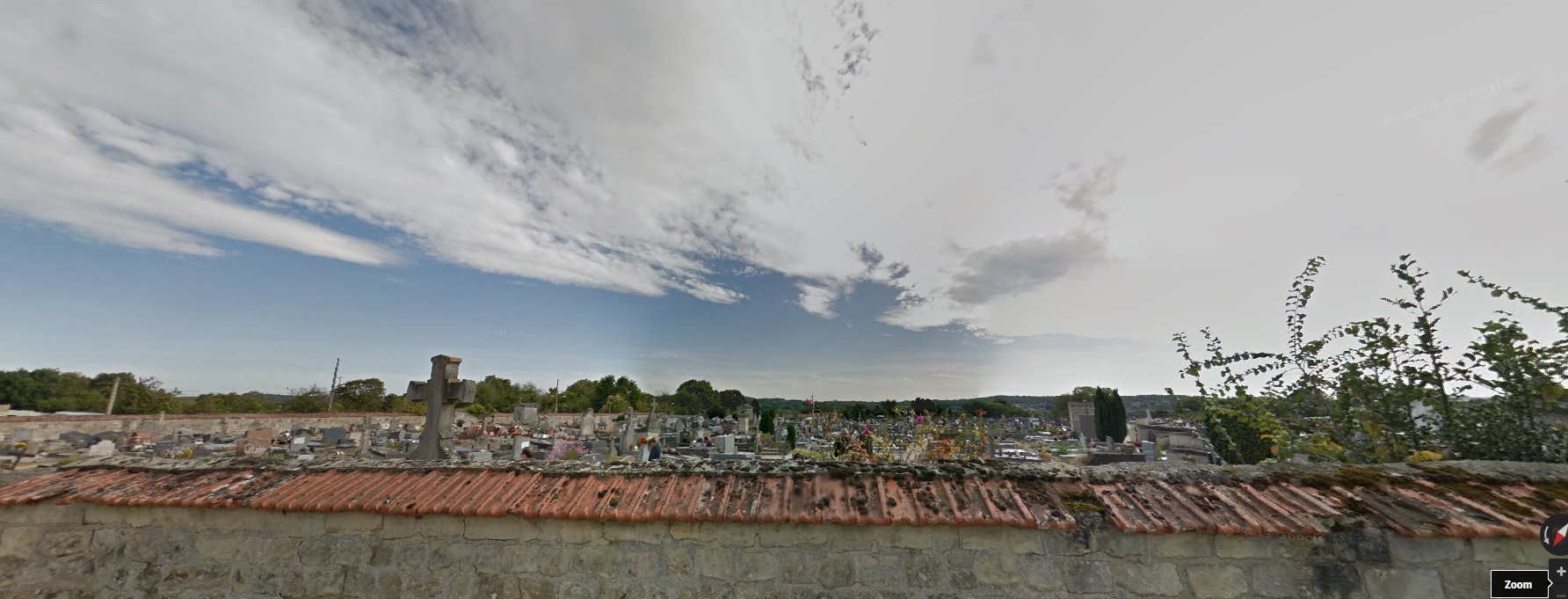
    Van Gogh was buried in Auvers, north-east of Paris, and Google will take you there, too. I went, mainly just to see what was on the other side of the wall that you see in the endless series of photos of the Vincent and Theo headstones.  You can ride the Google car from the church, up a small hill, and certainly less than a kilometer away is the cemetery, reachable along a roughish road.  The other side of the wall is featured in the fist screen capture, with Theo’s headstone to the right of the large cross, and Vincent next to him, there against the other side of the wall, which has clay shingles on the street side:
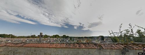
    Van Gogh grave

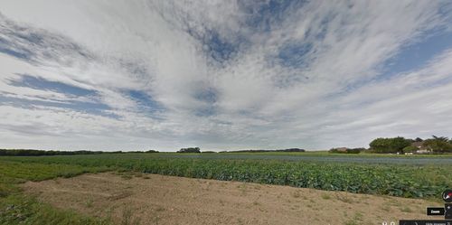
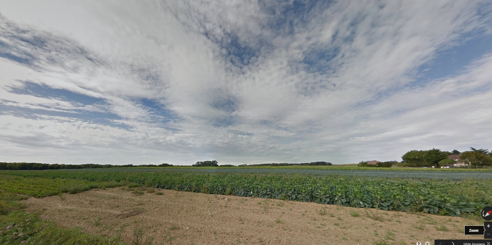
    And what you would see if you could see over the wall from the cemetery, looking over and past the van Goghs:
    Van Gogh grave opposite

    I like this view better.
     

    ·Posted by :

    ·in:


  • Louisiana Sellathon, 1888

    JF Ptak Science Books   Quick Post

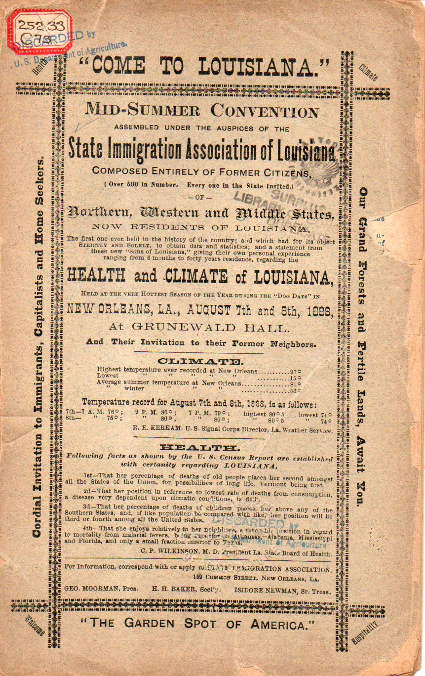
    This is an extraordinary title page, what with so much information and narrative and data and salesmanship and so on, right there on the cover,conveying twists and turns and temperature and a challenge from the Dogs Days of New Orleans, all challenging the reader to open the pamphlet for a look inside. There are legions of examples of Title Pages of Enormous Complexity and Content that drive from the Renaissance on into the 19th century, but in my experience for the vast majority of them you actually have to open the book to get there.  Here the hear of the pamphlet is worn right on the sleeve–and once the pamphlet is opened it gets right down to business, dispensing with the title page entirely.  

    Louisiana immigration435

    The work is dedicated to propagandizing the highest qualities of the state of Louisiana–and New Orleans itself–in order to attract new people to come to the state, and doing so in a convention/conference. As stated on the cover, it is “The first one ever held in the history of the country; and which had for its object strictly and solely, to obtain data and statistics; and a statement from these new “Sons of Louisiana” giving their own personal experience ranging from 6 months to forty years of residence, regarding the health and climate of Louisiana, held at the very hottest season of the year during the “Dog Days” in New Orleans, La., August 7th and 8th, 1888, at Grunewald Hall and their invitation to their former neighbors.”  

    It seems a not-so-calculating throw-of-the-dice to hold the meeting in New Orleans in August. True it doesn’t get Phoenix-hot, but then again there’s the 75-point difference in humidity that does make all the difference in the world.  After having suffered through two massive blizzards that year (in January and March, 1888), perhaps the prospect of 92/72 temp/humidity didn’t seem nearly as painful as frigid and 50 inches of snow.  

    Full text here from Internet Archive. 

    ·Posted by :

    ·in:


  • Superior Cover Design: Battery Catalog, 1940

    JF Ptak Science Books   Quick Post 

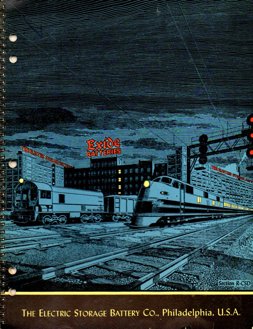
    This is another quick stop to appreciate a job-well-done, a wonderful illustration for a largish catalog (12×9 inches) for Exide Electric Storage Battery Company (Philadelphia), which was printed in 1940. It would be simple to have a plain text cover for this sort of thing, being batteries and all, but Exide went the extra step and had designed for them this wonderful cover. It seems to transfer the reliance of their battery in the dark and cold environment via the working trains, their lights working, safe and secure. It is understated and very effective.

    Cover--batteries433

    ·Posted by :

    ·in:


  • An Annotated Poetry of Clouds

      JF Ptak Science Books  Quick Post

    Clouds cromenius

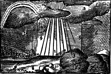
    [Image from John Comenius,  Orbis Senfualium Piélus: Omnium Principalium in Mundo Rerun/ Vita Аllопит,  translated as Pictura et Nomenclatur, the Visible World, or A Nomenclature, and Pictures of all Chief Things that are int he World, translated into English by Charles Hoof…1726.  See an earlier post here for more on Comenius. Image Source:  PROJECT GUTENBERG.]


    Clouds

    A Vapour, (1). ascendeth
    from the Water.

    From it a Cloud, (2).
    is made, and a white Mist, (3).
    near the Earth.

    Rain, (4).
    and a small Shower
    distilleth out of a Cloud,
    drop by drop.

    Which being frozen, is Hail, (5).
    half frozen is Snow, (6).
    being warm is Mel-dew.

    In a rainy Cloud,
    set over against the Sun
    the Rainbow, (7). appeareth.

    A drop falling into the water
    maketh a Bubble, (8).
    many Bubbles make
    froth, (9).

    Frozen Water
    is called Ice, (10).
    Dew congealed,
    (13) is called a white Frost

    Thunder is made of
    a brimstone-like vapour,
    which breaking out of a Cloud,
    with Lightning, (11).
    thundereth and
    striketh with lightning