A Daily History of Holes, Dots, Lines, Science, History, Math, Physics, Art, the Unintentional Absurd, Architecture, Maps, Data Visualization, Blank and Missing Things, and so on. |1.6 million words, 7500 images, 4.9 million hits| Press & appearances in The Times, Le Figaro, Mensa, The Economist, The Guardian, Discovery News, Slate, Le Monde, Sci American Blogs, Le Pont, and many other places… 5000+ total posts since 2008.

Author: JF Ptak

  • The Graduated Surrender, Philippines, September 1945

    JF Ptak Science Books  Quick Post

    Even though WWII in the Pacific was ended on 15 August 1945 (or at least the surrender was initiated then) and the surrender papers signed aboard the USS Missouri in Tokyo Bay on 2 September 1945 (“VJ Day”), there were many elements of the Japanese Army that took weeks and in some cases months to actually lay down their weapons and submit. (There are some rare cases of individual soldiers lasting for years and decades past the surrender, refusing to give in, living their lives in remote places.)

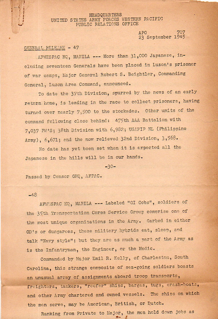
    This document–“Headquarter / United States Army Forces Western Pacific / Public Relations Office / General Release – 47, APO 707, 23 September 1945”–released by the propaganda/public relations office of the U.S. Army Force Western Pacific, details some of the process of large forces of Japanese forces in the Philippines coming in to surrender. 

    Stating that 31,000 Japanese soldiers (and 17 generals) had already been placed under guard in Luzon’s POW camps, the three-paragraph document ends with this interesting statement:

    “No date has yet been set when it is expected all the Japanese in the hills will be in our hands.”

    WWII--Japanese prinsoers surrender 23 Sept 1945150

    ·Posted by :

    ·in:


  • A Seldom Scene and Perhaps Influential Early Paper in Artificial Intelligence.

    JF Ptak Science Books   Quick Post

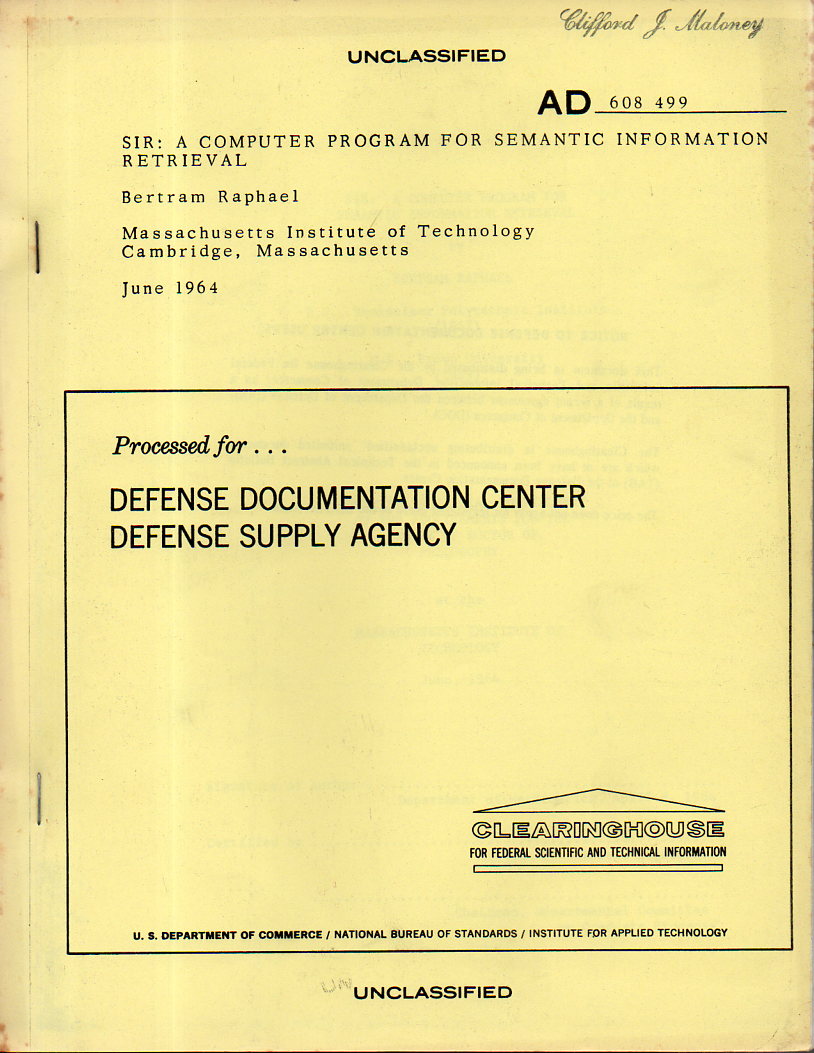
    Raphael, Bertram119Bertram Raphael’s  SIR: a Computer Program for Semantic Information Retrieval made a surprise appearance tonight. It was published/printed by the Clearinghouse for Federal Scientific and Technical Information, Defense Documentation Center, Defense Supply Agency, U.S. Dept. of Commerce, June 1964.  (156PP+12PP, plus one page of biographical information on Raphael with a bibliography including his work on LISP, the last entry dated May 1964). It is an oversized some-sort-of-photomechanical production, and may or may not be a very early and influential paper in artificial intelligence–it seems as though there are several approaches to that determination, none of which I can pass judgment on.

    This is the Ph.D. dissertation by Raphael (b. 1936), who had the great Marvin Minsky as thesis supervisor.

    ·Posted by :

    ·in:


  • The Automobile as a Dominating Life Form (1930)

    JF Ptak Science Books

    0 blog jan 07 car future364

    If I was an alien (of the outer-space variety) looking at the United States, I’d find it difficult not to assume that the biological units scurrying around the place were not put there to service the automobile.  Cars get born, then put on display, then selected and driven to their new home.  They get washed, and fed, and sometimes have their own places to sleep at night in their very own structure with their caretakers housed nearby.  They get taken out for airs in the morning and evening, resting while the humans labor all day to make enough money for their care and maintenance and feeding.  In the evening, they get brought back home and allowed to rest further.  They respond directly to inputs only and give no unsolicited response:  sort of like cats.  Fantastically large allowances are made for cars, humans going so far as to remove life- and atmospheric-sustaining biological units such as trees and good dirt so that the car can be taken virtually anywhere in the country on a path made specifically for them.  These pathways, which are padded and smooth, have ancillary bits attached to them so that the humans may walk beside them—houses and such are all connected to these paths to more easily enable the people to have access and maintain the car.  And, at the end of the day, humans breathe in the very excrement and excretia produced by the cars.  Placed under a microscope, the whole thing might resemble a biological unit, the cars being its very blood, everything else present to contain and move it.

     0 blog jan 222 car bfuture398


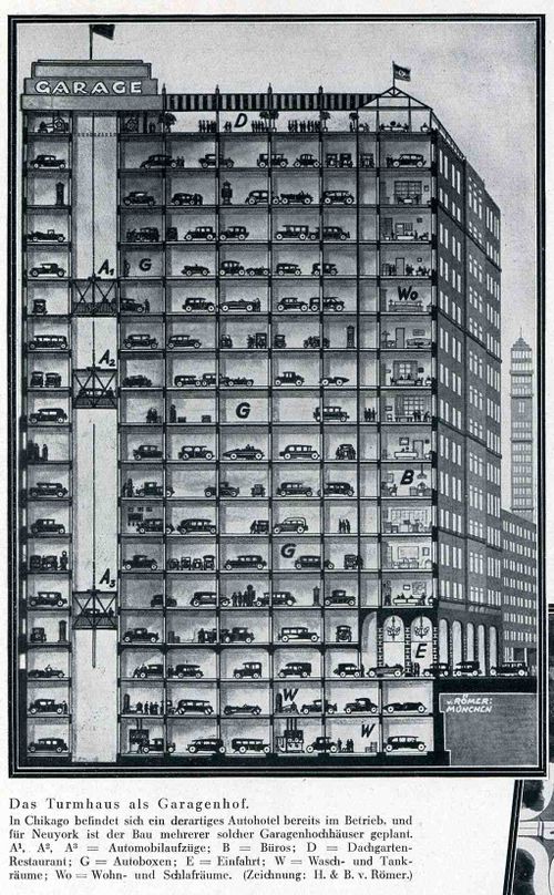
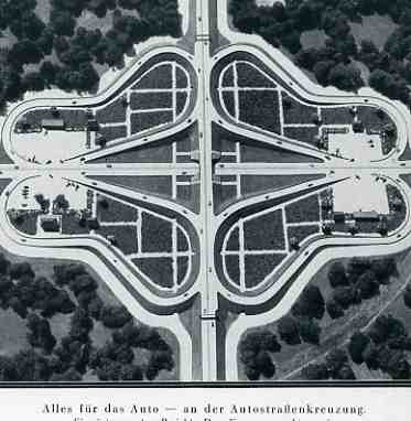
    These images from the Illustriete Zeitung (Leipzig, issue 4484, pp 239-240) for November 1930 speak to the exact issue of how to care for the now ever-present automobile.  Entitled “Wie Bringe Ich Meinen Kraftwagen Unter?”, the short article (by the engineer Botho von Romer of Munchen) addresses the need of what to do with cars at bedtime—where do we put them?  One answer was this spectacular carpark (“Garagenhof”) high rise—seventeen floors of parking (with two more underground), serviced by a variety of elevators, pointing out that varieties of this structure already existed in Chicago and New York

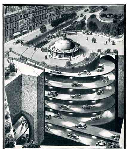
    There was also the possibility of vast masses of sunken garages, their entrance way screwed into the earth leading to tunnels and networked warehouses where the cars could be safely deposited and removed from city streets.  There were also these two versions of the simple above-ground garages and parking lots:  the apartment block gives over the entire interior area to individual parking and garages (doing away with any greenspace), while the massive semi-cloverleaf design is made for nothing else in mind than to park the cars in the four semi-centers.

     0 blog jan 222 car bfuture399

    By 1930 the production of the automobile had been revolutionized to such an extent that virtually anyone with a job and less than five kids could actually afford a car.  It is interesting to note that at the average price of say 30 cents a gallon for gasoline (in the U.S.A.) that folks 80 years ago were paying pretty more per gallon (adjusted via CPI, roughtly $4.25 iva the Bureau of Labor Statistics inflation calculator) than we are paying now at $2.75/gallon (in my mountain city at the far end of the pipeline). 


  • The Mona Lisa of British Female Swimmers Photographed in an Awkward Moment (1918)

    JF Ptak Science Books  Quick Post

    WWI Photos--female swimmer detail

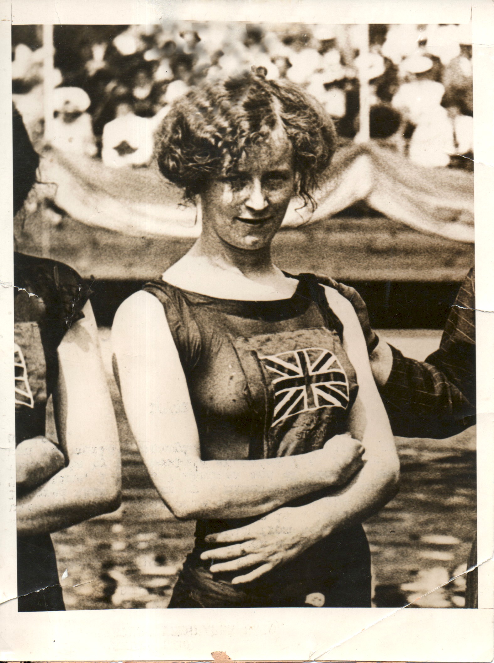
    I have made perhaps 100 posts on the images from a collection of WWI news photo service images that I have, and for quite some time this image  (below) has been one of he most captivating of the thousand or so that were in that collection.  Generally the images were accompanied by a suggested text that could appear alongside the picture when it was published (see here for the ins and outs of publishing photographs during WWI), but this one had no description at all, save for the copyright on the back belonging to Underwood and Underwood. 

    I thought that this photo was from 1918, as 1000 of its companions were, but I was corrected by on twitter about the Mona Lisa’s true name–Jennie Fletcher, (1890-1968), and the picture was at the 1912 Olympics.  It is nice to be able to put a name to the face.  (See the BBC for a good story: http://news.bbc.co.uk/2/hi/uk_news/wales/7554196.stm)

    The camera has caught her at an awkward time, especially given the sensitivities of showing skin in bathing attire. 

    What is she conveying? What is she saying with the attitude of her head and the look in her eyes?

    There have been Classic Attitudes among the photographs (like the Venus of the Tars, for example), and in all of these examples, she is the only Mona Lisa.

    WWI Photos--female swimmer185

    ·Posted by :

    ·in:

    —

  • A Fantastically-Lettered Letter, 1868

    JF Ptak Science Books   Quick Post

    CHild Art NEw Bedford184

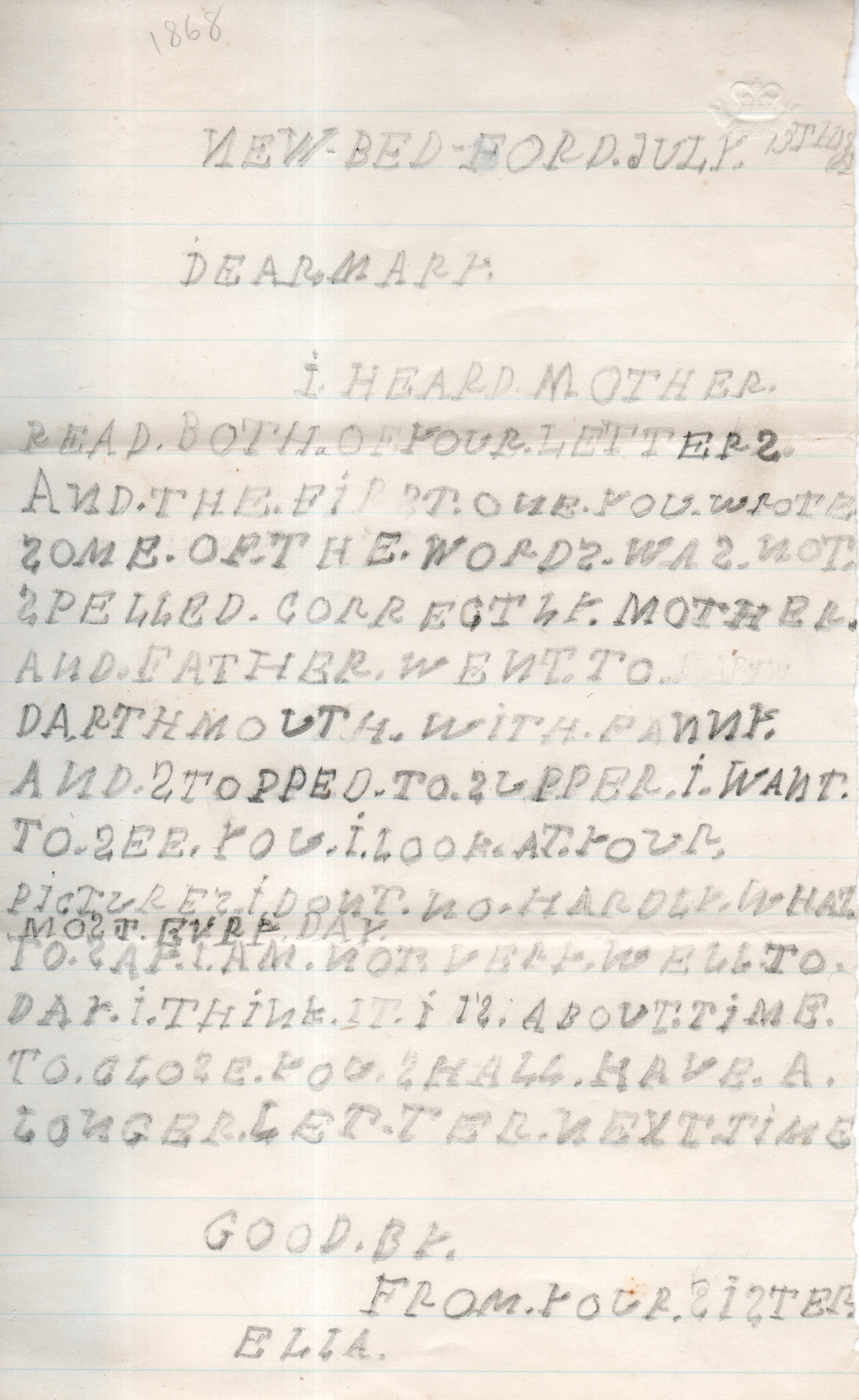
    I’ve mentioned on this blog a number of times that I like to collect antique art done by children–art, doodles, letters, that sort, mostly from before 1900.  This material is difficult to find, mainly because it was difficult to produce when it was being done given the relative scarcity of paper and pencils/pens/etc., and then having to survive moves and cleanings and generational changes for 100 or 200 years, so from my experience not that much survived.

    CHild Art NEw Bedford183

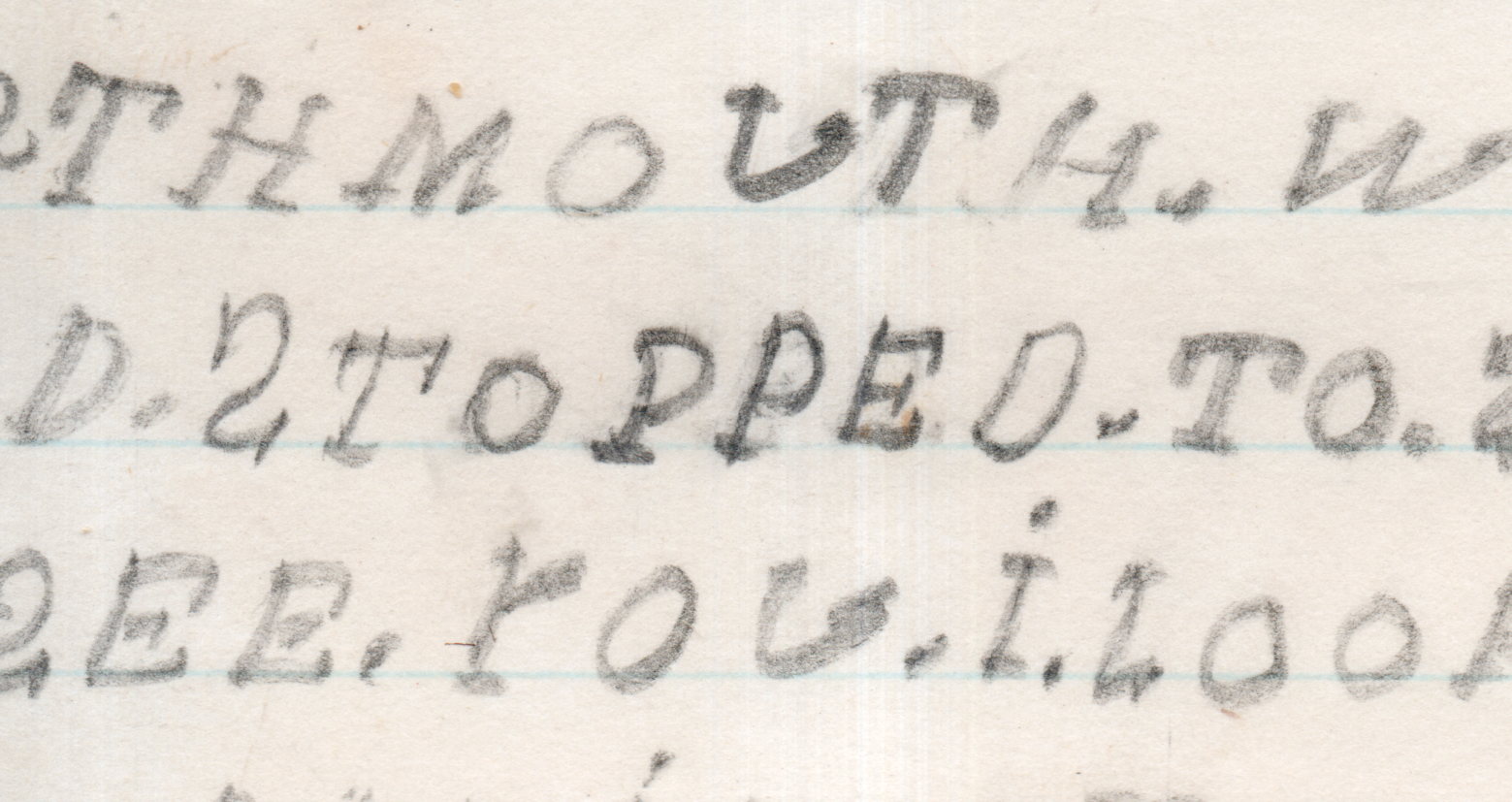
    Today’s sample is a letter from 1868, and the lettering, the handwriting, is very intense, and labored, and very very deliberate while at the same time being written very slowly.  You can tell about the speed when looking at the lettering under magnification–there are a lot of twists and turns in the formation of the letters and words such that could not be made if you were writing fluidly or quickly.  This was slow going.  

    Ella, the writer, was probably quite young. She used the period quite a bit, mostly in-between words, but also used it as a mark to show beginning and ending points in some letters. She also used lines and slashes to help her form the letters that she had probably just learned not to long before she wrote this letter.

    The effort is superior, and no one could fault little Ella in her brave attempt.  

    ·Posted by :

    ·in:


  • Found Art in Books: String & Maritime Law, 1849

    JF Ptak Science Books  Quick Post

    FYI–there have been about 90 posts to this blog since June 1, which is a lot more than you can see in the “Recent Posts” column at left.  You can check them out by clicking on the “Archives” column on the left.

    Admiralty lecture notes string

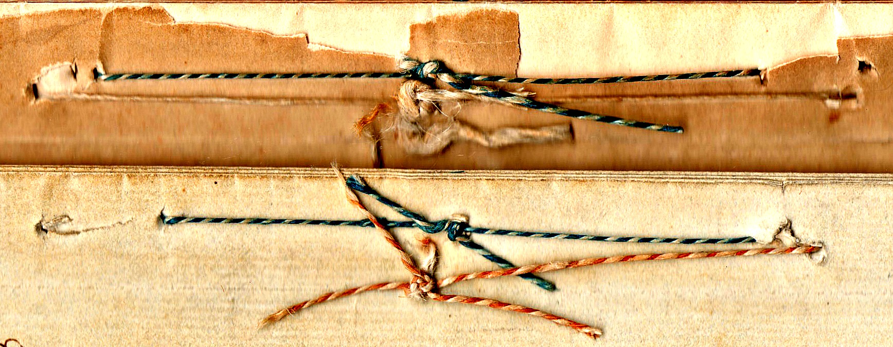
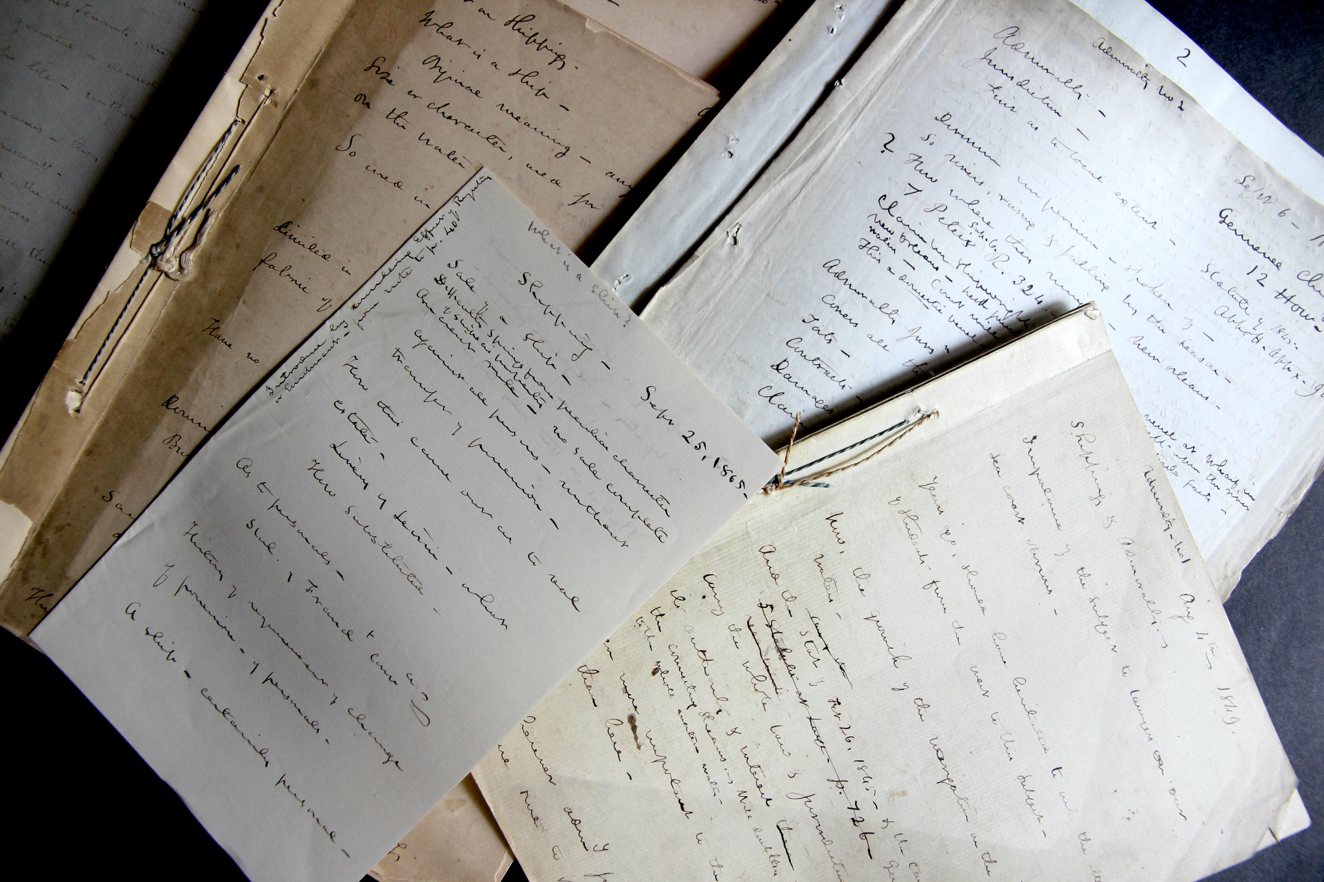
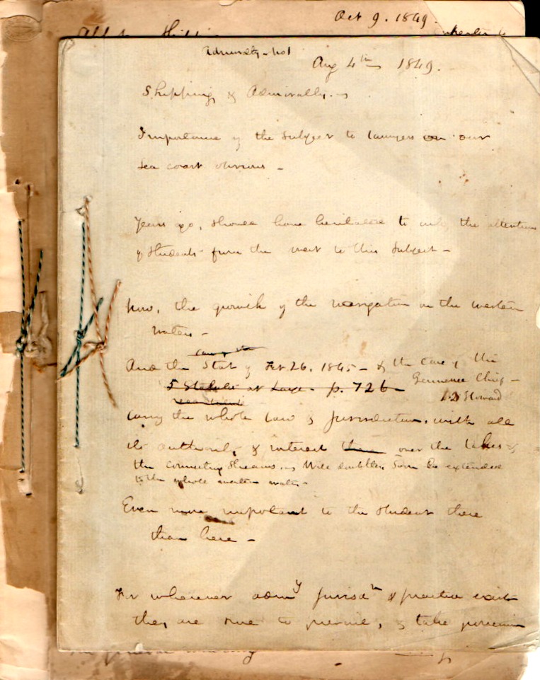
    The odd thing about this “find” this morning is that only yesterday I was asking a question regarding what I saw (or imagined) to be the equality of vessels in maritime law and how interesting it would be to have those laws transferable to land. That said, in clearing out a backlog in one of the bookcases I found a series of lecture notes on admiralty law from 1849.  Clearly they belonged to a lecturer in the subject, as there are broad statements on involved topics, with room to spare in going from one subject to the next–these are not “notes” in the sense that someone would lecture by reading from them; they are the notes of a person for moving through time inside of a lecture, references for what needs to be covered. With this the case most of them are too advanced for me to make much sense of….but there was plenty there to distract and attract–perhaps the least of that is the string used to tie everything together.  

    Admiralty notes _3_

    • You can actually buy this archive at the blog’s bookstore, here.  

    The stuff of old books can be very attractive in their own way–just the fact that they have made it in this relatively now-fragiler form is remarkable. (I am certain that these will make it hundreds of years more if cared for, or simply ignored, because that is what most books with do.)  In any event I find the found bits like this to be fascinating. 

    Admiralty lecture notes181

    ·Posted by :

    ·in:


  • The Savage Stain: Slave Ownership Map in the U.S., by County (!) 1860/1.

    JF Ptak Science Books  Quick Post

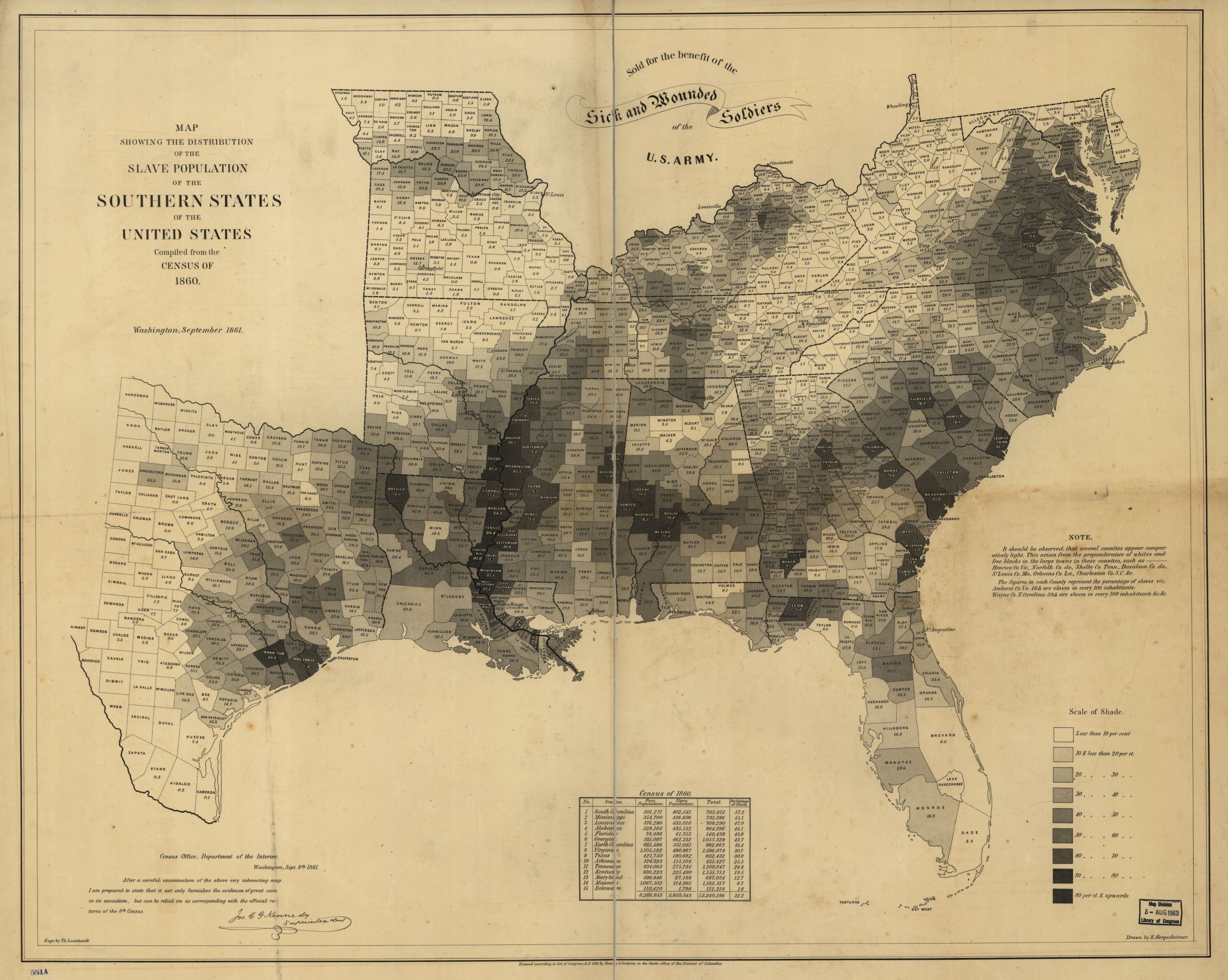
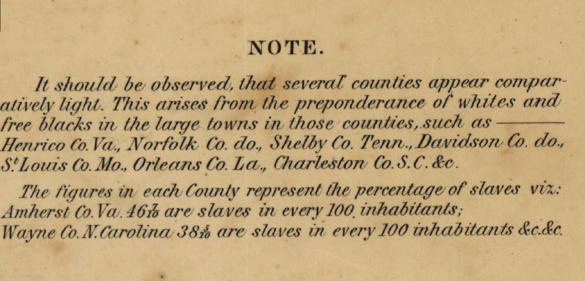
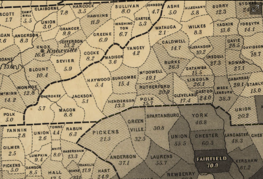
    Continuing several posts on slavery made here over teh last few days is this extraordinary map depicting slave ownership in the U.S. on the county level (!) based on data from the 1860 census and then published in 1861. Titled Map showing the distribution of the slave population of the southern states of the United States. Compiled from the census of 1860, I find it an enormous success in putting all of this data on one piece of paper, especially since the proportion of slave ownership is depicted also in shades of gray so that a visual impression of the state of slavery in this country can be seen and comprehended almost instantly.  

    The image below is clickable and expandable; mega files are found at the originating site of the Library of Congress (link follows).

    Map--slavery 1860 full

    [Source: the Library of Congress: http://www.loc.gov/resource/g3861e.cw0013200/]

    Map--slavery--detail note

     And a detail:

    Map--slavery--detail of map


    Adolph Von Steinwehr

    Hergesheimer, E.
    Hergesheimer, E. (Edwin)

    “Scale ca. 1:3,000,000.-  LC Civil War Maps (2nd ed.), 13.2-  “Entered according to Act of Congress, A.D. 1861 by Henry S. Graham.”-  “Sold for the benefit of the sick and wounded soldiers of the U.S. Army.”-  “Census Office, Department of the Interior, Washington, Sept. 9th, 1861. After a careful examination of the above very interesting map I am prepared to state that it not only furnishes the evidences of great care in its execution, but can be relied on as corresponding with the official returns of the 8th Census. [Signed in facsimile] Jos. C. G. Kennedy, Superintendent.”-  Map indicates by gray patterns, the percentage of slaves in each county. “It should be observed, that several counties appear comparatively light. This arises from the preponderance of whites and free blacks in the large towns in those counties. . . The figures in each county represent the percentage of slaves. . .”–Library of Congress website  http://www.loc.gov/resource/g3861e.cw0013200/]


  • Civil War Maps with an Unusual “Drowned World” Perspective (1861)

    JF Ptak Science Books   Quick Post

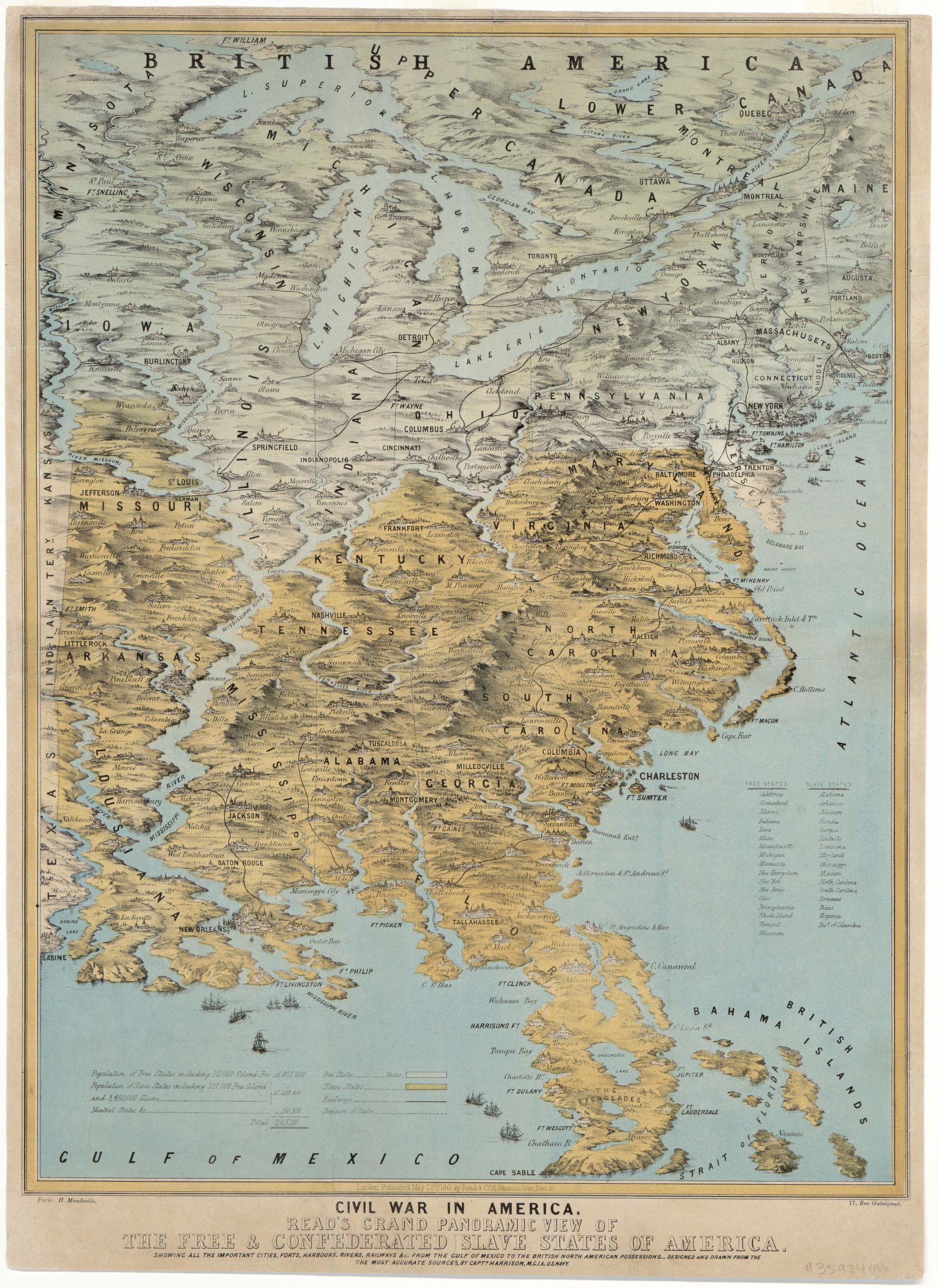
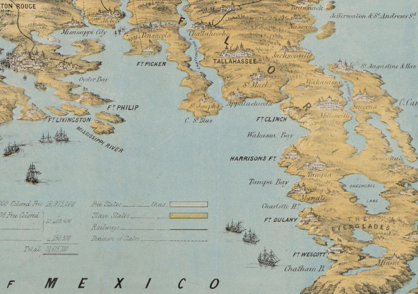
    The cartographer responsible for this unusual map successfully emphasized the rivers and mountains of a region–so much so that they are mostly completely out of perspective/scale to the other elements of the map.  The effect is magical.scary/startling in some ways, especially when you look at the detail for places like Florida and points along the Mississippi River. They remind me of J.G. Ballard’s The Drowned World, particularly with Florida, which look to be mostly submerged.  I know what the cartographer was trying to achieve in establishing the importance of natural boundaries, but this was probably a little overboard, so much so that he may have lost the “c” in “cartographer”.

    Here’s a clickable version of the map, with some zoom capacity:

    Maps-_Civil War--unusual perspec large[Source (including all details, below): Library of Congress, http://www.loc.gov/item/2014589394/]

    • Civil War in America : Read’s grand panoramic view of the free and confederated slave States of America : showing all the important cities, forts, harbours, rivers, railways &c. : from the Gulf of Mexico to the British North American possessions, 1861
    • Read’s grand panoramic view of the free and confederated slave States of America

    It seems as though I have seen something similar to this reckoning what the Florida “coasts” would look like according to global warming trends in the next century:

    Maps--Civil War--Unusual persp  FL

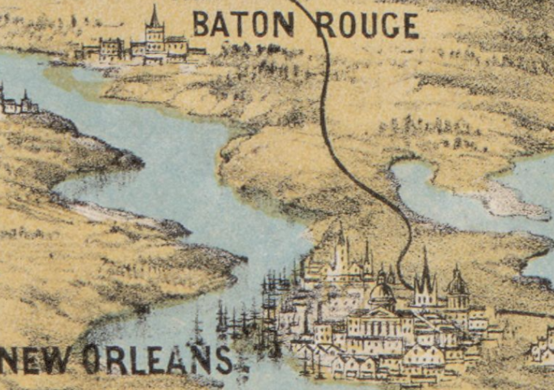
    Of all the city profiles the one for New Orleans looks a little like it could be accurate, if for no other reason than for the large number of ship masts:

    Maps--Civil war--Unusual Persp New Orleans

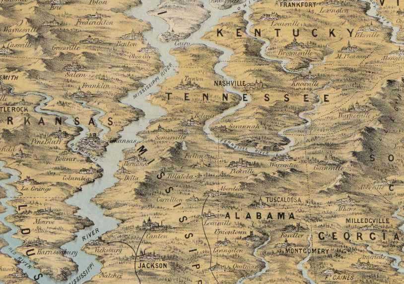
    The Mississippi looks mighty indeed–if this was drawn to scale the river would be 50+ miles wide in many areas:

    Maps--Civil War--unusual perspective MS river


  • Atomurbia II: Expanding on the Dis-Utopian-Dystopia (1951)

    JF Ptak Science Books    Post 2491    Part of the series History of Atomic and Nuclear Weapons

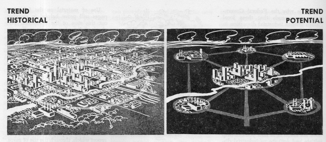
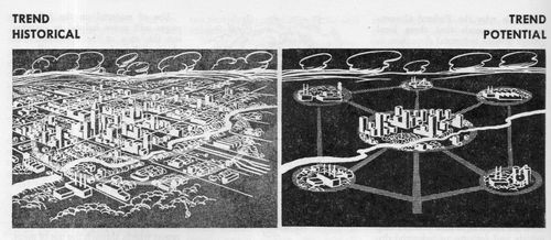
    Earlier in this blog in 2010 there appeared a post called “Atomurbia: Responding to Atomic Threat by Moving Everyone Everywhere, 1946“–it turned out to be very popular, being about the dispersal of the U.S. population centers to thwart nuclear attacks.  (I’ll repeat: it was about the plan to redistribute the population and industry and appropriate infrastructure of the United States of America.)
    Atomurbia II179

    It was of course (as Somerset Maugham would say in “The Three Fat Women of Antibes”) an Enormous Situation, involving (basically) moving everyone everywhere.  The term was “dispersion”, and the planners of such plans meant it–and I’ve come across it again–unexpectedly–in another issue of the Bulletin of Atomic Scientists for September 1951.

    You may recall that this is the journal that keeps a doomsday clock ticking off the minutes on its front cover showing the advance or retreat from the Midnight of Armageddon.  On this issue the clock is at three minutes to midnight, though I think that the greatest distance from the zero hour was ten minutes to the hour–so for decades the clock has been very close to striking the doomed hour without much relief.  

    In this issue of the Bulletin nearly every article is dedicated to the idea of dispersion (at that point under the auspices of the National Security Resources Board) and the creation of a federal program to directly oversee dispersion (the National Defense Dispersal Administration (NDDA)). And people are talking about moving around cities and people and industry as though it wasn’t that big a deal, though I must admit I haven’t seen any cost or time estimates in this source.  Moving the populations centers of the U.S. to a more “garden city” idea involves so much effort and expense it seems almost impossible to contemplate actually paying for all of it.  (And we haven’t begun to talk about how people and essential personal are actually ‘enticed” to leave their surroundings, nor is there any talk about the property rights of the owners of all of that land that is to be built on.)

    As much as Frank L. Wright’s “Broadacre City” seems to be a lead balloon so far as actual implementation goes for size and scope, this type of “dispersion” idea would be of gargantuan, orders-of-magnitude bigger/costlier than what Wright was talking about. At least in this department Wright was thinking in terms of a utopia; the dispersion business was more like a dis-utopian-dystopia, or something, no matter how these authors attempted to green-up and de-slum their proposal.

    I am mostly making this post for the image at the top of this post(from page 268 of the Bulletin), which fits nicely with those others posted in the earlier Bulletin article (reproduced in the link above). 

      Atomurbia II180

    ·Posted by :

    ·in:


  • Found Beauty in Mathematics, ca. 1895

    JF Ptak Science Books   Quick Post

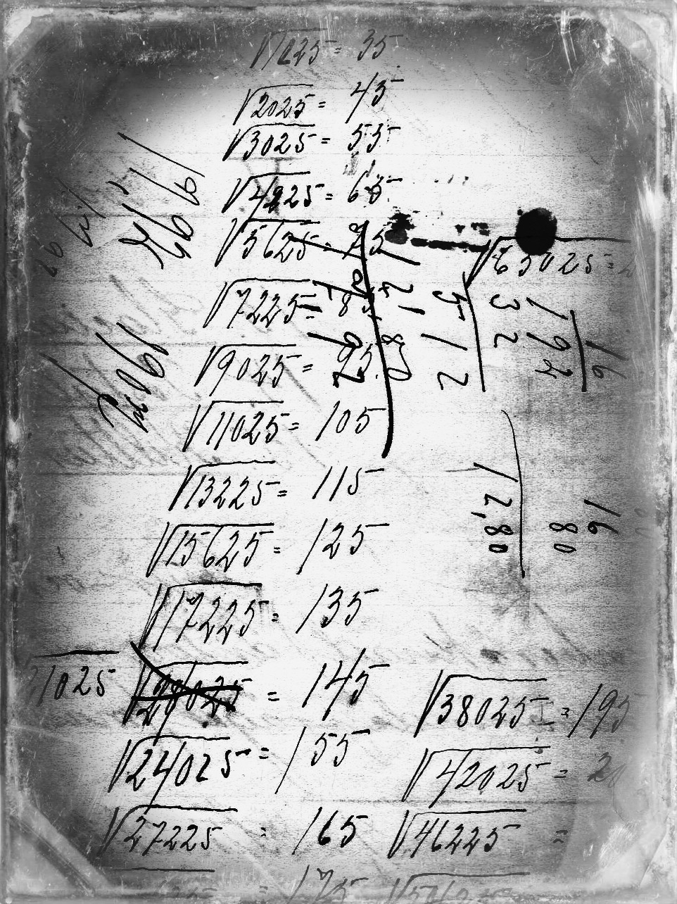
    MATH ART134--dag

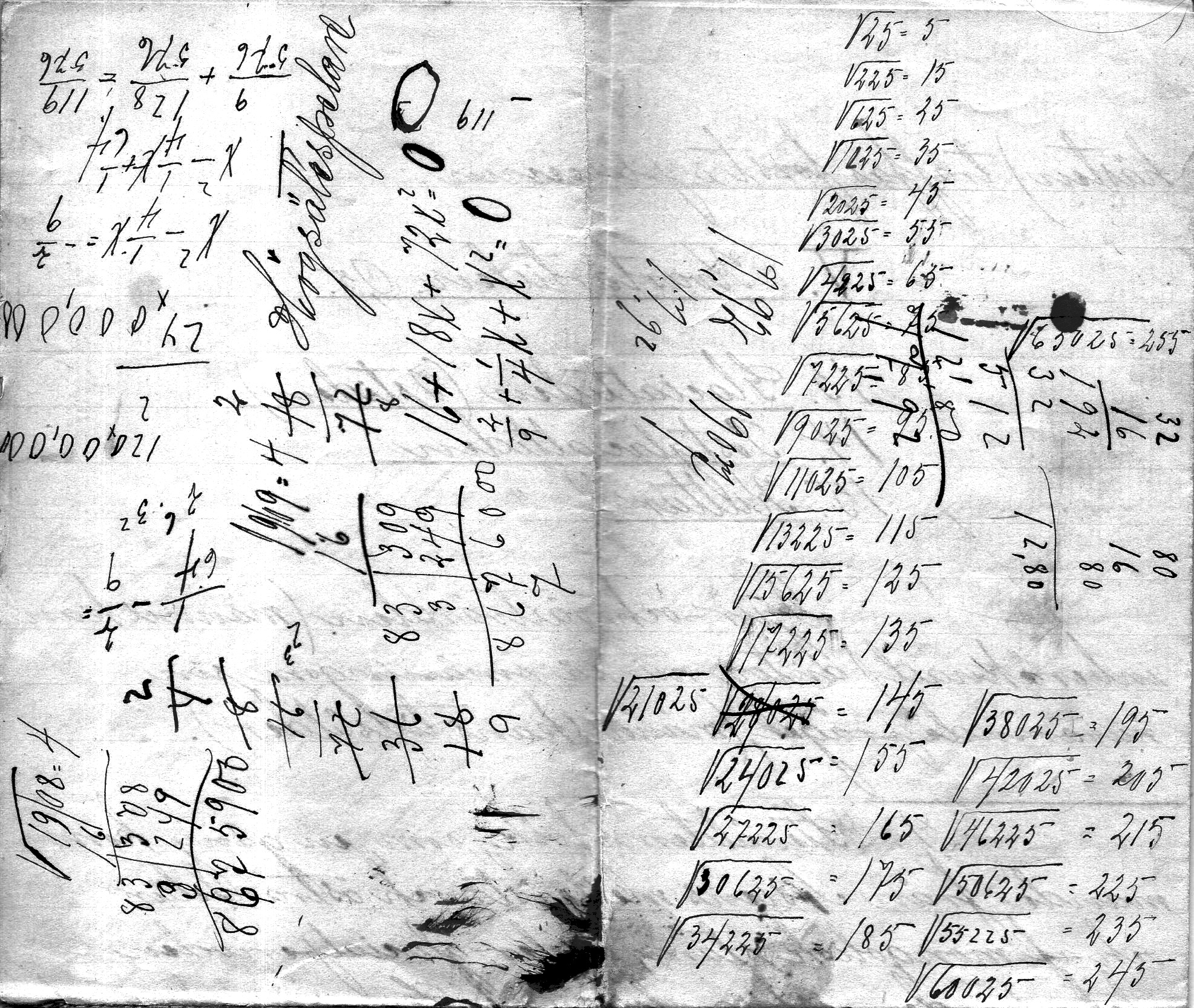
    This is a slightly manipulated image of the original (below) with an overlay of a daguerreotype process.  The math notes (square roots of numbers from 25-60,025 in 25 increments) occurs on the back of several pages of foolscap note “di geologiska formationrma” and by the footnotes it seems as though the notes are from 1893/5 or thereabouts.  In any event the calculations have a certain beauty to them. 

    MATH ART134

    ·Posted by :

    ·in: