A Daily History of Holes, Dots, Lines, Science, History, Math, Physics, Art, the Unintentional Absurd, Architecture, Maps, Data Visualization, Blank and Missing Things, and so on. |1.6 million words, 7500 images, 4.9 million hits| Press & appearances in The Times, Le Figaro, Mensa, The Economist, The Guardian, Discovery News, Slate, Le Monde, Sci American Blogs, Le Pont, and many other places… 5000+ total posts since 2008.

Author: JF Ptak

  • A Good Appreciation of Thomas Huxley by Ernst Haeckel

    JF Ptak Science Books   Quick Post

    I found this fine appreciation of one great naturalist (Ernst Haeckel, 1834-1919) on the career and work of a great biologist and educator (Thomas Henry Huxley, 1825-1895) in the February 1874 issue of Nature.  [Ernst Haeckel, “Scientific Worthies II–Thomas Henry Huxley”, in Nature, February 5, 1874, pp 257-258, four very-compact columns.]  Huxley was first-class and was perhaps the major defender and exponent of Charles Darwin (earning him the well-known nickname of “Darwin’s Bulldog”)–in a sense, Haeckel was a German equivalent of the Huxley/Darwin relationship, along with being an embryologist, physician, philosopher, biologist, and a great and demanding scientific illustrator. The article is a quick and interesting read, and is reproduced in full, below.  

    Huxley623

    ·Posted by :

    ·in:


  • Maps of Hamlet, Moles, Hair, Hobolands, and Nothing

    JF Ptak Science Books  Post 2252

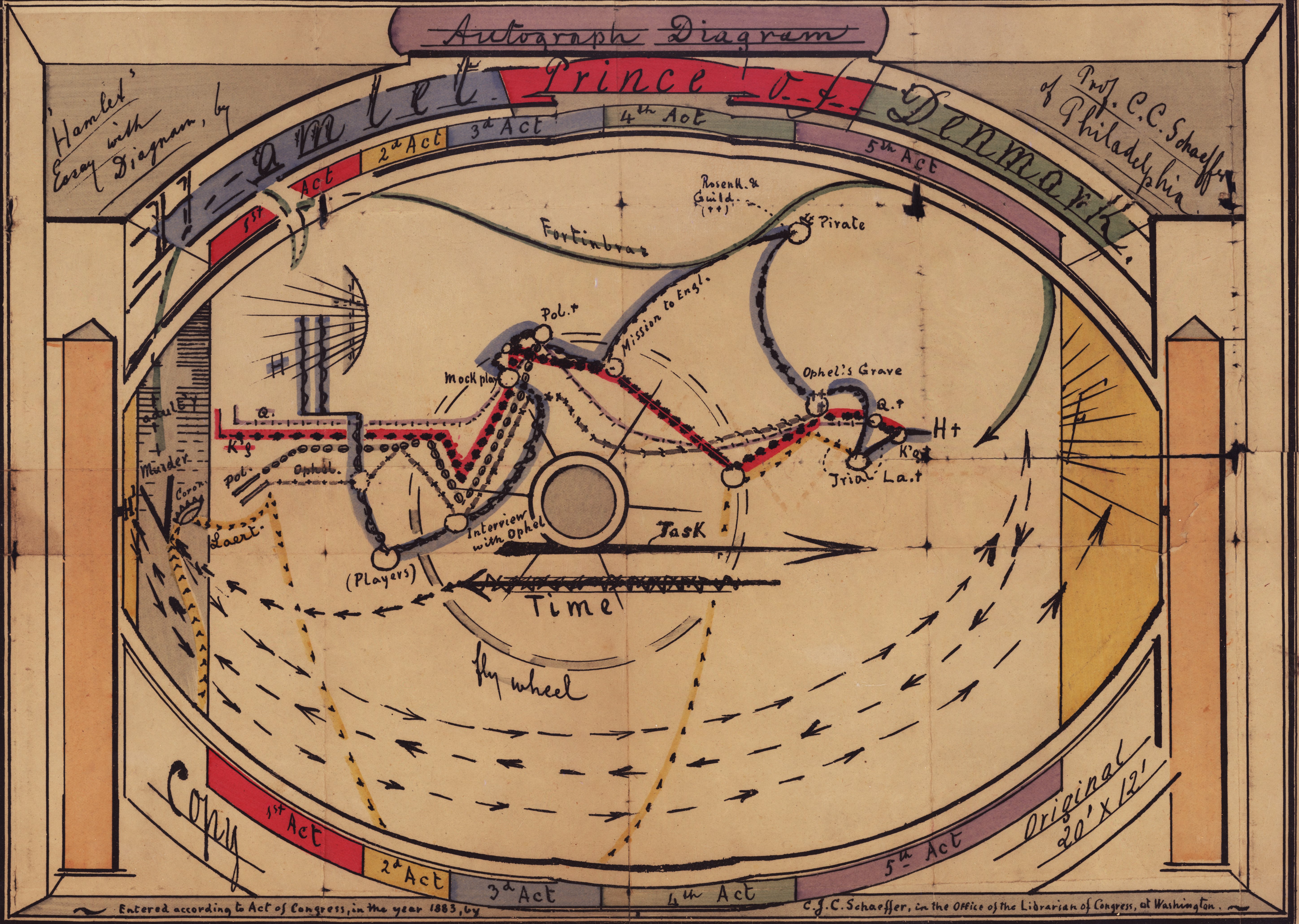
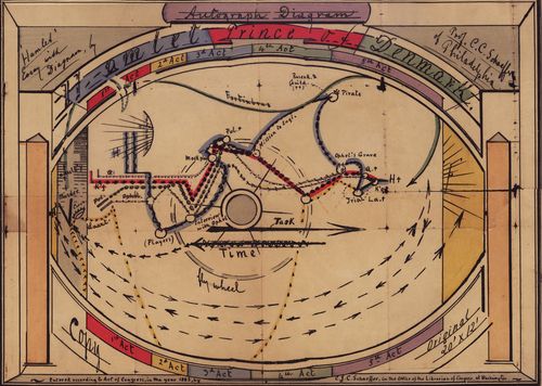
    There are a number of posts on this blog relating to maps of unusual, odd, and non-existent places (see for example Maps of Imaginary Places III, here,  and On Missing Antique Atlases of Imaginary Places and the Sameness of Alien Math and Music: Huygens’ 1698 ETs, here) so this lovely map of the action in Hamlet came as an unexpected and welcome addition.  
    Hamlet stage direction

    [“Autograph diagram: Hamlet Prince of Denmark, 30x47cm, stage sets and scenery.” Source: http://www.library.upenn.edu/collections/rbm/photos/]

    It makes sense of course to chart the action in a play, but I think that I’ve never seen one that was of some age…and to see this plotting the advances and retreats of Gertrude, Hamlet, Laertes, Ophelia, Polonius, Fortinbras, Claudius, King of Denmark, Rosencrantz, and Guildenstern and to see them all at once made everything more comfortable, and confusing.  Perhaps that is the great quieter of maps and diagrams of imaginary places, adding another layer of mystery by making the nonexistent more complex.  

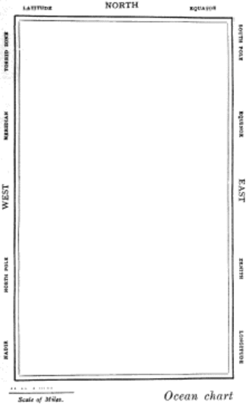
    The greatest map of nothing must be from Lewis Carroll’s The Hunting of the Snark, an Agony in Eight Fits, and occurs in the Bellman’s tale, starting the second fit. It begins:

    The Bellman himself they all praised to the skies-
    Such a carriage, such ease and such grace!
    Such solemnity too! One could see he was wise,
    The moment one look in his face!

    He had bought a large map representing the sea,
    Without the least vestige of land:
    And the crew were much pleased when the found it to be
    A map they could all understand.

    “What’s the good of Mercator’s North Poles and Equators,
    Tropics, Zones, and Meridian Lines?”
    So the Bellman would cry: and the crew would reply,
    “They are merely conventional signs!

    “Other maps are such shapes, with their islands and capes!
    But we’ve got our brave Captain to thank”
    (So the crew would protest) “that he’s bought us the best-
    A perfect and absolute blank!”
    Snarkmap

    Sometimes there is nothing so fine as something that beautifully illustrates the nothing that isn’t there, and this lovely map, unencumbered of all of the elements and details that define the mapness of something,  perfectly explains the origin of its need.

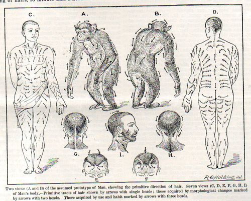
    Another great and perhaps probably not-imaginary map is the wonderful hair growth/directional map that was the creation of Dr. Walter Kidd (Fellow of the Zoological Society, London) and his attempt to reconcile the the influences of gravity, inheritance, genetics, Weismannianism, and other assorted biological bits via his study of hair growth patterns.  The article appears in the (many) pages of the Scientific American Supplement for 13 September 1902, on page 22, 328. 
    Hair map contract086
     
     
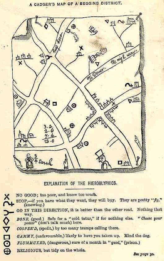
    And as much as Kidd’s map was one of tracing impossible connections of hope in a hairy back, the “Cadger’s Map” from the land of Hobos hopes to thread out a decent pass-through experience for the People With Nothing to try and get a little something.  
     
    Map Hobo
     
    [Source:  John Hotten, The Slang Dictionary, Etymological, Historical, and Anecdotal, 1874; full text available here.]

    The symbols are explained in the book on page 38:  

    “Another use is also made of hieroglyphs. Charts of successful begging neighbourhoods are rudely drawn, and symbolical signs attached to each house to show whether benevolent or adverse“In many cases there is over the kitchen mantelpiece”[30] of a tramps’ lodging-house “a map of the district, dotted here and there with memorandums of failure or success.” A correct facsimile of one of these singular maps is given in this book. It was obtained from the patterers and tramps who supplied a great many words for this work, and who were employed by the original publisher in collecting Old Ballads, Christmas Carols, Dying Speeches, and Last Lamentations, as materials for a History of Popular Literature. The reader will, no doubt, be amused with the drawing. The locality depicted is near Maidstone, in Kent; and it was probably sketched by a wandering Screever in payment for a night’s lodging. The English practice of marking everything, and scratching names on public property, extends itself to the tribe of vagabonds. On the map, as may be seen in the left-hand corner, some Traveller has drawn a favourite or noted female, singularly nicknamed Three-quarter Sarah. What were the peculiar accomplishments of this lady to demand so uncommon a name, the reader will be at a loss to discover; but a patterer says it probably refers to a shuffling dance of that name, common in tramps’ lodging-houses, and in which “¾ Sarah” may have been a proficient. Above her, three beggars or hawkers have reckoned their day’s earnings, amounting to 13s., and on the right a tolerably correct sketch of a low hawker, or cadger, is drawn. “To Dover, the nigh way,” is the exact phraseology; and “hup here,” a fair specimen of the self-acquired education of the draughtsman. No key or explanation to the hieroglyphs was given in the original, because it would have been superfluous, when every inmate of the lodging-house knew the marks from his cradle—or rather his mother’s back.”

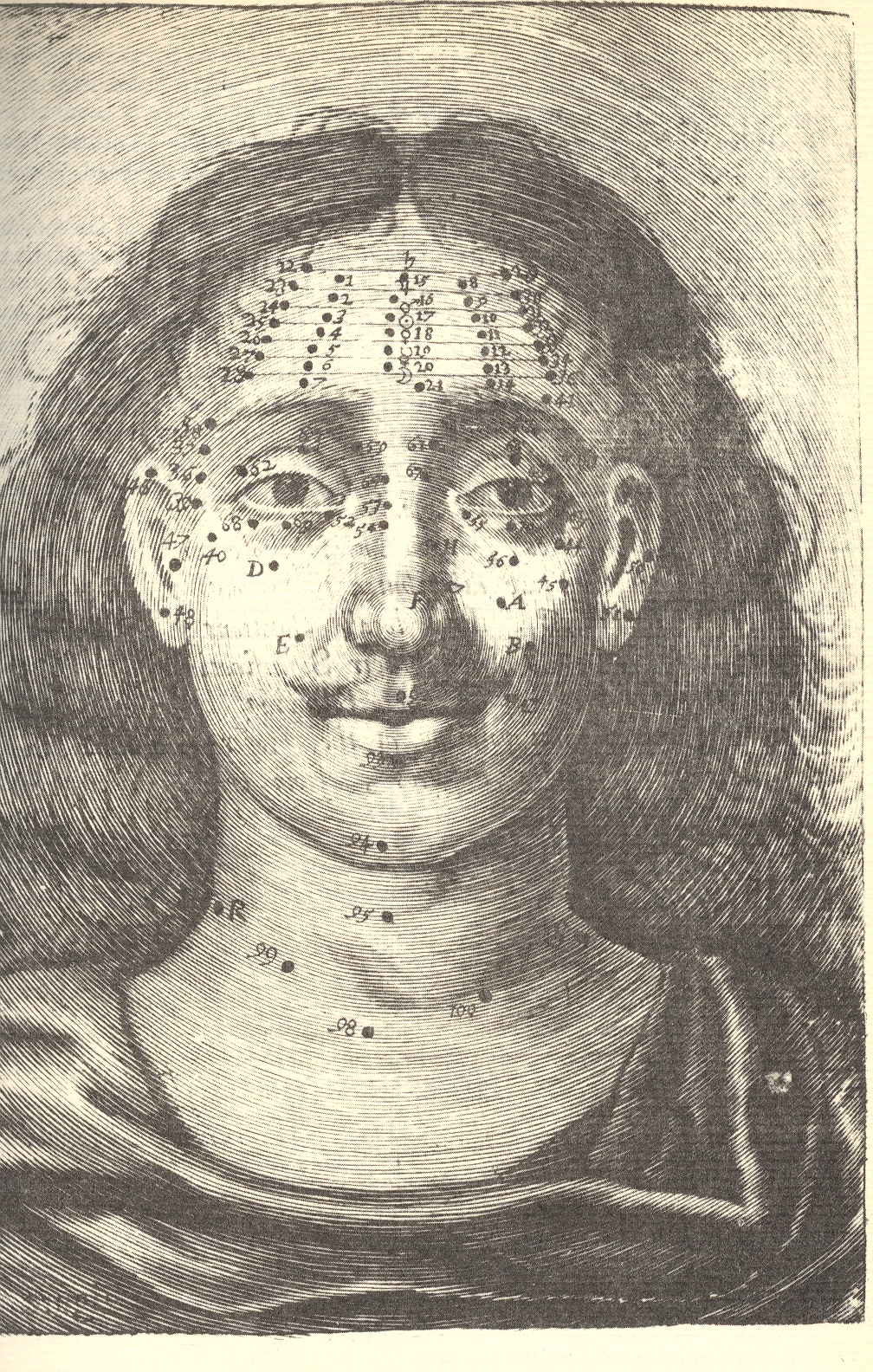
     This all leads somehow to this impossible quest of Richard Saunders, who sought spiritual/biblical/cosmo-comographical spiritualness connecting the dots and creating lined matrices in human mole placement: 

    I’ve written a bit about this in 2009 in this blog, here. It seems to me that in all the maps of something-that-is-nothing, Saunders’ efforts may be at teh top or bottom of that heap.  
    ·Posted by :

    ·in:


  • A Pie Line and Sugar Angel, 1918–US Troops in Paris

    JF Ptak Science Books 

    0 ebay 16 pie line280

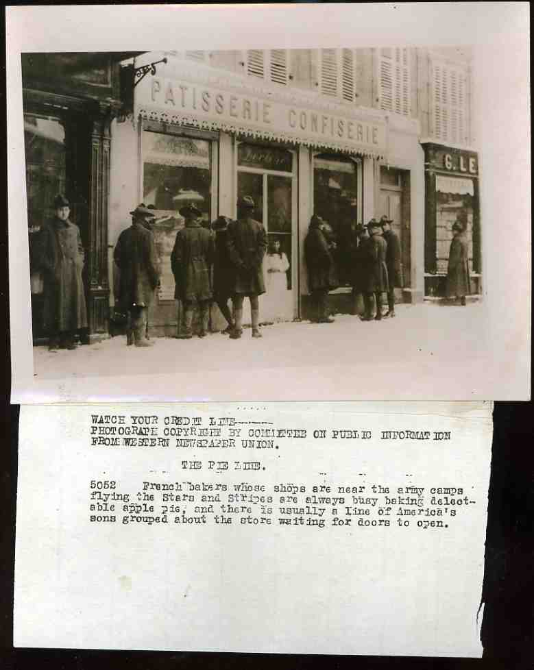
    There’s definitely an angelic figure in this photograph, an image made showing American Doughboys lining up in front of a bakery/candy store (high-sugar delivery transport systems enhancer) in Paris in 1918.  This photograph is a News Photo Service item, produced by the Western Newspaper Union, which would send photographs (and their captions) on demand  to newspapers and magazines requesting a scene, say, of American soldiers waiting patiently in line for apple pie at a Parisian bakery.  The caption says that “America’s sons (were) grouped about the store waiting for doors to open” so that they could have at the apple pie. They are waiting for something, to be sure; it doesn’t seem quite right that a bakery would not be open during daylight hours (though the shutters on the upper floors are closed still) in the winter (I see snow), but then again I’m not an expert on the hours kept by small business in Paris during WWI. 

    I am taken with the figure of the small girl in the windowed-door of the bakery, standing there with her hands clasped, framed by the window pane, dressed in flowing white.  Is the place really closed, or did the soldiers simply have no money for these treats, the little girl standing there in the unlocked doorway wondering why all of these soldiers just don’t come inside?  Were the men paid in scrip with no value in the streets of the city?  The good news is that these men were alive, and it may have been November or December of 1918, which means that the killing of millions and millions of soldiers and civilians had just about come to an end, so they could probably stay living,  safely making their idle if not penniless way around the snowy streets of Paris, wanting and waiting to go home.

    This photograph is available for sale at our blog store, here. 

    0 ebay 16 pie line281


    ·Posted by :

    ·in:


  • Big Tonnage Visualization–on Quantifying Images of Bigness

    JF Ptak Science Books  Post 2251   Artistic Display of Information series

    Infographic railways

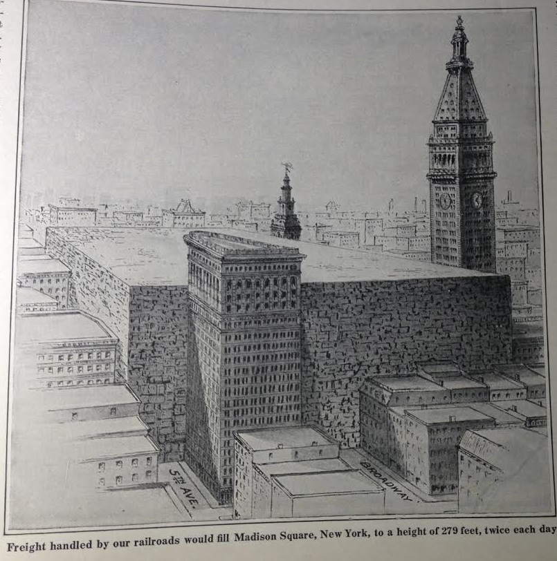
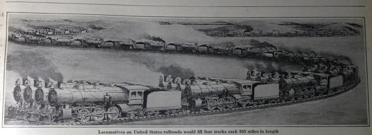
    There are many posts on this blog relating to pre-WWII visualizations of bigness and smallness, of what it would like exactly to see 54,000 B-17s in flight, or how much a German prisoner eats per year in British compounds in 1917, and so on. I found the following qualitative display of quantitative data regarding American railroads and the astonishing amount of material they transported per year, resting comfortably in the pages of a Scientific American for 1918.  The editor placed the display right on the first page of the issue, stating that “every one of us knows that the railway system of the United States has the quality of bigness, but not every one understands just how immense it actually is”, and he was correct.  The top image relates to the 2 billion tons of freight hauled by the railways every year–that would mean that you could fill up Madison Square Garden (one of the earliest versions of the building now occupying that spot) twice every day with stuff for one whole year. That would be a cube 870′ long and 540′ wide and 280′ deep.  (The editor doesn’t reckon it but that would also make for a tower 870’x540’x90,000′ (or 18 miles) high.)

    The editor also points out that if you took all of the locomotives (and coal cars) in the U.S. and lined them up they’d be a 4-track-wide string of them 385 miles long–that’s a lot of locomotives. 

    [Source, Scientific American, January 12, 1918, volume 118, page 49. ]

    Infographic railways2


  • A Memory of a Hard-to-Break Bottle of Australian Wine, 1906-1918

    JF Ptak Science Books   Quick Post

    WWI Photo--ship launch128[A detail from:]

    WWI Photo--ship launch127

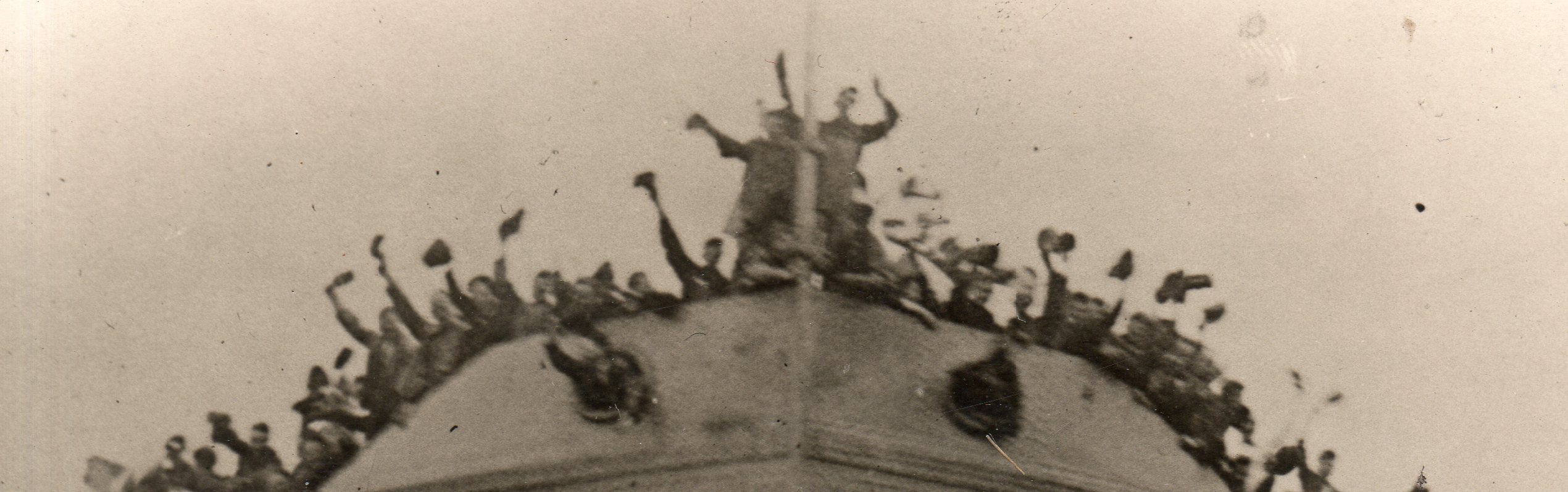
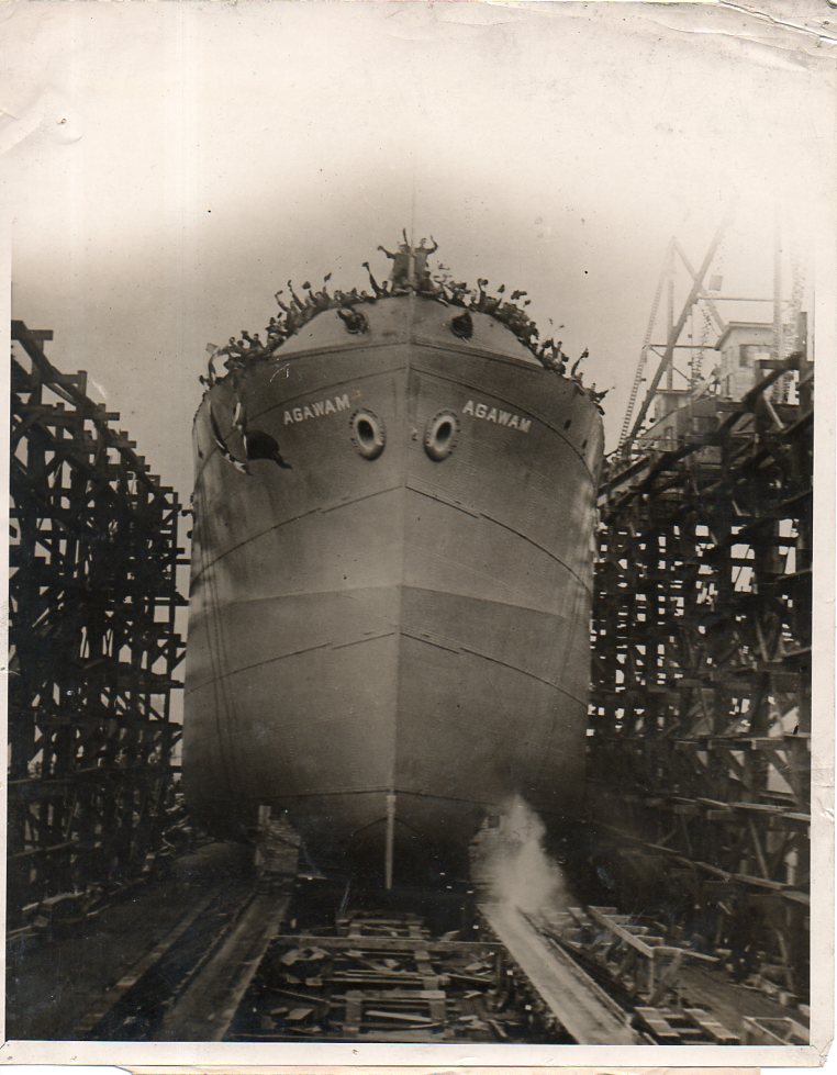
    This great photograph was made in 1918 and stamped on the reverse “Photo by Central News Photo Service” of NYC. It shows the launching of the U.S.S. Agawam, the first standardized ship launched by the U.S. Navy (according to a New York Times article for May 3, 1918, (“FIRST FABRICATED SHIP; The Agawam, Forerunner of Standardized Fleet, to be Launched Today”).  [This image is actually available for purchase via the World War I Photography section of this blog, here.]

    The image reminds me in a way of the launching of the Dreadnought, which in some ways was another beginning of WWI, or at least of the naval race right before the war and of the competition for naval superiority between the Germany and England.  And I remember how King Edward VII, rickety with illness, climbed the stairs to deliver his speech, and to break open the bottle of Australian wine against the Dreadnought‘s bow. Except that the bottle didn’t break on the first attempt–a somewhat forbidding element, except that it was her bow that Dreadnought used to sink a German sub.  The ship revolutionized naval technology and Germany played catch-up to it (and in effect an entire new class of battleship) right to the beginning of the war.  Less than 15 years later, the Dreadnought was sold for scrap.  

    ·Posted by :

    ·in:


  • Books as War Loot, 1918

    JF Ptak Science Books   Quick Post

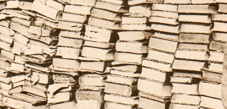
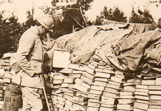
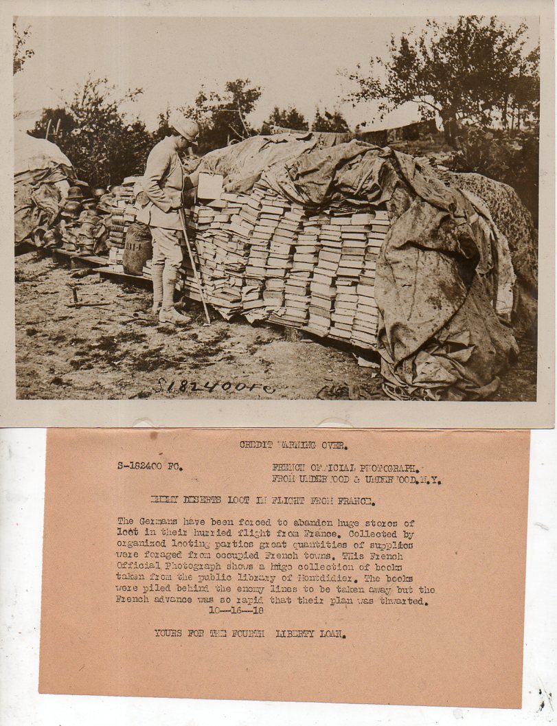
    In the vast caches of loot taken during the course of war I suspect books have ranked somewhere in the middle of stolen stuff–no doubt some fine libraries have disappeared, though I can’t offhand say how many fine libraries emerged from the slaughterhouse.  This photograph–a wartime news photo service image–is one of the few that I have seen depicting the capture of stolen books.

    WWI photos--looted books113

    [A deep detail, followed by a more moderate detail]

    WWI photos--looted books112

    And the full image, along with the news photo service prepared description of the image:

    WWI photos--looted books111

    ·Posted by :

    ·in:


  • Before-and-After of Massive Moustaches, 1878

    JF Ptak Science Books  Quick Post

    Moustachedet124

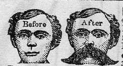
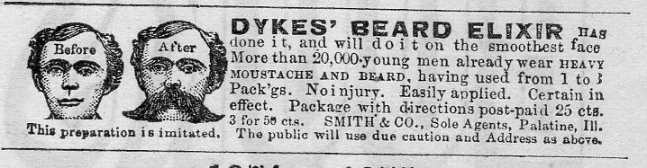
    There was perhaps nothing so satisfying to a fellow in America in 1878 than to have a massive moustache–or at least the idea of one, a call to high fashion in hairstyles for men. But since not everyone could produce a garden on their upper lip there was always someone around to take advantage of the necessity of hope–in this case, the hope was provided by Smith & Co of Palatine, Illinois. They sold a concoction of some sort that promised (on three applications) to produce a heavy moustache and/or beard with ‘no injury”.  

    The detail from the following snippet, which is actually a tiny detail from a full-page sheert of ads (see below):

    Moustache124

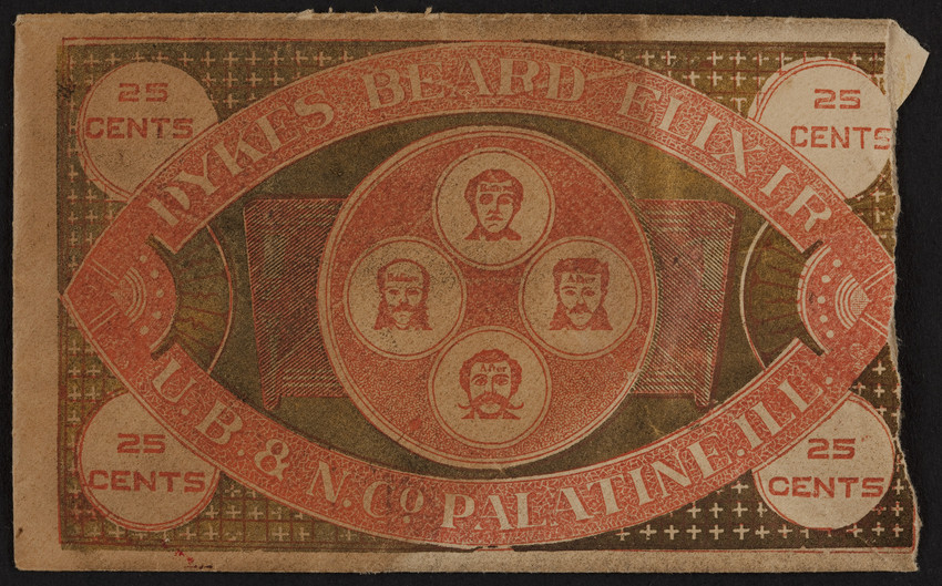
    A little research reveals the packet for the miracle-grow:

    Moustache elixir[Source, Historic New England site]

    I’m sorry now that I didn’t collect these before-and-after images, as I’ve seen dozens over the years–this one was a little too beforey-and-aftery to pass up. 

    ·Posted by :

    ·in:


  • The Correct Tools for the Job: Making Crime Pay But Not Really, 1893

    JF Ptak Science Books  

    As long as there is something worth stealing it is probably the case with the human race that what that something is won’t be, and will be stolen.  This has been the case forever, and as vigilant as an owner of property might be–whether that bit that stood for labor exchange units was a cow or land or gold or money itself–there will be someone else out there in the anti-vigilant world tempting fate and chance and skill at taking someone else’s belongings away.  

    We have a little window that has opened to reveal a piece of that world–an unusual one, for the 19th century, anyway.  That is what I saw when breezing through the memoirs of George Washington Wallace (1823-1891), Recollections of a Chief of Police, which was published in 1887. Wallace was police chief of NYC, making him THE police chief (sorry, Chicago), and he had some pretty good recollections to recollect. (Which is a good thing he recorded this book when he did, because he would be deads four years later.) 

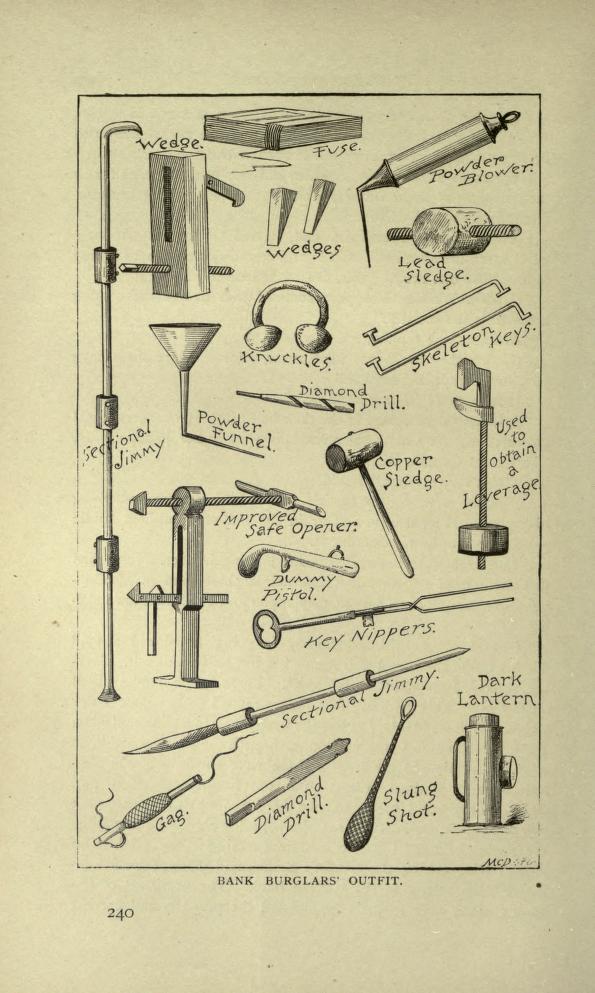
    But as I said, the image that stopped me was the one shown below, displaying the tools criminals would use to creak/creep their way into someone else’s life.  

    Burglar tools

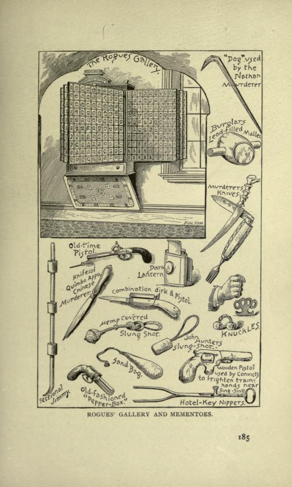
    And this:

    Burglar stuff-- rogues gallery

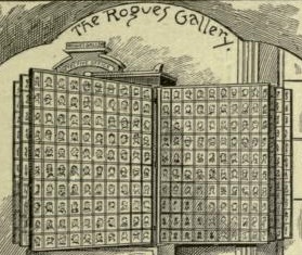
    And the interesting bit inside the interesting bit?  The wall-mounted collection of mugshots:

    Burglar stuff-- rogues gallery det


    ·Posted by :

    ·in:


  • A Town for Escaped Slaves–Surrounded by Livestock & Swamp (1862)

    JF Ptak Science Books   Post 2248

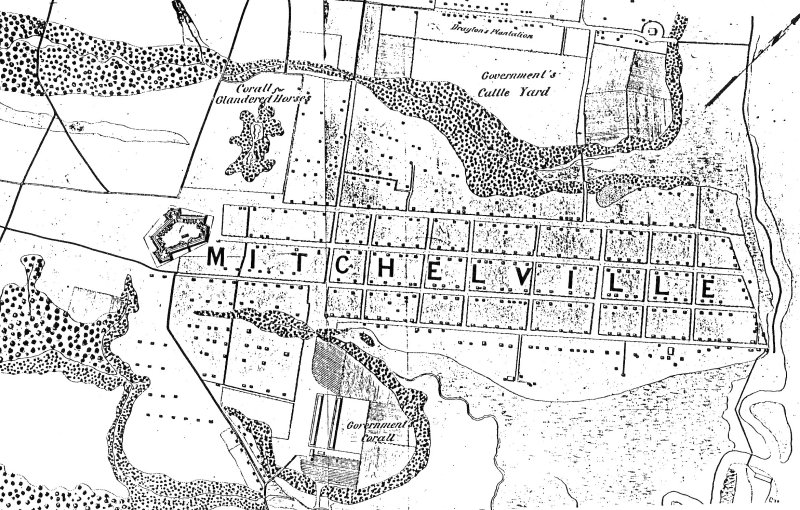
    The “Port Royal Experiment” established in 1862 by the Union Army at Mitchelville, Hilton Head Island, Beaufort County, South Carolina for freed slaves was certainly a very interesting  and perhaps life-saving idea for many freed slaves.  Well, the “freed” slaves weren’t really that–they escapes their servitude when the Union Army took control of Hilton Head and surrounding areas early in the war on November 8, 1861.  The island became a staging area for Union forces and was fortified–it also attracted the attention of escaped slaves,m who by 1862 had sought a form of asylum there, numbering around 600.  They were not exactly welcomed to the island, as there were prejudices against African Americans in the Union ranks as well–in fact some needed protection as the lower low-lifes among the Northern ranks stole from the escaped slaves what little they had.  In any event, it was a difficult situation, with no clear way of dealing with the new ex-slave population from a legal.administrative point of view.  These ex-slaves were considered as ‘contraband” of war, and my early 1862–on Hilton Head at least–the solution was found in establishing a town for them.


    Mitchellville

    The town was created by and  named for Kentuckian and Major General Ormsby M. Mitchel–he wouldn’t survive the year, dying of yellow fever in Beaufort S.C., and then buried in Green-Wood Cemetery in Brooklyn (and as it turns out his marker is not far from my mother’s mother’s family.  Furthermore he is the O.M. Mitchel I know from the history of astronomy, his life before the military and before his country needed him.  He wound up at the troubled Albany observatory right before leaving for the war).  

    Mitchelville was necessary and perhaps it was even sufficient for the time–certainly it had its share of trouble during the war, and then with ownership of land issues after the war, and so on. 

    What struck me about this map was the placement of Mitchelville.  

    It was mostly surrounded by poop.

    Situated on a cotton field–some of the slaves who lived there used to work those same fields for the land owner who directed the Confederate unsuccessful defense of the island–the town had a huge swamp to its south, with a ‘government corall” just west of that; the northern boundary of the town was a large “government cattle yard”, and the to the west was a fort and horse coral.  And then to he east was the ocean.  Hot, swampy, and mostly surrounded by cows and horses, the town doesn’t look particularly appetizing.  On the other much larger hand, the people living there were no longer slaves.  


  • The Floating Eden of Allendale, South Carolina

    JF Ptak Science Books  Post 2247

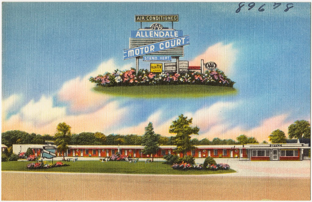
    Allendale motor court

    (From the Passion of Former Days site–with many more Very Highly Colorful examples of motel advertising postcard art, here.)

    Slate Vault‘s Rebecca Onion shared a great post from the Passion of Former Days site, a feature of colors-not-found-in-nature color postcards from the 1950’s or so.  They are all striking, and striking in one form or another above being simply striking, but the most striking for me was the Allendale Motor Court’s floating Allendale Eden.  It is, in its thrift-store-velvet way, a sublime image, a late Renaissance woodblock image depicting normality and piety and an expression of what could come for the obedient and penitent, the promise of the rewarded afterlife (as seen in so many images published in the first 50 years after Gutenberg), lifted from that dusty sleep and re-imagined on this linen-backed postcard promising a happy sleep removed from a dirt road in deep South Carolina. 

    Above all else, whatever it is in this floating paradise, it is all air conditioned. And heated with steam. And with a telephone.  And a “Room TV” (thanks to Linda Anderson for that clarification!)

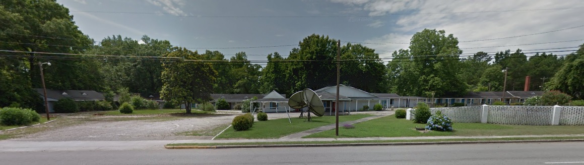
    And today:

    Allendale motor court today

    The town has seen better days. It is a small place–3 square miles–and has a population of 3,800, down from 4,000 a decade ago.  The tough part is that the median income in Allendale is $16,000, and the per capita is just $10,000, making for a very hard go.  About 60% of the town’s under-18 population lives under the poverty line, as does 41% of the population in general. This makes it a poor city in a poor county of a poor state–S.C. ranks 48th in per capita income in the country ($34,000 against a national average of $42,000).[Source] Another site listing S.C. counties and places shows Allendale at 348th in 368 listed areas in the state, with Allendale county coming in at 43rd out of 46 counties for per capita income.  

    Nearly a third of the town is single-mother households.  That is a hard life.  I don’t know what the percentage of children in town that figure represents–that is, how many of all of the town’s children are being raised in single-parent households…but the number seems big.  Bigger than the big number that is the national average, where something approaching 30% of all American children are being raised by single parents.  

    Somehow this is so even though the University of South Carolina Salkehatchie campus is located there–a public school with an enrollment of 1100 and an academic staff of 57.  Evidently it does not draw much income for the town. 

    Part of this problem surely are the sky-high unemployment figures for the town, which topped out at 22% in the years following the 2008 Disaster.  Today unemployment stands at about 10%, far above the national avergae of 6.6 (whatever)%  There is no telling what these Allendale numbers mean, not knowing how many people simply fell out of the queue for work.  The numbers sound mean and nasty.  

    The floating Eden I think has not been seen in Allendale for quite some time–or at least since Route 95 skirted the town and made one of the major north-south arteries–Route 301–a thing of the past. Or passed.  301 goes through Allendale and in pre-95 times there was quite a tourist trade.  I called the newly-expanded library in Allendale and the librarian I spoke with confirmed this. She did tell me though that for as small a place as Allendale is that they get 150-200 patrons a day, which is about 5% of the town’s population, which is pretty high traffic, per capita.  She was very enthusiastic about her town, and I commmend her for it. “We’re expecting great things to happen in Allendale” she said. And I wish every good thing for her.