A Daily History of Holes, Dots, Lines, Science, History, Math, Physics, Art, the Unintentional Absurd, Architecture, Maps, Data Visualization, Blank and Missing Things, and so on. |1.6 million words, 7500 images, 4.9 million hits| Press & appearances in The Times, Le Figaro, Mensa, The Economist, The Guardian, Discovery News, Slate, Le Monde, Sci American Blogs, Le Pont, and many other places… 5000+ total posts since 2008.

Category: Propaganda

  • Office of War Information–Hitler’s Lies (1942, With Full Text)

    JF Ptak Science Books    Post 2609

    Here we go–after Hitler had been in power for 11 years of many highly-veneers layers of lies great and small the U.S. Office of War Information produced a short and truncated scorecard of the most “conspicuous” of them.  The paper, Hitler’s Lies. A short, documented list of the more conspicuous lies of Adolf Hitler, from 1935 to 1942, in chronological order was an 11-page chronological abbreviation of some of Hitler’s most notorious lies. Oddly enough there seems to be hardly anything printed as a book or pamphlet in the 1933-1945 period with “Hitler” and “Lies” in the title (though there is Lies as Allies, or, Hitler at War, by Frederic Maugham, 1941)–there are a few more if you use “Nazi” and Lies” in the search, and o revealing Nazi Lies (1940), 1001 Nazi Lies (1940), and  Here Lies Goebbels (1940). In any event the OWI copy seems to not be around in libraries–there seem to be no copies of this edition located in the WorldCat/OCLC, though there is one other very similar version of this (in four pages, double columns) at the Denver Public Library. With this in mind I decided to share the entire document, which is now reprinted below. It is well worth readign to see how an official hearst/minds information arm of the U.S. government was dealing at a popular/informed level with Hitler.  

    (The following quotes come from a review by Martin Melosi of Allan M. Winkler,  The Politics of Propaganda: The Office of War Information, 1942-1945 , published by Yale in 1978):

    • The Office of War Information (OWI, created in 1942)  was “dominated by liberal interventionists, such as Archibald MacLeish and Robert Sherwood, the OWI sought to play an activist role in winning the war by affirming the value of democracy over any totalitarian threat”. “The leadership of OWI were sure that if they could simply repeat it loudly enough and often enough, it would win the hearts and minds of all who heard  (p. 150).”  “But alas, the grandiose dreams and high expectations of the major OWI figures were dashed by several forces, including a hesitant, almost indifferent president; a suspicious Congress and State Department with little faith in the plans of OWI; a variety of internal squabbles over attempts to define what American policy was and how best to present it; and, most significantly, the more pragmatic requirements of war.”
    • And so “the home front was short-lived; how Congress dismantled the domestic branch which had tried to the American people about the war effort” and the OWI shifted its interests and direction to the theaters of war, “intense efforts to support the military effort via psychological warfare against the enemy…The propaganda of war had finally come to represent the war being fought.”
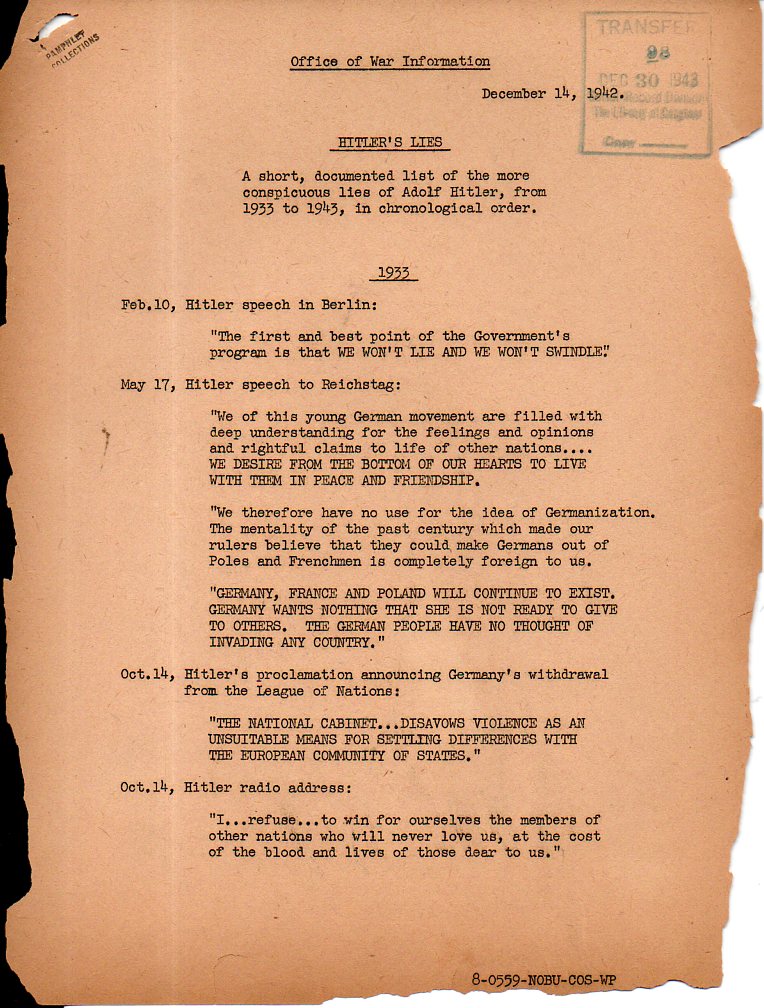
     

    Hitler's lies 1153

    ·Posted by :

    ·in:

    —

  • Propaganda Maps Showing Threats to Hitler’s Germany, 1930’s

    JF Ptak Science Books   Post 2572

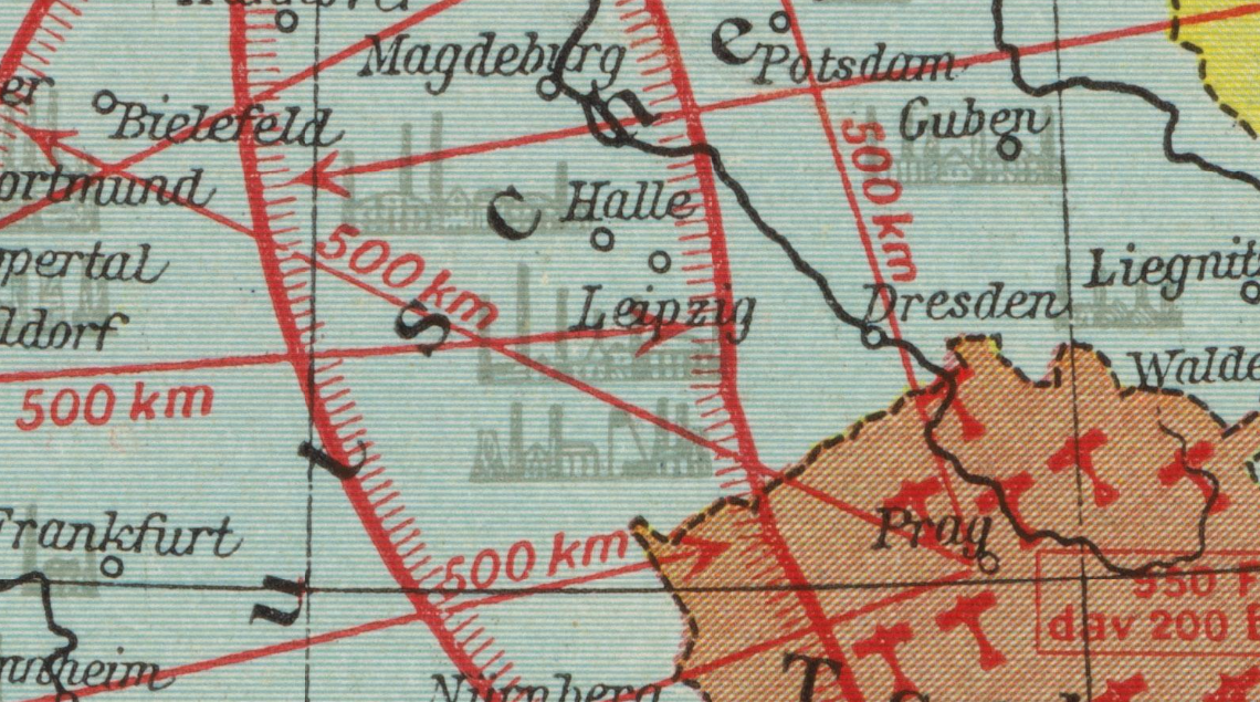
    Maps air raid 1936 detail

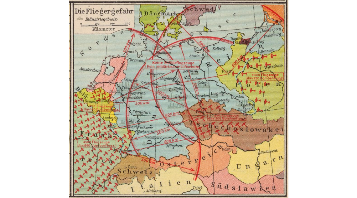
    I’ve found another example of map/propaganda display of the-threat-against-Germany in the between-the-wars period, this one published in  a very popular historical atlas by F.W. Putzger (Putzgers historischer Schul-atlas). The find comes in the fabulous “Persuasive Maps” collection of P.J. Mode (and housed and presented now at Cornell University, the source for the detail above and the originating image below) and supplements some earlier posts I’ve made to this blog on perceived and imaginary air and ground threats to Hitler’s Germany. These images no doubt gave pause to their viewers, driving home at least the need for building up “defensive” military responses to the threats posed to Germany.  In the top image the possible invaders of Germany are shown only in terms of airpower, depicting the range of the bombers and their country of origin, as well as the major cities that could be affected by such sorties.  No doubt the intent was to riddle Germany with as many red lines as possible, creating a morass of invasion and destruction possibilities, so much so that you have to look with a little discernment to see the city names under the limit lines.  It is a strong message, especially considering that in this case at least the audience was upper-level school children, and given that it appeared in an historical atlas the image was given that much more credibility and further entrenched a duck-and-cover mentality in its young viewers.  


    Maps air raid 1936

    [Image source: P.J. Mode Colelction at Cornell University, https://digital.library.cornell.edu/?page=18&q=persuasive&search_field=all_fields&utf8=%E2%9C%93&view=gallery]

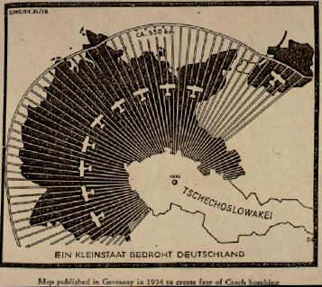
    As I said this map is a good supplement to other similar efforts that have appeared in this blog. For example, in continuing the heavy-lines-obliterating-Germany design is this earlier (1933) map showing the range of the air force of Czechoslovakia:

    [See https://historyofideasblog.com/thesciencebookstore/2010/10/nazi-propaganda-germany-surrounded-1933.html]

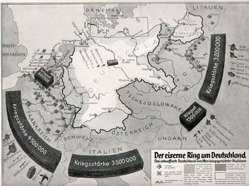
    And this fantastic effort (“The Iron Ring Around Germany”) showing the general possibilities of general attack against Germany:

    Nazi Prop surrounded538

    [See https://historyofideasblog.com/thesciencebookstore/2010/10/nazi-propaganda-germany-surrounded-1933.html]

    Nothing quite rallies people to your side as the unifying response to a perceived national threat


  • Unusual WWII Maps by a Significant Soviet Intelligence Agent

    JF Ptak Science Books  

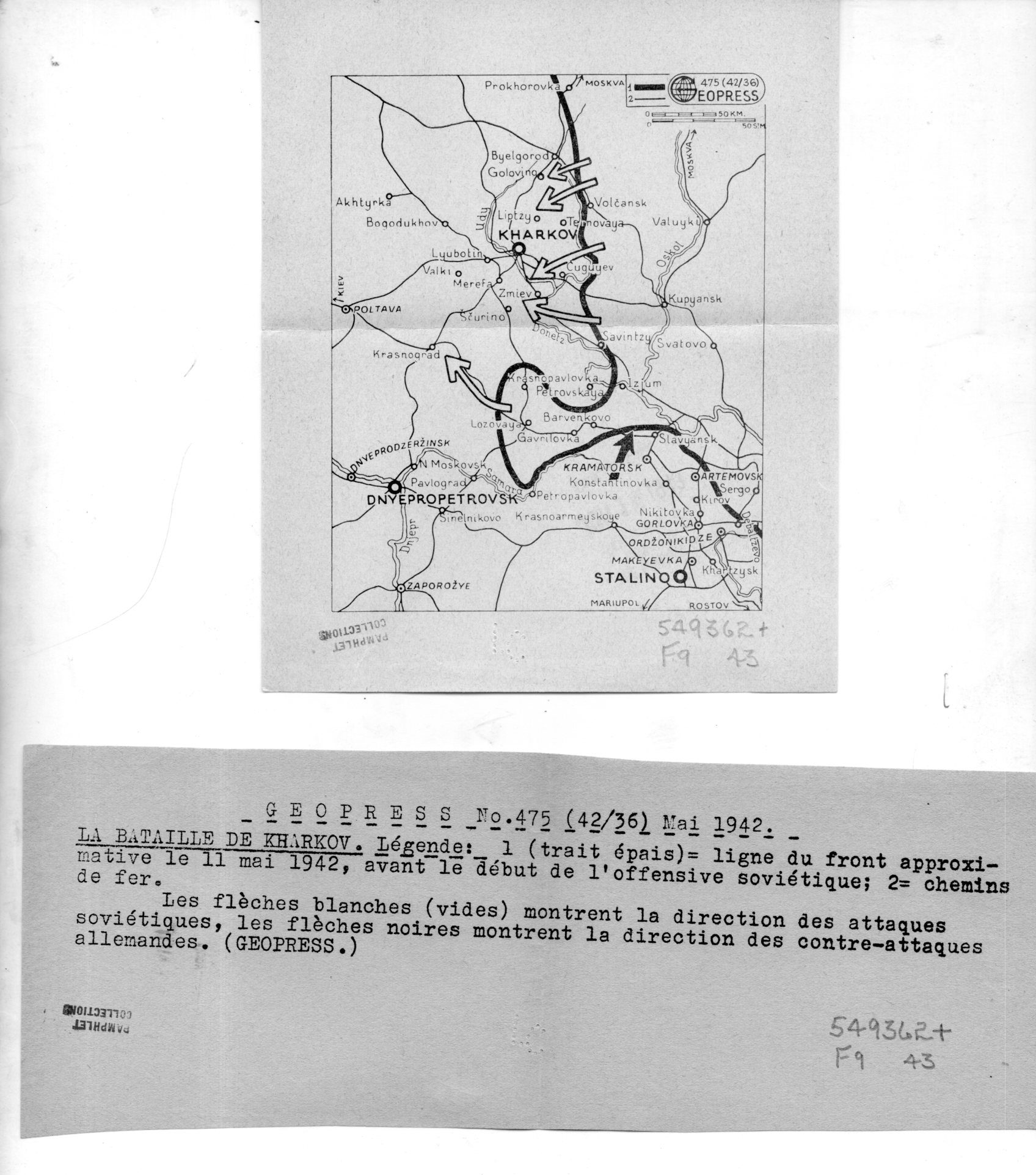
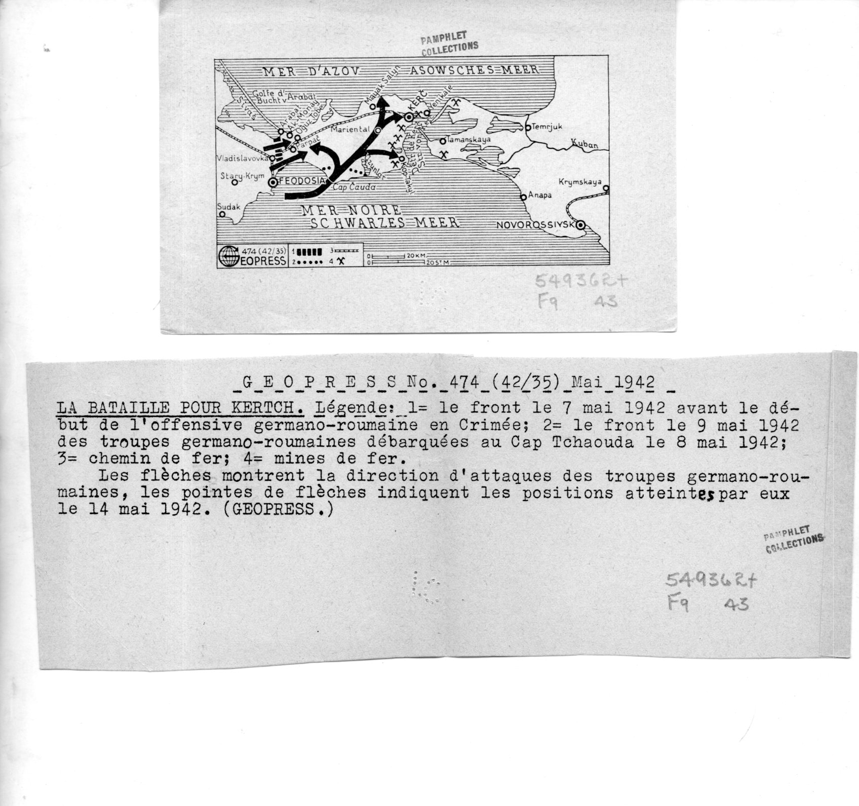
    I’ve found a number of interesting maps in the pamphlet collection here–these are highly unusual to my experience in that they were the work of a firm called “Geopress”, which was an active business and cover for a significant intelligence agent for the Soviet Union, operating in Switzerland, collecting data relating to German activities during WWII. There’s nothing I can add beyond the information that I quote extensively below from the CIA website on Rado–except that I cannot find images/examples of his Geopress work. So it seems the most efficient thing to do here is to simply quote the known sources and reproduce the images of the 18 maps and their accompanying texts.  

    Geopress _4_080

    As I said Rado operated Geopress as a news/cartographic service, and Rado was an accomplished cartographer, so the mans in and off themselves as maps are perhaps not a singular issue.  Their evident scarcity, however, does seem to be an issue. Also I do not understand why these maps are so small, some of which are just 1″x 3″; also the uneven;y cut/torn text sheets that are made to accompany the maps are also puzzling in their own way.  I do not understand the format–someone out there in Weblandia no doubt will.  

    All of the maps shown below are from 1942. They were received by the Library of Congress in June 1943 and stamped so on the backs of the maps.  (They lived for some time in the “Pamphlet Collection” at the LC before being purchased by me in 1998.)  

    The following quotes come from the CIA website, the Center for the Study of Intelligence, here:  https://www.cia.gov/library/center-for-the-study-of-intelligence/kent-csi/vol12i3/html/v12i3a05p_0001.htm]

     “Alexander (Sandor) Rado, Alexander Foote’s chief in the Swiss-based “Rote Drei” net that in 1941-43 supplied Moscow with detailed information on German order of battle… His activity in intelligence, mapping, and related fields has lasted nearly 50 years and may earn him a place in the pantheon of major intelligence figures of the times.”

    And this:

    “In 1936 or 1937, with Soviet funds and having a Swiss citizen as silent partner, Rado organized Geopress, a news agency specializing as Inpress had in maps and geographic background data. Geopress was more successful than Inpress because of better organization and the increased demand for news maps in the advancing shadows of World War II. As cover for an intelligence operation it proved ideal. Its normal activity—news collection and dissemination—provided justification for contacts with businessmen, officials, diplomats, journalists, and military leaders, some of whom became intelligence sources. It also justified a large volume of telephone and telegraph traffic, extensive postal business, and the maintenance of a courier system.”

    And so:

    “While building up his Geopress cover Rado also developed his sources, organized communications, and summarized for transmission the reports collected by his growing network. And he even found time to maintain through publications his image as an internationally known geographer.”

    And:

    “24 Feb. 1945.  During the German occupation of Hungary, (Rado) lived in Geneva where (he) published geographical maps for the Allied Governments until 1943; discovered by the GESTAPO and consequently his relatives in Hungary were murdered/ went with family to Paris in September 1944 and continued his work/summoned to Russia to report on his activities with the Free French Organization and left on 8 Jan. 1945 by special plane for Moscow/suspecting a trap, he got off the plane in Cairo where he remained/received no news from his wife in Paris and suspects that she might have been deported/he was formerly a Fellow of the Geographical Society in London, New York, Paris, Geneva, Rome and Washington, D.C.  OFFICE OF CENSORSHIP, Egypt, 11 April 1945.”

    [Again, the source for this and the above quotes:  https://www.cia.gov/library/center-for-the-study-of-intelligence/kent-csi/vol12i3/html/v12i3a05p_0001.htm]

    The maps:

    Geopress _3_079


  • The Coming Threat from the Air: Austria, 1935

    JF Ptak Science Books  Post 2582

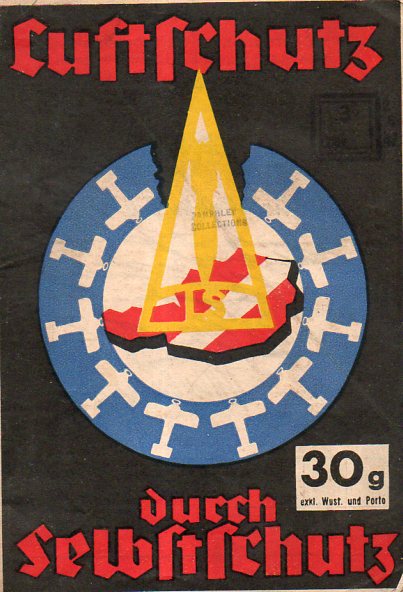
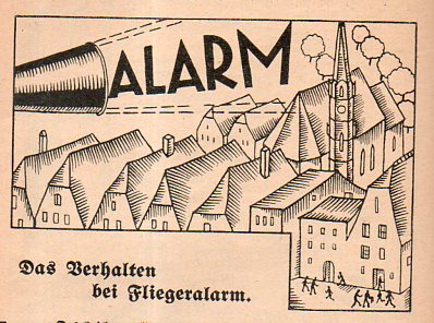
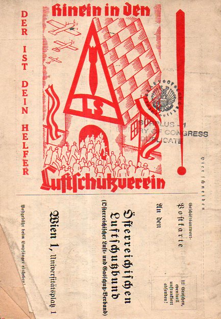
    1935 was not a particularly good year for Austria.  The country was fighting off the threat of Anschluss–the occupation of Austria by Nazi Germany–for several years, the cause hurt by the infamous assassination of the federal chancellor Englebert Dollfus in July 1934.  When this pamphlet was printed in 1935, the threat to Austria from Germany was real and advanced.  This publication, Luftschutz durch Selbstschutz (“Self Protection by Anti-Aircraft Defense” or so) addressed part of this issue. It sounds more militarily-based than it is; the story though is that the pamphlet was intended as a sort of civilian defense piece, for example, asking people to join an air defense club (“hinein in dem Luftschutverein”) for the protection of all (“Schutz fuer jedermann”) and to be general aware and prepared for the possibility of air raids.

    Austria air defenses cvr map001

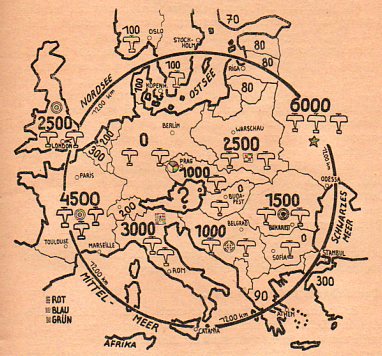
    What attracted me from the outset was the cover design which at first doesn’t actually appear to be a map, though it is–and an effective one at that.  In the middle of the circle is a red Austria with a white bar; on top of that, in yellow, is a bomb in a triangle; and surrounding Austria in a blue circle are the possible approaching/attacking/threatening air forces of its neighbors. Inside the pamphlet is another, more detailed map (below) showing the disposition of opposing air forces. It is interesting to note here that Germany is shown as having zero aircraft as dictated by the Treaty of Versailles, though it was in February of this year (1935) that the Luftwaffe was organized thus disbanding part of the treaty–at this point in 1935 the threat from Germany was not presently from the air.

    The pamphlet runs 64 pages and contains information for Austrians in preparing for aerial assault, in general: what to do when the bombs fall, how to prepare, what sort of supplies are needed to survive a sustained attack, and the like–plus ads for gas masks, survival goods, and such.  

    In the end, Germany did not bomb Austria–it disappeared as part of the Reich in March 1938 as a result of intimidation, embargo, political subterfuge, and finally the threat of war.  

    Austria air defenses cvr map003


    Austria air defenses cvr map004


    Austria air defenses cvr map002


  • Japan Attacks L.A. (and the Rest of Us) in 1937

    JF Ptak Science Books  Post 2573

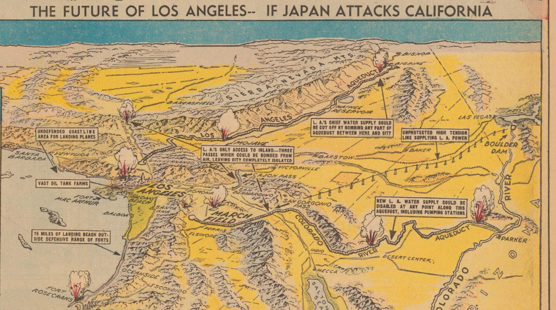
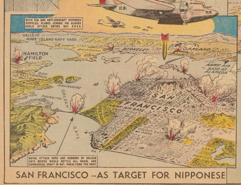
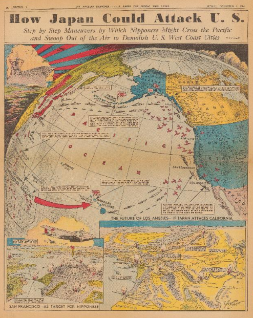
    Earlier in this blog I posted about an article that appeared in Life magazine on the various invasion/attack routes on the United States in 1941. (I believe this was the most visited of all 4000+ posts over eight years, with something on the order of 200k visits.) It came to mind while I was working my way through the P.J. Mode Persuasive Map Collection (digitized) at Cornell University and found this glorious appraisal of the possibilities of a Japanese attack on Los Angeles and the western U.S. It screamingly appeared in the Los Angeles Examiner on November 7, 1937  (p. V-8), and no doubt was meant to incite some sort of thinking in the paper’s reading population. (I don’t think it a coincidence that California is shown in yellow in the details when under attack and blue before being attacked.) Remember that the Japanese had already been mucking around in China for several years and the (Second) Sino-Japanese War was already full-on for a year by this point, so giving the possibility of Japanese imperial designs on the U.S. in 1938 is not necessarily so far out of reach.  (On the other hand many of the high command in Japan thought it a miserable and in some cases an insane idea to finally attack the U.S. in 1941, so there’s that–plus there’s the larger and more substantial issue of the incredible amount of ships and planes and support and energy that goes into manufacturing an invasion of this scope that would just be out-of-hand for Japan.) All that said, it is an interesting to see this play out in the pages of the Examiner.

    • Mapping the Invasion of America, 1942  https://historyofideasblog.com/thesciencebookstore/2009/12/mapping-the-invasion-of-america-1942.html
    • Invasion Routes to the U.S. 1940  https://historyofideasblog.com/thesciencebookstore/2011/06/invasion-of-the-us-1940.html
    • The Invasion of America, 19?? (1935) https://historyofideasblog.com/thesciencebookstore/2010/01/the-invasion-of-america-19-1935-scenario-for-invasions-via-canada-mexico-and-the-caribbean.html

    Maps Japan attacks LA detail a[Source: PJ Mode Persuasive Maps Collection, at Cornell: https://digital.library.cornell.edu/catalog/ss:3293952]

    And the vision for San Francisco:

    Maps Japan attacks San Fran
    [Source: PJ Mode Persuasive Maps Collection, at Cornell: https://digital.library.cornell.edu/catalog/ss:3293952]

    And the full page, showing the importance of the Aleutians to the general plan:

    Japan attack US[Source: PJ Mode Persuasive Maps Collection, at Cornell: https://digital.library.cornell.edu/catalog/ss:3293952]


  • On B-17s & Death–from the Other Side (Vichy France, 1943)

    JF Ptak Science Books   Post 2580

    The U.S. bombing raid on Schweinfurt–the location of a German ball bearings complex–on October 14, 1943, was the most devastating loss of life and aircraft suffered by the USAAF to that time.  In the week prior to the Schweinfurt raid there were already enormous losses, more than 90 B-27s lost in three missions.  Of the 351 B-17s that started the mission on the 14th only 228 actually made it to the target–some dropping out of formation and some being shot down–at the end of it all some 60 planes came down over Europe, 5 over England, and another 17 were damaged beyond repair. Bombs were delivered to the target, though without great success, the factory being up and running again after a few weeks. It was a disaster. 

    B-17 Schweinfurd _a_ 367 B-17 Schweinfurd _b_ 368

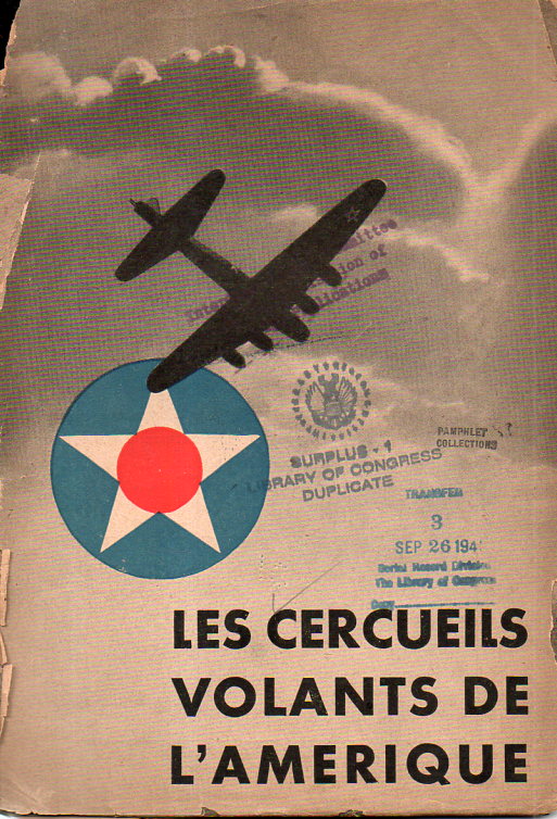
    The Nazis working no doubt through the Vichy regime in France produced a quick little pamphlet on the raid, Les Cercueils Volants de l’Amerique, a play on words, working the “Flying Fortress”  into the “Flying Coffins”.  In 1943 the Lutftwaffe was still formidable, though that would not last for much longer, the Allies gaining more-or-less uncontested control of the skies by Overlord, though with Schweinfurt (which translates to “Pig Crossing” or Pig Ford” or something along those lines) more than 300 were sent aloft.  In any event the Nazis sought to make good use of the disaster for their French readers.

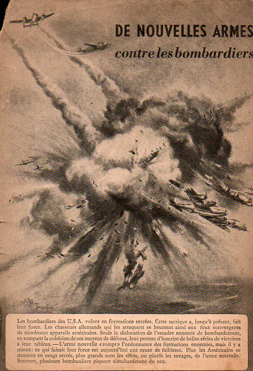
    There are a number of pictures at the centerfold depicting dead and maimed U.S. fliers, and a lot of words about how much it will take to replace the aircraft, and the crews, and the bombs that were “wasted”, and so on.  And that the German resistance to Allied bombing raids were making inroads and will eventually save the day.  They were wrong of course, what with the astonishing industrial base in the U.S., and the state of the dying Nazi war machine.  (After everything was said and done, Schweinfurt was bombed 22 times during the war, receiving something like 590,000 bombs; there seems to have been no real effect on the important production of ball bearings, and for whatever reason the German military seems not to have been in desperate need of them at any point. The town of course was decimated, and a thousand or so civilians were killed, but ball bearing production seems to have not been affected, overly.)  It is a nasty little pamphlet. [Evidently this is a rare work–only one copy is located in WorldCat, at the Bibliotheque de Documentation Internationale Contemporaine Nanterre. I should probably reproduce the whole thing right here, but some of the images are pretty disturbing…maybe I’ll do it later.]  

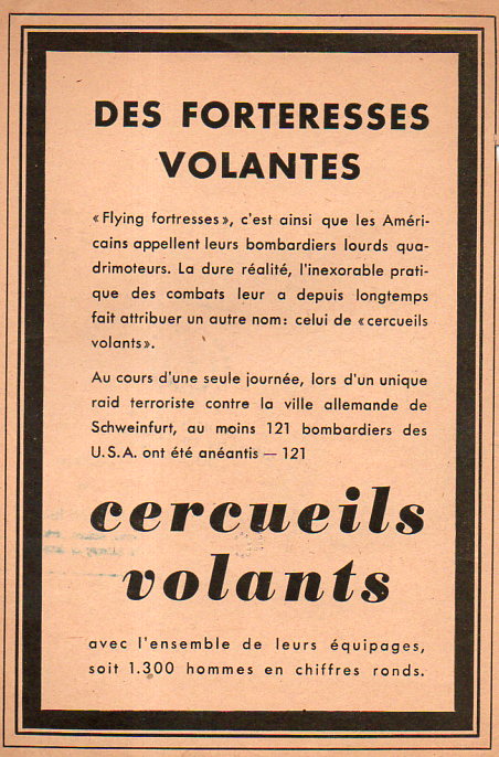
    Also: the page at upper right claims different numbers of planes shot down (121) as well as aviators killed (1300) but that is the job of propaganda. That, or they just got it wrong.  The reports from the gunners on the B-17s recorded many times the number of Luftwaffe planes shot down than actually were–this could be due to several/many gunners shooting the same plane, and so on.


    B-17 Schweinfurd _c_ 369

     Notes:

    Years ago on this blog I wrote a short piece on the bombing of Great Britain as reported in the Illustrirte Zeitung–it is worth a look. https://historyofideasblog.com/thesciencebookstore/2008/03/bombing-england.html

    Dsc04741


    ·Posted by :

    ·in:

    —

  • Nazi Propaganda and the British “Trade War”, 1940

    JF Ptak Science Books  

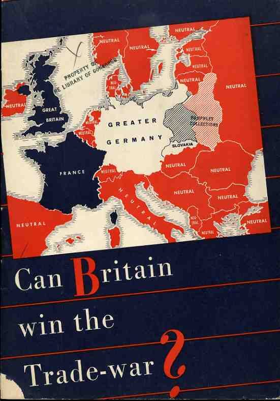
    The Nazi propaganda office published this effort (printed in August 1940) with every intent of making it seem as though it was produced in the U.K. as a sober reconsideration of fighting against the Germans, casting much of the argument in terms of economics. It was a relatively soft-sell effort in a hearts-and-minds campaign, hitting its target audience with reminders of how alone everyone on the British Isles were in the hard summer of 1940.  
                                                                   
    Nazi Propaganda Map  Can Britain win trade war


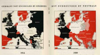
    These two maps compare the economic and trade situation of 1914 and 1939, from the Nazi perspective.  In 1914, the British, “as a preliminary condition for the success of the hunger-Blockade, only achieved, however after four years if struggle during which Britain was to sustain heavy losses”.   They announce with exclamation (!) that for 1939 there was:

    “a totally different situation! The encirclement of Germany miscarries, leaving way for the expansion of Germany, and the way for her trade with neutral countries, especially with the Balkans and Russia…thus is the blockade against Germany a hopeless enterprise”.   

    The Nazis’ state that “Britain…energetically refuses to admit the hopelessness of her winning this trade war and tenaciously grasps upon all kinds of unfounded rumours…”, all the while refusing to discus the bombing of Britain or any other aspect of military war

    Blogaugust_26_nazi_prop_2_map450                                                                                                                                                           

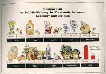
    After a dozen pages of making the case against the British position in being able to take care of itself, there is this folding quantitative display, making a diametrical-pictorial presentation of the British failings.  The Nazis show that they overpower the British in the ability to supply itself with grain, flour, meat, cooking fat, cheese, eggs, sugar and vegetables–in every area, in fact, except for fish. 

    Blogaugust_26_nazi_prop_food454

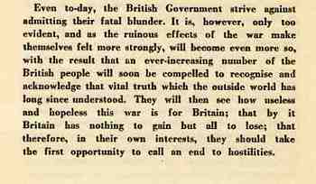
    This is the summation of the pamphlet, the last paragraph, asking the Brits to just give it up and quit their fight. 

    Blogaugust_26_nazi_prop_text452


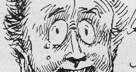
  • FDR’s Crazy Commie Eyes of 1944(!)

    JF Ptak Science Books   Quick Post

    Fdr crazy eyes212

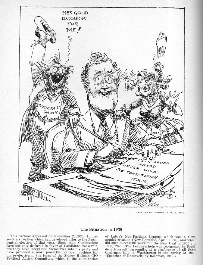
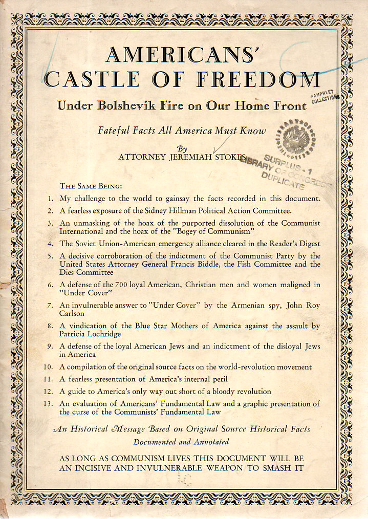
    Nothing quite says crazy like crazy eyes, and the best sort of crazy eyes are Commie.  At least that is what we are led to believe in (“Attorney”) Jeremiah Stokes’ identity-romp through Democratic politics in his enormously-titled  America’s Castle of Freedom under Bolshevik Fire on Our Home Front Fateful Facts All Americans Must Know…

    Fdr crazy eyes211

    In what may be the first time I have seen someone identify themselves as an attorney in nearly 40 years of hard reading by putting the word in front of their name on the title page, Mr. Stokes fills up the title on the front of his pamphlet with 13 additional points. There are points in this slippery-mortared wall of protection that are salient; on the other hand there’s a lot of Commies-in-the-pink-sheets stuff too–particularly his indictment of President Roosevelt as a Communist agent.  

    There are other pamphlets here that also make this claim–of Roosevelt’s constitution-crushing pagan Communism–but none I think are accompanied by the ad hominem assault giving him those crazy Commie eyes.  

    Fdr crazy eyes213

    Here’s the surprise: I thought that this publication would have been published in 1936/7 or thereabouts, but it actually came out in 1944, deep into Mr. Roosevelt’s superior presidency and nearly at the end of a war in which he played a broad part in winning. Mr. Stokes had some old scores to settle with the Democrats, and he used a very broad brush on a very small canvas.  People were very concerned about the Soviet Union in 1944, even as it had just emerged a year before from the meat-grinder assault by Germany.  Mr. Stokes was getting his readers ready for what was ahead, and for the Communist infiltrators that were already at home. While Stokes (from Salt Lake City, 1877-1954) could be considered far-right politically,  he late in life married Elizabeth Dilling, a propagandist of means who was far-right to his far-rightism.  

    ·Posted by :

    ·in:


  • When a “War” with 25 Million Dead is an “Incident” (1938)

    JF Ptak Science Books   Quick Post

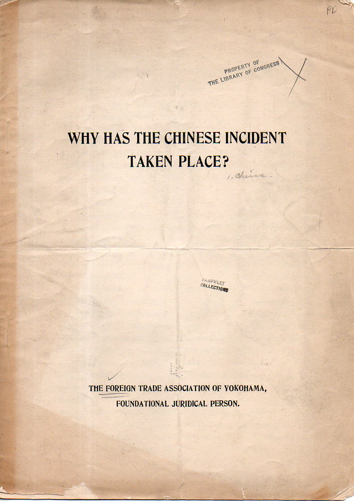
    Why Has the Chinese Incident Taken Place?  published by the Foreign Trade Association of Yokohama, “Foundational Juridicial Person”, 1938. is is an extreme appeasement in extremis for the Japanese invasion of China. This hearts/minds campaign begins with the very title, which calls the Japanese war against China (already a year underway) an “incident”.

    If an “incident” it was then a very deadly one–actually, it was probably the most deadly one in the history of civilization. Fought from 1938-1945, this war (the Second Sino-Japanese War) cost China more than 3,000,000 soldiers killed and wounded–and then the astonishing numbers of something on the order of 20 million civilians killed.  (Japanese lost about 2.2 million soldiers killed and wounded.)

    The main thrust of the argument is that “greedy” Chinese politicians have constructed an “imaginary” enemy in Japan in order to unify their country. And then it goes downhill from there.  The Japanese among other things was “endeavoring to develop China in various branches of civilization and economic industries, thereby extending the bounty f modern civilization to the masses”.  Them there is the “fighting Communism part that comes into play in the next very long paragraph. 

    Chinese Incident171

     This is a formidable example of the Big Lie, introduced to modern social demagogues on a wide scale by Adolf Hitler in Mein Kampf (telling a lie enormous enough and often enough so that the popular thinking interprets it as a truth because nothing so incredible and far-fetched a lie could be told and be expected to be believable). 

    ·Posted by :

    ·in:


  • Houghton Miflin Suing on Behalf of Hitler and “Mein Kampf” (1939)

    JF Ptak Science Books   Post 2469

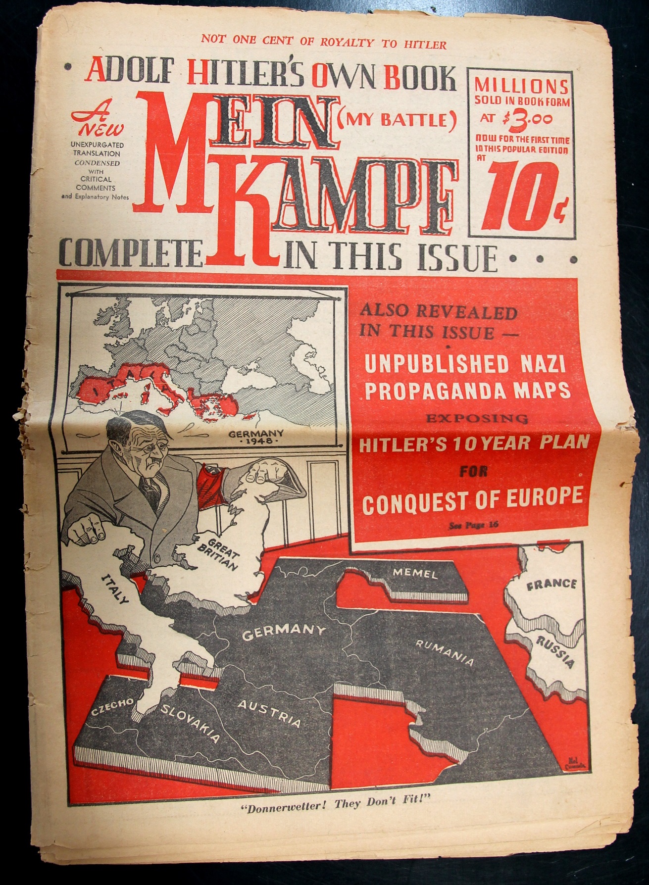
    Mein kampf full

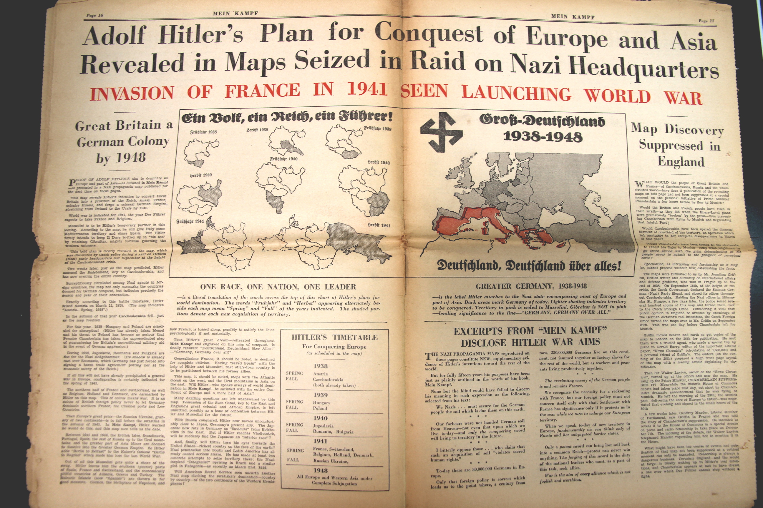
    This “critical” edition of Hitler’s Mein Kampf was published in a 32-page tabloid format, editing in the choice bits, and adding critical commentary and interpretation, whittling Hitler’s 270,000 words down to 70,000, and including sections that were evidently heinous and omitted from other English versions.

    Noram Publishing Company of Greenwich, Connecticut, loudly proclaims “Not One Cent to Hitler” so far as royalties go (and make no mistake he did make a fair amount of money on the book outside of Germany, while making a lot inside Germany). Any profits were to go the refugees of Hitler’s Germany. 

    Interestingly Noram Publishing Company was the creation of journalist and future Senator Alan Cranston and a business associate, Amster Spiro (city editor of William Randolph Hearst’s New York Journal-American). 

    • An interesting account of Cranston’s involvement is in this article by attorney John Aquino. Also see here for an article in the Los Angles Times.

    The problem was that Mein Kampf  was already published in full form in the U.S. by Houghton Miflin (among others), and Noram’s shortcut was interfering with their business. And so Houghton Miflin successfully sued Noram1, forcing the company to destroy the 500,000 copies of their tabloid that hadn’t yet sold (about half of the print run to that point). 

    On the other hand Cranston and Spiro did reach at least a half-million people with their version, which importantly discusses the concept of the Big Lie, with “The Only Lie Worth Telling is the Colossal One”.

    Mein kampf maps

    Notes

    1.  “Houghton Mifflin Co. v. Noram Pub. Co., 28 F. Supp. 676 (S.D.N.Y 1939).U.S. District Court for the Southern District of New York – 28 F. Supp. 676 (S.D.N.Y 1939)
    July 14, 1939

    District Court, S. D. New York.

    July 14, 1939.

    28 F. Supp. 676 (1939)

    HOUGHTON MIFFLIN CO.
    v.
    NORAM PUB. CO., Inc., et al.

    *677 Hines, Rearick, Dorr & Hammond, of New York City (Archie O. Dawson and John D. Mooney, both of New York City, of counsel), for plaintiff.

    Hoguet, Neary & Campbell, of New York City (Walter H. Free, of New York City, of counsel), for defendants.

    CONGER, District Judge.

    This is a motion for a temporary injunction to restrain infringement of the copyright which the plaintiff claims to have of the book “Mein Kampf” (author, Adolf Hitler).”

    ·Posted by :

    ·in:

    —