A Daily History of Holes, Dots, Lines, Science, History, Math, Physics, Art, the Unintentional Absurd, Architecture, Maps, Data Visualization, Blank and Missing Things, and so on. |1.6 million words, 7500 images, 4.9 million hits| Press & appearances in The Times, Le Figaro, Mensa, The Economist, The Guardian, Discovery News, Slate, Le Monde, Sci American Blogs, Le Pont, and many other places… 5000+ total posts since 2008.

Category: Uncategorized

  • A Good Appreciation of Thomas Huxley by Ernst Haeckel

    JF Ptak Science Books   Quick Post

    I found this fine appreciation of one great naturalist (Ernst Haeckel, 1834-1919) on the career and work of a great biologist and educator (Thomas Henry Huxley, 1825-1895) in the February 1874 issue of Nature.  [Ernst Haeckel, “Scientific Worthies II–Thomas Henry Huxley”, in Nature, February 5, 1874, pp 257-258, four very-compact columns.]  Huxley was first-class and was perhaps the major defender and exponent of Charles Darwin (earning him the well-known nickname of “Darwin’s Bulldog”)–in a sense, Haeckel was a German equivalent of the Huxley/Darwin relationship, along with being an embryologist, physician, philosopher, biologist, and a great and demanding scientific illustrator. The article is a quick and interesting read, and is reproduced in full, below.  

    Huxley623

    ·Posted by :

    ·in:


  • Maps of Hamlet, Moles, Hair, Hobolands, and Nothing

    JF Ptak Science Books  Post 2252

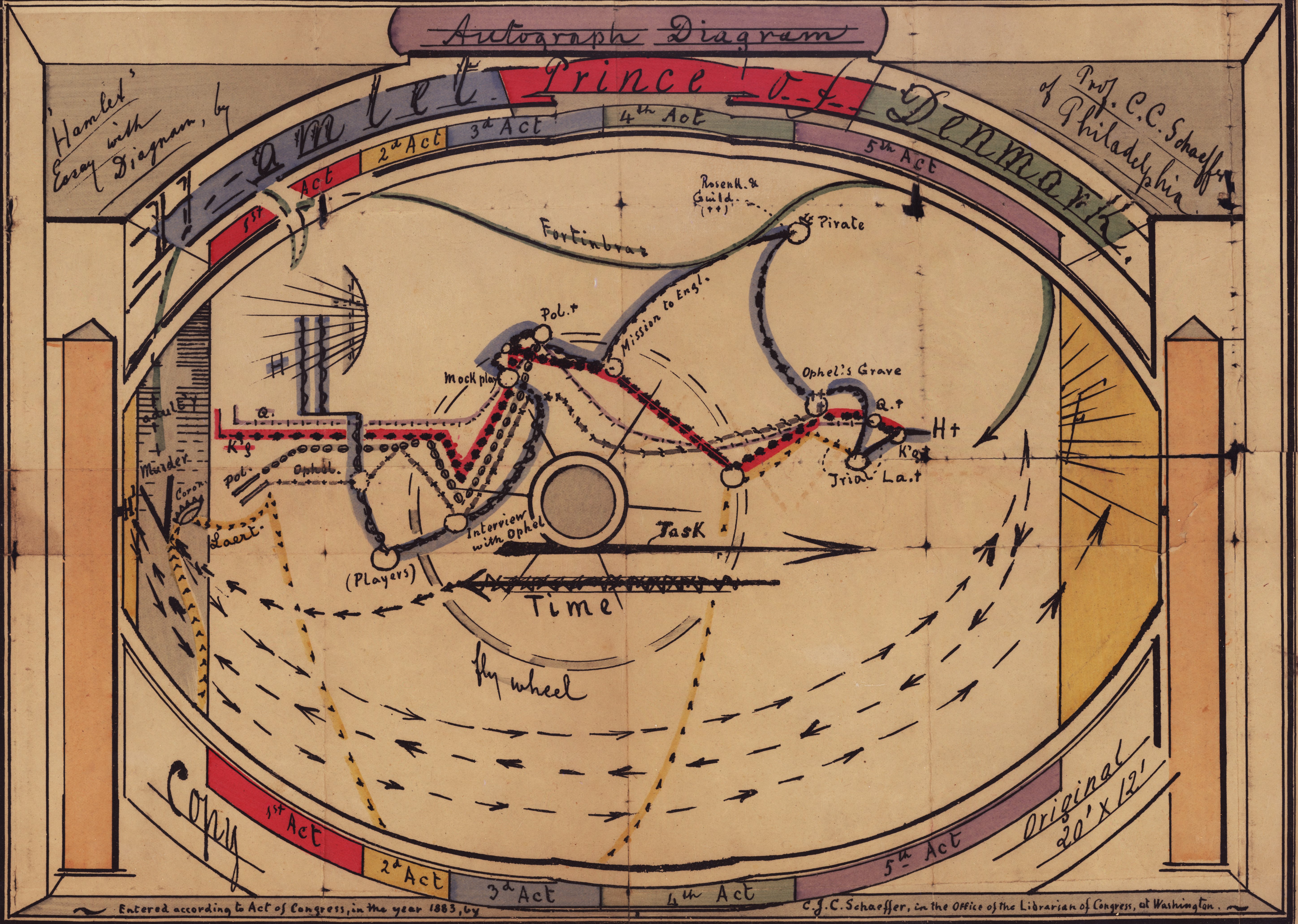
    There are a number of posts on this blog relating to maps of unusual, odd, and non-existent places (see for example Maps of Imaginary Places III, here,  and On Missing Antique Atlases of Imaginary Places and the Sameness of Alien Math and Music: Huygens’ 1698 ETs, here) so this lovely map of the action in Hamlet came as an unexpected and welcome addition.  
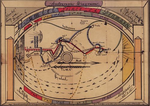
    Hamlet stage direction

    [“Autograph diagram: Hamlet Prince of Denmark, 30x47cm, stage sets and scenery.” Source: http://www.library.upenn.edu/collections/rbm/photos/]

    It makes sense of course to chart the action in a play, but I think that I’ve never seen one that was of some age…and to see this plotting the advances and retreats of Gertrude, Hamlet, Laertes, Ophelia, Polonius, Fortinbras, Claudius, King of Denmark, Rosencrantz, and Guildenstern and to see them all at once made everything more comfortable, and confusing.  Perhaps that is the great quieter of maps and diagrams of imaginary places, adding another layer of mystery by making the nonexistent more complex.  

    The greatest map of nothing must be from Lewis Carroll’s The Hunting of the Snark, an Agony in Eight Fits, and occurs in the Bellman’s tale, starting the second fit. It begins:

    The Bellman himself they all praised to the skies-
    Such a carriage, such ease and such grace!
    Such solemnity too! One could see he was wise,
    The moment one look in his face!

    He had bought a large map representing the sea,
    Without the least vestige of land:
    And the crew were much pleased when the found it to be
    A map they could all understand.

    “What’s the good of Mercator’s North Poles and Equators,
    Tropics, Zones, and Meridian Lines?”
    So the Bellman would cry: and the crew would reply,
    “They are merely conventional signs!

    “Other maps are such shapes, with their islands and capes!
    But we’ve got our brave Captain to thank”
    (So the crew would protest) “that he’s bought us the best-
    A perfect and absolute blank!”
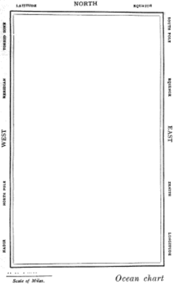
    Snarkmap

    Sometimes there is nothing so fine as something that beautifully illustrates the nothing that isn’t there, and this lovely map, unencumbered of all of the elements and details that define the mapness of something,  perfectly explains the origin of its need.

    Another great and perhaps probably not-imaginary map is the wonderful hair growth/directional map that was the creation of Dr. Walter Kidd (Fellow of the Zoological Society, London) and his attempt to reconcile the the influences of gravity, inheritance, genetics, Weismannianism, and other assorted biological bits via his study of hair growth patterns.  The article appears in the (many) pages of the Scientific American Supplement for 13 September 1902, on page 22, 328. 
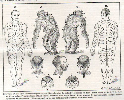
    Hair map contract086
     
     
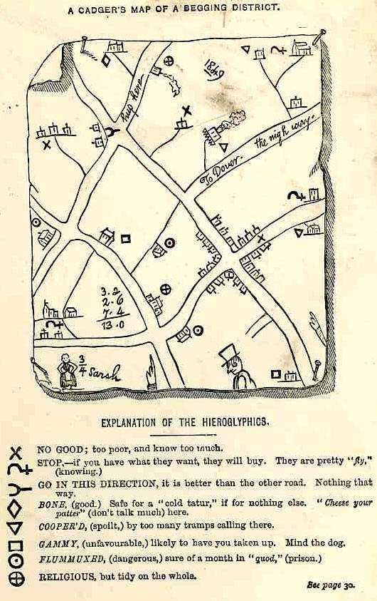
    And as much as Kidd’s map was one of tracing impossible connections of hope in a hairy back, the “Cadger’s Map” from the land of Hobos hopes to thread out a decent pass-through experience for the People With Nothing to try and get a little something.  
     
    Map Hobo
     
    [Source:  John Hotten, The Slang Dictionary, Etymological, Historical, and Anecdotal, 1874; full text available here.]

    The symbols are explained in the book on page 38:  

    “Another use is also made of hieroglyphs. Charts of successful begging neighbourhoods are rudely drawn, and symbolical signs attached to each house to show whether benevolent or adverse“In many cases there is over the kitchen mantelpiece”[30] of a tramps’ lodging-house “a map of the district, dotted here and there with memorandums of failure or success.” A correct facsimile of one of these singular maps is given in this book. It was obtained from the patterers and tramps who supplied a great many words for this work, and who were employed by the original publisher in collecting Old Ballads, Christmas Carols, Dying Speeches, and Last Lamentations, as materials for a History of Popular Literature. The reader will, no doubt, be amused with the drawing. The locality depicted is near Maidstone, in Kent; and it was probably sketched by a wandering Screever in payment for a night’s lodging. The English practice of marking everything, and scratching names on public property, extends itself to the tribe of vagabonds. On the map, as may be seen in the left-hand corner, some Traveller has drawn a favourite or noted female, singularly nicknamed Three-quarter Sarah. What were the peculiar accomplishments of this lady to demand so uncommon a name, the reader will be at a loss to discover; but a patterer says it probably refers to a shuffling dance of that name, common in tramps’ lodging-houses, and in which “¾ Sarah” may have been a proficient. Above her, three beggars or hawkers have reckoned their day’s earnings, amounting to 13s., and on the right a tolerably correct sketch of a low hawker, or cadger, is drawn. “To Dover, the nigh way,” is the exact phraseology; and “hup here,” a fair specimen of the self-acquired education of the draughtsman. No key or explanation to the hieroglyphs was given in the original, because it would have been superfluous, when every inmate of the lodging-house knew the marks from his cradle—or rather his mother’s back.”

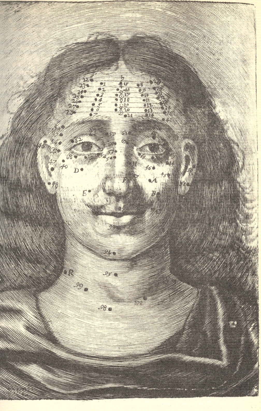
     This all leads somehow to this impossible quest of Richard Saunders, who sought spiritual/biblical/cosmo-comographical spiritualness connecting the dots and creating lined matrices in human mole placement: 

    I’ve written a bit about this in 2009 in this blog, here. It seems to me that in all the maps of something-that-is-nothing, Saunders’ efforts may be at teh top or bottom of that heap.  
    ·Posted by :

    ·in:


  • A Memory of a Hard-to-Break Bottle of Australian Wine, 1906-1918

    JF Ptak Science Books   Quick Post

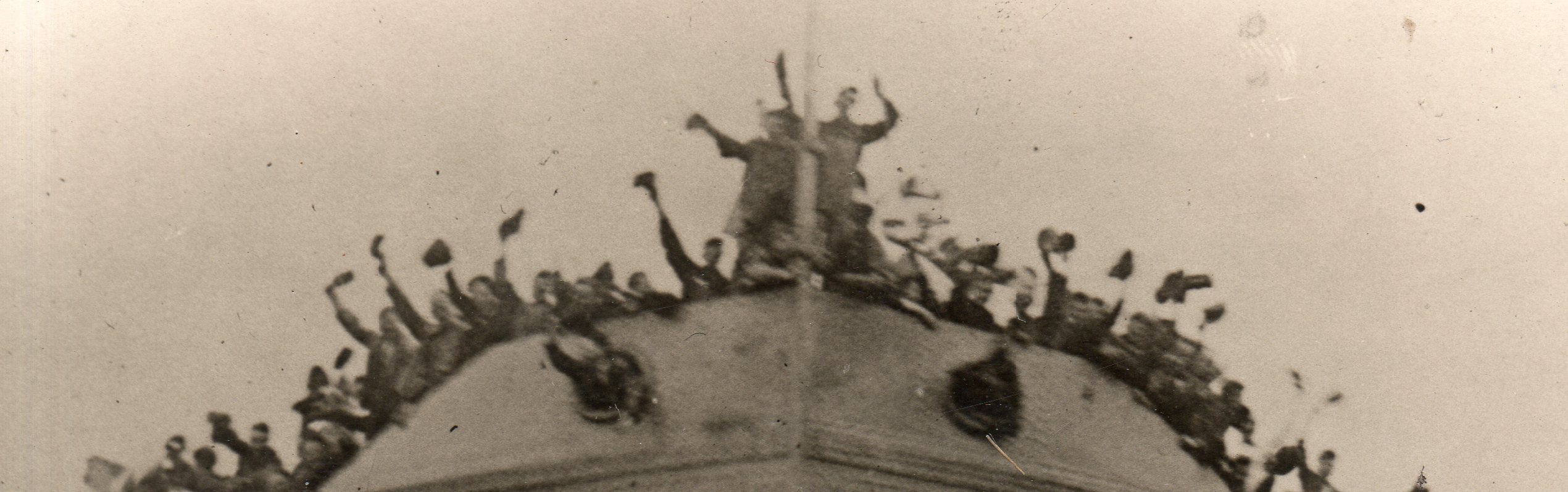
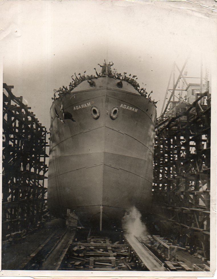
    WWI Photo--ship launch128[A detail from:]

    WWI Photo--ship launch127

    This great photograph was made in 1918 and stamped on the reverse “Photo by Central News Photo Service” of NYC. It shows the launching of the U.S.S. Agawam, the first standardized ship launched by the U.S. Navy (according to a New York Times article for May 3, 1918, (“FIRST FABRICATED SHIP; The Agawam, Forerunner of Standardized Fleet, to be Launched Today”).  [This image is actually available for purchase via the World War I Photography section of this blog, here.]

    The image reminds me in a way of the launching of the Dreadnought, which in some ways was another beginning of WWI, or at least of the naval race right before the war and of the competition for naval superiority between the Germany and England.  And I remember how King Edward VII, rickety with illness, climbed the stairs to deliver his speech, and to break open the bottle of Australian wine against the Dreadnought‘s bow. Except that the bottle didn’t break on the first attempt–a somewhat forbidding element, except that it was her bow that Dreadnought used to sink a German sub.  The ship revolutionized naval technology and Germany played catch-up to it (and in effect an entire new class of battleship) right to the beginning of the war.  Less than 15 years later, the Dreadnought was sold for scrap.  

    ·Posted by :

    ·in:


  • Books as War Loot, 1918

    JF Ptak Science Books   Quick Post

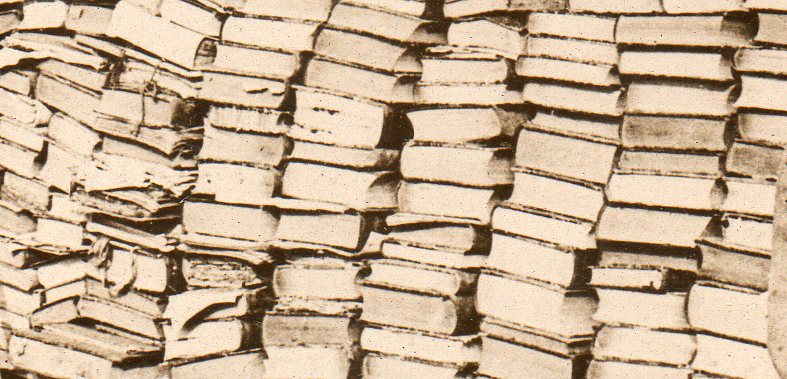
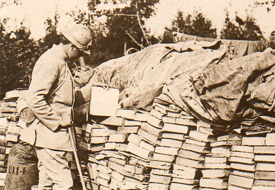
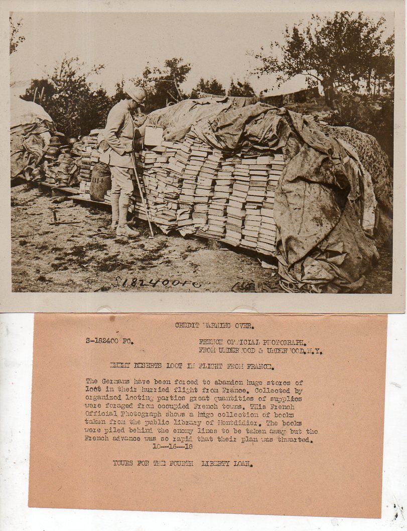
    In the vast caches of loot taken during the course of war I suspect books have ranked somewhere in the middle of stolen stuff–no doubt some fine libraries have disappeared, though I can’t offhand say how many fine libraries emerged from the slaughterhouse.  This photograph–a wartime news photo service image–is one of the few that I have seen depicting the capture of stolen books.

    WWI photos--looted books113

    [A deep detail, followed by a more moderate detail]

    WWI photos--looted books112

    And the full image, along with the news photo service prepared description of the image:

    WWI photos--looted books111

    ·Posted by :

    ·in:


  • The Correct Tools for the Job: Making Crime Pay But Not Really, 1893

    JF Ptak Science Books  

    As long as there is something worth stealing it is probably the case with the human race that what that something is won’t be, and will be stolen.  This has been the case forever, and as vigilant as an owner of property might be–whether that bit that stood for labor exchange units was a cow or land or gold or money itself–there will be someone else out there in the anti-vigilant world tempting fate and chance and skill at taking someone else’s belongings away.  

    We have a little window that has opened to reveal a piece of that world–an unusual one, for the 19th century, anyway.  That is what I saw when breezing through the memoirs of George Washington Wallace (1823-1891), Recollections of a Chief of Police, which was published in 1887. Wallace was police chief of NYC, making him THE police chief (sorry, Chicago), and he had some pretty good recollections to recollect. (Which is a good thing he recorded this book when he did, because he would be deads four years later.) 

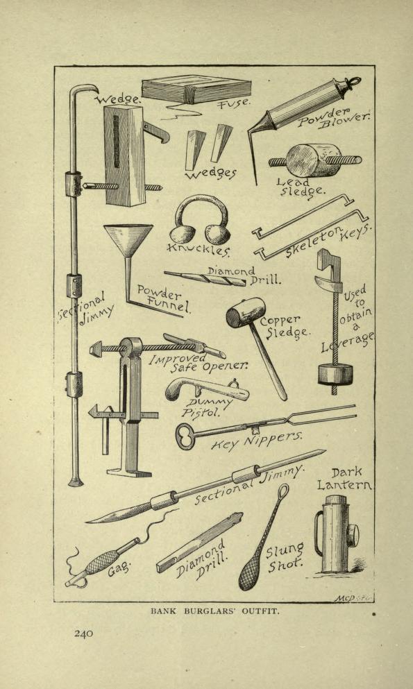
    But as I said, the image that stopped me was the one shown below, displaying the tools criminals would use to creak/creep their way into someone else’s life.  

    Burglar tools

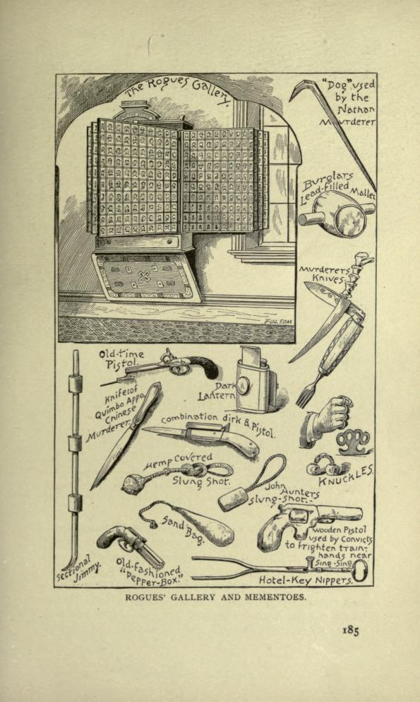
    And this:

    Burglar stuff-- rogues gallery

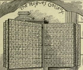
    And the interesting bit inside the interesting bit?  The wall-mounted collection of mugshots:

    Burglar stuff-- rogues gallery det


    ·Posted by :

    ·in:


  • Camouflaged Manhattan–a Map of Nationalities, 1895

    JF Ptak Science Books    Post 1343–expanded

    Frederick Erastus Pierce (1878-1935), is the creator of  The Tenement-House Committee Maps, with two maps on one sheet, showing the densities of Manhattan populations (on top) and the distribution of nationalities (at bottom) which was published in Harper’s Weekly for 1895.1 

    And a detail:

    Manhattan nationalities110

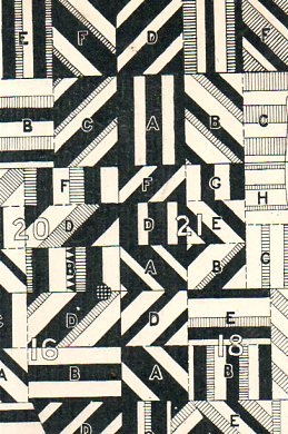
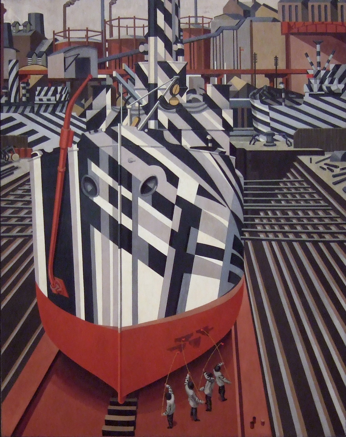
    The distribution of nationalities exhibited in this half-crazy quilt of varying blocks and densities reminds me a lot of the “razzle dazzle” camouflage used in WWI, as seen here:

    http://upload.wikimedia.org/wikipedia/commons/3/3d/SS_Empress_of_Russia_1918_cropped.jpg

    actually appiled on a ship, as well as this interesting artistic representation of the practice by Edward Wadsworth, Painting of Dazzle-ships in Drydock, 1919:

    File:Dazzle-ships in Drydock at Liverpool.jpg

    This sort of display of information has been around for quite a while–perhaps no example mor edistinctive than that found in the U.S. Census volumes for the 1880 census, a small detail of a chart showing the rise and fall of the populations of American states and territories over ten censuses (see an earlier post on this blog regarding this census atlas):

    Blogaugust_24_statesd_detail442_2


    [Please note–the images I’ve used for the post here–save for the details ahown above–are those for the copy at the Library of Congress.  My copy is actually a little nicer than these; I’ve used the LC images because the  map is just too big for the scanner.] 

    Text on verso:

    There’s a significant amount of crowded, complex information exhibited here, some somewhat more successfully than others.  The population density map is pretty straightforward.  The distribution of nationalities, however, is another story–there are eleven groups followed here, each given a bit of a confusing flavor, given that the representations are done in black-and-white.  Its difficult data to present, especially considering that the groups shown could vary block-to-block, and that the population of Manhattan at the 1890 showed 76% with foreign-born mothers and 40+% of the city foreign-born themselves.  (It should be noted that only the groups with 2/3 of the base of any particular zone has bene plotted.)

    Detail of bottom map:

    Much of this population–a good chunk of the city’s 1.9 million people–were housed in tenements, a pre-high-rise pre-elevator version of the highrise.  They were six or seven story walk-up buildings that were narrow (usually about 25-35 wide) and long (100-125+ as an average). There were 10-14 rooms per floor, and were generally packed with families.  A massive expose on the tenement house was photographically depicted in “The Tenement House Exhibition of 1899”, the un-pretty picture described below by Lawrence Veiller in Charities Review   in 1901: 

    “It has shown, step by step, the different changes that have taken place in New York tenement houses, and by means of 1,000 photographs has illustrated nearly all the evils of the present tenement-house system. Special emphasis has been laid upon the terrible evils of the dark, unventilated airshafts, which are the chief characteristic of the present type of buildings. There are over forty-four thousand tenement houses in the boroughs of Manhattan and the Bronx, and in the year 1899 about two thousand new tenement houses were erected. These, as a rule, are built on lots twenty-five feet wide by one hundred feet deep, and are planned to accommodate four families on a floor. The buildings are six or seven stories high, and each floor generally contains fourteen different rooms.”

    “Only four of these rooms on each floor have direct light and air from the street or the small yard. The other ten open on a narrow “air-shaft,”which is a well hole closed at both ends, seldom more than five feet wide, when between two buildings, and often only two feet six inches wide, varying in length from forty to sixty feet, and being generally from sixty to seventy-two feet high.”

    “The first of the accompanying illustrations represent a typical airshaft. As usual, it is closed at both ends. It is two feet ten inches wide, forty-eight feet long, and seventy-two feet high. Forty-two windows open upon it, the sole source of light and air to the rooms. Rents in this building run from$10 a month for three rooms to $17 for four rooms. The baby’s bathtub is hung out of the window because the rooms are so small that there is no place to keep it inside. The shaft is only a little wider than the tub.”–Charities Review, 10 (1900-1901), 19-25.

    Mr. Pierce did a commendable job in exhibiting some difficult quantitative stats in a fairly restrictive medium. 

    Notes:

    1.  The map sections are entitled: No. 1. Map of City of New York showing densities of population in the several sanitary districts, June 1, 1894 . And No. 2. Map of City of New York showing the distribution of Principal nationalities by sanitary districts.  On verso: text, two smaller maps “Map of the of City of New York”, showing density of population by wards, and then an unrelated but interesting  A bird’s-eye view of the Cotton States and International Exposition, Atlanta, Georgia; image of C.A. Collier, President and Director-General of the International Cotton State Exposition.  2 maps : on 1 sheet ; 14 x 48 cm. and 17 x 48 cm.

    ·Posted by :

    ·in:


  • WWI Ads–Gallipoli Coal Tar Soap, 1915 (?)

    JF Ptak Science Books    Quick Post

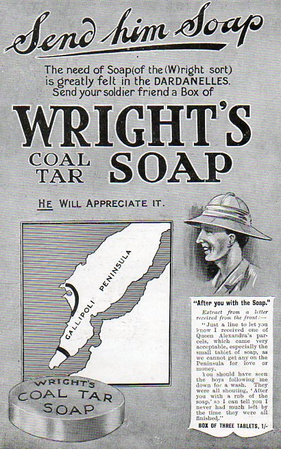
    These ads are interesting and take a bite, both ways.  For example, the first–for Wright’s Coal Tar Soap–uses the background of the enormous struggle in Gallipoli to sell itself.  The ad appears in the 9 October 1915 issue of The Illustrated London News, and stresses the fact that the troops were badly in need of, well, soap, among other things, not the least of which was forward motion, or victory.  

    WWI--e---galipolli640 

    But the fact of the matter is that this relatively cheery image of the actions at Gallipoli looks entirely misplaced, especially at this point in the campaign when things were going badly.  The battle took place at Gallipoli peninsula in Turkey from 25 April 1915 to 9 January 1916, and the conditions were deplorable: massive heat, rotting corpses, poor sanitation, dysentery, flooding and then frostbite and bitter cold in the winter–that, plus the killing part, with 392,338 killed and wounded on both sides of this one campaign.  There’s much more to this campaign, of course–especially for my New Zealand and Australian friends–but this is not the place for it.   I was just taken by the spectacularly mundaneness of this ad for selling soap on the back of a terrible campaign, and an eventual disaster for the Allied forces. 

    ·Posted by :

    ·in:


  • On the Continued Rediscovery of the Horizontal Pendulum

    JF Ptak Science Books   Quick Post    

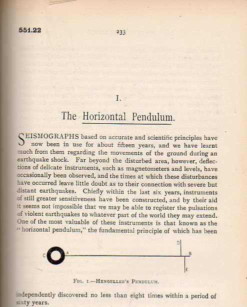
    I found this lovely little article in the not-terribly-common Natural Science for April 1896 while looking for an article on the nearly still brand-new discovery of X-rays. “Natural Science” was really more like natural philosophy than the biological stuff, as a quick breeze through any of its volumes shows, though there is plenty of high-Victorian interest in all aspects of living sciences found here. What was so interesting about the horizontal pendulum was how the author (C.Davison of “King Edward’s High School, Birmingham”) traced down its history of having been independently discovered (and forgotten) “no less than eight times within a period of sixty years”. As with other inventions that were “in the air” (like the telephone, and the electric telegraph, and the television, and so on, where a number of people were working independently at the same time) the horizontal pendulum was that too–except that the process of discovery continued for quite a long time.  

    Pendulum096

    I don’t mean to go into this at all–I just liked the wonderful research and presentation in this little five-page article.  And for anyone who cares, C. Daivson’s (not C. Davisson as in Daivsson and Germer) references are included below.

    ·Posted by :

    ·in:


  • Early Bibliography for the History of Relativity, 1921

    JF Ptak Science Books     Reference Tools series

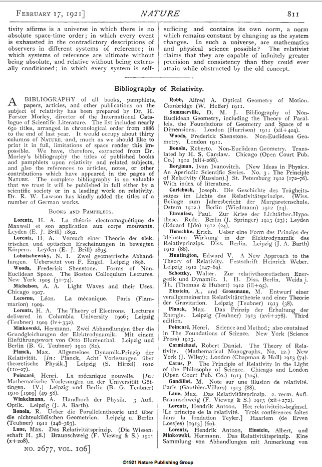
    This is a very unexpected find in the journal Nature for 1921–a selection from a bibliography by Forster Morley for early works in relativity, in this case limiting the number of selections from the full 650 Morley numbers to only those that appeared in some way in Nature.  Truncated or not, it is an interesting and early read in the area.  

    Relativity Nature Bibliog 1

    ·Posted by :

    ·in:


  • The Smell and Cheapness of Communist Dreams, 1942

    JF Ptak Science Books Post 2243

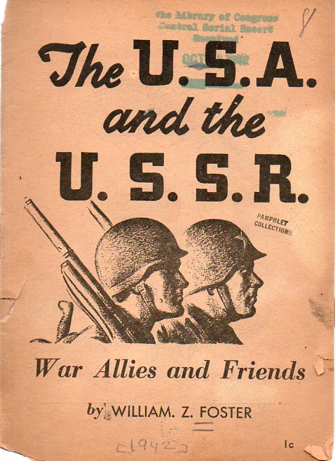
      Foster082

    William Z. Foster. Great name, interesting history, but also Joe Stalin supporter of high order who ran for president of the U.S. in ’32 as a Communist (and got 100K votes). Foster does have organizational chops, working for unions and union organizing for several decades. In the mid-1920’s and beyond he was interested in the Soviet Union and Communism, and published many small works of wonder, many of which had interest cover illustrations, pushing the penny publication.

    Many of these publications also had that particular feel of cheapness to them, as well, as with the pamphlet I’m sharing above. They feel cheap because they were cheaply printed, written bits made to be whispers into any listener’s ear, and then dissolve after the need was perhaps filled and perhaps not.  They turned brittle after just a little while, and nowadays just crumble into flaking slivers of bad paper that suck the moisture right out of your fingers.  

    This hopeful pamphlet addressed the very tenuous amity between the United States and its mew-ish ally, the Soviet Union. This was printed in 1942, a third of the way through the Nazi invasion of the Soviet Union, an operation that caused the deaths of about 5 million Soviet soldiers and dozens of millions of civilians. Of course the Soviets weren’t always on the side to the U.S. And the Allies, far from it. 23 August 1939 is when Stalin signed the Non-Aggression Pact with Hitler (the Ribbentrop-Molotov Pact) , foreign up Hitler to move against Poland, which is did on the first of September. On the third the British declared war on Germany, and on the 17th The Soviets rolled into the eastern part of Poland, taking what it wanted, as per the agreement in divide and conquer.

    The honeymoon between the two states wasn’t to last long, because Hitler could not stand the Russians, who he felt were an inferior, servile people, holding much-needed natural resources for the Reich, deserving death or slavery. And so on 22 June 1941, the agreement was annulled when the Nazis undertook a full-out-mega-frontal attack on the Soviet Union called Operation Barbarossa. It was a massive campaign, and the Soviet Union reacted slowly to it, given Stalin’s insistence that such a thing as Nazi subterfuge and betrayal was not possible.  The plan was quite nearly successful, with tremendous progress made in the first few months (due to Nazi strategy and surprise as well as Stalinist purges of top Soviet military figures and mismanagement) but then the Soviet Union grew into the necessity of stopping the onslaught, and wound up destroying the German capacity for the two-front war.

    In any event in 1942 Foster made a play for American-Soviet friendship just at the time when the Nazi invasion was being turned around, falling short of Moscow, engaged in awfullness in Crimea, and just about to get into Stalingrad (mid-’42), Hitler’s dream repackaged by an extraordinary effort by the Soviet army. We absolutely needed each other at this point in the war, because the Soviet Union basically killed much of the Nazi war effort, and the U.S. was the seat of fantastic resources. But before the war was out, the Foster’s plea for the beacon of light of Super Friends was not much more than a wet stubby candle in a closet.

    ·Posted by :

    ·in: