A Daily History of Holes, Dots, Lines, Science, History, Math, Physics, Art, the Unintentional Absurd, Architecture, Maps, Data Visualization, Blank and Missing Things, and so on. |1.6 million words, 7500 images, 4.9 million hits| Press & appearances in The Times, Le Figaro, Mensa, The Economist, The Guardian, Discovery News, Slate, Le Monde, Sci American Blogs, Le Pont, and many other places… 5000+ total posts since 2008.

Book Category: Maps

  • The Origin of all Great European Rivers (1678)

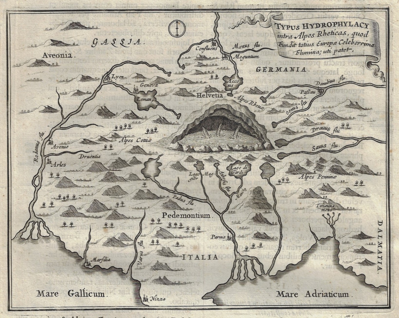
    KIRCHER, Athanasius. “Typus Hydrophylacy intra Alpes Rheticas, quod Fundit totius Europae Celeberrima Flumina uti patet”, being a map salvaged from a beyond-repair copy of the great Mundus Subterraneus, (“Athanasii Kircheri Mundus subterraneus in XII libros digestus… “), 1678, from the second section “Officium Globi Terreni”, p. 71; 6”x 8” on a 15”x 9” sheet. Very Good condition. $175

    “The foundations of the whole of the famous European rivers” or so the title reads.

    The great semi-mystifying polymath Athanasius Kircher (1602-1680) lived for a long time and filled his life with ideas and words,  producing dozens of books during his time on Earth, some of which were never published even though written, some manuscripts lost forever. His was a massive output of extraordinary breadth.  He wasted little time that I can see, writing on a spectac Kircher typus european rivers detail
    ular range of subjects: enlightening people, confusing people, generating great theories and some occasional bad ideas. 

    The images presented here comes from his Mundus Subterraenus , published in 1678, which was concerned mainly with geology and the theory of the Earth. There is an enormous amount of wide-ranging thinking going on in these two volume, most of which were scientific and experimental, and some of that being flavored and coated by hermetic and religious influences, while some bits were entirely religio-speculative. A product of the great Jesuit institution, the Collegio Romano, he postulated and dove fearlessly into the structure of the interior of the Earth, the origin of heat, the source of the tides, the composition of light, mechanics, the structure of music, linguistics, astronomy, astrology, alchemy, fossils, fluid dynamics, mining, and of course the existence of anthropomorphic images in stone (for example, the Virgin Mary found in agate).  There was also a fair amount of work on one of his side interests that populated a number of his works, alchemy and the search for the organization of materials. He also sought a primum mobile so to speak, a force or reckoning that was beyond what he recognized as the creator’s, a cosmic pansperma, an automatic/spontaneous cosmic energy at the root of change of all things.
    ·Posted by :

    ·in:


  • The Underground Canals of the Middle East (1678)

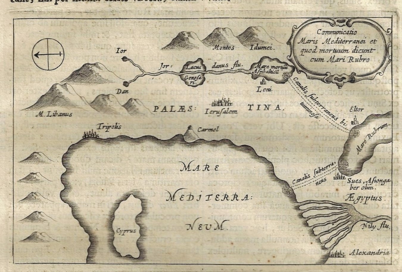
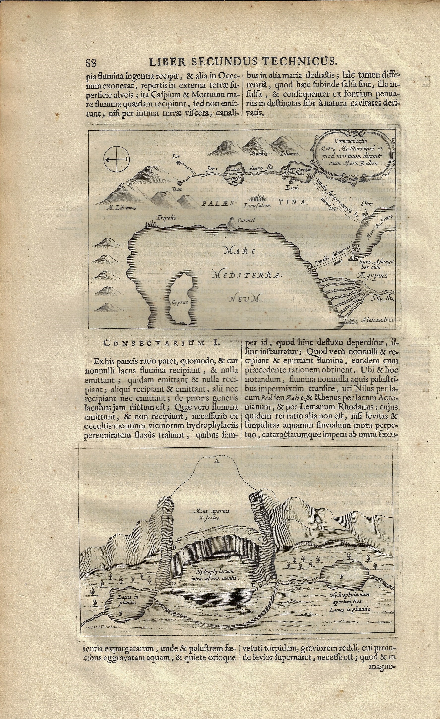
    KIRCHER, Athanasius. “Communicatio Maris Mediterranei et quod Mortuum dicunt cum Mari Rubro”, being an engraved map of the Middle East salvaged from a beyond-repair copy of the great Mundus Subterraneus, (“Athanasii Kircheri Mundus subterraneus in XII libros digestus… “), 1678, from the second book, “Liber Secundus Technicus”, page 88.  $150

    4”x 6.5” image on a 15”x 9′ sheet, showing Kircher’s hypothesis for the existence of underground canals connecting the Mediterranean with the Red Sea to the Dead Sea.

    Kircher holy land detail;

    The great semi-mystifying polymath Athanasius Kircher (1602-1680) lived for a long time and filled his life with ideas and words,  producing dozens of books during his time on Earth, some of which were never published even though written, some manuscripts lost forever. His was a massive output of extraordinary breadth.  He wasted little time that I can see, writing on a spectacular range of subjects: enlightening people, confusing people, generating great theories and some occasional bad ideas. 

    The images presented here comes from his Mundus Subterraenus , published in 1678, which was concerned mainly with geology and the theory of the Earth. There is an enormous amount of wide-ranging thinking going on in these two volume, most of which were scientific and experimental, and some of that being flavored and coated by hermetic and religious influences, while some bits were entirely religio-speculative. A product of the great Jesuit institution, the Collegio Romano, he postulated and dove fearlessly into the structure of the interior of the Earth, the origin of heat, the source of the tides, the composition of light, mechanics, the structure of music, linguistics, astronomy, astrology, alchemy, fossils, fluid dynamics, mining, and of course the existence of anthropomorphic images in stone (for example, the Virgin Mary found in agate).  There was also a fair amount of work on one of his side interests that populated a number of his works, alchemy and the search for the organization of materials. He also sought a primum mobile so to speak, a force or reckoning that was beyond what he recognized as the creator’s, a cosmic pansperma, an automatic/spontaneous cosmic energy at the root of change of all things.
    Kircher holy land

    ·Posted by :

    ·in:


  • First French Edition of the First Weather Map (1687)

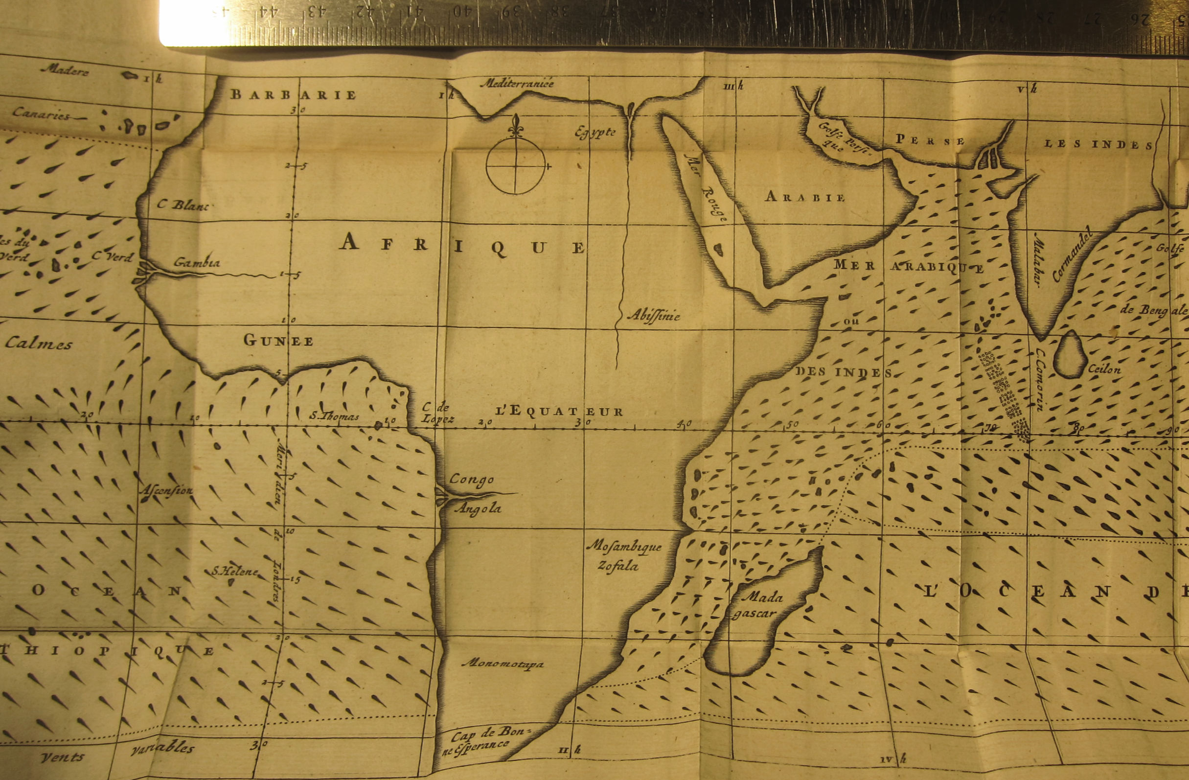
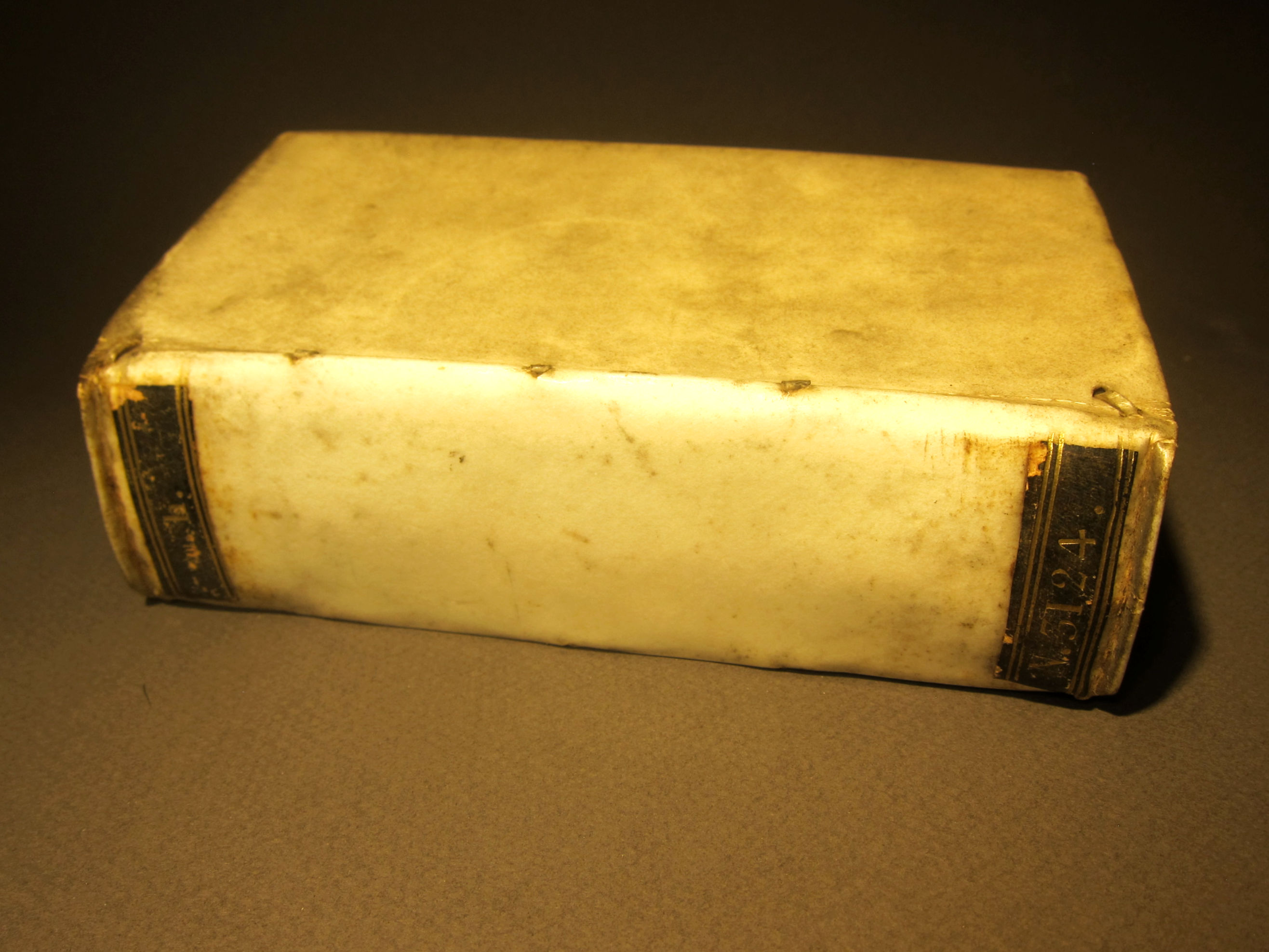
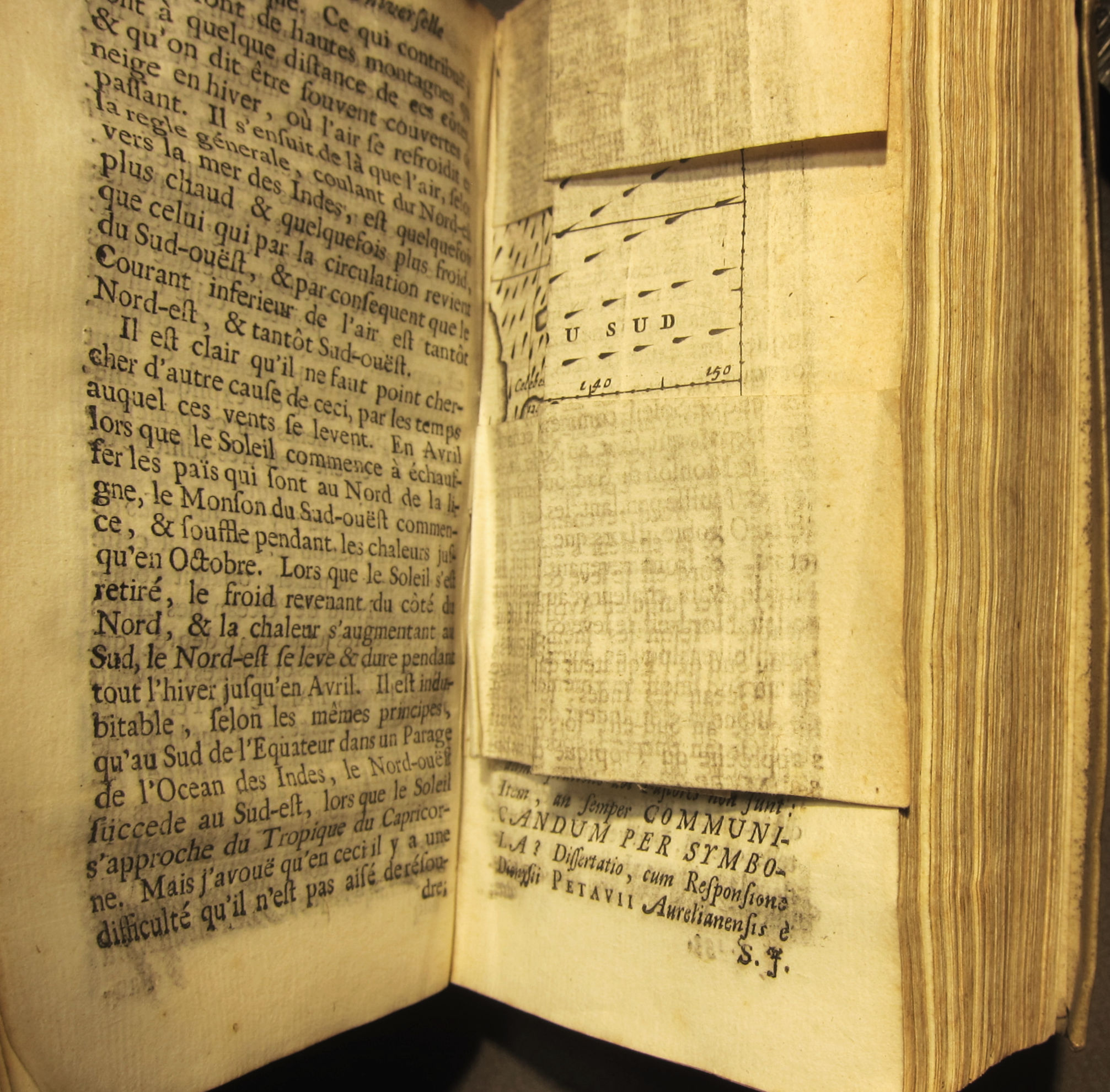
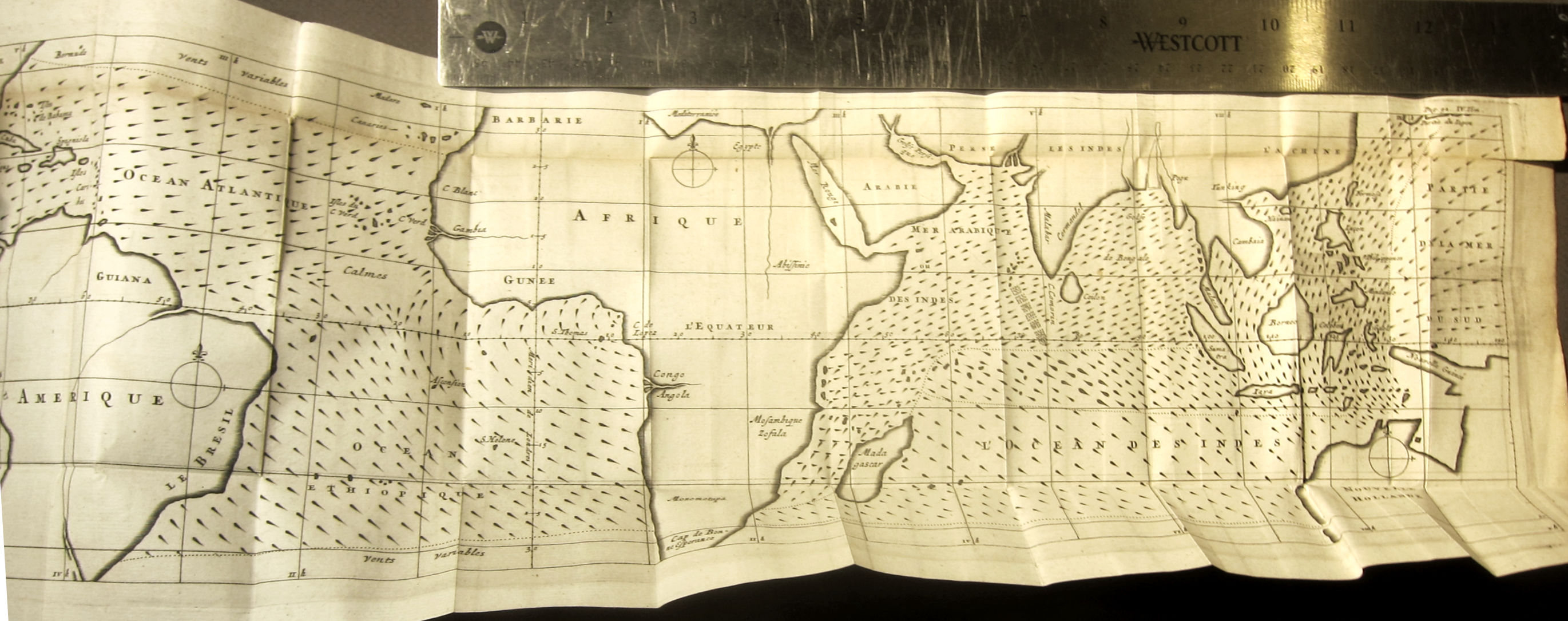
    HALLEY, Edmund. “Extrait du Journal D’Angleterre, contenant one Relation Historique des Vents reglez & des Monsons que l’on remarque dans les Mers qui sont entre les Tropiques, ou qui n’en sont pas éloignées, avec un Essai de Physique touchant leurs causes naturelles par Mr. Halley”, in Bibliothèque universelle et historique, Amsterdam, 1687, published by Warsbergew, Boom, and VanSomeren; vol 4, pp. 66-93 in the volume of (18), 552, (22)pp, with two folding plates, one of which is the first weather map. 142X80mm, bound in vellum.   $1250

    The famous map (14.8 × 48 cm) is very fresh and strong, and has only one minor defect—a small 1/2” teat at upper right edge. Other than that it is in excellent condition.

    Halley _4_


    This is the French translation of Halley’s “An Historical Account of the Trade Winds, and Monsoons, Observable in the Seas between and near the Tropicks, with an Attempt to Assign the Phisical Cause of the Said Wind,” that appeared several months earlier in the Philosophical Transactions of the Royal Society (1686, in issue no. 183).

    Here is a summary of the map from the Princeton University site dedicated to thematic maps:

    • “First meteorological map, charting the directions of trade winds and monsoons. Having collected information from navigators familiar with ocean transits, and also from his own tropical experience on St. Helena (1677–1678), Halley sought to rectify the work of earlier writers on the subject. He attributes the circulation of prevailing winds to the solar heating of volumes of atmosphere as the earth revolves, which thus draw air after them, forming a generally easterly wind; as the sun departs, the air reverses direction to establish equilibrium. He argues that the effects of continents (and other landmasses) and latitudes complicate but do not compromise the basic principle. (Today, of course, solar heating is viewed as only a piece in the puzzle of winds; ocean currents would be another. Adding Halley’s wind map data to Eberhard Happel’s 1675 map of ocean currents [see his entry in the Hydrography section] would make an interesting thematic map.) Elsewhere in the article, Halley correctly identifies the West Indies as the source of hurricanes in the Atlantic.

    “On the map, rows of brief lines show the course of the winds; the sharp ends of those lines point to wind sources. Where winds go back and forth, notably in the monsoon-prone area of the Indian Ocean, the lines are thicker than elsewhere and point both ways.”

    Had Halley–called Father of Dynamical Meteorology—not made his important contributions to astronomy and other fields he would have been remember for being the first geophysicist, and also perhaps the earliest thematic mapmaker.

    Halley _4_
    Halley _4_

    Halley _4_

    ·Posted by :

    ·in:


  • Propaganda Maps–France, ca. 1935

    JF Ptak Science Books  Quick Post

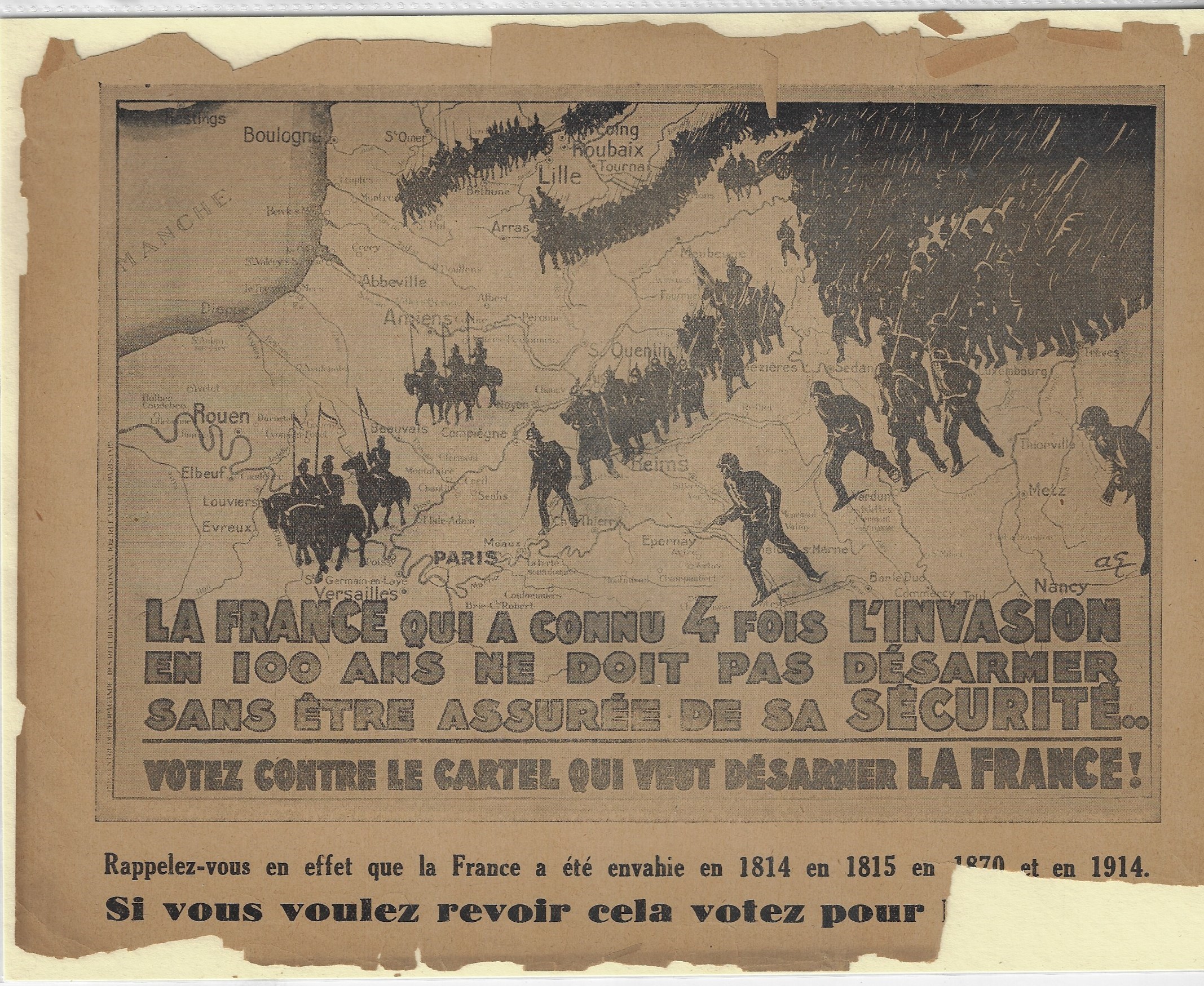
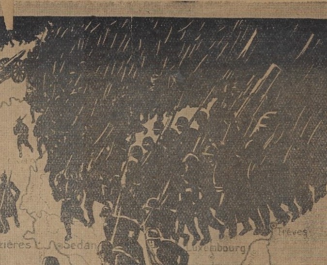
    This is certainly a successful design in describing fear and possibility for the near future and the security  (or lack of it) for France. Nothing quite conveys temporal disruption than a consolidated mass of dark and sharp objects advancing on the home front. 


    Maps propaganda France detail

    • “La France qui a connu 4 fois l’invasion en 100 ans ne droit pas desarmer sans entre assuree de sa securite. Votz contre le cartel qui vent desarmer la France!” (“France, which has been invaded four times in 100 years, should not disarm with being assured of its security! Vote against the cartel that will disarm France!”)   $50
    • Maps propaganda France detail

    The image is a moderate Right Wing political propaganda piece extolling people not to vote for a political group (unnamed but Left Wing) that would “disarm France” by referencing the four times that France has been invaded in the last 100 years (1814, 1815, 1870, and 1914). Design by Andre Galland and printed 1932-1936. The fifth invasion was already on its way, coming in 1940, when Germany simply did an end-run around the ill-conceived modern antique of the Maginot Line, after which the very large French army was slow to respond, with France surrendering 46 days later on 25 May 1940.

    • In a tiny scroll script in the left margin reads: (translated) Propaganda Center of the National Republicans (Republicains Nationaux).

    This is an effective design for sure, showing a mass of infantry and cavalry crossing the northern French border…so massive in fact that most figures blend into an almost-solid black mass save for the white streaks of rifles/bayonets.

    I’m not sure what the intended use was for my copy of this image, which was originally produced as a poster, though this copy measures only 27x21cm. I don’t know if it was meant as a flyer, or small poster, or if it was simply an illustration in a larger book. It is interesting, regardless. It is certainly worth sharing, though. 

    ·Posted by :

    ·in:


  • Mt. Everest, 1922 (with three maps)

    Mallory and Howard-Bury Expedition to Mt. Everest, 1921, including 6 papers in three issues of the Geographical Journal of the Royal Geographic Society, published in London by the Society, 6 issues (January-June), 1922 These are among the Earliest-Printed Works on the Mount Everest Expeditions, including photos and three large folding maps. 8vo, viii, 492pp, numerous photo plates, plus six folding maps (including three for Everest) and one very large one for Arabia.  Leather backed cloth boards; ex-library, with a call number on spine and several interior stamps, though none on the maps.  Nearly all of the maps are fine, the exception being the Arabia map, which has numerous tears and splits.  Overall a VG volume. $350

    Includes the following Everest-related papers:

    George Mallory, “Mount Everest, the Reconnaissance”, February issue, pp 100-112.

    Howard-Bury, “The Mount Everest Expedition”, pp (81)-99, February issue, featuring 5 plates of photographs, including one folding panorama. I can’t help but think that these are among the first publications of photos of the area.

    “The Mount Everest Expedition maps and plates,” pp 131-137, February issue.

    The February issue includes two folding maps: (1) Map 1, “Preliminary Map to Illustrate the Route of the Mt. Everest Expedition of 1921”, which is a close regional map. 14”x 16”  (2) Map II, “Preliminary Map of Mount Everest Constructed at the RGS…” 14”x 16”, which is a far  more detailed map almost entirely limited to Everest.   

    A.M Heron, “Geological results of the Mt. Everest Expedition of 1921, pp 418-436, in the June 1922 issue, with 1 plate. This is followed by a folding map, “Map III, the Geology of the Mount Everest Region”, 12” x19”.

    Also a book review of Howard-Bury’s great classic, Mount Everest, the Season, 1921”, which appears on pp 459-462.

    Also includes an earlier paper, “the Mount Everest Expedition”, which lists members and equipment on one page (p 207).

    ·Posted by :

    ·in:


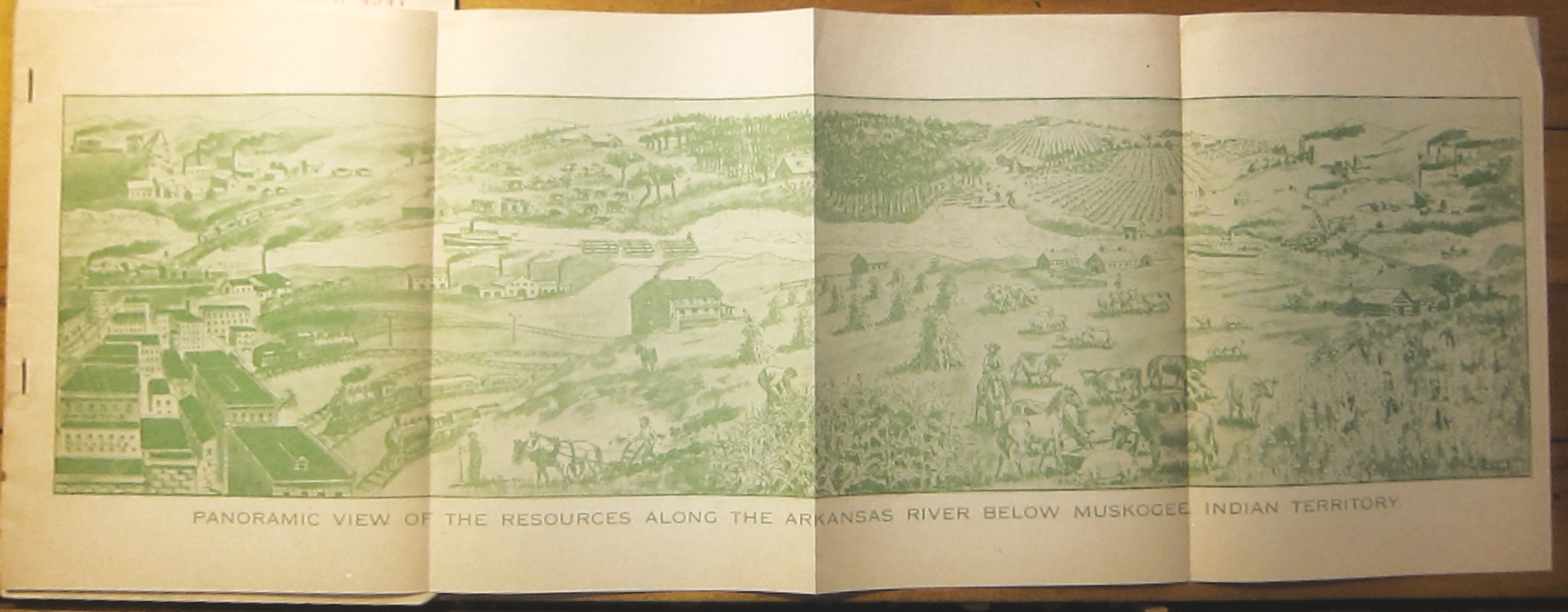
  • With a Rare semi-Utopian View of the Arkansas Valley

    Theodore W. Gulick, Commercial Value of Arkansas River Improvement in Arkansas and Indian Territory, Government and Commercial Reports.  Published by the Muskogee Commercial Club, Muskogee, Indian Territory, ca. 1907.  8.5” x 6”, 17pp. Original wrappers, detached. Provenance: Bureau of Corporations, dept of Commerce, 1907; Library of Congress, with their surplus stamp. Good copy. SOLD

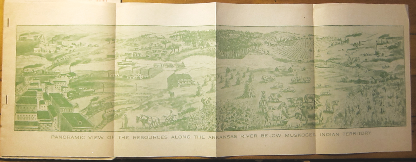
    Muskogee panorama

    Includes a folding map “Commercial Map of the Arkansas River Valley (26″x8.75”, which has been repair along the length of three folds.

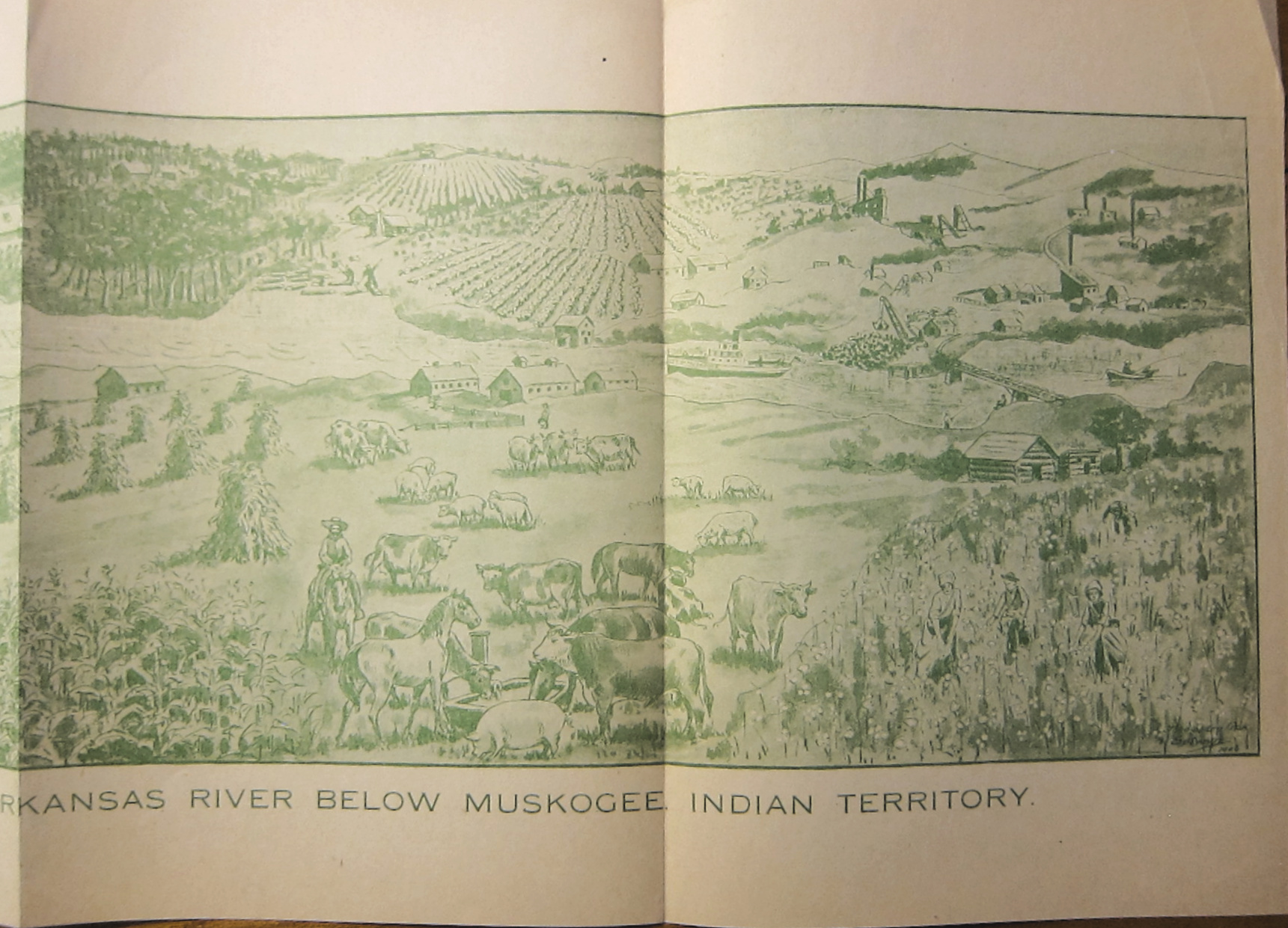
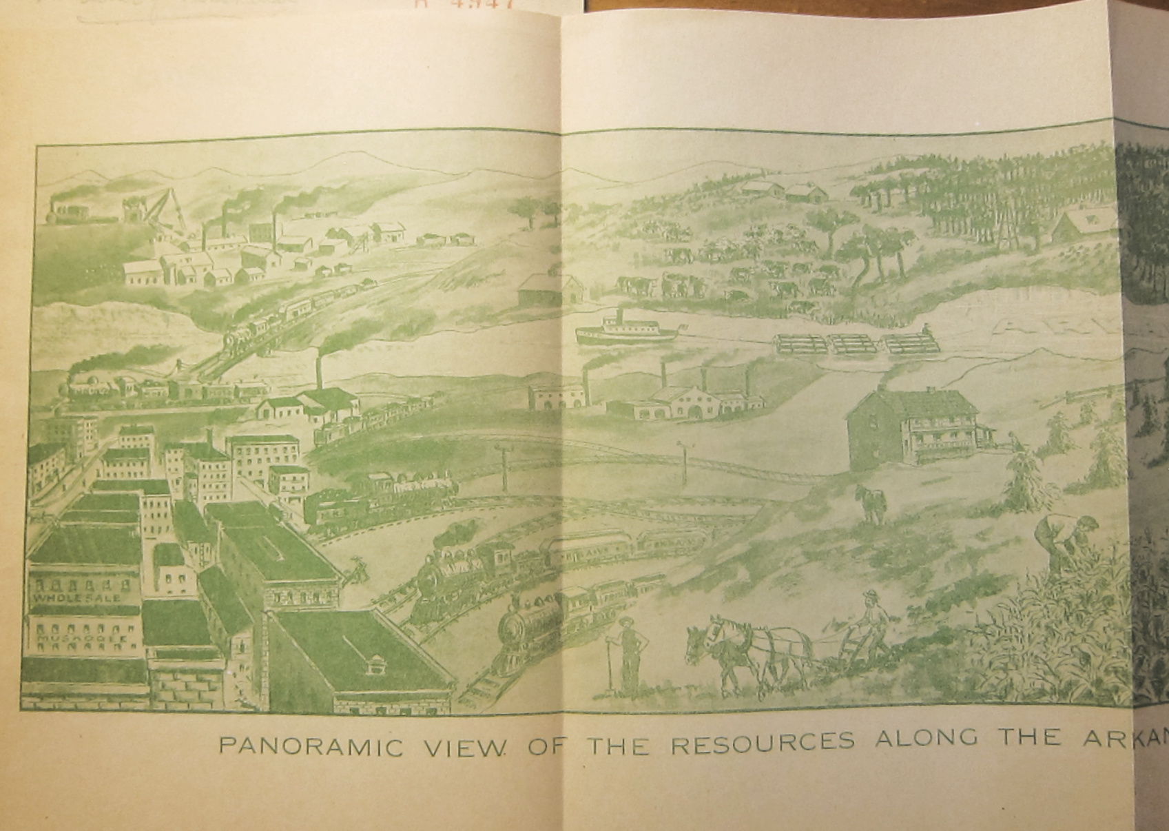
    ALSO: includes an 8″x22″ view, “Panoramic View of the Resources along the Arkansas River Below Muskogee Indian Territory”, printed in green. It shows the best of all possible worlds–a green utopia–flourishing along the Arkansas River.  

    I cannot find this title in the usual places, nor are there any references to it in WorldCat/OCLC, nor is there any mention of the panoramic view or the map. I’d say this was scarce.

    “…Theodore W. Gulick [d. 1913], an early newspaper editor. He is credited with establishing the Muskogee Evening Times which was Muskogee s first daily newspaper. He is also credited with reorganizing the Muskogee Commercial Club into the Chamber of Commerce and served as an officer of the Chamber for many years.”–Muskogee Phoenix

    There must’ve been one of the land rushes in the 1900-1909 period as the Muskogee as the population exploded from 4,500 to 25,000.

    Muskogee Pano right
    Muskogee Pano right

    ·Posted by :

    ·in:


  • Geronimo, Finally Defeated by Miles and the Sun (1886)

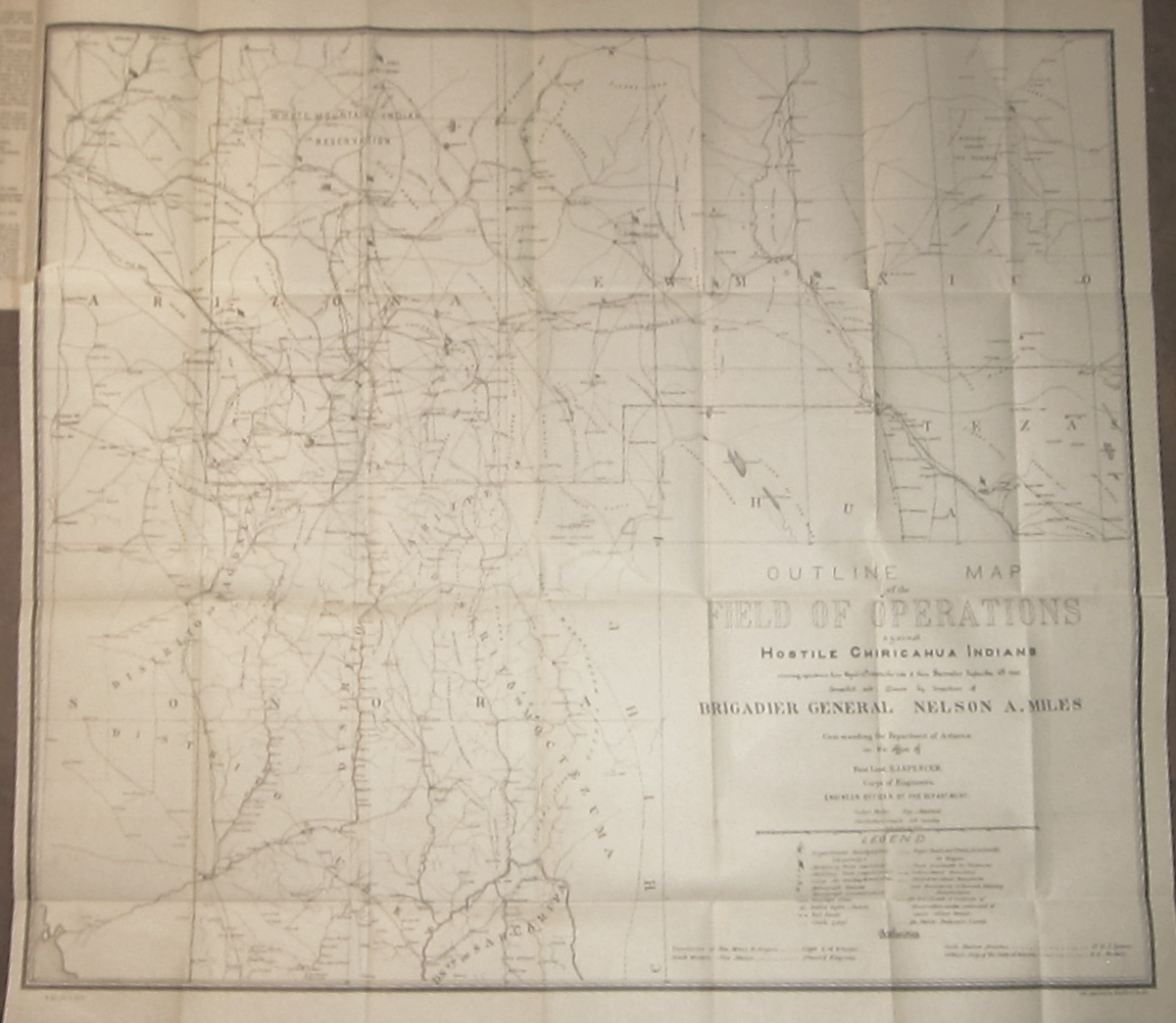
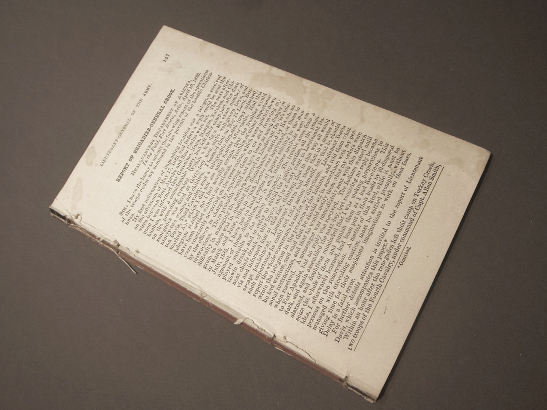
    Report of Brigadier-General Crook. Headquarters, Department of Arizona, in the Field, Fort Bowie, Ariz., April 10, 1886. Washington D.C., War Department publication, 1886, pp 147-196. Disbound from larger volume, with last signature disbound (but present) from this report.  Contains the following terrific map:

    Geronimo _1_ full
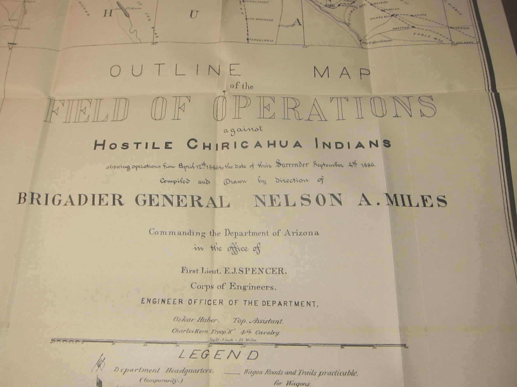
    Outline Map of the Field of Operations against Hostile Chiricahuan Indians showing operations from April 12th, 1886 to the date of their Surrender 4th, 1886. 
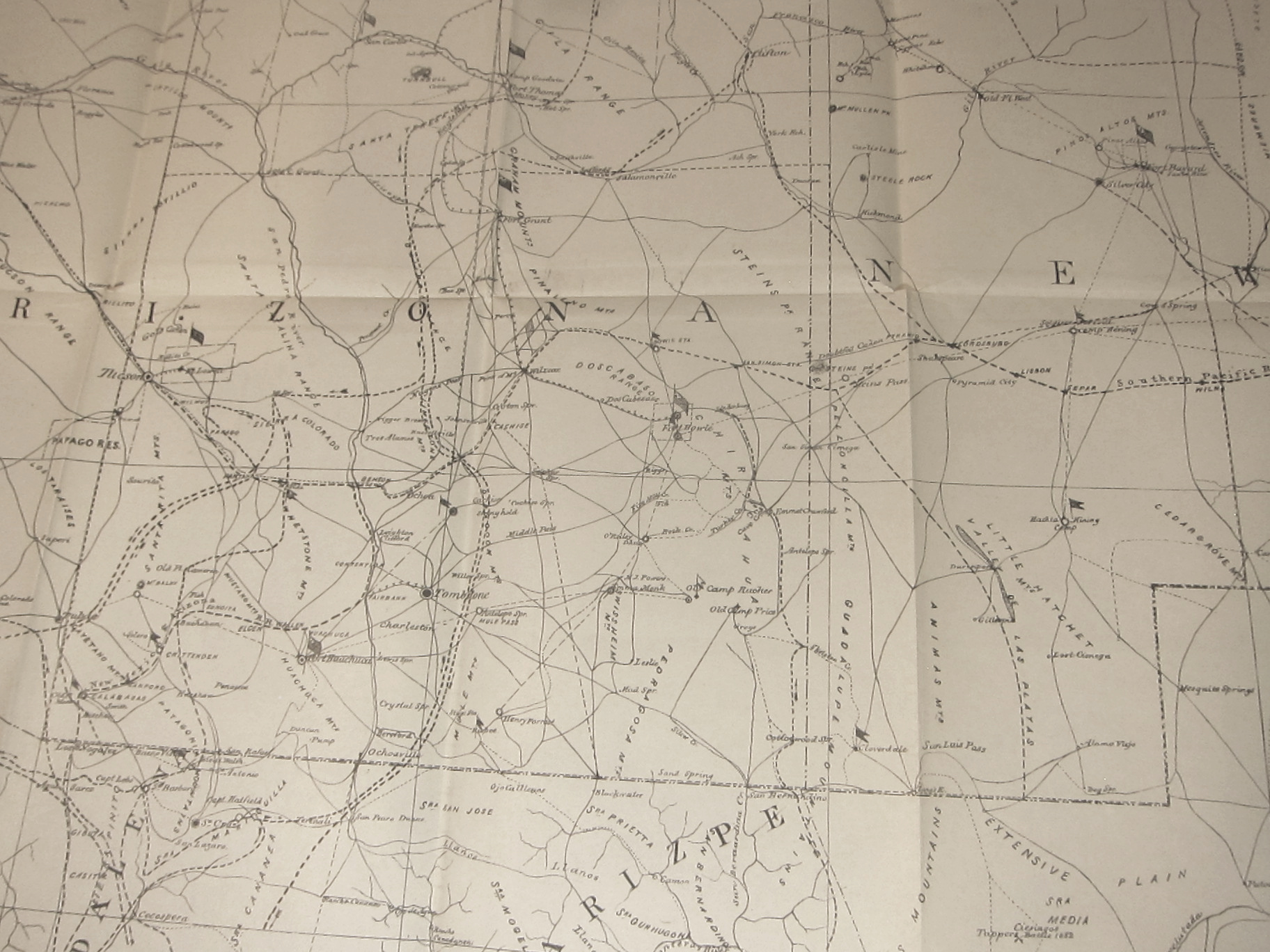
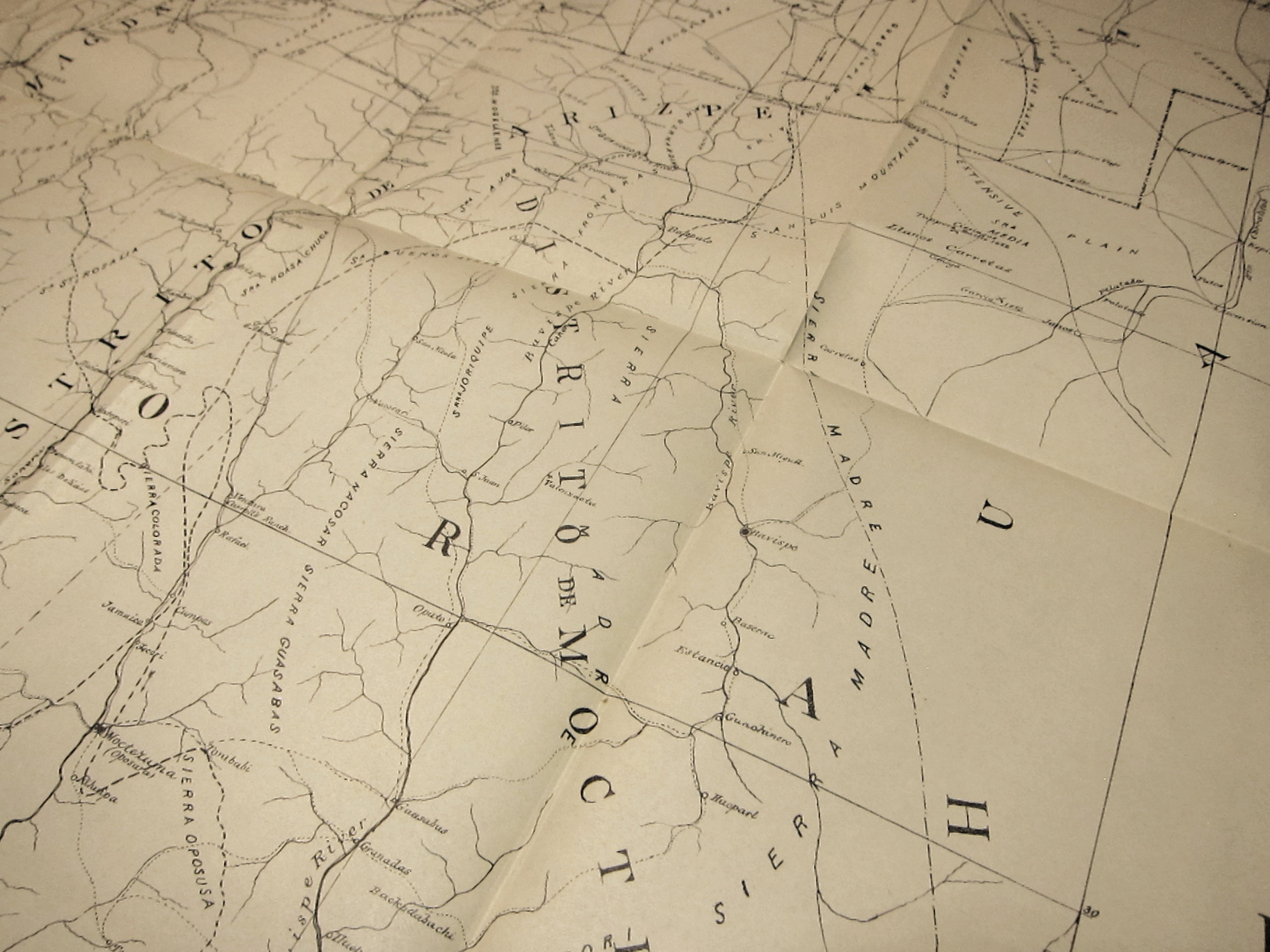
    A large, 29×25-inch folding black and white map lithographed by the American Graphic Company.  (The map’s condition is about Fine–there are a few tiny tears at the meeting of the folding joints along the top row, and then a 1″ tear from where it was carelessly opened rom the pamphlet–otherwise, this is in great condition.)

    The map covers all of Arizona and New Mexico south of 34 degrees N, from Phoenix on the west to not quite Roswell on the east, northern Sonora to well below Hermosillo, and extreme west Texas.  On this detailed (1″=15 miles) map are located at least 40 army forts, camps and posts, as well as innumerable railroad whistle stops, ranches, and water holes.  And of course locations of heliographic stations. Fine copy.  SOLD

    The Chiricahuan Apache leader and chief, Geronimo (1829-1909), famously led a progressively diminishing band  through the  Apache Wars of the 1850’s-1880’s.  For thirty  years of so he quirted the U.S. Cavalry, darting here and there in great exploits and famous escapes, evading the armies of the United States and Mexico.  In the end, by 1886, there were just dozens who were following him, including women and children, and the elderly, ragged, tired, hungry, and pretty much, finally, beaten.

    Geronimo _2_

    I think what finally did Geronimo in were the miles of pursuit and the sun. 

    The sun got to him via the heliographic communication network established by Major W.J, Volkman under the direction of General Nelson Miles (the other “miles” of this equation of defeat), which allowed the pursuing American army to communicate instantaneously over great distances, over hundreds of miles, without the need for runners or men or horseback or cutable telegraph wires or time  The heliograph is an ancient instrument, used for more than two thousand years–in this case, they were very highly polished mirrors that reflected brilliant signals between stations, getting their light source from the sun. It allowed the army an enormous advantage, and one that finally caught up to Geronimo.

    The “miles” were just those, the thousands of miles Geronimo was tracked and retracked over that very difficult terrain in the southeastern part of Arizona and into northern Mexico, sharp mountains, endless badlands, caves, heat, height, cold….very difficult. (I’ve been there on treks.. .its tough land.)

    The capitalized “Miles” was the surname of General Nelson A. Miles who sent out  with Lt. Col. George F. Crook to track down and capture Geronimo–and they almost did, again, in late MArch, 1886, when Geronimo presumably surrendered, but then fled to Mexico. After another five months and 1,600 miles, Miles came upon Geronimo om in Sonoran mountain camp, and induced him for the final time in September, 1886, at Skeleton Canyon, Arizona.

    The details of the capture and surrender are told in many places by many others–I just wanted to surface the role of the sun in the capture of Geronimo.

    The old man was shipped east,  never to see Arizona again. He died after being thrown from his horse and contracting pneumonia as a result of being unable to help himself to safety through a long cold night, died in a bed as a prisoner in Ft. Sill, Oklahoma.

    Geronimo _4_
    Geronimo _4_
    Geronimo _4_

    ·Posted by :

    ·in:


  • Early Geological Map (1823)

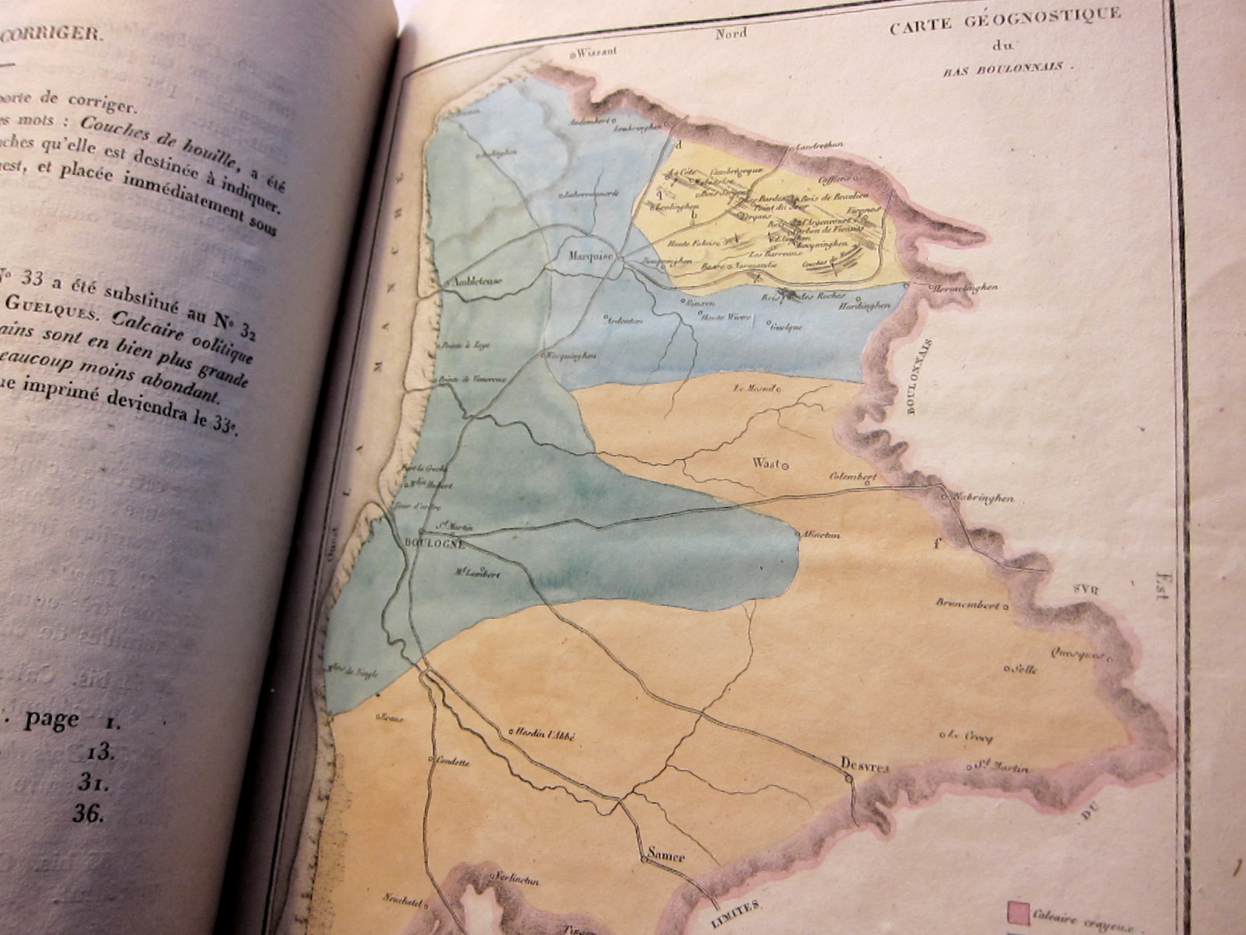
    Garnier, F. Memoire Geologique sur les Terrains du Bas-boulonnais et particulierement sur les Calcaires Compactes ou grenus qu’il Renforme. Boulogne sur Mer, published by P. Hesse, 1823. From an address at Boulonge in July 1822.  Original wrappers. Dusty. Rubber stamp ownership mark on rear wrapper.  Very Good condition. SOLD

    10×8”, 39pp, with a full-page geological map of the region, which is evidently an early geological (“Geognostique”) map of the region, and appears (as with some others) 18 years before the publication of the first full-country geological map of France (1841. Dufrenoy, PA and de Beaumont, E, Tableau d’Assemblage des six feuilles de la Carte de la France.)Maps france boulonge geo

    Book arts knot march 2019 _3_

    ·Posted by :

    ·in:


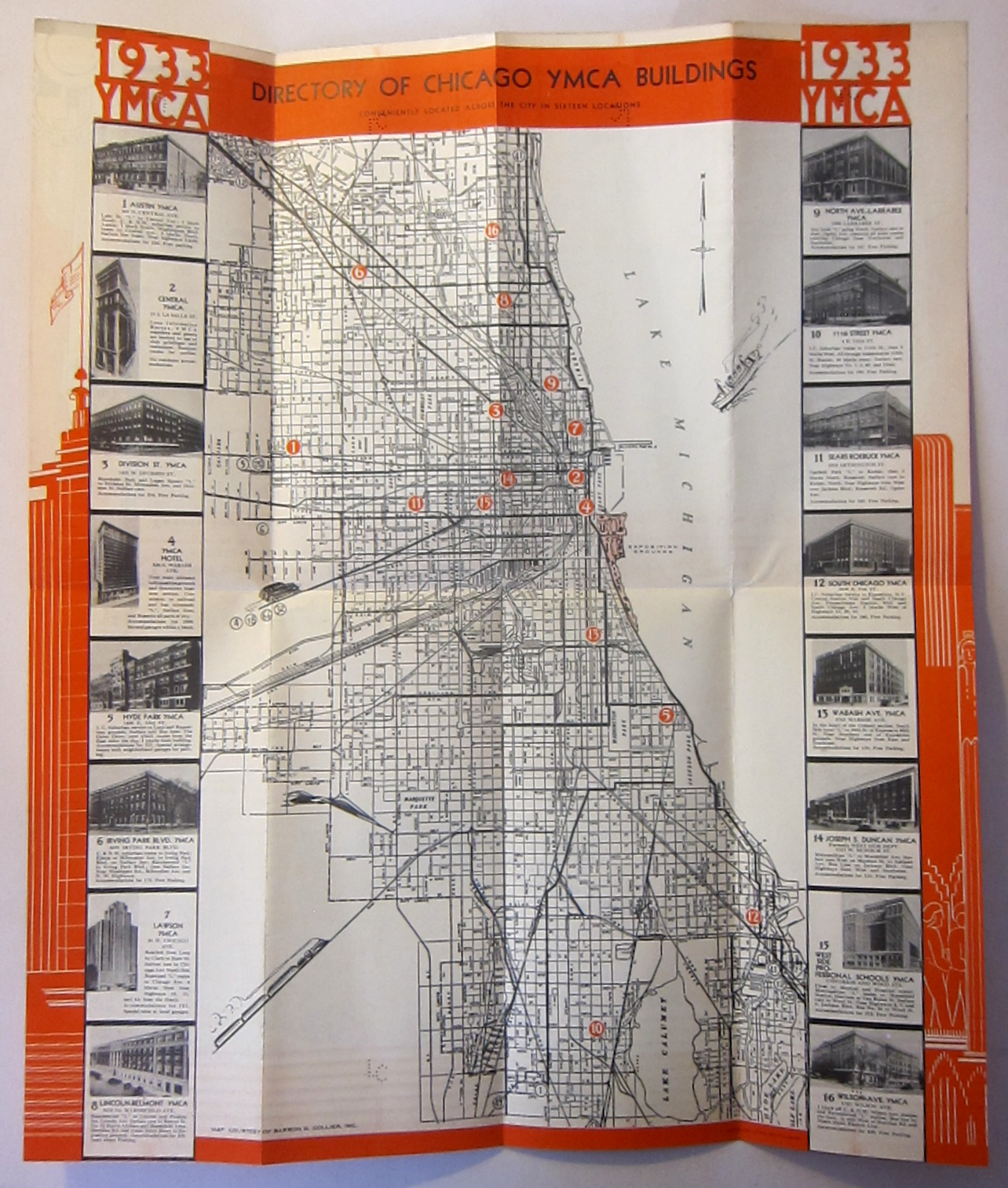
  • Chicago World’s Fair, 1933–Pamphlets with Maps of the Fair (1933-4)

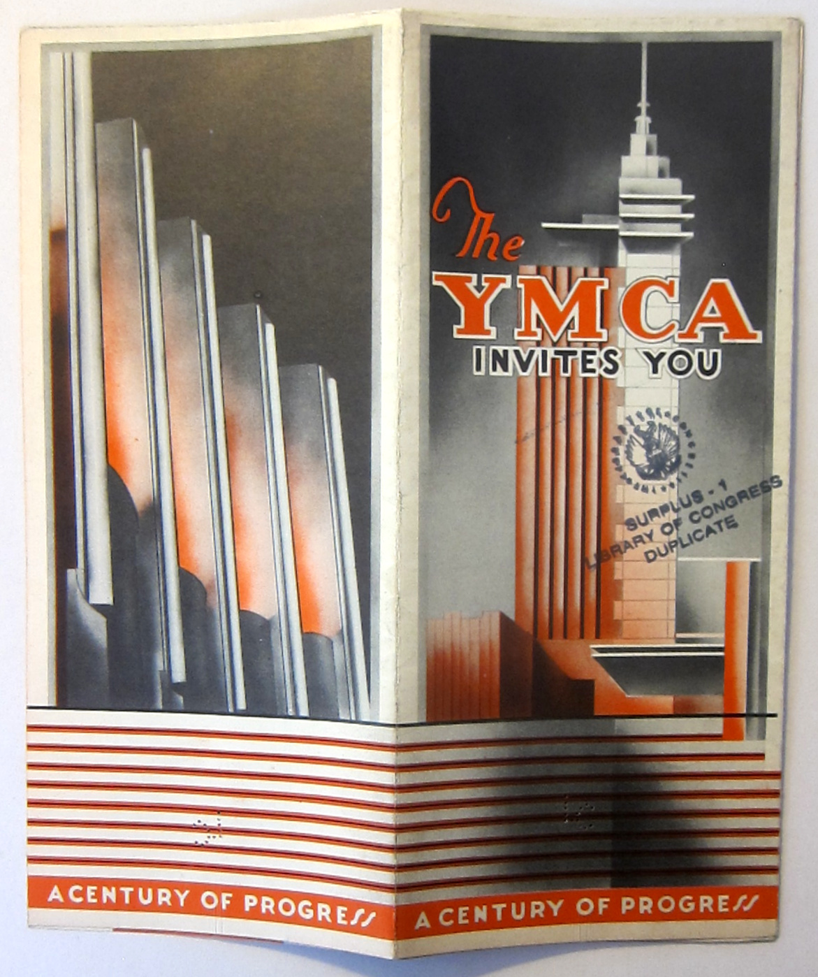
    Maps of the Chicago Century of Progress World’s Fair, 1933-4

    The YMCA Invites You, a Century of Progress. (1933). 8.25” x 3.5”.  This fabulous pamphlet opens to a  16.5” x 14” map of downtown with photo vignettes along the borders of 16 YMCAs in Chicago.  Provenance: Library of Congress, with their surplus stamp on the front cover.  Fine copy otherwise.  $75

    Chicago Maps YMCA _2_
    Chicago Maps YMCA _2_

    ·Posted by :

    ·in:


  • The First Weather Map Printed in the United States (1838)

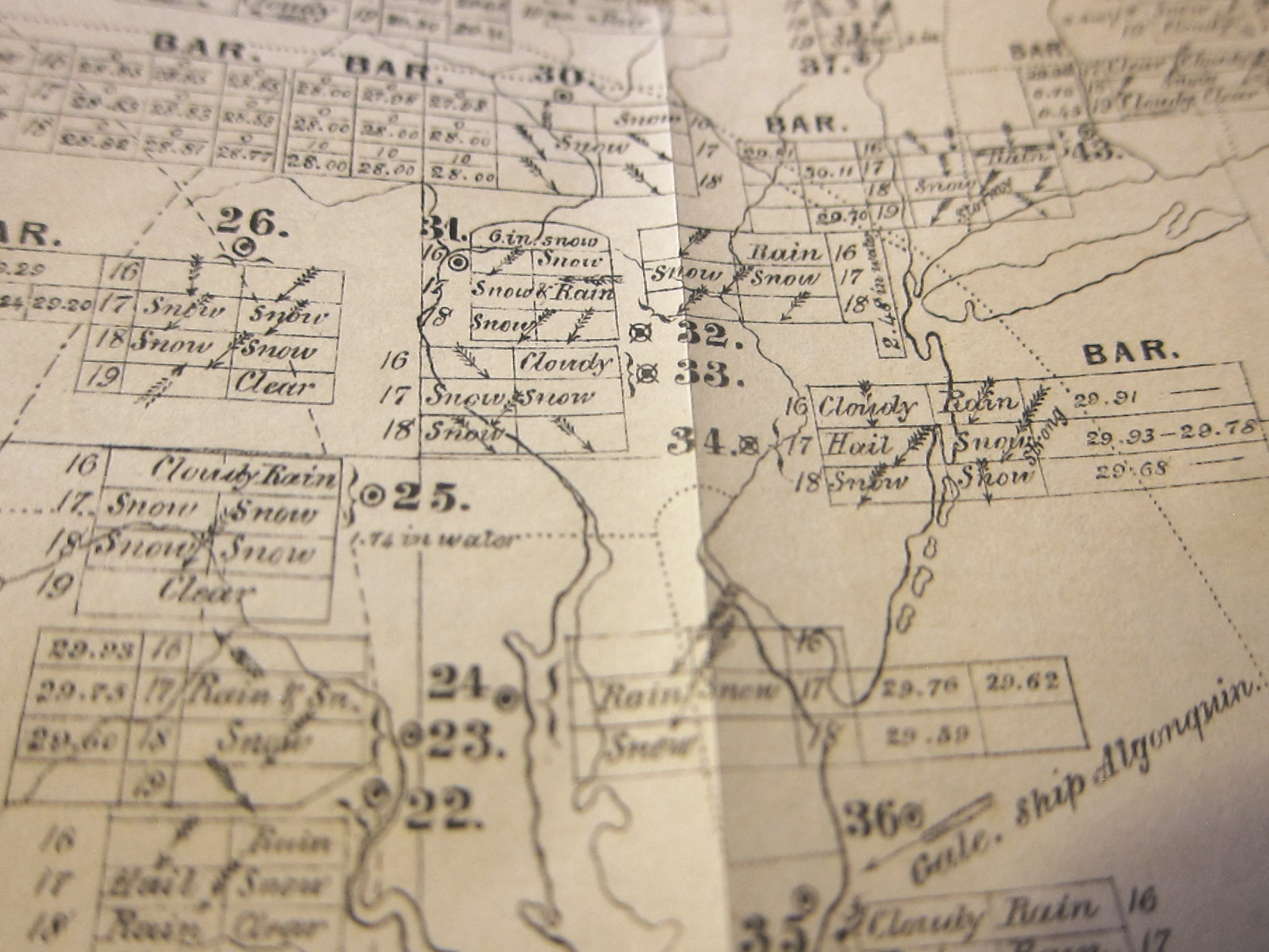
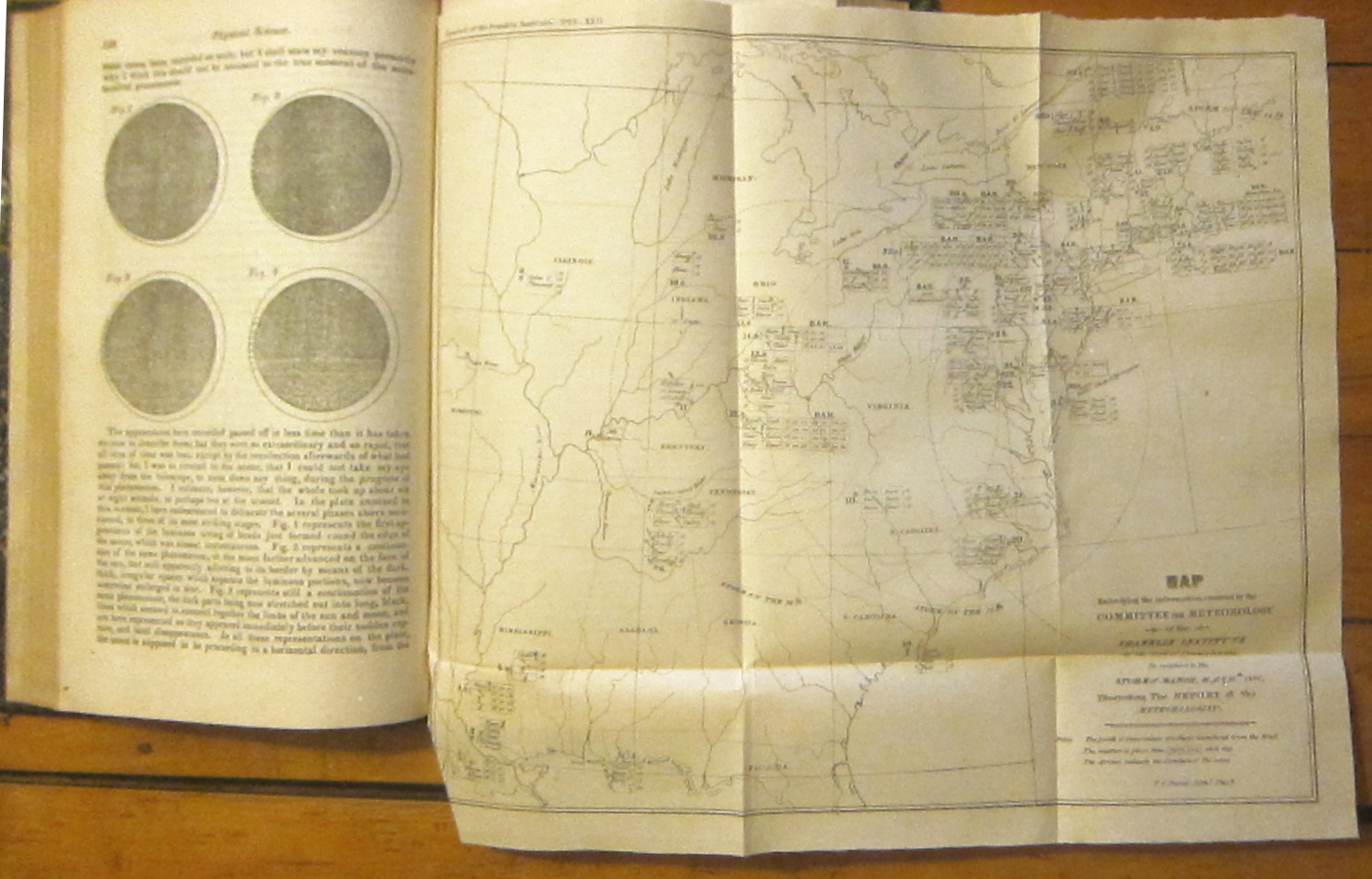
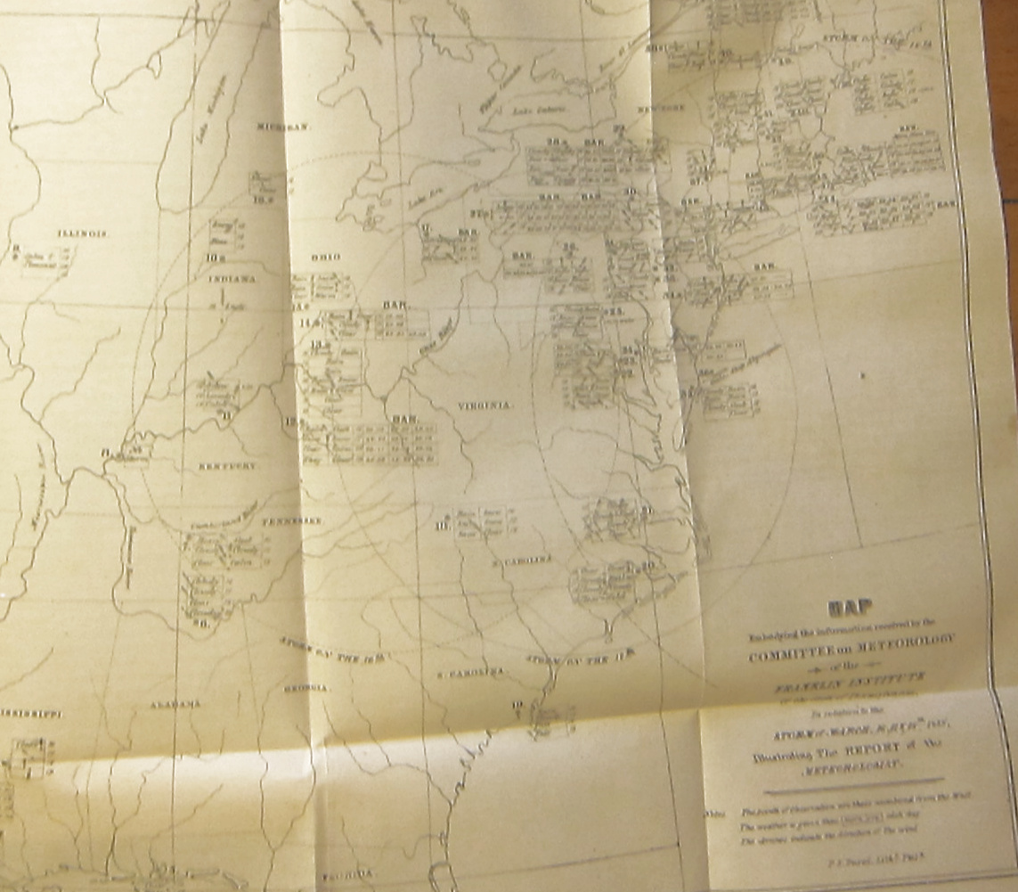
    (Espy, James P) Robley Dunglison, A.D. Bache, James Espy, and others. “Report of the Committee on Meteorology to the Board of Managers of the Franklin Institute, embodying the facts collated by the Meteorologist relative to the storm of the 1 6th, 17th, and 18th March, 1838.” (The report is signed by Espy at the last line.)  Illustrated with a folding map, also by the pioneering Espy:“Map Embodying the Information Received by the Committee on Meteorology of the Franklin Institute of the State of Pennsylvania in Relation to the Storm of March, 16th, 17th, & 18th, 1838, Illustrating the Report of the Meteorologist.,” and is a folding 23x27cm, and which was lithographed (“by steam”) by Duval in Philadelphia. In: Journal of the Franklin Institute, Philadelphia, Vol   22  (new series) vol 26 overall, July-December 1838, with text illustrations, and a folding map. 442pp. Half-calf, with raised bands. Ex-library, with some scuffing on the spine; and the remnants of a paper spine call number label; also a few stamps on the title page. That said, still in Very Good condition.  The map is in excellent condition, without any tears, and printed on a good, thin paper.   $950

    Espy weather map _2_
    Espy weather map _2_

    • [That piece at the bottom left corner is not missing–it is just folded back.]

    This is the first weather map printed in the U.S. (The first weather map(s) to be printed by the U.S. government occurred with the same author, in 1850, in ESPY, James Pollard. (1785-1860) Letter of the Secretary of the Navy Transmitting the Report [containing] Second Report on Meteorology to the Secretary of the Navy (which is actually the) Third Report on Meteorology with Directions for Mariners, etc. Navy Department, Washington DC, March 13, 1850).

    • “This is the first U.S. weather map. In his accompanying report, Espy states that the committee received back 50 responses from the 250 circulars it sent out to different parts of the United States and Canada regarding this notable storm. The map represents the assembled data, with reporting stations numbered from 1 to 50, roughly in order from south to north and from west to east as the storm was tracked. The three large circles show the eastern progress of the storm over the three days. Readings of barometric pressure, arrows for wind direction and relative strength, and descriptive words for precipitation/sky (rain/sleet/hail/snow, clear/fair/cloudy/heavy) are provided in the cells of small tables (three or four rows by two or three columns) printed next to each station number. Morning and evening results, if given, appear in adjacent cells of a row, and each row represents a different day (March 16, 17, 18, and sometimes 19). Like a time-delay photograph, the map nicely traces the regional movement of the storm, but graphic methods (shading, color, use of symbols) have not been developed yet to replace Espy’s data tables—FROM Harvard’s Mapping History site.

    There are many other papers in the volume in different fields and of varying lengths and depths—it is the Espy though that is the heavyweight here, and supports the entire value of the volume.

    Espy weather map _2_

    ·Posted by :

    ·in: